St. Bride’s Well, London, Middlesex

Holy Well (covered):  OS Grid Reference – TQ 3157 8111

Archaeology & History

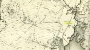
St Brides Well on 1896 map

Close to the centre of that corporate money-laundering place of homo-profanus that is the City of London, was once a site that represents the antithesis of what it has become.  Tacked onto the southeastern side of St. Bride’s church along the appropriately-named Bride Lane, the historian Michael Harrison (1971) thought the Holy Well here had Roman origins.  It “was almost certainly,” he thought,

“in Roman times, the horrea Braduales, named after the man who probably ordered their construction: Marcus Appius Bradua, Legate of Britain under Hadrian, and the British Governer in whose term of office the total walling of London was, in all likelihood, begun.”

This ‘Roman marketplace of Bradua’ that Harrison describes isn’t the general idea of the place though.  Prior to the church being built, in the times of King John and Henry III, the sovereigns of England were lodged at the Bridewell Palace, as it was known.  Mentioned in John Stow’s (1720) Survey of London, he told:

“This house of St. Bride’s of later time, being left, and not used by the Kings, fell to ruin… and only a fayre well remained here.”

The palace was eventually usurped by the building of St. Bride’s church.  The most detailed account we have of St. Bride’s Well is Alfred Foord’s (1910) magnum opus on London’s water supplies.  He told:

“The well was near the church dedicated to St. Bridget (of which Bride is a corruption; a Scottish or Irish saint who flourished in the 6th century), and was one of the holy wells or springs so numerous in London, the waters of which were supposed to possess peculiar virtues if taken at particular times.  Whether the Well of St. Bride was so called after the church, or whether, being already there, it gave its name to it, is uncertain, more especially as the date of the erection of the first church of St. Bride is not known and no mention of it has been discovered prior to the year 1222.  The position of the ancient well is said to have been identical with that of the pump in a niche in the eastern wall of the churchyard overhanging Bride Lane.  William Hone, in his Every-Day Book for 1831, thus relates how the well became exhausted: ‘The last public use of the water of St. Bride’s well drained it so much that the inhabitants of the parish could not get their usual supply.  This exhaustion was caused by a sudden demand on the occasion of King George IV being crowned at Westminster in July 1821.  Mr Walker, of the hotel No.10 Bridge Street, Blackfriars, engaged a number of men in filling thousands of bottles with the sanctified fluid from the cast-iron pump over St. Bride’s Well, in Bride Lane.”  Beyond this there is little else to tell about the well itself, but the spot is hallowed by the poet Milton, who, as his nephew, Edward Philips records, lodged in the churchyard on his return from Italy, about August 1640, “at the house of one Russel a taylor.”

In Mr Sunderland’s (1915) survey, he reported that “the spring had a sweet flavour.”

Sadly the waters here have long since been covered over.  A pity… We know how allergic the city-minds of officials in London are to Nature (especially fresh water springs), but it would be good if they could restore this sacred water site and bring it back to life.

Folklore

Bride or Brigit has her origins in early British myth and legend, primarily from Scotland and Ireland.  Her saint’s day is February 1, or the heathen Imbolc (also known as Candlemas).  Although in christian lore St. Bride was born around 450 AD in Ireland and her father a Prince of Ulster, legend tells that her step-father (more probably a teacher) was a druid and her ‘saintly’ abilities as they were later described are simply attributes from this shamanic pantheon. Legends—christian and otherwise—describe Her as the friend of animals; possessor of a magickal cloak; a magickian and a healer; and whose ‘spirit’ or genius loci became attached to ‘sacred sites’ in the natural world, not the christian renunciation of it.  St Bride was one of the primal faces of the great prima Materknown as the Cailleach: the Gaelic deity of Earth’s natural cycles, whose changing seasons would also alter her names, faces and clothes, as Her body moved annually through the rhythms of the year.  Bride was (and is) ostensibly an ecological deity, with humans intrinsically a part of such a model, not a part from it, in contrast to the flawed judaeo-christian theology.

References:

  1. Foord, Alfred Stanley, Springs, Streams and Spas of London: History and Association, T. Fisher Unwin: London 1910.
  2. Gregory, Lady, A Book of Saints and Wonders, Colin Smythe: Gerrards Cross 1971.
  3. Harrison, Michael, The London that was Rome, Allen & Unwin: London 1971.
  4. McNeill, F. Marian, The Silver Bough – volume 2, William MacLellan: Glasgow 1959.
  5. Morgan, Dewi, St Bride’s Church, Fleet Street, in the City of London, Blackfriars: Leicester 1973.
  6. o’ Hanlon, John, Life of St. Brigid, Joseph Dollard: Dublin 1877.
  7. Sunderland, Septimus, Old London Spas, Baths and Wells, John Bale: London 1915.

© Paul BennettThe Northern Antiquarian


Wife with the Bratty Plaid, Balfron, Stirlingshire

Standing Stone:  OS Grid Reference – NS 60027 91383

Getting Here

The Wife with the Bratty Plaid

The Wife with the Bratty Plaid

Take the same route as if you’re visiting the small Carlin Stone (a few hundred yards further along): along the B822 road between Kippen and Fintry, stop at Balafark farm and cross the road above the farm to take the track into the forest.  1km along, note the small green track, off the main central track, slightly up on the rise on your right, which bends round and then goes (eventually) to the other side of the forest.  Once you reach the gate at its edge, walk left 285 yards (261m) along the fence.

Archaeology & History

The Wife and the Carlin on the 1865 OS-map

The Wife and the Carlin on the 1865 OS-map

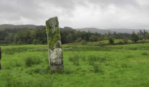
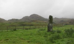
Described in the Ordnance Survey’s (1870) Book of Reference (volume 47) as “a flat rock on the boundary between Perth and Stirling,” the rock is certainly not flat—and any geographical relationship it had with Perth has long since gone.  Instead, the stone in question here is an upright one—although it’s not much more than two feet tall.  However, on the other side of the present-day fence there is a small flat stone in the ground; but it is the moss-covered upright that is our ‘Wife with the Bratty Plaid.’  A smaller curious-looking quartz-lined stone also lies next to this old Wife…

The Wife, looking east

The Wife, looking east

The Wife, looking west

The Wife, looking west

Marked on the ancient boundary line, this small but sturdy standing stone probably has a prehistoric pedigree, although we cannot be certain without an excavation.  It is shown on the earliest OS-maps from the 1860s, but we have no notifications from any literary sources telling the tale behind the stone’s fascinating name: meaning simply, the ‘wife wearing the tartan shawl.’  When Marion Woolley and I came here the other day, we tried to see if a simulacrum of such a figure was hiding in the moss-covered upright—but unlike the notable simulacrum at MacBeth’s Stone, we struggled somewhat here.  It was possible, from certain angles (if we didn’t stand on our heads and poke each other in the eyes!) to see this ‘wife in a shawl’, but twas a struggle…

There’s every likelihood that whatever the old tale once was about this petrified ancestral stone, it would have had some mythic relationship with the Old Wife known as the Carlin, or cailleach, a few hundred yards to the west, at the Carlin Stone.  As yet however, their histories remain hidden in the sleep of the Earth…

Links: 

  1. Nataraja’s Foot – The Wife with the Bratty Plaid

Acknowledgements:  Huge thanks to Marion Grace Woolley, for a truly soggy day out and for the photos in this site profile.

© Paul BennettThe Northern Antiquarian


St. Ninian’s Well, Stirling, Stirlingshire

Holy Well:  OS Grid Reference – NS 79690 93012

Also Known as:

  1. Canmore ID 46210
  2. St. Ringan’s Well

Getting Here

St Ninian's Well, Stirling

St Ninian’s Well, Stirling

A short distance south out of Stirling town centre, along Port Street where it meets with Ninian’s Road, walk across at the traffic lights then turn immediately left down Wellgreen Road.  Barely 100 yards down (before you reach the roundabout), note the path on your right.  Walk along here and as it bends round into the car-park, look to your left and see the small ivy-covered building hiding away in below you, with an information plaque at its side.

Archaeology & History

“St Ninian’s” is a district unto itself on the south side of the ancient city of Stirling—and it has this holy well (and the demolished chapel that once stood by its side) to thank for this. James Johnston’s (1904) place-name study of the region showed that it had acquired its association with St Ninian as early as 1242 CE when it was described, “Ecclesia Sancti Niniani de Kirketoune.”  It was mentioned again in 1301 CE as the site of “Saint Rineyan”, or St Ringan, which was the other name given to this saint who spent much of his time at Whithorn, Galloway, where he “preached the gospel among the southern Picts.” (Attwater 1965)

The waters in the building

The waters in the building

The old well building

The old well building

At some later date, Ninian is thought to have ventured north and sanctified this already renowned water source which, in his day, would have been open and surrounded by ancient trees and an abundance of wild flowers and healing plants.  But today, typically, it is hiding almost secretly away, behind locked doors and not in view for the general public.  This needs to be changed!  Standing outside of the unkempt and overgrown building, you can faintly hear these ancient waters still flowing within their darkened enclave.

It has been described in a number of local history books down the years, but a lot of the old stories and traditions have sadly moved into forgotten memories… The first major description of the site was by J.R. Walker (1883) who wrote freshly about it soon after his visit—despite being “disappointed” with the architectural features of the building built over the well; which is hardly the right attitude as far as I’m concerned!  The waters, their natural environment, feeling and genius loci are the primary features to sacred wells—nottheir dissolution, nor the artifice of humans to contain and reduce the natural world at such a place!  But, this aside:  for the architects amongst you, here’s what Walker had to say about the well-house:

“Mr T.S.  Muir, in his Characteristics of Old Church Architecture, mentions it as “a large vaulted building with a chamber above it, which is supposed to have been a chapel.” From this notice I was led to think something of interest would be found in the chamber; but as will be seen by the drawing…it is utterly destitute of any feature worthy of particular notice.  On looking at the surroundings, however, which are all modern, and mostly new houses and streets in course of erection, I came to the conclusion that at no distant date the well was doomed, and that consequently I had better make a correct drawing of it.

“The lower chamber measures 16 feet by 11 feet 1 inch, and is covered with a vault running from end to end, measuring from floor to springing 2 feet 9 inches, and from floor to crown of arch 6 feet.  At the end where the spring rises there is a square recess 1 foot 9 inches high and 1 foot 7 inches wide and 17 inches deep; and at the other end two recesses, the largest measuring 2 feet 7 inches in height, 1 foot 4 inches wide and 1 foot 4 inches deep, the other 8 inches high, 8 inches wide, and 8 inches deep.  To what purpose these have been put I have formed no idea; they are on an average 12 inches from the floor to the sill.  The side walls are 2 feet 9 inches thick, and the end gable 3 feet; the other gable, between the well chamber and the adjacent building, being about 2 feet 3 inches.  The room above is the same size as the vaulted chamber below, and is divided by timber partitions to form a dwelling-house.  There is an ordinary fireplace and press in the gable; the press, however, does not go down to the floor, but is simply a recess or “aumbry,” such as we see in old Scotch houses.

“The roof seems to have been renewed at no distant date, although some of the timbers are, without doubt, home-grown.  The ground rises rapidly to the back, so that the entrance door to the house is level with the top of the vault; this door is simply splayed in the Scotch manner, with a square lintel over, and a relieving arch inside.  The door to the well chamber is also splayed, and in like manner the windows; the largest window has been altered, and a new projecting sill put in.

“At present the well is used for washing purposes, and must have been so for a considerable length of time, if we may judge from the table of rates affixed to the building; and a channel has been formed down one side and along the bottom end to carry away the water, the floor being paved with stones.  The vault inside is roughly dressed, very little labour seemingly having been bestowed upon it.

“In the New Statistical Account it is suggested that the chamber was used as a bath, and it also states that, “it is celebrated for its copiousness and its purity. It is a hardish water, but of low specific gravity, and much used for washing. It has been calculated that were all the waters proceeding from this spring forced into the pipes that supply the town, it would afford every individual not less than 14.03 gallons per twenty-four hours.  Its temperature is very cold and it exhibits muriate of lime and sulphate of lime. It is also much used for brewing.”

“Externally the building is roughly cast, or in Scottish phraseology, harled.”

A few years later when J.S. Fleming (1898) wrote an account of the place in his survey of local holy wells, he described a number of other historical elements not included in Walker’s (1883) account, telling:

“RINGAN” is stated to be the Scoto-Irish form of Saint Ninian’s name. He is alleged to have come from Ireland in the fifth century. St. Ringan’s Chapel was one of three attached to St. Ninians, the others being at Skeoch—dedicated to the Virgin Mary—and at Cambusbarron.  The remains of St. Ringan’s Chapel, a simple, barrel-vaulted chamber, 11 feet by 14 feet, built over the spring, are situated a few yards off Pitt Terrace, the upper walls having been built, in 1731, by order of the Stirling Town Council, and formed into a house for the convenience of the town’s washerwomen.  A niche in the north-east wall has evidently been made to hold the image of the Saint; while there has also been a piscina in the same wall. The flow of water is enormous, and enters the building from under the south-west gable, and after passing through the little chamber, flows out at the east wall.  In 1740, the Town Council, considering the large volume of water of some value, entertained the idea of having it conveyed into the town by means of pipes, and consulted an Edinburgh engineer with regard to the feasibility of the project.  Nothing resulted from their efforts, however.  The water of this spring is stated to be so cold in summer that people cannot stand in it for any length of time; while in winter, again, it is so warm that it rapidly thaws whatever is thrown into it.  Smoke rises from it at times, hanging over it like a vapour on a frosty morning.  These characteristics indicate that the waters must issue from a great depth in the ground.

“This Chapel was apparently held in high repute by King James IV., as in the Exchequer Rolls we find the following entries: — “1497, April 24. — Item to the King’s offerand in Saint Ringans Chapel, besid Strivelin, 14/.” ” Samen day to Schir Andro to get say a hental of messes of Saint Ringans, 20⋅/.”

The site was mentioned in the standard surveys of MacKinlay (1893) and Morris (1981), but with very little additional information.

Folklore

Ninian's Well on 1832 map

Ninian’s Well on 1832 map

St. Ninian’s festival date is September 16, but I’ve been unable to find any information about any practices here for that date. However, in 1659, St Ninian’s Well was mentioned as a site used in what the deluded criminal courts of the period called “a case of witchcraft”, against one Bessie Stevenson.  The lady concerned told of performing quite normal herbal practices and similar animistic healing traditions, typical of those found universally in peasant cultures, but which the crazed church-goers saw as something completely different.  Bessie told that for people who were either sick or bewitched, she would wash their clothes in the running waters of St. Ninian’s Well, to wash away any disease and cure the said person.  It is likely that the waters here were commonly used for such rites, much as the christian priesthood still do at many ‘holy waters’ to this very day.  Indeed, of the sacred waters here, St. Ninian himself was said to “have endowed it with peculiar virtues.” (Roger 1853)

References:

  1. Attwater, Donald, The Penguin Dictionary of Saints, Penguin: Harmondsworth 1965.
  2. Fleming, J.S., Old Nooks of Stirling, Delineated and Described, Munro & Jamieson: Stirling 1898.
  3. Johnston, James B., The Place-Names of Stirlingshire, R.S. Shearer 1904.
  4. MacKinlay, James M., Folklore of Scottish Lochs and Springs, William Hodge: Glasgow 1893.
  5. Morris, Ruth & Frank, Scottish Healing Wells, Alethea: Sandy 1982.
  6. Mould, D.D.C.P., Scotland of the Saints, Batsford: London 1952.
  7. Reid, John, The Place-Names of Falkirk and East Stirlingshire, Falkirk Local History Society 2009.
  8. Roger, Charles,  A Week at Bridge of Allan, Adam & Charles Black: Edinburgh 1853.
  9. Ronald, James, Landmarks of Old Stirling, Eneas Mackay: Stirling 1899.
  10. Simpson, W.D., St. Ninian and the Origins of the Christian Church in Scotland, Oliver & Boyd: Edinburgh 1940.
  11. Walker, J. Russel, “‘Holy Wells’ in Scotland,” in Proceedings of the Society of Antiquaries of Scotland, vol.17 (New Series, volume 5), 1883.

© Paul BennettThe Northern Antiquarian


St. Maha’s Well, Buchanan, Stirlingshire

Sacred Well:  OS Grid Reference – NS 4573 9180

Also Known as:

  1. Canmore ID 43475
  2. Saintmaha Well

Getting Here

St Maha's Well on 1865 map

St Maha’s Well on 1865 map

Bittova walk to reach this one.  From The Square in Drymen village, take the long Old Gartmore Road north for 1.4 miles (2.25km) until you reach the West Highland Way track. Turn left and walk along the track for 1.75 miles (2.8km), making sure that you note crossing the large burn as a guide before your next turn, right, uphill and further north. About 400 yards up, you emerge from the forestry plantation and onto the open moorland. Walk about 200 yards (185m) up the track then walk left, right into the boggy moorland. Keep your eyes peeled for a small standing stone on the heath about 130 yards along, and just below this is a stone-lined spring of water.

Archaeology & History

St Maha's Well

St Maha’s Well, near Drymen

This little-known healing spring of water, high upon the moors overlooking the southern isles of Loch Lomond and the mountains beyond, is in a beautiful (if boggy) setting.  We visited here on a somewhat wet day, amidst a wealth of Nature’s downpours in previous days giving us the masks of grey overcast skies and soaking grounds.  Despite this, the setting is gorgeous and, if we’d have visited on a sunny day, the feel and views would be outstanding.  This mighthave been one of the reasons that this particular spring of water was chosen to be sanctified.  Certainly it has an ancient history, if christian tales are anything to go by…

Although listed in the parish of Buchanan, the well resides on the hills above the village of Balmaha more than 2 miles to the west, on the shores of Loch Lomond; and Balmaha is thought to have its origins enwrapped with an early christian characters of some prominence.  The element maha derives, said Watson (1926) from the Scottish Gaelic ‘Mo-Thatha’, from the earlier Irish name Tua, meaning “the silent one.”  The character known as St. Maha gives his name to the village and according to H.G. Smith (1896),

Bal maha may most probably retain the memory of St Mochai or Macai; Latin, Maccaeus, also known as St Mahew, a companion to St Patrick, to whom the church of Kilmahew in Cardross was dedicated.  Mahew lived at Kingarth in Bute, and Buchanan formed part of the district superintended by Kingarth.  He was a poet, physician, and noted in his day for his mathematical learning… (St Mahew’s day was 11 April).”

Close-up of the waters and stone surround

Close-up of the waters and its stone surround

It seems therefore probable that this poet-healer character underlies the old name at this well.  St. Maha’s attributes as a poet and healer would suggest he was trained in archaic techniques before declaring himself as ‘christian.’  In the landscape nearby are other early Irish christian traditions, pasted onto much earlier heathen ingredients.

When Mr Smith (1896) wrote about the well, the remains of an old tree still grew above the waters onto which local people left memaws and offerings for the resident spirit, maintaining the animistic traditions of popular culture that still endure.  He wrote:

“St Maha’s Well is in an upper field of the farm of Crietihall.  It was of old a healing well, and in the memory of man pieces of cloth used to be fastened to a tree which overshadowed it, votive offerings by the pilgrims who sought the saint’s favour.”

…Although in truth, “the saint’s favour” is mere window dressing for the more archaic and natural feel of the site: what John Michell (1975) would have termed the “resident Earth spirit.”

The well is surrounded by a small arc of stone masonry, which the ever-reliable Royal Commission (1963) lads tell us, “measures 2ft by 3ft internally and stands about 1ft above the surface of the water.”  Just above the well itself is a small rise with a standing stone at its edge—probably medieval in origin.  Barely three feet tall, it sits upon an overgrown arc of stones that curves around the hillock reaching down towards the well and was obviously a small building of some sort in previous centuries.  Its precise nature is unknown, but it has been suggested to have either been an earlier well-house or surround, or perhaps the remains of a hermit’s cell—even St. Maha himself—that has fallen away over time.  Without an excavation, we may never know what it was!

Little Leo by the little stone

Little Leo by the little stone

Aisha with Leo, shortly before he threw himself in!

Aisha with Leo, shortly before he threw himself in!

Whatever the origin behind the small standing stone and the overgrown scatter of rocks, one of our adventurers on the day we visited—little Leo—was fascinated by it, almost attaching himself to it and stroking his way round and round the old stone with playful endurance.  And then, when he got to see the sacred spring below, became so taken by it that he simply sat down in the waters without as much as making a gasp, despite the cold!  Aisha (his mum) would pick him up, only for him to walk right back over and sit himself right back into it again!  It was both comical and fascinating to watch and he seemed quite at home in the pool, despite being drenched and cold.  Indeed, he took exception to being lifted out of the water—and simply plonked himself back in it again!

Folklore

The Canmore website tells some intriguing folklore about the place, saying:

“The well is still a focus of local cult, and is visited by people who leave offerings in the water. A man dying recently in a local hospital refused to drink any water except water taken from this well.”

References:

  1. Edlin, Herbert L. (ed.), Queen Elizabeth Forest Park, HMSO: Edinburgh 1973.
  2. Johnston, James B., The Place-Names of Stirlingshire, R.S. Shearer 1904.
  3. Michell, John, The Earth Spirit: Its Ways, Shrines and Sanctuaries, Thames & Hudson: London 1975.
  4. Morris, Ruth & Frank, Scottish Healing Wells, Alethea: Sandy 1982.
  5. Nicholson, A. & Beaton, J.M., “Gaelic Place-Names and their Derivations,” in Edlin’s Queen Elizabeth Forest Park, HMSO: Edinburgh 1973.
  6. Royal Commission on the Ancient & Historical Monuments Scotland, Stirling – volume 1, HMSO: Edinburgh 1963.
  7. Smith, H. Guthrie, Strathendrick and its Inhabitants from Early Times, James Maclehose: Glasgow 1896.
  8. Watson, W.J., The History of the Celtic Place-names of Scotland, Edinburgh 1926.

Acknowledgements:  Many thanks to Aisha Domleo, Lara Domleo, Leo (the stone-hugger) Domleo, Unabel Gordon, Nina Harris, Paul Hornby and Naomi Ross for their help and attendance in finding and falling about this ancient sacred well. A damn good wet day all round!

© Paul BennettThe Northern Antiquarian


Our Lady’s Well, Stirling, Stirlingshire

Holy Well (destroyed):  OS Grid Reference – NS 7932 9454 

Also Known as:

  1. Whiskey Well
  2. Whusky Well

Archaeology & History

Fleming's 1898 drawing of Our Lady Well

Fleming’s 1898 drawing of Our Lady Well

Once found beneath the northern foot of Gowan Hill, below the old hillfort and close to Stirling’s famous castle, the Industrialists, as usual, built over and destroyed this piece of ancient heritage in the 20th century, leaving us only a few words and an old drawing to remember it by.  It was one of several holy wells in and around Stirling, most of which have fallen prey to the same scavengers in the march they call ‘progress.’

Thankfully the local writer J.S. Fleming’s (1898) talked about the well in his fine work, where he told:

“This Well is situated at the foot of the Gowan Hills, and adjacent to the skating pond, as shown in (the) sketch.  Though part of the waters of this Well have been abstracted, and led, by means of a pipe, to a neighbouring factory, it still gives off a considerable flow of water.  The local name, “Whusky Well” is supposed to be given this Well on account of the virtues of its waters for mixing with whisky, without any perceptible deterioration of the latter.  We can find no allusion to this Well in any of the Burgh Records, and Dr. Rogers gives no reason for its dedication to the Virgin Mary.  We do know, however, that “St. James’s Chapel of the Crag” was situated only 200 or 300 yards distant, and is referred to frequently as receiving alms from King James IV, especially on 26th July, 1496, of 14s.  We learn from a charter by Robert III to the Canon of Cambuskenneth Abbey, dated 10th March, 1402, that he grants “to God, and the blessed Virgin Mary, and to the said Canon,” this Chapel, or Hospital of St. James, at the end of the roadway of the Bridge of Stirling; and that King James II, on 24th June, 1456, grants the said Chapel, or Hospital, to the town of Stirling, ” to the praise and honour of God, the blessed Virgin Mary, his mother, and Saint James the Apostle.” May not this well have had connection with St. James’s chapel, an appanage of Cambuskenneth Abbey, dedicated to our Lady the Virgin, and thus give reason for its name, ” Our Lady Well? ” Saint James’s Chapel was held by Sir Robert Cristisoun, as part of his emoluments as master of the Grammar School, whose right was challenged in 1522; and in November, 1562, having become ruinous, the stones of the Chapel were directed by the Magistrates to be “brocht to the utility and profit of the common work,” — strengthening the town’s wall.  A northern boundary, in a charter of the Abbot of Aberbrothock, dated 1299, of lands in the burgh, is described as “the land of Saint Marie of Strivelin.” There is also “a Ladyrig,” but its situation is not indicated and, therefore, its connection with the Well is hypothetical.”

In early references of the site by Ordnance Survey in the 1860s and 1890s, it was only described and shown as the Whiskey Well.

References:

  1. Bennett, Paul, Holy Wells and Healing Springs of Stirling and District, forthcoming
  2. Fleming, J.S., Old Nooks of Stirling, Delineated and Described, Munro & Jamieson: Stirling 1898.
  3. Roger, Charles, A Week at Bridge of Allan, Adam & Charles Black: Edinburgh 1853.

© Paul BennettThe Northern Antiquarian


Chapel Well, Cambusbarron, Stirlingshire

Holy Well:  OS Grid Reference – NS 7781 9251

Also Known as:

  1. Bruce’s Well
  2. Canmore ID 46248
  3. Christ’s Well

Getting Here

Site of the Chapel Well

Site of the Chapel Well

Along the Main Street in Cambusbarron, walk down Mill Hill for a hundred yards or so, to The Brae.  Just here, a paved footpath goes to the right.  Walk along here for about 120 yards until you reach a small footbridge crossing the stream.  On the other side of this bridge you’ll notice a notice board and a sign.  You’re here!

Archaeology & History

Today, all that remains of this spring of water that was sacred in the animistic pantheon of our ancestors, is a notice board and an epitaph, reading “Site of the Chapelwell (or Christ’s Well)”; but in times past this simple spring of water was a place of considerable activity.  Not only did the local people of Cambusbarron get their water supply from this (and others close to the Main Street), but it was also a place of ritual and reverence.  We know this from early church accounts—most of which were complaints about the traditions performed by local people, in contravention to the christian cult.

J.S. Fleming's old drawing

J.S. Fleming’s old drawing

The best account of the site is found in J.S. Fleming’s (1898) work, in which we find it also referred to as the ‘Christ’s Well’.  This attribution adds further mystery and controversy regarding another Christ’s Well a few miles away at Blair Drummond, whose position by the academic community is questioned by local historians.  Be that as it may, Mr Fleming’s words on this Chapel Well are worth reading.  He wrote:

“the most famous of all the Stirling Holy Wells, was, early in this century and is still, known by the name of ‘Chapel Well,’ and its water, up till a recent date, was used for domestic purposes by the villagers.  It originally consisted of a square, stone-built, open well, with parapets, but its walls are now built up and roofed, and it has a door, now shut up, however, and the well closed by the sanitary authorities of the district.  The well is situated on the brink of what we assume to be Glenmoray Burn, here crossed by a rustic wooden bridge in a part of the Chapel Croft garden, containing the alleged site of the chapel, from which it is distant a few feet.  The stump of an ancient thorn is shown on the right hand of the sketch.  The overflow of water empties itself into the adjoining burn.  The site of this famous well has been so variously described as to almost challenge its identity, but the authorities examined, all, with one single exception, afternoted, virtually agree in its situation:

“1) Sutherland, about a hundred years ago, writes:  “Not far from St. Thomas’ Well there is another, on the farm of Chapel Croft, called ‘Christ’s Well,’ of great repute, and visited by women, etc.”

“2) Dr. Rogers, later, after referring to the Chapel of Cambusbarron, says ”two of the three wells connected with the establishment still exist near its site by the margin of Glenmoray stream.”

“3) Another writer says: ‘”Christ’s Well,’ now called ‘ Chapel Well,’ is at bottom of a small dell called Glenmoray, immediately adjoining Cambusbarron, and there is a tradition that here the water was got for the religious services at the Battle of Bannockburn, one redeeming quality of the superstition which would consecrate its water.”

“4) A writer, over the initials “S.I.,” in the Stirling Observer of 27th September, 1866, says:  “Within its Chapel King Robert the Bruce partook of the sacrament on the eve of the Sabbath preceding the Battle of Bannockburn, and its sacred font was the resort at Beltane of the superstitious of a former age, as may be seen from extracts from kirk session records.”

“These all agree that ‘Christ’s Well’ was situated not far from St. Thomas’ Well, on Chapel Croft; that it and other two wells existed some few years ago near the site of the Chapel, on the margin of Glenmoray stream, by the name of “Chapel Well”; ” is situated in a small dell called Glenmoray, and is immediately adjoining Cambusbarron; and that it retains, and is presently known by, no other name than the “Chapel Well.”  Further, a small distillery, now removed, situated a few yards from the Chapel on this burn, taking its name from the glen and burn, was called Glenmoray Distillery…”

“However, a writer in the Stirling Observer of 7th September, 1871, in an article on “Touch Glen,” says that not far from the road leading to the three reservoirs on Touch Hills, two of the three Wells connected with the Chapel (which, he states, is 1000 yards distant from Gartur Lodge) still exist, and may be seen near the brink of a little burn which trickles from the miniature glen of Glenmoray, visible on the hillside just below the lowest reservoir. This burn is crossed by a small stone bridge on the main road, and is known as “Johnnie’s Burn.” These Holy Wells, including Chapel Well, would thus, according to this writer, be about a mile, if on “Johnnie’s Burn,” and if near the lower reservoir, on Touch Hill,’ fully a mile and a half from Chapel Croft and the Chapel…

“…The Church dealt severely with the devotees—principally women—who resorted to the virtues of “Christ’s Well,” as is shown by the session records, from which we make a few extracts: —

“July 12, 1610. — The quhilk day compeirit Grissal Glen and Marioun Gillaspie quha for ther superstitione in passing in pilgrimmage to ‘Christe’s Well’ as they confessit the last day ar ordeinit to mak publick repentance the next Sonday in lining claithis.”

” 1 June, 1630. — The quhilk day compeirit Elspet Aiken, spous to Anclro Cuyngham, tinckler; Jonet Harvie, William Huttoune, cutler; Margaret Mitchell, dochter to Alex Mitchell; Jonet Bennet, dochter to James Bennet, cuick; James Ewein, son of John Ewein, wobster, Margt. Wright, James Watsoune, who confessis passing in pilgrimmage to ‘Christe’s Well’ in Mai, and thairfoir they ar ordeaned to mak publik repentance the nixt Sabbat in thair awin habeit, under the paine of disobedience.”

” Lykway I, Mr. Patrik Bell, am ordeaned to desyre the breithren of the Presbyterie to appoint ane actuale minister for to preach upon Sonday nixt for to tak ordour with the said persounes above writen.” (Note — This offence seems a mere ploy of young people observing May morning, as is done at the present day on the first of May, and the responsibility “of asking” an “actual minister’s aid” to take “order” with the accused seems treating the offence too seriously.)

“6 October, 1631. — The quhilk day compeirit Jonet Norbell, in Cambusbarron, for going for water to help her sick son; and Jonet Main, in Cambusbarron, going to ‘Christe’s Well’ for water for help to her bairns; “and for another offence are ordained” to sair the pulpit on Sonday nixt in her ain habit to mak repentance.”

Mr Fleming seemed to think the traditions of Mayday a healthy thing and wrote well of local traditions, speaking of the healing virtues of the dew on May morning, used by people all over the country; also remembering a song that would be sung in honour of “the delightful custom of maying”:

I, been a rambling all this night,
And some time of this day ;
And now returning back again,
I brought you a garland gay.

Why don’t you do as we have done
The very first day of May ?
And from my parents I have come,
And would no longer stay.

Chapel Well on 1865 map

Chapel Well on 1865 map

Modern plaque at the site

Modern plaque at the site

The fact that Mr Fleming cites the Chapel Well to be known locally as the ‘Christ’s Well’ needs to be remembered when you visit a site of the same name 5 miles northwest of here at Blair Drummond.  It was a place of considerable renown and much used by local people for a variety of indigenous rites and customs for many miles around.  The ancient Scottish practices were still very much alive…

References:

  1. Fleming, J.S., Old Nooks of Stirling, Delineated and Described, Munro & Jamieson: Stirling 1898.
  2. MacKinlay, James M., Folklore of Scottish Lochs and Springs, William Hodge: Glasgow 1893.
  3. Morris, Ruth & Frank, Scottish Healing Wells, Alethea: Sandy 1982.
  4. Roger, Charles, A Week at Bridge of Allan, Adam & Charles Black: Edinburgh 1853.

© Paul BennettThe Northern Antiquarian


Carlin Stone, Balfron, Stirlingshire

Legendary Stone:  OS Grid Reference – NS 59553 91277

Getting Here

Carling Stone on 1866 map

Carling Stone on 1866 map

Take the B822 road between Kippen and Fintry, stopping at Balafark farm.  On the other side of the road, above the farm, take the track into the forest.  Naathen…. 1120 yards (1.02km) along, note the small green track, off the main central track, slightly up on the rise on your right. It bends round and then goes (eventually) straight to the edge of the forest.  Once you reach the edge, go left all along the fence until it meets the large gate 800 yards WSW.  20 yards past the gate, a small stone is along the fence-line. This is the Carlin!

Archaeology & History

Carling Stone, looking east

Carling Stone, looking east

Found along the same boundary line as another stone with similar mythic virtues (called the ‘Wife with the Bratty Plaid’), when Marion Grace Woolley and I visited the site earlier, we found only a small upright, barely a foot tall, right in line with the ancient boundary along a newly made fence.  Thankfully, whoever built the fence, understood the nature of the stone, and left it in the ground where it belongs.  We know not for sure exactly how old this stone might be, but it its name and position suggest very old – probably prehistoric.

The Carlin is another word for the Cailleach: the prima mater or great Earth goddess in Irish, Scottish and northern English animistic traditions.  Her virtues are immense, representing the cycles of the natural world, a creation giant, healer and a whole host of other elements inherent to the natural world.  Although She tends to be represented as the Winter hag, the Cailleach changes Her faces and attributes as the cloaks of the seasons go by, annually, cyclically, year after year after year.  She’s as much the cloak of the Winter as She is the fertility of Spring, the warmth of the Summer and the fruits of Autumn.

Carling Stone, looking west

Carling Stone, looking west

Whatever traditions there might have been at this small Carlin Stone are now long forgotten it seems.  We find no bodach (Her husband) in immediate attendance.  However, the existence of the small standing stone called the ‘Wife with the Bratty Plaid,’ several hundred yards to the east along the same ancient boundary line, implies there would have been a traditional perambulation along this boundary, and during such annual ritual walks, tales or words may have been said here.  Does anyone know more…?

© Paul BennettThe Northern Antiquarian


Christ’s Well, Blair Drummond, Stirlingshire

Sacred Well:  OS Grid Reference – NS 72919 98903

Also Known as:

  1. Canmore ID 46067
  2. Fountain Head

Getting Here

Christ's Well (allegedly...)

Christ’s Well (allegedly…)

Along the A84 Stirling-Doune road, watch out for the minor Cuthill Brae road to the caravan park. Go past the caravan place (ignore the grumpy fella there who tells you “this is private”) over the cattle grid and walk immediately to your right, along the top of the field, going through the first rickety gate 150 yards along.  Follow the overgrown circular woodland path around, and as you see the Safari Park and Blair Drummond House ahead of you, walk just another 100 yards or so along the path until you reach a boggy hollow in the ground with an old small building inside it. That’s it!

Archaeology & History

For a variety of reasons, this little known site hiding away and all but lost in the mythic lives of homo-profanus, is one of the most important sites in the Stirlingshire region due to it being a site where animistic rites and practices were regularly enacted by local people in the 15th century—and before, no doubt!  We know this because we have a veritable list of, albeit, ranting christian accounts from some early church records, that were thankfully transcribed at the end of the 19th century by local writer R.F. Menzies. (1899)  Despite the seemingly “christian” title given to this old well, the local people used it extensively for their magick, their traditions, their healing, their solace and their spirituality.

The waters within...

The waters within…

Before we start, it’s important to note that the geographical position stated here, in the trees at Blair Drummond, is taken from the reference at Canmore, who do not cite a literary source or oral account which affirms this to be the exact spot.  I mention this as there has been a problem regarding its exact location, not only by Mr Menzies, but also in the texts by MacKinlay (1893) and Morris (1982), each of whom said that the well was in the parish of Menteith, several miles to the west.  In Menzies (1905) history of Logie parish, a footnote is added in relation to the position of the site:

“Mr W.B. Cook considers that ‘there is no authority for saying the well was in Kincardine-in-Menteith.  An exhaustive enquiry by me has narrowed its locality down to two possible places, viz. Walton (i.e., well-town) and Bridge of Teith, both sites of pre-Reformation chapels, in the parish of Kilmadock.  It is as nearly certain as can be that Christ’s Well in Menteith was near the ancient chapel at Bridge of Teith, the remains of which—along with the well itself—are still to be seen.’”

This would therefore differ from the position presently cited by Canmore and the official records.  The ruins of the chapel described by Mr Cook were noted by the Ordnance Survey team at the Bridge of Teith when they visited in 1862 and it was highlighted on their maps four years later.  No “well” was noted however—and although we have Mr Menzies (1899) to thank for the presently accepted spot for this Christ’s Well, we don’t know for certain that this is the correct place.  The situation is made more troublesome if we refer to Moray Mackay’s (1984) definitive history of the adjacent parish of Doune.  Mr Mackay wrote his work in the early 1950s and, like other local historians, was both fascinated and puzzled about this well. He wrote:

“Many writers in the past have been content with placing this well “in Mentieth” and leaving it at that, but my curiosity was aroused by the fact that more than one reference indicated that it was ‘near to Doune,’ and I set about locating it.  It was a somewhat involved process, but I give here a resume of my findings which I published in the Stirling Observer of April 22, 1954.

“Firstly I was led to a paper of modern origin in Blair Drummond Estate Office which gave the site of Christ’s Well as ‘in the fernery at Blair Drummond.’  I found the fernery and also a rather fine well, over which a stone covering has been raised at an unknown date, and thought my quest ended. Later however…a reference in the Register of the Secret Seal, dated 1519, very strongly indicated Bridge of Teith as the site of Christ’s Well, and I was led to a very old well between the back door of the church there and the brink of the river.

“Still later I came across a pencilled note on a map in Doune Lodge Estate Office which read ‘Walton or Christwell unentailed’ as applying to a piece of ground immediately east of the Walton or Welltown site…

“There were, therefore, three alternative sites for Christ’s Well, only one of which had all the qualifications implied in the records as being (1) near Doune; (2) associated with a chapel; (3) in Kilmadock parish.  Consequently, I am convinced that the very old, dry-stone well at Bridge of Teith is, in fact, the once-famous Christ’s Well in Menteith.”

Christ's Well (as 'Fountain Head') on 1866 map

Christ’s Well (as ‘Fountain Head’) on 1866 map

Cook & Mackay's site of Christ's Well, by the chapel

Cook & Mackay’s site of Christ’s Well, by the chapel

The site that Mr Mackay and W.B. Cook believe to be the Christ’s Well is 1.5 miles (2.43km) north of the position cited by Canmore (at NN 7221 0121).  As if to make things even more complicated, if we travel exactly 5 miles (8.05km) southeast to Cambusbarron, anothersite of the same name (later to be called the Chapel Well and associated with ancient ruins) is found!  J.S. Fleming (1898) describes it in some detail.

Carved stone dated 1690

Carved stone dated 1690

Carved stone dated 1678

Carved stone dated 1678

However, for the time being at least, if we assume that the Canmore entry is the real Christ’s Well, if you visit the place you will find an old well-house that has been built over a redirected spring of water which seems to have originally rose just a few yards to the rear of the structure.  Above the open front of the well-house—also constructed only a few hundred years ago—are placed two separate inscribed stones: one with the letters “CD ER” and the year 1690 beneath them; and above this an older stone, with the date 1678 etched on it.  These may be the dates when an earlier stone structure, whose scattered rocky edges are visible beneath the vegetation around and behind the present well-house, were demolished and then rebuilt.  But this is guesswork on my behalf!

'Standing Stone' to the rear

‘Standing Stone’ to the rear

The entire structure is built inside a deep hollow which has no doubt been created and eroded into being by the spring of water itself.  On the rise at the back of this hollow is a curious standing stone which, as Penny Sinclair pointed out when we visited here a few days ago, was made out of a fossilized tree. This standing stone is only a few centuries old and either marks the original rise of the spring, or was erected at the same time of the well-house.

Less confusing were the activities performed here by local people in the 16th century—and way before that no doubt.  We have a lengthy set of accounts that describe how local people visited the Christ’s Well at the traditional dates of Beltane, Midsummer, etc, performing a variety of rites typical of those found in animistic cultures the world over. Sadly, it was the activities of the incoming christian cult that put an end to such ancient traditions by persecuting local people, as we know it has done everywhere that its virulent tendrils have infested.  Anyway, I hope that readers will forgive me citing the entire length of the accounts described by Mr Menzies (1899) about this well; but I think they give us vital insights into traditional healing practices that were just about destroyed by that corrupt institution that is the Church (for ease of reading, I’ve edited and modernized to some degree the repetitive and fragmentary language of the early written accounts):

“The brethren of the Presbytery of Stirling and various Kirk Sessions within the bounds were much exercised and troubled by frequent pilgrimages to a holy well, called Christ’s Well, situated somewhere in the neighbourhood of Ochtertyre, in the parish of Kincardine. For at least thirty years after 1581, pilgrimages were undertaken by certain people, who imagined they could obtain cures for certain diseases at this well. The wonderful thing is that tradition is dumb regarding the exact site of the holy spring.  There is a fine spring situated within the grounds of Blairdrummond, which may have been the Christ’s Well, the supposed virtue of which was, on the one hand, so consequential to the public health, and on the other, so troublesome to the Kirk.

“On 20th August, 1581, the Presbytery Record runs: ‘The brethren understands that a papist pilgrimage began of late at the Christ’s Well, and ordains every minister within their own bounds to try those persons who resort to it, and to call them before the particular Sessions that they can be convicted…’

“Two years later the evil crops up again, and on 7th May, 1583, ‘The brethren understand that a great abuse by the rascal sorts of people that pass in pilgrimage to Christ’s Well and use it for great Idolatry and superstition that are expressedly against God’s law; and because the Kings Majesty with advice of his three estates of parliament, (there shall be) certain punishments as well as corporal pains as pecuniary sums of money to be executed against such persons; and for execution of which against persons passed and to the said Well, the brethren understands my Lord of Doune Stewart of Menteith has commission given to him to that effect to see that punishment is executed in conformity with the said Act.  Therefore the brethren ordains and gives commission to Mr. Andro Zung (Minister at Dunblane), Mr. William Stirling (at Kilmadock), and Michael Lermonthe (at Kilbryde) to pass to my Lord of Doune to treat with him for execution of punishment against the persons according to the said Act and his commission.”  On 4th May, 1583, “The brethren ordains and gives commission to the brothers dwelling in Dunblane or any three of them to pass to Christ’s Well this next Saturday evening, accompanied with such persons as you may have to espy which persons comes to the said Well and report the names of such persons you can get to the brethren.’

“On 28th May, 1583, “On which day the brethren understanding that a great number of people have resorted to, and resorts in pilgrimage to Christ’s Well, using yet superstition and Idolatry expressedly against God’s law and the acts of parliament.  Therefore…the brethren ordains summons to be directed to charging of such the said persons, whose names shall be given in writing to the clerk to appear before the brethren to answer therefore, to the effect that orders may be taken with them that have been there, to the glory of God and execution of the Kings Majesty’s laws and in example of others to do the same.’

“On 4th June, 1583, “Margaret Wright in Cambus, Janet Kidstoun in Cambus, and Thomas Patersone in Black Grainge” did not appear in courtto answer “for passings in pilgrimage to Christs Well,” and were summoned the second time under pain of excommunication. On 11th June, “Janet Tailzor (spouse to Robert Cowane) in Touch, Marione Watsone in Touch, Marjorie Fargusson in Touch, Margaret Downy in Polmais,” also for the same “compeared not.” (i.e., did not appear in court, as ordered – PB)

“The depositions given in excuse referred to some disease or ailment: One, “confessed she passed there to get help for a  soreness in her side and confessed she passed about the well and prayed to Christ’s Well on Sunday and drank of the Well and washed her side with the water thereof and left behind her a  sown thread” (as offering).  Another, “passed….because she was sick in her heart and in her head and lipnit (trusted) that the Well would have helped her sicknesses…and she passed about the Well and cast the water over her shoulder and drank of it and left one piece of silver behind her.”

Ten years later several cases of pilgrimage to Christ’s Well come before the Presbytery.  22nd May, 1593, “On which day the brethren are credibly informed that Malcolme Alexander in Menstrie, James Baird at Muckart mill, and Jonet Mairschell, his spouse, passed in pilgrimage to Christ’s Well and visit superstition and Idolatry thereat. Therefore the brethren ordains them and such others who have done such like within their bounds to be summoned to answer for the same and unduly discipline them therefore under the pain of disobedience; and ordains each Minister to travel with one or two gentlemen in his parish to pass to the said Well on Saturday evening and espy what persons come there and what they do and relate the information to the minister, and see that each minister take Inquisition in his own Eldership what passes at the said Well and relate them to the presbytery.”

29th May, 1593, *On which day the summoned James Baird…to answer for passing in pilgrimage to Christ’s Well appeared in court, the said James, and confessed that through earnest persuasion of his wife (who was also moved to be there by other people), he passed with her to Christ’s Well on Saturday the 12th day of May instant, and that she two hours before the sun went down on Saturday evening drank of the said well and washed her legs and arms in it and did no fairer; he did nothing with the water, for his errand there was only with his wife who was persuaded to go there for her healing by Issobel Scotland.  He confessed that there was at the said Well this year Ewffam Wilsone in Blairhill.  Alaster Leany who was some time servant to Alexander Ezat in Culross.  He confesses that David More is he whom bears aqua-vitae and being oft times in David Fargus house in Alva, said to his wife that there was money brought to that Well…; and that Crystie cadzear in Alva confessed to him when he and his wife came home from the well, that he was three or four times at Christ’s Well and was the better, he confesses that his wife is sick and cannot come to court this day and obey the summons and therefore desires that his excuse for her may be admitted. The brethren having considered the said James Baird’s fault, ordains him to make repentance therefore in Dollar kirk as it is adjacent to him the next Sunday in secclayth (???), and that the plaintiff above written be summoned to answer for the said offence under the pain of disobedience.”

Another case falls to the ground for want of proof.  On 5th June, 1593, “One summons upon Malcolme Alschunder in Menstrie…to answer for passing to Christ’s Well and using superstition and Idolatry there at, but there is no appearance in court.  He appears on 12th June, “And denies that he passed to Christ’s Well or was bewast (to the west of – PB) Teith at any time in May, and therefore the said matter remains to be proven.” On 3rd July, “Inquisition being taken, asks if there be any witnesses that can prove Malcolme Alexander was at Christ’s Well, there is none found, and therefore it is thought good to proceed no farther against him for the said offence.”

On 14th May, 1595, James Duncansone in Fossoway, and Helen Jameson, his spouse, are charged to answer “For superstition and Idolatry in passing to Christ’s Well in pilgrimage… The said Helen confesses she passed to Christ’s Well through the year to get her bairns eye healed which was blind a month before.  She washed his eye thrice with the water thereof, and alleged that the bairn saw or he come home; and confesses that she passed there this year also to give thanks for the benefit she received the year preceding, and left a shirt of the bairns behind her, which was on the first Sunday of May…  The said James Duncansone denies that he passed to the said well with her, but only to Ochtertyre, where he was all night—well the morning that she come to him, and then they passed together to Dunblane.  The brethren finds him also culpable as his wife in her said fault, seeing he has known thereof and past with her to Ochtertyre, which is the most part of the way, where he ought and should have stopped her, and therefore they are ordained to make public repentance in linen clothes the next three sabbath days bare-footed.”

James Duncansone’s wife appears to have refused to obey the Presbytery, and on 16th July, 1595, she is summoned to appear in court, “beand chair- git as said is to heir and sie hir self decernit to be excommunicated for not completing the injunctions to her for passing in pilgrimage to Christ’s Well two different times, who being oft times called, appeared not. Therefore the brethren ordains her to be summoned de novo to the effect aforesaid with certification.”

“As no further mention is made of this woman’s case, she must ultimately have satisfied (them).  The resorting to this well comes before the Presbytery (again) on 23rd April, 1600: ‘The brethren being credibly informed of the great abuse and superstitions of visits by many people at Christs Well, namely in the night immediately preceding the Sabbaths in the month of May; for remaid thereof the brother of the Ministry within their boundaries are ordained that publicly in their kirks the next Sabbath inhibit and forbid in the name of God and his kirk that no persons shall pass to the said Well… And to the end that such abusers that go there may be stopped from their superstition.  The brethren ordains the ministers of Kilmadock and Kincardine with the special gentlemen of their flocks, to await vicissim (in return) at the said well on the night preceding the Sabbath during all the month of May; and to that effect the brethren ordains the clerk to write in the names (of visitors) to the gentlemen of the said parishes.’

“The members of Presbytery were determined to put a stop to such superstitious practices, and ere long, their efforts met with success.  In the meanwhile however, isolated cases came before them for judgment . Thus on 29th July, 1601, “Jonet Rob in Pendreich” is summoned to appear to answer “for disobedience to the elders of her parish church of Logie, conjoined with slandering the kirk by passing in pilgrimage to Christ’s Well.” She does not appear, and is summoned pro tertio, but apparently having satisfied the “eldership” of Logie, the matter is not again referred to.

“The last mention of Christ’s Well is at the meeting held on 1st July, 1607, when a batch of nine penitents from the parishes of Airth and Bothkennar, “Compare and confess they were at Christ’s Well to heal their diseases, and took some of the water and left something behind, every one of them, at the well. The brethren finds that they have committed superstition and have dedicated to Satan that thing they have left behind them (at the well), and are therefore ordained to make public repentance at the next adjacent kirks of Airth and Bothkennar.”

Menzies noted another mention of people using the waters here a few years later, telling:

“As late at June 6, 1630, the Kirk Session Records of Stirling contain an entry, where five women and two men, “confesses passing in pilgrimage to Christ’s Well in May, and therefore they are ordained to make public repentance at the next sabbath, in their own habit, under pain of disobedience.”

In these records we can clearly see that a bunch of incoming religious fanatics have arrived and set themselves up to engage with the Scottish people so as to undermine and destroy the indigenous traditions and practices prevalent at that time, by imposing laws against them which were not for the benefit of the local people.  Indeed, the laws were preposterous!  The initial description that the rituals performed by the local people were ‘papist’ in nature is, of course, a cover—as was the name, Christ’s Well—in an attempt to avert the christian cult from attacking their traditional places of healing and rites.  This failed—but at least we have the accounts describing the outlandish presbyterian impositions.

Penny sits guarding the well

Penny sits guarding the well

However, even with these accounts it is difficult to say with any certainty where the original Christ’s Well emerged.  The position Penny Sinclair and I visited, as marked on the modern OS-maps, is congruous for rites of solitude as described in the church accounts; and a distinct genius loci feels to be just beneath the surface.  However, it is difficult to see how people visiting here would have been noticed by the christian enforcers, as it is away from prying eyes.  However, if the well was at the Bridge of Teith, it would explain how so many people were “caught in the act” of performing their rites, as an old chapel was adjacent to the well.  More research is required, obviously…

In the meantime, I truly recommend visiting this place to those who enjoy the quietude of sacred sites.  Tis a fine secluded place—although it could do with a good tidying-up to free its fresh waters once again…

References:

  1. Bennett, Paul, Holy Wells and Healing Springs of Stirling and District, forthcoming
  2. Bradley, Ian, Water—A Spritual History, Bloomsbury: London 2012.
  3. Edensor, Tim, “Watery Traces and Absences: Sensations and Speculative Histories of an Ancient Well and a Carse Landscape,” in Cultural Geographies, October 2024.
  4. Eliade, Mircea, Patterns in Comparative Religion, Sheed & Ward: London 1958.
  5. Eliade, Mircea, The Sacred and the Profane, Harcourt: New York 1959.
  6. Fergusson, R. Menzies, Alexander Hume: An Early Poet-Pastor of Logie, Alexander Gardner: Paisley 1899.
  7. Fergusson, R. Menzies, Logie: A Parish History – volume 1, Alexander Gardner: Paisley 1905.
  8. Fleming, J.S., Old Nooks of Stirling, Delineated and Described, Munro & Jamieson: Stirling 1898.
  9. Grant, William (ed.), The Scottish National Dictionary – volumes 1-10, SNDA: Edinburgh 1931-1976.
  10. Mackay, Moray S., Doune – Historical Notes, Forth Naturalist: Stirling 1984.
  11. MacKinlay, James M., Folklore of Scottish Lochs and Springs, William Hodge: Glasgow 1893.
  12. Morris, Ruth & Frank, Scottish Healing Wells, Alethea: Sandy 1982.
  13. Wright, Joseph (ed.), English Dialect Dictionary – volumes 1-6, Henry Frowde: London 1898-1905.

Acknowledgements:  Huge thanks to Penny Sinclair for the venture over and help to locate this fascinating site.

© Paul BennettThe Northern Antiquarian


Strathblane Churchyard, Stirlingshire

Standing Stone:  OS Grid Reference – NS 56387 79375

Also Known as:

  1. Canmore ID 44452

Getting Here

Strathblane church's heathen creator

Strathblane church’s heathen creator

From whichever direction you’re coming from along the A81 into Strathblane, make sure you keep your eyes peeled for where the A891 turns off it to the east.  Go  and along there and barely 100 yards on the church is set back from the road.  Walk into the graveyard, turn left and you can’t really miss it amidst the mass of modern graves.

Archaeology & History

Location of the stone, from Smith 1886

Location of the stone, from Smith 1886

In accordance with the occasional tradition of standing stones in churchyards (such as the Rudston monolith and many others), a short stumpy monolith, less than four feet high, here stands alone in the christian burial ground surrounding Strathblane’s parish church.  The top of the stone is quite flat and it’s possible that this once stood much taller, with the top of the stone being chopped off (such destruction has happened at the Cuckoo Stones and many other megalithic sites).  It’s certainly worth looking at and stands amidst a cluster of other ancient sites—some gone, some still in evidence—in and around this lovely old village.  Not much has been written about the stumpy little fella and its first literary reference seems to be in Mr Smith’s (1886) magnum opus on the area, where he tells:

“There is a very old standing stone in the churchyard, but most probably it was placed there long before there was any church in the parish.”

…Nothing else.  Even the Royal Commission (1963) lads said little about it, merely telling us:

“A few yards within the entrance to the graveyard of Strathblane Parish Church…a standing stone appears among the monuments.  It is a five-sided pillar, 3ft 9in high, with an uneven but flattish top.  At ground level the sides range from 1ft 9ins to 2ft 3in in width.”

The stone, looking south

The stone, looking south

The stone, looking southeast

The stone, looking southeast

The fact that it stands by the church (rebuilt around 1803 out of its more ancient fabric) suggests that the site was a heathen temple or sacred site, redesignated by the invading christian priesthood.  A short distant east and west have been found a number of prehistoric remains in the forms of burials, standing stones and giant cairns, indicating this site to have had particular mythic importance in earlier centuries.  From the standing stone if we look southeast, we see the rise of Dunglass, but the view to the stones and great pyramid of Dumgoyach, northwest, is blocked by the rise of Cuilt Brae, which I found to be a little surprising.

References:

  1. Royal Commission on the Ancient & Historical Monuments Scotland, Stirling – volume 1, HMSO: Edinburgh 1963.
  2. Smith, John G., The Parish of Strathblane, James Maclehose: Glasgow 1886.
  3. Ure, David, The History of Rutherglen and East Kilbride, Glasgow 1793.

© Paul BennettThe Northern Antiquarian


Broadgate Farm, Strathblane, Stirlingshire

Standing Stone:  OS Grid Reference – NS 56929 79402

Also Known as:

  1. Canmore ID 44439

Getting Here

Broadgate Farm standing stone

Broadgate Farm standing stone

From Strathblane, take the A891 road eastwards out of the village, past the standing stone in the churchyard and the row of houses set back off the road until, a few hundred yards along, the fields open up on both sides of you.  In the very first field on the north side of the road, you’ll see the standing stone, all alone, resting quietly.  There’s a gate enabling you access into the field…

Archaeology & History

Broadgate Stone, with Dunglass SE

Broadgate Stone, with Dunglass SE

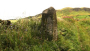
Found in close proximity to the destroyed chambered tomb of Broadgate, this small standing stone is presently set in a concrete base after an excavation here in 1982 located a cremation urn beneath the stone, confirming an old tradition that told as much.  But there are some who think the stone isn’t a prehistoric one—the Royal Commission (1963) lads for one.  In their brief resumé of the site they wrote:

“This stone stands just N of the road from Campsie to Strathblane, 140 yds E of Broadgate farmhouse.  It is 4ft high and measures 2ft 3inches by 3ft at ground level.  It may well be the stone referred to in the New Statistical Account as marking the spot where Mr Stirling of Ballagan was murdered in the 17th century and should therefore not necessarily be accepted as of prehistoric origin.”

And were it not for an excavation nearly twenty years later, this view may have been maintained.  However, when Lorna Main (1982) told of what was found beneath the monolith, no mention was made of any recent remains.  She wrote:

“Excavation at the base of the fallen standing stone was undertaken prior to its re-erection. A ledge had been cut on the south-west side of the shallow stone hole and fragments of the base survived and the diameter of the base is approximately 17cm.  The urn contained a cremation and a small quantity of charcoal.  It lay only 15cm below the ground surface and is in a poor condition.”

The very fragile state of the urn and the very eroded rounded stature of the rock itself would seem to indicate that this is more a prehistoric upright than a later 17th century one.

Folklore

There are legends of early battles in this region and J.G. Smith (1886) thought that perhaps “this great stone…mark the resting-places of Cymric heroes who did their share of the battle on the north side of the valley.”

References:

  1. Main, Lorna, “Broadgate Farm – Standing Stone and Cinerary Urn,” in Discovery & Excavation Scotland, 1982.
  2. Royal Commission on the Ancient & Historical Monuments Scotland, Stirling – volume 1, HMSO: Edinburgh 1963.
  3. Smith, John G., The Parish of Strathblane, James Maclehose: Glasgow 1886.
  4. Ure, David, The History of Rutherglen and East Kilbride, Glasgow 1793.

© Paul BennettThe Northern Antiquarian