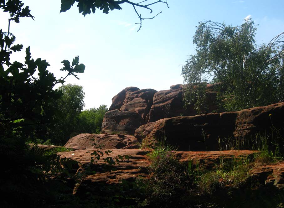
Bryn Celli Ddu, Llandaniel Fab, Anglesey

Chambered Cairn:  OS Grid Reference – SH 50761 70185

Also known as:

  1. Bryncelli Ddu
Bryn Celli Dhu in 1847

Archaeology & History

An excellent passage grave tomb that’s been described by many historians over the last two hundred years, and was subject to a fine excavation in the first half of the 20th century.  Ascribed as neolithic in origin, recent finds of human activity on the edge of the surrounding henge indicates people have been “up to things” hereby since at least 6000 BC.  Deriving its name from “the mound of the black grove,” the site as we see it today has been much restored and is so different to when it was visited by Thomas Pennant and other antiquarians.

According to an anonymously written essay in Archaeologia Cambrensis in 1847, the site was first described by Henry Rowlands (1723) where, in relation to another site, he told were,

“the remains of two carnedds, within a few paces of one another: the one is somewhat broken and pitted into on one side, where the stones had been carried away; the other having had its stones almost all taken away into walls and hedges, with two standing columns erected between them.”

A somewhat more detailed description came from Thomas Pennant a few years later.  He wrote:

“A few years ago, beneath a carnedd similar to that at Tregarnedd, was discovered, on a farm called Bryn-celli-ddu…a passage three feet wide, four feet two or three inches high and about nineteen feet and a half long, which led into a room about three feet in diameter and seven in height.  The form was an irregular hexagon, and the sides composed of six rude slabs, one of which measured in its diagonal eight feet nine inches.  In the middle was an artless pillar of stone, four feet eight inches in circumference.  This supports the roof, which consists of one great stone near ten feet in diameter.  Along the sides of the room was, if I may be allowed the expression, a stone bench, on which were found human bones, which fell to dust almost at a touch: it is probable that the bodies were placed on the bench… The diameter of the incumbent carnedd is from ninety to a hundred feet.”

Ground-plan

But the main excavation work at Bryn Celli Ddu was done in the late-1920s by W.J. Hemp (1930) and his team, who, as usual following such digs, ended up with just as many questions about the site as they had answers!  One of the best descriptions of Hemp’s excavation work was by W.F. Grimes (1932) in an essay he wrote for the East Anglian Prehistoric Society where he gave the following detailed description of the finds:

“The cairn here was circular, with a chamber of some 160ft and an original maximum height of at least 12ft.  The chamber is a polygonal structure of large stones augmented…with dry-stone walling, entered on the northeast side by a long passage built in the same way.  Many of the stones had been dressed and in the chamber stood a single pillar which had been artificially rounded and smoothed, but which had never actually supported the capstone.

“These features had been more or less apparent for many years.  But the reparation work soon showed that this was by no means all.  In the first place, it was found that the chamber had been surrounded by four circles of standing stones.  The first of these, around the outside of the mound at its base, had disappeared, although early accounts and a single hole found in the course of the work of excavation, are evidence of its existence.  The second and third circles were found when the entrance to the passage wall was being cleared.  Here the walls of the passage were found to merge into an outer circle of large stones and an inner of smaller, set close together and elaborately packed and sunk in a ditch six feet deep and eighteen wide, enclosing the chamber in such a way that passage, chamber and circles together form a gigantic unbroken spiral, with the chamber itself as an unbroken loop in it.  The fourth and innermost circle was in the area enclosed by the ditch (which is represented on the plan by the shaded portion).  This consisted of a number of stones of various sizes, irregularly placed and in some cases inclined outwards.  Under some of them were deposits of burnt human bones.  Lines connecting these stones diametrically were found to intersect at the centre of the monument, directly behind the chamber, and here was found a slab-covered pit which contained an elaborate filling whose purpose is unexplained.  Beside the cover-stone of the pit was a second larger slab of grit, lying flat, the faces of which were covered with an elaborate and continuous pattern of spirals, scrolls and zig-zags.  The position of this stone is shown beside the central stone on the plan.  Of it purpose it can only be said that it was probably magical…

“As if the elaborate features already described thus badly were not enough, a uniform floor of purple clay was found to cover the old natural surface within the area enclosed by the ditch, and there were on the floor, in the ditch, and in many other places extensive traces of fire in the form of burnt patches, blackening and quantities of charcoal.  In addition there were outside the entrance, a line of post-holes and remains of walls suggesting the former existence of some kind of forecourt crossed by a temporary barrier.  Here also were traces of fire and of elaborate ritual.  It must be emphasized of course, that all these features, with the exception of the outer circle of stones and the forecourt, had been completely concealed by the mound, so that they were not visible once the monument was completed… Moreover…the entrance to the chamber had been closed with an elaborate blocking which suggested that once closed the chamber had not been intended to be re-opened.”

Although many questions emerged following the excavation, perhaps that relating to the chronology and evolution of the site (after its ritual use) was most important.  The site as we see it today sits within the confines of a henge monument (which should also be given an independent entry account) and once a stone circle.  And although present day field evidence is inconclusive about which came first, archaeologists like Richard Bradley, Clare o’ Kelly and others are not without opinion.  Bradley (1998) told:

“O’ Kelly argued that there had been two successive monuments on the site.  The earlier one was a stone circle, enclosed by the earthworks of the henge.  In a later phase this was replaced by a passage grave which was built over the surviving remains of the stone circle, its outer kerb being bedded in the ditch of the older monument.”

But Bradley himself doubts this for various reasons, himself interpreting,

“the sequence at Bryn Celli Ddu is to suggest that in its first phase it consisted of a circular unrevetted mound about 15m in diameter, containing a passage grave.  Around the edge of this structure was a stone circle, and beyond that there was a quarry ditch.  When the monument was enlarged, not on one occasion but twice, the passage was extended as far as the earlier ditch and a significantly larger mound was bounded by kerbstones.”

Though adding himself that there is also a trouble with this idea!  As with many other sites, Bryn Celli Ddu appears to have been aligned to the summer solstice.  This notion was first propounded by astronomer Sir Norman Lockyer (1909) in his hugely revised work on the astronomical function of megalithic sites.  It was nearly 100 years before any archaeologist got off their backside and tested Lockyer’s original proposal and found the scientist to have been way ahead of them at their own discipline.  Not unsurprisingly, archaeologist Mike Pitts (2006) was a bit slow in his gimmicky headline in British Archaeology, where he deemed Steve Burrow’s personal observation as “sensational.”  Oh how common this theme seems to be in archaeology.  Twenty years previously Miranda Green (1991) posited that the chamber alignment from Bryn Celli Ddu aligned towards “May Day sunrise” — which doesn’t seem to work.  And on a similar astronomical note, archaeologist Julian Thomas (1991) thought that five post-holes found some five yards beyond the entrance were somewhat reminiscent of the “A” holes at Stonehenge and related to some lunar alignments, thinking that:

“It seems likely that  (they) record a series of observations upon the rising of some heavenly body in order to ascertain its standstill position.”

A point that Clive Ruggles (1999) explored with a little scepticism, pointing out:

“The only possibility is the northern minor limit of the moon, and while the adjacent posts are ranged on the correct side to record the position, say, of the midwinter full moonrise in years before and after the minor standstill, many other interpretations of these posts are doubtless possible.”

There’s been lots written about this place and lots more could be added with various archaeologists showing their relative opinions about the place.  But perhaps more worthwhile is a visit to the place, later on, when the tourists have fallen back under a starlit sky…

References:

  1. Anonymous, “Cromlech at Bryn Celli Ddu, Anglesey,” in Archaeologia Cambrensis, volume 2, 1847.
  2. Barber, Chris & Williams, John G., The Ancient Stones of Wales, Blorenge: Abergavenny 1989.
  3. Bradley, Richard, “Stone Circles and Passage Graves – A Contested Relationship,” in Prehistoric Ritual and Religion, edited by Alex Gibson & Derek Simpson (Sutton: Stroud 1998).
  4. Green, Miranda, The Sun Gods of Ancient Europe, Batsford: London 1991.
  5. Grimes, W.F., “Prehistoric Archaeology in Wales since 1925,” in Proceedings of the Prehistoric Society of East Anglia, 7:1, 1932.
  6. Hemp, W.J., “The Chambered Tomb of Bryn Celli Ddu, Anglesey,” in Archaeologia, volume 80, 1930.
  7. Lockyer, Norman, Stonehenge and other British Stone Monuments Astronomically Considered, MacMillan: London 1909.
  8. Lynch, Frances, Prehistoric Anglesey, Anglesey Antiquarian Society 1991.
  9. o’ Kelly, Clare, “Bryn Celli Ddu: A Reinterpretation,” in Archaeologia Cambrensis, volume 118, 1969.
  10. Ruggles, Clive, Astronomy in Prehistoric Britain and Ireland, Yale University Press 1999.
  11. Thomas, Julian, Rethinking the Neolithic, Cambridge University Press 1991.

© Paul Bennett, The Northern Antiquarian

St. Oswald’s Well, Winwick, Cheshire

Holy Well:  OS Grid Reference – SJ 6072 9408

Folklore

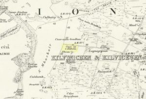
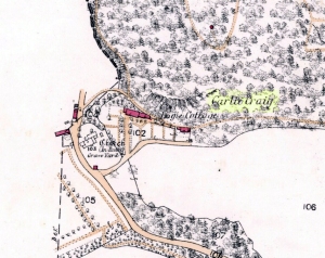
St Oswalds Well on 1849 map

In the old Hundred of West Derby in what was once Lancashire (them there political types shifting boundaries for their own greasy deeds) still remains to this day the trickling remains of old Oswald’s sacred spring, close to the Hermitage Green, which is thought to have gained its named after just such a hermit living hereby and who, no doubt, frequented or looked after this holy well for both refreshment and spiritual sustenance.

Named after the once-pagan King of Northumbria — who was later patronized and regressed to the cultus of a saint — the well was said to be close to an ancient palace, which was later moved when the King regressed into christendom.  The well itself was said to have been created through the tradition that the very Earth here possessed healing powers so renowned that people came from many miles to collect and take it for its sacred and medicinal qualities.  In Henry Taylor’s (1906) magnum opus he told:

“A writer in The Antiquary twenty years ago (vol.3, p.261) described it as having a very modest appearance for so famous a spot, looking merely like a hole into the hillside.  The writer goes on to say, “Passing through a small cottage garden, a well-trodden path leads to the well, which is merely a fosse, as described by Bede, and, situated as it is at the bottom of a tolerable declivity, derives its supply from the drainage of the upper ground rather than from any spring.  The water is not very bright, but the well is substantially walled inside, and two or three deeply worn steps lead to the water.”

“The Venerable Bede gives an account of numerous miracles which took place at St. Oswald’s Well.  He says: “After which period Oswald was killed in a great battle by the same Pagan nation and Pagan King of the Mercians who had slain his predecessor Edwin at a place called in the English tongue Maserfield in the 38th year of his age on the 5th day of the month of August.  How great his faith was towards God, and how remarkable his devotion, has been made evident by miracles since his death; for in the place where he was killed by the pagans…infirm men and cattle are healed to this day.  Whereupon many took up the very dust of the place where his body fell, and putting it into water did much good with it to their friends who were sick.  This custom came so much into use, that the earth being carried away by degrees, there remained a hole as deep as the height of a man… Many miracles are said to have been wrought in that place, or with the earth carried from thence; but we have thought it sufficient to mention two, which we heard from our ancestors.””

References:

  1. Taylor, Henry, The Ancient Crosses and Holy Wells of Lancashire, Sherratt & Hughes: Manchester 1906.

© Paul Bennett, The Northern Antiquarian

Banbury Cross, Oxfordshire

Cross:  OS Grid Reference – SP 45323 40397

Also Known as:

  1. High Cross
  2. Market Cross

Archaeology & History

Banbury Cross (after Ronald Goodearl, 1973)

The original stone monolith that stood here has long since been destroyed (by christians arguing amongst themselves) and the ornate edifice that we see today was erected in 1859 to commemorate the marriage of Queen Victoria’s eldest daughter, Victoria Adelaide Mary Louisa, to Friedrich Wilhelm of Prussia.  Standing more than 52 feet tall, it is of a neo-Gothic design and is one of the tallest crosses in the country.  Originally there were going to be six carved statues cut into the niches of the cross, but this was later reduced to three.

First mentioned in place-name records from 1478, the original stone cross was itself very prominent, rising some 20 feet tall and sitting upon a square base of eight steps.  It was described by John Leland in his Itinerary when he visited the town sometime between 1535 and 1545, who said:

“At the west part of the street…is a large area, having a goodly cross with many degrees (steps) about it.  In this area is kept every Thursday a very celebrated market.”

The old cross was also a site where public notices and proclamations were dispensed to local people and seems to have been an old meeting place.  Whether it had a prehistoric predecessor isn’t known.

Folklore

The nursery rhyme we’ve all recited when we were kids and growing-up, has much of its origins around this ornate edifice and in the 20th century was thought to have its origins in pre-christian practices hereby, but this is questionable.  The rhyme, to those who don’t know it, goes:

Ride a cock-horse to Banbury Cross,
To see a fine lady upon a white horse,
With rings on her fingers and bells on her toes,
She shall have music wherever she goes.

As Kirsten Ayles (1973) told:

“This rhyme was first recorded in 1784, but it probably originated much earlier.  The Banbury Cross mentioned was destroyed at the turn of the 16th century by the Puritan inhabitants of Banbury.  It has been suggested that “bells on her toes” points to the fifteenth century, when a bell was worn on the long tapering shoe of each shoe.  It has (also) been thought that the “fine lady” was Queen Elizabeth I, or Lady Godiva.”

Another option identifying the “fine lady” in the rhyme is perhaps a member of the Fiennes family, ancestors of Lord Saye and Sele who owns nearby Broughton Castle.

References:

  1. Ayles, Kirsten, “A Short History of Nursery Rhymes,” in This England, 6:3, Autumn 1973.
  2. Gelling, Margaret, The Place-Names of Oxfordshire (2 volumes), Cambridge University Press 1954.
  3. Vallance, Aymer, Old Crosses and Lychgates, Batsford: London 1920.

Acknowledgements:

To Ronald Goodearl, for use of his 1973 photograph of the Banbury Cross.

© Paul Bennett, The Northern Antiquarian 

Salford Cross Cup-Marks, Oxfordshire

Cup-Marked Stone:  OS Grid Reference – SP 28644 28058

Getting Here

Pretty simple this one.  From Chipping Norton, head west on the A44 for a coupla miles till you hit the lovely Salford village.  The church stands out, so head for it and, as you walk towards the building, watch for the small stone cross in front of you.

Archaeology & History

Salford Cross cup-markings

This is curious.  Very curious!  We might expect to find cup-markings occasionally on some of the cross-bases or other early christian monuments in northern England and Scotland, but to find them in the heart of a small Oxfordshire village where the tradition of cup-marked stones is unknown, was something of a surprise when Tom Wilson and I (1999) found it, to say the least!  But this is what we’re looking at here.

Salford Cross remains

On the remains of an old medieval cross, whose broken shaft has seen better days,  as the photo shows — and as a personal viewing shows even clearer — there are 3 simple cup-markings etched on one side of the cross-base in Salford churchyard.   The cups certainly aint natural, but then also they don’t have the archaic looks of the prehistoric carvings from Yorkshire to Scotland.  It would be good if we had a more extensive history of the cross monument itself, perhaps saying precisely where the stones which make it up came from, but local records tell us nothing it seems.  If we could ascertain that parts of it were made up of some remains taken from some local prehistoric ‘pagan’ tomb (and a number of tombs have been found in and around this area), then some sense could be thrown upon its position here.  But until we can ascertain more about the history of the cross, the three clear cup-markings on the cross-base remain somewhat of a mystery.

Folklore

Lovers of ley lore will be intrigued to find this carved cross-base is on a very accurate ley linking the King Stone, Rollright stone circle, Little Rollright church (where a standing stone can be found in the walling just before it), the Salford Cross and the site of another cross on the hill outside the village.

References:

  1. Bennett, Paul & Wilson, Tom, The Old Stones of Rollright and District, Cockley: London 1999.

© Paul Bennett, The Northern Antiquarian

Herder’s Cross, Wycoller, Lancashire

Cross:  OS Grid Reference – SD 94057 39369

Also Known as:

  1. Herders Common Cross

Getting Here

From Laneshaw Bridge, near Colne, take the long country road that goes up above Wycoller to Stanbury and Haworth over the Yorkshire-Lancashire border.  A couple of miles uphill, there’s a parking spot with views across the moors.  Stop here.  Cross the road and walk up for about 100 yards, going thru the rickety gate on the left, and up the field (past the small disused quarry) until you see the large rock looming ahead of you, perched on its own.  That’s it!

Archaeology & History

Herders Cross stone

This is a really curious spot to me.  A large singular boulder sat on the edge of an uninhabited moorland with no real history of heathenism, nor religious practices; yet someone at sometime in the not-too-distant past saw something here that made them cut a large square hollow into the top of this stone, in which they stuck an old cross.  We came across this site a few weeks ago quite by accident, but realised that the deep hollow in the rock was an old cross base; so when I got home I checked Taylor’s (1906) magnum opus, expecting to find some info therein.  But even Taylor seemed to know nothing of this place.

A week or two later, Paul Hornby pointed me in the direction of an unpublished essay by a local chap called Clifford Byrne (1974) who’d studied some of the early christian remains in the region and who wrote the following of what he named “Herders Cross”:

“This cross, or more properly its socket, is probably one of the least known in the area.  It was shown to the writer by Mr Stanley Cookson of Trawden, who discovered the socket in passing, so to speak.  On the road to Haworth from Laneshawbridge, opposite the site of Foster’s Leap rocks, on the east side of the road, is a really huge boulder on the moor top.  In the south side is the cross socket, whilst on the north side of the rock can be made out a right-angled mark which implies that either the socket was being placed on that side in the first instance, or that two sockets were once envisaged…

“Old maps show the rock in situ with a “shaft” protruding from the top.  Some yards west a shallow pony track  bypasses the site, whilst some four or five hundred yards east a very well worn and ancient road, long unused, passes in the direction of Emmot Holy Well.  The cross may thus have been a Wayside Cross showing the way to this Holy spring which is remembered as being propitious in the cure of rheumatism.”

Cross-base socket

This may be so; but I suspect earlier, heathen remains upon the moors here to explain the curious position of both this and another cross-base some 400 yards away.  Some dubious cup-marks can be seen by the side of the stone hollow; and other dubious ones have been found on the moors above here.  There is folklore of a lost stone circle on the hills above here, and a scattering of little-known faerie lore, indicating hidden sites and lost myths.  These ingredients are more likely the reasons that Herders Cross was erected here, overlooking the countryside south and west, with the holy hill of Pendle rising in the centre of the distant landscape…

References:

  1. Byrne, Clifford, A Survey of the Wayside Crosses in North East Lancashire, unpublished 1974.
  2. Taylor, Henry, The Ancient Crosses and Holy Wells of Lancashire, Sherratt & Hughes: Manchester 1906.

© Paul Bennett, The Northern Antiquarian

Ben Ledi, Callander, Stirlingshire

Sacred Mountain:  OS Grid Reference – NN 562 097

Getting Here

The hazy peak of Ben Ledi

From the tourist-infested (but lovely) town of Callander, look west to the largest of the nearby mountains — that’s where you’re heading!  You can keep along the A84 road out of the town for 4-5 miles (past the Falls and Pass of Leny) till you reach the parking spot on your left.  Cross the river and go up into the signposted woodland.  Keep walking up thru the trees until the rocky mass emerges above you.  You can either keep to the path and follow the long walk round the mountain, or go straight up the crags above you.  The top’s in sight!

Folklore

Getting up here is no easy task if you’re unfit — but it’s well worth the effort for the journey alone!  And in bygone centuries it seems, local people made it a particular pilgrimage at specific times during the year.  Even the name of this great hill has some supposed affinity with holy issues; though some modern english etymologists put a dampener on such things.  In Charles Rogers’ (1853) excellent Victorian exposition, he told that,

Benledi is an abbreviation of the Celtic Ben-le-dia, signifying the hill of God.”

But whether the old heathens who named most of these ancient mountains would echo his oft-repeated derivation is another thing altogether!  However, there are other decidedly pre-christian events that used to be enacted here, for the summit of Ben Ledi was, tradition tells, where the sun god was worshipped.  It would seem, however, that this tradition is a somewhat watered-down version of it as a site of cosmological and social renewal. (see Eliade 1974) For akin to the annual pilgrimage that happens upon Croagh Patrick in County Mayo, Ireland, here upon Ben Ledi,

“For three days and three nights…the inhabitants of the district in those primitive times convened, at the period of summer solstice, on the summit of the mountain, to join in the rites of heathen worship.”

More recent lore tells the date of such sacred gatherings was Beltane.  Also a short distance to the north of the summit of Ben Ledi is a small loch known as Lochan-nan-corp.  Mr Rogers again tells us that,

“Here two hundred persons, who were accompanying a funeral from Glenfinglas to the churchyard of St. Bride, suddenly perished; the ground had been covered with snow and the company were crossing the lake on the ice, when it at once gave way.”

It seems a most unusual event.  But the tale itself implies that a corpse route passed by the way of this high summit, down to the heathen chapel of St. Bride at the bottom of its eastern face: a huge undertaking in itself with probably archaic origins.  Does anyone know owt more about this?

References:

  1. Eliade, Mircea, The Myth of the Eternal Return, Princeton University Press 1974.
  2. Eliade, Mircea, Patterns in Comparative Religion, Sheed & Ward: London 1958.
  3. Roger, Charles, A Week at Bridge of Allan, Adam & Charles Black: Edinburgh 1853.

© Paul Bennett, The Northern Antiquarian

Almscliffe Crags, North Rigton, North Yorkshire

Legendary Rocks:  OS Grid Reference – SE 2681 4900

Also Known as:

  1. Ormscliffe Crags

Getting Here

This is an outstanding site visible for miles around in just about every direction – so getting here is easy! If you’re coming from Harrogate, south down the A658, turn right and go thru North Rigton.  Ask a local.  If you’re coming north up the A658 from the Leeds or Bradford area, do exactly the same! (either way, you’ll see the crags rising up from some distance away)

Archaeology & History

Almscliffe Crags – looking east

This giant outcrop of rock rises out from the meadowlands here like a miniature volcano, visible for many miles all round.  The history and legends surrounding the aged edifice are prodigious and the view from its tops on a fine day is one to be remembered.   It is likely, although there is little corroborative historical evidence, that is was an “omphalos”, or navel centre of the universe for the local people many centuries ago.  A great cutting runs through its centre and “runs from nearly north to south, and forms the boundary between the townships of Rigton and Stainburn, so that a portion of the rock is in each township.”  On the respective sides of this division are carved the letters “T.F.” and “E.L.”, being the initials of the families who owned the land here in olden days, Thomas Fawkes [of the legendary Guy Fawkes’ family] and Edwin Lascelles, of the ancient Harewood family.

Although Almscliffe Crags have been described in a great many local history books, it almost beggars belief to find it omitted from all the ancient mystery or “sacred sites” books ever written.  Curious…  Such lesser sites as Alderley Edge, the Cow and Calf rocks, Kilburn’s White Horse, Twelve Apostles stone circle, and many more, whilst having their respective virtues, don’t touch this place for ritual or sacred intent.

First described in the early 13th century records of Fountains Abbey, A.H. Smith (1961) thought the name of Almscliffe itself originally came from a hypothetical lady’s name, which seems an all-too-easy proclamation to make, instead of the humble option of  “I don’t know”!  But Smith wasn’t the only one to throw some curious ideas up about the etymology of Almscliffe.  Said by some local etymologists to derive from the Celtic Al-, a rock or cliff, and mias, an altar, there are other attempts to bring its rocky form into a consensus meaning.  The anglo-saxon Ael or El, being fire, and messe, or mass; and the Scandinavian Ormcliff, being the “cliff of the serpent”.  In Jones’ History of Harewood (1859), he tells

“it to have derived its name from the distribution of almes, at certain times, agreeably to the tenor of legacies left to the chapel which stood there in the sixteenth century, and was at that time dedicated to the Virgin Mary.”

It’s difficult to say which one tells its true title.  Many a druidic tale has also been carved into its form.  Such is the nature of this site that Grainge (1871) wrote how,

“it would not be difficult to show, with the exception of the artificial temple or circle of stones, this place possesses all the accessories of that ancient worship as…typical of the worship of the sun.”

Simpson’s 1879 drawing of the Almscliffe ‘cromlech’

A remark that was even echoed by one of Yorkshire’s finest and most sober historians, Harry Speight. (1903)  Grainge also pointed out that in his day there were three standing stones by the great Crags, one fallen, but “two of these rocks yet stand upright.”  A few years later we find that the ranting christian writer,  Henry T. Simpson (1879), described similar megalithic remains here, though his description was of a “cromlech.” (illustrated here)  I can find no trace, nor further references to these relics; but think it reasonable to suggest that, perhaps, Simpson’s cromlech and Grainge’s standing stones may have been one and the same monument.

In the field 100 yards immediately north of the Crags (the one with the two rocks in it) there used to be seen the remains of some primitive early walling, suggestive of a small, early settlement site.  Very little can be seen of these remains today and, as far as I’m aware, no archaeological survey was ever done of them. In all honesty, it’s highly probable that a number of other important prehistoric sites were once in evidence at varying distances around Almscliffe Crags…

Folklore

The creation myth of Almscliffe tells that, long long ago, the great giant Rombald — whose main place of residence tended to be Ilkley Moor — was having a fight with the devil upon his homeland heath.  As is common in the myths of giants, the ‘devil’ picked up a great boulder and threw it at Rombald, but it missed and fell just short of the village of North Rigton, creating Almscliffe Crags. A variation of this tale tells that it was Rombald and his wife having the argument and she threw the stones to create the place.  Several sites have been named as the place where the mythological argument occurred: the Cow and Calf rocks, the Great Skirtful and Little Skirtful of Stones all cited in the folktales of our Yorkshire peasants.  Another variation of the tale tells that the devil was simply carrying some stones (as devils and giants are renowned to do in the folk-tales of the world) and he accidentally dropped them where the Crags now stand.  Such rock-throwing tales are, once more, symptomatic of cailleach tales more commonly found in Ireland and Scotland.

There are a great many cup-markings on the top surface of these Crags, most of which seem natural, but it is not unreasonable to think that, perhaps, some may have been carved by human hands? (not sure misself)  Eric Cowling (1946) sincerely believed the antiquity of some carvings here.  One of them particularly, three feet across and eighteen inches deep, though seemingly natural, has for several centuries been known as  the “Wart Well.”  Its name is attributed to folklore that is more commonly found in Ireland and the Scottish highlands; that is, should you have a wart, prick it with a pin until a drop or two of blood drips into the water that gathers in the stone bowl, then dip your hand in afterwards.  The wart is sure to vanish.  Another method to achieve the same end is to merely wash the skin affliction in the water, and it will soon fade. (Interestingly, an old psychotherapist friend, afflicted with the damned things, did just this and they promptly vanished.)

A more minor creation myth tells that the stone bowls we see on top of the Crags here – including the Wart Well – was actually made when the giant Rombald stepped from his home onto the Crags and left his footprint embedded in the rock face.  He was said to have made it in just one step, from the Giant Skirtful of Stones prehistoric cairn [where one legend reputes him buried].

Faerie folk were also long held to live here.  On the northwest side of the Crags is the entrance to a small cave that was always known as the Faerie’s Parlour, as it was said to be an entrance to their supernatural world.  In times past, many people have scrambled down into the cave, but never reached their Otherworldly paradise.  William Grainge (1871) wrote how the little people “were all powerful on this hill and exchanged their imps for children of the farmers round about.”  This is typical of old changeling lore!  In outlying villages surrounding the Crags there is a particular excess of faerie and old heathen lore.

One very curious-sounding tale tells how a goose was sent down the hole and, after some considerable time, re-emerged 3½ miles away out from a well near Harewood Bridge.  The goose is one of the many symbols of the sun and one of its primary symbolic attributes is that of winter.  Interestingly perhaps, as the rock art writer Graeme Chappell has pointed out, the underground journey of the goose from Almscliffe to Harewood Bridge coincides closely with the rising of sun on morning of the winter solstice.  This tale may simply be a folk remnant — and an archaic one at that — of just that event: ritualising winter solstice from these Crags.  In Norse lore, shamans tell of geese carrying the great god Wotan across the skies at the coming of the Yule period.

Another ritual date that was celebrated here was Beltane, or May 1.  Not only do we find many of the outlying villages possessed their own maypoles, but in 1879 Mr Simpson of Adel reported seeing Beltane fires atop of these rocks.  Other meetings were made here as the Crags are spliced in half by the local boundary line, and perambulation records show that people came here during the ‘beating of the bounds’, as they used to be called.  This boundary perambulation moot ingredient is what strongly implies the site to have had ritual importance.  And the fact that a mass of folktales emerge from here adds to this.  Then of course we have the physical situation of the Crags at the heart of the mid-Wharfedale landscape.  All these ingredients combined, strongly suggest the site would have been, not just the ritual meeting place of tribal elders in pre-christian times, but an omphalos: it rises majestically from the land and all monuments gaze towards its giant form.  Important giant prehistoric monuments from the hills miles away tell of myths that come and go from this proud mass of stone.  Although we have other omphali just over the extended horizons from Almscliffe, this is where the World began in the creation myths of ancient times in mid-Wharfedale, at the heart of the ancient kingdom of Elmet.

But there is still more lore to be told of these rocks…

The centre piece of the Crags is known as the Altar Rocks.  Upon its western side is carved the “figure of a large tree, which we take to be the monogram of the Celtic Jupiter,” says Grainge.  This assumption is derived from an eighteenth century writer who, said Speight (1903), told that “Almnus and Alumnus are titles of Jupiter, to whom this high altar was dedicated.”

The highest part of the Crags, to the west, is known as Lover’s Leap where, in 1766, a daughter of a respectable Rigton farmer of the name Royston, having been disappointed in love, decided to kill herself.  She jumped, so legend reputes, from a point some sixty feet above ground, but a strong wind blowing at the time caught hold of her dress and carried her through the air until she landed safely in an adjoining field with naught but a sprained thumb!  The said lady realised the stupidity of her ways and was said to have lived out a long and fine life.

In recent years earthlights (UFOs) have been seen floating above and around the great outcrop.  It is likely that these were the same things which, in days of olde, the people would call the faerie.  I highly recommend visiting the place!

References:

  1. Bennett, Paul, The Old Stones of Elmet, Capall Bann: Milverton 2001.
  2. Bogg, Edmund, From Eden Vale to the Plains of York, James Miles: Leeds 1895.
  3. Bogg, Edmund, Higher Wharfeland, James Miles: Leeds 1904
  4. Cowling, E.T., Rombald’s Way, William Walker: Otley 1946.
  5. Eliade, Mircea, Patterns in Comparative Religion, Sheed & Ward: London 1958.
  6. Grainge, William, History & Topography of Harrogate and the Forest of Knaresborough, J.R. Smith: London 1871.
  7. Jones, John, The History and Antiquities of Harewood, Simpkin Marshall: London 1859.
  8. Simpson, William, Archaeologia Adelensis, W.H. Allen: London 1879.
  9. Smith, A.H., The Place-Names of the West Riding of Yorkshire – volume 5, Cambridge University Press 1961.
  10. Speight, Harry, Kirkby Overblow and District, Elliott Stock: London 1904.

© Paul Bennett, The Northern Antiquarian

Tobar na Cailleach, Keith, Banffshire

Sacred Well:  OS Grid Reference – NJ 42659 47528 

Also Known as:

  1. Cailleach Well 
  2. Tobar Chailleach 
  3. Well of the Cailleach

Folklore

Cailleach Well on 1869 map

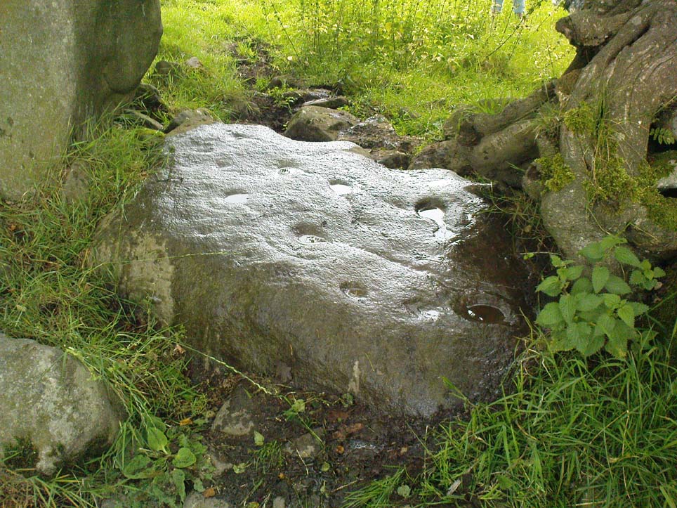
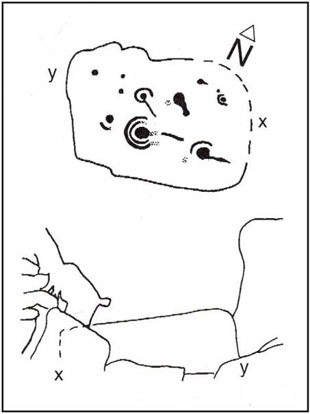
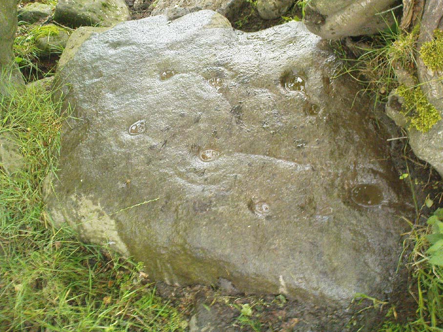
Described on the earliest OS-map of the region as Taber Chalaich, this great “well of the old woman, or hag” is found on the northern slopes of Cairds Hill, amidst increasingly dense woodland up the top of the stream which ebbs and flows in strength (depending on the weather).  A water source dedicated the prima mater Herself — i.e., the heathen pre-Celtic female creation deity par excellence — it was once of considerable repute locally as being a great curing well and was described by Ruth and Frank Morris (1981) as being,

“the scene of a pagan ceremony in which the Earth Mother in her old woman phase bathed at the well and returned as a young maiden.”

On the hill at the top we find remains of old tombs (mistakenly ascribed by Mr & Mrs Morris as ‘stone circles’), some of which may have had some mythic relationship with this legendary water source.  Further information and/or any photos of this little-known site would be hugely welcomed!

References:

  1. Morris, Ruth & Frank, Scottish Healing Wells, Alethea Press: Sandy 1982.

© Paul Bennett, The Northern Antiquarian


Devil’s Dyke, Poynings, Sussex

Hillfort:  OS Grid Reference – TQ 260 111

Also Known as:

  1. Brighton Dyke
  2. Poor Man’s Wall 

Getting Here

Map of Devil's Dyke
Map of Devil’s Dyke

Plenty of ways of approaching this huge fella!  Personally, I’d take it from the steep valley immediately east and north where the ramparts drop you down the hill, if only to get a decent idea of the scale of the thing!  But those of you into taking it easy can do no better than take the country road south out of Poynings village (towards Brighton), down Saddlescombe Road, for just under a mile, where you should take a right-hand turn along the Summer Down lane for a mile. You’ll then hit the Devil’s Dyke Road. Turn right here and go to the end.  You’re right in the middle of it!

Archaeology & History

Early plan of Devil’s Dyke ‘camp’

Although most of this huge monument hasn’t been given the investigation it deserves — hence making knowledge of its origins more speculative than factual — as Jacquetta Hawkes (1973) wrote, seemingly all those years ago now, “it is known that a village lying half in and round them was occupied in the Belgic period at the end of the Iron Age.”  And it’s certainly big enough!  The encircling circuit of dykes themselves stretch all the way round a distance of more than 2150 yards long (that’s 1.22 miles, or 1.97km!), with the longest east-west axis being more than half-a-mile across.

Nowadays it seems, the Devil’s Dyke is the name given to the steep valley below the encampment, but a hundred years back it was the camp itself that was known by this name.  Described by the wandering antiquarian R. Hippisley Cox (1927) as “a camp containing forty acres (with) very steep and difficult approaches,” another early account in The Antiquaries Journal — commenting on a ground-plan of the site from the Brighton and Hove Herald of 1925 — told:

“The heavy encircling lines represent ramparts, and the thin line marks the outer margin of the accompanying ditch.  A spur renders the earthwork weakest on the south-west, and the rampart is therefore highest between the points 1 and 3, rising 21ft vertically above the ditch, which is nearly filled up at the present time.  On the north-west there is steep slope outside the camp, and the ramparts are considerably lower, the iner ditch being nearly obliterated.  The outer rampart is now wanting betwen 7 and 8, but this inner one becomes stronger as the outer slope of the ground decreases, only to die away again on the south-east where the camp overlooks the steep Dyke Valley.  A double-bank and inner ditch can still be traced from the north-east angle to a point near the old golf-club house.”

I first came here as a young lad and the site was lost on me (in them days, if monuments weren’t stiff and upright, I really didn’t see the point!).  These days however, the size of it alone blows you away somewhat.

Folklore

As you’d expect the creation myths of this site and its edges relate to our old heathen friend, the devil!  The landscape itself was, in old lore, the work of the devil (though prior to this, the devil was known in peasant-lore to be a legendary giant, though I am unaware of the name/s of the giant in question); and the great valley below the Devil’s Dyke encampment was actually dug out by Old Nick in the old tales.  That old folklorist Jacqueline Simpson (1973) takes up the story:

“The Devil…had been infuriated by the conversion of Sussex, one of the last strongholds of paganism in England, and more particularly by the way the men of the Weald were building churches in all their villages.  So he swore that he would dig right through the Downs in a single night, to let in the sea and drown them all.  He started just near Poynings and dug and dug most furiously, sending great clods of earth flying left and right — one became Chanctonbury, another Cissbury,  another Rackham Hill, and yet another Mount Caburn.  Towards midnight, the noise he was making disturbed an old woman, who looked out to see what was going on.  As soon as she understood what he was up to, she lit a candle and set it on her window-sill, holding up a sieve in front of it to make a dimly glowing globe.  The Devil looked round, and thought this was the rising sun.  At first he could hardly believe his eyes, but then he heard a cock crowing — for the old woman, just to make quite sure, had knocked her cockerel off his perch.  So Satan flew away, leaving his work half done.  Some say that as he went out over the Channel, a great dollop of earth fell from his cloven hoof, and that’s how the Isle of Wight was made; others, that he bounded straight over into Surry, where the impact of his landing formed the hollow known as his Punch Bowl.”

That’s the story anyway — take it or leave it!  Of importance in this fable is the figure of the “old woman”: a much watered-down version of the cailleach figure of more ancient northern and Irish climes, where tales of her doings are still very much alive.  And many are the tales of her battles with other giant figures, just as we evidently once had here.

Ghosts have been reported by local people upon this hill-top site; and there are a number of other folktales to be found here…which I’ll unfold over time as the months pass by…

References:

  1. Anon., “Notes: The Brighton Dyke,” in The Antiquaries Journal, 5:4, October 1925.
  2. Clinch, G., “Ancient Earthworks,” in Victoria County History of Sussex – volume 2 (edited by W. Page), St. Catherine’s Press: London 1905.
  3. Cox, R. Hippisley, The Green Roads of England, Methuen: London 1927.
  4. Hawkes, Jacquetta, A Guide to the Prehistoric and Roman Monuments in England and Wales, Chatto & Windus: London 1973.
  5. Hogg, A.H.A., “Some Aspects of Surface Fieldwork,” in The Iron Age and its Hillforts (edited by M. Jesson & David Hill), Southampton University Archaeology Society 1971.
  6. Simpson, Jacqueline, The Folklore of Sussex, Batsford: London 1973.
  7. Simpson, Jacqueline, “Sussex Local Legends,” in Folklore Journal, volume 84, 1973.

© Paul Bennett, The Northern Antiquarian

Tobar Mor, Tarbert, Gigha, Argyll

Sacred Well:  OS Grid Reference – NR 6564 5190

Also Known as:

  1. Canmore ID 38609
  2. Great Well of the Winds
  3. St Beathag’s Well
  4. Tobar Bheathaig

Folklore

There are a number of sacred and healing wells on this small island, but this site in particular was deemed magickal by folk from far and wide.  Found on the northwest slopes of Cnoc Largie (around which are other heathen spots) this legendary site had an attendant keeper of the well:

“an aged female direach, or guardian, whose uncanny powers could be commanded by a small offering of silver.  Following this the cover of the sacred well would be removed in order that its waters might be ceremonially cleansed with a white clamshell prior to being stirred three times, sunwise, to the accompaniment of ritual incantations.  Then three shell-fulls of the sacred water would be hurled aloft in the direction of the desired wind which, before the day was out, invariably appeared.”

This simple ritual obviously tells that it was a heathen site, seemingly one for divination and magick.  Another piece of folklore (found at other wells) told that if the cover on the well were left unattended, its waters could overflow and flood the entire island.

References:

  1. Anonymous, Exploring Historic Kintyre and the Isle of Gigha, Harlequin Press: Oban n.d.

© Paul Bennett, The Northern Antiquarian