Banbury Cross, Oxfordshire

Cross:  OS Grid Reference – SP 45323 40397

Also Known as:

  1. High Cross
  2. Market Cross

Archaeology & History

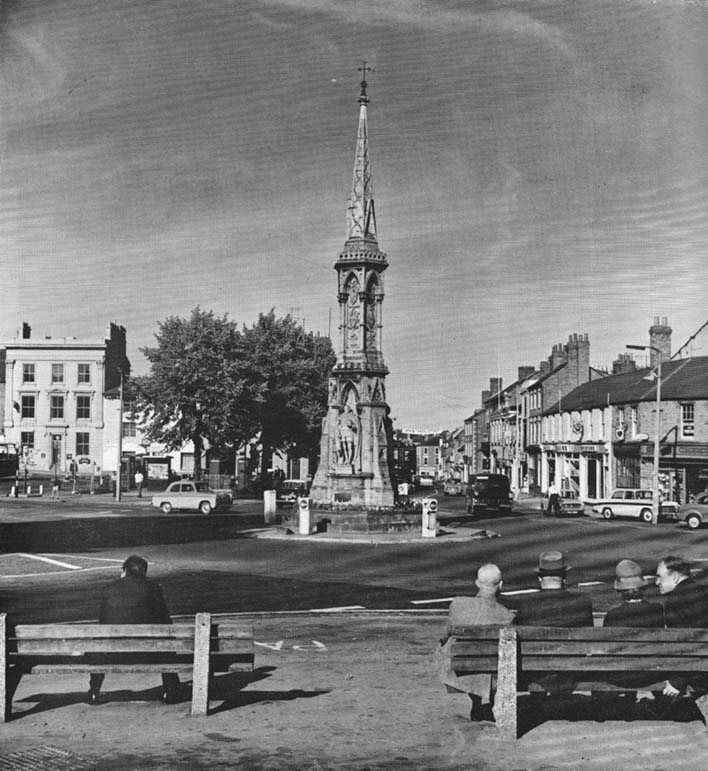
Banbury Cross (after Ronald Goodearl, 1973)

The original stone monolith that stood here has long since been destroyed (by christians arguing amongst themselves) and the ornate edifice that we see today was erected in 1859 to commemorate the marriage of Queen Victoria’s eldest daughter, Victoria Adelaide Mary Louisa, to Friedrich Wilhelm of Prussia.  Standing more than 52 feet tall, it is of a neo-Gothic design and is one of the tallest crosses in the country.  Originally there were going to be six carved statues cut into the niches of the cross, but this was later reduced to three.

First mentioned in place-name records from 1478, the original stone cross was itself very prominent, rising some 20 feet tall and sitting upon a square base of eight steps.  It was described by John Leland in his Itinerary when he visited the town sometime between 1535 and 1545, who said:

“At the west part of the street…is a large area, having a goodly cross with many degrees (steps) about it.  In this area is kept every Thursday a very celebrated market.”

The old cross was also a site where public notices and proclamations were dispensed to local people and seems to have been an old meeting place.  Whether it had a prehistoric predecessor isn’t known.

Folklore

The nursery rhyme we’ve all recited when we were kids and growing-up, has much of its origins around this ornate edifice and in the 20th century was thought to have its origins in pre-christian practices hereby, but this is questionable.  The rhyme, to those who don’t know it, goes:

Ride a cock-horse to Banbury Cross,
To see a fine lady upon a white horse,
With rings on her fingers and bells on her toes,
She shall have music wherever she goes.

As Kirsten Ayles (1973) told:

“This rhyme was first recorded in 1784, but it probably originated much earlier.  The Banbury Cross mentioned was destroyed at the turn of the 16th century by the Puritan inhabitants of Banbury.  It has been suggested that “bells on her toes” points to the fifteenth century, when a bell was worn on the long tapering shoe of each shoe.  It has (also) been thought that the “fine lady” was Queen Elizabeth I, or Lady Godiva.”

Another option identifying the “fine lady” in the rhyme is perhaps a member of the Fiennes family, ancestors of Lord Saye and Sele who owns nearby Broughton Castle.

References:

  1. Ayles, Kirsten, “A Short History of Nursery Rhymes,” in This England, 6:3, Autumn 1973.
  2. Gelling, Margaret, The Place-Names of Oxfordshire (2 volumes), Cambridge University Press 1954.
  3. Vallance, Aymer, Old Crosses and Lychgates, Batsford: London 1920.

Acknowledgements:

To Ronald Goodearl, for use of his 1973 photograph of the Banbury Cross.

© Paul Bennett, The Northern Antiquarian 


Salford Cross Cup-Marks, Oxfordshire

Cup-Marked Stone:  OS Grid Reference – SP 28644 28058

Getting Here

Pretty simple this one.  From Chipping Norton, head west on the A44 for a coupla miles till you hit the lovely Salford village.  The church stands out, so head for it and, as you walk towards the building, watch for the small stone cross in front of you.

Archaeology & History

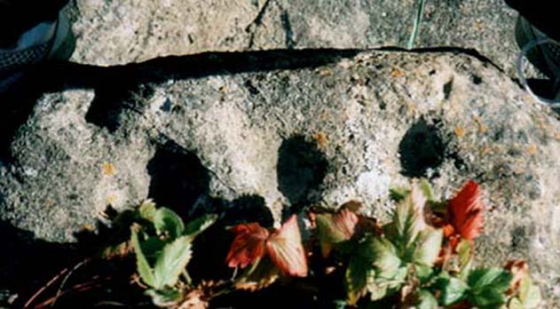
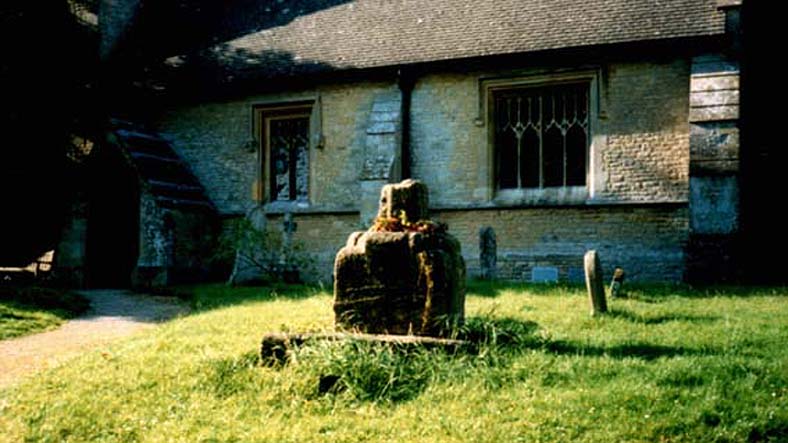
Salford Cross cup-markings

This is curious.  Very curious!  We might expect to find cup-markings occasionally on some of the cross-bases or other early christian monuments in northern England and Scotland, but to find them in the heart of a small Oxfordshire village where the tradition of cup-marked stones is unknown, was something of a surprise when Tom Wilson and I (1999) found it, to say the least!  But this is what we’re looking at here.

Salford Cross remains

On the remains of an old medieval cross, whose broken shaft has seen better days,  as the photo shows — and as a personal viewing shows even clearer — there are 3 simple cup-markings etched on one side of the cross-base in Salford churchyard.   The cups certainly aint natural, but then also they don’t have the archaic looks of the prehistoric carvings from Yorkshire to Scotland.  It would be good if we had a more extensive history of the cross monument itself, perhaps saying precisely where the stones which make it up came from, but local records tell us nothing it seems.  If we could ascertain that parts of it were made up of some remains taken from some local prehistoric ‘pagan’ tomb (and a number of tombs have been found in and around this area), then some sense could be thrown upon its position here.  But until we can ascertain more about the history of the cross, the three clear cup-markings on the cross-base remain somewhat of a mystery.

Folklore

Lovers of ley lore will be intrigued to find this carved cross-base is on a very accurate ley linking the King Stone, Rollright stone circle, Little Rollright church (where a standing stone can be found in the walling just before it), the Salford Cross and the site of another cross on the hill outside the village.

References:

  1. Bennett, Paul & Wilson, Tom, The Old Stones of Rollright and District, Cockley: London 1999.

© Paul Bennett, The Northern Antiquarian


Cornwell Stone, Salford, Oxfordshire

Standing Stone:  OS Grid References – SP 2770 2785

Getting Here

Go west along the A44 from Salford village ’til just before the crossroad with the A436. 100 yards before here there’s a small left turn, downhill, past Hollis Hill Farm and Park Farm. Before reaching Cornwell at the bottom, walk into the fields to your left and find the township boundary (on 1:25,000 OS maps), which is marked with old hedges.  It’s in here!

Archaeology & History

Walk along the line of old hedges, checking either side if it’s overgrown, until you find this well-worn three-foot tall standing stone (exact coordinate SP 2770 2785) standing in the hedgerow. It’s a cute little thing which may have marked the old boundary line, but it has a distinctly prehistoric feel and look to it, in a region where many old prehistoric remains still linger…

References:

  1. Bennett, Paul & Wilson, Tom, The Old Stones of Rollright and District, Cockley: London 1999.

© Paul Bennett, The Northern Antiquarian


Lyneham Barrow, Ascot-under-Wychwood, Oxfordshire

Long Barrow:  OS Grid Reference – SP 2975 2107

Getting Here

Lyneham Barrow stone

Pretty easy really.  From Shipton-under-Wychwood take the A361 road north (to Chipping Norton) for just over 2 miles.  You’ll pass the TV mast on your right and then a small country lane sign-posted to Ascott-under-Wychwood.  Go past this and then stop at the next right-turn a half-mile further up the road.  The barrow is about 100 yards before this turning, in the hedgerow, on the left-hand side of the road!

Archaeology & History

This once great and proud neolithic monument is today but a shadow of its former self.  Described by various antiquarians and archaeologists over the years, O.G.S. Crawford (1925) included it in his fine survey, telling:

“The barrow is between 160 and 170 feet long and stands in two fields on the west side of the Chipping Norton and Burford main road… In the northern field, at the NE end of the barrow, stands a single upright stone, 6 feet high, 5 feet broad and 1 foot 6 inches thick.  This stone is stated to be buried three feet deep in the ground and its height is given by Conder as 10 feet 6 inches.  When visited October 18, 1922, a large piece of the top had been broken off, but replaced in position.”

This damage was reported around the same time and described in the early “Notes” of The Antiquaries Journal by a Mr A.D. Passmore (1925), who wrote:

“About 30ft from the north-east end of this long barrow stands a large monolith now nearly 6ft above ground…and roughly 6ft wide and just under 2ft thick, of local stone.  At the top is an ancient and natural fissure extending right across the stone and penetrating some way downwards obliquely.  Early in 1923, either by foul play or natural decay, another crack appeared spreading towards the first about a right-angle, the result being that a large piece at the top of the monolith became detached.  Such an opportunity of mischief was speedily taken advantage of and the piece of stone, weighing over 4 cwt, was pushed off and fell to the ground.  In August 1924 the owner of the land, his man, and the writer spread a bed of cement and hoisted up the large broken mass and relaid it in its bed.”

But even in their day, the tomb had already been opened up and checked out, by a Lord Moreton and a Mr Edward Conder, in 1894 no less!  Conder’s account (1895) of the inside of this ancient tomb told:

“There were found (1) a chamber at right angles to the long axis of the barrow; on the south-eastern side of the barrow were two uprights, 4 feet 2 inches by 2 feet 1o inches, and 1 foot 9 inches by 2 feet 8 inches.  At the north-western end of the chamber were two uprights set with their long faces (edges?) abutting.  On the surface-line at the level of the base of the barrow were traces of paving and fragments of bone, pottery and charcoal.  (2) Chamber, a little south of the south-east corner of No.1,  slightly above the ground level.  It was formed of three uprights, on the north, east and west sides respectively, and a paving slab with a perforation 4 inches in diameter.  At the north-eastern end of the barrow was a ridge of large ‘rug’ stones up to 8 feet long, 5 feet wide, and 2½ feet thick, terminating in a standing stone…10 feet 6 inches high…buried 3 feet below ground level.  At the southwest end was a standing stone, 4½ feet by 3 feet by 11 inches thick, in a horizontal position lying east and west, 2 feet below the surface. At various points were found skulls and human and animal bones and hearths, with no indications of date, and (as secondary interments) two Saxon graves.”

Today, poor old Lyneham Barrow is much overgrown and could do with a bittova face-lift to bring it back to life.  But I wouldn’t hold y’ breath…..

Folklore

At the crossroads just above this old tomb, the ghost of a white lady is said to roam.  And at the old quarry on the other side of the road a decidedly shamanistic tale speaks of an old lady who lived in a cave and guarded great treasure!  Her spirit is sometimes seen wandering about in and around the fields hereby.

References:

  1. Bennett, Paul & Wilson, Tom, The Old Stones of Rollright and District, Cockley: London 1999.
  2. Brooks, J.A., Ghosts and Witches of the Cotswolds, Jarrold: Norwich 1992.
  3. Conder, Edward, “An Account of the Exploration of Lyneham Barrow, Oxon,” in Proceedings of the Society of Antiquaries, volume 15, 1895.
  4. Crawford, O.G.S., Long Barrows of the Cotswolds, John Bellows: Oxford 1925.
  5. Dyer, James, Discovering Regional Archaeology: The Cotswolds and the Upper Thames, Shire: Tring 1970.
  6. L.V. Grinsell’s Ancient Burial Mounds of England, Methuen: London 1936.
  7. James, Dave, “A Brief Foray into Oxfordshire,” in Gloucestershire Earth Mysteries 14, 1992.
  8. Passmore, A.D., “Lyneham Barrow, Oxfordshire,” in Antiquaries Journal, 5:2, April 1925.
  9. Turner, Mark, Folklore and mysteries of the Cotswolds, Hale: London 1993.

© Paul Bennett, The Northern Antiquarian


St. Margaret’s Well, Binsey, Oxford, Oxfordshire

Holy Well:  OS Grid Reference – SP 486 080

Archaeology & History

A sacred water source that is thought to have taken its name from the adjacent church of St. Margaret (makes sense!).  The site was described at some length in the fine work of Robert Charles Hope (1893), where he quoted extensively from earlier works:

At the west end of this chappel, about three yards distant, is the well or spring, antiently and to this day called St. Margaret’s Well, being the very same that she by her prayers at the building of the chapple opened. Of which heare a certaine old English poet, who in the life of St. Frideswyde in the legend of English saints, speaking of her various fortunes and of her passage from Bampton to this place, saith thus:

Ther fer with her [fellows.] she be laft ther
And to serve Jhesu Christ . a chapel leet [raise.]
Ther as is yit a fayr cort . and a cherche fayr and swete
Arerid in the honour . of her and Seynte Margrete
As this mayde [lived.] ther . in holy lyf and clene
The maydenes that were with her . gone hem ofte be [bemoan.]
That water was sum del to fer . hem ofte for smale dede
And cride on Seynt Friswid . that she schold hem therof [rid]
This mayde Seynt Friswid . bad our lordis sonde
That he water thorw his gras . hem sente ner honde
So sprong ther up a welle . cler [enough] and clene
That fond hem water inowf . tho dorst hem nought be mene
That beside the cherche is [it] . in the west syde
That mony a mon hath bote do . and that men seggeth wide.

Over St. Margaret’s Well was a covering of stone, and thereon on the front the picture of St. Margaret (or perhaps St. Frideswyde), pulled down by Alderman Sayre, of Oxon, a little before the late war, 1639.

To this well also and her image and certaine reliques in the chapple did the people come on pilgrimage with as great devotion to ease their burdened soules and obtaine resolutions of their doubts, as they would to an oracle.

And here, also, when those maimed and unsound folke had bin cured either by bathing in, or drinking of; this water, hang up their crutches as a speciall memorandum of their cured griefs. For which end and purpose there were severall preists that inhabited here appointed by the Prior of St. Frideswide’s purposely to confess and absolve those pilgrims.

Near to this place it was that the Lady Edyne, of Wynton, the widdow of Sir William Lancelot, knight, had a vision. (See Twyne, xxi., 199.)

The well wee find almost to the last frequented by superstitious people, and especially about a hundred years before the dissolution.  Soe much, that they were forced to enclose it–as in old time before, they had defended it–with a little house of stone over it with a lock and a dore to it. But all decaying and going much to ruine, at the suppression of St. Frideswyde’s Priory, was at last –I meane the little house–about twenty-five years agoe, pulled downe and quite taken away. Soe that now being overgrowne with nettles and other weeds, and harbouring frogs, snails, and vermin, scarce owneth the name of a well; noe more than the old and small building joyning to the north side of the chapple doth–as formally it did–a court.

The well is now in better condition. When I visited it on 25th October, 1887, the churchyard was tidily fenced and very neatly kept. At the well a descent of some five steps brought one to an arched vault, beneath which, in the centre of the flooring, was a round basin containing the water of the well, the surface of the water being about six feet below the level of the ground.  On the wall above the arch was this inscription:

“S. MARGARET’S WELL.

S. Margaretae fontem, precibus S. Frideswidæ (ut fertur) concessum, nquinatum diu obrutumque in usum revocavit T. J. Prout, Aed. Xti alumnus, Vicarius, A. S. MDCCCLXXIV.

At the time of the restoration of this well, an Oxford wit, having regard to its proximity to the church, suggested for an inscription:

Ariston men hydor
When you open your pew-door,
This may comfort supply
Should the sermon be dry.

(Ibid., pp. 323-328, et seq.)

Denham Tracts, p. 151: The well of St. Margaret or St. Frideswide, in Binsey churchyard, scarce two miles from Oxford, is supposed to have sprung from the prayers of St. Frideswide, and many in olden times consulted it as an oracle on the state of their burdened souls; maimed and sick persons drank and bathed in the waters, and were cured by them. The stone edifice was in the last century destroyed, but has been restored.

References:

  1. Hope, R.C., The Legendary Lore of the Holy Wells of England, Elliot Stock: London 1893.

© Paul Bennett, The Northern Antiquarian 


Hawk Stone, Spelsbury, Oxfordshire

Standing Stone:  OS Grid Reference – SP 33923 23544

Getting Here

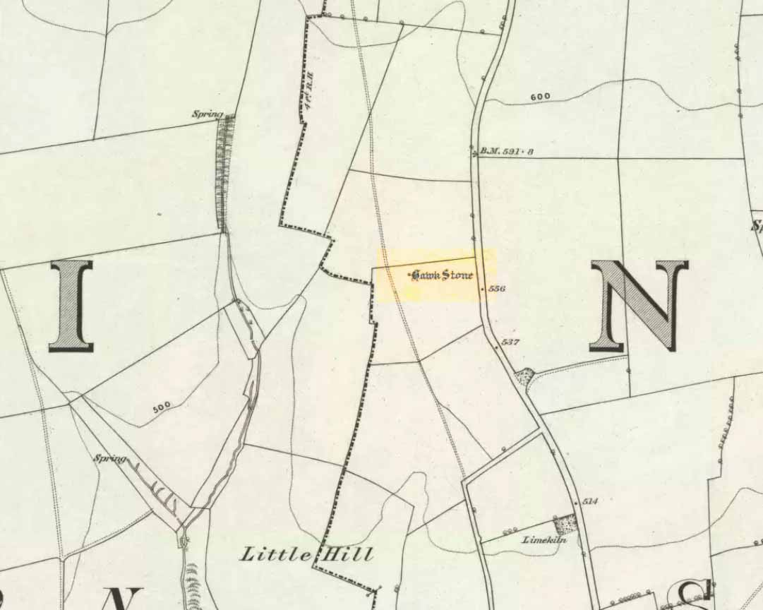
Hawk Stone on 1885 map

Best visited out of season before the corn’s been planted. It makes it  easier to find and doesn’t annoy the land-owner here, who tends to be a decent dood.  From Chipping Norton go southeast along the B2046 road to Charlbury.  After about 1½ miles take the second right turning down the small country lane.  Go slowly down here for less than half a mile, watching the fields on your right.  You’re damn close!

Archaeology & History

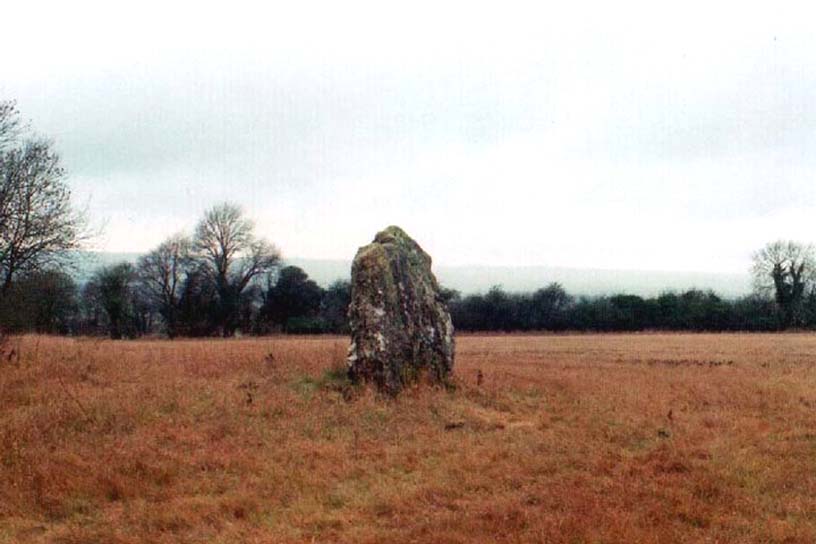
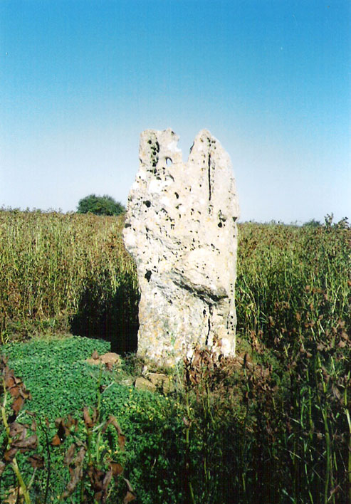
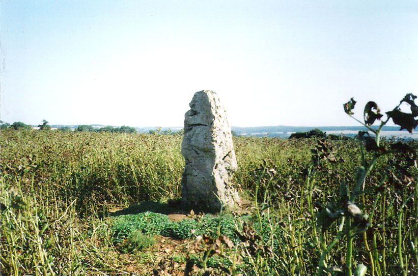
The Hawk Stone

This impressive, weather-worn, eight-foot tall standing stone stands aloft in the middle of a field due west of the road between Chalford Green and Dean.  It’s an excellent monolith and one which, I think, has a lot more occult history known of it than described here.  Thought by O.G.S. Crawford (1925) and others in the past to have been “formerly part of a chambered structure,”  or prehistoric chambered tomb like that of the Hoar Stone at nearby Enstone, no remains of such a structure unfortunately remain today.  It is first illustrated and named on a local map of the region in 1743 CE, and the stone at least has fortunately managed to escape the intense agricultural ravages endemic to this part of the country.

The name “Hawk” stone has been fancied by some to relate to some obscure resemblence to a Hawk, or because there very often are hawks hovering over those upland fields – but these are unlikely.  It’s thought by place-name authorities more likely to derive from a corruption of ‘Hoar’ meaning a grey or boundary stone; and as it stands just yards east of the present township boundary line, this derivation seems more probable.

To all lovers of megalithic sites, we highly recommend a visit here!

Folklore

In local folklore and in the opinion of some earlier historians, the Hawk Stone formed an integral part of a stone circle here, but there is little known evidence to substantiate this.

Hawk Stone in summer
Hawk Stone in winter

A creation legend attached to this site tells that the stone was thrown, or dragged across the land, by a old witch or hag — though we are not told from where.  This is a motif found at megalithic sites all across the country (see Bord & Bord 1977; Grinsell 1976, etc).  In Corbett’s History of Spelsbury (1962) the author told of the folklore spoken of by one Mr Caleb Lainchbury who

“said the cleft at the top of the Hawk Stone at Dean was supposed to of been made by the chains of the witches who were tied to it and burnt. As witches seem to have been extremely rare in Oxfordshire it cannot have been a very common practise to burn them at Dean; but there may indeed have been some kind of fire ceremonies near the stone.”

Grinsell (1976) also tells how the Hawk Stone has that animistic property, bestowed upon other old monoliths, of coming to life and going “down to the water to drink when it hears the clock strike 12.”

This evidently important and visually impressive monolith also plays an important part in an incredibly precise alignment (ley) running roughly east-west across the landscape.  At first, Tom Wilson (1999) thought the alignment had previously gone unnoticed, but later we later found a reference to the same line in an early copy of The Ley Hunter (Cooper 1979). It links up with other important megalithic sites, such as the Hoar Stones at Enstone, Buswell’s thicket, and the ancient Sarsden Cross.

Similarly, when Tom Graves’ (1980) was doing some dowsing experiments at the Rollright stone circle a few miles west, he found what he described as an ‘overground’ (or ley) linking the ring of stones to the Hawk Stone, but no other connecting sites are known along this line.

References:

  1. Bennett, Paul & Wilson, Tom, The Old Stones of Rollright and District, Cockley: London 1999.
  2. Bord, Janet & Colin, The Secret Country, BCA: London 1977.
  3. Cooper, Roy, “Some Oxfordshire Leys,” in The Ley Hunter, 86, 1979.
  4. Corbett, Elsie, A History of Spelsbury, Cheney & Sons: Banbury 1962.
  5. Crawford, O.G.S., The Long Barrows of the Cotswolds, John Bellows: Gloucester 1925.
  6. Gelling, Margaret, The Place-Names of Oxfordshire – volume 2, Cambridge University Press 1954.
  7. Graves, Tom, Needles of Stone, Granada: London 1980.
  8. Grinsell, L.V., Folklore of Prehistoric Sites in Britain, David & Charles: Newton Abbot 1976.

© Paul Bennett, The Northern Antiquarian 


Thor Stone, Taston, Oxfordshire

Standing Stone:  OS Grid Reference – SP 3592 2208

Also Known as:

  1. Thunor’s Stone

Getting Here

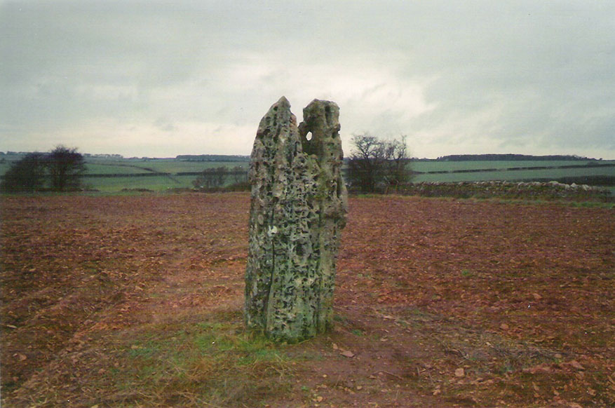
Thor Stone, Taston, hiding in shadows on bright sunny day

Very easy! From which ever direction you approach the gorgeous little village of Taston, get to the Cross in the middle of the road and look up the slight hill and at the old walling on the right-hand side.  You can’t really miss it!

Archaeology & History

An impressive seven-foot tall standing stone resting up against the walling of Martin and Martha’s Thorstone Cottage, and which appears to have been recorded as far back as the late thirteenth century in the survey of the Chadlington hundred.  Indeed, according to the respective place-name authorities, the village of Taston itself appears to get its name from the Thor Stone, as it’s recorded as Thorstan in 1278 CE. (Gelling 1954)

Less than 100 yards away is a large old stone cross, the top of it now fallen, which may once have had some earlier pre-christian relationship with the Thor Stone; perhaps originating from other standing stones close by our now solitary Thor Stone (see Folklore, below).  No other monoliths or prehistoric tombs are presently associated with this site, but its folklore tells of earlier companions…

More than a hundred miles north of here we find an etymological sister in the old village of Thurstaston and where, not surprisingly, we have another Thor’s Stone — but in this instance the name applies to a huge rock outcrop with old pagan legends attached.

Folklore

Elsie Corbett (1962) tells that the creation myth for this stone was that it originated after the great god Thor cast a thunderbolt down from the heavens and this stone appeared as a result.  But more intriguing from an archaeological perspective is what Mike Howard (he of The Cauldron magazine) told us in a short article for the Gloucester Earth Mysteries magazine in 1994, which said that our grand old Thor Stone was once part of a stone circle.  He wrote:

“At Taston…are the rather battered remains of a megalithic circle known locally as the Thor Stones. It seems the original circle was dug up many years ago and the stones now reside in a neat pile at the crossroads in the centre of the village. The whole edifice resembles nothing less than an eccentric market cross, topped by a phallic stone.”

Although he doesn’t cite any sources for this bit of info (where’d you gerrit from Mike?), we need to take a more careful look at the old cross nearby.  And we find another piece of folklore relating to the Taston cross which said that it was placed there to abate the evil influences that were supposed to come from the Thor Stone.  This piece of folklore is simply one laid down by the Church which portrayed most things it did not understand, or sought to repress, as being the work of their own demonic power, Satan.

Between these two old monuments was once a huge old elm tree which, says Caroline Pumphrey (1990), was a meeting place of the local villagers in times gone by.  Whether this implies the Thor Stone to have been a moot spot is difficult to tell, although the erection of the cross would seem to add weight to this.

More recent screwy notions comes from one woman who reckoned, curiously, that the Thorstone got its name from some completely invented made-up goddess, saying:

“I believe its more likely to be a corruption of the name of ‘Hoar’, the great Goddess. Indeed the Hawk Stone, and various Hoar stones stand widely hereabouts and probably derived their names from the same deity.”

Utter drivel of course (there’s no such goddess as Hoar)! But — like the christians and others before them — people believe what they want to believe and this sorta nonsense is increasingly found all over the internet.  As is well known, the word hoar derives from ‘har’, being ‘grey’ or ‘a boundary’ (Gelling, 1954; Smith 1956); and numerous studies show this quite clearly.

References:

  1. Bennett, Paul & Wilson, Tom, The Old Stones of Rollright and District, Cockley: London 1999.
  2. Corbett, Elsie, A History of Spelsbury, Cheney & Sons: Banbury 1962.
  3. Gelling, Margaret, The Place-Names of Oxfordshire – volume 2, Cambridge University Press 1954.
  4. Grigson, Geoffrey, The Shell Country Book, George Rainbird: London 1962.
  5. Howard, Mike, ‘From Thor to Rollright,’ in Gloucestershire Earth Mysteries 18, 1994.
  6. Pumphrey, Caroline, Charlbury of our Childhood, Sessions Book: York 1984.
  7. Smith, A.H., English Place-Name Elements – volume 1, Cambridge University Press 1956.

© Paul Bennett, The Northern Antiquarian


Ringstone, Cropredy, Oxfordshire

Stone Circle (destroyed):  OS Grid Reference – SP 470 464?     

Also Known as:

  1. Ringstone Well

Archaeology & History

In 1239 CE we find records of a field-name site called “Ringstoneswelle.” Although the place-name writer Margaret Gelling (1954) initially ascribed this as the watering-place of some dood called Hringstan, it is in fact the only record that I’ve found of a “stone circle by a well” in the village.  This etymological root is confirmed in A.H. Smith’s English Place-Name Elements (vol.1, p.265) as a probable stone circle.

Folklore

There is also the curious field-name legend of a place in Cropredy called Kirk or Church Piece, where a christian church was being built, but in the morning all the stones had been uprooted & moved back from whence they came. This happened several times according to the folktale – a story that has with all the hallmarks of a megalithic site. (see Grinsell’s Folklore)  To me it seems likely that the nearby Cup and Saucer Stone also had something to do with this lost stone circle.

In the same area we have another intriguing bit of folklore that was reported in an early edition of the Banbury Guardian (1932) which told that,

“on one of the top stones of a wall in front of one of the farmhouses is what is supposed to be the Devil’s footprint and there are nail-marks in the stone, but how it gots it name is a puzzle.  At the back of the vicarage gardens is a small jetty called HellHole, the old ‘Old Man’ must have visited this village a time or two.”

Are there any local antiquarians or historians who can throw further light on this seemingly lost megalithic ring?

References:

  1. Anonymous, ‘Cropredy and its Legends,’ in Banbury Guardian, December 29, 1932.
  2. Bennett, Paul & Wilson, Tom, The Old Stones of Rollright and District, Cockley: London 1999.
  3. Gelling, Margaret, The Place-Names of Oxfordshire – volume 2, Cambridge University Press 1954.
  4. Grinsell, Leslie V., Folklore of Prehistoric Sites in Britain, David & Charles: London 1976.
  5. Smith, A.H., English Place-Name Elements – Part 1, Cambridge University Press 1954.

© Paul Bennett, The Northern Antiquarian 


Boulter’s Barn Stone, Churchill, Oxfordshire

Standing Stone:  OS Grid Reference – SP 2938 2569

Also known as:

  1. Churchill Stone

Getting Here

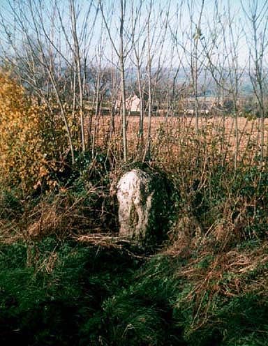
Boulter's Barn standing stone, Churchill (Tom Wilson)
Boulter’s Barn stone (© Tom Wilson)

This stone stands on the south-side of the B4450 just north of the crossroads, halfway between Churchill and Chipping Norton.  Generally troublesome to see at first as it tends to get hidden in the hedgerow, but it aint too difficult to locate with a bitta patience.

Archaeology & History

First described in O.G.S. Crawford’s (1925) fine survey of megalithic remains following a letter he received from a local man, Mr A.D. Passmore, who first drew it to the attention of archaeologists.  Crawford told:

“This stone is a little over a mile southwest of Chipping Norton station.  It stands in the hedge on the northwest side of the road and is about four feet high… Nothing more is known about it, but it seems not unlikely that it may be of considerable antiquity.”

A few years later Leslie Grinsell (1936) mentioned it in his fine survey of prehistoric English tombs and associated remains, describing here, “a large stone which may be the remains of a megalithic monument.”  Tom Wilson then illustrated it in our crappy little Old Stones of Rollright (1999) work (which really needs updating and expanding).  It’s a cute little stone and may have once served as a companion to a prehistoric tomb as there are many others nearby.  It is also quite close to one of the local boundary lines and, p’raps, might once have served as a marker hereabouts.  We might never know…

References:

  1. Bennett, Paul & Wilson, Tom, The Old Stones of Rollright and District, Cockley: London 1999.
  2. Crawford, O.G.S., The Long Barrows of the Cotswolds, John Bellows: Gloucester 1925.
  3. Grinsell, Leslie V., The Ancient Burial Mounds of England, Methuen: London 1936.

© Paul Bennett, The Northern Antiquarian


Lidstone, Chipping Norton, Oxfordshire

Standing Stones:  OS Grid Reference – SP 35487 24627

Also Known as:

  1. King Lud’s Stone
  2. Leodwine’s stone

Getting Here

Just get to the top of the hill thru the village and where the sharp bend turns, you’ll find one of the monoliths up against the wall above the roadside (hard to find in the undergrowth sometimes!).  The other stone is on the eastern side of the road through Lidstone from the A44, halfway into the village itself.

Archaeology & History

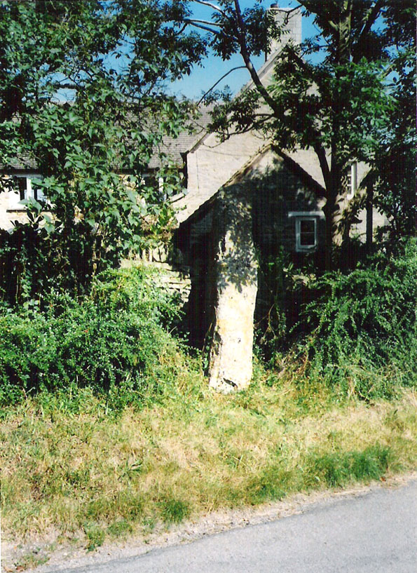
Lidstone monolith
Lidstone monolith

There are two small stones to be found in the lovely little hamlet of Lidstone.  The main one—Leodwin’s Stone—is at coordinate SP 35517 24656; and the smaller stone further up the hill is at SP 35487 24627.  First described in a treatise from 1235 AD as Lidenstan, the great place-name writer Ekwall (1940) thought this derived from ‘Leodwine’s Stone.” A few years later Gelling (1954) told us that “there is a monolith at Lidstone”, which she thought gave rise to the place-name, and not some chap named Leodwine.  Whichever it may be, we certainly have two small upright stones here — both worth having a look at if such things take your interest. (Tom Wilson and I included them in our short survey of the standing stones of the region in 1999) Further up at the top of the hill from here are the remains of an old tumulus.

Folklore

Said by Caroline Pumphrey (1990) to be the resting place of old King Lud, one of England’s last great pagan kings; another local writer Elsie Corbett (1962) also told a tale well-known to folklore students about this little monolith.  She related how a local man they knew as Mr Hitchcock told them,

“that they used to kid the boys there by telling them that when the stone hears the clock strike twelve it goes down to the stream to drink, and that it was just a ‘catch’ because there was no striking clock in the first place; but it is a ‘catch’ tacked onto some tale that must have been told in the hamlet long ages before there were clocks at all.”

The said stream is a short distance due north of here, down the little valley.  The tale may come from it once acting as a shadow-marker, highlighting midday when the sun was high in the sky due south.  Makes sense of the folktale anyway!

References:

  1. Bennett, Paul & Wilson, Tom, The Old Stones of Rollright and District, Cockley: London 1999.
  2. Corbett, Elsie, A History of Spelsbury, Cheney & Sons: Banbury 1962.
  3. Ekwall, Eilert, Oxford Dictionary of Place-Names, OUP: Oxford 1940.
  4. Gelling, Margaret, The Place-Names of Oxfordshire – volume 2, Cambridge University Press 1954.
  5. Pumphrey, Caroline, Charlbury of our Childhood, Sessions Books: York 1990.

© Paul Bennett, The Northern Antiquarian