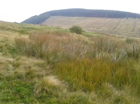
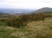
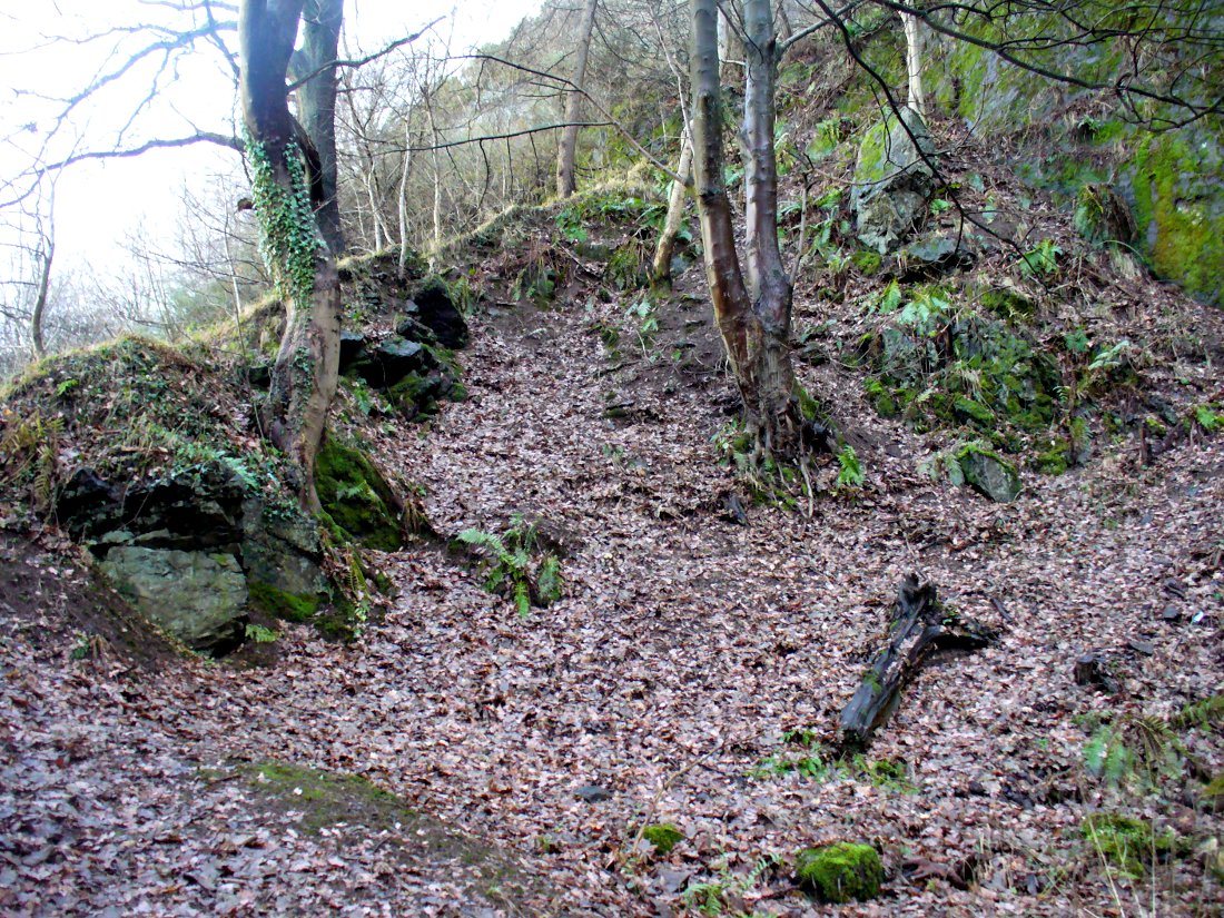
A fascinating site that was described in Johnston & Tullis (2003) local history work on the parish of Muckhart. Amidst an area bedevilled with faerie, boggarts, ghosts and historical shamanic moot sites we find more curious folklore pointing at a long forgotten site, whose age and precise nature remains a mystery. Adjacent to the old boundary line, close to the meeting of streams, the Muckhart authors told that,
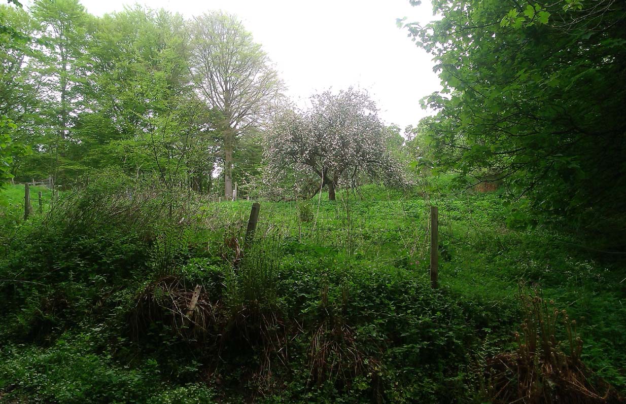
“an orchard above the old farmhouse to this day remains mainly untouched. It was the burial site of warlocks from the parish and it is thought some may have even been burned at the Mill. It has always been said that this ground should never be touched! There is an ancient rubble bridge over the Hole Burn which has a Masonic Eye painted on it to ward off any unwelcome spirits. Despite the eye, both the Farmhouse and the Millhouse have been home to many strange and ghostly manifestations.”
The folklore sounds to be a mix of archaic and medieval animistic traits: perhaps of a prehistoric cairn, visited and maintained by local people (as found throughout Britain) until the Burning Times, when christian fanatics arrived, debasing the cultural rites and murdering local innocent people. …Perhaps not.
When Paul, Maggie and I explored the area a few days ago, we were greeted most cordially by the owner of Muckhart Mill, who knew of the folklore, but didn’t know the exact whereabout of the grave. We couldn’t find any clues as to its exact location either. Apart, perhaps, from the top of the hill immediately above the orchard where, alone and fenced off with an old covered (unnamed) well, a solitary Hawthorn tree stood. We each recalled the aged relationship that Hawthorn has in witch-lore… but that’s as far as it went. The grave remains hidden and may have been destroyed. If anyone discovers its whereabouts, please let us know so that a preservation order can be made to ensure its survival.
References:
Johnston, Tom & Tullis, Ramsay (eds.), Muckhart, Clackmannanshire: An Illustrated History of the Parish, MGAS 2003.
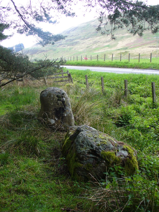
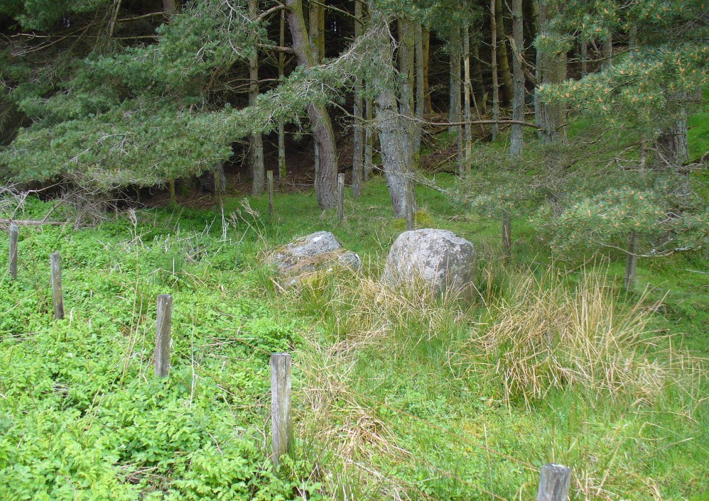
Take the A823 road up from Gleneagles to Glendevon and at the top of the long hill, where the road starts to level out and slightly drop, where the two glens meet up, take the right turn (west) and park up by the cattle-grid. Walk back onto the A823 and walk about 200 yards south towards Glendevon, to the small copse of trees past the cottage. As you get to the trees, look by the fencing and you’ll see one archetypal rounded standing stone, with another one next to it. You’re here!
Archaeology & History
At long last my huge nose is twitching back to its authentic sniffing-out lost sites in the landscape. During a visit to the St. Mungo’s Well a few days ago, on the way back to the car I kept saying to my fellow antiquarian Paul Hornby that “there’s something missing round here.”
“Wotcha mean?” he said.
“Summat missing Paul. It feels there should be a four-poster or summat like that here — where the two glens meet up. I can smell it. Summat should be here, or was here in the past.”
I said it several times as we walked back along the old track to the car. We took the photos and he set off to give me a grateful lift back home. But as we got back onto the road, we noticed a couple of upright stones just set back at the edge of a small copse of trees. One was very rounded and about four-feet tall, with a smaller companion next to it. But we didn’t stop to check them out as it was getting late.
A few days later Paul rang me to ask if I’d had a look at the old maps of the region where we’d visited and seen the old place-name where we’d been.
“No, why?”
“It’s known as the ‘Four Stanes’,” he said. “And right where those stones were standing by the trees!”
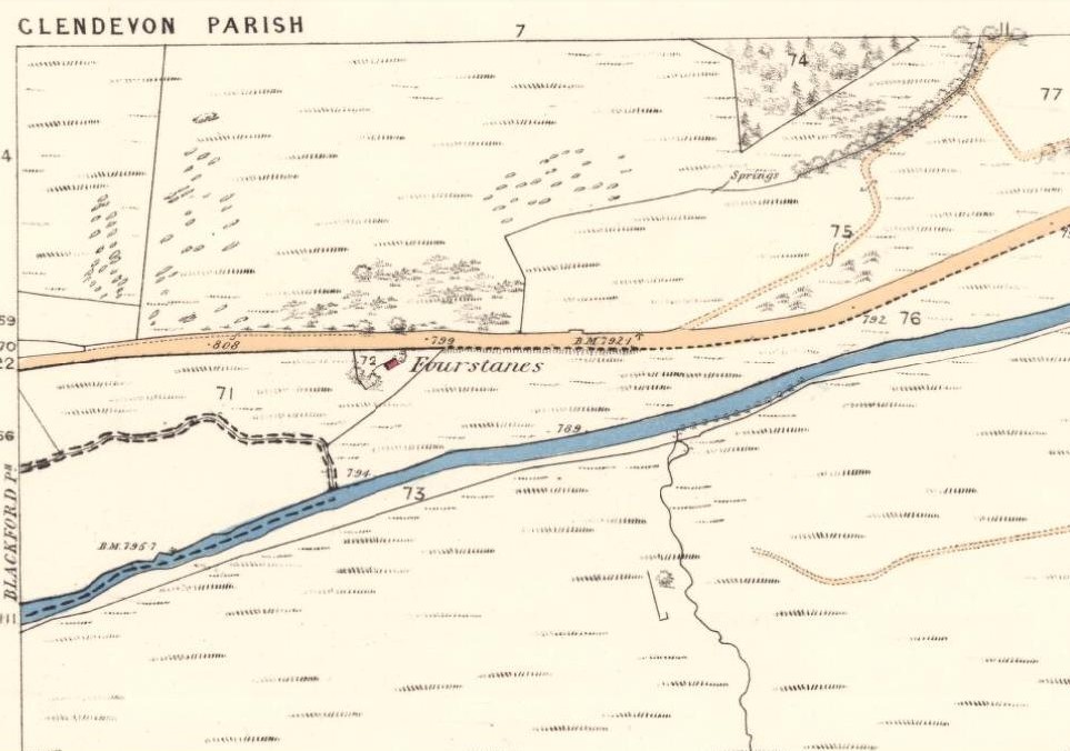
A few happy expletives came out, as usual for me. So I sought out the map he was talking about and, as we can see above, the “Fourstanes” (or Stones) are right where my ‘feelings’ and the stones were seen.
On the 1860 Ordnance Survey map of the area, a small building is shown and named as ‘Fourstanes’ right by the roadside, on the south side. It was also named as such in an earlier account of 1851 and was told to be inhabited by a Mrs Foote in 1866. Sometime after this the cottage appears to have been left to neglect and no trace of it now remains. According to evidences of the place-name societies in England and Scotland and the studies of Smith (1956), Scott (2004) and others, unless the term derives from the Gaelic fuar, meaning cold or chilly, it is usually evidence of ‘four stones’ in relation to megalithic remains like those found from Shetland to the more southerly counties in England. Dr Aubrey Burl (1988) shows clearly in his textbook of the same name, that “four poster stone circles” are common megalithic architectural features in the Perthshire landscape — where this happens to be! He also states that such place-names should be listed and checked as possible “sites of destroyed four posters.” So we did just that!
Although the stones look very good contenders in the photos and also when you first see them close up, there are some elements here that need highlighting that throw a more sceptical view of them as authentic megaliths. The larger of the two stones—very rounded and worn, typical of other four-poster remains—is three feet high. The lichen vegetation covering it on all sides is old—except on its back (northern) upright face, where there is almost no vegetation at all. Indeed, this face is almost entirely clear of any natural plant growth, showing it was moved into this position from a lower horizontal level and pushed upright, I would say within the last century. The smaller, lower stone next to this upright oddity, is laid down and covered on all sides by an excess of vegetation expected of a monolith that has been in this position for several centuries at least. The lichen growth on this stone is very old.
Both of these stones occur along the line of an old wall and may have originally been a part of such a structure, instead of any four poster megalithic feature. However, the road that runs past here replaced the earlier track (which you can still walk along on the other side of the river 100 yards away) running through Glen Devon and into Glen Eagles. This “new road” as it was then, was made sometime in the 19th century. It may be that, upon the construction of the new road, the ‘fourstanes’ themselves were “in the way of Progress” (as they like to say) and so were rolled down the side of the new road and into the position they now occupy. It’s difficult to say.
There is one additional element that needs exploring. The hill immediately above Fourstanes is called ‘The Law.’ Although this word can be a simple “hill”, there are additional historical factors to a place-name. In Laurence Gomme’s (1880: 260-77) excellent work on the subject, he illustrates time and again across Scotland that heathen gatherings, tribal meetings and early court sessions or ‘moots’ were held at places with this place-name element. It should come as no surprise then, that at other megalithic sites in Britain called the Four Stones, ancient pagan moot were also held there. (Gomme 1880; Grinsell 1936, 1976)
We’re going back onto The Law itself in the next week or two, just to see if these ‘fourstanes’ are hiding away in the heather on the tops, where oh so many megalithic rings tend to be found….
…to be continued…
References:
Burl, Aubrey, Four Posters: Bronze Age Stone Circles of Western Europe, BAR 195: Oxford 1988.
Dwelly, Edward, The Illustrated Gaelic-English Dictionary, Gairm: Glasgow 1973.
The best way here is to walk a mile to find it. All the way up the road from Gleneagles Standing Stones to Glendevon, right at the very top where the two glens meet, there’s a small road heading to the Fishery. 100 yards along, park up. Then take the old green road back down the Glen, north towards Gleneagles, parallel with the new road. A mile or so down you’ll reach the farmhouse, but a coupla hundred yards before this, in a wooden gap in the electric fence, you can walk straight downhill to the large pool below you. Y’ can’t really miss it!
Archaeology & History
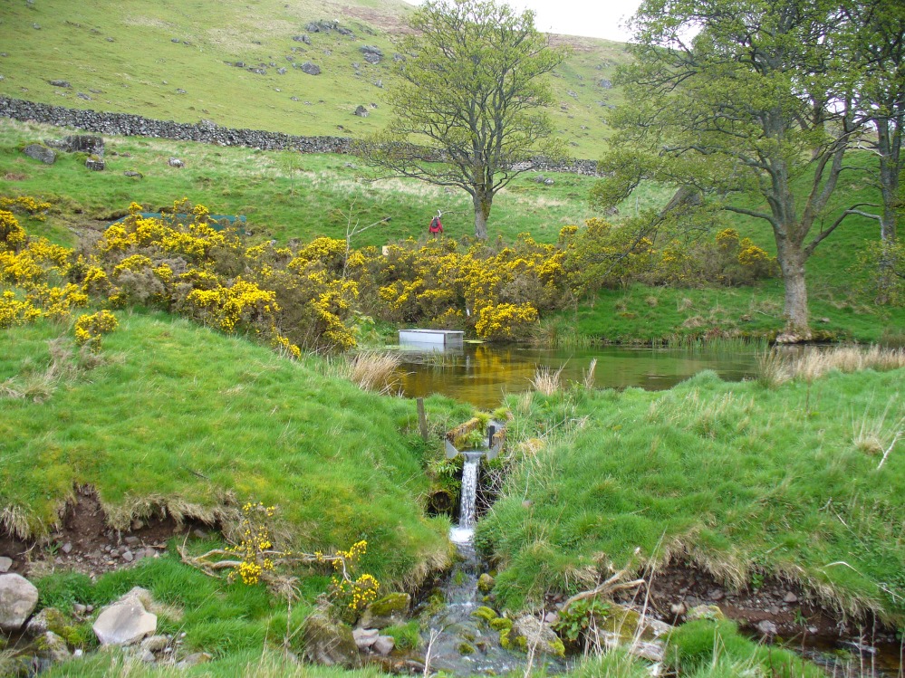
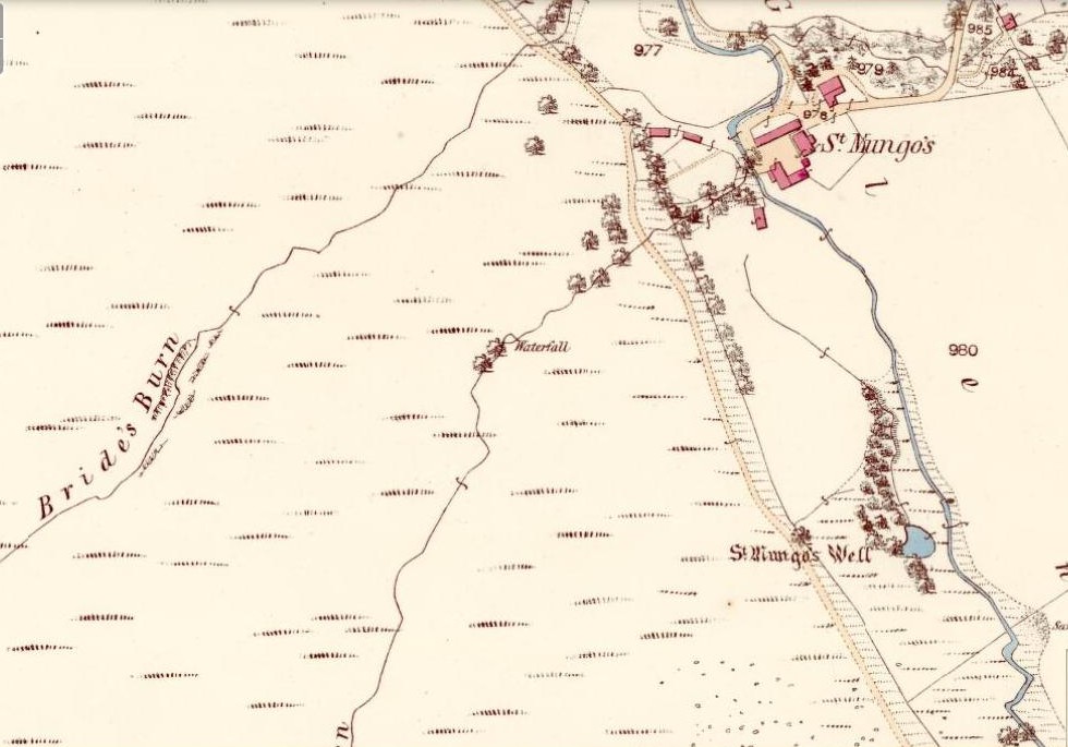
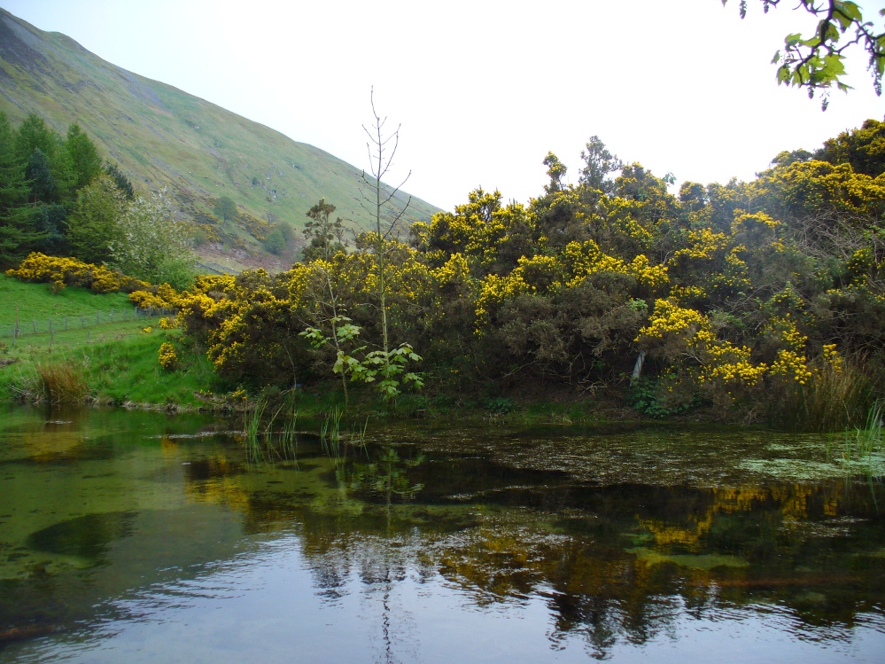
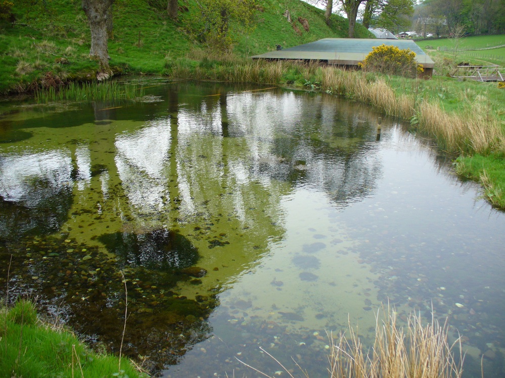
The strong cold spring of water known as St Mungo’s Well, now gathers into a large crystal clear pool and is gorgeous to drink and very refreshing! All around the edges are the brilliant yellow masses of gorse, held amidst widespread vivid hues of green in this most rocky of landscapes. Tis a gorgeous setting here….
Unfortunately there is no literary information that tells us why this spring of water, amongst the many others all around these hills, gained the ‘blessing’ of one of those roaming christians and was deemed to be ‘holy’. The greatest likelihood, as usual, is that the waters had some important heathen association which our peasant ancestors would have been able to tell us about if their animistic tales hadn’t been outlawed and demonized by the incoming cult — but we’ll probably never know for sure. As a result, we know nothing now of its medicinal qualities or old stories.
The transference of its old name (whatever it may have been) to their ‘St. Mungo’ may date from when the character was wandering with his christians in the 7th century, but we have no literary account proving as such. The name ‘St Mungo’ was an alternative name (a nickname if y’ like) of St. Kentigern — or at least that’s what the church historians tell us. There is no history of Kentigern or St Mungo up the glen, but we do have a more prosaic account that tells of a Mr Mungo Haldane of Gleneagles, a member of the Scottish parliament in 1673 onwards; he was succeeded by another Mungo Haldane MP in 1755. However, it’s highly unlikely that these political characters gave their name to the well.
Even the Scottish holy wells surveys are pretty silent on this beautiful site. It was mentioned in Morris’ (1981) survey, but with no real information. The earliest account seems to come from an article written in the Perthshire Advertiser in 1856, and thankfully reproduced in the otherwise tedious genealogical history of the Haldane (1880) family; but even here, the narrative simply mentions the presence of the well and no more. Described in a walk up Gleneagles, it told:
“Journeying westward along the desolate moor…we soon came in front of Gleneagles, a narrow picturesque glen in the Ochils, through which the old road from Crieff leads into Kinross-shire. The hills here, as throughout the whole range, are strictly pastoral, but in no place more so than Gleneagles. Crowning the heights on both sides of the glen, we have craigs ragged and bare enough; but their show of beetling hard sterility is as nothing to the winding receding mass of grassy heights that bound the view. In looking on that quiet, sunny, Sabbath-like retreat, one would be apt to deem the name a misnomer, and yet it is not much above a hundred years since the monarch of birds had a home among its cliffs. There, too, the Ruthven Water that dashes past Auchterarder has its rise — not in a scarcely seen bubbling spring almost covered with moss, but issuing at once into daylight at the bottom of yonder steep in volume sufficient to drive a mill. In ancient times, as now, it must have been an object of mark, as it is called St. Mungo’s Well; but who this St. Mungo or St. Magnus was — whether the ghostly patron of Glasgow, Auchterarder old chapel, or the guardian saint of this particular spot, we cannot tell. But he seems to have relished cold water; and it is satisfactory to know that he must have got his fill of it there, if his cell happened to be in the vicinity.”
The well was mentioned in passing in the Object Name Book in 1860 and shown on the earliest Ordnance Survey maps.
Folklore
Apart from the fact that the waters here never run dry, we have no other folklore. However it should be noted that St. Mungo’s Day was January 14th — which may have been when the qualities of the spring were deemed most efficacious, or when olde rites were enacted here. However, a hundred yards down we pass the stream known as Bride’s Burn, probably in honour of the heathen Queen St. Brigit, whose name and myths are integral to our great Earth goddess, the Cailleach and whose celebration date is only two weeks later than that of Mungo. Hmmmmmmm…..
References:
Attwater, Donald, Penguin Dictionary of Saints, Penguin: Harmondsworth 1965.
Haldane, Alexander, Memoranda Relating to the Family of Haldane of Gleneagles, C.A. MacKintosh: London 1880.
MacKinlay, James M., Folklore of Scottish Lochs and Springs, William Hodge: Glasgow 1893.
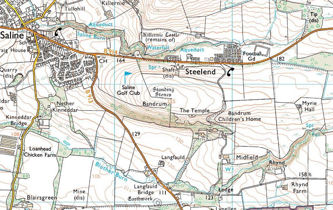
Go east on the B913 through Saline for a mile till you reach Steelend. Across the road from the houses there’s a dirt-track running uphill (south) into the fields. When you’re near the top, turn west into the fields, following the straight line of fencing towards the small clump of trees on the skyline. Near the top, a few hundred yards along you’ll see the large fat stone up against the wall. But keep walking east and another stone appears before your eyes!
Archaeology & History
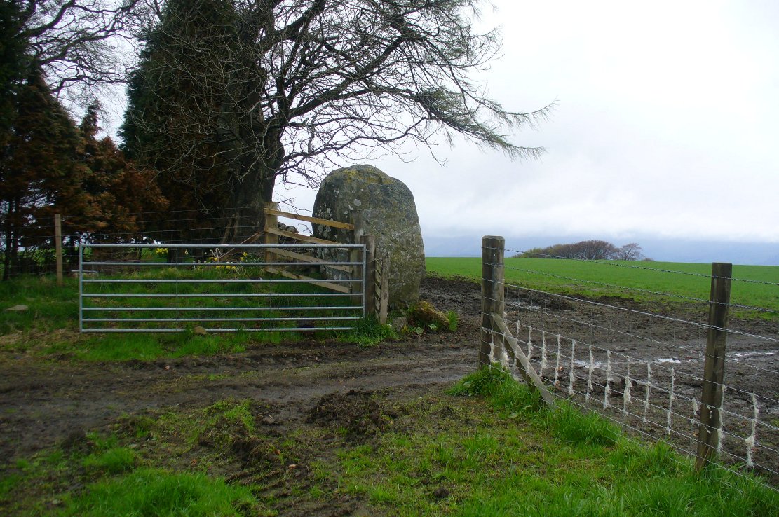
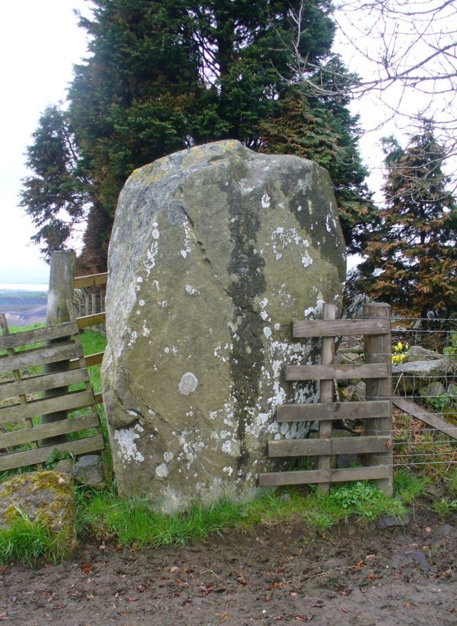
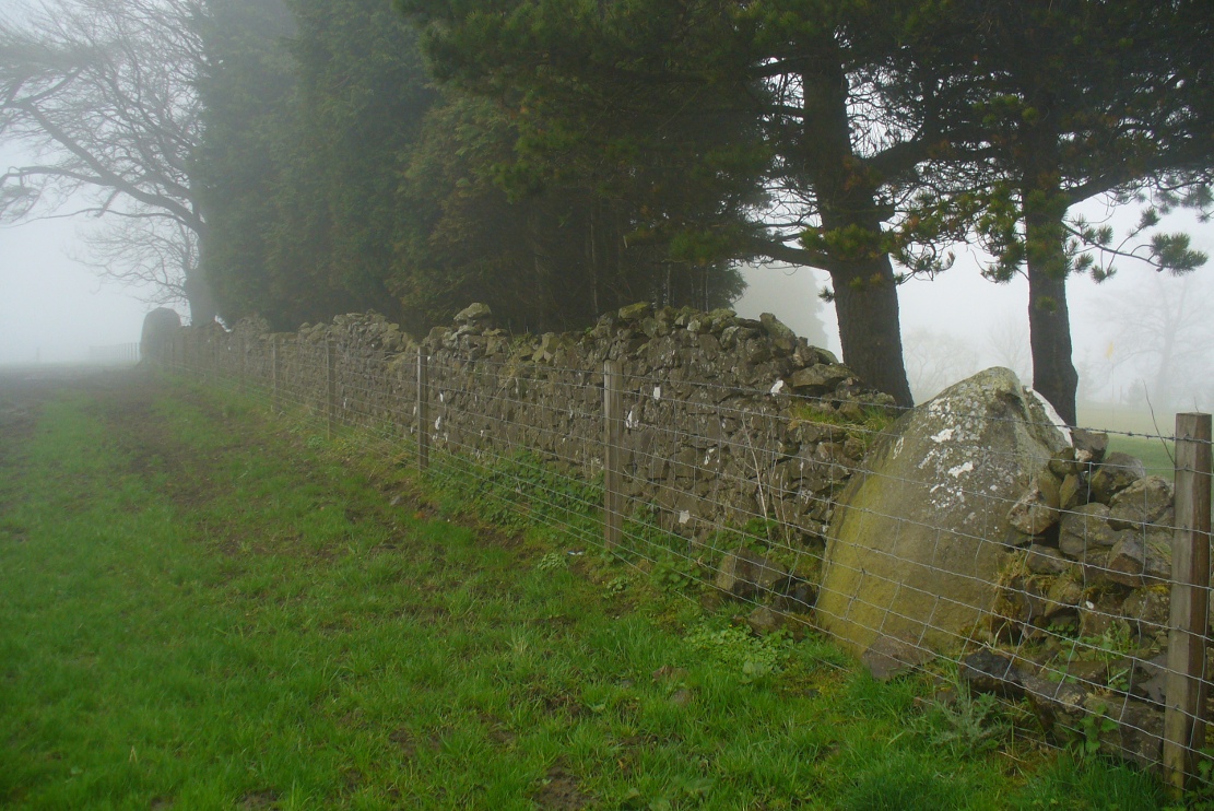
Near the very crown of this long hill, right by the gate separating the fields, you cannot miss this huge and very heavy-looking standing stone, whose position in the landscape was evidently of some importance to the people who put it here. It’s in a gorgeous spot. You can see in all directions for some considerable distance particularly to the west, and the eye catches other points on the land where prehistoric monuments of other forms speak to each other. (that’s assuming you visit here on a clear bright day, as opposed to when Paul Hornby and I visited the spot when, for much of the afternoon we could barely see 100 yards as the land all around us was cloaked in fog!)
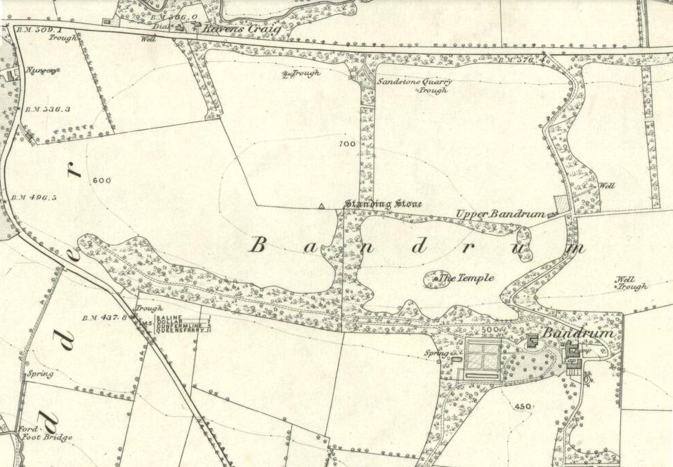
The site was included in Alexander Thom’s (1990) magnum opus on megalithic stone rows, in which he cites it as a debatable 2-stone row monument. For if we walk westwards, along the walling, we find another large, possibly prehistoric upright about 50 yards along. In Aubrey Burl’s (1993) work on the same subject, he merely copies Thom’s earlier questioning of the second stone in his listings. But in Mr Beveridge’s (1888) regional history work more than a century earlier, he told clearly that on “the ridge of the hill behind Bandrum House, there are built two standing stones.” Of their origin and purpose, Beveridge could find none; but a few years later, A.S. Cunningham (1902) thought simply that
“of the two standing stones on the march fence behind Bandrum House…it is questionable if they ever served any other purpose than a dividing line for properties.”
The site was highlighted on the earliest OS-maps of the region in 1854—albeit with only the largest of the two stones marked, at the meeting of the gates—and then many decades later those other official doods, the Royal Commission (1933) lads, made their way up here and included the site in their inventory, where they told:
“On the crest of rising ground at an elevation of 700 feet above sea level, at the end of a dole near to the extreme east end of Saline golf course about a quarter of a mile due west of Bandrum farmhouse, stands a huge whinstone boulder of irregular form. It measures 7 feet 10 inches in height to the highest point of a somewhat rounded top, and has a slight inclination towards the west. Its girth at the base is 13 feet 7 inches and at the middle 14 feet 10 inches. The broadest faces are to the north and south… At a distance of 162 feet due west, there is another large boulder measuring 3 feet 10 inches in height and approximately 10 feet in circumference at the middle, set with a marked inclination towards the east and built into a continuation of the same dike. The two suggest the remains of a stone circle, the rest of which has been swept away by the cultivation of the neighbouring fields. There is however, no record of other stones having been removed.”
Thom’s (1990) account of the site was simply put: “Bandrum. NT 036 915. Huge whin boulder, 7ft 10 (2.4m) h. 162ft (49m) W another 3ft 10 (1.2m) h.” He gave no indication of astroarchaeological alignments.
References:
Beveridge, David, Between the Ochils and Forth, William Blackwood: Edinburgh 1888.
Burl, Aubrey, From Carnac to Callanish, Yale University Press 1993.
Cunningham, A.S., Romantic Culross, Torryburn, Carnock, Cairneyhill, Saline and Pitfirrane, W. Clarke: Dunfermline 1902.
Royal Commission on the Ancient & Historical Monuments, Scotland, Inventory of Monuments and Constructions in the Counties of Fife, Kinross and Clackmannan, HMSO: Edinburgh 1933.
Thom, A., Thom, A.S. & Burl, Aubrey, Stone Rows and Standing Stones – volume 2, BAR: Oxford 1990.
Acknowledgements: Huge thanks to Paul Hornby for his photos of these standing stones. Cheers Paul!
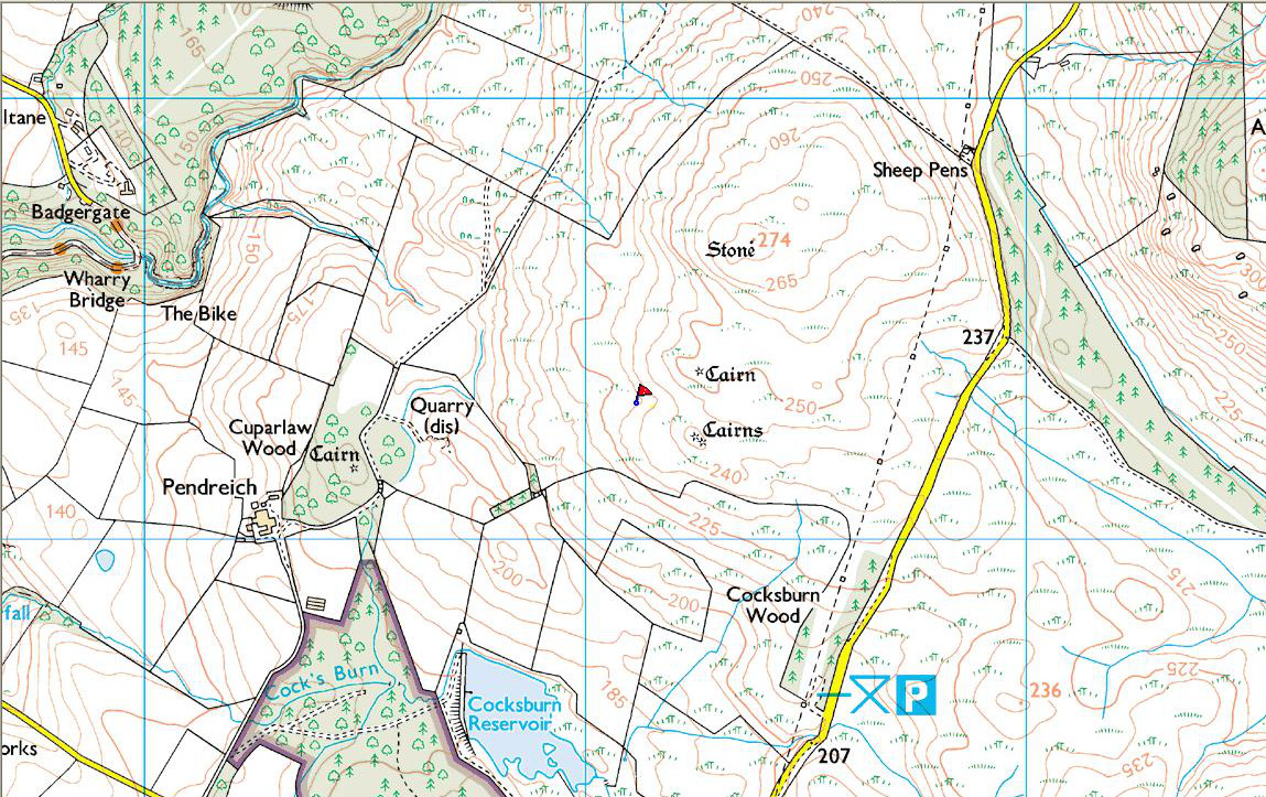
Take the same directions as if you’re gonna find the Pendreich Moor cairn up the hills behind and north of Stirling University (there are 2 very close to each other). Once upon the cairned hill, walk dead straight WNW for 100 yards or so, or down the slope into the small valley, then westwards. You’ll hit an overgrown length of very old walling. Keep walking along here and, below it, you’ll find these stones laying down in the shallow grasses on the south-side of the all-but dried stream. The large Cuparlaw Wood cairn is 0.4 miles west of here.
Archaeology & History
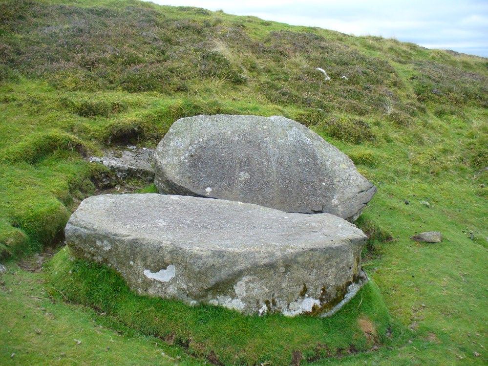
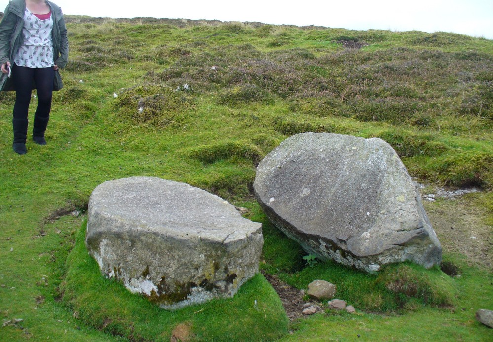
This is something of an anomaly. There is no previous written history about the place (that I can find) and archaeologists and historians on The Prehistoric Society and CBA forums can offer no other explanation when asked: is this a standing stone that, many centuries ago, was cut and prepared to be erected, but never made it into the intended monument? (wherever that might have been) And so, I offer it onto TNA and ask the same of any readers, geologists or archaeo’s who might have an explanation for this curious, large split piece of stone, that lays silently on the western moorland edges of the Ochils, asking the same question.
When I first came across this site I was simply perplexed as to the why’s and wherefore’s of who had cut such a large rock into approximate halves. I must have walked around it many times, puzzling what the purpose would have been of doing such a thing, and how long ago the ‘split’ had been performed. About a year later I ventured up again and, when leaving to head back into Stirling, found no resolution to my puzzlement. It had me truly stumped!
It wasn’t until I visited the prehistoric Witches’ Stone about 15 miles away near Monzie Castle last year, that one of those ‘eureka!’ events occurred. The last thing on my mind was the curious split rock above Bridge of Allan. Fellow antiquarian Paul Hornby and I were taking photos of the Witches’ Stone, when one of us remarked how unusually flat and smooth one face of this upright standing stone was – in fact, incredibly flat and smooth – and that’s when it hit me! As I walked round and round the Witches’ Stone, the similarity between this upright example and the one laid on the ground about 15 miles away got stronger and stronger.
A week or two later, archaeology student Lisa Samson and I went back to the Split Stone to have another look at it. Without doubt, the appearance and size and type of rock were one and the same. The only real difference between the Witches Stone and this Split Stone on the edge of Pendreich Moor, is that one stands upright and the other is laid down.
As you can see from the photos, we have a large rock, 5-6 feet long, which was, at some time many centuries ago, split almost straight down the middle, following a natural line of weakness or mineral deposit running through the stone. In all probability this was a standing stone prepared and ready to be used in some neolithic or Bronze Age monument not too far way—but for some reason it never made the journey to its intended spot.
The age of this split rock needs assessing correctly by geologists. Walking around the earthfast halves, it is difficult to see any recent evidence of mason marks that might help us determine when the rock was cut like this. In looking at erosion marks on cut-and-dressed quarried stone from post-medieval periods, we find no equivalent scars on this Split Stone. There is what may be faint evidence of some cuts into the stone at the top and side, but these are very debatable; and very probably it seems that the stone must have been cut a very long time ago, thousands of years back, in order to erode all obvious mason marks. But it would be good to get a geologist to have a look and confirm or deny such things.
…And, as if this isn’t a mystery unto itself: walk across the dried stream and go up the slope right in front of you immediately north. There’s a small, almost level ridge you’ll reach after 30 yards up, before the hill then rises further. If you notice, in the grasses and heather around you, there’s much more of the overgrown ‘walling’ here along this ridge—and some of it, with dips here and there and about three feet tall in places, is in a circle! It’s man-made, it’s a ring of stones, you can see it on GoogleEarth pretty clearly, and it’s not in any official record books.
The destruction of this site more than two hundred years ago almost beggars belief. It isn’t merely the fact that the self-righteous Industrialists did such things consistently, but that this particular tomb was more than just a few cartloads of stone being removed. The site would also have been completely lost to history were it not for the diligent research of local historian William Gibson (1883). In exploring the local place-names of the village, he asked the old locals as to “the origin of the name of Cairnpark in Dollar.” This is what he found:
“I have just learned, in the course of my present inquiries, that at the beginning of this century Dollar was possessed of an object of very great interest, but which unfortunately was entirely removed about the year 1806 or 1807. This was nothing less than a great pyramid (well, it was not quite so big as the famous one of Egypt, but still it was a great pile) which had evidently been erected to commemorate some great battle, or the death of some celebrated warrior; and it certainly is very much to be regretted that it should have been removed. This was an immense cairn of stones, some thirty feet high, and as many square at the base; and the park in which it stood took its name from it—Cairnpark; and the street leading up to the Academy also got its name—Cairnpark Street—from its being made through this park. It will scarcely be believed, yet it is nevertheless true, that this ancient and interesting cairn was removed for the ignoble purpose of being broken into road-metal for the new turnpike road that was then being constructed along the foot of the Ochils. By whose orders it was removed I cannot say; but the late Mr. William Blackwood, of the New Town, superintended its removal, and kept a correct note of the cart-loads that were in it, and found they amounted to the astonishing number of one thousand! (my emphasis, PB)
“When the bottom was reached, there were found in the centre of it a number of ancient clay urns, showing that this immense cairn was a thing of great antiquity, and connected with some important event, and, had it been allowed to remain, would have been an object of interest second only to Castle Campbell itself, and an additional attraction to the ancient town of Dollar. The Rev. Mr. Watson got possession of some of the urns, but what became of them is not now known.”
More than fifty years later, A.L. Drummond (1937) mentioned this old tomb, but could add no further details about it. Does anyone know what became of the burial remains? And how on earth could a giant tomb nearly 10 metres tall (Newgrange is 12m), consisting of 1000 cartloads of stone, be destroyed with barely any record of its existence? Astonishing!
Folklore
In a field south of the giant tomb, Gibson (1883) reported, “we used to have glorious ‘bonfires’ on the King’s birthday.” In Simpkins’ (1914) work, we read of an excess of witches nearby; and of a local giant responsible for creating parts of the landscape—akin to those we sometimes find attached to giant tombs—but nothing specifically relating to this tomb. Surely there must be remains of some traditions of this place, somewhere…?
References:
Drummond, A.L., “The Prehistory and Prehistoric Remains of the Hillfoots and Neighbouring District”, in Transactions Stirling Natural History & Antiquarian Society, volume 59, 1937.
Royal Commission on Ancient & Historical Monuments of Scotland, The Archaeological Sites and Monuments of Clackmannan District and Falkirk District, Edinburgh 1978.
Simpkins, John Ewart, County Folklore – volume VII: Examples of Printed Folk-Lore Concerning Fife, with some Notes on Clackmannan and Kinross-Shires, Folk-Lore Society: London 1914.
Go up the road alongside the Dollar Burn, turning right, up the steep hill as if heading to the Wizard’s Stone and the impressive Castleton monolith, a mile further along. Before reaching the Wizard’s Stone, keep your eyes peeled on the right for the street-name, ‘Moir’s Well’. From here, walk up the road less than another 100 yards and till you reach the water-cover.
Archaeology & History
There is little known about any history of this now-covered old well, halfway up the steep slope towards Lochy Launds. It was noted by Ordnance Survey in 1861 and subsequently published on the earliest OS-map a few years later. It was obviously a wayside well for those venturing up the steep hill and used to have an old stone trough into which the waters ran. Although we don’t know for certain, the etymology of the well probably comes from the surname Muir, which according to William Gibson (1883) was common in the old village.
People living in the houses below here, told us that after heavy rains their gardens become very boggy, which is probably due to the sub-surface water from Muir’s Well. Tis good to know that the waters are still finding their way out!
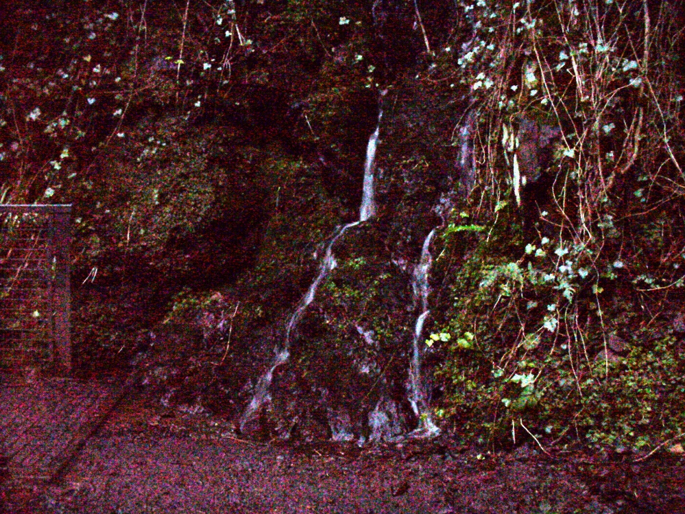
From Alva, take the signs to walk up the gorgeous Alva Glen gorge, past the site of the Dwarf’s Tomb, over the bridge past the first waterfall and up footpath into the glen. The path runs parallel with the gorge and a few hundred yards along you’ll reach a small footbridge. Immediately before this, on the right, coming down through the crags by the side of the path, the waters fall from the well in question.
Archaeology & History
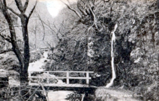
The history of this site is seemingly hidden. Little has been written of it and its dedication to some ‘Lady’ is an oddity. I can find no specifics telling who the ‘lady’ in question is. The other Lady Well at Tillicoultry, a mile or two east, is equally bereft of historical certitude. Whether it is another dedication to the supposed ‘virgin’ Mary of the christian cult, or a local lady whose name has long since been forgotten, we do not know. Additional info on this site would be most helpful.
Shown on an early postcard of the Ava Glen and highlighted in Mr Pithie’s (1982) work, the waters here—running down the crag-face from a spring at the top—are fine, fresh and almost sweet-tasting, rich in minerals and healthy nutrients no doubt. Without doubt, I’d recommend a drink of this every time you walk past here! (apologies for the dark photo – I’ll get a better one next time we’re up there)
References:
Corbett, L., et al., The Ochil Hills, Forth Naturalist & Historian 1994.
Pithie, A., Views of Alloa and the Neighbourhood, Clackmannan District Libraries 1982.
Acknowledgements: Grateful thanks to Lisa Samson for help with directions.
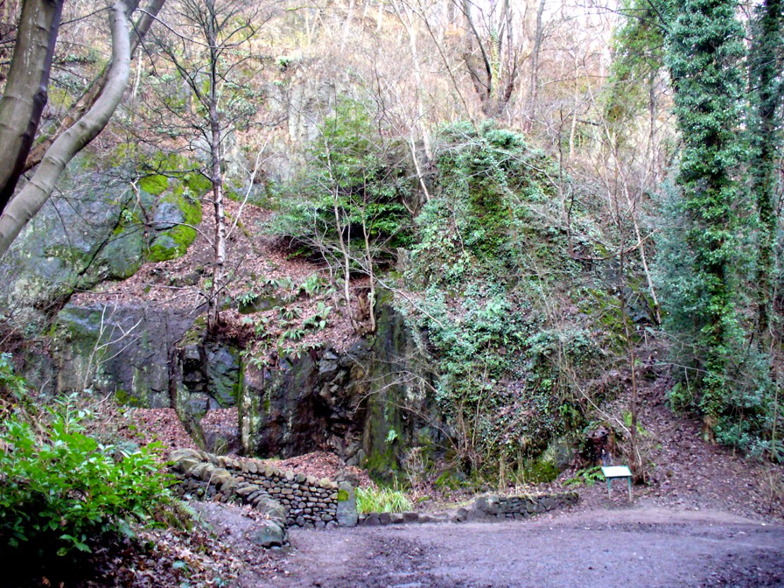
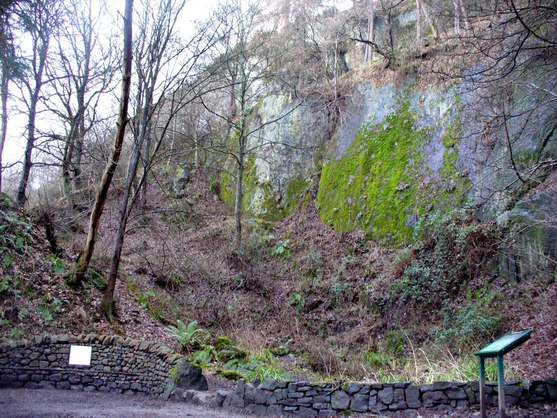
From the main street through Alva, between the Co-op and the corner shop, go up the small road at the side of the Johnstone Arms Hotel (Brook Street) and, at the small crossroads, straight across as if following the sign to the golf course. Stay along the track parallel with the Alva Burn waters and as you go into the trees a hundred yards or so along, to your left is a disused quarry, with a couple of plaques telling you its brief history. This is the spot!
Archaeology & History
This is a truly fascinating site for a number of reasons. Sadly, we can no longer see what had been here for oh so many thousands of years thanks, as usual, to the industrialists destroying the land here. Although in this case, without them we’d be unaware of its very existence. Additionally, there is a twist to the industrial’s find, which seems to have stopped further quarrying by some local people….
Listed in the relative Royal Commission accounts (1933; 1978), without comments, the tale is a simple one, but was narrated in some detail by J.G. Callander (1914) in Scotland’s prodigious Society of Antiquaries journal. During some quarrying operations over the Christmas period of 1912, James Murdoch “uncovered the remains of a human skeleton which had been buried in a natural cavity in the rock.” Three weeks later, local police officer George Donald and Dr W.L. Cunningham of Alva, accompanied Mr Callander to the site and made a detailed assessment of what had been found. He wrote:
“The quarry in which the grave was found is situated at the mouth of Alva Glen, a few yards distant from the right bank of the burn which flows through it. The body had been placed in a cavity or rock shelter in the face of the cliff, about 40 feet from the base, and about 200 feet above sea-level, and a rough, curved wall of dry-stone building, about 1 foot in thickness, had been built across the opening, which faced the east, the ends of the wall being still in situ when I visited the site. The space enclosed measured about 4 feet 6 inches from north to south, and about 5 feet from east to west. Subsequent to the burial the whole face of the rock and the walling had been covered, to a thickness of probably some 6 feet, by soil and detritus washed down from the hill face above. The greater part of the floor of the cavity was formed of clean, broken, angular stones, but the space on which the body was placed had been covered with a thin layer of soil preparatory to the burial. No charcoal or charred wood, which is so often seen in prehistoric graves, was found in this deposit. The skull lay in the north end of the grave, on its right side, facing the rock to the west, the vertebrae and ribs followed a line to the south, and the nether limbs were inclined towards the interior of the cavity. The whole face, including all the teeth and the lower jaw, was a-wanting. Apparently the body had been placed in a flexed position, half on its side and half on its back. Nothing else was found in the grave but a quantity of snail shells, probably twenty or thirty, which were nearly all broken, the few complete examples being in a very fragile condition.
“Elsewhere it has been stated that these formed a necklace, but while they were strewn out in front of the skeleton for a distance of over 3 feet, none of them showed any signs of artificial perforation. The species of Helixis is probably hortensis, the common garden snail.”
Mr Callander then included a lengthy description of the body itself, some of whose bones were fractured. He told that a certain
“Professor Bryce states that the skeleton is that of a dwarf of about 4 feet 2 inches in stature. The epiphyses are all fully united, although the line of union is visible on the surface at some points. Growth must therefore have been completed, and the person must have been, if the union of the epiphyses of the long bones had pursued its normal course, over twenty-one years of age…”
Regarding the sex of the dwarf, Mr Bryce wasn’t 100% certain, but told:
“The calvaria shows the general characters of a female skull, but it cannot be stated definitely that the individual was a woman, because the cranial characters are such as might have been present in a dwarf of the male sex. The calvaria is of moderate size, and is well formed.”
Bryce concluded as a whole that this person was in reasonably good health and, from the condition of the bones, showed “there was no evidence of the disease known as rickets.” In his final remarks he told:
“The general conclusions to which a careful examination of the skeleton leads, is that we have here to do, not with a representative of a dwarfish race, but with an individual who from premature union of the epiphyses was to a remarkable degree stunted in growth. The condition is a well-known one, and the class of dwarfs, in which this individual must be included, is well recognised.”
The exact spot of the tomb appears to have been destroyed, or at the very least is certainly covered over and no longer visible. The section of the quarry looking east, into which the tomb was built, is all-but gone and no initial evidence prevails to show its exact location. However, it would seem from the description to have been close to the tops of the tree-line, perhaps giving a clear view to the rising sun in the east. Perhaps…
The position of this tomb, enclosed high up in the cliffs, hidden away at the entrance to the deeply cut ravine of the Alva Glen, is intriguing in that it is a rarity. Ravines like this are always peopled by olde spirits in animistic tribal traditions — and this dangerous glen with its fast waters and high falls would have been no different, especially to the Pictish people who we know were still here even after the Romans had buggered off. Is it possible that this figure was a guardian to the Glen itself, a medicine woman or shaman, whose very Glen was her home? We know from traditional accounts in many of the North American tribes that dwarves were accessories to the spirit worlds, and some were shamans. (Park 1938) In northern and central European lore, these small people are “the mysterious craftsmen-priests of early civilizations.” (Motz 1987) Whilst in Scottish lowland lore, the ‘Brown Man of the Muirs’ was a dwarfish creature described by Briggs (1979) as “a guardian spirit of wild beasts”, or watered-down shaman figure. There is more to this burial than meets the eye of dry academia…
Folklore
The Alva Glen—in addition to being beautiful and home to the Ladies Well—was long known to be one of many places in the Ochils that were peopled by the faerie folk. (Fergusson 1912) Local people still say this place is haunted by the spirit of a dangerous witch called Jenny Mutton.
It’s worth reiterating the words of Mr Callander (1914) regarding the finding and subsequent death of the man who uncovered this fascinating tomb, as some folk (then as now) think his demise was as inevitable as the man who planned on building turbines in Glen Cailleach:
“On the 24th December last, while quarrying stone for road metal in a quarry at the foot of the Ochils, at Alva, James Murdoch uncovered the remains of a human skeleton which had been buried in a natural cavity in the rock. Two days later he was killed at the same spot by the fall of a mass of overhanging rock, a tragic sequel, which not long ago would have been considered a judgement on him for disturbing the dead.”
References:
Briggs, Katherine M., A Dictionary of Fairies, Penguin: Harmondsworth 1979.
Corbett, L., et al., The Ochil Hills, Forth Naturalist & Historian 1994.
Drummond, A.L., “The Prehistory and Prehistoric Remains of the Hillfoots and Neighbouring District”, in Transactions Stirling Natural History & Antiquarian Society, volume 59, 1937.
Fergusson, R. Menzies, The Ochil Fairy Tales, David Nutt: London 1912.
Gimbutas, Marija, “Slavic Religion,” in Encyclopedia of Religion – volume 13 (editor M. Eliade), MacMillan: New York 1987.
Motz, Lotte, “Dvergar,” in Encyclopedia of Religion – volume 4 (editor M. Eliade), MacMillan: New York 1987.
Park, Willard Z., Shamanism in Western North America: A Study in Cultural Relationships, Evanston: Chicago 1938.
Royal Commission on the Ancient & Historical Monuments, Scotland, Inventory of Monuments and Constructions in the Counties of Fife, Kinross and Clackmannan, HMSO: Edinburgh 1933.
Royal Commission on the Ancient & Historical Monuments, Scotland, The Archaeological Sites and Monuments of Clackmannan District and Falkirk District, Society of Antiquaries of Scotland 1978.
From Bridge of Allan go down the main A9 road towards the University, but turn left up the Sheriffmuir road, 100 yards up turning right to keep you on track up the steep narrow dark lane, turning left at the next split in the road. Follow this for a mile or two all the way to the very end where the tell-tale signs of the unwelcoming english incomers of ‘Private’ now adorns the Pendreich farm buildings. There’s a dirt-track veering uphill diagonally right from here. Go up here and as it bends slightly left, look into the open copse of trees to the highest point here less than 100 yards to you right. That’s it!
Archaeology & History
The remains of this prehistoric tomb sits right on the very crown of the hill round the back of Pendreich, covered on its western edges by old gorse bushes. Its eye speaks with the nearby sites of the Fairy Knowe to the south, the fallen standing stone of Pendreich Muir to the northeast, the associated cairns to the east, and the Pictish fortress of Dumyat behind them. When I came up here for the first time last week with local archaeologist Lisa Samson, we found that the land upon which the cairn now lives is fertile with a variety of edible (Boletus, Amanita, etc) and sacred mushrooms (Panaeolina, Psilocybes, etc). And, despite being told by locals and the archaeology record as a place where very little can be seen, I have to beg to differ.
The crowning cairn is of course much overgrown and has been dug into in earlier years, but just beneath the grassy surface you can feel and see much of the stone that constitutes this buried site. The cairn itself rises a couple of feet beneath the grass and is clearly visible as you walk towards it. At its edges there seems to be the fallen remains of a surrounding ring of stones. Inside of this ring we can see and feel the overgrown rocky mass and open cists sleeping quietly, awaiting a more modern analysis to tell us of its ancient past. When the site was visited by the Royal Commission lads in the 1960s, they went on to tell us the following about the place:
“This cairn is situated on the summit of a low knoll within a felled wood, 170 yards ENE of Pendreich farmhouse at a height of 600ft OD. It consists of a low, grass-covered mound which measures 40ft in diameter and stands to a maximum height of 1ft 6in. The surface is disfigured by pits caused in 1926 when the cairn was opened and three cists were uncovered. Two of these contained no relics; in the third there were fragments of bones and a broken beaker, some sherds of which are preserved in the Smith Institute, Stirling.”
Although we find the scattered remains of old farm equipment lying round the edge of this tomb, it’s still a good site to visit and, I’d say, worthy of further archaeological attention.
References:
Royal Commission on the Ancient & Historical Monuments Scotland, Stirling – 2 volumes, HMSO: Edinburgh 1963.
Royal Commission on the Ancient & Historical Monuments of Scotland, Archaeological Sites and Monuments of Stirling District, Central Region, Society of Antiquaries of Scotland 1979.
Watson, Angus, The Ochils – Placenames, History, Tradition, Perth & Kinross District Libraries 1995.