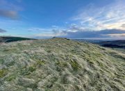
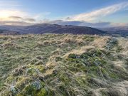
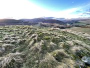
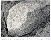
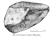
Montalt, Dunning, Perthshire

Cup-Marked Stone:  OS Grid Reference – NO 06 13

Also Known as:

  1. Canmore ID 26675
  2. Mount Alt Farm

Archaeology & History

Montalt’s curious cup-marked stone

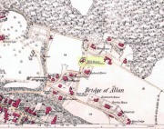
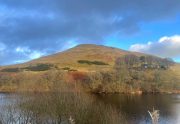
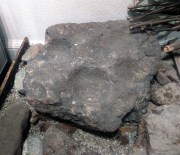
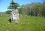
This is a curious stone and may not be the type of ‘cup-marked’ rock we’re used to.  Maybe… It is presently housed in Stirling’s Smith Art Gallery & Museum, where a small note tells that is was originally found “on the top of the Ochils, near Mount Alt Farm, Path of Condie in 1893.”  The stone was found at the same time, and adjacent to, a prehistoric collared urn—which implies it had an association with a cairn or cist, or burial site of some sort (which isn’t uncommon).  However, the exact location of its original whereabouts has been forgotten.

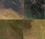
Broken off from a larger piece of stone, the remaining piece of rock has six cup-markings cut into it, between one and three inches across.  The smallest cup is what we might call a ‘normal’ size, but the rest of them get increasingly large and may have been more functional than purely mythic in nature.  In a small note attached to the stone in the Museum, they add the interesting note that,

“There are…indications that in some places they may be related to transhumance: the practice of moving sheep, cattle and goats to higher pastures in the summer, where they may have been used to mark routes or sources of water.”

They may indeed – amongst a variety of other things too.  But the suggested relationship with cattle occurs in stones found near Haworth, West Yorkshire, where large man-affected carved ‘cups’ such as the ones here, were known to be filled with milk at specific times of Nature’s calendrical rhythms, for the spirits of the place to give good fortune to the farmer and local people.  We know of one instance where this practice still occurs and goes back generations in the same family.  Examples of this animistic practice have also been found in the Scottish Highlands.

© Paul BennettThe Northern Antiquarian


Katie Thirsty’s Well, Logie, Stirlingshire

Sacred Well:  OS Grid Reference – NS 81787 97653

Getting Here

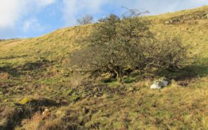
The scraggy hawthorn of Katie Thirsty’s Well

Not too tricky to locate, as long as you get onto the right footpath!  Take either road (both steep narrow and very bendy in places!) up from Logie on one side or Bridge of Allan on the other, towards Sheriffmuir and head to the Faerie or Highlandman’s Well.  About 150 yards before this, note the small car-park.  From here, go through the gate as if you’re walking to Dumyat, but 50 yards along the footpath it splits into two.  Take the lower right-hand path and keep walking for another 600 yards until you see a large worn hawthorn tree on your left, with boggy land just in front of it that runs to the path you’re walking on.  That’s it!

Archaeology & History

‘Katie Thirsty’ is a most intriguing character who pops up at a number of healing wells, primarily in Scotland.  Dedications to her are known near Abernethy, Falkirk, Innerleithen, Killearn, Kilsyth and elsewhere, with one example just over the Scottish border in Northumberland.  So who was she? And what’s the story behind this little known example, close to the ruinous Iron Age village east of Dumyat?  The truth is, we don’t know for sure as yet.  Tales are told of a local lady called ‘Katie’ at the wells near Abernethy and Kilsyth, each with their own domestic myth—but it seems that a wider mythic status underlies this dedication.

One very fine notion comes from the pen of Pictish researcher Ronald Henderson (2008; 2014), who tells that the name derives from a corruption of both St. Katherine of Alexandria [Katie] and the Pictish King, Drust or Drustan [Thirsty].  The latter etymological postulation finds faith in the fact that the great crags of Dumyat less than a mile to the east is universally credited with being the last Pictish stronghold at the old hillfort there.

The flowing clear waters

…This well on the hills north of Logie village—with its old hawthorn for companion above the old path to medieval Fossachie village—flows nicely, and its freezing waters are very good to drink.  Twenty yards east of the boggy overflow are the overgrown remains of an isolated Iron Age ‘homestead’ or hut circle, and the waters of Katie Thirsty’s Well would have been the primary drinking supply to the people living there in ancient times.

Very little is known about the specific history or folklore of the site and it is mentioned only in passing by David Morris (1935) who told us simply:

‘“Katie Thirty’s Well’ was the old name of a clear spring on the hillside by the track leading to Dumyat.”

It’s a beautiful spot to visit, with lovely views for many miles to the east, south and west.  If you’re going to visit the Fairy or Highlandman’s Well nearby, take time to visit Katie Thirsty’s refreshing flow too.

As for Katie herself: does anyone have their own ideas about her…?

References:

  1. Henderson, Ronald W., Rex Pictorum – The History of the Kings of the Picts, Perth 2008.
  2. Henderson, Ronald W., “Drust… of the Hundred Battles,” in Celtic Guide, 3:4, April 2014.
  3. Morris, David B., “Causewayhead a Hundred Years Ago,” in Stirling Natural History & Archaeological Society Transactions, 1935.

© Paul BennettThe Northern Antiquarian

Devil’s Well, Abernethy, Perthshire

Sacred Well:  OS Grid Reference – NO 19430 14758

Also Known as:

  1. Canmore ID 28084

Getting Here

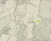
Devil’s Well on 1860 map

From Abernethy village, go west along the A913 road for half-a-mile, then turn left up the long and winding Glenfoot road up the Abernethy Glen.  About a mile up on your left-side is Craigden Farm and, just a bit past this, the forestry plantation.  Just before the trees, cut up the field and head uphill, passing the near forest of gorse, until you reach the huge detached house of Turflundie.  In the field immediately east, right up against the barbed-wire fence where it meets the depleted forestry, a very small trickle of water emerges beneath a small pile of rocks.  You’re here!

Archaeology & History

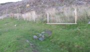
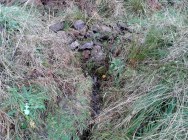
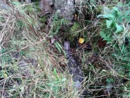
Long since thought to have been lost, the trickling remains of this old Well of the Devil are, in fact, still running beneath the pile of stones just over the barbed-wire fence on the edge of the forestry section.  A cluster of other worn rounded rocks scatter the ground just to the rear of where the water first comes out of the ground, suggesting, perhaps, that a small well-house covered the spring; but this is me being speculative, as there’s no mention of this in the early writings of the Ordnance Survey lads, nor is one shown on the first OS-map of the area in 1860.  And you’ll see on the OS-map how the well is slightly lower than where it presently trickles, but this is down to the fact that the source of it was piped-off at sometime in the not-too-distant past, as evidenced by remains of such piping laying just over the barbed-wire fence close to the source.  In truth, unless you’re hardcore, there’s very little to see.

Folklore

The trickling waters are on the other side of this fence

The dedication of this water-site to the christian ‘devil’ is obviously a corruption of its original traditional name, which may have simply been to the Bodach, or ‘Old Man’ in Gaelic and northern British lore.  The bodach‘s consort is the great prima Mater of the northern realms known as the Cailleach, but I can find no dedication to Her anywhere nearby.  The best we have are the ‘Witches Graves’ a half-mile to the northwest, below the edge of the geological ridge overlooking Abernethy, where folklore tells us 22 women were murdered and buried by the local christians several centuries ago.

In the Ordnance Name Book of 1859, they recorded that,

“A small Spring well on the farm of Turflundie, so called from the mark of a cloven hoof on a near, supposed to have been made by his Satanic majesty when he stopped to quench his thirst at this well during some of his midnight rambles.”

There’s no apt word that follows the word “near”, but assume it was meant to be a “stone,” although we could find no such stone close by and there are no known petroglyphs that could account for that ingredient.

References:

  1. Morris, Ruth & Frank, Scottish Healing Wells, Alethea: Sandy 1982.

© Paul BennettThe Northern Antiquarian


Airthrey Mineral Wells, Bridge of Allan, Stirlingshire

Healing Wells:  OS Grid Reference – NS 79504 97686

Also Known as:

  1. Airthrey Spa
  2. Airthrey Springs
  3. Bridge of Allan Spa
  4. Canmore ID 317260

Getting Here

Site shown on 1865 OS map

The old well-house is accessed easily.  From the main road of Henderson Street (or A9), that runs through the town, as you approach the main shopping area, go up Alexander Drive, then immediately turn right up Well Road. 100 yards up, take your first right again along Kenilworth Road and then first right up Mine Road.  100 yards or so along here, as you reach the tennis courts on your right, a small crumbly-tumbly building is to your left, just by the car-park to the hotel, with some old trees hiding its presence.  You can’t get into it and the waters therein sound to have fallen silent.

Archaeology & History

In 1761, the great writer Daniel Defoe in his Tour across Britain, found himself visiting a healing spring under the western reaches of the Ochils:

“Airthrey Well, two miles north of Stirling, flows from a mountain, where is a copper mine, with some mixture of gold; the water is very cold, and being tinctured with the minerals it flows through, is of use against outward distempers.”
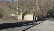
Airthrey Wellhouse in ruins

Perhaps the earliest literary description of this site, the Bridge of Allan that we see today was little more than a stretch of old abodes, reaching into woodland above the crystal clear river and burns, chiming with countless fauna and that rich chorus of colours that pre-date the Industrialist’s ‘progress’.  The old hamlet was said by Robert Chambers (1827) to be “a confusion of straw-roofed cottages and rich massy trees; possessed of a bridge and a mill, together with kail-yards, bee-skeps, colleys, callants, and old inns.” But all of this was about to change.

In the old woods on the northwest slopes above the hamlet was indeed an old copper mine as Defoe described, and housed therein were a number of mineral springs–six of them according to the early reports of Forrest (1831) and Thomson. (1827)  They were obviously “known to the country people,” said Thomson, and had been “used by them as an occasional remedy for more than forty years”; although in Forrest’s very detailed account of these wells, he told how

“one of the old miners, an intelligent man and an enthusiastic admirer of the medicinal virtues of these waters, informs me, that they have been known for at least one hundred years.”

This comment was echoed a few years later when Charles Roger (1853) wrote his extensive book on the village.

It was in the 1790s when the mineral waters were channeled out of the mines for the first time, and Mr Forrest told that they were collected lower down the slope,

“in a wooden trough, for the use of the miners, and of the country people, some of whom used it as an aperient, whilst others, deeming the water impregnated with common salt merely, employed it for culinary purposes. …It was…much used as a medicine by the country people of the neighbourhood who attended regularly every Sunday morning to partake of it.”
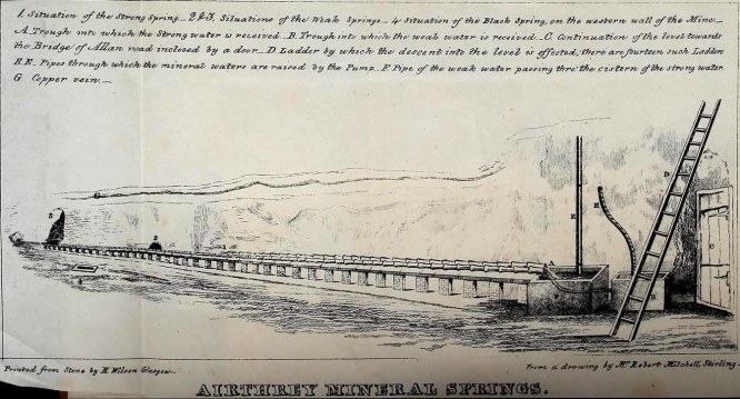
Airthrey waters channeled along the long trough (Robert Mitchell 1831)

The fact that Sunday mornings was when people came here tell us that the Church had something to do with the timing; strongly implying that the wells possessed earlier indigenous traditions—probably similar to those practiced at the Christ’s Well, the Chapel Well and countless others across the country.  But written records on this are silent.

The main history of the Airthrey Springs is of them becoming famous Spa Wells and, much like Harrogate in Yorkshire, were responsible for the very growth of Bridge of Allan itself.  Oddly enough, this came about a few years after the copper mines were closed in 1807.  This wouldn’t have stopped some of the local people still getting into them and drinking the waters when needed—but the written records simply tell that, for a few years at least, their reputation faded.  Around the same time in the village of Dunblane, just a few miles to the north, another Spa Well had been discovered and it was attracting quite a lot of those rich wealthy types—bringing fame and money to the area.  As a result of this, the medicinal virtues of the Airthrey Springs were revived thanks to the attention of the local lord, a Mr Robert Abercromby, who thought that Bridge of Allan could gain a reputation of his own.  And so in the winter of 1821-22, Abercromby procured the research chemist Thomas Thompson to analyse the medicinal waters at Airthrey and have them compared with the ones at Dunblane.  He was in luck! Not only were they medicinal, they were incredibly medicinal!

Dr Thomson then wrote a series of articles in various academic journals in the early 19th century—each espousing, not just the health-giving property of the Airthrey waters, but lengthy chemical analyses outlining the active constituents.  To his considerable surprise he found that the Airthrey waters were as good as any of the great spa towns in England at Harrogate, Buxton, Bath and Leamington.  Their virtues were so good that Mr Forrest (1831) doubted any of the Spa Wells in England were as beneficial as the waters here!  R.M. Fergusson (1905) echoed this sentiment in his massive work on the adjacent parish of Logie, calling the Airthrey springs “the Queen of Scottish Spas”!—and these accolades prevailed long after Dr Thomson’s analyses.  He wrote:

“At Airthrey there are six springs containing, all of them, the same saline constituents, but differing a good deal in their relative strengths. I analyzed two of these during the winter of 1821-22, and the other four during the autumn of 1827.”

He found that, in varying degrees, the main constituents were salt, muriate of lime, sulphate of lime and muriate of magnesia. At that time, in medical circles, these ingredients were beauties!  As Mr Logie (1905) said:

“This mineral water has been for long distinguished as a specific for derangements of the stomach and liver, and skin and chest diseases, rheumatism, gout, sciatica, and nerve affections…”

Thomson’s initial findings were much to the liking of Mr Abercromby; for hereafter, he realised, all and sundry who could read and travel to the country spas in England and beyond, would visit Bridge of Allan and bring with it great trade.  So Abercromby quickly,

“caused the water of the two Springs analysed by Dr. Thomson, one of which was characterised by its strength, the other by its comparative weakness, to be carefully collected and conveyed apart in earthen pipes, to two stone troughs placed in a convenient situation, from which it was raised by two well-constructed forcing pumps. Over these pumps a commodious house was erected.

In 1822, several thousand copies of Dr. Thomson’s analyses were circulated; and the water acquired immediate celebrity.  Invalids from all parts of the country, but especially from Glasgow and its vicinity, resorted to Airthrey. Every house, in fact, in its neighbourhood, however mean and incommodious, was occupied by strangers; and so great was the popularity of the new springs that even in 1823 they threatened to supersede all the other same springs of Scotland.”

The success of these medicinal waters created the town itself and, unlike many other spa wells, this one continued to be used until the end of the 1950s.  Its demise came when, in one financial year, only two people came to “take the cure,” as it was called.
Side wall of ruined wellhouse

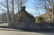
If you visit the well-house nowadays, it’s in rather poor condition and will be of little interest unless you’re a devout architectural fanatic.  It’s thought to be the earliest surviving building associated with this spa town, said by Mr Roger (1853) to have been built in 1821.  Shown on the first OS-map of the area, adjacent buildings were constructed to accommodate the overflow of people who came here.  And in the woodlands above, if you look around halfway up the slopes, an old trough has water running into it just by the side of a path.  This, say some local folk, is the trickling remains of the medicinal waters, still used occasionally by some people…

References:

  1. Durie, Alastair J., “Bridge of Allan: Queen of the Scottish Spas,” in Forth Naturalist & Historian, volume 16, 1993.
  2. Erskine, John, Guide to Bridge of Allan, Observer Press: Stirling: 1901.
  3. Fergusson, R. Menzies, Logie: A Parish History – 2 volumes, Alexander Gardner: Paisley 1905.
  4. Forrest, W.H., Report, Chemical and Medical, of the Airthrey Mineral Springs, John Hewit: Stirling 1831.
  5. Morris, Ruth & Frank, Scottish Healing Wells, Alethea: Sandy 1982.
  6. Roger, Charles, A Week at Bridge of Allan, Adam & Charles Black: Edinburgh 1853.
  7. Stewart, Peter G., Essay on the Dunblane Mineral Springs, Hewit: Dunblane 1839.
  8. Thomson, Thomas, “On the Mineral Waters of Scotland,” in Glasgow Medical Journal, volume 1, 1827.
  9. Turner, E.S., Taking the Cure, Michael Joseph: London 1967.

© Paul BennettThe Northern Antiquarian


Fairy Well, Logie, Stirlingshire

Sacred Well:  OS Grid Reference – NS 8135 9804

Also Known as:

  1. Canmore ID 47123
  2. Hielantman’s Well
  3. Highlandman’s Well
  4. Holy Well

Getting Here

Fairy Well, emerging from wall

Fairy Well, emerging from wall

From Stirling, take the A9 to Bridge of Allan, turning right at the roundabout along the A907 for less than a mile, then turning left at the next roundabout up the A91.  A half-mile down, at the small roundabout, bear left and first right, up to Logie Church.  Keep going all the way up this steep winding road, turning right at the junction.  Go along here for a quarter of a mile and park up at the roadside.  Walk along a bit further where the road has a bittova sharp bend.  The sound of the stream coming out of the small glen is obvious.  Walk past this and, on the right-hand side of the road, past the stream, you’ll find a water source emerging from the boscage of an overgrown wall.  Keep looking.  It’s damn close!

Archaeology & History

In the 1792 Statistical Account of this northeastern edge of Stirling, moving into the ancient parish of Logie, we were given an early brief account of this all-but-forgotten sacred water source which, thankfully, still runs fine water to this day.  It was described in tandem with the ancient Hill of the Picts called Dunmyatt, more than a mile to the east; but,

“About half-a-mile from the foot of this hill…is a very fine well, which issues from more than sixty springs, that rise through the sand and channel.  It is called the Holy Well, and is said to have been much resorted to by the Roman Catholics.”

Close-up of the running waters

Close-up of the running waters

In R.M. Menzies (1905) magnum opus on the parish of Logie, he told that it “was popularly known as ‘the Heilantman’s Well’, a possible reminiscence of the ’15 where the battle of Sheriffmuir was fought nearby.”  This tradition is echoed by several local historians; though Angus Watson (1995) wonders whether it’s ‘Highlandman’s Well’ name (and its variants) is “perhaps more likely to the use of the well by Highland drovers.”  It’s in the perfect spot too!

When the Royal Commission (1963) lads visited the place in 1952, they described the well to have “been filled up.”  Thankfully today, the old well emerges out of the overgrown remains of an old wall, the waters of which still run fast and free and into the larger stream ahead of it.  The waters are fine and clear, and tasted cold and refreshing when I drank some a few days ago.  It’s an excellent spot to quench the thirst after a day out in the Ochils.

Folklore

Of the various titles given to this old water source, the more popular choice in recent years has been to call it the Highlandman’s Well.  However, local lore had always known it to be a place where the little people had acquaintance and it seems more vital to maintain its old folk-name.  In R.M. Menzies (1912) rare work on the folklore of the region, he told us the story behind the name:

“Once upon a time, when people took life more leisurely, and when the wee folk frequented the glens and hills of Scotland, there was one little fairy whose duty it was to look after certain wells renowned for their curative properties.  This fairy was called Blue Jacket, and his favourite haunt was the Fairy Well on the Sheriffmuir Road, where the water was so pure and cool that nobody could pass along without taking a drink of the magic spring.  A draught of this water would have such a refreshing effect that the drinker could go on his journey without feeling either thirsty or hungry.  Many travellers who had refreshed themselves at the Fairy Well would bless the good little man who kept guard over its purity, and proceed upon their way dreaming of pleasant things all the day long.

“One warm day in June, a Highland drover from the Braes of Rannoch came along with a drove of Highland cattle, which he was taking to Falkirk Tryst, and feeling tired and thirsty he stopped at the Fairy Well, took a good drink of its limpid water, and sat down beside it to rest, while his cattle browsed nearby.  The heat was very overpowering, and he fell into a dreamy sleep.

“As he lay enjoying his noonday siesta, Blue Jacket stepped out from among the brackens and approaching the wearied drover, asked him whence he came.  The drover said:

“‘I come from the Highland hills beside the Moor of Rannoch; but I have never seen such a wee man as you before.  Wha’ may you be?’

“‘Oh,’ said the fairy, ‘I am Blue Jacket, one of the wee folk!’

“‘Ay, ay man, ye have got a blue jacket, right enough; but I’ve never met ony o’ your kind before. Do ye bide here?’

“‘Sometimes; but I am the guardian of the spring from which you have just been drinking.’

“‘Weel, a’ I can say is that it is grand water; there is no’ the likes o’t frae this to Rannoch.’

“‘What’s your name?’ asked the fairy.

“‘They ca’ me Sandy Sinclair, the Piper o’ Rannoch,’ was the reply.

“‘Have you got your pipes?’ asked Blue Jacket.

“‘Aye, my mannie, here they are.  Wad ye like a tune?  Ye see there’s no’ a piper like me in a’ Perthshire.’

“‘Play away then,’ said Blue Jacket.

“Sandy Sinclair took up his pipes and, blowing up the bag, played a merry Highland reel.  When he finished, he was greatly surprised to see above the well a crowd of little folk, like Blue Jacket, dancing to the music he had been playing.  As he stopped they clapped their little hands and exclaimed, ‘Well done Sandy! You’re the piper we need.’

“Thereupon Blue Jacket blew a silver whistle, which he took from his belt, and all the wee folk formed themselves into a double row.  Blue Jacket then took the Highland piper by the hand, led him to the front of the procession, and told him to play a march.  Sandy felt himself unable to resist the command of the fairy, and, putting the chanter into his mouth, blew his hardest and played his best, marching at the head of the long line of little people, who tripped along, keeping time to the strains of the bagpipes.  Blue Jacket walked in front of the piper, leading the way in the direction of the Fairy Knowe.

“Sandy Sinclair never marched so proudly as he did that day, and the road, though fairly long, seemed to be no distance at all; the music of the pibroch fired his blood and made him feel as if he was leading his clansmen to battle.   When the Fairy Knowe was reached, the wee folk formed themselves into a circle round the little hill, and sang a song the sweetest that ever fell upon the ears of the Highlandman.  Blue Jacket once more took his whistle and, blowing three times upon it, held up his hand, and immediately the side of the knoll opened.  Bidding the piper to play on, Blue Jacket led the procession into the interior; and when all were inside, the fairies formed themselves into sets, and the piper playing a strathspey, they began dancing with might and main.

“One dance succeeded another, and still Sandy played on, the wee folk tripping it as merrily as ever.  All thoughts of Sandy’s drove had gone quite out of his head, and all he thought of now was how best to keep the fairies dancing: he had never seen such nimble dancers, and every motion was so graceful and becoming as made him play his very best to keep the fun going.  Sandy Sinclair was in Fairyland, and every other consideration was forgotten.

“Meanwhile his cattle and sheep were following their own sweet will, the only guardian left to take care of them being his collie dog.  This faithful animal kept watch as well as he could, and wondered what had become of his master.  Towards evening another drover came along with his cattle for the same tryst.  He knew the dog at once, and began to pet the animal, saying at the same time, ‘Where’s your master, Oscar? What’s become o’ Sandy?’

“All the dog would do was to wag his bushy tail, and look up with a pleading air, as if to say, ‘I don’t know; will you not find him?’

“‘My puir wee doggie, I wonder what’s come over Sandy?  It’s no like him to leave his cattle stravaiging by the roadside.  Ay ay man; and at the Fairy Well too!  Indeed, this looks unco bad.’

“The newcomer, who was also a Highlander, made up his mind to spend the night with his own drove and that of Sandy Sinclair, thinking that the missing man would turn up in the morning.  But when the morning came there was no sign of Sandy.

“Taking Sandy’s collie and leaving his own dog in charge of the combined droves, he said, ‘Find master, Oscar!’  The wise beast sniffed around for a little and then trotted off in the direction taken the day before by Sandy Sinclair and the fairies.  By and by they reached the Fairy Knowe; but there was nobody there as far as the drover could see.  The dog ran round and round the knoll, barking vigorously all the time, and looking up into the face of the drover as if to say, ‘This is where he is; this is where he is.’  The drover examined every bit of the Fairy Knowe, but there was no trace of Sandy Sinclair.  As the drover sat upon the top of the Fairy Knowe, wondering what he should do next, he seemed to hear the sound of distant music.  Telling the faithful dog to keep quiet, he listened attentively, and by-and-by made out the sound of the pibroch; but whether it was at a long distance or not, he could not be certain.  In the meantime, the dog began to scrape at the side of the mound and whimper in a plaintive manner.  Noticing this, the drover put his ear to the ground and listened.  There could be no mistake this time: the music of the pibroch came from the centre of the Fairy Knowe.

“‘Bless my soul!’ exclaimed Sandy’s friend. ‘He’s been enticed by the fairies to pipe at their dances.  We’ll ne’er see Sandy Sinclair again.’

“It was as true as he said.  The Piper of Rannoch never returned to the friends he knew, and the lads and lasses had to get another piper to play their dance music when they wished to spend a happy evening by the shore of the loch.  Long, long afterwards, the passers-by often heard the sound of pipe music, muffled and far away, coming from the Fairy Knowe; but the hidden piper was never seen.  When long absent friends returned to Rannoch and enquired about Sandy Sinclair, they were told that he had gone to be piper to the wee folk and had never come home again.”

The Fairy Knowe is the large prehistoric burial mound, neolithic in origin, found 1.08 miles (1.74km) west of the Fairy Well, above Bridge of Allan—and an absolute must to visit for any lovers of fairy lore!

References:

  1. Fergusson, R. Menzies, Logie: A Parish History – volume 1, Alexander Gardner: Paisley 1905.
  2. Fergusson, R. Menzies, The Ochil Fairy Tales, David Nutt: London 1912.
  3. Royal Commission on the Ancient & Historical Monuments Scotland, Stirling – volume 2, HMSO: Edinburgh 1963.
  4. Watson, Angus, The Ochils – Placenames, History, Tradition, Perth & Kinross District Libraries 1995.

© Paul BennettThe Northern Antiquarian


Gray Stone, Dunning, Perthshire

Standing Stone:  OS Grid Reference – NO 02182 11809

Also Known as:

  1. Big Stane
  2. Canmore ID 26681
  3. Grey Stone
  4. Maormar‘s Stone

Getting Here

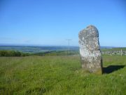
Grey Stone, looking NE

Take the B934 road south, uphill, out of Dunning, for 2.1 miles (3.4km), past Kippen, past Pitmeadow and past Quilts.  It’s the track to Knowes that you’re after!  Along this track, keep to the field-side on your right, following the edge of the fencing until you reach the small copse of trees.  At the far side of the trees a gate takes you into the field with the standing stone, which is just over 100 yards to the north. You can’t miss it!

Archaeology & History

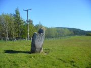
Although mentioned in several folklore works and just a couple of archaeology tomes, almost nothing has been written about this large upright standing stone.  A very bulky stone nearly seven feet tall, it has been broken into pieces at sometime in the recent past but, thankfully, good locals put the stone back together and placed it upright once again.  Its position in the landscape is quite superb, overlooking the lowlands of Tayside below and then far into the rising mountains of Perthshire and beyond, easy fifty miles or more.


Grey Stone, looking south
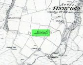
Gray Stone on 1866 map

Shown on the earliest Ordnance Survey map of the area, the name of the stone is somewhat of a puzzle, for in a lot of cases ‘gray’ stones are found on local boundary lines—indeed, the name gray stone and boundary stone are interchangeable in many cases—yet the nearest boundary from here is some distance to the east.  It may simply relate to the colour of the rock (although this is unlikely).  Whatever its reason, it’s an impressive stone and is well worth checking out!

Folklore

Gray Stone, looking east

The local farmer told that the field where the Grey Stone lives was known as the Big Stane Field.  Makes sense!  Legend has it that the Gray Stone was the burial place of Maormor, the Steward of Atholl in the Battle of Duncrub, after dying in Thanes Field (Watson 1995), on land to the north of Dunning village in 964-5 CE.

References:

  1. Holder, Geoff, The Guide to Mysterious Perthshire, History Press 2006.
  2. McKerracher, Archie, Perthshire in History and Legend, John Donald: Edinburgh 1988.
  3. Swarbrick, Olaf, A Gazetteer of Prehistoric Standing Stones in Great Britain, BAR: Oxford 2012.
  4. Watson, Angus, The Ochils: Placenames, History, Tradition, PKDC: Perth 1995.

© Paul BennettThe Northern Antiquarian


Priest’s Well, Tullibody, Clackmannanshire

Holy Well:  OS Grid Reference – NS 86069 95324

Also Known as:

  1. Canmore ID 47056

Getting Here

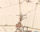
Priest Well on 1866 map

Priest Well on 1866 map

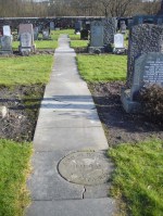
Along the A907 Stirling to Alloa road, turn onto the B9096 through Tullibody, turning up Menstrie Road until, on your right, you reach the old graveyard.  Walk along the track past the old section and go into the new graveyard. The second pathway down, keep your eyes peeled on the floor and you’ll see it.

Archaeology & History

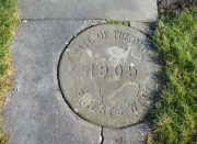
Just a flat carved stone laid in the expanded graveyard is all that remains to mark the site of this once sacred well.  On it, the inscribed slab reads, “Site of the old Priest’s Well – 1905.”

In the 19th century when the waters were still used by local villagers, Robert Kirk (1890) wrote the following,

Site of the Priests Well

Site of the old well

Carved commemorative stone

Carved commemorative stone

“Like the trees, we will now keep outside the dyke (round the old graveyard) and come to the Priest’s Well.  This well, an adjunct of the ancient building, appears to be coeval with the Old Church, and lay a few yards south of the Parsonage, which was demolished at the Reformation.  A small piece of ground in the immediate vicinity is known as the ‘Priest’s Croft’, and the adjacent field, tradition imagines to be the site of the original hamlet. When this well, from its proximity to the Churchyard, was condemned as unfit for human use, one old wife was heard to exclaim, “Na, na, I aye like a drink o’ the guid sweet priest.”

Despite being cited in the various Scottish holy wells reports, all mythic history of the site seems to have been forgotten.

References:

  1. Morris, Ruth & Frank, Scottish Healing Wells, Alethea Press: Sandy 1982.
  2. Kirk, Robert, Historical Sketch of Tullibody, Alloa 1890.
  3. Royal Commission on the Ancient & Historical Monuments, Scotland, Inventory of Monuments and Constructions in the Counties of Fife, Kinross and Clackmannan, HMSO: Edinburgh 1933.
  4. Simpkins, John Ewart, County Folklore – volume VII: Examples of Printed Folk-Lore Concerning Fife, with some Notes on Clackmannan and Kinross-Shires, Folk-Lore Society: London 1914.
  5. Walker, J. Russel, “Holy Wells in Scotland,” in Proceedings Society Antiquaries Scotland, volume 17, 1883.

© Paul BennettThe Northern Antiquarian


Tillicoultry House Carving, Tillicoultry, Clackmannanshire

Cup-and-Ring Stone (lost):  OS Grid Reference – NS 9240 9752

Also Known as:

  1. Canmore ID 48255

Archaeology & History

Multiple-ringed carving

A recent visit to try find this intricate carving—the only one of its kind in Clackmannanshire—proved unsuccessful, and so I add it here in the hope that someone might know where it is and bring it back to light.  It looked like quite an impressive petroglyph.  If the stone isn’t hiding in undergrowth at the edge of someone’s garden, it may well have been destroyed—which would be appalling.  As a unique design, this important carving should have been preserved.  Even when the Victorian explorers found it, the covering stone circle had been greatly damaged and many stones in the ring had been removed.  This carved stone remained intact however.  When Mr R. Robertson (1895) and his friend visited the site, it was covered in sand and dirt and had fallen to the side of an internal cist:

“On clearing this away a remarkable feature was brought to light.  The block was found to be elaborately ornamented on its sides and upper surface, with rings, spirals and lines.  The labour of cutting these in the hard granite with primitive tools of the period must have been very great. Several successful photos of the stone and its carvings were taken by Provost Westwood, Dollar…. This stone has now been removed to the vicinity of Tillicoultry for safety.”

In the same article, George Black told slightly more of the design:

“The covering stone of the cist…bears on the face a series of concentric circles, and spirals springing from one of the groups of circles,  Four grooves also unite the same set of circles with the left-hand edge of the stone.  On the edge shown in the photograph there is another group, consisting of two concentric circles.  The unevenness of the surface of the stone appears to have been of no moment to the sculptor of the circles, as the incisions follow the surface into its sinuosities and depressions.”

Not long after Robertson & Black’s visit, the great megalithomaniac Fred Coles (1899) came here—and he found that the “spirals” that Mr Black described were nothing of the sort.

“The huge irregularly-shaped diorite boulder which covered the cist has several cup-and-ring marks on one face and one side…. These marks are now, so I was informed when inspecting them, very much less distinct than they were when the photograph was taken (above) in 1894.  It would be difficult now to describe the incised markings with accuracy; it is difficult even to see them when wet.  But…I must take exception to the term ‘spirals’ as applied to any of these ‘rings.’  There are three groups of rings so placed as to make the outermost ring in each group touch that of the others (not an uncommon form), but there is no one true volute.

“…What is more noteworthy is the group of four long parallel, nearly perpendicular grooves issuing (probably) from the outermost ring of the group of five rings, and ending at the edge of the boulder.”

Alison Young’s 1937 sketch

Cole also noted that the carvings were to be found on the upper surface of the stone.  It would seem very probable that the excessive erosion which Cole described was due to the fact that the stone was, many centuries earlier, exposed to the elements within the stone circle and not buried as it later came to be.  It makes sense.

The excessive erosion was spoken of by the Royal Commission (1933) lads, aswell as the last person to describe the site, Ronald W.B. Morris (1981), who said that during his visits here between 1966-75,

“the author has only found traces of possible cups visible on the rough surface, which has flaked badly.”

Morris (1981) said that the stone measured “1½m by 1¾m by ½m (5½ft x 4½ft x 2ft)”—and was last known to be some 10 yards NW of the Tillicoultry House cottage, but we could locate no trace of the stone or its carving.  If anyone is aware of the whereabouts or fate of this important neolithic carving, please let us know.

References:

  1. Coles, Fred R., (1899b) ‘Notices of the discovery of a cist and urns at Juniper Green, and of a cist at the Cunninghar, Tillicoultry, and of some undescribed cup- marked stones’in Proceedings of the Society Antiquaries, Scotland, volume 33, 1899.
  2. MacWhite, Eoin, “A New View on Irish Bronze Age Rock-Scribings,” in Journal Royal Society Antiquaries, Ireland, 76:2, 1946.
  3. Morris, Ronald W.B., ‘The cup-and-ring marks and similar sculptures of Scotland: a survey of the southern Counties, part II’in Proceedings of the Society Antiquaries, Scotland, volume 100, 1969.
  4. Morris, Ronald W.B., “The Cup-and-Ring and Similar Early Sculptures of Scotland; Part 2 – The Rest of Scotland except Kintyre,” in Transactions of the Ancient Monuments Society, volume 16, 1969.
  5. Morris, Ronald W.B., The Prehistoric Rock Art of Southern Scotland, BAR: Oxford 1981.
  6. Robertson, R., Black, G.F. & Struthers, J., ‘Notice of the discovery of a stone cist and urns at the Cuninghar, Tillicoultryin Proceedings of the Society Antiquaries, Scotland, volume 29, 1895.
  7. Royal Commission on the Ancient & Historical Monuments of Scotland, Fife, Kinross and Clackmannan, HMSO: Edinburgh 1933.
  8. Young, Alison, “Cup-and-Ring Markings on Craig Ruenshin, with some Comparative Notes,” in Proceedings of the Society Antiquaries, Scotland, volume 72, 1937.

© Paul BennettThe Northern Antiquarian


Castle Craig, Tillicoultry, Clackmannanshire

‘Fort’ (destroyed):  OS Grid Reference – NS 9116 9769

Also Known as:

  1. Canmore ID 48294

Archaeology & History

This ancient fort could once be seen in the ancient woodlands on the western side of the Mill Glen, above the village, going into the Ochils—but it was completely destroyed, as usual, by the Industrialists when they quarried the entire structure out of existence.  It was a big thing too, by all accounts.  When Stewart Cruden (1964) saw it, shortly before its final demise, it was still impressive to look at.  He told that the fort consisted of a deep rock-cut ditch with a stone wall on the inside and the remains of a stony rampart on the outside.  Although damaged it still measured 300 feet across.  Its interior contained an almost precise circular enclosure, more than eighty feet across inside the remains of a large stone wall some twelve feet thick.

Nearly a hundred years earlier, Miss Christian MacLagan (1875) told it to be much bigger!  Not only did she report how locals remembered a stone roof on top, but it possessed three concentric circular walls, thirty-five apart, with the central area eighty feet in diameter—much as Cruden later reported.  However, even in MacLagan’s day, she told how many of the stones from the fort were being used to construct sheepfolds.  This destruction was being lamented by the local historian William Gibson (1883), who wrote:

“On the west side of the burn, and overtopping the village, stands the beautiful Castle Craig, wooded to the top, and on which stood, in ancient times, a round Pictish fortress, the traces of which can still be distinctly seen. This craig is, I think, one of the most picturesque objects on the Alva estate, and it is a very great pity that it should be so disfigured by the extensive quarrying operations that are being at present carried on at it.”

On the top of the quarry edges can still be found old walled remains crumbling at the edge of the huge cliffs, but these are unlikely to have been attached to the ancient fortress, and may just be the fragmentary memories of the sheepfolds built from the old fort.

Folklore

Tradition told that this was one of the old forts of the Picts who lived in the Ochils.  If it was a fort, then the Pictish tradition is probably true.  Old lore also told that some of the stones from the fort were used in the construction of Stirling Castle, 7.8 miles (12.6km) to the west.

References:

  1. Corbett, L., et al., The Ochil Hills, Forth Naturalist & Historian 1994.
  2. Cruden, Stewart H., “Castle Craig, Tillicoultry,” in Discovery & Excavation Scotland, 1964.
  3. Feacham, Richard, Guide to Prehistoric Scotland, Batsford: London 1977.
  4. Gibson, William, Reminiscences of Dollar, Tillicoultry and other Districts Adjoining the Ochils, Andrew Elliot 1883.
  5. Maclagan, Christian, The Hill Forts, Stone Circles and other Structural Remains of Ancient Scotland, Edinburgh 1875.
  6. Royal Commission on the Ancient & Historical Monuments, Scotland, Inventory of Monuments and Constructions in the Counties of Fife, Kinross and Clackmannan, HMSO: Edinburgh 1933.
  7. Royal Commission on the Ancient & Historical Monuments, Scotland, The Archaeological Sites and Monuments of Clackmannan District and Falkirk District, Society of Antiquaries of Scotland 1978.
  8. Watson, Angus, The Ochils: Placenames, History, Tradition, PKDC: Perth 1995.

© Paul BennettThe Northern Antiquarian


Butter Well, Dollar, Clackmannanshire

Sacred Well:  OS Grid Reference – NN 9610 0018

Getting Here

The marshland of the Butter Well

The marshland of the Butter Well

Take the long uphill road to Castle Campbell and park up at the top.  From here, bear to your right and walk up the footpath onto the hills.  A few hundred yards along you’ll reach a gate and you have the choice of continuing along the path, or dropping down into the small glen and up the other side, towards the ruins of an old settlement called Craiginnin, whose walls you can see from here.  Head there, keeping to the path that leads you to it, going through the first couple of gates and out the other side.  Just above the burn, some very overgrown walling is evident (possibly Iron Age in nature), where excessive Juncus reeds are growing. Amidst this is a boggy pool.  Unless the boggy-land across the burn is the place in question, this is probably the spot!

Archaeology & History

The boggy waters of the well

The boggy waters of the well

There’s very little to see here today other than a murky boggy pool, indicating it hasn’t been used for a long time; although when we visited the place there were several animal tracks into the edge of the pool, indicating that they still drink here.  This implies it has/had some medicinal virtues, but even I wasn’t going to try drinking this!  If there was ever a stone trough here, it too has gone (probably nabbed by a farmer in bygone years) and there seems to be no archaeocentric reference to the place.  The well was described in place-name and folklore accounts, where its waters were used by the people living at this settlement to clean and prepare the butter made by the farmer.

Folklore

The hills, glens and burns of the Ochil range were well-known haunts of fairy folk—and Craiginnan was no exception.  In an early article in the Scottish Journal of Topography, a pseudonymous “J.C.” of “13 Dalrymple Place” (who was it?) told of several dying traditions and, amidst it all, the story behind the Butter Well above Castle Campbell:

“The meadow of Craiginnan, in the vicinity of these hills, was (and still is) famous for the quantities of hay it yearly produces.  Nearly seventy years ago, David Wright rented the farm of Craiginnan.  His servants on cutting the grass of the meadow, were in the custom of leaving it to the management of the fairies.  These aerial beings came from Blackford, Gleneagles, Buckieburn, etc., and assembling on the summit of the Saddlehill descended to their work among the hay.  From morning till evening they toiled assiduously.  After spreading it out before the sun, they put it into coils, then into ricks, when it was conveyed into the adjacent farm-yard, where they built it into stacks.  This kindness of the fairies David Wright never forgot to repay, for, when the sheep-shearing came round, he always gave them a few of the best fleeces of his flock.  He flourished wonderfully, but finding his health daily declining, and seeing death would soon overtake him, he imparted to his eldest son the secret of his success and told him ever to be in friendship with the “gude neebors.”

“The old man died and was succeeded by his son, who was at once hard, grasping and inhospitable.  The kind advices and injunctions given him by his father were either forgotten or unattended to.  Hay-making came round, but young Wright, instead of allowing the “green-goons” to perform what they had so long done (thinking thereby to save a few fleeces), ordered his servants to the work.  Things went on very pleasantly the first day, but on going next morning to resume their labour, what was their surprise to find the hay scattered in every direction.  Morning after morning this was continued, until the hay was unfit for use.  In revenge for this, he destroyed the whole of their rings, ploughed up their green knolls, and committed a thousand other offences.  He had soon reason, however, to repent of these ongoings.

“One day the dairymaid having completed the operation of churning, carried the butter, as was her wont, to the butter well on the east side of the house, to undergo the process of washing, preparatory to its being sent away to the market.  No sooner had she thrown it into the well, than a small hand was laid upon it, and in a second the bright golden treasure disappeared beneath the crystal waters!  The servant tried to snatch it; but alas! it was lost—irrecoverably lost forever! and as she left the place a voice said:

“Your butter’s away’
To feat our band
In the fairy ha’.”

“The horses, cows and sheep sickened and died; and to complete all, Wright, on returning from a Glendevon market, night overtook him in the wild pass of Glenqueich.  He wandered here and there, and at last sunk into a “well-e’e”, in which he perished.  After his death the farmhouse went gradually to demolition and its bare walls are now only to be seen.”

Butter Well site, looking west

Butter Well site, looking west

The place-name ‘Craiginnan’ is thought to derive from the somewhat banal “crags by the anvil-shaped land”, which is grasping at some desperate straws if you ask me!  But it’s also been suggested by Angus Watson (1995) to possibly derive from the “Gaelic Creag Ingheann, maiden crag”, which would acquaint it with the nearby Maiden’s Well and Maiden’s Castle a mile northeast of here—both of which are possessed of their own fairy-lore.  Makes a lot more sense too!

References:

  1. “J.C.”, “Rhymes and Superstitions of Clackmannanshire,” in Scottish Journal of Topography, Antiquities & Traditions, volume 2, Jul 1, 1848.
  2. Simpkins, John Ewart, County Folklore – volume VII: Examples of Printed Folk-Lore Concerning Fife, with some Notes on Clackmannan and Kinross-Shires, Folk-Lore Society: London 1914. p.312
  3. Watson, Angus, The Ochils: Placenames, History, Tradition, PKDC: Perth 1995.

© Paul BennettThe Northern Antiquarian