Walloper Well, Newton, Lancashire

Healing Well:  OS Grid Reference – SD 71823 48265
Getting Here

Walloper Well

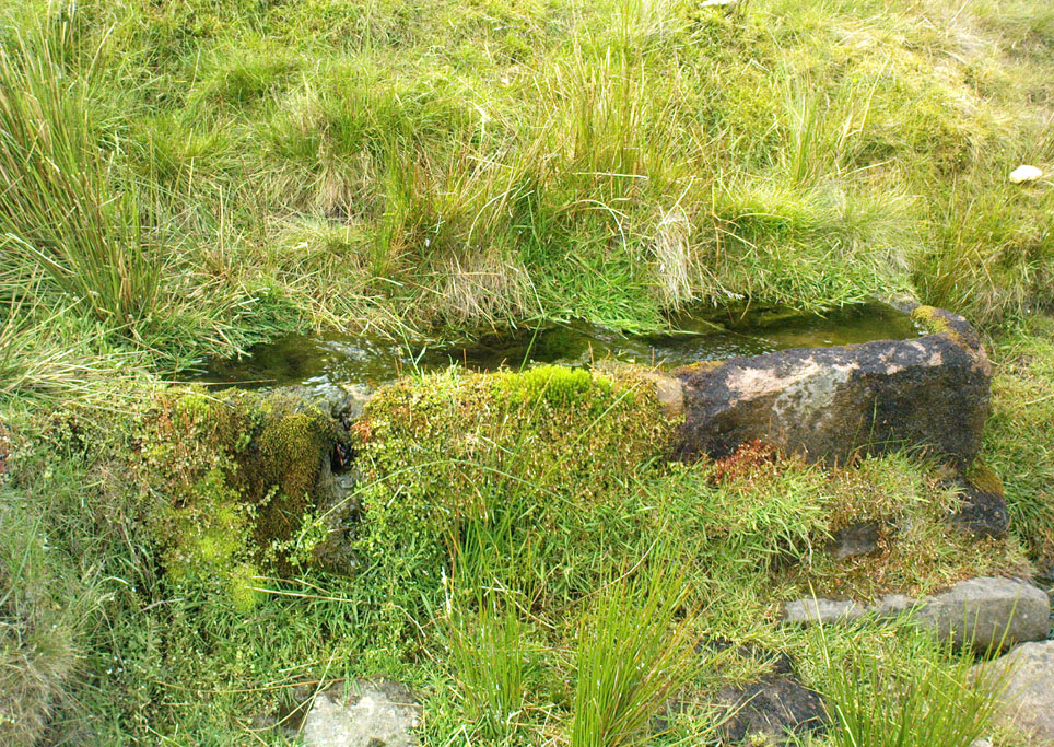
Take the B6478 road between Clitheroe and Newton, heading up north out of Clitheroe until you’re on the very top of the hill with fine views, mainly north and west.  There’s a car-park about here, on the right-hand side of the road.  From here, walk further along the road for about 200 yards, keeping your eyes peeled for the large stone trough at the left-hand side of the road.  That’s it!

Archaeology & History

When we met up with John Dixon in the summer of this year, to wander on the nearby hills in search of old monuments, this was the first spot he showed us — and the waters were flowing nicely and tasted alright aswell!  But its history is not widely know.  Jessica Lofthouse (1976) described the place, saying:

“In the days of horse and pedestrian traffic none passed Walloper Well without stopping  to ‘quaff the clear crystal.’  Long ago, hill men, hunters, forest wardens and farmers off to Clitheroe markets and fairs, pedlars, lead miners from the nearby workings, all met here.  The name is thought-provoking. Why Walloper? From a word meaning a ‘fresh bubbling spring’, which this is, fresh from the moorside into stone troughs.  Age, wartime army practice and vandalism of 1974 made renewal of the trough necessary, but the flow has been constant.  One must drink, just as one throws pennies into the Roman fountain, to ensure one comes back again.

“The true derivation does not satisfy everyone.  One can choose.  A man and his wife climbed towards Walloper with raised voices, she nagging, he protesting.  A pedlar watched them.  “I’ll tell thee what I’d do if she were my wife.  I’d wallop her, wallop her, wallop her well.” A song which every local singer was once compelled to have in his repertoire told the same story.  The chorus sums up the reason for the name:

“…lovers of tell, each beau to his belle
The olden time story of Walloper Well.
The mason who built it in love with a maid
Who brought him his dinner one day, so tis said,
Was struggling to kiss her when over the Fell
A pedlar then passing cried, ‘Wallop her well’.”

References:

  1. Byrne, Clifford H., Mineral Springs and Holy Wells of North-East Lancashire, unpublished manuscript, 1972.
  2. Lofthouse, North Country Folklore, Robert Hale: London 1976.

© Paul Bennett, The Northern Antiquarian


Skelshaw Ring, Easington, Lancashire

Enclosure:  OS Grid Reference – SD 7194 5037

Archaeology & History

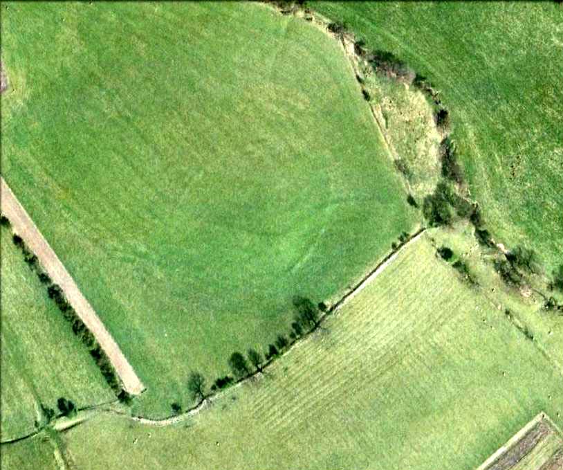
Faint outline of oval remains

Very little can be seen of this once large oval-shaped prehistoric enclosure, a mile south of Slaidburn, on the level below the rise towards Easington Fell.  Few archaeologists know about the site and there has been little written about it.  Although very little of it is visible at ground level today, three-quarters of the site is vaguely discernible from the air and on GoogleEarth, as the photo here shows.  The Skelshaw Ring was described in Greenwood & Bolton’s Bolland Forest (1955), where they said, “The late Colonel Parker (Browsholme Hall) claimed to have found a good specimen of an ancient earthwork above Easington Green. Unfortunately, this has been ploughed over during the last war (WWII).” And little else appears to have been said of the place until the Lancastrian writer John Dixon (2003) wrote about it.  More recently John said the following about the site:

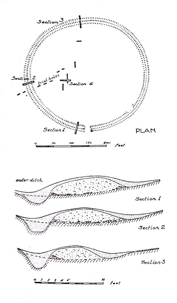
Skelshaw Ring plan (after Dixon 2003)

“This oval earthwork, 320 ft. diameter, crowns a small hill on the general slope of the east bank of Easington Beck. It consists of a ditch and bank with a gateway through the bank and a causeway across the ditch on the west side. Inside the bank and ditch the ground rises gently into a rounded hill so that most of the inside of the earthwork is well above the level of the bank.

“During the spring of 1934 a preliminary excavation of the site was undertaken by the late Dr. Arthur Raistrick. Three sections were cut through the ditch and bank and the inner area was briefly explored.

“Although nothing was obtained to date the earthwork, the sections did show the ordered structure of the site and proved the presence of large floors that may well have been the site of huts.

“This site may be compared with the large ringwork at Fair Oak Farm, SD 648 458, as both have a similar size and the same features are displayed. Bleasdale Circle, SD 577 460, is a slightly smaller ringwork, but I consider all three monument (plus: Easington Fell Circle [no:2] SD 717 492 ) to have the same origins.

“These earthworks represent the first settlements of a people determined to tame, settle and cultivate the landscape. What we observe at Skelshaw is the possible farmstead of an extended family unit, part of a clan that worked the land here some 4000 years ago in what is referred to as the Bronze Technology Period.”

References:

  1. Dixon, John, Slaidburn and Newton, Bowland Forest, Aussteiger Publications: Clitheroe 2003.
  2. Greenwood, Margaret & Bolton, Charles, Bolland Forest and the Hodder Valley: A History, privately printed 1955.

© John Dixon & Paul Bennett, The Northern Antiquarian


Foulscales Stone, Newton, Lancashire

Carved Stone:  OS Grid Reference – SD 692 492

Also Known as:

  1. Bonstone
  2. Yolstone

Archaeology & History

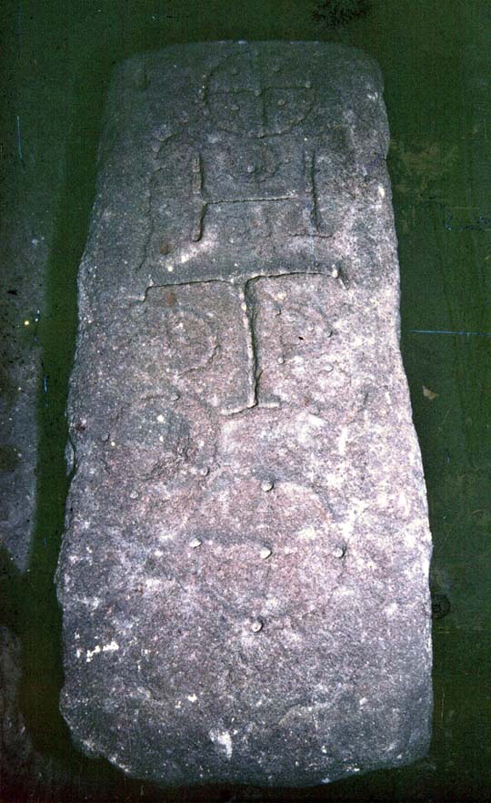
An intriguing and little-known carved stone whose existence has been brought to our attention by historian and author John Dixon.  Its precise history and nature seems unknown; but aspects of the carving possess symbols that are found on early christian remains, as well as some cup-and-ring designs.  John wrote:

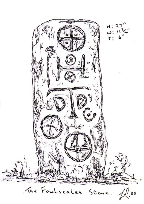
Artist’s impression
Foulscales Stone

“This enigmatic stone (27 inches height, 12 inches wide, 6 inch thickness), anciently known as the Yolstone and later as the Bonstone, once stood behind Foulscales Farm, near Gibbs.  For some reason the stone was removed from this site and taken into the cellars of Knowlmere Manor under the authority of the Peel Estate.

The stone displays possible early native chi-rho symbols that may have a 6/7th century provenance. The lettering ‘HT’ look to be of 16/17th century origin and may refer to the Towneley family who held lands in Bowland.”

Was it a boundary stone?  A gravestone?  Was it an early christian stone?  A Romano-British stone?  The carved circles with ‘crosses’ inside them are typical Romano-British period designs, covered extensively in the early works of J. Romilly Allen and found to be widespread across Britain.  Any further information on this stone would be greatly appreciated.

References:

  1. Dixon, John, Slaidburn and Newton, Bowland Forest, Aussteiger Publications: Clitheroe 2003.

© John Dixon & Paul Bennett, The Northern Antiquarian


Skip Knowe, Newton, Dumfriesshire

Standing Stone:  OS Grid Reference – NY 1118 9443

Also Known as:

  1. Site no.66950 (Canmore ID)
  2. Skipknowe

Getting Here

Skip Knowe stone
Skip Knowe stone

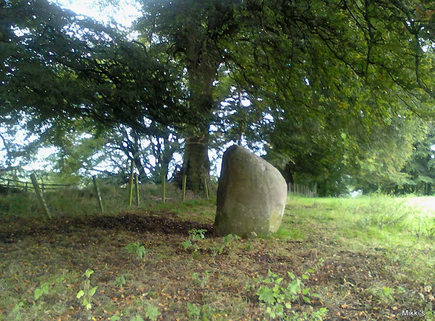
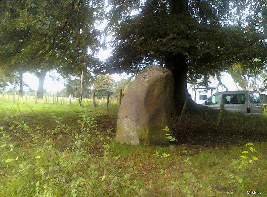
From junction 16 on the A74(M) turn off an go up the B7076 road, roughly parallel with the motorway, for about 2 miles, turning right – over the A74(M) – until you hit the T-junction by the lovely hamlet of Newton.  At the T-junction turn right again and along down the road for just 300 yards or so.  You’ll see the small Skip Cottage, almost overgrown by the tiny roadside on your right.  Stop here and look into the field across the road.  It’s right in front of you!

Archaeology & History

Looking SW

Despite the size and almost romantic setting of this large standing stone, I can find little by way of early descriptions or archaeological reports here.  Nearly six feet tall with its long axis aligned east-west and in seeming isolation, I find it hard to believe that we have no other sites or relevant data here. Echoing the work by Alexander Thom (1990:2), Aubrey Burl (1993) makes mention of it as one in a possible “pair” of standing stones, with its companion being “18ft (5.5m) away…in roadside bank,” but this is debatable.  This second stone seems as much a part of the old walling.  On purely subjective grounds, it gave the impression of once playing a part in a stone circle — an opinion also held by the Scottish Royal Commission (1920) lads after their visit here in August, 1912.  Does anyone know anything more about this place?

References:

  1. Burl, Aubrey, From Carnac to Callanish, Yale University Press 1993.
  2. Royal Commission on Ancient & Historical Monuments, Scotland, Inventory of Monuments and Constructions in the County of Dumfries, HMSO: Edinburgh 1920.
  3. Thom, A., Thom, A.S. & Burl, Aubrey, Stone Rows and Standing Stones – volume 2, BAR 560: Oxford 1990.

© Paul Bennett, The Northern Antiquarian