Dragon Well, Eccleshill, Bradford, West Yorkshire

Sacred Well (destroyed):  OS Grid Reference – SE 17567 35473

Also Known as:

  1. Pendragon Well

Archaeology & History

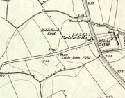
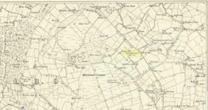
Site on the 1893 map

A most curious place:  this ‘Well of the Dragon’ as it was first called (on the 1852 OS-map) and subsequently the ‘Pendragon Well’ (on the 1922 map) just off Pendragon Lane, seems to have been forgotten in both folklore and history.  I grew up round here and no legends of dragons were known, either in my life, nor that of the old folks I knew; nor any pub of that name that might account for it.

Equally unexplained is the name of the adjacent ‘Pendragon Lane’, which has been known as that for some 175 years.  We have no Arthurian myths anywhere in West Yorkshire that remains in folk memory—and certainly nothing hereby that accounts for it.

As for possible landscape associations (i.e., serpentine geological features), nothing in the vicinity has any bearing on the name.  Indeed, the only thing of any potential relevance was the former existence of a healing rock known as the Wart Stone, some 100 yards to the east at Bolton Junction.  Such stones are usually possessed of naturally-worn ‘bowls’ of some sort on top of the rock—akin to large cup-markings—into which water collected that was used to rid the sufferer of warts or similar skin afflictions.  But such an association seems very unlikely.

The only thing we can say of this Dragon Well is that probably, in times gone by, a folktale or legend existed of a dragon in the neighbourhood that had some association with the waters here.  Dragons are invariably related to early animistic creation myths, and this site may have been all that remained of such a forgotten tale.  The nearest other place in West Yorkshire with dragon associations is six miles northwest of here on the south-side of Ilkley Moor.  In Britain there are a number of other Dragon Wells, the closest of which is in South Yorkshire.

© Paul BennettThe Northern Antiquarian

Two Eggs, Morton Moor, West Yorkshire

Legendary Rocks:  OS Grid Reference – SE 1058 4490

Getting Here

Two Eggs on 1851 map

By whichever route you wanna take, get y’self to the prominent cup-and-ring marked rocks known as the Thimble Stones near the very top of these moors. From here, walk roughly 400 yards southwest onto the bare open moors (there are no footpaths here) and you’ll see these two isolated prominent boulders living quietly on their own.  You can’t really miss ’em!  You’re there.

Archaeology & History

Of the two giant boulders here, both are included in the petroglyph surveys of Hedges (1986) and Boughey & Vickerman’s (2003) as possessing “all natural” cup-marks on their top and vertical surfaces.  Those on top of the rocks certainly seem to be Nature’s handiwork, whilst many of the seeming ‘cups’ on the vertical face of one (not the one pictured here) are due to gunshots.  I’m not quite sure when they were done, but they certainly didn’t exist during the many visits I made here in the in the 1970s and ’80s.

They stones included in most of the standard antiquarian surveys of the 19th century, with the earliest being Forrest & Grainge (1869) who described them as,

“two detached masses of rock, standing alone upon the moor.  The first is 14ft in length by 8ft in height, tapering to the ground; a set of cups and channels occupy the highest point.  The other, distant 13 yards, is of an irregular square form, 45 yards in circumference and 7ft high.  This stone appears to be tilted on its edge, presenting its cleavage upwards, and has hollows containing water, but is so much wasted above that if it has ever borne the cups and channels, they are now obliterated.”

On top of an Egg, c.1986

Collyer & Turner (1885) described “a number of cups” on the edge of the northern rock; and Romilly Allen (1896) likewise.  Even that historical literary giant, Harry Speight (1900), added his own tuppence here, telling folks how both Eggs “are channelled and bear cups.”

It’s very possible that these isolated stones did have some sort of significance to our prehistoric ancestors.  There are innumerable examples worldwide of rocks like this possessing ritual and mythic lore—and many in the British Isles too.  And the cupmarks on the stones may have been enhanced by those same prehistoric ancestors.  But we’ll never know for sure…

Folklore

The creation myth behind the Two Eggs is one echoed in traditions across the world.  Folklore tells that the Eggs were said to have been laid here by a great dragon who lived within a hill some distance to the south.  All other aspects of the tale have sadly long since been forgotten…

References:

  1. Allen, J. Romilly, “Cup and Ring Sculptures on Ilkley Moor,” in The Reliquary, volume 2, 1896.
  2. Bennett, Paul, The Old Stones of Elmet, Capall Bann: Milverton 2001.
  3. Boughey, Keith & Vickerman, E.A., Prehistoric Rock Art of the West Riding, WYAS: Wakefield 2003.
  4. Collyer, Robert & Turner, J.H., Ilkley: Ancient and Modern, William Walker: Otley 1885.
  5. Forrest, Charles & Grainge, William, A Ramble on Rombald’s Moor, Northern Antiquarian: Bradford 2012 (1st published 1867-69).
  6. Hedges, John (ed.), The Carved Rocks on Rombalds Moor, WYMCC: Wakefield 1986.
  7. Speight, Harry, Upper Wharfedale, Elliott Stock: London 1900.

© Paul BennettThe Northern Antiquarian


Beinn na Cailleach, Broadford, Skye

Sacred Mountain:  OS Grid Reference – NG 601 232

Getting Here

Seems rather daft giving directions for a mountain, but… For incomers, cross the bridge onto the island and keep on the A87 road to Broadford.  A couple of mile the other side of the village westwards, take the small left turn in the trees and go to the dead-end.  The hill reaching up above you (west) is the legendary mountain to walk up!

Folklore

Beinn na Cailleach

This giant old mountain has been associated with the primal female creation figure, the cailleach, for many a moon. And strangely – for me anyway – I’ve not ventured to sleep with this old place in my passings here as I usually do wherever the cailleach resides.

It doubtless has many more tales than the one A.A. MacGregor (1937) mentions in his superb Peat-Fire Flame.  Here he tells the story of,

“the cairn situated on the summit of Beinn na Cailleach, not far from Broadford… This cairn is believed to mark the site of burial of a Norse princess who died at Ord. On her deathbed this princess commanded her attendants to convey her, when dead to the top of Beinn na Cailleach, and to bury her there, in order that she might lie in the wake of the winds from Norway.”

MacGregor then follows the tale with a lovely note on some boring old dood he obviously had little respect for, saying:

“It is the traditions associated with this cairn that MacCulloch, the geologist, in his Description of the Western Isles of Scotland, asks to be excused from repeating, since he considers them, one and all, to be unworthy of regard. But, then, MacCulloch was a most tiresome fellow; and he seems to have imbued most of his writings with something of the same tiresomeness”!

On the lower northeastern slopes of this great mountain we find another of the old woman’s abodes, the ‘Lochain Beinn na Cailleach’, where this great hag would no doubt wash her linen, as many old myths tell she did at other pools of the same name.

A slightly different version of the folktale was told by Archibald Geikie in his Note-book of a Field Geologist from 1858:

“The top of Beinn na Cailleaich is flat and smooth, surmounted in the centre by a cairn. Tradition tells that beneath these stones there rest the bones of the nurse of a Norwegian princess. She had accompanied her mistress to “the misty hills of Skye,” and eventually died there. But the love of home continued strong with her to the end, for it was her last request that she might be buried on the top of Beinn na Cailleaich, that the clear northern breezes, coming fresh from the land of her childhood, might blow over her grave.”

An early essay in the Gentleman’s Magazine in 1841 tells the grave atop of the mountain to have been the resting place of the Norwegian King Haco’s wife or his nurse. Derek Cooper (1970) meanwhile told us that whilst the cairn was “erected as a memorial to a Skye chieftain,” the cailleach of the mountain, or “the old woman is reputedly Saucy Mary, who laid a chain between Kyle and Kyleakin to exact toll from passing ships.”

There are other mythic place-names scattered around the edges of this mountain with hints of ancient female deities, or pagan goddesses — whichever way one cares to see them.

References:

  1. Cooper, Roy, Skye, Routledge: London 1970.
  2. Geikie, Archibald, The Story of a Boulder, MacMillan: London 1858.
  3. MacGregor, Alisdair Alpin, The Peat-Fire Flame: Folk-Tales and Traditions of the Highlands and Islands, Ettrick Press: Edinburgh 1937.
  4. o’ Crualaoich, Gearoid, The Book of the Cailleach, Cork University Press 2003.
  5. Swire, Otta F., Skye: The Island and its Legends, Blackie & Sons: London 1961.

© Paul BennettThe Northern Antiquarian


Robin Hood & Little John Stones, Whitby, North Yorkshire

Standing Stones (destroyed?):  OS Grid Reference – NZ 9171 0952

Also Known as:

  1. Robin Hood’s Pillars

Archaeology & History

The 2 stones on 1853 map

The 2 stones on 1853 map

References to these old standing stones are scarce—at least in archaeology books anyway.  Even the usually diligent masters of Burl (1993) and Thom (1990) missed them!  But thankfully our folklorists and antiquarians with their keen interest in popular culture have written about these long lost monoliths, which could once be seen in fields just a mile or so south of Whitby town.

The earliest known account of the site is as the “Robyn-Hood-stone” in records dating from 1540 CE cited in the Cartularium Abbathiae de Whiteby (1881).  It was later described in land registers in 1713 and the fields in which they stood were—and still are—respectively known as Robin Hood’s Close and Little John’s Close.

These Whitby monoliths—like their namesakes in Northamptonshire— weren’t too big.  In Mr Young’s (1817) early description, when the stones were still visible, he told how Robin Hood’s stone was “a stone pillar about a foot square and four feet high”, and Little John’s Stone was “a similar pillar about two-and-a-half feet high.”  Mr J.C. Atkinson, the editor of the Cartularium (1881), also told that the two stones were “still in situ in the earlier part of the present century,” continuing:

“Both stones have now been removed, and are, I was informed, set up again near the enclosing fence of the field in which they stood. Almost beyond question , like the other monoliths of the district, they marked the site of ancient British interments.”

So—do the remains of these old stones still exist somewhere close by as J.C. Atkinson said, either in the walling, as a gatepost, or just pushed over and now covered in grass (like the long lost Thief Thorne standing stone near Addingham)?  Are any northern antiquarians living close by who might enable their rediscovery?

Folklore

A number of writers exploring the mythic histories of Robin Hood have included this site in their surveys, usually repeating the earlier creation myths about them that could be heard in popular culture.  The Whitby historian George Young (1817) told the tale:

“According to tradition, Robin Hood and his trusty mate, Little John, went to dine with one of the Abbots of Whitby, and, being desired by the Abbot to try how far each of them could shoot and arrow, they both shot from the top of the Abbey, and their arrows fell on the west side of Whitby Laithes, beside the lane leading from thence to Stainsacre; that of Robin Hood falling on the north side of the lane and that of Little John about a hundred feet further, on the south side of the lane.”

Whitby folklorist P.S. Jeffrey (1923) took this myth literally, saying how the distance of the arrows fired by the respective folk heroes was “scarcely credible, as the distance in each case is about a mile-and-a-half.”  However, the earlier historian Lionel Charlton (1779) thought the incredible feat quite credible!

The distance between the Abbey and the stones is 1.36 miles (2.2km); but it may be that the direction related in the tale was more important than the distance, as the alignment between the two sites runs northwest to southeast—or southeast to northwest, whichever you prefer!—and may relate to an early astro-archaeological alignment.  Might…..

References:

  1. Anonymous, “Robin Hood in Yorkshire“, in Yorkshire Folk-Lore Journal – volume 1, T.Harrison: Bingley 1888.
  2. Anonymous, “Whitby Arms,” in Yorkshire Folk-Lore Journal – volume 1, T.Harrison: Bingley 1888.
  3. Benedicti, Ordinis S., Cartularium Abbathiae de Whiteby – volume 2, Andrews: Durham 1881.
  4. Burl, Aubrey, From Carnac to Callanish, Yale University Press 1993.
  5. Charlton, Lionel, The History of Whitby and Whitby Abbey, T. Cadell: York 1779.
  6. Doel, Fran & Goeff, Robin Hood: Outlaw or Greenwood Myth, Tempus: Stroud 2000.
  7. Green, Barbara, The Outlaw Robin Hood – His Yorkshire Legend, KCS: Huddersfield 1992.
  8. Gutch, Mrs, County Folk-lore – volume 2: North Riding of Yorkshire, York and the Ainsty, David Nutt: London 1901.
  9. Jeffrey, P. Shaw, Whitby Lore and Legend, Whitby 1923.
  10. Mitchell, W.R., Exploring the Robin Hood Country, Dalesman: Clapham 1978.
  11. Parkinson, Thomas, Yorkshire Legends and Traditions – volume 2, Elliot Stock: London 1889.
  12. Thom, A., Thom, A.S. & Burl, Aubrey, Stone Rows and Standing Stones – 2 volumes, BAR: Oxford 1990.
  13. Young, George, The History of Whitby and Streoneshalh Abbey – volume 2, Clark & Medd: Whitby 1817.

© Paul Bennett, The Northern Antiquarian


Two Lads, Withens Moor, West Yorkshire

Cairns: OS Grid Reference – SD 98394 22116

Getting Here

Best way here is, from Mytholmroyd go up the Cragg Vale road for a coupla miles, then turn right and heading down, then up, towards Withens Clough reservoir.  Once there, walk onto the moor to your left (south) until you’re on the ridge above you.  Keep walking until y’ see the rocky cairn-like creatures stood in isolation on a flat moorland plain.

Archaeology & History

Two Lads – on a dark, rainy, windy day

Truly weird spot this one, but I love it! Seemingly miles from anywhere, it’s one helluva walk to most folk, but utterly worthwhile when your arrive.   On a clear day you can see for miles and the landscape is adorable!  On a cloudy rainy day, the feel of the place changes if you take care to stay with the site, saturated, meditating (as no other people ever turn up when She’s like that – so you and the place get the best from each other!).

The site comprises of two boulders, each crowned with a cairn of stones.  The westernmost one of the two (SD 98392 22111) is intriguing as it has, carved upon the rock beneath the stone cairn on the northwestern edge of the stone, what looks like a singular cup-marking, plus a large water-worn bowl on its northern edge, and a very distinct deeply-cut cross-base, several inches deep, near the northeastern corner of the rock.  This cross-base seems slightly more rectangular in form than square; although the large covering of stones makes an accurate ascription difficult.  If this cross-base and cup-markings are authentic, we would have here a clear example of the christianization of a previously heathen site.

A cursory examination of the easternmost of the Two Lads (SD 98397 22117) doesn’t indicate any artificial workings on the rock surface.

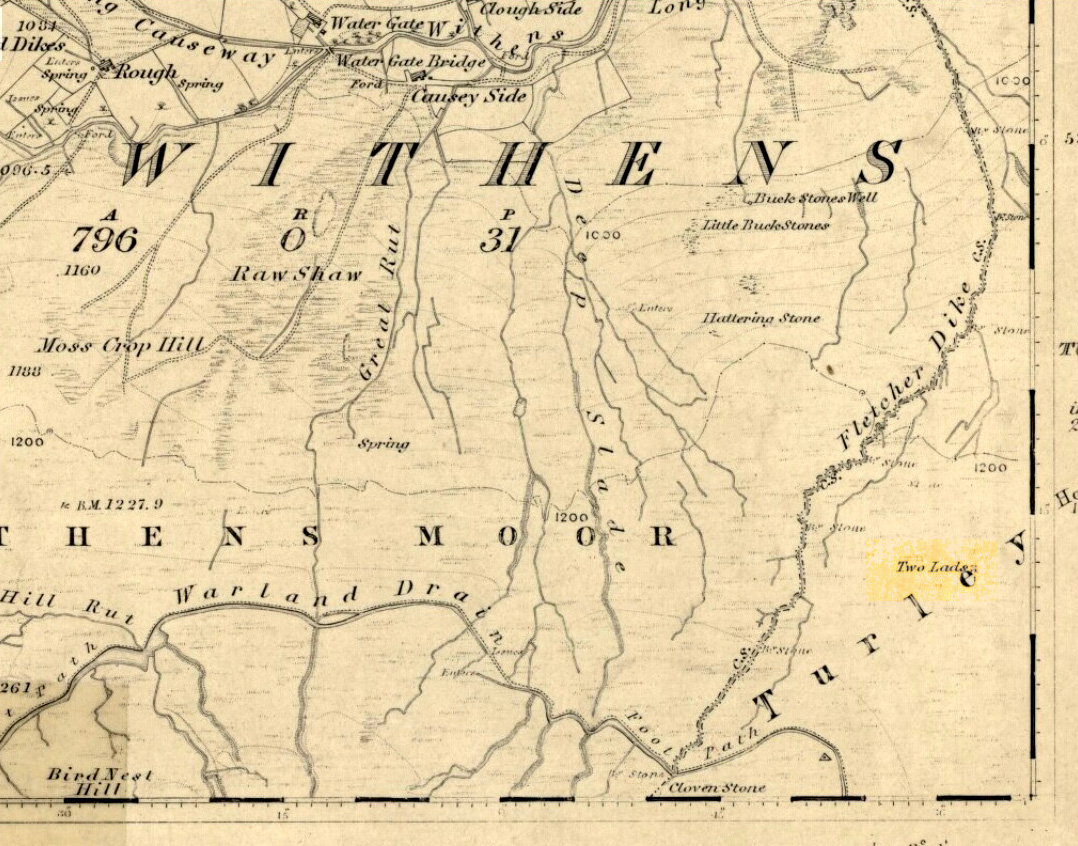
Two Lads on 1853 OS-map

Although the two ‘cairns’ on top of these two rocks are not prehistoric in nature, about 20 yards behind the Two Lads (south) may once have been the severely denuded remains of a once large prehistoric cairn.  Although the position in the landscape is perfect for such a construction, this is somewhat tentative, it’s gotta be said!  Further examinations are obviously necessary here.

The studious A.H. Smith (1961-63) believes that a field-name record from 1624, describing some ‘Lad Stones’ in the parish of Heptonstall relates to this site.  We know with certainty however, that this site was first illustrated on Greenwood’s 1771 map of Yorkshire, then highlighted on more recent 19th century Ordnance Survey maps as ‘cairns.’

Folklore

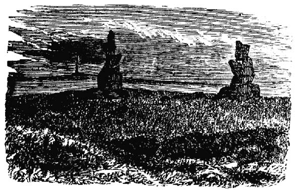
Drawing of the Lads in 1877

The creation myth behind this place is that two lads were walking over the moor in midwinter and got caught in a blizzard. Losing all sense of visibility they tried to shelter from the wind and snow by hiding behind these rocks, but perished. Sometime later their bodies were found and the curious “cairn” of rocks were mounted onto the boulders to mark where they’d died.  This is a folktale we find at many other old stone remains on the hilltops of northern England and Scotland.

The Two Lads seems to be very close to a midwinter alignment (or izzit a lunar standstill line?), linking it with the huge Rudstoop Standing Stone and, eventually, Robin Hood’s Penny Stone on Midgley Moor – which might be the root of the folktale. (i.e. midwinter, snow, death)  Any archaeoastronomy buffs out there wanna check this one out?  Then we can confirm or dismiss it.

References:

  1. Anonymous, “The ‘Two Lads’, Withens Moor,” in Todmorden & Hebden Bridge Historical Almanack, T. Dawson: Todmorden 1877.
  2. Bennett, Paul, The Old Stones of Elmet, Capall Bann: Milverton 2001.
  3. Smith, A.H., The Place-Names of the West Riding of Yorkshire, Cambridge University Press 1961-63.

© Paul Bennett, The Northern Antiquarian 


Fairies Chest, Embsay Moor, North Yorkshire

Legendary Rocks:  OS Grid Reference – SD 98696 56105

Also known as:

  1. Fairy’s Chest

Getting Here

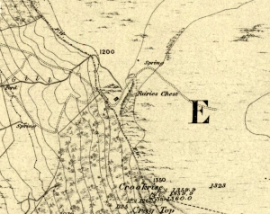
Fairies Chest on 1853 map

This is an awesome beast! You can either approach it from Nettlehole Ridge ‘stone circle’ as I did, or take the more sensible approach and begin from Embsay village, walking up the path towards Embsay reservoir and onto the moorland heights of Crookrise Crag, 1350 feet above sea level. Worra view! But keep walking a little more, downhill, and it’ll hit you right in the face!

Archaeology & History

Fairy’s Chest, Embsay Moor

Known as an abode of the little people in the 19th century and shown on the earliest Ordnance Survey map of the region, I know of no previous accounts of this giant elongated boulder, forty feet long and nearly the same size as our legendary Hitching Stone that’s nestled below the small cliffs.  The boulder is surrounded by what seems like cairn-material on all sides (though it doesn’t look prehistoric). You’re looking straight west from here, right at the three small paps of Sharp Haw, Rough Haw and Flasby Fell.  If you like huge rocky outcrops, this (and others nearby) will make your day!

Folklore

Said to have been the abode of the little people in ages gone by; though even an old chap we met on our wander here told us how the legends it once held “have died with the old folk it seems.”

© Paul Bennett, The Northern Antiquarian


St. Alban’s Well, St. Albans, Hertfordshire

Holy Well:  OS Grid Reference – TL 146 066

Also Known as:

  1. Holy Well of St. Albans

Archaeology & History

The ancient and once sacred water source was described in local place-names such as Holywell strete and Holywellbrugge from the 13th Century onwards; yet despite it being at the heart of one of the cradles of the English church, there are only scant accounts of the legendary well down the centuries.  The most detailed essay on this site was written by Tony Haynes (1986) in the specialist holy well journal, Source, more than 20 years ago.  Haynes tells as much as it known of the site, saying:

“Late in the seventeenth century, when John Churchill, future Duke of Marlborough, pulled down his wife’s house and built a new mansion in the middle of Holywell Hill, thus creating a major diversion, the Holy Well was a feature of his terraced gardens.  Maps of the period show the site of the well to be a focal point of his lawns.

“In 1815, Shaw’s guide to the town states, ‘The holy-well is still held in some esteem for its purity and salubrious qualities’.  The Duke’s residence later became the property of the Earl Spencers. It eventually fell into ruin and was demolished in 1837, and the original route of Holywell Hill was restored, no doubt much to the relief of contemporary coach and wagon drivers. After this time, the grounds were left to decay.  Ten years later little remained of the gardens but a fishpond and the Duke’s ‘canal’ marking the original course of the River Ver.

“Of the Holy Well, in his History of St Albans published in 1893, Charles Ashdowne laments that: “It is now remembered only as a muddy depression, sheltered by the remains of a dilapidated wall and a mournful specimen of blackthorn.”  Eventually the land was acquired by the St Albans School for Boys as a playing field.  “The exigencies of athleticism necessitated the ground being levelled and turfed over,” Ashdown continues, “and it is much regretted that there is nothing to mark the site of what was essentially one of the most ancient of English Holy Wells.”

“This is confirmed by a Miss Lightfoot of Holywell Hill. In 1960, when she was 85, she wrote in a letter to Hertfordshire Countryside magazine:  ‘I remember the well quite well, for as a child I often went round it. It was surrounded by a fence, inside was a tree, water and weeds – not very inviting.’

“The ‘Old boys’ of St Albans School recall, about fifty years ago, there being a concrete slab at one end of their football pitch which they knew as the site of the well. Their playing field fell into disuse in the 1960’s, but the exact site of the well was lost long before this.”

Naff all is visible here nowadays, apart from some concrete square bitta brickwork that betrays any sense whatsoever of a once sacred site.  Very disappointing indeed…..

Folklore

As with a great many British holy wells, this all-but-forgotten site was named after one of the early christian martyrs — in this case from as early as the late 3rd century AD.  A number of early folklore texts describe St. Albans story, with Vernon Brelsford (1958) telling:

“Tradition states that on his way to execution he walked up a neighbouring hill where he prayed for water to quench his thirst, whereupon a fountain of water sprang up under his feet.  Here he was beheaded on June 23, AD 303.”

This date indicates the site probably replaced an earlier, heathen midsummer solstice custom at, or near this spot.  Another tale tells that when St. Alban had been executed, the saint’s head rolled down the hill and into the waters of the well below.  Mr Haynes (1986) described other early folklore which seems to relate to St. Alban’s Well, telling:

“An early reference to the well can be found in the writings of Brompton who lived in the time of Richard II. He recorded that the father of King Arthur, a British Prince, was severely wounded in the battles with the Saxons:

‘A long time he lay confined to his bed until at length he was cured by resorting to a well or spring not far distant from the city. at that time reputed to be salubrious; and for that reason, and for the cures thereby performed, esteemed holy; and blessed in a peculiar manner with the flavour of Heaven.’

“Two devout sisters built a shelter near the well. They served the weary pilgrims who trudged up the steep hill towards Alban’s shrine in the abbey, by dipping, or ‘sopping’ their bread in the holy water and offering it to the thirsty travellers.  Hence was founded Sopwell Priory, nearby.”

References:

  1. Brelsford, Vernon, Superstitious Survivals, Centaur Press: London 1958.
  2. Gover, J.E.B., et al, The Place-Names of Hertfordshire, Cambridge University Press 1938.
  3. Haynes, Tony, “Well-Wishing in St. Albans,” in Source, no.6, 1986.
  4. Hope, R.C., The Legendary Lore of the Holy Wells of England, Elliot Stock: London 1893.

© Paul Bennett, The Northern Antiquarian


Allt na Ceardaich Knoll, Killin, Perthshire

Cup-Marked Stone:  OS Grid Reference – NN 564 364

Getting Here

Truly troublesome if you aint into walking.  Many ways up, but the easiest has to be the zigzagging trackway up from the valley bottom just by The Green a few hundred yards past Lochay Power Station, up the southern edge of Creag na Cailleach. At the end of the trackway, take the stream uphill for a few hundred yards and watch out for the rocky rise to your right (east).  Head for it and check out the rocks there.  You’ll find it!

Archaeology & History

Allt na Ceardaich01
Single cup-marked rock below Creag na Cailleach

I’m not sure that anything’s previously been written about this curious single cup-marked boulder. I say ‘curious’, simply because of the location and position of the clear cup-mark on this near-gigantic piece of embedded stone.  We walked upon the rocky outcrop south of Creag na Cailleach (above the tree-line where the land levels out) and first saw the cup-marking at the top-end of this huge rock (amidst a number of others) on the large rise a coupla hundred yards west of Allt na Ceardaich.  And as the carved cup was on the top-end of the boulder, I was expecting to find much more of the rock with other motifs scattering its body — but was amazed to find that this was the only single cup-marking on an otherwise huge stone.  A mixture of bewilderment and disappointment came over me as I shook my head in disbelief that only a single cup had been scribed into an otherwise massive rock.

Allt na Ceardaich02
Close-up of the cup-marking

However, the light was poor with low cloud and it was nearing sunset, so there may have been other aspects to this carving which we missed out on.  One other ‘possible’ cup-mark might have been done, but it seemed very dubious even in the poor light.  I was all for having another look at it the following day; but wandering halfway up a mountain just to see if this was the only cup-marking on this outcrop was summat my daughter wasn’t into doing!  So the site must await another mad cup-and-ring-crazed traveller on another day to get a more detailed inspection!  George – are you out there anytime soon!?

© Paul Bennett, The Northern Antiquarian


Creag na Cailleach, Killin, Perthshire

Sacred Mountain:  OS Grid Reference – NN 5640 3715

Also known as:

  1. Creag na Caillich

Getting Here

Another silly-sounding directional pointer!  Get to the now tourist-infested town of Killin (best in Winter, when the town is quiet and you get to know the locals a lot better) and travel through it as if you’re going to follow Loch Tay up its western side.  As you’re going out of the village towards the Bridge of Lochay Hotel (an excellent place), you’ll see an amphitheatre of mountains in the background.  The tallest of the hills on the left is where you’re heading.  Go straight up the hillside and follow your nose!

Creag na Cailleach, Perthshire
Creag na Cailleach, Killin

The hill guards the entrance to the legendary Glen Lochay (Valley of the Black Goddess).  There are many ways to climb her, but my first venture here took me up the waterfalls and steepish burn of Allt na Ceardaich.  Once on the level, I found myself surrounded by that amphitheatre I mentioned, from which – on my first visit – I took up the sheer face of this great mountain. (to be honest it’s nowt special if you’re into mountaineering and stuff) From the tops you’ve got a damn good view all round.  But respect this old hill, as danger awakens to idiots who would think themselves champions.

Folklore

Here, where axes were quarried by ancient man from beneath Her rocky slopes, this ‘Hill of the Old Woman’, or ‘Hag’, was one of the abodes of the primal Mother Goddess in olden times, so says her name.  Her ‘dark’ aspect seemed manifest one time when I climbed her with a rather stupid man in tow.  Following one of the streams back into the valley below, he thought it wise to copy my gazelle-nature as I sprang without thought, quickly, from rock to rock, bouncing at speed down the fast-flowing stream  (which takes a lotta weird practice and very strong ankles!), in spite of the advice to do otherwise – and in doing so he broke his leg in three places and, to make it worse, had to spend the night there in complete agony!

Don’t tell me there’s no ‘dark’ goddess to some of these great places!

Axe production has been found to have occurred as early as 2500 BC.  There have been numerous flint finds hereabouts aswell – but considering this is a mountain, you’d expect to find something on or about Her slopes!

I’ve just been back up here as the first good snow fell upon the hills and the white cover brought the elements out of her form in a way I’d not seen before.  Tis a wonderful place the Creag na Cailleach; and, it seems, a site that played a now forgotten part in the ancient name of the glen, Lochay, which was the living abode of the Black Goddess in more archaic days.  Twouldst be good to hear some of the authentic old stories from old locals that were once known of this ancient deity in the glens.  If anyone knows of such tales, let us know before they are lost forever…

References:

  1. Ritchie, P.R., ‘The Stone Implement Trade in Third Millenium Scotland,’ in Coles & Simpson’s, Studies in Ancient Europe, Leicester University Press 1968.

Acknowledgements:  Huge thanks to Lindsay Campbell for her hospitality, food and roof hereby.

© Paul Bennett, The Northern Antiquarian


Sowerby Lad, Mytholmroyd, West Yorkshire

Standing Stone (destroyed): OS Grid Reference – SE 024 244

Archaeology & History

Standing stone on 1894 map

Also known as the Field House Standing Stone, this monolith seems to have gone.  It was first described in local Minister’s Accounts of 1403, and then again in the Wakefield court-rolls of 1515.  By the time John Watson (1775) wrote about the place there had been several other references describing this old “standyngstone”. It was still upright in 1852, but Ordnance Survey showed it as “Site of – ” at the beginning of the 20th century, and the stone had been moved a short distance away, further down from its original position to a spot at the side of the old trackway — but all trace of it has since vanished.

Folklore

This is thought to have been the standing stone which Robin Hood threw here, from the appropriately called Robin Hood’s Penny Stone at Wainstalls. The tale tells how he dug it out of the ground with a spade and threw it three-and-half miles across the valley until it landed here. Ooh, what a strong boy!

References:

  1. Bennett, Paul, The Old Stones of Elmet, Capall Bann: Milverton 2001.
  2. Smith, A.H., The Place-Names of the West Riding of Yorkshire, volume 3, Cambridge University Press 1961.
  3. Watson, John, The History and Antiquities of the Parish of Halifax, T. Lowndes: London 1775.

© Paul Bennett, The Northern Antiquarian