Maiden Castle, Glendevon, Perthshire

Legendary Hill: OS Grid Reference – NN 9710 0141

Also Known as:

  1. Maiden’s Castle

Getting Here

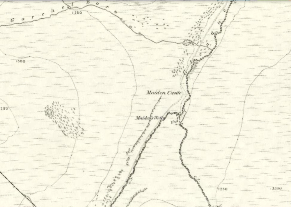
1860 map showing Maiden Castle (and the Maiden's Well)
1860 map showing Maiden Castle (and the Maiden’s Well)

Take the small steep road uphill from the town of Dollar in Clackmannanshire towards Castle Campbell. Less than 100 yards above the small parking spot by the small white house near the top of the hill, turn to walk up the footpath on your right above the house, following the edge of the depleted forestry plantation parallel with the valley.  Cross the valley a few hundred yards up, but keep to path on the other side that stays parallel with the stream.  You’ll hit a small rocky glen a half-mile up. Walk thru it, alongside the very edge of the forest till the trees break and there’s a gap in the hills.  You’ve just walked past the Maiden’s Well and in front of you is a large natural rounded hill, which the footpath bends around. This hill is the Maiden Castle. (if you walk round this, a view into the eastern hills and a small lake opens up ahead of you)

Archaeology & History
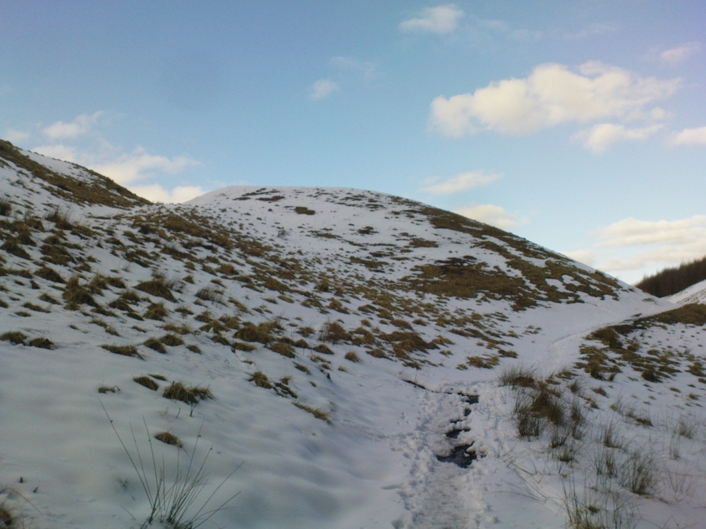
The fairy hill of Maiden Castle

A large rounded hill marking the opening of Glenquey to the north and the Glen of Care to the south. Although ascribed in place-names old and new as a ‘castle’, there are no remains as such left here to account for this title. Angus Watson (1995) tells of the possibility of the place deriving its name from the Gaelic Creag Ingheann, or maiden crag. In Bruce Baillie’s (1998) survey of the area, in trying to give some relevance to the place-name, he points out that whilst no hillfort or cairn that might help account for the folklore (see below),

“Large-scale maps indicate a spot opposite on Hillfoot Hill as Greig’s Grave. There would seem to be something ancient here but of what nature it is, at the moment, impossible to say.”

When we visited the place yesterday, snow still covered much of the ground hereby, so we couldn’t do our usual explorations seeking for old sites (even the hut circles 100 yards away were covered over). The legendary healing waters of the Maiden’s Well are below here, by the side of the burn.

Folklore

This large rounded hillock was evidently a place of some importance in bygone days if the folktale here is anything to go by. Although the story echoes the some of the core sequences of modern ‘close encounter’ abduction events, other ingredients here tell of more arcane peasant rites that were once part of the social structure of our ancient heathen tribes:

“A piper, carrying his pipes, was crossing from Glendevon to Dollar in the grey of the evening. He crossed the Garchil (a little stream running into the Quaich), and looked at the Maiden Castle and saw only the grey hillside and heard only the wind soughing through the bent. But when he had passed beyond it, he suddenly heard a burst of lively music and turned round to look at what was causing it. And there, instead of the dark knoll which he had seen a few moments before, he beheld a great castle, with lights blaring from the windows, and heard the noise of dancing issuing from the open door. He went back somewhat incautiously to get a closer view, and a procession issuing at that moment from the Castle’s open door, he was caught up and taken into a great hall ablaze with lights, while people were dancing on the floor. He was at once asked to pipe to them and was forced to do so, but agreed to do so only for a day or two. At last getting anxious, because he knew his people would be wondering why he had not come back in the morning, as he had promised to do, he asked permission to return home. The faeries seemed to sympathise with his anxiety and promised to let him go if he played a favourite tune of his, which they seemed fond of, to their satisfaction. He played his very best. The dance went fast and furious, and at its close he was greeted with loud applause. On his release he found himself alone in the grey of the evening, beside the dark hillock, and no sound was heard save the purr of the burn and the soughing of the wind through the bent. Instead of completing his journey to Dollar, he walked hastily back to Glendevon in order to relieve his folk’s anxiety. He entered his father’s house and found no kent face there. On his protesting that he only gone away for a day or two before, and waxing loud in his bewildered talk, a grey old man was aroused from a doze beside the fire, and told how he had heard when a boy from his father that a piper had gone away to Dollar on a quiet evening, but had never been seen or heard since, nor any trace of him found. It turned out the piper had been in the ‘Castle’ for a hundred years.”

The Fortean experts John Keel (1971) and Jacques Vallee (1970) both contended, quite rightly, that some aspects of the ancient encounters related in such folklore has strong parallels to modern UFO ‘abduction’ events. In addition, Paul Devereux (1989) cites that such events occur where strong geomagnetic forces exist in proximity to rock outcrops, as found here.

There is the additional feature in these stories of the music of both faerie and pipers alike, whose revelling jigs carry the mortal out of time and, when returning back to human life, find no one recognises them.  This is a condition of some rites of passage in traditional societies, where mothers and fathers no longer recognise their child after they have been through the rituals after visiting spirit-lands and returning as adults for the first time: an element in our faerie-lore that has been overlooked in assessing the nature of these fascinating tales.

References:

  1. Baillie, Bruce, History of Dollar, DMT: Dollar 1998.
  2. Devereux, Paul, Earthlights Revelations, Blandford: London 1989.
  3. Fergusson, R. Menzies, The Ochil Fairy Tales, David Nutt 1912.
  4. Keel, John A., UFOs: Operation Trojan Horse, Souvenir Press: London 1971.
  5. Rhys, John, Celtic Folklore – Welsh and Manx: volume 1, Oxford University Press 1901.
  6. Vallee, Jacques, Passport to Magonia: From Folklore to Flying Saucers, Tandem: London 1975.
  7. Watson, Angus, The Ochils: Placenames, History, Tradition, PKDC: Perth 1995.

© Paul BennettThe Northern Antiquarian


Allt Leathan Stone, Fortingall, Perthshire

Standing Stone: OS Grid Reference –NN 7251 5659 

Getting Here

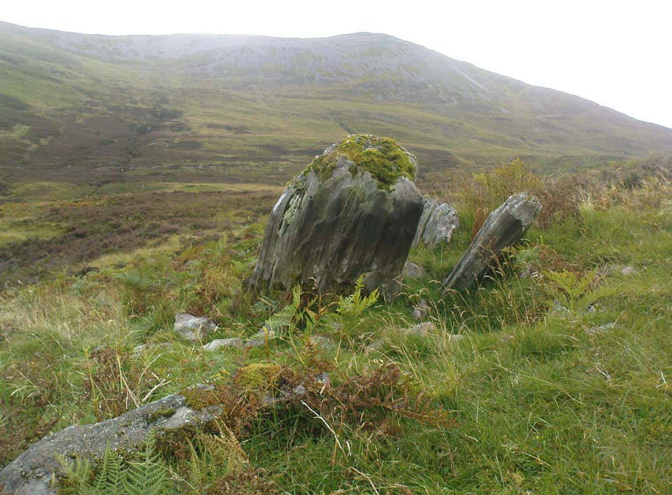
Allt Leathan stone

Follow the same directions to reach the Allt Leathan enclosure and hut circles.  Walk along the eastern side of the hill on which the enclosure mainly sits, and as it slopes down the hill, you’ll note an odd-shaped stone leaning at an angle less than halfway down.

Archaeology & History

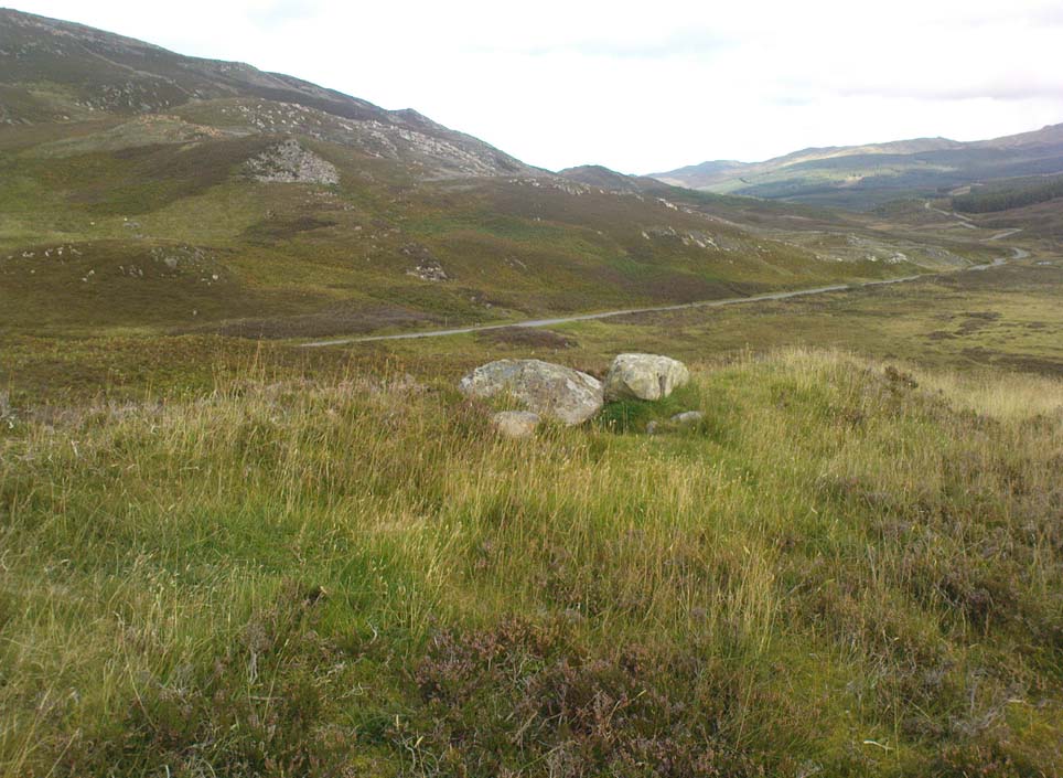
A truly curious and fascinating site, not previously recorded, but found by Paul Hornby on August 7, 2012, during a venture to explore the nearby settlement and hut circles around Meall Dubh.  On the eastern slope over the edge of the Allt Leathan enclosure, with its hut circles and possible cairns, we see this upright worn stone, leaning at an angle, which would stand nearly 5 feet high if pushed properly upright.  It is found in association with two other smaller stones, all of which stand and lean in the same direction.

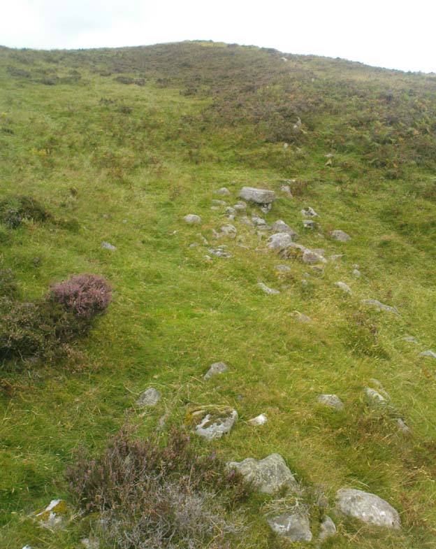
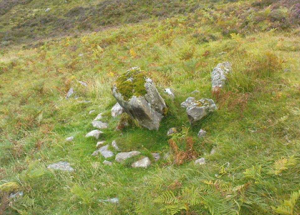
Possible cairn remnants surrounds base of stone
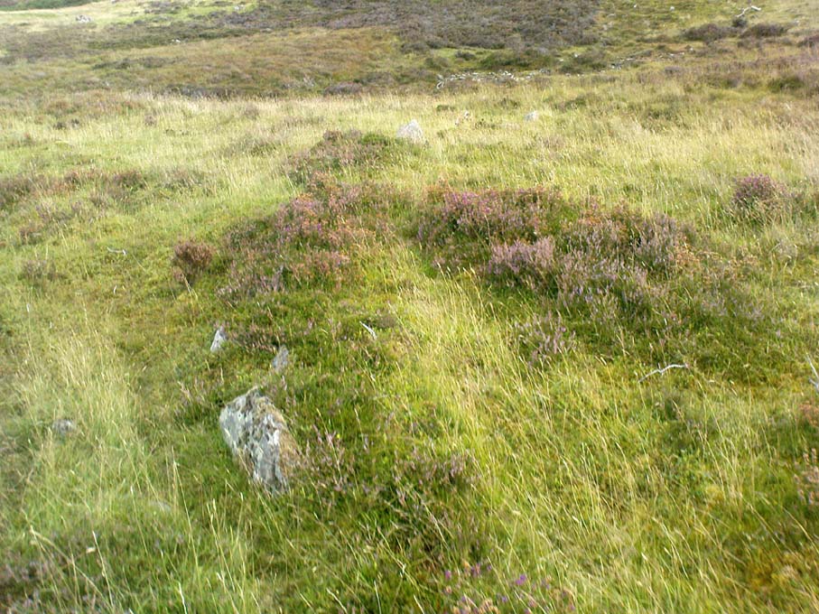
…and again

Around the base of the main stone is a scatter of small rocks, as if suggesting that a cairn was once next to the standing stone, perhaps inferring that the stone marked a tomb.  There is also a very distinct line of walling running along the axis of the upright stones, meaning that we cannot discount the possibility that the monoliths here were connected with a walled enclosure in some capacity. And considering the excess of other prehistoric remains close by, this may be more likely than not!

© Paul Bennett, The Northern Antiquarian

Allt Leathan, Fortingall, Perthshire

Enclosure: OS Grid Reference – NN 7246 5659

Also Known as:

  1. Canmore ID 25089

Getting Here

Eastern enclosure walling

Although found within the parish of Fortingall many miles to the south, this site is much closer to Kinloch Rannoch, just a few miles northwest.  From Kinloch Rannoch, take the south road, heading east for about 5 miles, till you go past the small Lochan an Daim on the left (north) of the road.  As the moorland opens up ahead of you, about a half-mile further on, watch for the dirt-track running up onto the hills on your left. Cross the road from here, over the stream and bogs, onto the small hill ahead of you.  You’re getting very close!

Archaeology & History

The Canmore entry for this site tells of just a large single hut circle being here, 13.5m by 12m across, but this is in fact part of a much larger enclosure system with extensive walls rising to heights of up to 3 feet in places and covering a very wide area indeed across the sloping grass-covered ridge above the streams on either side. The walling is typically Iron Age in structure and there are remains of other internal features that we gave only cursory attention to (other sites were calling out for us!).

This shows walling of another nearby enclosure
Allt Leathan enclosure walling

What seem to be a cluster of several very overgrown cairns, roughly 20 feet across and 3 feet high, are evident on the south side of the enclosure walling. These need examining in greater detail. Also, on the eastern slope below the edge of the main walled enclosure, Paul Hornby found what seems to be a prehistoric standing stone, leaning to one side, which if completely upright would be about 5 feet tall. There are also the remains of at least two other large walled enclosures further onto the hillside, just before you start walking up the slopes to Schiehallion. They appear to be similar in nature and structure to this one at Allt Leathen, but I can find no account of them in any records.

© Paul Bennett, The Northern Antiquarian

Rye Loaf Hill, Settle, North Yorkshire

Cairn:  OS Grid Reference – SD 86419 63309

Also Known as:

  1. Inglehow

Getting Here

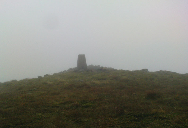
Triangulation & cairn atop of Rye Loaf Hill on a truly foggy eve

Best way is to take the Settle to Kirkby Malham road: a tiny little thing running steep from Settle up and around the hills, making sure you don’t miss the turn-off to Kirkby and head down to Airton instead.  About 100 yards along from the road-junction to Kirkby, there’s a small copse of trees and a gate just before it.  Walk up through that and head right to the top of the nice hill a mile or so ahead of you to the north.  It can be boggy, slippy and well good!  A decent Barmy Bennett expedition this way lies!  Get to the top of the hill and you can’t miss the cairn!

Archaeology & History

First shown on the 1771 Greenwood map, this is another intriguing little-known antiquity in our Yorkshire hills.  It’s intriguing as the precise age and nature of the site doesn’t appear to have been ascertained.  On top of this lovely rounded hill is not only a stunning view for many miles in all directions (unless you climb it on a very cloudy foggy day, like we did!), but the rock-pile which someone in recent years has turned into a wind-break has been taken from a much larger, and much older rock-pile on the very summit.

The cairn stands about a yard tall at the highest and measures roughly 12 yards in diameter, but the edges of the site seem to disappear further beneath the peat and vegetation on the hilltop.  A section in the middle of the cairn has obviously been dug into, probably to create the stone shelter on its southern side, but it also gives the impression of having been dug into by treasure-seekers in the past — similar to the trenches found in the Snowden Crags cairn circle, the Great Skirtful of Stones and other prehistoric tombs.

The site has been marked on Ordnance Survey maps as a simple marker cairn (non-antiquated writing on the maps), but I have strong suspicions after visiting this peak that the cairn in question is a lot older than has previously been assumed.  So I contacted local archaeologist Robert White and asked if he knew of any archaeological data about the cairn, but he said there was nothing that he knew.  However, an additional piece of information that adds potential to the antiquity of the cairn came from the awesome pen of Harry Speight (1895) who told that,

“The original name of this eminence is Inglehow, which suggests like Ingleborough and ancient look-out post or beacon hill.”

The suffix how or howe is well-known to place-name students in northern England and beyond as a burial mound or tumulus.  We must be cautious however, for as Gelling (1988) says, the word “is frequently applied to a tumulus, but it can refer to a natural hill.” But Speight’s idea that the name may have had something to do with beacons was mentioned — albeit without reference to Rye Loaf Hill, whose history and features he ignored — in Thomas Whitaker’s (1878) huge survey, where he wrote:

“In this parish was an immemorial custom, continued within the memory of many persons yet alive, of kindling fires on the tops of the surrounding hills on St. Laurence’s Eve, the 9th of August.  This night was called the Kennel or Kennelk night; and the tradition of the place is, that the fires were intended as a memorial of the beacons kindled by the Saxons to alarm their countrymen on the sudden approach of the Danes.”

The parish in question that Whitaker described was Giggleswick, which is right next door to Settle, in whose parish Rye Loaf Hill lives.

On the southern edge of Rye Loaf are a couple of other archaeological place-names that need looking at.  We have a couple of ‘Stone Haws’, which are probably cairns, close to which we find extensive evidence of human activity at some time in the past.  But close to one of these piles of stones is another, far more fabled rock whose history appears to have long since been neglected: the Dragon Stone of Scosthrop Moor.  Never heard of it?  That’s not surprising…

References:

  1. Gelling, Margaret, Signposts to the Past, Phillimore: Chichester 1988.
  2. Smith, A.H., English Place-Name Elements – volume 1, Cambridge University Press 1956.
  3. Speight, Harry, Tramps and Drives in the Craven Highlands, Elliot Stock: London 1895.
  4. Whitaker, Thomas Dunham, The History and Antiquities of the Deanery of Craven in the County of York, (3rd edition) Joseph Dodgson: Leeds 1878.

© Paul Bennett, The Northern Antiquarian


Invercharnan, Glen Etive, Argyll

Cairn:  OS Grid Reference – NN 1439 4761

Also Known as:

  1. Canmore ID 23689

Getting Here

As you enter the top eastern end of Glencoe, take the only tiny road to your left (south) into Glen Etive, past the great Buachaille Etive Mor (she kills four or five folk a year, so a local told me, as if to remind me who’s boss!), past Dalness for another couple of miles until you hit Invercarnan (watch you don’t miss it). Behind you are the great falls screaming down the mountain slopes on Buachaille’s south-side; but on the east-side of the road another 500 yards down (you’ll have to gerrout and walk down near the riverside – if you hit the tidgy bridge, you’ve missed it) on the far side of the trees behind the singular house, the little mound can be seen.

Archaeology & History

Down this awesome valley (perhaps mi favourite – it’s difficult to say) is very very little in terms of ancient remains – at least according to the record books. I find this hard to believe. Etive is scattered with various ancient legends of hero-figures and mythical creatures, and harbours geological features, waterfalls and magic unlike anywhere else in these great mountains.  The tomb here is only a small one, but it’s pretty well-preserved.  It’s about 30 feet across and three or four feet high. Described by the Royal Commission lads, thus:

“One of the best-preserved cairns in Lorn is situated in pasture on the west bank of the River Etive, some 700m south of Invercharnan.  Bowl-shaped in profile, it measures 8.25m in diameter by 1.6m in height, and has been constructed with a kerb of boulders on which a second retaining course of stones has been carefully set.”

…Tis an utterly gorgeous arena. The cairn is good – but it’s the land upon which it rests that truly holds you. I was just ambling here – and the rain didn’t stop for three solid days, but I could have stayed amidst its blessing for an eternity. On the walk back up to my tent, two mature stags came out from the trees and enacted a play-fight right in front of me, careless of me being there.  It was utterly superb to watch!  I was saturated, cold, hungry – but watching this stopped it all.  I bimbled back to mi tent in that dreamy state beloved of such places when the elements are alive.

Anyway – back to normality!  Just north of the old tomb – which I didn’t know at the time as I had no decent map – is found the ‘Crag of the Cailleach’ (a favourite creature of mine); and there are also a couple of old fairy place-names a few hundred yards to the southeast.  There’s got to be more ancient stuff around here tat are off the record-books.  Bimbling expeditions are a-calling…!

References:

  1. Barnett, T. Ratcliffe, The Land of Lorne and the Isles of Rest, W. & R. Chambers: Edinburgh 1933.
  2. Royal Commission on the Ancient & Historical Monuments of Scotland, Argyll – volume 2: Lorn, HMSO: Edinburgh 1974.

© Paul Bennett, The Northern Antiquarian