James Stone, Blubberhouses Moor, North Yorkshire

Standing Stone: OS Grid reference – SE 15196 54722
Getting Here

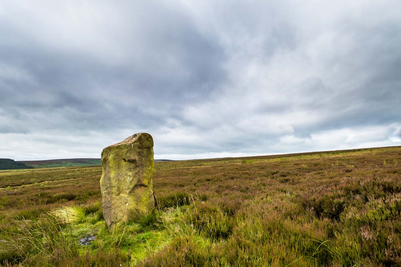
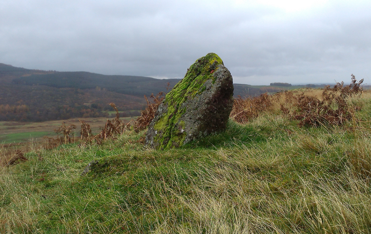
James Stone, looking SW

From Blubberhouses church by the crossroads, walk up the slope (south) as if you’re going to Askwith, for 100 yards or so, taking the track and footpath past the Manor House and onto the moor.  Once you hit the moorland proper, take the footpath that bears left going down into heather and keep going till you hit the dead straight Roman Road path running west onto Blubberhouses Moor. Carry along the Roman Road for about 200 yards as though you are going towards the Eagle Stone, and looking right (if you squint) you can just make out a small pimple on the top of the moors about a quarter of a mile away. That is where you are heading (be warned – it is boggy getting there).

Archaeology and History
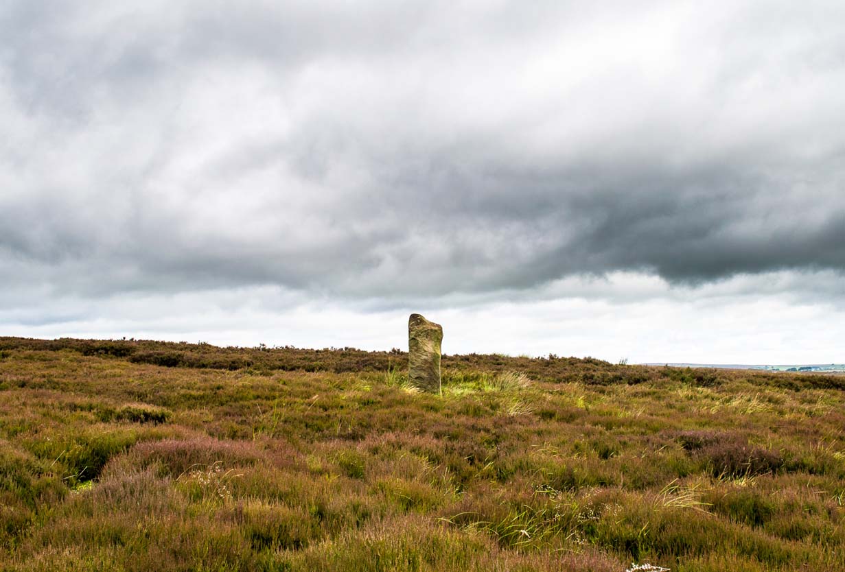
James Stone, looking NE

Discovered (or rather ‘noticed’) by James Turner and James Elkington in July 2016 (hence the name James Stone), this standing stone is of an indeterminable age – although it does look ancient.  Standing more than 5 feet tall, and in the middle of nowhere, it is fairly difficult to get to unless you want to get wet feet.  It is situated very close to a small and unexcavated prehistoric settlement and we could find no physical evidence of any tracks nearby (although Google Earth does show what looks like one or two very short, faint tracks near the stone, which is the old ‘Benty Gate’ track).

It could be a boundary stone, although doubtful – it has a feel to it that says it is prehistoric, although this is just guesswork on our part.  I can find no reference to it in Cowlings Rombalds Way (1946) and there seems nothing about it in either of William Grainge’s (1871; 1895) detailed history works of the region.
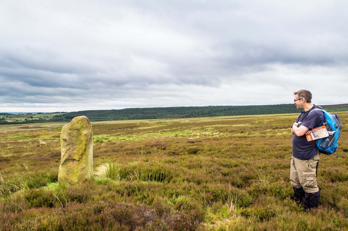
Mr Turner gazing at the stone

At first we thought it unlikely to be a new find, however the stone is difficult to see from the Roman Road (I had been up here dozens of times before I noticed it) and seeing that people rarely go up here anyway, and it is relatively difficult terrain getting to it, it is not surprising that no one has bothered visiting it. It would take someone who is quite keen on megaliths to want to examine it and it is well off any tracks.

Having said that, it is a nice find and it could be linked in some way with the small unexcavated settlement nearby, or possibly the large Green Plain settlement nearly a mile away.  Well worth a visit…bring your wellies!

References:

  1. Cowling, Eric T., Rombald’s Way, William Walker: Otley 1946.
  2. Grainge, William, The History and Topography of Harrogate and the Forest of Knaresborough, John Russell Smith: London 1871.
  3. Grainge, William, The History and Topography of the Townships of Little Timble, Great Timble and the Hamlet of Snowden, William Walker: Otley 1895.

© James Elkington, The Northern Antiquarian


Clachan Aoraidh, Balquhidder, Perthshire

Stone Circle (ruins):  OS Grid Reference – NN 5389 2076

Also Known as:

  1. Canmore ID 24151
  2. Worshipping Stones

Getting Here

Clachan Aoraidh, looking W

Along the A84 road betweeen Callander and Lochearnhead, take the small road west when you reach Balquhidder Station, towards Balquhidder village.  Go along here for 1½ miles (2.5km) as if you’re gonna visit the Puidrac Stone; but 200 yards past this, go through the gate on the south-side of the road into the boggy field for about 150 yards towards the River Balvag.  You’re looking for several stones, as in the photos.  You’ll find ’em. (you may get soaked though!)

Archaeology & History

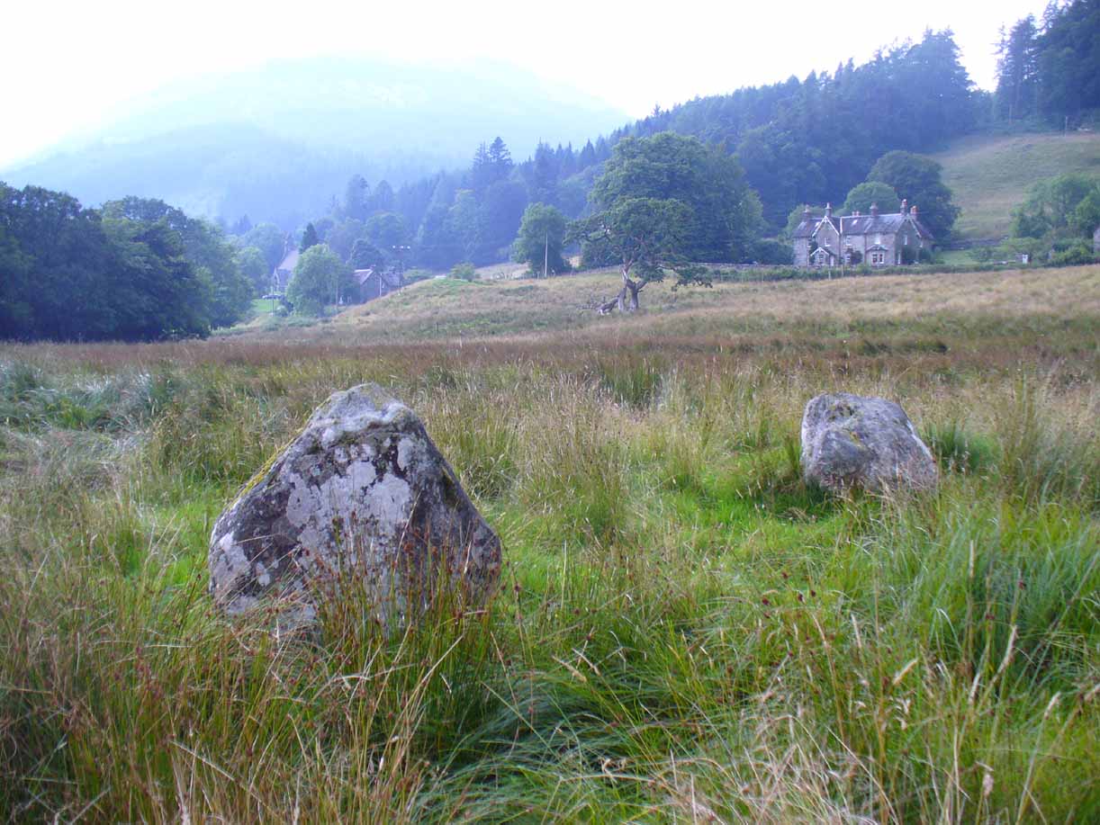
The stones, looking NW

After many thousands of years, this innocuous-looking group of small stones found in the very boggy field immediately west of the Puidrac Stone looks nothing like it once did. Some modern academics would have you think there was nothing here of prehistoric interest, but oral tradition and earlier writings tell otherwise. Although not shown on the early OS-maps, it was first described in James Gow’s (1887) articulation on the antiquities of the area, in which he told:

“A short distance east from the present (Balquhidder) parish church, in the haugh below the manse, there are seven stones remaining of a circle which appears to have been about 30 feet in diameter; only one stone is in its original upright position, but there are fragments of others lying about; as usual, they are known as “Clachan-Aoraidh,” or worshipping stones, and are not likely to be disturbed during the lease of the present tenant.”

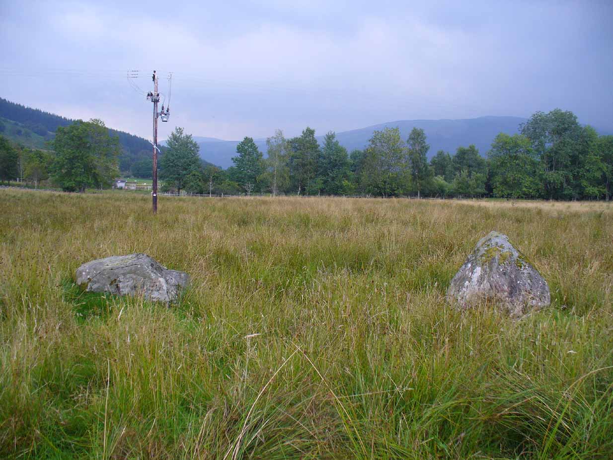
Looking E, with Puidrac Stone just visible left of telegraph post

A few years later when Thomas Ross (1919) visited the area with a Prof Cooper and others, they reported the single standing stone still in position and the anglicized name of the Worshipping Stones was still in evidence amongst locals.

Arc of fallen stones by the trees

Nowadays the site is in ruin.  Two of the stones stand out when the rushes aren’t too high, with one earthfast and its companion prostrate; but as you can see in the photo (right), there remains a sunken arc of two other stones laid down, running away from the larger ones, with a fifth overgrown and nearly covered by vegetation and the young trees.  In all probability, tradition is probably right here: this is the remains of a stone circle.

Folklore

The field in which these denuded megalithic remains are found, was, wrote Thomas Ross (1919),

“the site of a long-popular market called ‘Feill Aonghais’, i.e., St Angus’ Fair.  It was held, according to Mr Campbell, in May; according to Mr Gow, on “the Saint’s Day, the 6th of April.”  It was quite the custom…to hold a fair after divine service on the Patronal Feast. The folks came to “kirk and market” on the same day, and mixed good fellowship and manly sport with their worship and their business.”

If you were to hold a fair there nowadays, likelihood is it would get flooded!  Christian myths tell of a “St. Angus” taking over whatever the heathen traditions were in this domain, more than a thousand years back.

References:

  1. Gow, James M., “Notes in Balquhidder: Saint Angus, Curing Wells, Cup-Marked Stones, etc”, in Proceedings of the Society of Antiquaries Scotland, volume 21, 1887.
  2. Ross, Thomas, “Saint Angus’ Stone, Balquhidder,” in Transactions of the Scottish Ecclesiological Society, volume 6 – part 1, 1919.

© Paul Bennett, The Northern Antiquarian

Croft Moraig Carving (02), Kenmore, Perthshire

Cup-Marked Stone:  OS Grid Reference – NN 79744 47263

Also Known as:

  1. Croft Moraig – Stone D

Getting Here

Follow the same directions for the Croft Moraig stone Circle.  Then check out the largest of the fallen or elongated stones on the northwest side of the ring, with a smoothed sloping surface, just at the side of the overgrown stone platform on which it rests.  Y’ can’t really miss it.

Archaeology & History

When William Gillies (1938) wrote about the carvings at the Croft Moraig stone circle, he told how, previously, Fred Coles,

“noticed that several of the upright stones…show cup-markings on their perpendicular surfaces. Some of these are quite distinct, but others are so worn through weathering that they can only be traced with the fingers.”

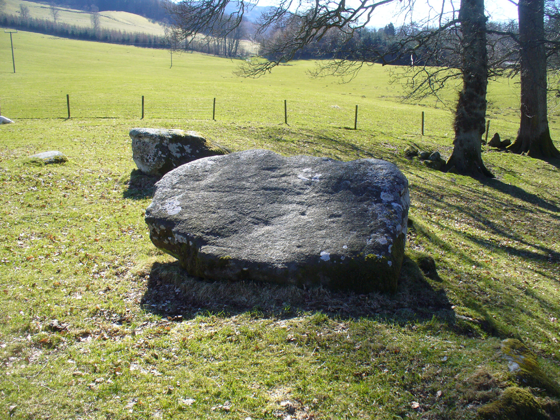
Stone D, with cupmarks
Stone D, with faint cups
Close-up of the cupmarks

This is one of them. Barely visible at the best of times, the cup-markings are faded and very hard to see unless daylight conditions are just right. As you can see in the photos, several distinct cup-like impressions are visible, but it only appears that two of them are cup-marks.  The others seem to be more geophysical in nature – but I’d love to be wrong!

At the SSW edge of the circle, 13 yards (11.75m) away, is the Croft Moraig cup-and-ring stone.

Folklore

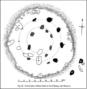
Stone D on Fred Coles' plan
Stone D on Coles’ plan

The great northern Antiquarian Fred Coles (1910) noted that this particular stone (stone D in his ground-plan of the circle) had “been polished by the sliding of generations of children”.  This playful action on stones elsewhere in the UK and around the world sometimes relates to fertility rites (i.e., the spirit of the stone could imbue increased fertility upon the practitioner), but Mr Coles made no mention of such rituals here.

References:

  1. Coles, Fred, “Report on Stone Circles Surveyed in Perthshire,” in Proceedings of the Society of Antiquaries, Scotland, volume 44, 1910.
  2. Gillies, William A., In Famed Breadalbane, Munro Press: Perth 1938.
  3. Yellowlees, Sonia, Cupmarked Stones in Strathtay, Scotland Magazine: Edinburgh 2004.

Acknowledgements:  Many thanks to hardcore crew for our various visits here: to Paul Hornby, Lisa Samson, Fraser Harrick, James Elkington, Penny & Thea Sinclair.

© Paul Bennett, The Northern Antiquarian

Colpy, Culsalmond, Aberdeenshire

Stone Circle (destroyed): OS Grid Reference – NJ 6411 3261

Also Known as:

  1. Canmore ID 18272

Archaeology & History

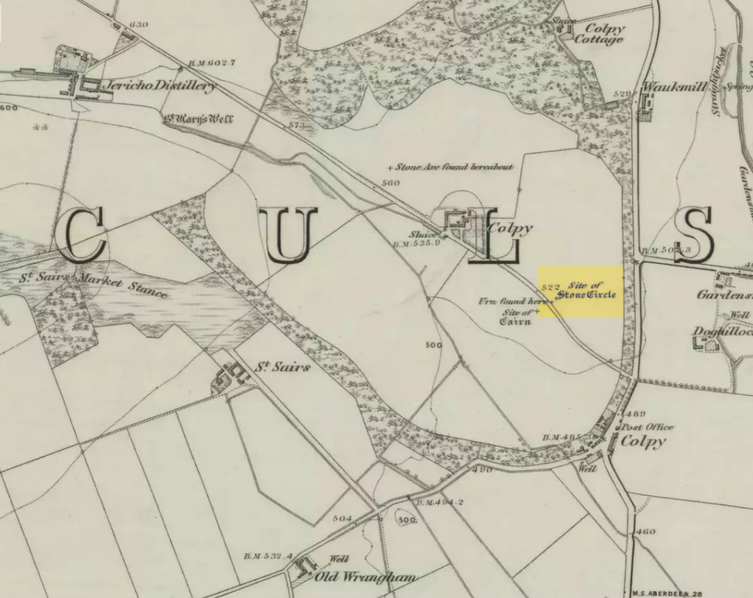
Colpy Circle site on 1868 map

Just like the stone circle a half-mile east at Kirkton of Culsalmond, nothing now remains of this megalithic ring.  It was first described very briefly by Rev. F. Ellis (1845) in the New Statistical Account as a “druidical temple”: one of two hereby, “on the farm of Colpie, although now almost obliterated. Several urns were dug up in making a road near one of them”—implying that one of them was a cairn circle or funerary monument of some kind.  This was subsequently affirmed on the early OS-map and then described in Fred Coles’ (1902) survey, where he wrote:

“Site of a stone circle, the road going to Jericho Distillery having been made through it, and, on the south side of this road, the site of a cairn. Within the possible diameter of the circle an urn was found.”

Folklore

A few hundred yards west of the circle an ancient fair used to be held, known as St Sair’s Fair, named after St Serf.  Although St Serf’s Day is July 1, early records show that the fair—held in a long field with the curious name of ‘St Sairs Market Stance’—was to be held on the Wednesday after the last Tuesday in June.  For a stone circle, this is too close to Midsummer to be a coincidence!  Early records show that the fair was granted in 1591 and subsequent years thereafter.

St Serf is a very peculiar mythological figure with quite shamanistic traits and tales around him.  In truth, many of these early saints were little more than lapsed shamans, utilising natural magick and medicine in the olde traditions, but which became grafted onto the incoming christian mythos.  The evidence for this is quite overwhelming!

References:

  1. Barnatt, John, Stone Circles of Britain – volume 2, BAR: Oxford 1989.
  2. Browne, G.F., On Some Antiquities in the Neighbourhood of Dunecht House, Aberdeenshire, Cambridge University Press 1921.
  3. Burl, Aubrey, “The Recumbent Stone Circles of North-East Scotland”, in Proceedings Society of Antiquaries, Scotland, volume 102, 1973.
  4. Burl, Aubrey, The Stone Circles of the British Isles, Yale University Press 1976.
  5. Burl, Aubrey, The Stone Circles of Britain, Ireland and Brittany, Yale University Press 2000.
  6. Coles, Fred, “Report on Stone Circles in Aberdeenshire (Inverurie, Eastern Parishes, and Insch Districts),” in Proceedings Society Antiquaries, Scotland, volume 36, 1902.
  7. Ellis, F., “Parish of Culsalmond,” in New Statistical Account of Scotland – volume 12: Aberdeen, William Blackwood: Edinburgh 1845.

© Paul Bennett, The Northern Antiquarian 

Cloven Stone, Colinton, Edinburgh, Midlothian

Standing Stone (destroyed):  OS Grid Reference – NT 2139 7001

Archaeology & History

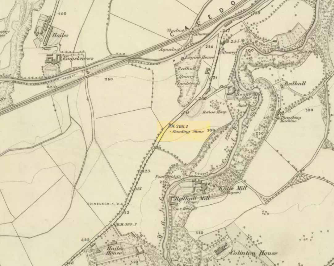
Cloven Stone on 1855 map

Highlighted on the earliest OS-map of 1855 and the Knox Map of 1816 in non-antiquated lettering as a ‘Standing Stone’, the Edinburgh historian Stuart Harris (1996) thought it was an authentic site.  He was probably right.  First named in land rentals in 1631, it was known by local people as the Clovenstone and used to stand in a park of the same name, before quarrying works extended into the area and destroyed it in the 1870s. Mr Harris thought that it may have been a pair of uprights, but the term ‘cloven’ could just as well mean it was a stone that had a split in it.

References:

  1. Harris, Stuart, The Place-Names of Edinburgh, Gordon Wright: Edinburgh 1996.

© Paul Bennett, The Northern Antiquarian 


Staniston Hill, Stainburn, North Yorkshire

Standing Stone (lost):  OS Grid Reference – SE 2522 5010

Archaeology & History

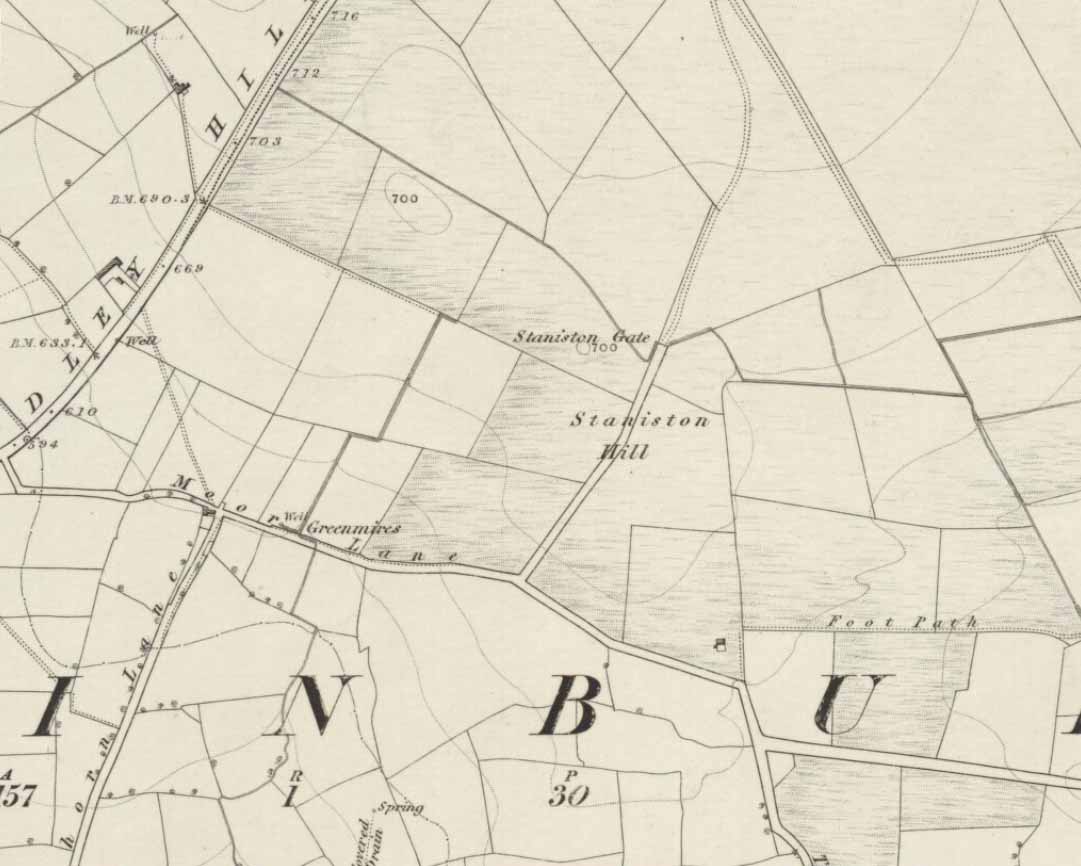
Staniston Hill on 1851 map

This long-lost standing stone gave its name to the small hill between the geological giants of Little Almscliffe and Almscliffe Crags, ‘Staniston Hill.’  Described as early as the 13th century in the Cartulary of Fountains Abbey as ‘Standandestan’, its precise whereabouts is unknown—but it’s damn close to the grid-reference cited here.  As the early OS-map shows, a small rounded hill occurs a short distance northwest of the small copse of trees now growing.  The monolith may have been felled by some grumpy christian, or it could be standing in some nearby walling.  Local antiquarians, dowsers or archaeologists may or may not find a search for it worthwhile…

Its position between the two Almscliffe Crags makes it very close to marking the midway point of a natural solstice marker: the Winter sunrise from Little Almscliffe and summer sunset from the greater Almscliffe.

References:

  1. Bennett, Paul, The Old Stones of Elmet, Capall Bann: Milverton 2001.
  2. Smith, A.H., The Place-Names of the West Riding of Yorkshire – volume 5, Cambridge University Press 1961.

© Paul Bennett, The Northern Antiquarian

Kirkton of Culsalmond, Aberdeenshire

Stone Circle (destroyed): OS Grid Reference – NJ 6503 3293

Also Known as:

  1. Canmore ID 18243

Archaeology & History

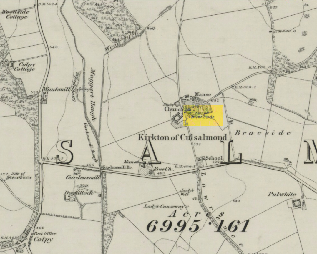
Site of the circle on 1873 map

After standing at the same spot for 3000 years or more, near the beginning of the 19th century this stone circle was destroyed by the self-righteous christian cult that was rampaging its way through cultures far and wide.  After all, they needed to rid the area of local traditions and “improve” the locals, whether they liked it or not!  Thankfully however, one of their creed—a reverend Ferdinand Ellis: minister of the parish for forty years—recorded its destruction in the New Statistical Account between 1834-45. Amongst a variety of important traditional monuments that once existed hereby,

“A Druidical place of worship anciently stood about the middle of the churchyard or burying ground.  It consisted of a circle of twelve upright large granite stones from Benochee, which were overturned when the first Christian temple was erected.  One of these was taken up in 1821 and now remains above ground, near the spot where it was taken up.  The other eleven are still underground.  This is proof that the first christian missionaries, in this country, erected their places of worship as near as possible to the holy hills of the heathens, that the people might be more easily persuaded to assemble there.”

Persuaded‘ being a very broad term indeed when it came to the land confiscation of indigenous folk…

The stone that Ellis said “was taken up in 1821 and now remains above ground” was gone when Fred Coles (1902) surveyed the site, but he told how an earlier antiquarian and writer for the Scottish Society of Antiquaries, J.G. Callander, lived nearby, and who was

“told by the aged sexton, Florance, that he many a time came across a great stone, when preparing graves, and that he had himself blasted these more than once.”

It seems that all trace of this single stone, and the rest of them, either still lay in the ground or were used for local building material.

When John Barnatt (1989) came to add this circle in his corpus, for some reason he postulated that

“the number of stones suggest it was a recumbent stone circle”,

…that is: a stone circle possessing one large stone in the ring that’s laid down with two standing stones either side.  However, there seems no real evidence to show that this was the case.

References:

  1. Barnatt, John, Stone Circles of Britain – volume 2, BAR: Oxford 1989.
  2. Browne, G.F., On Some Antiquities in the Neighbourhood of Dunecht House, Aberdeenshire, Cambridge University Press 1921.
  3. Burl, H.A.W., “The Recumbent Stone Circles of North-East Scotland“, in Proceedings Society of Antiquaries, Scotland, volume 102, 1973.
  4. Burl, H.A.W., The Stone Circles of the British Isles, Yale University Press 1976.
  5. Burl, H.A.W., The Stone Circles of Britain, Ireland and Brittany, Yale University Press 2000.
  6. Coles, Fred R., “Report on Stone Circles in Aberdeenshire (Inverurie, Eastern Parishes, and Insch Districts),” in Proceedings Society of Antiquaries, Scotland, volume 36, 1902.

© Paul Bennett, The Northern Antiquarian


Dunadd House, Kilmichael Glassary, Argyll

Standing Stone:  OS Grid Reference – NR 83865 93619

Also Known as:

  1. AR27 (Ruggles 1984)
  2. Canmore ID 39592

Getting Here

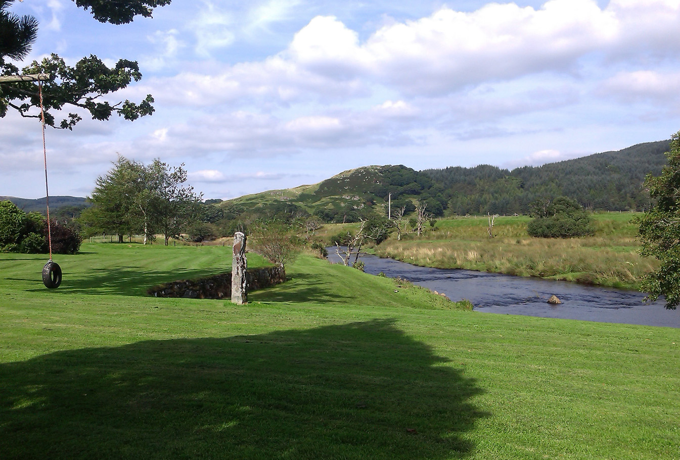
Standing stone below Dunadd

From Lochgilphead, take the A816 road north for several miles (towards the megalithic paradise of Kilmartin), keeping your eyes peeled for the road-signs saying “Dunadd.”  Turn left and park-up.  Instead of walking up the craggy fortress, follow the road-track to the house and, alongside the River Add, you’ll see the standing stone in the well-mown garden on your right.

Archaeology & History

As a monolith within the Kilmartin Valley complex, this is a slight, almost gentle standing stone, missed by most when they visit the other larger sites in Argyll’s Valley of the Kings.  Set upright close to the gentle winding River Add and only a few yards from the ancient ford that bridged the waters beneath the shadow of Dunadd’s regal fortress, the late great Alexander Thom (1971) wrote about it in his exploration of lunar alignments found at other nearby standing stones. This one however, was 3° out to have any astronomical validity.

Described only in passing by a number of writers, the greatest literary attention it has previously been afforded was by the Royal Commission lads (1988), whose notes on it were short:

“An irregularly-shaped block of stone, 1.35m high and 1.35m in girth at the base, is situated 25m S of Dunadd farmhouse, it is aligned NNW and SSE, and the top the SSE edge appear to have been broken off.”

…My first visit here was when I lived north of Kilmartin and each time I found the same ‘gentle’ feeling, in all different weathers: a most unusual phenomenon, as there tends to be changes in psychological states between rain, sunshine, frosts, dark night and mists.  But there was a consistency of subtlety; a regularity in genius loci—probably due to its proximity to the River Add, the lowland tranquility below the crags.  It’s a wonderful little place.  Well worth visiting if you go to Dunadd.

References:

  1. Campbell, Marion, Mid-Argyll: An Archaeological Guide, Dolphin Press: Glenrothes 1984.
  2. Lane, Alan & Campbell, Ewan, Dunadd: An Early Dalriadic Capital, Oxbow: Oxford 2000.
  3. Royal Commission on the Ancient & Historical Monuments of Scotland, Argyll – Volume 6: Mid-Argyll and Cowal, HMSO: Edinburgh 1988.
  4. Ruggles, Clive L.N., “A critical examination of the megalithic lunar observatories,” in Ruggles & Whittle, Astronomy and Society in Britain, BAR: Oxford 1981.
  5. Ruggles, Clive L.N., Megalithic Astronomy, BAR: Oxford 1984.
  6. Thom, Alexander, Megalithic Lunar Observatories, Clarendon: Oxford 1971.
  7. Thom, A., Thom, A.S. & Burl, Aubrey, Stone Rows and Standing Stones – volume 1, BAR: Oxford 1990.

© Paul Bennett, The Northern Antiquarian 


Easter Nether Urquhart Circle, Gateside, Fife

Stone Circle (destroyed):  OS Grid Reference – NO 18873 08865

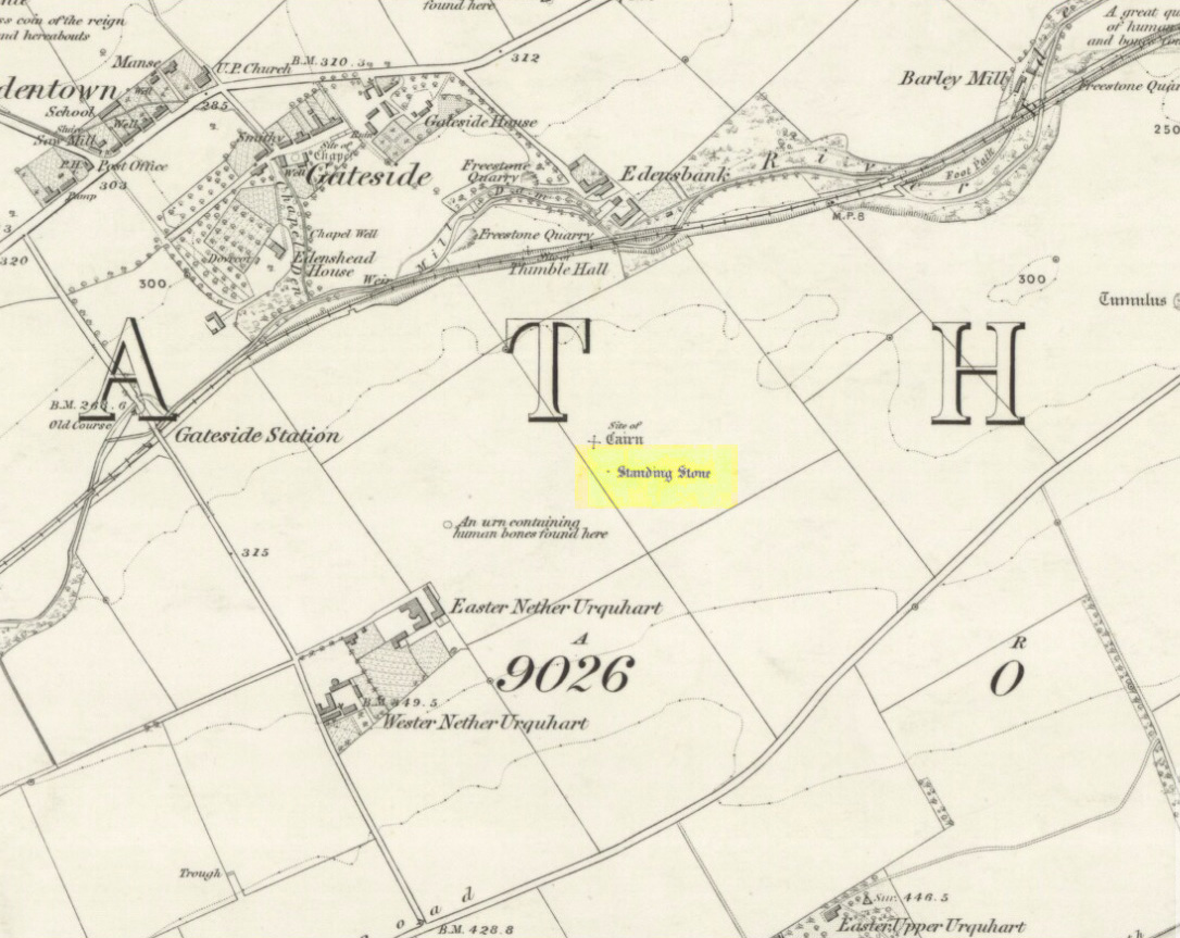
Remaining standing stone of Easter Nether Urqhart stone circle on 1856 map
1856 map showing stone of Easter Nether Urquhart circle

Also known as:

  1. Canmore ID 27809

Getting Here

Turn off the A91 road at Gateside and go down Station Road, crossing the old railway line at the bottom.  From here, cross the fields to your left and the site of the circle will be found in the field to the north east of Easter Nether Urquhart Farm.

Archaeology & History

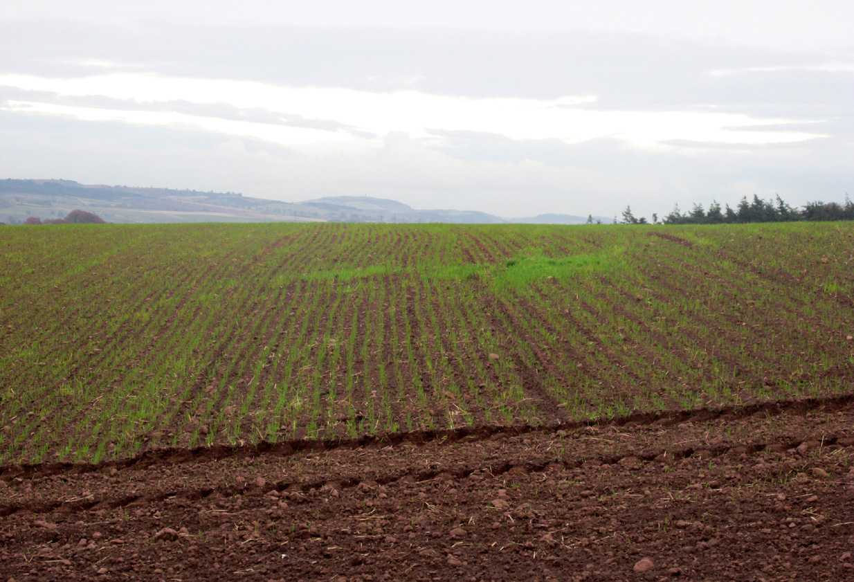
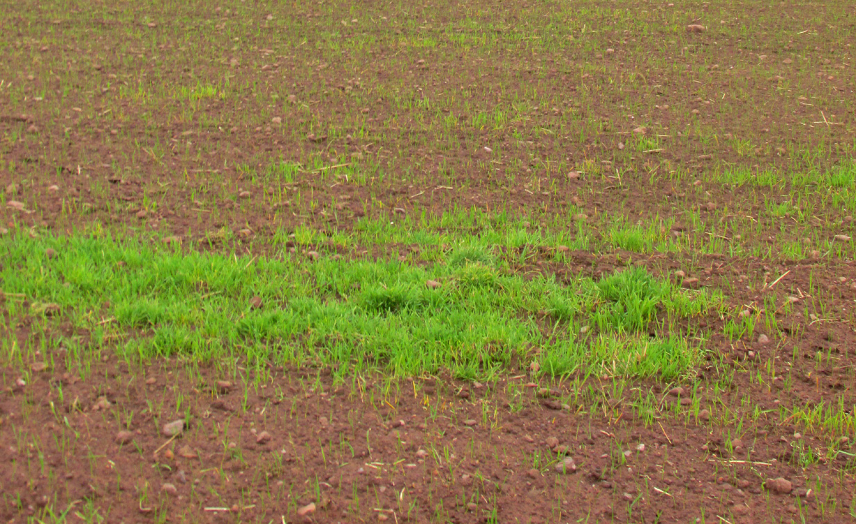
65 years after last stone was removed, its position is evident in crop-growth
Position of the circle, evident in crop-growth

Marked on the 1856 6″ Ordnance Survey map as a “standing stone,” earlier references record this as being the survivor of a stone circle.  Not listed in Aubrey Burl’s (2000) magnum opus, this circle was on the edge of the site of a major battle between the Romans and the native defenders, and large amounts of human remains have been found in the vicinity.  Referring to an adjacent cairn, Lieutenant-Colonel Miller wrote in 1829:

“A very fine Druid’s Temple stood on the south side of it, consisting of seven very large stones. All these were blasted with powder and removed, except half the one of them, which still marks the spot.”

Of the same cairn, the Reverend Andrew Small wrote in 1823:

“This cairn stood a little north of an ancient Druids’ temple, only one stone now remaining, out of ten of which it formerly consisted.”

The Ordnance Survey Name Book for 1853-55 imparts the following:

“This standing Stone is about 13 chains on the South side of the River Eden opposite Edensbank but whether it is the remains of a druid’s temple or set up to mark something relative to the battle contested between the Romans and Caledonians according to Messrs. Miller & Small, it is difficult to determine. It stands about 4 feet 10 inches high and its sides are about 2 feet broad…many of the inhabitants consider it to have been a druid’s temple…”

A close-up of the site

J.S.Baird of Nether Urquhart informed an Ordnance Survey officer in 1956 that the remaining stone was broken up and removed around 1952, and measured 5 feet high with a girth of 9 feet at the base. Near the top of the stone, on the south-side were two slight cracks weathered to suggest a simple incised cross.

On the day of my November field-visit the winter barley was sprouting and it was interesting to see how much better it was growing at the place where the remaining stone had stood.

A standing stone at Wester Nether Urquhart, rediscovered by Maggie Overett in July 2020, can be seen a half-mile southwest.

References:

  1. Burl, Aubrey, The Stone Circles of Britain, Ireland and Brittany, Yale University Press 2000.
  2. Miller, Lieutenant-Colonel, “An Inquiry respecting the site of the battle of Mons Grampius (Read 27th April 1829 and 25th January 1830),” in Proceedings of the Society of Antiquaries of Scotland, Volume IV, 1857.
  3. Small, Reverend Andrew, Interesting Roman Antiquities Recently Discovered in Fife Ascertaining the site of the Great Battle fought betwixt Agricola and Galgacus, John Anderson & Co: Edinburgh 1823.

© Paul T. Hornby 2016 – The Northern Antiquarian 


Dunruchan Hill, Muthill, Perthshire

Standing Stone:  OS Grid Reference – NN 8022 1645 —  NEW FIND

Getting Here

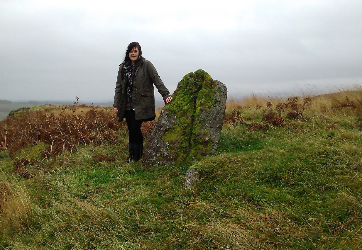
Lisa standing with the old stone
Lisa with the old stone

Take the directions to the hugely impressive Dunruchan A standing stone.  Walk directly south, over the gate and follow the fence straight down the fields, crossing the burn at the very bottom. Walk over the boggy grassland and start veering uphill, southeast.  You’ll notice the land goes up in geological ‘steps’ and, a few hundred yards up, a small standing stone pokes up on the near skyline ahead of you.  Head straight for it!

Archaeology & History

This small standing stone was first noted after a quick visit to the major Dunruchan megalithic complex in the summer of 2016.  Photographer James Elkington was taking images of the landscape and the standing stones when he noticed a stone on the horizon a half-mile away.  As we were in a rush, he took a couple of photos from different angles on the way back to the car—both of which looked promising.  And so, several months later, we revisited the site again.  Lisa, Paul and Mr Fukner and I meandered up the geological steps of the hillside until we reached the site in question.

Looking northwest
Looking northwest
Looking northeast
Looking northeast

Standing more than four-feet tall, this solitary stone overlooks the megalithic Dunruchan complex a half-mile or so to the north and northwest.  Like the Dunruchan C monolith, this smaller upright is conglomerate stone.  Paul Hornby noted what may be a single cup-marked stone roughly 100 yards east along the same ridge. (Please note that the grid-ref may be slightly out by perhaps 50 yards or so at the most. If anyone visits and can rectify my ineptitude on this matter, please let me  know.)

© Paul Bennett, The Northern Antiquarian