There are numerous ways to get here from all directions: i) from the west-side of Wimbledon Common, on the Robin Hood’s Way A3 road, keep your eyes peeled for the small crossroad of Robin Hood Lane and Road, obivously taking the one into the park. Keep on the dead straight Robin Hood Ride path until your hit the carpark ¾-mile on; and from here, bear sharp left (NW) for 250 yards or so, where a small slope down on your left takes you there; or, ii) from Wimbledon village side on the A219 Parkside A219 road, where the War Memorial stands, head onto the Common along The Causeway, past the Fox & Grapes going on Camp Road, then up the Sunset Road towards the carpark. And then, once again go NW for 250 yards or so, where the small slope on your left takes you there. You’ll find it.
Archaeology & History
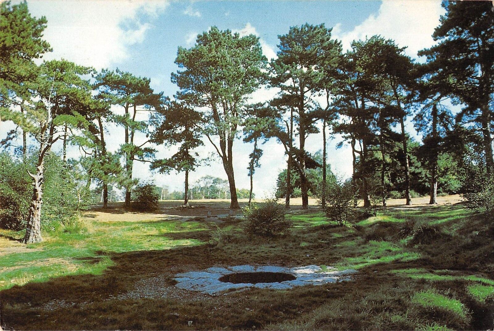
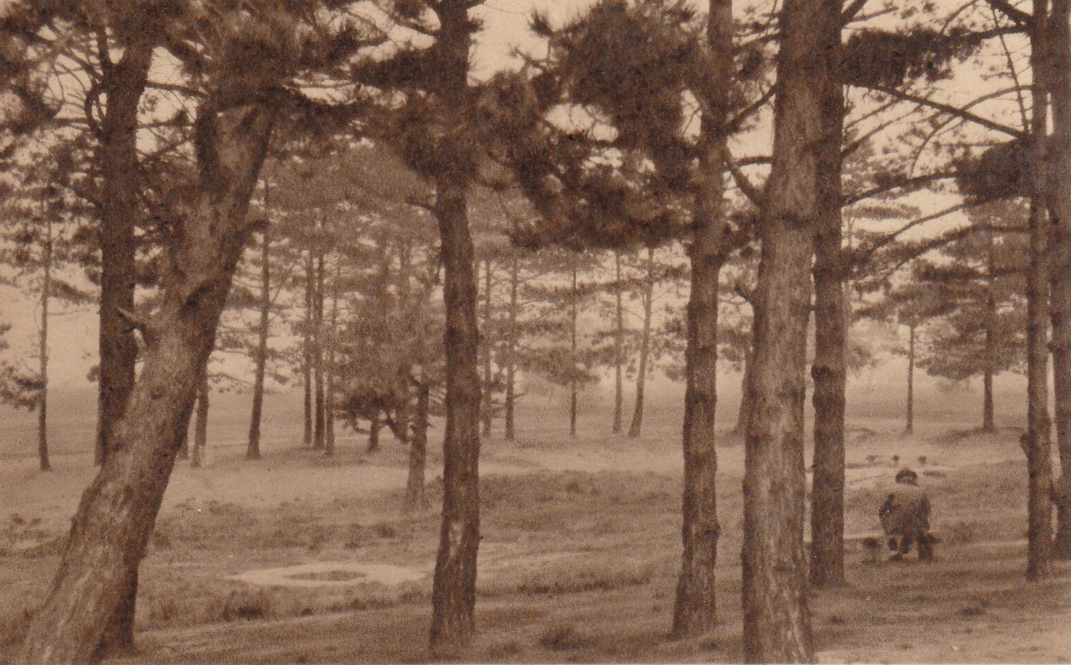
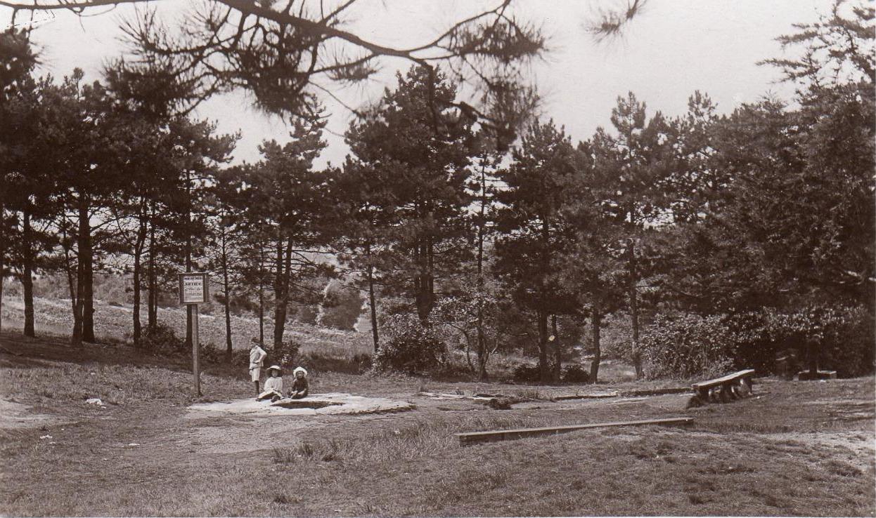
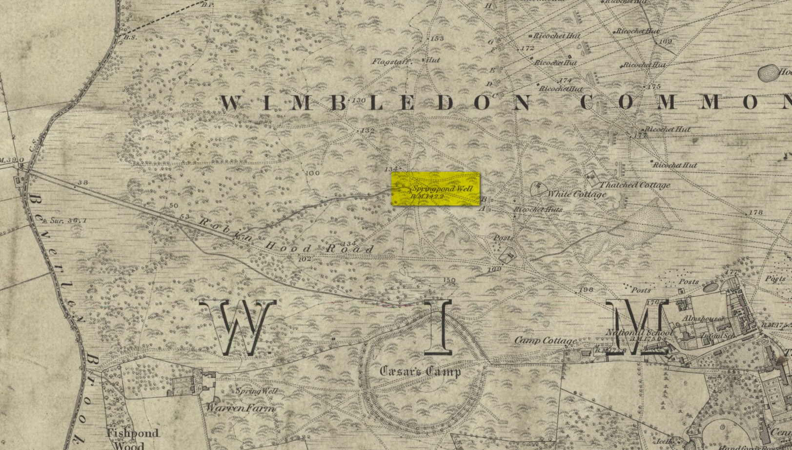
Described by William Bartlett (1865) as “the never-failing spring of water, improperly called the Roman Well”, its constant flow was severely tested in the great drought of 1976—and it kept on flowing. Only just though! It was highlighted on the early Ordnance Survey map with the plain name of the Springpond Well. The great historian and folklorist Walter Johnson (1912) gave us the best historical resumé of the site, telling that,
Caesar’s Well around 1900Caesar’s Well around 1911
“Caesar’s Well, formerly known as Robin Hood or Roman Well—the Springpond Well on the Ordnance Map—issues on the other side of the little watershed above mentioned, at a height of 149 feet O.D. The well lies in a little hollow, now ringed with Scottish pines. The gathering ground is the land to the east, rising to 198 feet O.D. This area is not large, but quite sufficient to maintain a permanent rill of pure water. The well, the waters of which once were deemed of special medicinal merit, was enclosed with brick in 1829, and, as the inscription tells us, refaced with granite blocks by Sir Henry W. Peek, M.P., in 1872. The outflowing waters descend to Brickfield Cottage, where they expand into a turbid duckpond; thence the course is through the yard behind the house, and along the north side of Robin Hood Road to Brook Cottage. During 1911 the “Well” proper altogether dried up, but water still issued from the stand spout a few yards below, which is supplied by an artificial boring and pipe that tap the spring at a depth of 18 feet.”
Site shown on the 1874 map
The proximity of this never-failing spring to the huge prehistoric enclosure of Caesar’s Camp just a few hundred yards to the south would indicate it was an important water source in Bronze Age times and, I’d hazard, would have been bestowed with some sanctity, as many such wells tended to be.
Folklore
James Rattue (2008) informed us that the name Robin Hood’s Well was known here in the 18th century prior to it being known as Caesar’s Well, but there seems to be no known relationship between Robin Hood and this site. However, a piece written in 1922 told that there was a lingering tradition that Julius Caesar encamped on Wimbledon Common in 51 BCE and that this folk memory was kept alive in the lore of local children who devoutly believed that the great Roman Emperor drank from the cool depths of this well.
References:
Bartlett, William A., The History and Antiquities of the Parish of Wimbledon, Simpkin Marsall: London 1865.
Hughes, John L., “Caesar’s Well, Wimbledon Common,” in Source magazine, no.9, Spring 1989.
Johnson, Walter, Wimbledon Common – Its Geology, Antiquities and Natural History, T.Fisher Unwin: London 1912.
Rattue, James, Holy Wells of Surrey, Umbra: Weybridge 2008.
Healing Well (destroyed): OS Grid reference – TQ 330 827
Also Known as:
Balsamick Well
Archaeology & History
In that typically rambling style beloved of early writers on medicinal springs, Timothy Byfield (1687) narrated the tale of uncovering this well in an almost alchemical discourse. It was located when digging out the cellar of a house near Charles Square in the 1680s. Upon investigation, the waters were found to possess a good quantity of sulphur and a small amount of iron, leading Byfield to proclaim it could cure a whole army of medical disorders, from cleaning out blockages in the alimentary canal, to treating kidney stones, scurvy, ulcers, headaches, migraines and more. If used correctly and in the right amount,
” There is,” he says, “no unwholesome glebe (concretion) or any dangerous mineral or metal (in them) that casts one unhappy ray into this healing fountain.” On the contrary, they set up ‘* such a pretty bustle or ferment in nature that makes gay a well-temper’d Healthy Body.”
In the early days when Spa Wells were in vogue, the Balsamic Well became a competitor to the nearby St Agnes le Clear Well, which is probably the reason why one doctor dissuaded the toffs of the time to avoid it!
The waters possessed a slight vinegar-esque flavour—hence the name. In John MacPherson’s (1871) work, he described it as a “chalybeate well” and despite it having that typical “bituminous scum on it, strange to say,” it yielded “a pleasant aromatic flavour.” The site has long since been covered over.
References:
Byfield, Timothy, A Short and Plain Account of the late-found Balsamick Wells at Hoxdon, London 1687.
Foord, Alfred Stanley, Springs, Streams and Spas of London: History and Association, T. Fisher Unwin: London 1910.
Hembry, Phyllis, The English Spa 1560-1815, Athlone Press: London 1990.
MacPherson, John, Our Baths and Wells, MacMillan: London 1871.
Sunderland, Septimus, Old London Spas, Baths and Wells, John Bale: London 1915.
Cross (destroyed): OS Grid reference – SD 5152 9280
Also Known as:
Cold Stone
Market Cross
Archaeology & History
Not to be confused with the carved cross fragments held in the local church, this old town cross has long since gone. It’s existence was recorded by the great Kendal historian Cornelius Nicholson (1861), but even in his day, this “obstruction” as he called it, was no longer standing. Known as the local Market Cross where all the wheeling and dealing took place—official ones, as well as the not-so-official works of local folks—it stood just off Stricklandgate,
“opposite the Covered Market, and was an obstruction in the street. There still remains a remnant of it in a stone at the corner, vulgarly called “cold stone,” where the charters and so forth were usually proclaimed. Cold stone is a corruption of “call stone;” an appendage common to most ancient towns, where all public matters were “called” prior to the “institution” of belman.”
This folk etymology of “cold” needs to kept in mind when we come across other stones of this name. …The earliest record of a market held at Kendal is from 1402, but written records of the Market Cross are scant until 1714. Such edifices tend to be architecturally ornate, but we have neither sketches nor descriptions of this lost site and must await the work of fellow researchers who may hopefully find out more.
References:
Nicholson, Cornelius, The Annals of Kendal, Whitaker & Co.: London 1861.
Smith, A.H., The Place-Names of Westmorland – volume 1, Cambridge University Press 1967.
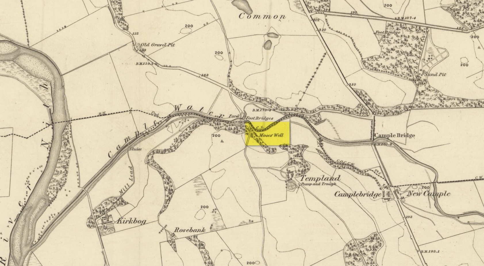
This little-known Biblical-sounding spring has apparently long since fallen back to Earth (perhaps there might be some local folk who could find out for certain). Shown on the 1861 Ordnance Survey map as being at the side of the wall in the small copse of trees—immediately east of kirk- place-names and a half-mile north of St Ninian’s Well—it was briefly described by T.C. Ramage’s (1876), who seemed to know nothing of its lore, merely telling us that,
“on Templand farm, close to the wooden bridge over the Cample, there is Moses’ Well, an unusual designation, but which some Knight Templar may have given in remembrance of his toils in Palestine.”
The Templar designation was deemed by Ramage to come from the name of the farm. However, a few years prior to this, the early Scottish place-name surveyors were traversing the area and found from local people how it derived “its name from a Tinker named Moses Marshall who with his family lived near it in a Camp during the time they had the small pox.” The Well was also included in the Morris survey (1982), but without comment. Another Moses Well can be found 44½ miles to the northeast, near Galashiels at NT 4046 4306.
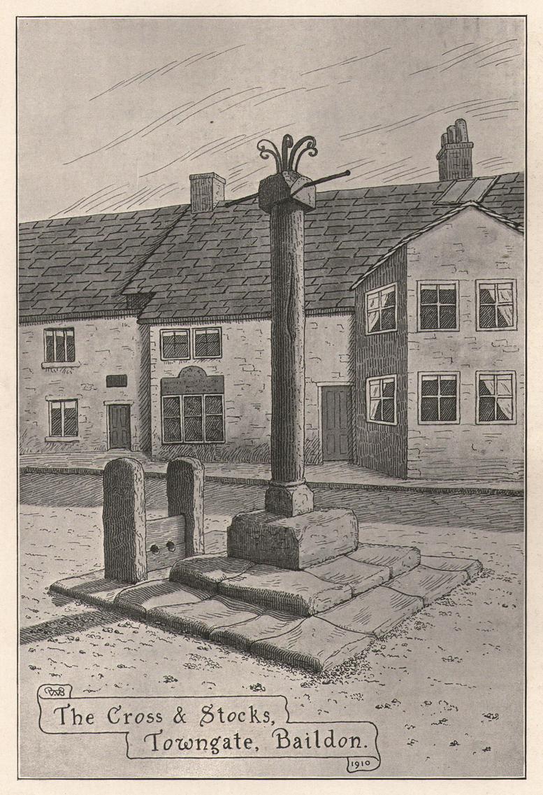
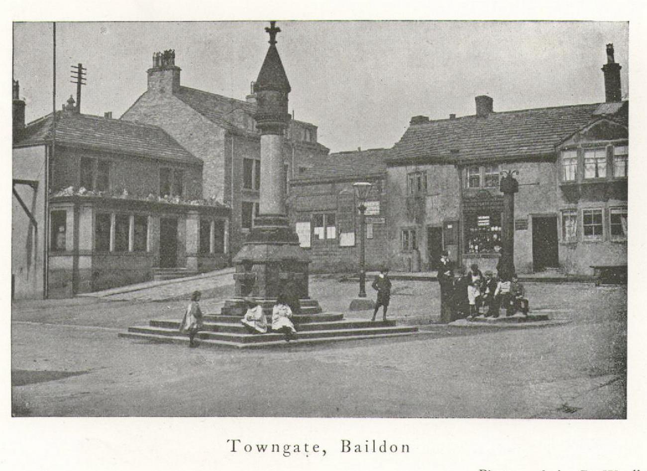
Located next to the old stocks by the main roundabout right in the middle of the town is this tall market cross, nearly ten feet high and well known to the local people. It has been described by several local historians, although its recognition as a “market cross” is slightly contentious as it seems there are no written records to indicate that a market ever existed here. The great Baildon historian, W. Paley Baildon (1912) was unable to find any info about such a market, commenting simply that “most villages…had crosses in medieval times, many of which still exist; so that the presence of a cross at Baildon is (not necessarily) evidence of a market.”
His description of its form is as valid then as it is to this day:
Old sketch, c.1900Old photo of the cross c.1900
“The cross, as we see it to-day, is not an interesting object. The square platform of two stages, with its well worn stones, looks as though it might be medieval, and part of the original work. In the centre of this is a large square block of stone, from which rises a tall cylindrical shaft.
The base is square, with chamfered corners, and a plain roll moulding at the upper edge; the cap is a plain square block, without any attempt at ornament.”
One of Bradford’s industrial historians, William Cudworth (1876) thought that the present cross replaced an earlier one, and that this one was erected by a member of the wealthy Butler family a few centuries ago. Mr Baildon wasn’t quite as sure as Mr Cudworth. Nevertheless they both agreed that this edifice replaced an earlier one. Baildon said:
“My own view is that there was probably a cross here in medieval times; that it was destroyed, either after the Reformation (as so many were), or by the Puritan soldiery during the Civil War; that the steps and perhaps the base remained; and that in the eighteenth century, when the Butlers were one of the leading families in the place, one of them may have erected a new shaft on the old site.”
In much earlier days it was said to have been surrounded by a grove of trees and a brook ran by its side. Villagers would gather here as it was “a favourite gossiping resort.” At the beginning of the 20th century, an old gas light surmounted this old relic.
References:
Baildon, W. Paley, Baildon and the Baildons – volume 1, St. Catherine’s Press: Adelphi 1912.
Cudworth, William, Round about Bradford, Thomas Brear: Bradford 1876.
la Page, John, The Story of Baildon, William Byles: Bradford 1951.
Cross (destroyed): OS Grid-Reference – SE 3224 4498
Archaeology & History
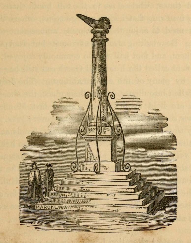
A Charter in the time of King John allowed for markets to be held in Harewood from 1209 CE onwards, “on the first day of July and the two following days, and also to hold one market there every week on the Monday.” But whether or not a market cross was erected that far back, we don’t quite know. Certainly, the edifice illustrated by John Jones (1859) in his standard work on Harewood didn’t date from such an early period! It stood close to the old road junction to Wetherby in old Harewood village, “a little below the intersection of the roads, and about fifty yards higher up than the market house.” Jones told us:
Harewood Cross (Jones 1859)
“It stood upon a large stone pedestal, and was approached by a quadrangular flight of seven steps, very broad, where the neighbouring farmers used to stand, and dispose of their butter, fowls, eggs, &c. It was re-erected, AD 1703, by John Boulter, Esq., and in the year 1804, when the road was lowered, it was taken down and destroyed. This is to be regretted, it might have been re-erected in another situation, if that was inconvenient, and would have been in the present day, not only an ornament to the village but a relic of the past, of which the villagers might have been justly proud. On the top of this cross there was a knur and spell, a game for which the village was celebrated in old times, while close to the toll booth there was a strong iron ring fastened to a large stone, where the villagers used to enjoy the barbarous amusement of bull baiting.”
References:
Bogg, Edmund, Lower Wharfeland, J. Sampson: York 1904.
Jones, John, The History and Antiquities of Harewood, Simpkin Marshall: London 1859.
Speight, Harry, Lower Wharfedale, Elliott Stock: London 1902.
Nothing has previously been written of this site. Its existence came to light during one of umpteen enquiries I’d made with a well-known and very respected local lady, born and bred in Killin (sadly, a dying breed), who is known as a fount of knowledge regarding the history of the area. We were talking about the ancient sites and folklore of the neighbourhood and, amidst being her usual helpful self she asked, “have you been to the Coin Tree? The place where we leave offerings to the spirit of the place?”
I hadn’t.
“No, I’ve never heard of the place.”
“We keep it quiet, ” she said, “for obvious reasons.”
I knew what she meant. The Fairy Tree at Aberfoyle is a case in point: littered with plastic pentagrams, children’s toys and so-called “offerings” of all kinds that have made it little more than a dumping ground for pseudo-pagans and new-age nuts that needs to be cleaned regularly by local folk.
Anyhow, our informant proceeded to give us directions to find the place, going out of the village, but asked that if we were to write about it, to keep its location quiet, “as the place is still used by us”—i.e., old locals. After a slow trek along one of the roads out of the village we saw nothing that stood out. Eventually we came across a fella relaxing in his garden and asked him if he knew anything about an old tree where offerings were made. He gave us that look that olde locals do, to work out whether you’re a tourist or not and, after telling him what we’d been told and who had told us —that seemed to do the trick!
“You’d mean the Fairy Oak I s’ppose? Aye,” he said, “gerrin the car and I’ll drive y’ down to it.”
So we did. A short distance back along the road that we’d come down he stopped and walked along a to large oak tree beside the road. We’d walked straight past it—but in truth it’s not a conspicuous tree and unless you were shown where it was, you’d miss it as easily as we did (and I’m usually damn good at finding such things!). We thanked the fella for taking us to see it and he drove back home to leave us with out thoughts.
More coins as offeringsCoins for the little people
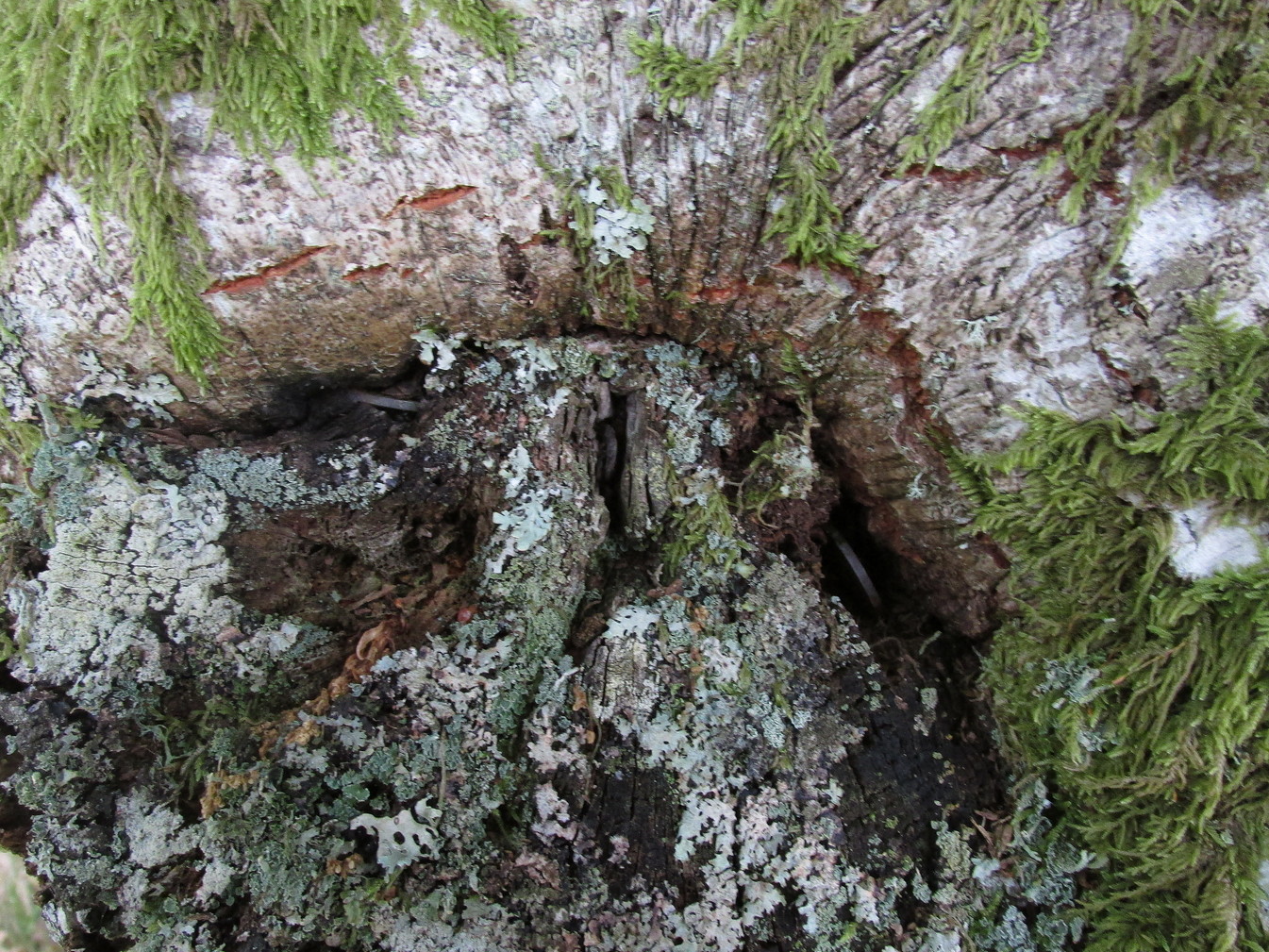
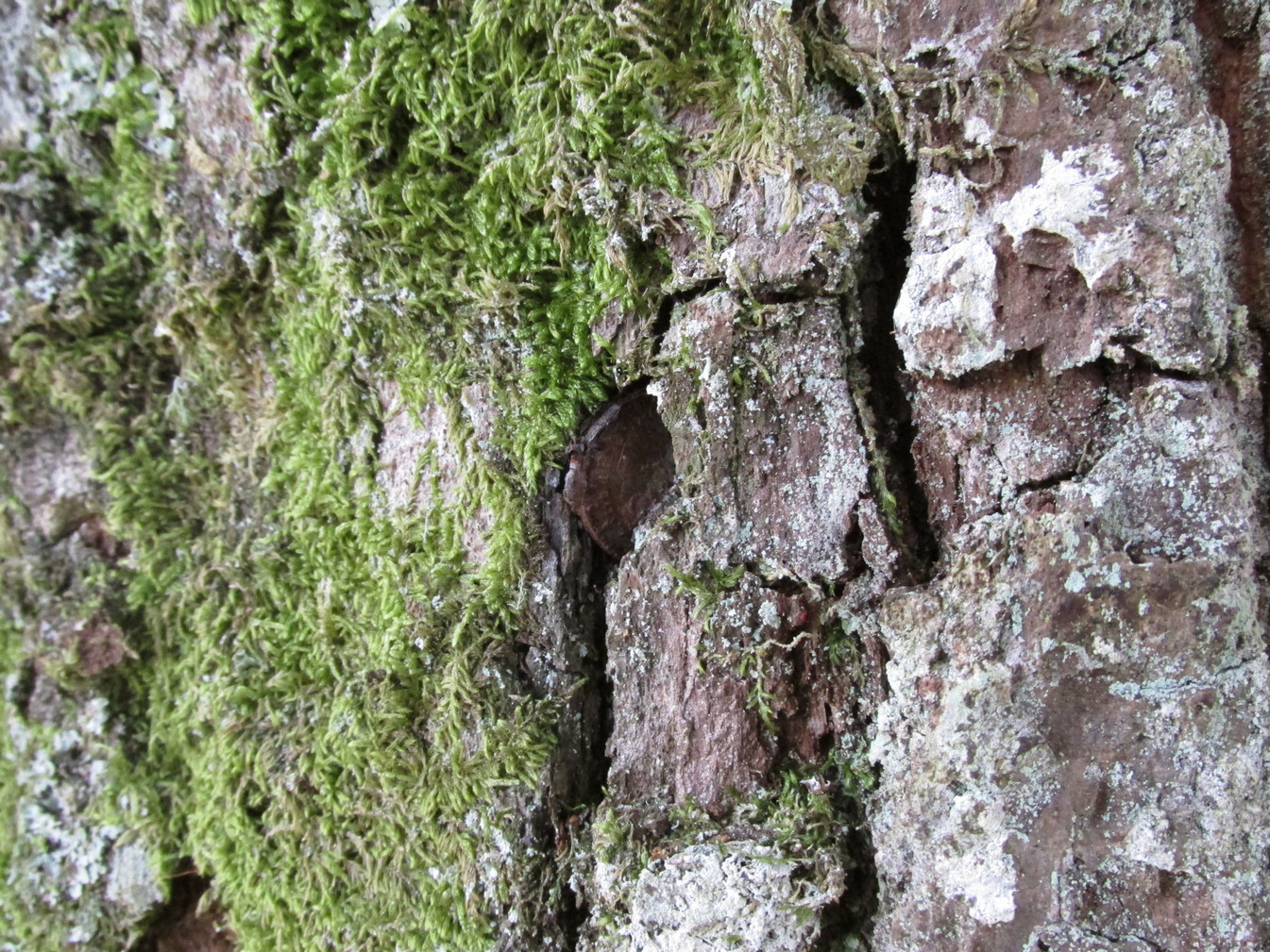
Embedded into the tree—some of them barely visible where the bark had grown over them—were clusters of old coins all around its trunk; some of them very old. These had been inserted into the tree as offerings in the hope that the little people, or the genius loci would bring aid to that which was asked of it.
In a field across the road there’s a large “fairy-mound” hillock: one of Nature’s creations, but just the sort of place where many little people are said to live in many an old folk-tale. Some such mounds are old tumuli, but this aint one of them. It’s possible that it had some relationship with the tree where the fairy folk are said to reside but, if it did, our informants didn’t seem to know.
The important thing to recognise here is that in some of the small villages and hamlet in our mountains, practices and beliefs of a world long lost in suburbia are still alive here and there… But even these are dying out fast, as most incomers have no real attachment to the landscape that surrounds them. Simply put: they see themselves as apart from the landscape as opposed to being a part of it.
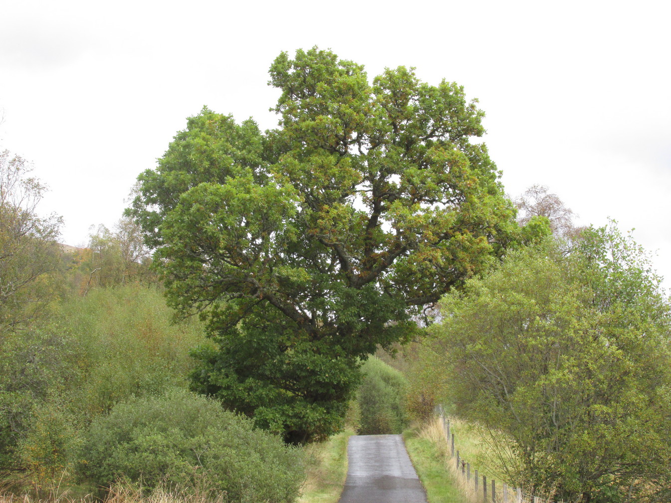
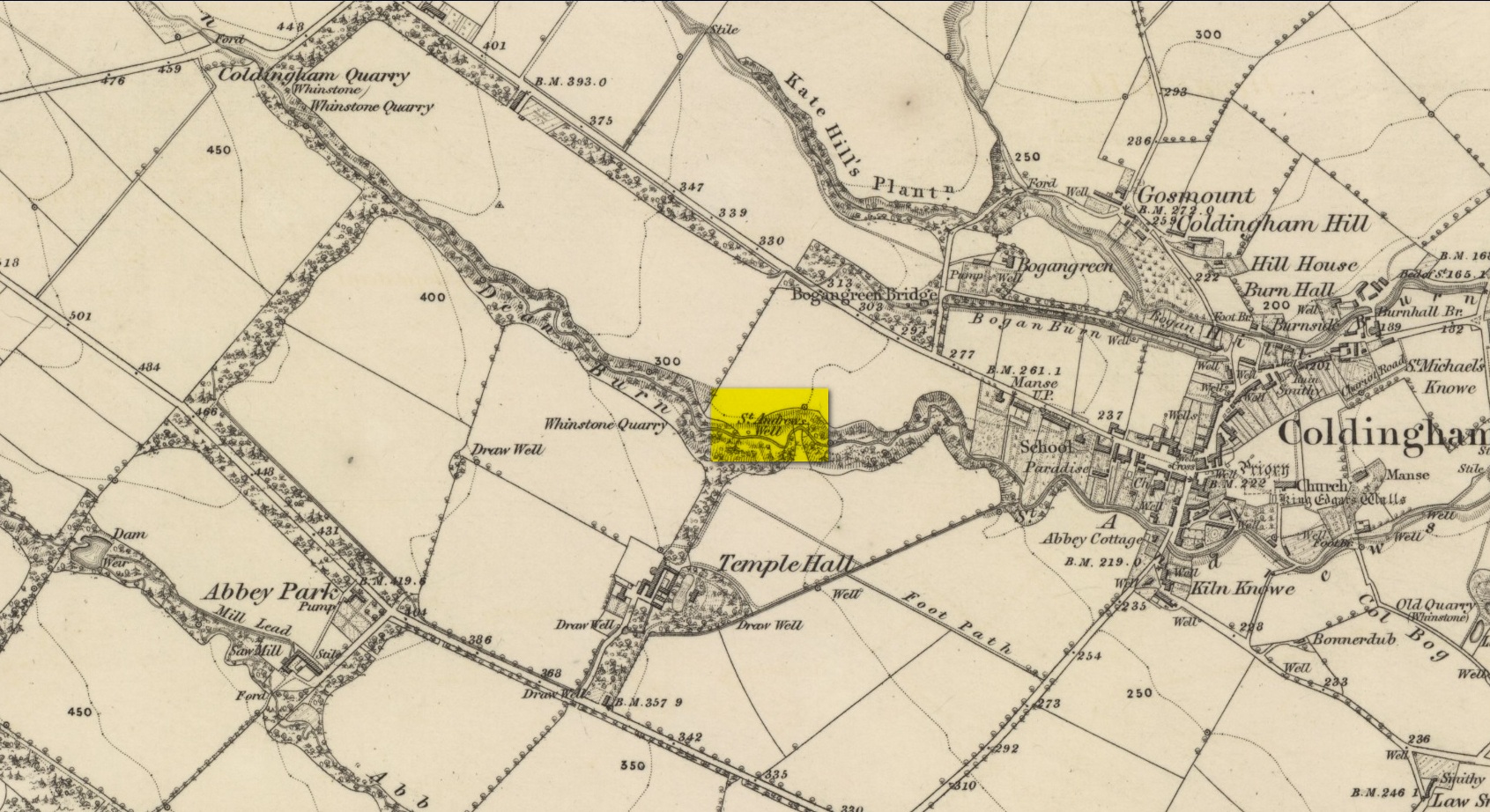
By the side of the stream known as St Andrew’s Burn, in the small wooded glen to the rear (west) of the Crosslaw Caravan Park (right by the side of the A1107 road), you can still find the flowing waters of this all-but-forgotten holy well that was dedicated to Scotland’s patron saint, god knows how long ago! The first description I’ve come across relating to the site is in William King’s (1858) early work on Coldingham Priory, where he told that,
“In a dean a little westward from the village, and on the border of the property of Bogangreen, is a spring of excellent water, called St Andrew’s Well, from which the monastery was supplied by leaden conduits, portions of which are occasionally turning up to view. These pipes are thick and well made.”
Fifty years later when Adam Thomson (1908) penned his magnum opus on Coldingham parish, the well was still in a good state of affairs. Hereby there grew much chamomile which, he thought, “the monks were wont to cultivate for the healing of the sick.”
Folklore
St Andrew’s feast day is November 30 and is known as Anermas.
References:
Hunter, William K., History of the Priory of Coldingham, Sutherland & Knox: Edinburgh 1858.
Holy Well (destroyed): OS Grid Reference – SE 6071 5187
Archaeology & History
At the beginning of the 19th century, William Hargrove (1818) described the scant remains of some old walling along old Haver Lane (renamed as Green Lane and now known as The Stonebow) which were the remains of a building, long gone, and which,
“tradition informs us (was) a religious house, which formerly stood here, called Holy-Priests; and though the site of it is not known, the report is greatly strengthened by the appearance of the walls just mentioned, and by the circumstance of a deep draw-well which now remains, being still called Holy-Priests Well.”
Some suggest that this water source may still exist beneath one of the buildings hereby, but the landscape here has been so badly mutilated over the last two hundred years that it’s very unlikely.
References:
Hargrove, Willliam, History and Description of the Ancient City of York – volume 2, part 2, W. Alexander: York 1818.
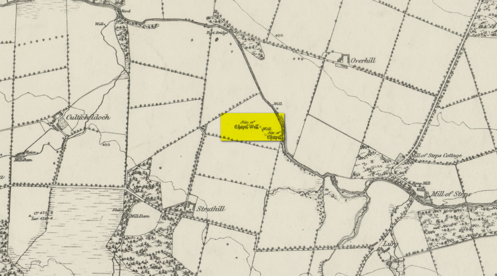
From Muthill, go up Thornhill Street out of the village for nearly 1½ miles. You’ll have just passed the double hairpin bend, crossed the rivulet, then reached the large old farmhouse of Lurgs. From here, turn right and after just over half-a-mile you reach Struthill where, running by the side of the house, is a small trackway. Ask the folks at the house, who are most helpful, and walk down the track for nearly 400 yards and go through the first gate on your right, crossing the field until it dips down to the burn. The boggy marshy mass running from near the top of the slope is what you’re looking for!
Archaeology & History
Shown on the 1863 map as the Chapel Well, the dedication of the waters to St. Patrick coincided with a chapel that once stood here, also in his name. Very low faint remains of the chapel, completely overgrown, can still be made out amidst the rushes. It’s one of two holy wells in Muthill parish that are dedicated to St. Patrick.
Very little of any real spring of water can be seen nowadays. Indeed, the site today is merely a much overgrown bog-of-a-well whose water oozes down the slope into the Juncus rushes, trickling into the adjacent burn. I had a drink of the water from the slopes, which tasted OK and did me no harm whatsoever.
Folklore
The most important aspects of this site was its use by local people and the attributes it was given. We know not how far back such folklore goes, but it would have been many many centuries, if not millenia. Water worship (if that’s the right word) is the most archaic of all traditional forms of veneration. This place was no exception. In John Shearer’s (1883) excellent local history work, he gave the following account of the site:
“About a quarter of a mile west from the Mill of Steps, upon a height on the right bank of the Machany, are to be seen the ruins of a small chapel. When other places of Popish worship were thrown down after the Reformation, the Presbytery of Auchterarder ordered it to be demolished about 1650 to repress the superstitions practised at this place of resort. West from the chapel is an excellent spring which was held in great veneration in those dark ages of superstition, when the ignorant and credulous populace were deceived by the crafty priests who stood below the spreading branches of an ancient ash which grew near the fount, pronouncing a benediction on the weary pilgrims as they drank of the waters. And as it was celebrated for its healing qualities in many different distempers, numbers yearly visited it from a great distance to benefit by its virtues with as much devotedness as the Mahometan pilgrims visit the tomb of their Prophet. Insanity was also cured here. Several persons testified before the Presbytery of Stirling, in 1668, that having carried a woman thither, they staid two nights at a house hard by the well. The first night they bound her twice to a stone at the well, but she came into the house to them being loosed without any help. The second night they bound her again to the same stone and she returned loosed. And they also declared that “she was mad before they took her to the well, but since that time she is working and sober in wits.”
“This well was still celebrated in the year 1723 and votive offerings were left, but no one then surviving appeared to appreciate the virtues of the stone. Small offerings were given in coin and thrown into the well and those who had no coin brought white stones which were laid in regular order along the declivity where the water runs to the river. Coins have been of late found in the well and the white stones are still to be seen. The officiating priest generally resided at Drummond Castle. Within the last sixty years, several of the gentry have come in their carriages to inspect these relics which were held in so great reputation in ancient times. The chapel and well are about one mile south west from Muthill.”
References:
MacKinlay, James M., Folklore of Scottish Lochs and Springs, William Hodge: Glasgow 1893.