St. Helen’s Well, Maybole, Ayrshire

Holy Well (covered):  OS Grid Reference – NS 31322 13423

Archaeology & History

Site on the 1860 OS-map

In spite of this site being covered over some time in the 1950s, it is still retained on the modern Ordnance Survey maps.  It was shown on the first one in 1860, but its literary history goes back much further.  We find it described by the Minister for Maybole — one William Abercrummie — in his short 17th Century work named A Description of Carrict.  He noted several springs in Maybole township, with this one of possessing the usual hallmarks of both christian and peasant customs alike:

“Another spring there is called St. Helens well or by a curt pronuntiation St. Emus for St. Antonies well, it is about a myle and ane halfe from Mayboll on the road to Aire a litle north of Balachmont.  It is famous for the cure of unthriving children, to which at the change of the quarter especially at May-day there is a great resort of people from all quarters, and at a good distance.”

This piece was repeated in several 19th century works, including one by William Roberston (1891), who commented on the traditions themselves, saying:

“This can unquestionably be traced as a remnant of the ancient superstition that miracles were wrought at Holy Wells; which all the anathemas of the Reformed Kirk could not for a time obliterate from the minds of the common people.  The records of the Kirk-session bear witness to the prevalence of applying to Saints’ Wells for the cure of bodily infirmities on stated occasions; particularly, when the Saint or Angel was understood to ‘move the waters.’  Pins, pieces of the dress of the patient, or such small trifles, were left at the well – the remains, no doubt, of the offerings formerly made to the Clergy – and in token that the disease was transferred from the sufferer to the rags, thus offered to the Genius loci.  Numerous traces of this prevailing superstition could easily be cited.”

When the Ordnance Survey dudes wrote about the site in the Name Book in 1857, all they could tell us was that it was, “a beautiful spring of excellent water” but was said to have “no medicinal properties.”

Despite this sacred well now being covered over, there is surely a case to be made here for it to be restored back to its former glory, for all to visit and see.  Local historians, pagans and Christians alike — join forces and gerrit sorted!

References:

  1. MacKinlay, James M., Folklore of Scottish Lochs and Springs, William Hodge: Glasgow 1893.
  2. Mitchell, Arthur (ed.), Geographical Collections Relating to Scotland Made by Walter Macfarlane – volume 2, T. & A. Constable: Edinburgh 1906.
  3. Robertson, William, Historic Ayrshire; Being a Collection of Historical Works Treating of the County of Ayr, Thomson Brothers: Edinburgh 1891.
  4. Walker, J. Russel, “‘Holy Wells’ in Scotland,” in Proceedings of the Society of Antiquaries of Scotland, vol.17 (New Series, volume 5), 1883.

Acknowledgements:  The map accompanying this site profile is Reproduced with the kind permission of the National Library of Scotland

© Paul BennettThe Northern Antiquarian

St. Helen’s Well, Hartlepool, Durham

Holy Well (destroyed):  OS Grid Reference – NZ 5236 3421

Also Known as:

  1. Freemen’s Well

Archaeology & History

Highlighted on the 1861 OS-map of the area, there is a curious lack of reference to this holy well until Cuthbert Sharp wrote about it in 1816.  Records of an adjacent St. Helen’s Chapel are in plentiful supply, going all the way back to around 1200 CE—although it’s pretty obvious that a water supply would be attached to the chapel, despite its late literary account.   Sharp told us:

“This chapel is stated to have been on the warren.  According to local tradition, a church once stood near the Freemen’s or St. Helen’s Well, in the Far-well Field, where the ground at present is considerably elevated, and where many hewn stones are constantly discovered, which renders it highly probable that this was the site of the chapel in question.”

Site shown on 1861 OS map
Site on the 1862 Town plan

When Robert Surtees visited here in 1823, the well was still visible, but remains of the chapel were negligible.  On the 1862 Hartlepool Town map, it would seem that a construction—perhaps a well-house—covered the waters, although whatever it may have been seems to have been destroyed sometime in the 1880s, when the entire area was built over.  No remains of this sacred site have been seen since.

References:

  1. Cuthbert Sharp, A History of Hartlepool, Francis Humble: Durham 1816.
  2. Surtees, Robert, The History and Antiquities of the County Palatine of Durham (4 volumes), London 1816-40.

Acknowledgements:  The map accompanying this site profile is Reproduced with the kind permission of the National Library of Scotland

© Paul BennettThe Northern Antiquarian

Wheen, Glen Clova, Angus

Settlement:  OS Grid Reference – NO 3661 7044

Getting Here

Section of a hut circle

From Kirriemuir town centre up the B956 Kinnordy Road, turn left where it goes along the B955 road for several miles towards Cortachy, following the same route as if you’re going to the curious Whitehillocks stone circle.  Literally two miles (3.2km) along the road past Whitehillocks farmhouse, a large “parking” spot is at the right-hand side of the road.  From here, walk along the road for 230 yards and go thru the gate on your left.  The first low-rise hut circle is to your immediate right; and from here, meander along the track ahead of you, keeping your eyes peeled…

Archaeology & History

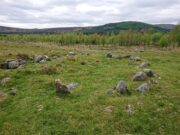
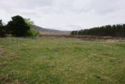
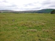
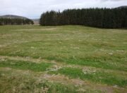
Despite being initially difficult to make out (as the photos here indicate), once your eyes have adjusted to the landscape morphology, you realise what an impressive prehistoric complex you’re wandering through.  Saying that, it’s primarily a site that’s gonna be of interest to antiquarians, archaeologists and historians, as this is a settlement you’re looking at, lacking in megaliths, petroglyphs and similar ritual sites.

First enclosure, through the gate on your right
Cairn in the meadows

The first site that you’ll probably notice is visible from the road—but it’s not the first part of the settlement that you’ll pass.  Immediately through the gate (as I’ve said) is the embanked rise of earth—only one or two feet high—making up the first notable hut circle (NO 36612 70453), measuring roughly 15 yards across.  The shape and form of this circle typifies the others in the arena ahead of you, so that once you’ve made yourself aware of what this one looks like, you’ll be able to see the others with greater ease.  Another low embanked circle of roughly the same size is just a few yards away at NO 36605 70439.

Straight back onto the track you’ll notice another larger D-shaped enclosure immediately on your left (NO 36622 70406), about 17 yards across; this is accompanied by what looks like a cairn immediately right of the track (NO 36609 70413), but this is actually a much smaller D-shaped enclosure, just right for one or two people.

The small rounded hill in front of you has what may be a circular enclosure on its top, but I wasn’t too sure about it.  But looking down from this hill is the most visible of all the structures in the settlement (NO 36580 70307)—and the one I mentioned as being visible from the road.  At first it’s a little deceptive in appearance, as you get the impression that the oval of stones (top photo) is what constitutes this hut circle, when in fact this element may be mediaeval in nature as it’s been built on top of an earlier Iron Age (?) enclosure.  You can barely see this earlier form at ground level, so it’s best to walk back up the rounded hillock and cast your gaze back and forth and round the side of the ring of stones.  You’ll see, eventually, the shallow overgrown walling of a larger oval-shaped enclosure, measuring eighteen yards across, whose edges start from the bottom of the hillock and arc around to the outer edges of the stone construction.

Hut circle, NO 36573 70230

Back onto the track and further into the meadows, the next hut circle you’ll meet is (keep your eyes peeled) right by the track-side (NO 36573 70230).  It has wide embanked walls that are low to the ground and completely overgrown, measuring 15 yards (E-W) by 18 yards (N-S), with what looks to be the original entrance or door on its south-side.  A similar large circle exists on the other side of the track a little bit further along (NO 36499 70138).

There’s much more to this settlement, including lengths of walling in the grasslands below the last two circles and where, if you look carefully, you’ll see one of at least two cairns in this area.  On the other side of the road are one or two other small hut circles and a much larger construction in the field further down the road, measuring 25 yards in length (NO 36569 70481).  This would seem to be the largest of the lot.

The age of this settlement probably covers a considerable period of time: beginning perhaps in the Bronze Age, certainly in the Iron Age and all the way through into the mediaeval period where, all down Glen Clova, remnants of such hamlets still live beneath the soil.  This entire arena is bathed in silence, save the wind and call of the birds.  Tis a beautiful space to spend a few endless hours…

© Paul BennettThe Northern Antiquarian

Holy Well, Nether Heyford, Northamptonshire

Holy Well (lost):  OS Grid Reference – SP 66 59 (approximate)

Archaeology & History

In George Baker’s (1822) massive regional history work he spoke of the village being “well supplied with springs, one of which, called Holywell, is medicinal.”  But it would seem to have fallen foul of that thing called progress, as no one has spoken of it since then.  When the Northampton historian, Beeby Thompson, looked for the site early in the 20th century, his enquiries drew a blank and he reported simply that “at the present time no one in the village appears to know of such a well.”  A field-name survey of the area may prove worthwhile…

References:

  1. Baker, George, The History and Antiquities of the County of Northampton, J.B. Nichols: London 1822.
  2. Harte, Jeremy, English Holy Wells – volume 2, HOAP: Wymeswold 2008.
  3. Thompson, Beeby, “Peculiarities of Waters and Wells,” in Journal Northamptonshire Natural History Society, volume 17, 1914.

© Paul BennettThe Northern Antiquarian

Holy Well, Aston, Oxfordshire

Holy Well:  OS Grid Reference – SP 35833 02611

Archaeology & History

‘Spring’ marks the holy well

First mentioned as the field-name Holywellefield in the Court Roll of 1432, there is a possibility that this seemingly lost site still exists.  It was mentioned briefly in John Giles’ (1848) old history book of the area where he told us that, “a field beyond Cote House on the road to Shifford is still called ‘Holy-well field’, (but) no legend has been recorded.”

If we go 400 yards northeast across the field on the other side of the road from Cote House, a “Spring” that was shown on the early OS-maps would still seem to be actively feeding a dyke that runs roughly north from here.  This is probably the holy well that was described in those Court Roll records—and it still seems to exist.

References:

  1. Gelling, Margaret, The Place-Names of Oxfordshire – volume 2, Cambridge University Press 1954.
  2. Giles, J.A., History of the Parish and Town of Bampton, privately published: Bampton 1848.

Acknowledgements:  Huge thanks for use of the Ordnance Survey map in this site profile, reproduced with the kind permission of the National Library of Scotland

© Paul BennettThe Northern Antiquarian

Chalybeate Well, Inverkeithing, Fife

Healing Well:  OS Grid Reference – NT 1486 8466

Archaeology & History

Site shown on 1856 map

This little-known iron-bearing spring takes some finding!  It’s all but lost beneath a mass of invasive rhododendrons that cover the slopes here (it needs to be severely cut back) and will only be found by the truly adventurous amongst you.  In notes of this site by Ordnance Survey in 1854, they told that “there was formerly a fountain to protect the Spring, but the fountain has been allowed to go to ruin” and I could see no remnants here on my visit.

In a detailed and lengthy analysis of the spring water that was done by W. Robertson in 1829, the principal minerals in it were found to be iron, magnesia and lime, but the spring was said to have no medicinal renown locally.

References:

  1. Robertson, W., “Analysis of the Water of a Spring on the Estate of Fordel near Inverkeithing,” in Edinburgh New Philosophical Journal (ed. Robert Jameson), volume 14, 1829.

Acknowledgements:  Huge thanks for use of the Ordnance Survey map in this site profile, reproduced with the kind permission of the National Library of Scotland

© Paul BennettThe Northern Antiquarian

St. Bride’s Well, Traquair, Peeblesshire

Holy Well (destroyed):  OS Grid Reference – NT 3190 3339

Also Known as:

  1. St Bryde’s Well

Archaeology & History

Site shown on 1858 map

Two hundred years ago, located halfway between Traquair’s present parish church and that of the demolished (apparently) 12th century church of St. Bride to the southwest, were the flowing waters of this once sacred water source.  But it’s long since been destroyed.  It was drained sometime prior to when the Ordnance Survey lads came here in 1856 and its water taken to supply the nearby manse.  Subsequent surveys by the Royal Commission (1967) and Mr & Mrs Morris (1982) affirmed its demise.  It was listed in the early Scottish holy well surveys, without comment, and I can find no local history accounts of the place.

References:

  1. Hallen, A.W. Cornelius, “Holy Wells in Scotland,” in The Scottish Antiquary, volume 9, 1895.
  2. Morris, Ruth & Frank, Scottish Healing Wells, Alethea: Sandy 1982.
  3. Royal Commission on the Ancient & Historical Monuments, Scotland, Peeblesshire – volume 2, Aberdeen University Press 1967.
  4. Walker, J. Russel, “‘Holy Wells’ in Scotland,” in Proceedings of the Society of Antiquaries of Scotland, volume 17,, 1883.

Acknowledgements:  Huge thanks for use of the Ordnance Survey map in this site profile, reproduced with the kind permission of the National Library of Scotland

© Paul BennettThe Northern Antiquarian

Caesar’s Well, Wimbledon, London, Surrey

Sacred Well:  OS Grid Reference – TQ 2237 7151

Also Known as:

  1. Robin Hood’s Well
  2. Roman Well
  3. Springpond Well

Getting Here

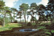
Caesar’s Well in the late-60s

There are numerous ways to get here from all directions: i) from the west-side of Wimbledon Common, on the Robin Hood’s Way A3 road, keep your eyes peeled for the small crossroad  of Robin Hood Lane and Road, obivously taking the one into the park. Keep on the dead straight Robin Hood Ride path until your hit the carpark ¾-mile on; and from here, bear sharp left (NW) for 250 yards or so, where a small slope down on your left takes you there; or, ii) from Wimbledon village side on the A219 Parkside A219 road, where the War Memorial stands, head onto the Common along The Causeway, past the Fox & Grapes going on Camp Road, then up the Sunset Road towards the carpark.  And then, once again go NW for 250 yards or so, where the small slope on your left takes you there.  You’ll find it.

Archaeology & History

Described by William Bartlett (1865) as “the never-failing spring of water, improperly called the Roman Well”, its constant flow was severely tested in the great drought of 1976—and it kept on flowing.  Only just though!  It was highlighted on the early Ordnance Survey map with the plain name of the Springpond Well.  The great historian and folklorist Walter Johnson (1912) gave us the best historical resumé of the site, telling that,

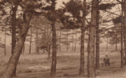
Caesar’s Well around 1900
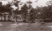
Caesar’s Well around 1911

“Caesar’s Well, formerly known as Robin Hood or Roman Well—the Springpond Well on the Ordnance Map—issues on the other side of the little watershed above mentioned, at a height of 149 feet O.D.  The well lies in a little hollow, now ringed with Scottish pines. The gathering ground is the land to the east, rising to 198 feet O.D. This area is not large, but quite sufficient to maintain a permanent rill of pure water.  The well, the waters of which once were deemed of special medicinal merit, was enclosed with brick in 1829, and, as the inscription tells us, refaced with granite blocks by Sir Henry W. Peek, M.P., in 1872.  The outflowing waters descend to Brickfield Cottage, where they expand into a turbid duckpond; thence the course is through the yard behind the house, and along the north side of Robin Hood Road to Brook Cottage.  During 1911 the “Well” proper altogether dried up, but water still issued from the stand spout a few yards below, which is supplied by an artificial boring and pipe that tap the spring at a depth of 18 feet.”

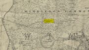
Site shown on the 1874 map

The proximity of this never-failing spring to the huge prehistoric enclosure of Caesar’s Camp just a few hundred yards to the south would indicate it was an important water source in Bronze Age times and, I’d hazard, would have been bestowed with some sanctity, as many such wells tended to be.

Folklore

James Rattue (2008) informed us that the name Robin Hood’s Well was known here in the 18th century prior to it being known as Caesar’s Well, but there seems to be no known relationship between Robin Hood and this site.  However, a piece written in 1922 told that there was a lingering tradition that Julius Caesar encamped on Wimbledon Common in 51 BCE and that this folk memory was kept alive in the lore of local children who devoutly believed that the great Roman Emperor drank from the cool depths of this well.

References:

  1. Bartlett, William A., The History and Antiquities of the Parish of Wimbledon, Simpkin Marsall: London 1865.
  2. Hughes, John L., “Caesar’s Well, Wimbledon Common,” in Source magazine, no.9, Spring 1989.
  3. Johnson, Walter, Wimbledon Common – Its Geology, Antiquities and Natural History, T.Fisher Unwin: London 1912.
  4. Rattue, James, Holy Wells of Surrey, Umbra: Weybridge 2008.

© Paul BennettThe Northern Antiquarian

Balsamic Well, Hoxton, London

Healing Well (destroyed):  OS Grid reference – TQ 330 827

Also Known as:

  1. Balsamick Well

Archaeology & History

In that typically rambling style beloved of early writers on medicinal springs, Timothy Byfield (1687) narrated the tale of uncovering this well in an almost alchemical discourse.  It was located when digging out the cellar of a house near Charles Square in the 1680s.  Upon investigation, the waters were found to possess a good quantity of sulphur and a small amount of iron, leading Byfield to proclaim it could cure a whole army of medical disorders, from cleaning out blockages in the alimentary canal, to treating kidney stones, scurvy, ulcers, headaches, migraines and more.  If used correctly and in the right amount,

” There is,” he says, “no unwholesome glebe (concretion) or any dangerous mineral or metal (in them) that casts one unhappy ray into this healing fountain.” On the contrary, they set up ‘* such a pretty bustle or ferment in nature that makes gay a well-temper’d Healthy Body.”

In the early days when Spa Wells were in vogue, the Balsamic Well became a competitor to the nearby St Agnes le Clear Well, which is probably the reason why one doctor dissuaded the toffs of the time to avoid it!

The waters possessed a slight vinegar-esque flavour—hence the name.  In John MacPherson’s (1871) work, he described it as a “chalybeate well” and despite it having that typical “bituminous scum on it, strange to say,” it yielded “a pleasant aromatic flavour.”  The site has long since been covered over.

References:

  1. Byfield, Timothy, A Short and Plain Account of the late-found Balsamick Wells at Hoxdon, London 1687.
  2. Foord, Alfred Stanley, Springs, Streams and Spas of London: History and Association, T. Fisher Unwin: London 1910.
  3. Hembry, Phyllis, The English Spa 1560-1815, Athlone Press: London 1990.
  4. MacPherson, John, Our Baths and Wells, MacMillan: London 1871.
  5. Sunderland, Septimus, Old London Spas, Baths and Wells, John Bale: London 1915.

© Paul BennettThe Northern Antiquarian

Town Cross, Kendal, Westmorland

Cross (destroyed):  OS Grid reference – SD 5152 9280

Also Known as:

  1. Cold Stone
  2. Market Cross

Archaeology & History

Not to be confused with the carved cross fragments held in the local church, this old town cross has long since gone.  It’s existence was recorded by the great Kendal historian Cornelius Nicholson (1861), but even in his day, this “obstruction” as he called it, was no longer standing.  Known as the local Market Cross where all the wheeling and dealing took place—official ones, as well as the not-so-official works of local folks—it stood just off Stricklandgate,

“opposite the Covered Market, and was an obstruction in the street.  There still remains a remnant of it in a stone at the corner, vulgarly called “cold stone,” where the charters and so forth were usually proclaimed.  Cold stone is a corruption of “call stone;” an appendage common to most ancient towns, where all public matters were “called” prior to the “institution” of belman.”

This folk etymology of “cold” needs to kept in mind when we come across other stones of this name.  …The earliest record of a market held at Kendal is from 1402, but written records of the Market Cross are scant until 1714. Such edifices tend to be architecturally ornate, but we have neither sketches nor descriptions of this lost site and must await the work of fellow researchers who may hopefully find out more.

References:

  1. Nicholson, Cornelius, The Annals of Kendal, Whitaker & Co.: London 1861.
  2. Smith, A.H., The Place-Names of Westmorland – volume 1, Cambridge University Press 1967.

© Paul BennettThe Northern Antiquarian