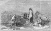
St. Patrick’s Well, Old Kilpatrick, Dumbartonshire

Holy Well (destroyed):  OS Grid Reference – NS 4631 7307

Also Known as:

  1. Trees’ Well

Archaeology & History

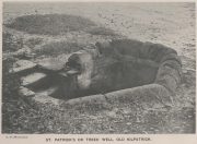
Photo of the Well in 1893

Sadly there are no longer any remains of this holy well which was found, “beside the church dedicated to St Patrick — which was said to be built on soil brought from Ireland in honor of its patron,” wrote John Bruce in 1893.  He told that its waters had “been used until lately from time immemorial by the villagers, but now has been found unfit for use and consequently ordered to be closed up.”  Although its waters were used for baptisms, he made no mention of any medicinal repute, which it surely would have possessed.

Site of well on 1939 map

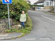
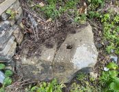
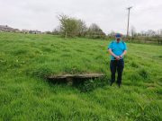
The original position of the well, according to Mr Bruce, was “adjoining the church” but, according to the Ordnance Survey lads, when they came here in 1963 they located a drinking fountain on the other side of the road about 80 yards to the west and designated that as being St Patrick’s Well.  The place had earlier been given a wooden sign saying “St Partrick’s Well.”  Local tradition attributes St. Patrick as originally coming from this village, whose saint’s day is March 17.

The place was also known as Trees’ Well, suggestive, perhaps, of a local person, although I can find no reference as to who or what that might have been.

References:

  1. Bruce, John, The History of the Parish of West or Old Kilpatrick,  John Smith: Glasgow 1893.

Acknowledgements:  Huge thanks for use of the Ordnance Survey map in this site profile, reproduced with the kind permission of the National Library of Scotland

© Paul BennettThe Northern Antiquarian

Atis Cross, Flint, Flintshire

Cross (destroyed):  OS Grid Reference – SJ 2534 7208

Archaeology & History

Actual location of the cross

This long-gone site, described in the Domesday Record of 1086 as Atiscros Hund, (or “hundred”, which is the word given to an administrative division of land which, at that time, was on the western edge of Cheshire bordering Wales), gained its title from an old English personal name, Æti.  The fact that it stood on an ancient boundary and was included in Domesday, means it would have been a stone cross.  Its location was shown on the 1871 Ordnance Survey map (and several subsequent ones), based on traditional accounts about its position.  The site is still preserved in local street-names.

Referring to the monument itself, Thomas Pennant (1796) said that it still existed in his day, telling that,

“A cross stood there, the pedestal of which I remember to have seen standing. There is a tradition that, in very old times, there stood a large town at this place; and, it is said, the foundations of buildings have been frequently turned up by the plough.”

References:

  1. Dodgson, J.M., The Place-Names of Cheshire – volume 4, Cambridge University Press 1972.
  2. Pennant, Thomas, The History of the Parishes of Whiteford and Holywell, B. & J. White: London 1796.
  3. Taylor, Henry, Historic Notices, with Topographical and other Gleanings Descriptive of the Borough and County-Town of Flint, Elliot Stock: London 1883.

© Paul BennettThe Northern Antiquarian

Tree Root Well, Liversedge, West Yorkshire

Healing Well:  OS Grid Reference – SE 19898 23679

Archaeology & History

Tree Root Well, 1908 map

Along with the nearby Attack Well and Balk Well, this was one of three water supplies for the people of Middle Gate between Hightown and Liversdge in the 19th century.  Found near the bottom of the old track known as Tanhouse Lane, its waters emerged at the base of some Victorian walling that’s built into the hillside, above which are the decayed remains of what seems to be an old hawthorn tree, whose roots obviously reached down to the stone trough, giving the place its name.  Its waters have long since dried up and fallen back to Earth.  Although it is shown on the 1908 OS-map of the region, I can find no virtues ascribed to the well nor any local history notes.

Acknowledgements: Huge thanks to the great Gary Ferner, for help in locating the site and the day’s venture!

© Paul BennettThe Northern Antiquarian

St. Giles’ Well, Lightcliffe, West Yorkshire

Holy Well (lost):  OS Grid Reference – SE 134 245

Archaeology & History

Giles’ House to centre

In times gone by there was a singular St.Giles’ Well in the old village of Lightcliffe, but the only reference we have of it is from one of James Parker’s works (1904) where, in his description of St. Giles’ House, he tells, “It derives its name from an ancient well, called ‘St. Giles’ Well,’ which once existed near to the house, and was dedicated to St. Giles”: an 8th century Greek prince who left everything to become a hermit. He lived on wild herbs and developed the ability to cure rheumatism (perhaps a curative aspect of the well), cripples and help beggars. He is the patron saint of woodlands and his symbol is the arrow gained after he healed a wounded doe shot by one (the mass of Robin Hood folklore in this area may have something to do with this symbolism).  His date is September 1.

A.H. Smith (1963) cites the “local tradition that it is named from a well dedicated to St. Giles,” but thinks this attribution to be an unlikely one.  As can be seen on the accompanying map, a great number of wells are in this area, none of them named, with one just below the said Giles House.

References:

  1. Parker, James, Illustrated History from Hipperholme to Tong, Percy Lund: Bradford 1904.
  2. Smith, A.H., The Place-Names of the West Riding of Yorkshire – volume 3, Cambridge University Press 1961.

Acknowledgements:  Huge thanks for use of the Ordnance Survey map in this site profile, reproduced with the kind permission of the National Library of Scotland

© Paul BennettThe Northern Antiquarian

Holy Well, Shoreditch, London

Holy Well (destroyed):  OS Grid reference – TQ 3337 8245

Archaeology & History

Holywell Lane on 1877 map

First described at the beginning of the 12th century as “fons qui dicitur Haliwelle“, these sacred waters were thereafter described in a variety of documents before eventually, in 1382, giving its name to the road on which it was found.  When the topographer John Stow (1603) described the well—along with those of St. Clement’s and Clerken Well—it was once “sweet, wholesome, and clear” and “frequented by scholars and youths of the city in the summer evenings.”  However, in his day it was already in decline, as he told that the “Holy well is much decayed and spoiled, with filthiness purposely laid there, for the heightening of the ground for garden plots.”

The history of the site was mentioned in John Noorthouck’s (1773) survey, where he told us:

“In the parish are two prebends, and part of a third, belonging to St Paul’s cathedral, in the city of London: The first dominated by Eald-Street, or Old Street, received that appellation from the Saxons being part of the Roman military way: the second, which had been a separate village for many years, by the name of Hochestone, vulgarly Hoxton, likewise itself to be of a Saxon origin: the third called Haliwell, had its name from a vicinal fountain, which, for the salubrity of its water, had the epithet Holy conferred on it.

In King John’s Court, Holywell-lane, are to be found the ruins of the priory of St. John Baptist, of Benedictine nuns, founded by Robert the son of Gelranni, prependary of Haliwell, and confirmed by charter of Richard I in the year1189. It was rebuilt in the reign of Henry VII by Sir Thomas Lovell, knight of the garter; who was there buried: and the following ditty was in consequence painted in most of the windows.
“All the nuns of Holywell,
“Pray for the soul of Thomas Lovell.”

The complete demise of the well occurred in the early part of the 19th century and efforts to locate its original position have proved troublesome.  Indeed, the modern Holywell Lane would seem  to be little more than an approximation of its whereabouts.  It was an issue explored at some length in the great A.S. Foord’s (1910) magnum opus, who wrote:

“In recent times efforts have been made to locate the well, and some of the results communicated to Notes and Queries.  A Mr. R. Clark drew attention, through the medium of that publication, to an article in The Builder of September 19, 1896, which states that ”the ancient holy well should be looked for in the area between Bateman’s Row and New Inn Yard and behind the Board School in Curtain Road, that is to say, west of New Inn Street.”  This is all very circumstantial, but the writer bases his statement on the survey by Peter Chassereau, taken in 1745, in which the supposed position of the well is marked by a cross and the words “Ye well from which the liberty derives its name.”  It should be borne in mind however that, as pointed out by Colonel W. F. Prideaux, Chassereau did not make his survey till more than two hundred years had elapsed from the date of the dissolution of the Nunnery (1539); the position of the well could therefore have been only a matter of tradition.  Another contributor to Notes and Queries (8th Series, May 22, 1897), quotes an article in the Journal of the Royal Institute of British Architects (vol. iv., 3rd series, p. 237), by Mr. E. W. Hudson, who says that the well of the priory was situate on the south side of what is known as Bateman’s Row, but was formerly (before 1799) called Cash’s Alley, near Curtain Road.  This agrees substantially with Mr. Clark’s statement.  Mr. Lovegrove, writing in 1904, says: “The well itself is to be found in a marble-mason’s yard in Bateman’s Row, but is covered over.”  The same writer notes that of the Nunnery buildings only a piece of stone wall about 50 feet long, in a timber yard at 186, High Street, Shoreditch, is now left.”

References:

  1. Foord, Alfred Stanley, Springs, Streams and Spas of London: History and Association, T. Fisher Unwin: London 1910.
  2. Gover, J.E.B., Mawer, Allen & Stenton, F.M., The Place-Names of Middlesex, Cambridge University Press 1942.
  3. Lovegrove, G.H., “Holywell Priory, Shoreditch,” in Home Counties, volume 6, 1904.
  4. Mills, A.D., A Dictionary of London Place-Names, Oxford University Press 2001.
  5. Noorthouck, John, A New History of London, Including Westminster and Southwark, R. Baldwin: London 1773.
  6. Stow, John, A Survey of London, John Windet: London 1603.
  7. Sunderland, Septimus, Old London Spas, Baths and Wells, John Bale: London 1915.
  8. Wood, Alexander, Ecclesiastical Antiquities of London, Burns & Oates: London 1874.

© Paul BennettThe Northern Antiquarian

Organn Well, Pontefract, West Yorkshire

Healing Well (destroyed):  OS Grid Reference – SE 45 21

Archaeology & History

The waters of the once-renowned Organn Well goes down in history as being one of the first wells in Britain whose waters were used in a town pump.  Written minutes from an early council meeting described how people gathered in the market place to discuss the objective of making such a pump in the times of Queen Elizabeth 1, in 1571.  It was completed a year later and, some 450 years on, this old relic can still be seen.  The Well used to be found off Penny Lane (now Wakefield Road), some 4-500 yards to the southwest and as such it’s exact position has been difficult to locate.  But the fact that the waters were piped such a distance strongly suggests that the water supply from the Well was damn good – and most probably damn refreshing too!  The old charter told us, in that wonderfully dyslexic manner of the period,

…that a conduit in the Markett Place with lead pipes leading to water from Organ Well to the said conduit shall bee cleansed and repayred at the charge and contribution of severall inhabitants of the Towne and espetially by those that fetch water from the same conduit. And according to the auncient custome of the said Towne, whoe shall not beare theire p’t of the chardge p’portionable to what water they from the same at the discretion of the Majo’ for the time being and his brethren shall be debarred from the benefitt of the said conduit except they shall be poore people.  And likewise that none shall receive any water from the said conduite for to brewe or steep barley w’thall at such time or times as others have need the same for meat water and water to washe w’hall, but onely at such times as there is water to spare over and besides what is convenient for meat and washing.”

More than two hundred years later the water pump was in dire need of attention, as George Fox (1827) told:

“Being in a ruinous state about the year 1810 and the supplies of water being insufficient for the public use; a clause was inserted in the act of parliament… wherein the pump, its pipes, and all other appurtenances belonging to it were vested in the power of the commissioners of the streets, who where bound to see it kept in proper repair.”

And so the water from the Organn Well continued to supply the townsfolk.

The etymology of this well—along with another of the same name near Harrogate—truly puzzled me for a long time; that was until I came across, quite by accident, records from early texts on herbalism.  As a result, it seems very likely that it derives its name from the old English ‘organe,’ which, according to Stracke (1974) and others relates to both varieties of the indigenous herb marjoram (Origanum vulgare and O.marjorana) — a grand medicinal plant that’s pretty common in northern England (I used to go out gathering it each year in my younger days).  There were obviously profuse supplies of this herb growing in and around the well and, as all good herbalists will tell you, when they grow by an old spring or well, their medicinal properties are much better than normal.  The waters and the plant obviously had a good symbiosis; or, as the old women who’d collect the waters and the herbs in days prior to the pump would have told us, “the spirits of the water here are good”…

References:

    1. Fox, George, The History of Pontefract in Yorkshire, J.Fox: Pontefract 1827.
    2. Padgett, Lorenzo, Chronicles of Old Pontefract, Oswald Homes: Pontefract 1905.
    3. Stracke, J. Richard (ed.), The Laud Herbal Glossary, Rodopi: Amsterdam 1974.

© Paul BennettThe Northern Antiquarian

St. Helen’s Well, Maybole, Ayrshire

Holy Well (covered):  OS Grid Reference – NS 31322 13423

Archaeology & History

Site on the 1860 OS-map

In spite of this site being covered over some time in the 1950s, it is still retained on the modern Ordnance Survey maps.  It was shown on the first one in 1860, but its literary history goes back much further.  We find it described by the Minister for Maybole — one William Abercrummie — in his short 17th Century work named A Description of Carrict.  He noted several springs in Maybole township, with this one of possessing the usual hallmarks of both christian and peasant customs alike:

“Another spring there is called St. Helens well or by a curt pronuntiation St. Emus for St. Antonies well, it is about a myle and ane halfe from Mayboll on the road to Aire a litle north of Balachmont.  It is famous for the cure of unthriving children, to which at the change of the quarter especially at May-day there is a great resort of people from all quarters, and at a good distance.”

This piece was repeated in several 19th century works, including one by William Roberston (1891), who commented on the traditions themselves, saying:

“This can unquestionably be traced as a remnant of the ancient superstition that miracles were wrought at Holy Wells; which all the anathemas of the Reformed Kirk could not for a time obliterate from the minds of the common people.  The records of the Kirk-session bear witness to the prevalence of applying to Saints’ Wells for the cure of bodily infirmities on stated occasions; particularly, when the Saint or Angel was understood to ‘move the waters.’  Pins, pieces of the dress of the patient, or such small trifles, were left at the well – the remains, no doubt, of the offerings formerly made to the Clergy – and in token that the disease was transferred from the sufferer to the rags, thus offered to the Genius loci.  Numerous traces of this prevailing superstition could easily be cited.”

When the Ordnance Survey dudes wrote about the site in the Name Book in 1857, all they could tell us was that it was, “a beautiful spring of excellent water” but was said to have “no medicinal properties.”

Despite this sacred well now being covered over, there is surely a case to be made here for it to be restored back to its former glory, for all to visit and see.  Local historians, pagans and Christians alike — join forces and gerrit sorted!

References:

  1. MacKinlay, James M., Folklore of Scottish Lochs and Springs, William Hodge: Glasgow 1893.
  2. Mitchell, Arthur (ed.), Geographical Collections Relating to Scotland Made by Walter Macfarlane – volume 2, T. & A. Constable: Edinburgh 1906.
  3. Robertson, William, Historic Ayrshire; Being a Collection of Historical Works Treating of the County of Ayr, Thomson Brothers: Edinburgh 1891.
  4. Walker, J. Russel, “‘Holy Wells’ in Scotland,” in Proceedings of the Society of Antiquaries of Scotland, vol.17 (New Series, volume 5), 1883.

Acknowledgements:  The map accompanying this site profile is Reproduced with the kind permission of the National Library of Scotland

© Paul BennettThe Northern Antiquarian

St. Helen’s Well, Hartlepool, Durham

Holy Well (destroyed):  OS Grid Reference – NZ 5236 3421

Also Known as:

  1. Freemen’s Well

Archaeology & History

Highlighted on the 1861 OS-map of the area, there is a curious lack of reference to this holy well until Cuthbert Sharp wrote about it in 1816.  Records of an adjacent St. Helen’s Chapel are in plentiful supply, going all the way back to around 1200 CE—although it’s pretty obvious that a water supply would be attached to the chapel, despite its late literary account.   Sharp told us:

“This chapel is stated to have been on the warren.  According to local tradition, a church once stood near the Freemen’s or St. Helen’s Well, in the Far-well Field, where the ground at present is considerably elevated, and where many hewn stones are constantly discovered, which renders it highly probable that this was the site of the chapel in question.”

Site shown on 1861 OS map
Site on the 1862 Town plan

When Robert Surtees visited here in 1823, the well was still visible, but remains of the chapel were negligible.  On the 1862 Hartlepool Town map, it would seem that a construction—perhaps a well-house—covered the waters, although whatever it may have been seems to have been destroyed sometime in the 1880s, when the entire area was built over.  No remains of this sacred site have been seen since.

References:

  1. Cuthbert Sharp, A History of Hartlepool, Francis Humble: Durham 1816.
  2. Surtees, Robert, The History and Antiquities of the County Palatine of Durham (4 volumes), London 1816-40.

Acknowledgements:  The map accompanying this site profile is Reproduced with the kind permission of the National Library of Scotland

© Paul BennettThe Northern Antiquarian

Wheen, Glen Clova, Angus

Settlement:  OS Grid Reference – NO 3661 7044

Getting Here

Section of a hut circle

From Kirriemuir town centre up the B956 Kinnordy Road, turn left where it goes along the B955 road for several miles towards Cortachy, following the same route as if you’re going to the curious Whitehillocks stone circle.  Literally two miles (3.2km) along the road past Whitehillocks farmhouse, a large “parking” spot is at the right-hand side of the road.  From here, walk along the road for 230 yards and go thru the gate on your left.  The first low-rise hut circle is to your immediate right; and from here, meander along the track ahead of you, keeping your eyes peeled…

Archaeology & History

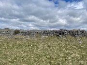
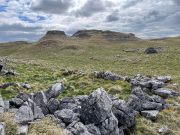
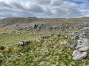
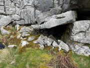
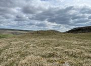
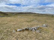
Despite being initially difficult to make out (as the photos here indicate), once your eyes have adjusted to the landscape morphology, you realise what an impressive prehistoric complex you’re wandering through.  Saying that, it’s primarily a site that’s gonna be of interest to antiquarians, archaeologists and historians, as this is a settlement you’re looking at, lacking in megaliths, petroglyphs and similar ritual sites.

First enclosure, through the gate on your right
Cairn in the meadows

The first site that you’ll probably notice is visible from the road—but it’s not the first part of the settlement that you’ll pass.  Immediately through the gate (as I’ve said) is the embanked rise of earth—only one or two feet high—making up the first notable hut circle (NO 36612 70453), measuring roughly 15 yards across.  The shape and form of this circle typifies the others in the arena ahead of you, so that once you’ve made yourself aware of what this one looks like, you’ll be able to see the others with greater ease.  Another low embanked circle of roughly the same size is just a few yards away at NO 36605 70439.

Straight back onto the track you’ll notice another larger D-shaped enclosure immediately on your left (NO 36622 70406), about 17 yards across; this is accompanied by what looks like a cairn immediately right of the track (NO 36609 70413), but this is actually a much smaller D-shaped enclosure, just right for one or two people.

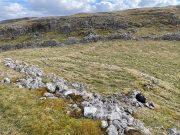
The small rounded hill in front of you has what may be a circular enclosure on its top, but I wasn’t too sure about it.  But looking down from this hill is the most visible of all the structures in the settlement (NO 36580 70307)—and the one I mentioned as being visible from the road.  At first it’s a little deceptive in appearance, as you get the impression that the oval of stones (top photo) is what constitutes this hut circle, when in fact this element may be mediaeval in nature as it’s been built on top of an earlier Iron Age (?) enclosure.  You can barely see this earlier form at ground level, so it’s best to walk back up the rounded hillock and cast your gaze back and forth and round the side of the ring of stones.  You’ll see, eventually, the shallow overgrown walling of a larger oval-shaped enclosure, measuring eighteen yards across, whose edges start from the bottom of the hillock and arc around to the outer edges of the stone construction.

Hut circle, NO 36573 70230

Back onto the track and further into the meadows, the next hut circle you’ll meet is (keep your eyes peeled) right by the track-side (NO 36573 70230).  It has wide embanked walls that are low to the ground and completely overgrown, measuring 15 yards (E-W) by 18 yards (N-S), with what looks to be the original entrance or door on its south-side.  A similar large circle exists on the other side of the track a little bit further along (NO 36499 70138).

There’s much more to this settlement, including lengths of walling in the grasslands below the last two circles and where, if you look carefully, you’ll see one of at least two cairns in this area.  On the other side of the road are one or two other small hut circles and a much larger construction in the field further down the road, measuring 25 yards in length (NO 36569 70481).  This would seem to be the largest of the lot.

The age of this settlement probably covers a considerable period of time: beginning perhaps in the Bronze Age, certainly in the Iron Age and all the way through into the mediaeval period where, all down Glen Clova, remnants of such hamlets still live beneath the soil.  This entire arena is bathed in silence, save the wind and call of the birds.  Tis a beautiful space to spend a few endless hours…

© Paul BennettThe Northern Antiquarian

Holy Well, Nether Heyford, Northamptonshire

Holy Well (lost):  OS Grid Reference – SP 66 59 (approximate)

Archaeology & History

In George Baker’s (1822) massive regional history work he spoke of the village being “well supplied with springs, one of which, called Holywell, is medicinal.”  But it would seem to have fallen foul of that thing called progress, as no one has spoken of it since then.  When the Northampton historian, Beeby Thompson, looked for the site early in the 20th century, his enquiries drew a blank and he reported simply that “at the present time no one in the village appears to know of such a well.”  A field-name survey of the area may prove worthwhile…

References:

  1. Baker, George, The History and Antiquities of the County of Northampton, J.B. Nichols: London 1822.
  2. Harte, Jeremy, English Holy Wells – volume 2, HOAP: Wymeswold 2008.
  3. Thompson, Beeby, “Peculiarities of Waters and Wells,” in Journal Northamptonshire Natural History Society, volume 17, 1914.

© Paul BennettThe Northern Antiquarian