Standing Stone: OS Grid Reference – NT 15061 20292
Also Known as:
-
Meggat Stane
Archaeology & History

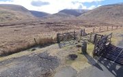
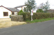
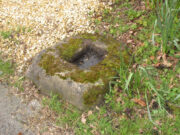
This curiously-named and barely frequented Megget Stane has seen better days. Found in the middle of a veritable nowhere, when Duncan Fraser (1901) first wrote about it there was only a solitary pathway running between these uninhabited glens, with this old stone standing as a solitary sentinel—albeit a not very grand one! It’s present position at the roadside was given it following a forced removal into a nearby ditch, when the old Edinburgh District Water authority who built the Talla Reservoir a couple of miles away all but destroyed it! On one of Mr Fraser’s many visits, in August 1899, he found what he called his “old friend…lying among the heather broken into three pieces.”
“I frankly confess that this wanton act of vandalism filled me with the deepest indignation,” he wrote—and so he sought to redress the situation and find out who’d damaged the old stone. It transpired that,
“The Edinburgh District Water Trust had a few months before this time purchased from Lord Wemyss the ground at the head of Meggat, which slopes down to Talla. In marking off their new possession, the Trust had run a strong five-barred wire fence along the march, and as Meggatstane stood on the line, why, Meggatstane was bound to go!”
He contacted a local farmer and, between them, they protested to the water company who, eventually, fixed the pieces of the stone back together and erected it in the position that we see today, very close to its original spot. Prior to it being damaged, Fraser told that it stood four feet tall, but when cementing it all back together again, some of its original size was lost.
Its history and legends had been forgotten even in his day and despite enquiries with other local wanderers, all that was ever told of it were variants on it standing hereby since time immemorial. For my part, I’m somewhat sceptical about it having a prehistoric provenance, despite the Royal Commission (1957) lads suggesting a Bronze Age origin—but that’s just my own feeling on the place. I’m more inclined to see this as an early mediaeval stone—but would love to be wrong. It may, perhaps, even date from Viking times…..
Fraser told us an intriguing note when the stone was eventually re-assembled,
” I was interested to learn that when they dug to the bottom of the stone, they found the part underground covered with certain runic-like characters.”
These don’t appear to have been seen since.
References:
- Fraser, Duncan, “Meggatstane – An Incident in a Riverside Ramble,” in Border Magazine, volume 6, no.70, November 1901.
- Royal Commission Ancient & Historic Monuments, Scotland, An Inventory of the Ancient and Historical Monuments of Selkirkshire, HMSO: Edinburgh 1957.
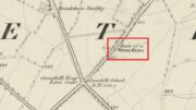
Acknowledgements: Huge thanks for use of the Ordnance Survey map in this site profile, reproduced with the kind permission of the National Library of Scotland.
© Paul Bennett, The Northern Antiquarian
The map could not be loaded. Please contact the site owner.


