St. Cuthbert’s Well, Leith, Midlothian

Holy Well (destroyed):  OS Grid Reference – NT 2611 7600

Also Known as:

  1. Bonnington Mineral Well

Archaeology & History
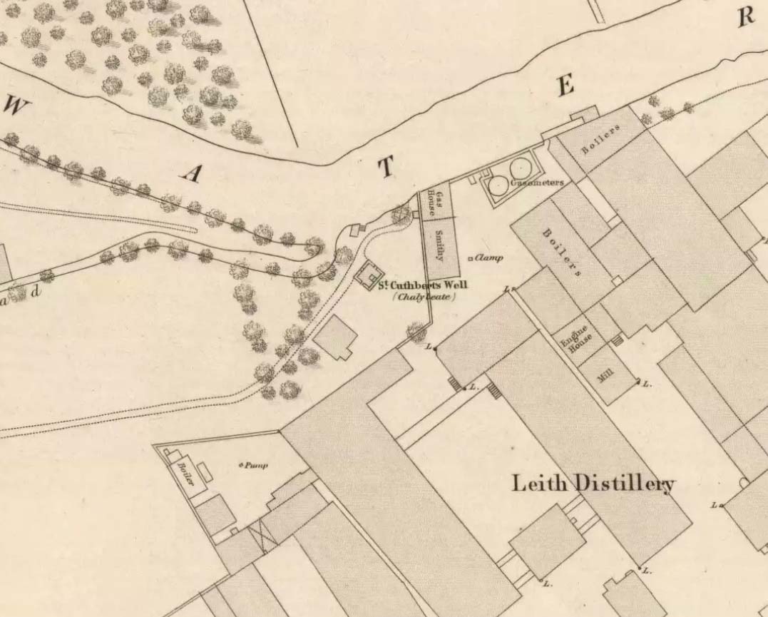
Site shown on 1862 map

If we’d have lived 200 years ago and walked several miles downstream from St Bernard’s Well on the Water of Leith, we would have eventually come across this little-known sacred site, sadly destroyed in the 19th century.  It was shown on the earliest OS-map on the south-side of the river, enclosed in a small square building with what looks like two entrances, and what appears to be a covering of the spring on the southeast side.  Marked as a chalybeate, or iron-bearing well, this would have obviously have had repute amongst local people and would have worked as a tonic or pick-me-up, aswell as fortifying the blood and a having a host of other benefits.

The Ordnance Survey lads wrote short notes about St. Cuthbert’s Well in the Name Book of 1852-53, where they told:

“A Well Situated at Bonnington. Supposed to have been dedicated to St Cuthbert; about 34 years ago the proprietor repaired the well and at the same time erected a house over it, and fitted it up for Visitors who are charged one penny for a drink. The Water of the well has been analysed by Professor Jameson and Doctor Turner and it was found to Contain Salts of Iron; Soda, magnesia and Lime, also Iodine under the form of Hydrisdate of Potash.”

About the same time as Jameson & Turner’s analysis of St. Cuthbert’s waters, one Dr Edward Schweitzer (1845) wrote one of the most detailed chemical essays on wells, ever!—using Bonnington’s holy well as his primary focus.  A near-thirty-page essay found that, along with an excess of iron, the medicinal aspects of the waters were due to the following compounds found, per grains, in each pint of water:

Sulphate of Potassa — 2.46554 gr
Sulphate of Soda — 1.51227 gr
Sulphate of Lime — 6.28816 gr
Iodide of Sodium — 0.00728 gr
Bromide of Sodium — 0.07886 gr
Chloride of Ammonium — 9.49939 gr
Chloride of Sodium — 3.82963 gr
Chloride of Magnesium — 3.12017 gr
Nitrate of Soda — 2.02154 gr
Carbonate of Magnesia — 1.70443 gr
Proto-Carbonate of Iron — 0.05807 gr
Proto-Carbonate of Manganese — 0.01535 gr
Ammonia (united to organic matter) — 0.42285 gr
Alumina — 0.02245 gr
Silica — 0.18651 gr

In 1837, a Mr Robert Fergusson was known to be “the keeper of the Mineral Well, Bonnington,” but much of its traditions and history have fallen outside of memory.  The site was soon to become another mid-Victorian ‘Spa Well’, where local people would have to pay for water they had always used as Nature intended.  In truth, the waters and its well-house were to become a place where the rich Industrialists could heal their infirm mind-bodies, hoping that the destitution they lacked emotionally and spiritually would be washed away in the sacred waters.  But it didn’t last long!  What little is known about it historically was best described in John Russel’s (1933) essay on Bonnington in the Old Edinburgh Club journal.  He wrote:

“Just where the Bonnington mill lade joins the Water of Leith once flowed St. Cuthbert’s Well, an ancient spring named after the patron saint of the once extensive parish of St. Cuthbert’s, and like the now forgotten mineral well of St. Leonard’s near Powderhall, a relic of a superstitious age.  As to when this well was so designated history is silent but it was probably before 1606, when the Leith portions of Bonnington, Pilrig and Warriston were, by the Scots Parliament, included in the Parish of North Leith…

“In May, 1750 St. Cuthbert’s Well was found to be possessed of medicinal properties.  The Scots Magazine of that year refers to many persons frequenting it.  The Well formed part of a building which included a pump room and a reading room. From advertisements in the periodicals of 1819 we learn that it was open from 6 o’clock in the morning and that newspapers were to be found on the table all day. The tenant also issued handbills headed “St. Cuthbert’s Mineral Well, Bonnington”, giving a chemical analysis of the water and a list of the ailments for which it had been found beneficial. The Well disappeared with the re-construction of Haig’s Distillery in 1857. It now lies beneath the buildings immediately west of the chimney stack of Messrs John Inglis and Sons.”

St. Cuthbert’s feast day was March 20 (Spring Equinox) and September 4.

A half-mile southwest of here could once be seen the waters of St. Leonard’s Well, which Ruth & Frank Morris (1982) erroneously thought to have been this Well of St. Cuthbert.

References:

  1. Bennett, Paul, Ancient and Holy Wells of Edinburgh, TNA 2017.
  2. Geddie, John, The Water of Leith, W.H. White: Edinburgh 1896.
  3. Morris, Ruth & Frank, Scottish Healing Wells, Alethea: Sandy 1982.
  4. Rhind, William, Excursions Illustrative of the Geology & Natural History of the Environs of Edinburgh, John Anderson: Edinburgh 1836.
  5. Russel, John, “Bonnington: Its Lands and Mansions”, in Book of the Old Edinburgh Club, vol.19, 1933.
  6. Schweitzer, Edward G., “Analysis of the Bonnington Water, near Leith,” in Philosophical Magazine & Journal of Science, volume 24, 1845.

© Paul Bennett, The Northern Antiquarian

Caesar’s Well, Wimbledon, London, Surrey

Sacred Well:  OS Grid Reference – TQ 2237 7151

Also Known as:

  1. Robin Hood’s Well
  2. Roman Well
  3. Springpond Well

Getting Here

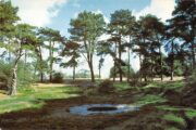
Caesar’s Well in the late-60s

There are numerous ways to get here from all directions: i) from the west-side of Wimbledon Common, on the Robin Hood’s Way A3 road, keep your eyes peeled for the small crossroad  of Robin Hood Lane and Road, obivously taking the one into the park. Keep on the dead straight Robin Hood Ride path until your hit the carpark ¾-mile on; and from here, bear sharp left (NW) for 250 yards or so, where a small slope down on your left takes you there; or, ii) from Wimbledon village side on the A219 Parkside A219 road, where the War Memorial stands, head onto the Common along The Causeway, past the Fox & Grapes going on Camp Road, then up the Sunset Road towards the carpark.  And then, once again go NW for 250 yards or so, where the small slope on your left takes you there.  You’ll find it.

Archaeology & History

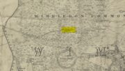
Described by William Bartlett (1865) as “the never-failing spring of water, improperly called the Roman Well”, its constant flow was severely tested in the great drought of 1976—and it kept on flowing.  Only just though!  It was highlighted on the early Ordnance Survey map with the plain name of the Springpond Well.  The great historian and folklorist Walter Johnson (1912) gave us the best historical resumé of the site, telling that,

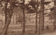
Caesar’s Well around 1900
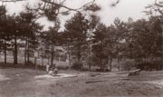
Caesar’s Well around 1911

“Caesar’s Well, formerly known as Robin Hood or Roman Well—the Springpond Well on the Ordnance Map—issues on the other side of the little watershed above mentioned, at a height of 149 feet O.D.  The well lies in a little hollow, now ringed with Scottish pines. The gathering ground is the land to the east, rising to 198 feet O.D. This area is not large, but quite sufficient to maintain a permanent rill of pure water.  The well, the waters of which once were deemed of special medicinal merit, was enclosed with brick in 1829, and, as the inscription tells us, refaced with granite blocks by Sir Henry W. Peek, M.P., in 1872.  The outflowing waters descend to Brickfield Cottage, where they expand into a turbid duckpond; thence the course is through the yard behind the house, and along the north side of Robin Hood Road to Brook Cottage.  During 1911 the “Well” proper altogether dried up, but water still issued from the stand spout a few yards below, which is supplied by an artificial boring and pipe that tap the spring at a depth of 18 feet.”

Site shown on the 1874 map

The proximity of this never-failing spring to the huge prehistoric enclosure of Caesar’s Camp just a few hundred yards to the south would indicate it was an important water source in Bronze Age times and, I’d hazard, would have been bestowed with some sanctity, as many such wells tended to be.

Folklore

James Rattue (2008) informed us that the name Robin Hood’s Well was known here in the 18th century prior to it being known as Caesar’s Well, but there seems to be no known relationship between Robin Hood and this site.  However, a piece written in 1922 told that there was a lingering tradition that Julius Caesar encamped on Wimbledon Common in 51 BCE and that this folk memory was kept alive in the lore of local children who devoutly believed that the great Roman Emperor drank from the cool depths of this well.

References:

  1. Bartlett, William A., The History and Antiquities of the Parish of Wimbledon, Simpkin Marsall: London 1865.
  2. Hughes, John L., “Caesar’s Well, Wimbledon Common,” in Source magazine, no.9, Spring 1989.
  3. Johnson, Walter, Wimbledon Common – Its Geology, Antiquities and Natural History, T.Fisher Unwin: London 1912.
  4. Rattue, James, Holy Wells of Surrey, Umbra: Weybridge 2008.

© Paul BennettThe Northern Antiquarian

Prior’s Well, Worksop, Nottinghamshire

Holy Well (destroyed):  OS Grid Reference – SK 589 790

Also Known as:

  1. Prior Well

Archaeology & History

Once to be seen in the ancient landscape immediately northwest of Worksop Priory by the old Mill Pond, this sacred well has sadly been built over, but memory of it is still retained in Priorswell street-name and, previously, the Priorwell Brewery.  Not much has been written about it, but thankfully the historian John Holland (1826) gave us a short account, saying:

“There is a spring, now enclosed, called the “Priorwell,” and a meadow, of four acres, denominated from the same; and from which, it might be presumed, that the canons would draw their supplies of water, was it not for the convenient proximity of the river, which they must have had to ford for that purpose.  It was “formerly”, says Parkyns, in his Monastic and Baronial Remains, “celebrated for miraculous cures; but since monastic deceptions have unveiled themselves, votaries no longer offer, and consequently cures are no longer performed.”  This may have been the case: more recently the well has been resorted to by persons having sore eyes, in the cure of which, it is said to be efficacious, and has probably the common virtue of fresh cool spring-water.”

References:

  1. Holland, John, The History, Antiquities and Description of the Town and Parish of Worksop, J. Blackwell: Sheffield 1826.
  2. Parkyns, George I., Monastic and Baronial Remains – volume 1, Longmans Hurst: London 1816.

© Paul BennettThe Northern Antiquarian

Bishop’s Well, Tottenham, Middlesex

Holy Well (destroyed):  OS Grid Reference – TQ 332 911

Also Known as:

  1. My Lady’s Hole

Archaeology & History

Long since gone after drainage operations on Tottenham Cemetery made the waters dry-up, this was one of several holy wells in the Tottenham area.  Its history has been described in various old tomes, but the most definitive is found in William Robinson’s (1840) classic on the parish of Tottenham, when the well was still visible.  He told us:

“There is a spring which issues from the side of a small hillock on the south side of the Moselle, nearly opposite the Vicarage, leading thence to the Church, called Bishop’s Well.  This spring was formerly considered famous for many strange and wonderful cures performed on the diseased by the use of this water.  It has been for some years neglected, but of late the owner of the field in which this well is, had it cleansed, and planted some trees round it, and put up posts and rails to prevent the cattle treading down the sides of it.  It is said that the water of this well never freezes.  In former times this well was in great repute from the purity of its water.  The ladies in the vicinity of it were accustomed to send their servants in the morning and evening for water for their tea, from which circumstance it was for many years known by the name of “My Lady’s Hole.”  The water of this well is not only esteemed for its medicinal qualities, but particularly for curing disorders of the eye.

“There were formerly many other springs about the village, especially one which issued out of the hill on which the Church stands; and another in Spottons Wood otherwise Spottons Grove, on the north side of Lordship Lane, which in the fifteenth century was of considerable notoriety; but none of which have in former times been so much frequented and held in such repute as Bishop’s Well.”

(Please note: the grid-reference for this site is an approximation)

References:

  1. Foord, Alfred Stanley, Springs, Streams and Spas of London: History and Association, T. Fisher Unwin: London 1910.
  2. Hope, Robert Charles, Legendary Lore of the Holy Wells of England, Elliott Stock: London 1893.
  3. Robinson, William, The History and Antiquities of the Parish of Tottenham, Nichols & Sons: London 1840.
  4. Sunderland, Septimus, Old London Spas, Baths and Wells, John Bale: London 1915.
  5. Thornbury, Walter & Walford, Edward, Old and New London – volume 5, Cassell: London 1878.

© Paul BennettThe Northern Antiquarian


Vauxhall Well, Lambeth, London, Surrey

Healing Well (destroyed):  OS Grid Reference — TQ 3006 7734

Archaeology & History

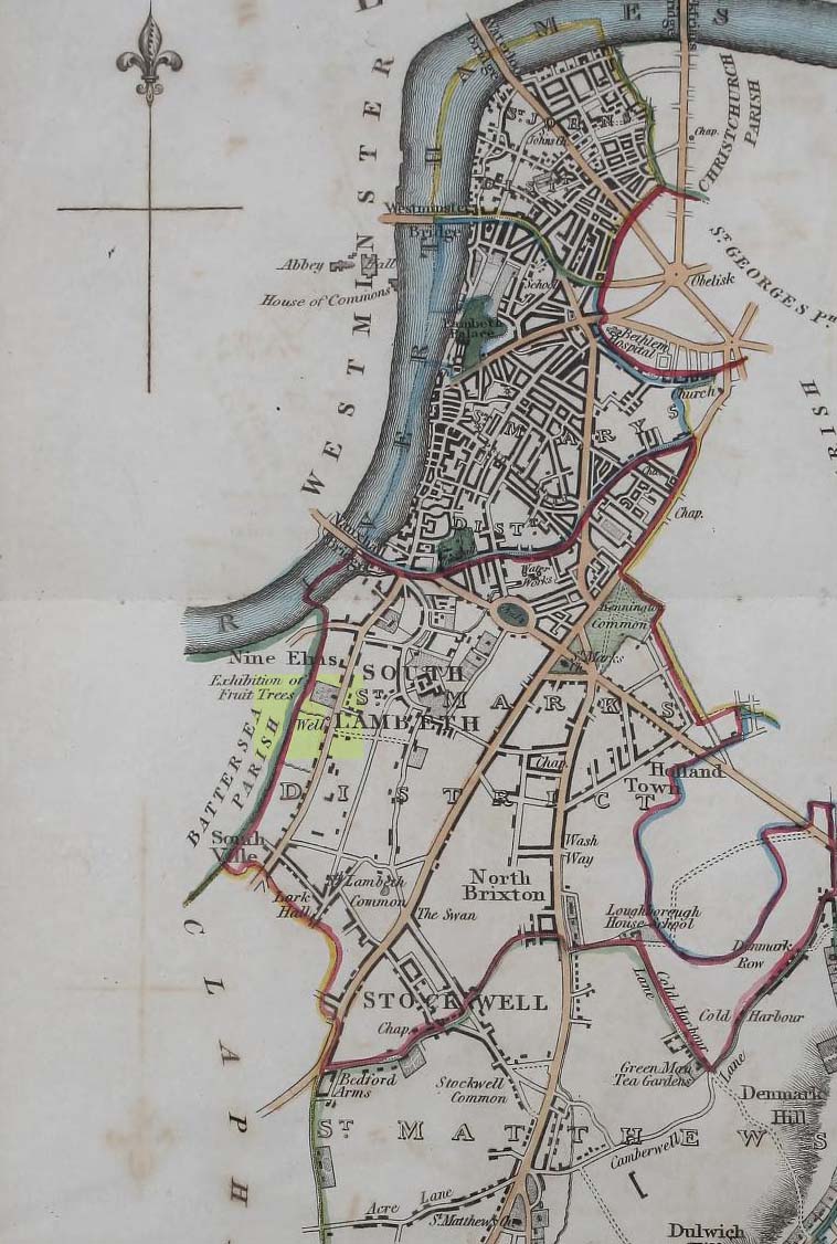
Position of Vauxhall Well on 1824 map

In Thomas Allen’s (1827) huge survey of Lambeth parish, he told that there was little of any interest along Wandsworth Road, apart from a good orchard, “and a fine spring called Vauxhall Well.”  According to Daniel Lysons (1792), it was located “not far from the turnpike”; and according to Mr Sunderland’s (1915), was to be found “on the right-hand side of the Wandsworth Road” as you walked down it to the south.  Thankfully its position was highlighted on the 1824 map of the parish (right) that accompanied Mr Allen’s work.

It appears to have been built over in the latter-half of the 19th century, soon after William Thornbury (1878) wrote that he thought the well was still visible, but vanished soon after.

The waters were universally ascribed by all historians, from Mr Allen onwards, as being,

“esteemed highly serviceable in many disorders of the eyes, and in the hardest winter it is never known to freeze.”

The name ‘Vauxhall’ derives from that brilliantly famous family name of ‘Fawkes’ (as in Guy Fawkes), being the ‘hall of Fawkes’.  The name was first recorded here as early as 1241. (Gover et al, 1934)

References:

  1. Allen, Thomas, The History and Antiquities of the Parish of Lambeth, J. Allen: London 1827.
  2. Foord, Alfred Stanley, Springs, Streams and Spas of London: History and Association, T. Fisher Unwin: London 1910.
  3. Gover, J.E.B., Mawer, A. & Stenton, F.M., The Place-Names of Surrey, Cambridge University Press 1934.
  4. Lysons, Daniel, The Environs of London – volume 1,  T. Cadell & W. Davies: London 1792.
  5. Sunderland, Septimus, Old London Spas, Baths and Wells, John Bale: London 1915.
  6. Thornbury, William, History of Old and New London – volume 6, Cassell, Petter & Galpin: London 1878.

© Paul BennettThe Northern Antiquarian 


Robin Hood’s Well, Higham, Lancashire

Sacred Well: OS Grid Reference – SD 81755 35151

Archaeology & History

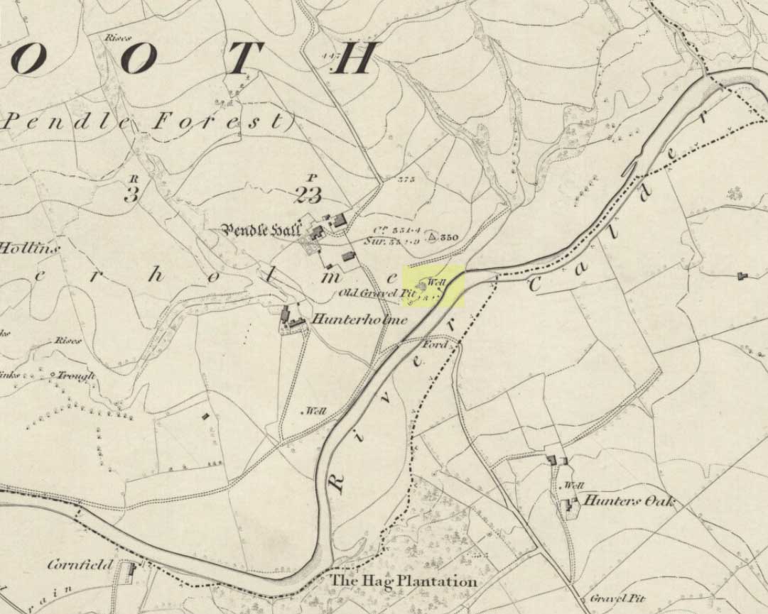
Robin Hoods Well on 1848 map

On the north-side of the River Calder, a short distance above the riverbank below Pendle Hall—as shown on the earliest OS-map of the area, but without a name—the local history writer, Joe Bates (1926), told us about this “spring of icy cold water”, which, in bygone years, “used to be called Robin Hood’s Well.”  (Having moved out of the area, I’m not able to say whether this site is still visible.  Can any local folk illuminate us on the matter?)

Folklore

Like many other sacred and healing wells across Britain, Bates (1926) said that the waters from Robin Hood’s Well,

“was at one time considered a specific for certain ailments of the eyes.”

References:

  1. Bates, Joe, Rambles twixt Pendle and Holme, Nelson 1926.

© Paul Bennett, The Northern Antiquarian