Rocking Stone, Warley Moor, Halifax, West Yorkshire

Legendary Rock:  OS Grid Reference – SE 03399 30199

Also Known as:

  1. Sleepy Lowe

Getting Here

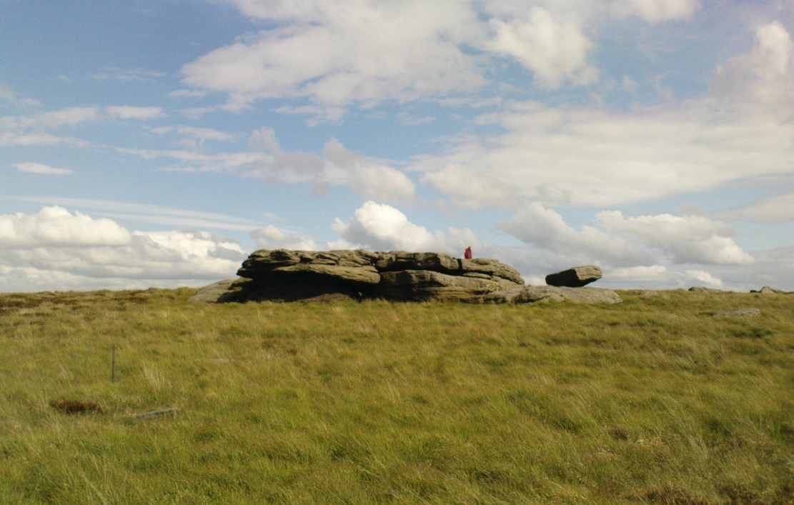
The old rocking stone, on the right
Looking east at the stone

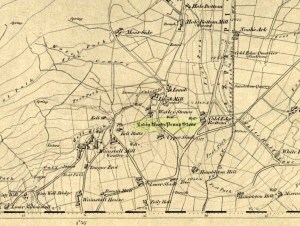
From Denholme, take the A6033 Hebden Bridge road up, but shortly past the great bend turn off right up the steep road towards the moorland windmills until you reach the flat dirt-tracked road, past the reservoir below.  A coupla hundred yards past the track to the reservoir, take the footpath south into the tribbly grasslands and moor.  A few hundred yards down you’ll note the large rock outcrop ahead of you. The rocking stone is there!

Archaeology & History
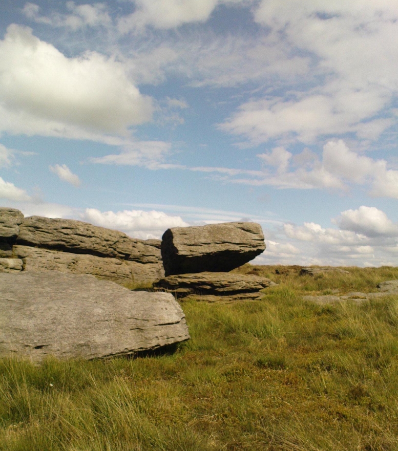
The old rocking stone

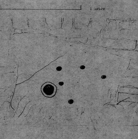
A small moorland arena with a neglected history. Many lost memories surround this site, with barely legible ruins from medieval and Victorian periods prevailing against scanty snippets of neolithic and Bronze Age rumours and remains.  The rocking stone here—which moves slightly with a bit of effort—sits amidst a gathering of other large rocks, some of which have debatable cup-markings on their smoothly eroded surfaces.

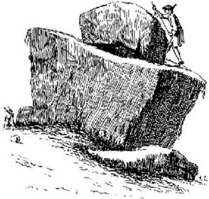
Our rocking stone, resting 1350 feet (411m) above seal level, was first mentioned in John Watson’s (1775) magnum opus, who gave a quite lengthy description of the site, telling us that,

“On a common called Saltonstall-moor, is what the country people call the Rocking-stone… The height of this on the west side (which is the highest) is, as I remember, about three yards and a half.  It is a large piece of rock, one end of which rests on several stones, between two of which is a pebble of a different grit, seemingly put there for a support, and so placed that it could not possibly be taken out without breaking, or removing the rocks, so that in all probability they have been laid together by art.  It ought to be observed, that the stone in question, from the form and position of it, could never be a rocking stone, though it is always distinguished by that name.  The true rocking stone appeared to me to lie a small distance from it, thrown off its centre.  The other part of this stone is laid upon a kind of pedestal, broad at the bottom, but narrow in the middle; and round this pedestal is a passage which, from every appearance, seems to have been formed by art, but for what purpose is the question.”
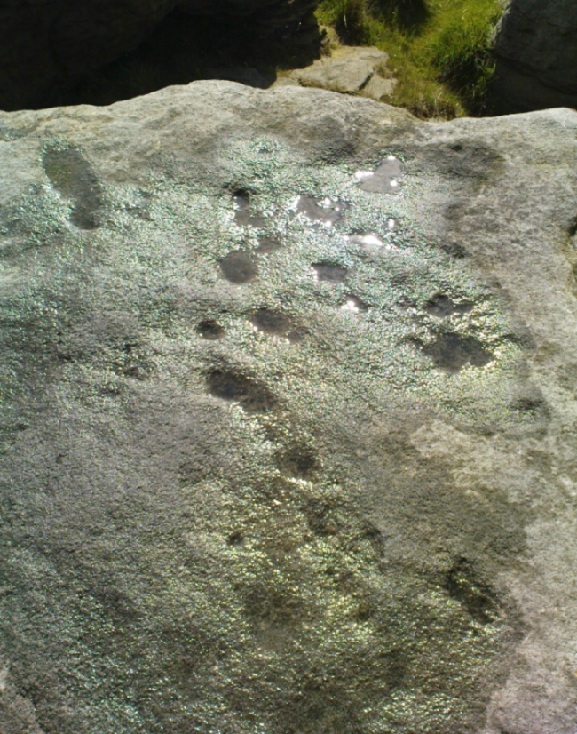
Dubious cupmarks
Dubious cups
Watson's 1775 drawing of the Rocking Stone
Watson’s 1775 drawing of the Rocking Stone

Watson then goes onto remark about other rocking stones in Cornwall and further afield with attendant “druid basins” on them, noting that there were also “rock basins” found here on Warley Moor, a few of which had been “worked into this rocking stone,” which he thought, “helps to prove that the Druids used it.”  And although these rock basins are large and numerous over several of the rocks on this plateau, like the cup-markings that also scatter the surfaces, they would seem to be Nature’s handiwork.
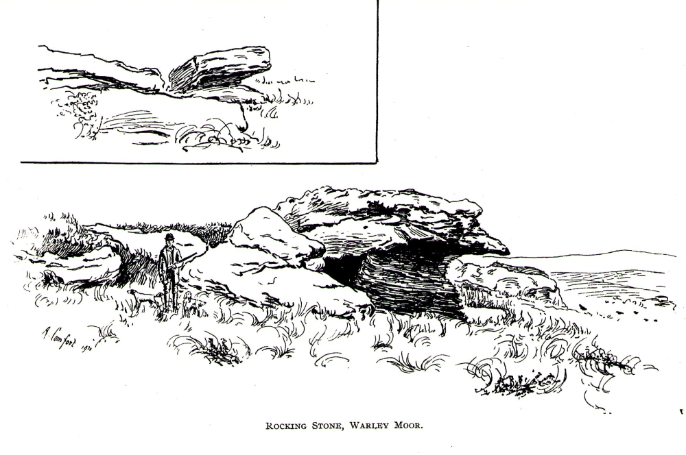
Turner's 1913 drawing
Turner’s 1913 drawing

Some 60 years later when the literary thief John Crabtree (1836) plagiarized Watson’s words verbatim into his much lesser tome, it seemed obvious he’d never ventured to explore the site.  But in the much more valuable historical expansion written by John Leyland around 1867, he at least visited the site and found the old stone, “still resting on its shady pedestal.” Later still, when Whiteley Turner (1913) ventured this way on one of his moorland bimbles, he added nothing more to the mythic history of these west-facing megaliths…

Folklore

Still reputed locally to have been a site used by the druids; a local newspaper account in the 1970s also told how local people thought this place to be “haunted by goblins.”

References:

  1. Bennett, Paul, The Old Stones of Elmet, Capall Bann: Milverton 2001.
  2. Crabtree, John, Concise History of the Parish and Vicarage of Halifax, Hartley & Walker: Halifax 1836.
  3. Leyland, F.A., The History and Antiquities of the Parish of Halifax, by the Reverend John Watson, M.A., R.Leyland: Halifax n.d. (c.1867).
  4. Smith, A.H., The Place-Names of the West Riding of Yorkshire – volume 3, Cambridge University Press 1961.
  5. Turner, Whiteley, A Spring-Time Saunter round and about Bronte Lane, Halifax Courier 1913.
  6. Watson, John, The History and Antiquities of the Parish of Halifax, T. Lowndes: London 1775.

© Paul BennettThe Northern Antiquarian


Tower Hill, Warley, Halifax, West Yorkshire

Cairns (destroyed): OS Grid Reference – SE 053 261

Archaeology & History

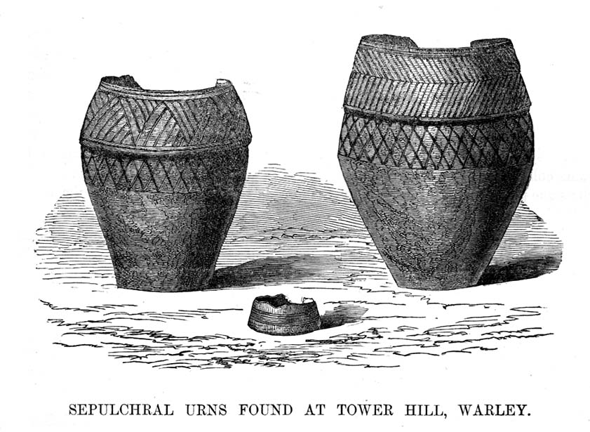
F.A. Leyland’s drawing of the urns

There’s really nowt to see around here nowadays (apart from a lovely view of the hills and the Calder valley), but it seems that not-too-long ago there were several burials in evidence upon this hill.  F.A. Leyland (1867) gives a quite detailed account of the urns and their discovery, which have been variously thought of as Roman, then Saxon, then prehistoric — with them finally ascribed as Bronze Age in Watson’s (1952) survey of the region.  Not too far away could once be found the legendary Robin Hood’s stone circle, which might have had some relationship with the burials here — though we’ll probably never know for sure!  Leyland’s (1869) lengthy notes of this site told:

“An interesting discovery was made in…recent times, of a number of cinerary urns in the township of Warley.  The site of the interments was at Tower Hill, a position on a line of military defences which extended from the entrenchments of Hunter’s Hill to Camp End in this township.  The urns were found in the process of quarrying for stone; but, owing to the nature of the operations, and the unlooked for discovery of such relics as these or the total absence of all knowledge of their value, by the people employed, many similar remains are known to have been demolished as worthless objects.

“On one occasion, however, an urn, bleached by the tempests of an entire winter, was observed to protrude half its own bulk from the stratum of soil in which it had been originally buried.

“The curiosity of the labourers was excited, and the relic was removed.  It was found to contain bones and ashes which the people, ever prone to the marvellous, held to be the remains of a child which had been destroyed by foul means and there buried.  This opinion was noised abroad, and the true nature of the interment explained.  We examined a fragment of this relic: it was rudely constructed of sun-burnt clay, and was grimed in the inside as if by the smouldering embers of the funeral pyre, and the smoking ashes of the dead, on their introduction to their narrow urn.

“This had been filled with these human exuviæ; and appeared to have been lined with moss mixed with fibres of plants which, after the urn had fallen in pieces, adhered firmly to its contents.  It was thirteen or fourteen inches high, and was no doubt made by the hand alone.  Within a few yards of this, another urn was found, containing bones and ashes, but so far decomposed as to preclude the possibility of its preservation: near the same place the smaller urn in our illustration was discovered buried in the dark soil peculiar to the locality; it was filled with calcined bones and ashes and, like the one found at Upleton—and in the possession of Dr Young of Whitby—had a small clay vessel placed within it, which is represented in our engraving.  The urn was, moreover, protected by a lid, resembling the inverted stand of an ordinary flower-pot: the relic measured six inches high.

“During the winter of 1848, a date subsequent to the above discoveries, there was a fall of earth from the same spot, into the quarry at Tower Hill; the soil, thus precipitated from the moor, impeded the operations of the labourers; and, on its removal, the larger urn of our illustration was brought to light.  This relic measured nine inches high and was twenty-two in circumference; but, in the rubbish, there were observed numerous fragments of other cinerary urns, and equally numerous relics of cremation.

“These discoveries lead one to one of two conclusions: either that Tower Hill was the field of some formidable engagement, in which numbers fell; or, that it was used as a place of frequent sepulture by the primitive inhabitants of the locality.  It is not at all improbable that these urns were the produce of some local pottery, if not made by the same hand, as the one described by Watson (1775), the patterns indented on the two upper compartments of the smaller vessel being of the same kind, and occupying the same positions as the one referred to.

“The larger urn, as will be observed, is divided like the others into three compartments, the upper one standing out in relief, but having a different kind of decoration resembling herring-bone masonry; while the smaller one of our illustration, and that of Watson, are furnished with a zigzag design.  But, although there is this slight variation in the upper moulding of the larger vessel, they all possess the lozenge-shaped decoration in their central compartments.”

We haven’t yet explored this site diligently and also know that if we have to await the slow hand of archaeology here we’d be waiting an aeon, but Tower Hill’s position in the landscape would tend to indicate the latter of Leyland’s earlier suggestions regarding the nature of the finds, i.e., the hill was a prehistoric graveyard, though of unknown size.

References:

  1. Leyland, F.A., The History and Antiquities of the Parish of Halifax, by the Reverend John Watson, M.A., R.Leyland: Halifax n.d. (c.1867)
  2. Roth, H. Ling, The Yorkshire Coiners, 1767-1783; and Notes on Old and Prehistoric Halifax, F.King: Halifax 1906.
  3. Watson, John, The History and Antiquities of the Parish of Halifax, T. Lowndes: London 1775.
  4. Watson, Geoffrey G., Early Man in the Halifax District, HSS: Halifax 1952.

© Paul Bennett, The Northern Antiquarian


Greenwood ‘B’ Stone, Midgley Moor, West Yorkshire

Standing Stone:  OS Grid Reference – SE 01659 28449

Also Known as:

  1. Midgley Moor Standing Stone

Getting Here

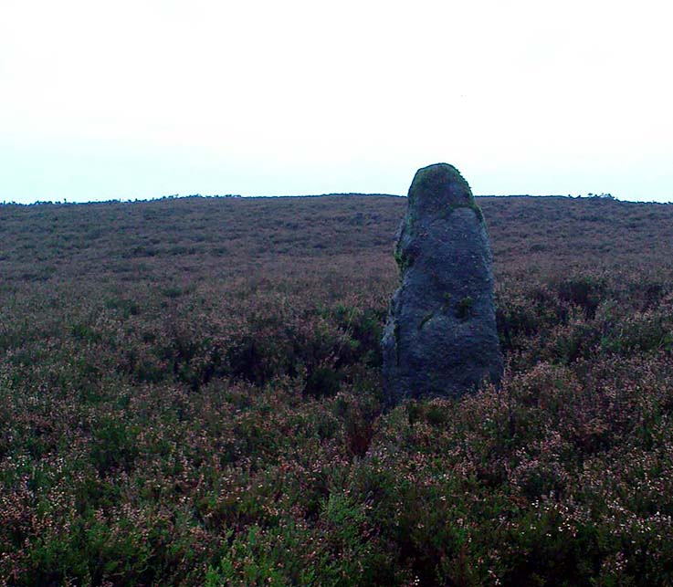
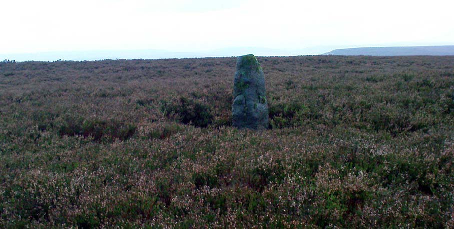
Midgley Moor Standing Stone

Takes a bitta finding – especially if some dood’s knocked it down again (as happens up here).  Best thing to do is get to the Miller’s Grave prehistoric cairn, which is only a few hundred yards away.  From Miller’s Grave, walk due west for 200 yards till you hit once a ditched footpaths, where you should turn right.  A short distance along you’ll hit a 5-foot-tall boundary stone called the Greenwood Stone with ‘1775’ carved on one side.  From here, walk due south into the heather for 75 yards.  You’re very close!

Archaeology & History

We resurrected this old standing stone in 1996, several years after first discovering it laid amidst the heather in the early 1990s. It appeared to mark an old boundary line (no longer used) betwixt Wadsworth Moor and Midgley Moor, but its nature is distinctly prehistoric. The remains of a small hut circle (seemingly Bronze Age, though excavation is needed) can be found a short distance to the west, though this is hard to find when the heather has grown. Other seemingly prehistoric remains scatter the ground nearby, none of which have received the attention of archaeologists.

Greenwood ‘B’ on a grey day

As you can see from these grey, rain-swept images, this upright stone is well-weathered (though we need to visit here again soon and get some better photos). It stands some 4-feet tall and may have accompanied one or two other monoliths close by.  The suggestion by one Peter Evans that the Greenwood B stone stood “possibly at the centre of a stone circle” is sadly untrue (soz Peter); though it probably had some relationship with the Millers Grave cairn site, a few hundred yards equinox east.

References:

  1. Bennett, Paul, The Old Stones of Elmet, Capall Bann: Milverton 2001.

© Paul Bennett, The Northern Antiquarian


Warley Edge, Halifax, West Yorkshire

Cup-and-Ring Stone (lost):  OS Grid Reference – SE 062 253

Archaeology & History

Warley Edge Cup-and-ring stone

A rare find in Calderdale, as it’s only one of a very small number of full cup-and-ring designs — though its exact whereabouts remains elusive.  From Heginbottom’s (1979) OS-reference, it’s close to a pretty built-up area, so may be destroyed.

He described it as a “large block with cup and ring markings, built into a dry stone wall,” 900ft above sea level. So where eactly is it…?

References:

  1. Heginbottom, J.A., The Prehistoric Rock Art of Upper Calderdale and the Surrounding Area, YAS: Leeds 1979.

© Paul Bennett, The Northern Antiquarian


Robin Hood’s Penny Stone, Wainstalls, West Yorkshire

Stone Circle (destroyed):  OS Grid Reference – SE 046 288

Archaeology & History

The Pennystone on 1852 map

All remains of this site, first mentioned as a stone circle in 1836, have gone. The place could be found by the appropriately named Stone Farm at the top end of Wainstalls and was first mentioned by John Watson (1775), who strangely said nothing about any circle here.  However, this changed when John Crabtree (1836) arrived and described a ring of stones surrounding a large boulder in the centre (illustrated here). The boulder itself was actually called the Robin Hood Penny Stone.

Folklore

Watson's 1775 drawing
Watson’s 1775 drawing

This was one of the many legendary sites from where our legendary outlaw practiced shooting his arrows.  He was also said to have picked up and thrown a large standing stone from this spot, until it landed three-and-a-half miles away on the hillside on the other side of the Calder Valley. (this was known as the Field House, or Sowerby Lad Standing Stone)

References:

  1. Bennett, Paul, The Old Stones of Elmet, Capall Bann 2001.
  2. Crabtree, John, Concise History of the Parish and Vicarage of Halifax, Hartley & Walker: Halifax 1836.
  3. Dobson, R.B. & Taylor, J., Rymes of Robyn Hood, Alan Sutton: Gloucester 1989.
  4. Faull, M.L. & Moorhouse, S.A., West Yorkshire: An Archaeological Guide (4 volumes), WYMCC: Wakefield 1981.
  5. Varley, Raymond, “A Stone-Axe Hammer, Robin Hood’s Penny Stone and Stone Circle at Wainstalls, Warley, near Halifax,” in Yorks. Arch. Journal 69, 1997.
  6. Watson, John, The History and Antiquities of the Parish of Halifax, T. Lowndes: London 1775.

© Paul Bennett, The Northern Antiquarian