Allt a’ Choire Chireinich (03), Kenmore, Perthshire

Cup-Marked Stone:  OS Grid Reference – NN 65249 39579  –  NEW FIND

Getting Here

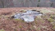
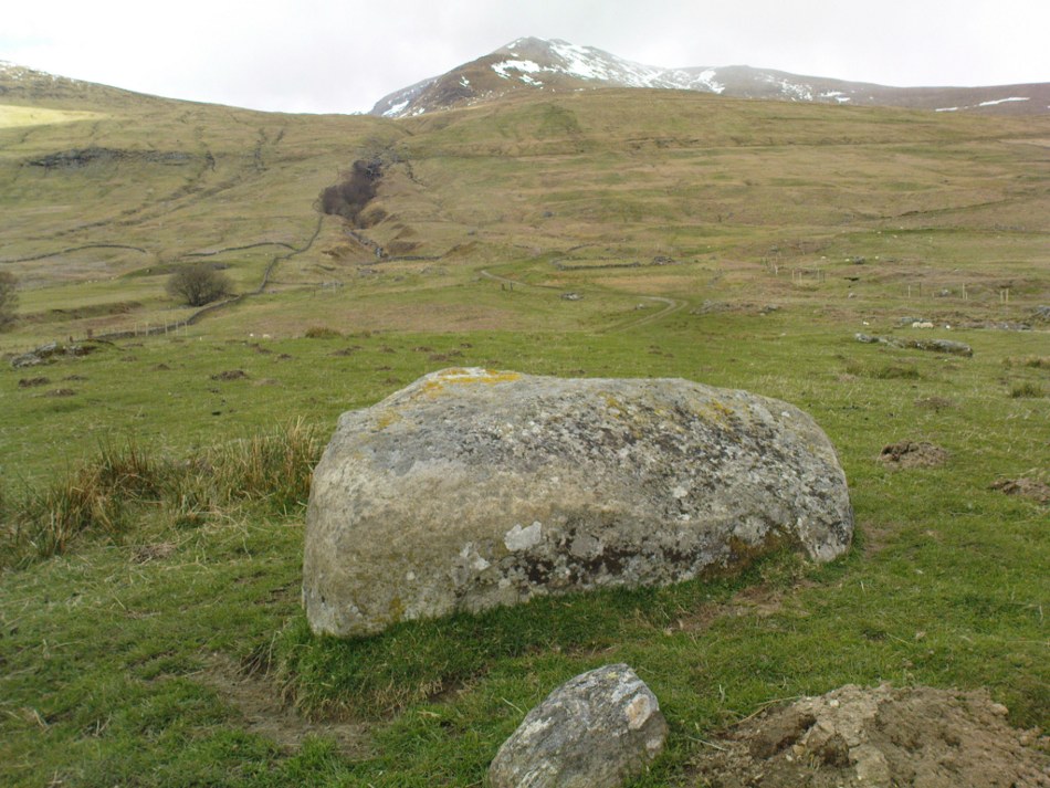
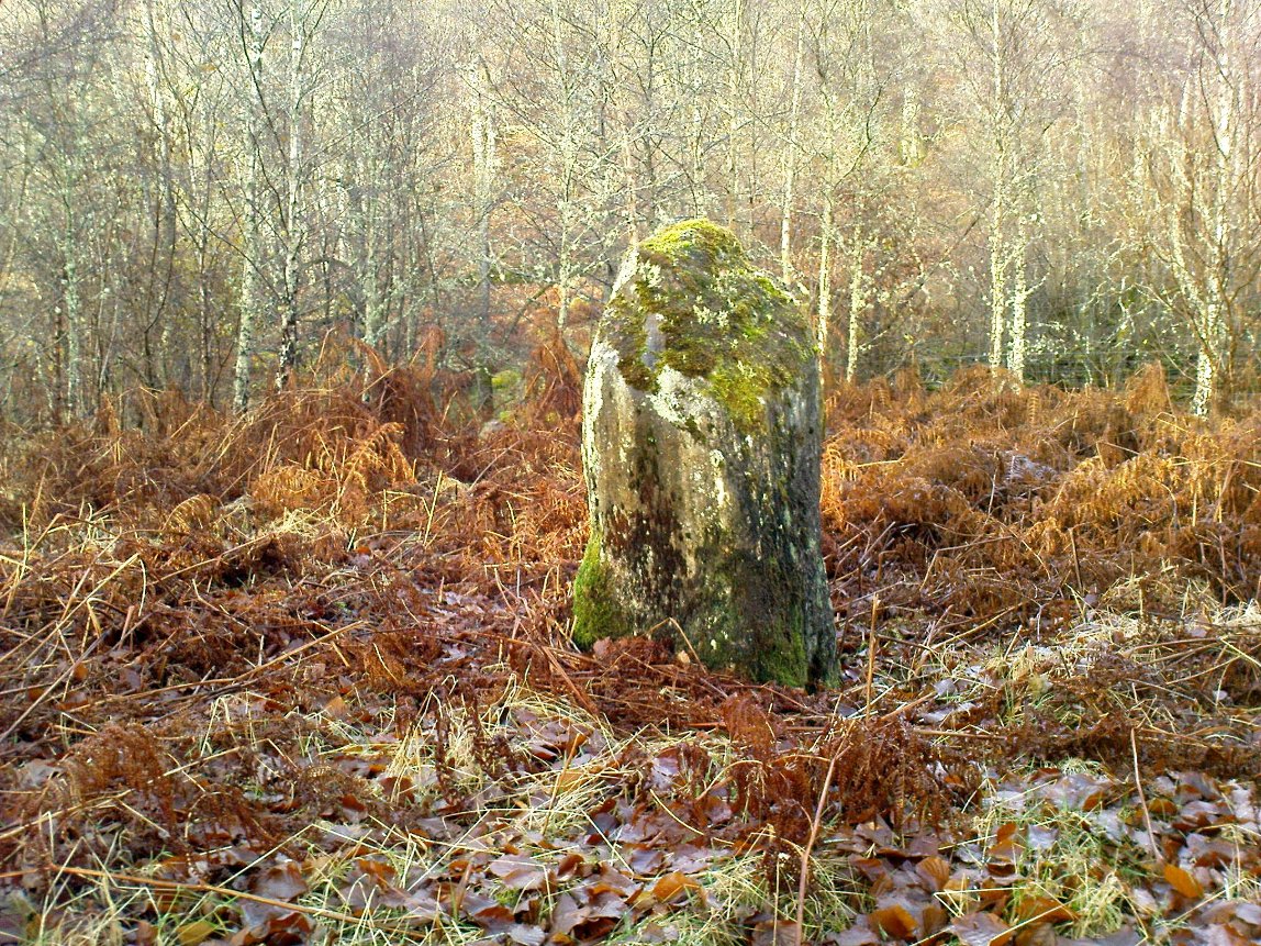
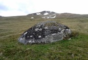
Allt a' Choire Chireinich 03 Stone

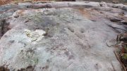
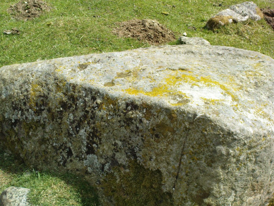
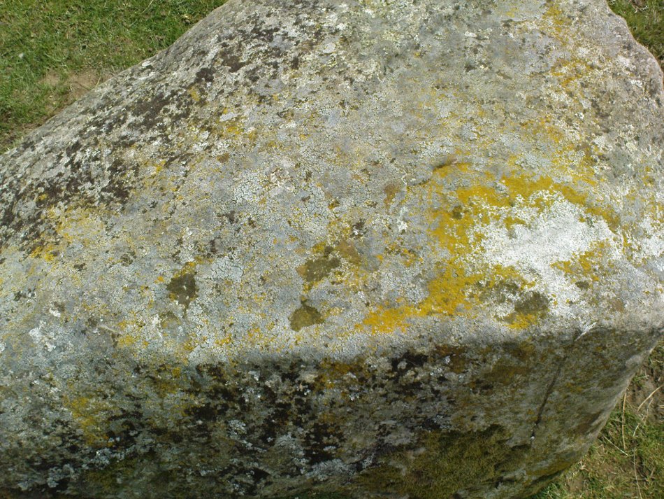
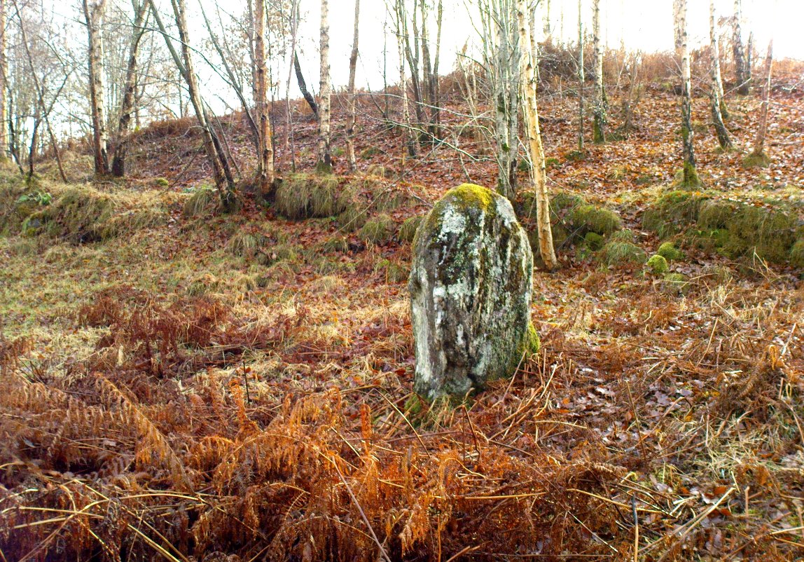
Allt a’ Choire Chireinich 03 Stone

Take the same directions to reach the large rounded Allt a’ Choire Chireinich 02 carving.  Walk 65 yards (60m) northwest diagonally uphill to another large rounded stone of similar size.  That’s the one!

Archaeology & History

A large cup-marked boulder, not previously recognised, was rediscovered on the afternoon of May 15, 2015.  The great majority of the rock surface is covered in aged lichens, but at least three well-defined cup-markings were noted on the upper rounded surface of the stone: one near the middle of the stone; one near the centre-north; and another towards the top northwest section of the stone.  The cups are more than an inch in diameter and eighth-of-an-inch deep.  Others may be in evidence beneath the vegetation.

© Paul BennettThe Northern Antiquarian


Allt a’ Choire Chireinich (02), Kenmore, Perthshire

Cup-Marked Stone:  OS Grid Reference – NN 65218 39525

Also Known as:

  1. Canmore ID 291477

Getting Here

Allt a' Choire Chireinich 2 stone

Allt a’ Choire Chireinich 2 stone

Along the A827 road between Killin and Kenmore, park-up at the Tombreck entrance and cross the road, taking the long track which eventually zigzags up the slope of Ben Lawers.  Keep your eyes on the copse of trees a few hundred yards east that runs up the slopes and when you are level with the top of it, walk along the line of walling that heads to it.  Go past the top of the trees and the first big boulder you reach is the fella in question.

Archaeology & History

Adjacent to an ancient trackway that runs across the slopes of the mountain, this large glacial boulder sits proudly on the slopes calling out for attention — and attention it certainly received countless centuries ago, when local people (perhaps) decided to cut at least nine cup-markings onto the top of the rock.

Lichen-encrusted cups

Lichen-encrusted cups

Lichen-encrusted cups

Lichen-encrusted cups

The surface today is encrusted with olde lichens of colourful hues, beneath which may be other cup and ring carvings; but as I’m a great lover of such forgotten medicinal primers, I wasn’t about to scratch beneath their bodies to find out.  This petroglyph is worth looking at when you’re exploring the other, more impressive carvings in this Allt a’ Choire Chireinich cluster.

© Paul BennettThe Northern Antiquarian


Allt a’ Choire Chireinich, Kenmore, Perthshire

Cup-and-Ring Stone:  OS Grid Reference – NN 65096 39442  —  NEW FIND

Getting Here

The stone, uncovered

The stone, uncovered

Take the A827 road between Killin and Kenmore and park-up at the entrance to Tombreck. Cross the road and walk up the track that goes up Ben Lawers.  As it zigzags uphill, watch out for you being level with the top of the copse of trees several hundred yards west, where a straight long overgrown line of walling runs all the way to the top of the copse. Go along here, and just as you reach the trees, walk uphill for about 50 yards.  You’re damn close!

Archaeology & History

Whether you’re into prehistoric carvings or not, this is impressive!  It’s one of several with a very similar multiple-ring design to be found along the southern mountain slopes of Ben Lawers.  Rediscovered on May 13, 2015, several of us were in search of a known cup-and-ring stone just 260 yards (238m) to the northwest in this Allt a’ Choire Chireinich cluster, but one stone amongst many called my nose to have a closer sniff—and as you can see, the results were damn good!

Looking from above

Looking from above

Etched onto a large flat rock perhaps 5-6000 years ago, probably over at least two different seasons, the primary design here is of two sets of multiple-rings: in one case, seven concentric ones emerging from, or surrounding a central cup-marking (more than an inch across); and the other is of at least eight concentric rings emerging from a cup-marking, about half-an-inch across. The largest cup-and-seven-rings is the one near the centre of the stone.  Initially I thought this was simply two concentric seven-rings; but the more that I looked through the many photos we’d taken, the more obvious it became that the residue of an eighth ring (possibly more) exist in the smaller-sized concentric system.  It must however be pointed out that neither of the concentric carved rings seem to be complete – i.e., they were never finished, either purposefully or otherwise.  The largest cup-and-seven-rings is the one near the centre of the stone; with the outer smaller example being half the size of the one in the middle.  At first glance, neither of the concentric rings seem complete – and so it turned out when it was enhanced by rain and sun.

First photo of the double-rings

First photo of the double-rings

The large central cup-and-seven-rings has two additional cup-marks within it: one on the outer fifth ring to the southeast, and the other in the outer sixth ring to the west.  This western cup-mark is also crossed by a carved line that runs from the first ring outwards to the west and to the edge of the rock, crossing another cup-mark along the way.  This particular carved line might be the same one that integrates itself into the first ring, and then re-emerges on is northeastern side, to continue out of the multiple-rings themselves and curve over to the eastern side of the rock.  Running roughly north-south through the middle of this larger seven-ring element, a line scarred by Nature is visible which has been pecked by humans on its northern end, only slightly, and running into the covering soil eventually, with no additional features apparent.  Another possible carved line seems in evidence running from the centre to the southeastern edge – but this is by no means certain.

The carving, looking north

The carving, looking north

This large central seven-ringed symbol has been greatly eroded, mainly on its southern sides, where the rings are incomplete, as illustrated in the photos.  Yet when the light is right, we can see almost a complete concentric system, with perhaps only the second ring from the centre being incomplete on its eastern side.  On the southern sides, the visibility factor is equally troublesome unless lighting conditions are damn good.  The northernmost curves, from west to east, are the deepest and clearest of what remains, due to that section of the stone being covered in soil when it was first discovered, lessening the erosion.
Smallest 7-ring section, with cups

Smallest 7-ring section, with cups

Multiple-ring complex & cups

Multiple-ring complex & cups

Moving onto the second, smaller concentric set of rings: this is roughly half the size of its counterpart in the middle of the stone.  Upon initial investigation you can clearly make out the seven rings, which have faded considerably due to weathering.  It seems that this section was never fully completed.  And the weathering on this smaller concentric system implies one of two things: either that it was left open to the elements much much longer than its larger seven-ring system, or it was carved much earlier than it.  In truth, my feeling on this, is the latter of the two reasons.  Adding to this probability is the fact that even more rings—or at least successive concentric carved ‘arcs’—are faintly visible around this more faint system: at least eight are evident, with perhaps as many as thirteen in all (which I think would put it in the record-books!).  But we need to visit it again under ideal lighting conditions to see whether there are any more than the definite eight.  It is also very obvious that the very edge of the rock here has been broken off at some time, and a section of the carving went with it—probably into the ancient walling below or the derelict village shielings on the mountains slopes above.

Just above the eroded eight-ring section are three archetypal cup-marks close to the very edge of the rock, one above each other in an arc.  Of these, the cup that is closest to the eight-rings possesses the faint remains of at least two other partial rings above it, elements of which may actually extend and move into the concentric rings themselves—but this is difficult to say with any certainty.  However, if this is the case, we can surmise that this small cup-and-two-rings was carved before its larger tree-ring-looking companion.

Below the smaller seven-ringer is the possibility of a wide cup-and-two-rings: very faint and incomplete.  This only seems visible in certain conditions and I’m not 100% convinced of its veracity as yet.
Curious 'eye'-like symbol

Curious ‘eye’-like symbol

'Eye' to the bottom-left

‘Eye’ to the bottom-left

We also found several other singular cup marks inscribed on the rock, all of them beneath the two concentrics, moving closer to the edge of the rock.  But a more curious puzzle is an eye-like symbol, or geological feature, on the more eastern side of the stone.  It gives the impression of being worked very slightly by humans, but as I’m not a geologist, I’ve gotta say that until it is looked at by someone more competent than me, I aint gonna commit myself to its precise nature.  What seems to be a carved line to the left (west) of this geological ‘eye’ may have possible interference patterns pecked towards it.  Tis hard to say with any certainty.

So – what is this complex double-seven-ringer?!  What does it represent?  Sadly we have no ethnological or folklore narratives that can be attributed to the stone since The Clearances occurred.  We only have the very similar concentric six- and seven-ringed petroglyphs further down the mountainside to draw comparisons with.  We could guess that the position of the stone halfway up Ben Lawers, giving us a superb view of the mountains all around Loch Tay might have some relevance to the carving; but this area was probably forested when these carvings were etched—which throws that one out of the window!  We could speculate that the two multiple rings represent the Moon and Sun, with the smaller one being the Moon. They could represent a mythic map of Ben Lawers itself, with the central cup being its peak and outer rings coming down the levels of the mountain.  Mountains are renowned in many old cultures as, literally, cosmic centres, from whence gods and supernal deities emerge and reside; and mountains in some parts of the world have been represented by cup-and-ring designs, so we may have a correlate here at Ben Lawers.  O.G.S. Crawford (1957) and Julian Cope (1998) would be bedfellows together in their view of it being their Eye Goddess.  But it’s all just guesswork.  We do know that people were living up here and were carving other petroglyphs along this ridge, some of which occur inside ancient settlements; but the traditions of the people who lived here were finally destroyed by the English in the 19th century, and so any real hope of hearing any old myths, or possible rites that our peasant ancestors with their animistic worldview possessed, has died with them.

Tis a fascinating carving nonetheless—and one worthy of seeking out amongst the many others all along this beautiful mountainside…

References:

  1. Bernbaum, Edwin, Sacred Mountains of the World, Sierra Club: San Francisco 1990.
  2. Cope, Julian, The Modern Antiquarian, Thorsons 1998.
  3. Crawford, O.G.S., The Eye Goddess, Phoenix House: London 1957.
  4. Eliade, Mircea & Sullivan, Lawrence E., “Center of the World,” in Encyclopedia of Religion – volume 3 (edited by M. Eliade), MacMillan: Farmington Hills 1987.
  5. Evans-Wentz, W.Y., Cuchuma and Sacred Mountains, Ohio University Press 1980.
  6. Gillies, William A., In Famed Breadalbane, Munro Press: Perth 1938.
  7. Michell, John, At the Centre of the World, Thames & Hudson: London 1994.
  8. Yellowlees, Sonia, Cupmarked Stones in Strathtay, Scotland Magazine: Edinburgh 2004.

Acknowledgements:  Huge thanks to Paul Hornby for the use of his photos in this site profile; to Lisa Samson, for her landscape detective work at the site; and to Fraser Harrick, for getting us there again.

© Paul BennettThe Northern Antiquarian


Lochay Woods, Killin, Perthshire

Cup-and-Ring Stone:  OS Grid Reference – NN 54125 35388

Also Known as:

  1. Canmore ID 274203

Getting Here

The stone in question

Going out of Killin towards Kenmore on the A827 road, immediately past the Bridge of Lochay Hotel, turn left.  Go down here for just over 2 miles and park-up where a small track turns up to the right, close to the riverside and opposite a flat green piece of land—right by The Green cup-marked rock-face.  Walk up the small bendy track for about ⅔-mile (1km) and eventually, high above the tree-line, the road splits.  Right here, go through the gate and walk downhill, over the boggy land, cross the burn, then the overgrown wall, and a second overgrown wall.  Very close hereby is a small rise in the land amidst the mass of bracken, upon which is the stone in question!

Archaeology & History

Close-up of some cups

This large long, undulating, quartz-rich stretch of rock has two main petroglyphic sections to it, with curious visual sections of natural geological forms accompanying the cup-markings, found either side of the stone on its north and south sides.  Its northern face has at least 20 cup-marks, of differing sizes, measuring between one and two inches across and up to half-an-inch deep.  Their visual nature is markedly different to those on the more southern side of the stone, where they are generally smaller and much more shallow, perhaps meaning they were carved much earlier than their northern counterparts. One of the cups on this section has a very faint incomplete ring around it.

Running near the middle of the rock is a large long line of quartz and a deep cleft in which I found a curious worked piece of quartz shaped like a large spear-head, and another that looks like it’s been deliberately smoothed all round the edges.  Both these pieces fit nicely in my hand.  All around the edges of the stone, many tiny pieces of quartz were scattered, as if they had been struck onto the stone—either to try carving the cups (damn problematic!), or for some visual/magickal reason.

© Paul Bennett, The Northern Antiquarian

An Sithean, Lawers, Kenmore, Perthshire

Legendary Hill:  OS Grid Reference – NN 6806 3976

Getting Here

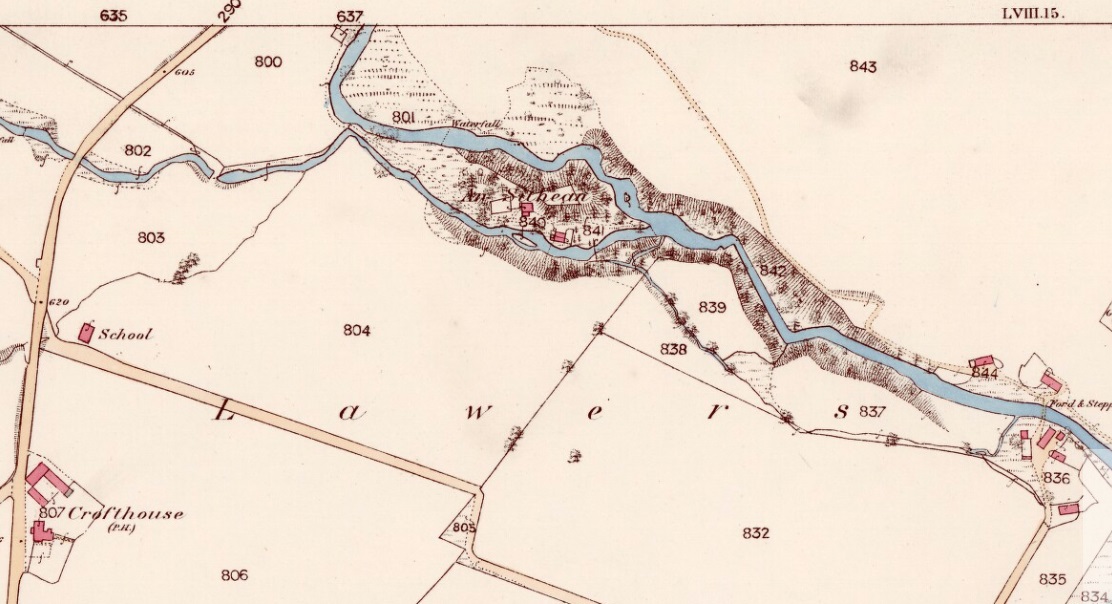
An Sithean on 1862 OS-map

Take the A827 road on the north-side of Loch Tay between Killin and Kenmore, and roughly halfway along you’ll find the tiny hamlet of Lawers.  Go down into the hamlet itself and, amidst the remains of the old trees where now are houses, nestled on a rise in the land with burns (streams) on either side, remains of the fairy mound of An Sithean still lives…

Folklore

Remnants of the legends of little people are legion in the Scottish mountains.  Sadly, many of them died when the English arrived and culled the population in ‘The Clearances’ of the 19th century – none moreso than in the area surrounding Loch Tay.  But thankfully, in the latter-half of the 19th century, a local man called James MacDiarmid (1910), took it upon himself to write down many of the old stories told by the remaining locals – as well as narrate those he remembered as a boy, as told by the elders around him.  Whilst tales of ‘fairies’ and other such creatures are thought by city-minds to be little other than fantasies, mountain-folk cosmologies differ greatly to those who are disconnected from the natural world.  Genius loci abound, and animism is the basic plinth integral to communities in the hills, where the world is much much more real.  This is one such tale…

“Not many years ago there lived in the neighbourhood of Killin a man who was in the habit of recounting his wonderful adventures with the white horse of the fairies.  When coming home one night from Kenmore market, and just as he was passing Sithean, Lawers, he heard most enchanting music proceeding from the knoll.  Unable to resist the temptation, he gradually went nearer and nearer the fairies’ place of abode, till at last he was fairly among them.  They received him most kindly, and on parting gave him one of their white horses to carry him home.  His steed went through the air at a speed almost equalling that of lightning, and in a few minutes he found himself above a house at Clifton, Tyndrum, some twenty-five miles westward from Lawers.  Happening to shout “ho!” when he was right above the chimney, the fairy horse threw him off its back, and down he dropped feet foremost through the wide, old-fashioned chimney, and alighted in the midst of a wedding party, much to their surprise and alarm. He continued in their pleasant company till daylight, when he returned home at his leisure, thanking the fairies for the pleasure they had so unexpectedly given him!”

Usually, tales such as this relate to the existence of prehistoric cairns or tumuli (burial sites), but no such archaeological remains have ever been known to live here.  Equally curious is how the man in this tale wasn’t kept in the timeless realms, beloved of faerie-land, where reveries with them would take decades from a man’s life, even though it only felt like one night.  This would imply

I’ve come across old locals who still speak, not just of the little-folk, but of other hauntings in this beautiful part of Loch Tay.  May the land not be cursed by the fools who put their idea of ‘development’ in front of the genius loci here; lest madness and ill-fortune will prevail…

References:

  1. MacDiarmid, James, “More Fragments of Breadalbane Folklore,” in Transactions of the Gaelic Society Inverness, volume 26, 1910.

© Paul Bennett, The Northern Antiquarian

Greenland, Acharn, Kenmore, Perthshire

Stone Circle:  OS Grid Reference – NN 76785 42490

Also Known as:

  1. Acharn Falls
  2. Auchlaicha
  3. Canmore ID 25004
  4. Queen’s Wood
  5. Remony

Getting Here

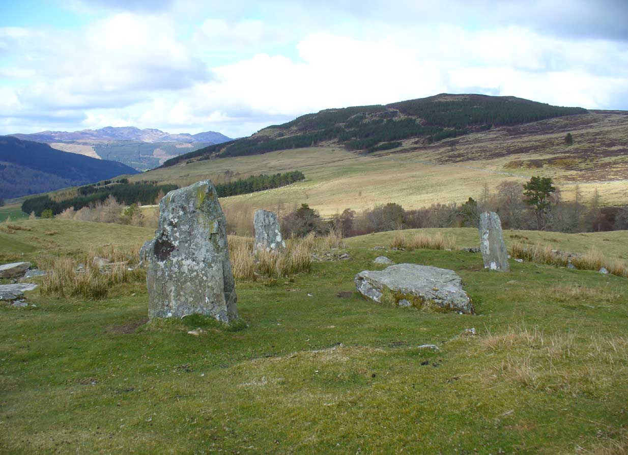
Greenland stone circle, Kenmore

From Kenmore, take the minor road on the south-side of Loch Tay for 1½ miles (2.4km) until you reach the hamlet of Acharn.  From here take the track uphill for ½-mile past the Acharn waterfalls and follow the same route to the Acharn Burn tumulus.  Walk past here along the track and, just before you reach the wooded burn, bear right and walk uphill for nearly another half-mile, roughly parallel to the Allt Mhucaidh (Remony Burn).  As you reach the proper moorland, you’ll see the stones rising up!

Archaeology & History

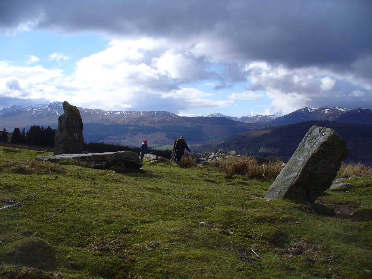
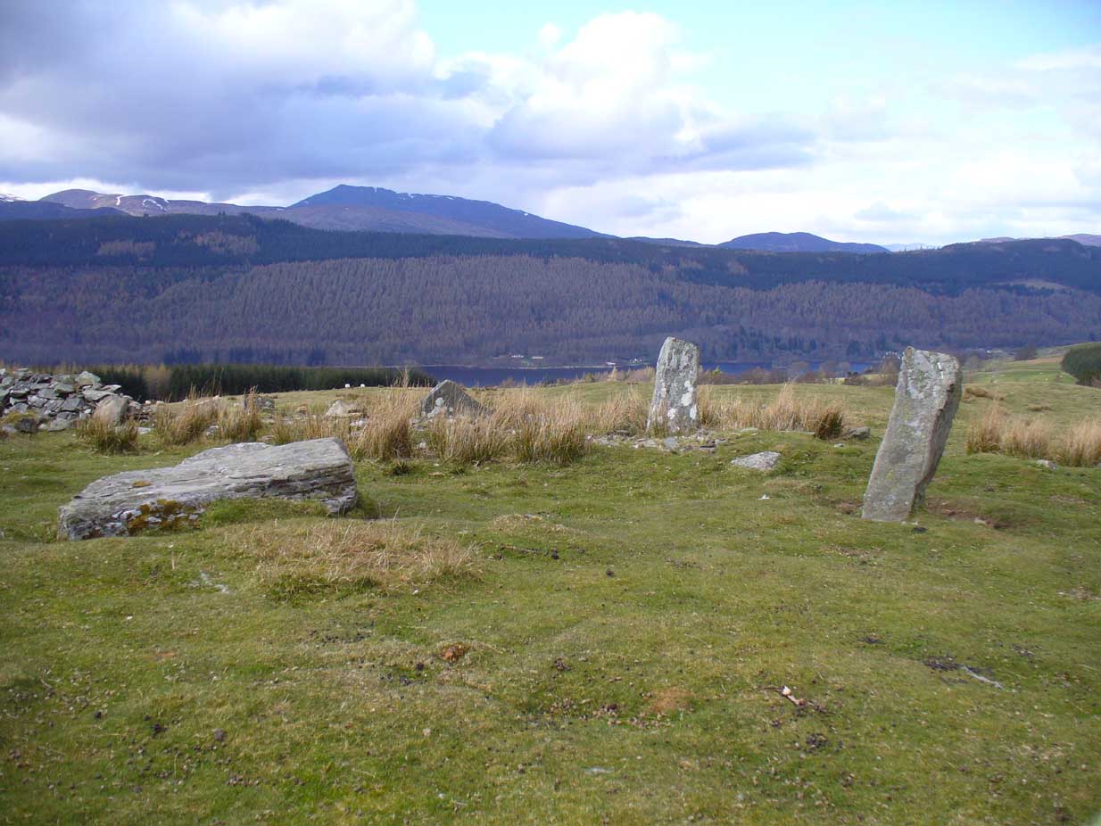
This is quite a spectacular site!  Not for the size of the stones or the arrangement of the megaliths, but for the setting!  It’s outstanding!  When a bunch of us wandered up here a few months ago, snow was still on the peaks and Nature was giving us a real mix of Her colours and breath in a very changeable part of Her season.  Twas gorgeous.  Perhaps the setting was the thing which has kept the circle pretty quiet until recent years.  It’s high up – and out of season the freezing winds and driving rains would keep all but the healthiest of crazy-folk away.  We all only wished we’d have had more time here.  But that aside…

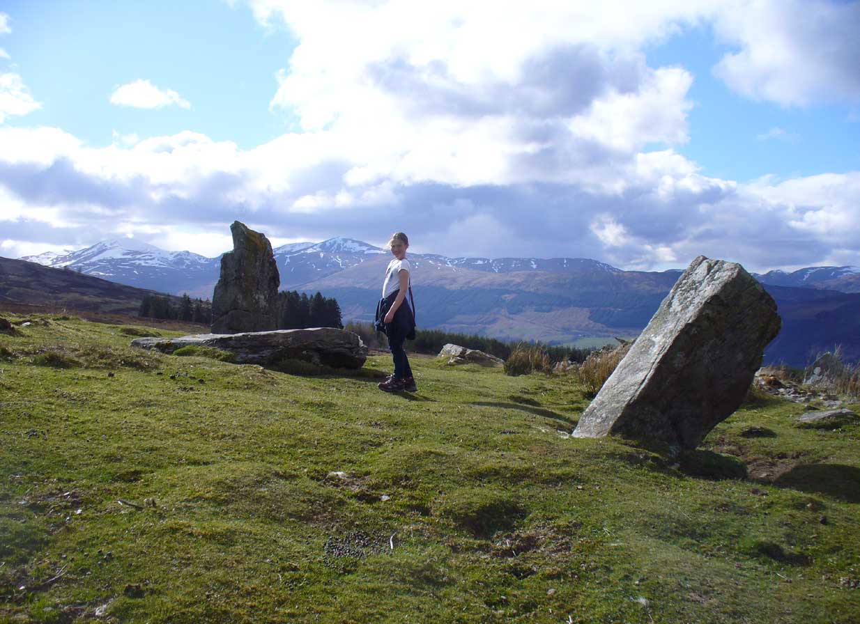
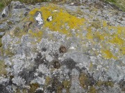
Lara between stones and mountains
Lara between the old stones
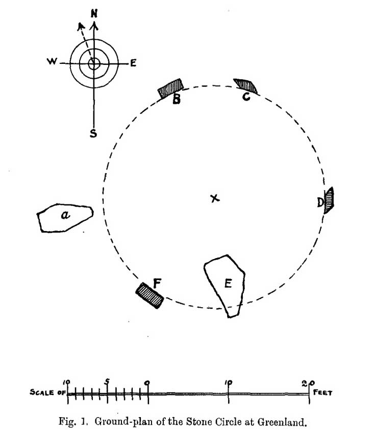
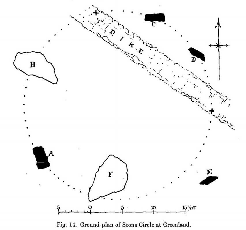
MacKenzie's 1909 groundplan
J.D. MacLeod’s 1909 groundplan

Along with the changeable weather She gives up here, the literary-types have given this circle changeable names too.  Nowadays known as the Acharn Falls stone circle, in truth that’s a mile away and lacks in both visual and geographical accuracy.  ‘Greenland’ was the name cited when J.B. MacKenzie (1909) wrote about it more than a hundred years back, and it’s the name we find in Mr Burl’s (2000) magnum opus, despite him telling how “a local name for it is Auchliacha, ‘the field of stones'” (Burl 1995), so perhaps we should adhere to what the locals say (my preference generally).

The atmospheric ring, looking W
Greenland Circle, looking N

The ring is in quite a mess, having had a drystone wall built through it in the last 100 years.  No walling is shown on the early Ordnance Survey maps, so some local land-owners (an english incomer?) was probably responsible.  The stones used to stand in parts of the ancient forest, which must have looked and felt quite something before they ripped the trees away.  It was hiding away in the woods when J.B. MacKenzie (1909) came here, shortly after the “modern wall” as he called it, had been constructed through the circle.  He wrote:

“Six stones remain on the site, of which four are still erect and in position, and two are prostrate, one of which has apparently fallen inwards and the other outwards of the line of the circle, the diameter of which, touching the inner sides of the stones still standing, is 27 feet 9 inches.  Mr MacLeod has supplied the following dimensions of the several stones:

A — 6 feet 9 inches x 3 feet 6 inches, lying flat
B — 8 feet 4 inches, in circumference at ground level
——1 foot 7 inches, high above the ground level
C — 6 feet 10 inches, in circumference at ground level
——4 feet 0 inches, high above ground level
D — 6 feet 0 inches, in circumference at ground level
——4 feet 3 inches, high above ground level
E — 7 feet 8 inches x 4 feet 6 inches, lying flat
F — 9 feet 0 inches, in circumference at ground level
——5 feet 8 inches, high above ground level.”

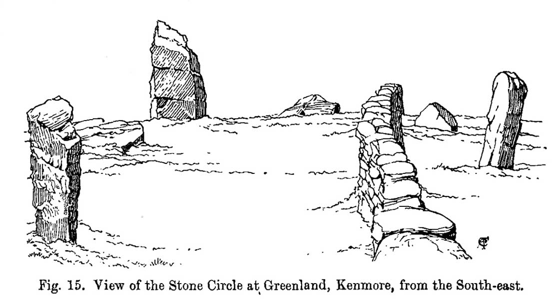
Coles' 1910 sketch of the site
Coles’ 1910 sketch of the site
Coles' 1910 ground-plan
Coles’ 1910 ground-plan

The year after MacKenzie’s notes, the great Fred Coles (1910) paid a visit here.   Noting how high it was in the landscape compared to other megalithic rings in the region (it’s the highest known circle, at 1240 feet up), he went on to give his usual detailed appraisal, telling:

“In a little clearing amid these woods on Craggan Odhar, but disfigured by a dike which separates some of the Stones from the others, stands this Greenland Circle of which the ground-plan is given…. The Stones are six in number, of which four are erect, and they all appear to be of the quartzitic schist.  Some disturbance has occurred, and it seems probable that there were at least two more Stones originally, one between B and C at the spot marked with a cross, and the other similarly marked midway between D and E.  There is, however, no vestige of any Standing Stone in the sides of the dike itself.

“On the south-west is Stone A, the tallest, with pointed top, 5 feet 7 inches in height, oblong in contour, and measuring at the base 9 feet 5 inches.  Having several deep horizontal fissures, this Stone…bears an odd resemblance to masonry.  The next Stone, B, lies prostrate, measuring 7 feet 9 inches by 4 feet, and about 1 foot in thickness above ground.  The little oblong Stone, C, on the other side of the dike, stands only 1 foot 10 inches above ground, and probably is a mere fragment—the stump of a much larger block. At D the Stone is 4 feet 3 inches in height, and is a very narrow slab-like piece; Stone E, which has a decided lean over towards the interior of the Circle, is 4 feet 2 inches high, and is in basal girth 6 feet 6 inches.  Like the others, it is angular and thinnish in proportion to its breadth.  Stone F measures 8 feet 2 inches by 5 feet 2 inches, and its position, with the narrow end resting almost on the circumference, suggests, as in other cases, the probability that it was this narrow end which was buried when the Stone was erected. These blocks were most likely brought from the low cliffy ledges near, for, as the name ‘Craggan Odhar’ implies, the place was, before being planted, conspicuous for its Grey Crags.”

Although no modern excavation has taken place, when the brilliant local historian William Gillies (1925) first got round to exploring the circle, he remedied that situation.  In probing the ground beneath the surface when the weather conditions allowed, Mr Gillies found that there seemed to have been more standing stones in the circle than presently meets the eye.  He wrote:

“I paid several visits last summer to this lonely and elevated spot, and examined the ground for stones, where the wide spaces between those indicated on the plan (see Coles’ 1910 drawing, above) suggested that others might be concealed beneath the turf.  There would appear to be three stones missing, which would make the circle to consist of nine in all when it was entire.  With little trouble, at a depth of only 3 inches, I located a large flat stone measuring 5 feet 6 inches by 4 feet 8 inches.  It had stood on the north-western arc of the circle half-way between the fallen stone on the west and the broken standing stone on the north-north-west.  It had fallen outwards. The foundation of the wall, built probably some seventy years ago to enclose the plantation, rested on the edge of the stone.  The ground along the circumference of the circle between the three stones on the eastern side was carefully probed, but the rod touched only small loose stones.

“I next turned up the centre of the circle, and at a depth of 5 inches below the surface came upon a dark deposit.  It extended over a space of 2 feet square and was about 5 inches in depth.  It was mixed with a white limy substance consisting of calcined bones, bits of which along with a sample of the dark substance I brought to the Museum.  A bit of charcoal from the deposit revealed the lines of cleavage in the wood.  There is no peat at the spot, although the elevation, which is at least 1200 feet, might suggest it.  The surrounding soil is of a reddish colour, and quite unlike the deposit which must have been placed there, and which was probably a burial after cremation.”

Greenland circle, looking NE

Gillies was exemplary in his exploration of sites that were on the verge of disappearing from tongue and text and we remain incredibly grateful for his later exposition on the antiquarian remains and legends of this truly stunning landscape.  In Aubrey Burl’s (1995; 2000) respective summaries of this stone circle, as well as that of John Barnatt (1989), they ascribe the situation of it originally having 9 stones, as Gillies suggested.

Visit this site!  If you’re into megaliths, you’ll bloody love it!

References:

  1. Barnatt, John, Stone Circles of Britain – volume 2, BAR: Oxford 1989.
  2. Burl, Aubrey, A Guide to the Stone Circles of Britain, Ireland and Brittany, Yale University Press 1995.
  3. Burl, Aubrey, The Stone Circles of Britain, Ireland and Brittany, Yale University Press 2000.
  4. Coles, Fred, “Report on Stone Circles Surveyed in Perthshire (Aberfeldy District),” in Proceedings of the Society of Antiquaries, Scotland, volume 44, 1910.
  5. Gillies, William A., “Notes on Old Wells and a Stone Circle at Kenmore“, in Proceedings Society of Antiquaries, Scotland, volume 59, 1925.
  6. Gillies, William A., In Famed Breadalbane, Munro Press: Perth 1938.
  7. Mackenzie, J B., “Notes on a Stone Circle at Greenland, Parish of Kenmore“, in Proceedings Society of Antiquaries, Scotland, volume 43, 1909.
  8. Money, Bob, Scottish Rambles – Corners of Perthshire, Perth 1990.

Acknowledgements:  Many thanks to the unholy bunch who helped travel, locate, photograph and take notes on the day of our visit here, including Aisha, Lara & Leo Domleo; Lisa & Fraser; Nina and Paul.  Let’s do it again and check out the unrecorded stuff up there next time!

© Paul Bennett, The Northern Antiquarian


Acharn Burn, Kenmore, Perthshire

Tumulus:  OS Grid Reference – NN 7607 4294

Also Known as:

  1. Canmore ID 25011

Getting Here

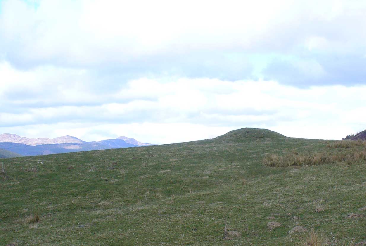
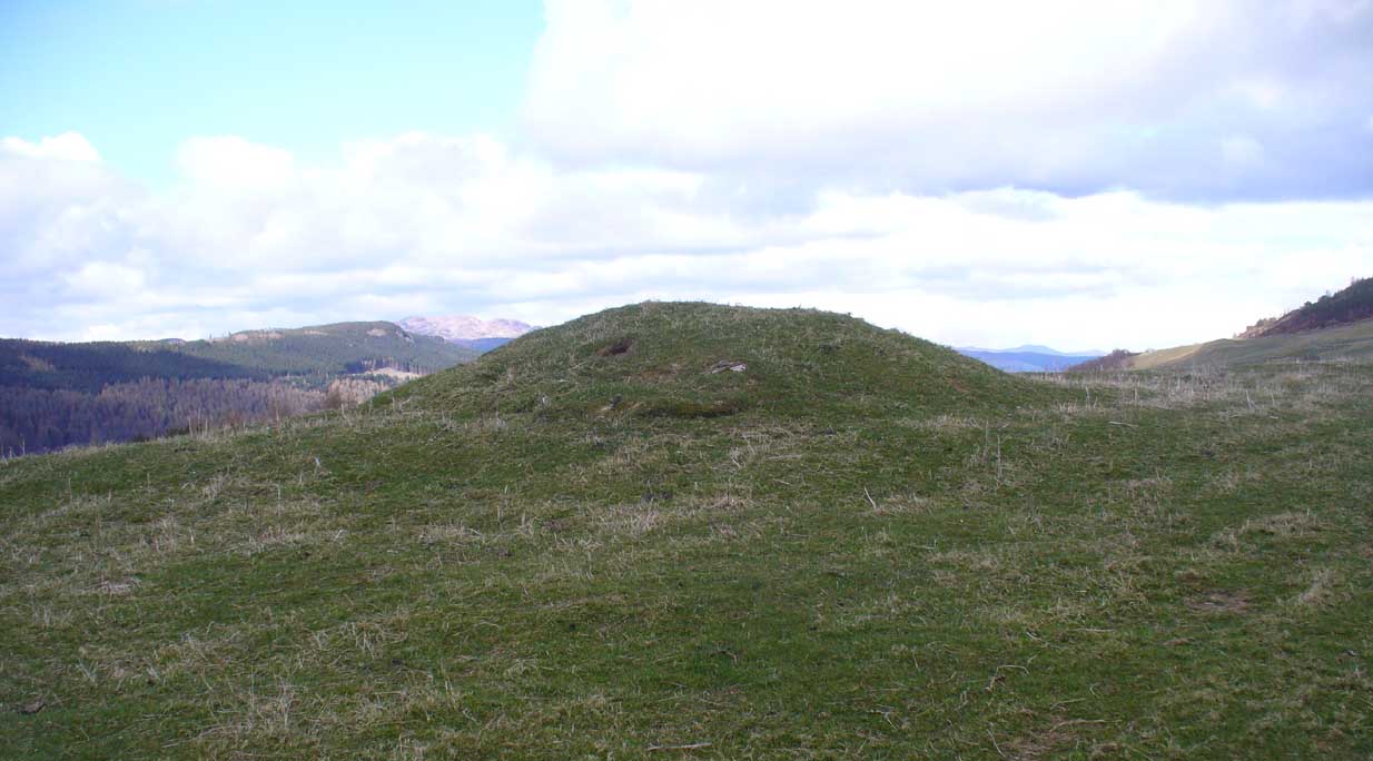
Acharn Burn tumulus, Kenmore

From Kenmore, take the minor road on the south-side of Loch Tay for 1½ miles (2.4km) until you reach the hamlet of Acharn.  From here take the track uphill for ½-mile past the Acharn waterfalls and when you come out on the east-side of the trees, keep walking uphill parallel to the trees and burn until the land levels-out and the track heads away, east.  200 yards ahead, on the left-side of the track, you’ll see the large fairy-mound.

Archaeology & History

The tumulus looking NE

First reported in archaeological circles in the Discovery & Excavation Scotland mag in 1964, this archetypal fairy-mound or tumulus sitting on the grassy plain overlooking the eastern end of Loch Tay and district would have been known of by local people in older times, but I can find no early accounts of it, nor its traditions.  When Bob Money (1990) came here, he told of the grand vista stretching into the distant mountains:

“From here the views…are superb, and the little mound, which is an ancient tumulus, or burial mound, has sat here undisturbed for several thousand years, guarding the secret of its once important occupant.”

Circular in structure and measuring 20 feet across, the mound rises nearly four-feet high and is probably Bronze Age in origin.  Although mostly covered in grass, there are some loose stones visible on the side of the mound, seeming to indicate that it may be a covered cairn.  No excavation have yet taken place here.

References:

  1. Money, Bob, Scottish Rambles – Corners of Perthshire, Perth 1990.

AcknowledgementsMany thanks to the unholy bunch who helped travel, locate, photograph and take notes on the day of our visit here, including Aisha, Lara & Leo Domleo; Lisa & Fraser; Nina and Paul.  Let’s do it again and check out the unrecorded stuff up there next time!

© Paul Bennett, The Northern Antiquarian

Tombreck 01, Kenmore, Perthshire

Cup-Marked Stone:  OS Grid Reference – NN 64798 38284

Also Known as:

  1. Canmore ID 289069

Getting Here

Cup-marked stone, with Ben Lawers to the rear

Along the A827 Loch Tay road between Morenish and Lawers, take the track uphill where Carie farmhouse and Tombreck are either side of the road. Walk up this track 2-300 yards till you go through the gate just past the sheep-folds on your left.  Ahead of you is a small grassy hillock on your right – go to the top of it, where you’ll find one of them has a row of cup-markings on its northern edge.

Archaeology & History

This is a reasonably large boulder near the top of the hillock above the trackside.  Several rocks have what may be single cup-markings on them, but this roughly oblong-shaped block has four or five of them running along the more northern edge of the stone, in a rough line sloping gently down the surface of the rock.  No carved rings or other lines were immediately notable here.  It’s nothing special to look at and will probably be of interest only to the hardcore petroglyph enthusiasts amongst you. However, there are many more ornate cup-and-rings found further along the ridges close by (which we’ll add as the weeks and months go by); as well as the remains of a prehistoric enclosure about 200 yards southeast.  The small standing stone of Carie is roughly the same distance to the south.

Cup-marks visible along the edge
...and from above
…and from above

(Note: although I’ve listed this as the ‘Tombreck 01’ carving, this is likely to be revised in the near future as there is a large gathering of carvings all around this area. The region is still being surveyed and the designations of the petroglyphs will be revised as and when they are recorded more fully, or if/when a detailed published account catalogues them satisfactorily.)

References:

  1. Currie, George, “Kenmore: Tombreck (2-4), Cup-and-ring Marked Rocks,” in Discovery & Excavation in Scotland, New Series volume 10, 2009.
  2. Currie, George, “Kenmore: Tombreck (5-7), Cup-Marked Rocks,” in Discovery & Excavation in Scotland, New Series volume 10, 2009.

© Paul Bennett, The Northern Antiquarian


Carie, Kenmore, Perthshire

Standing Stone:  OS Grid Reference – NN 64772 38018

Also Known as:

  1. Canmore ID 289028

Getting Here

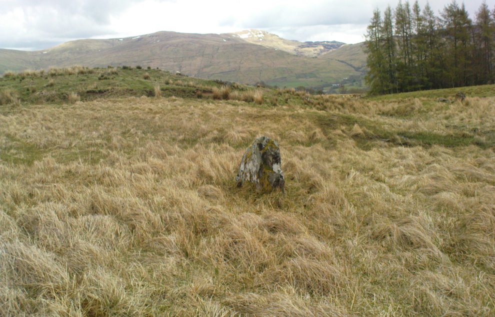
Small standing stone, looking east

Along the A827 Loch Tay road between Morenish and Lawers, keep your eyes peeled for the Carie farmhouse on the mountain-side (Tombreck is across the road).  The farmer here is very helpful and will let you walk up the land behind his abode if you ask. Go behind the trees at the back of the farm, following the small burn up for a coupla hundred yards till you see the stone in the long grasses on the right.

Archaeology & History

Carie Stone, looking south

Nothing seems to have been written about this small standing stone, found close to the large cluster of cup-and-ring stones of Ben Lawers.  It sits alone in now-boggy ground, in a small dip of land near the stream above Carie Farm.  The stone is barely a foot thick, but stands 3½ feet tall and is more than 4 feet wide.  Its isolation is curious and makes it difficult to contextualize; but the stone is worth visiting if you’re exploring the rock art on the slopes above.

© Paul BennettThe Northern Antiquarian

Tir Artair, Killin, Perthshire

Standing Stone:  OS Grid Reference – NN 58870 34720

Also Known as:

  1. Canmore ID 24205

Getting Here

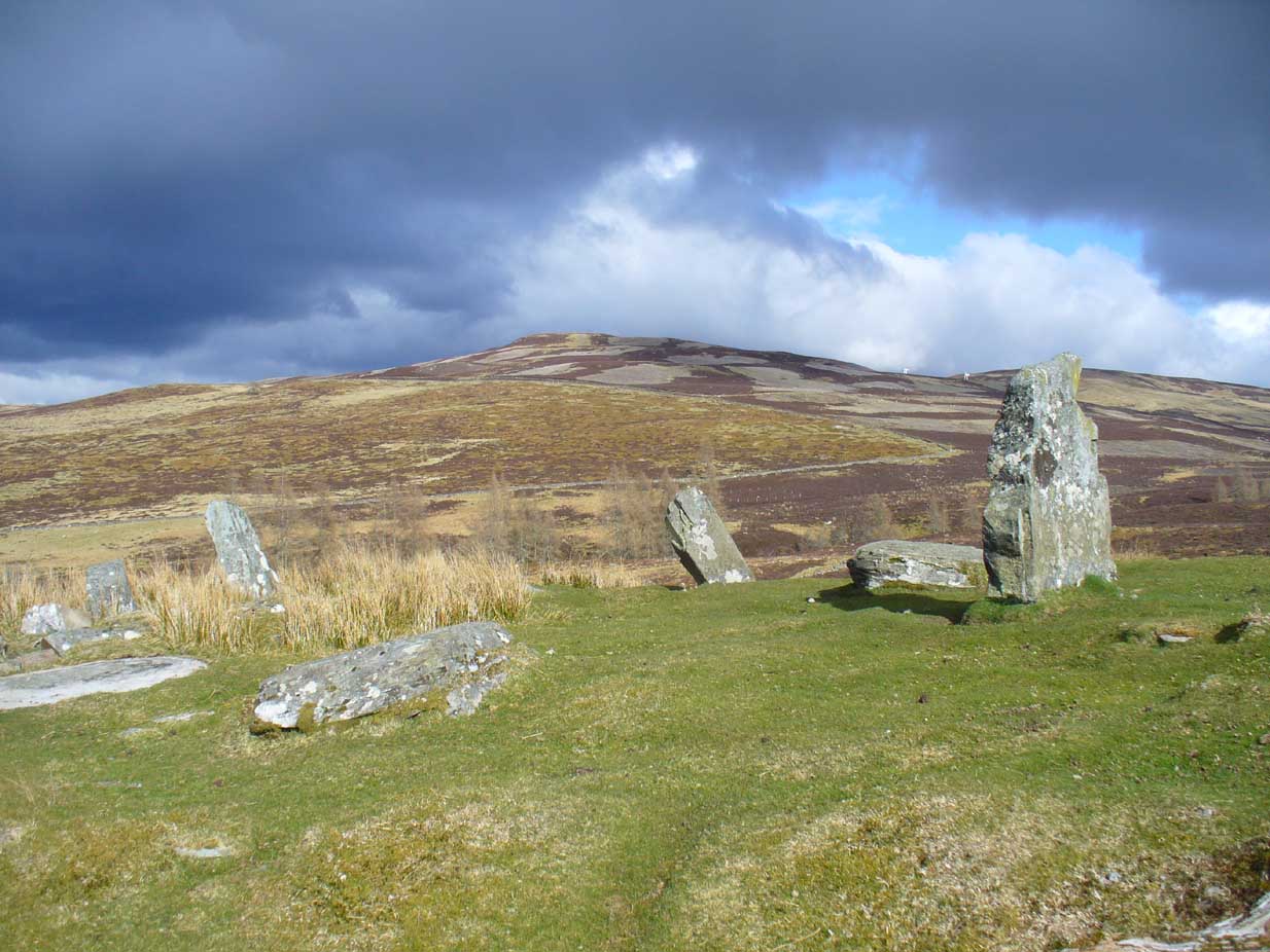
Standing stone of Tir Artair
The standing stone of Tir Artair

This lovely standing stone can be a pain-in-the arse to get to!  Unless you wanna clamber over the excess of increasingly stupid deer fences that are appearing all over the place (old locals aint happy), follow the directions to the Tir Artair cup-marking, then walk across to the fencing and follow it all the way down into the fields until you reach the stream on your right, running in front of the fenced woodland. There’s a large gate here into the trees. Go thru it. In front of you is some overgrown walling into the trees: follow this along, slowly, keeping your eyes peeled for the upright stone about 100 yards in.  Good luck!

Archaeology & History

The old mossy stone
The old mossy stone

In this “land of Arthur”—as the place-name means—we find this beautiful moss and lichen-encrusted standing stone, living alone in remains of mainly birch woodland.  It stands less than 5 feet tall, just in front of some old walling encircling one of the many rounded knolls in this area.  The stone may have had some megalithic partners in bygone days, as we find, about 25 yards away sleeping amidst overgrown vegetation beside an old oak, a couple of other old stones laid on the ground that seem to have been placed here by human hands.  Their antiquarian nature is unknown.
References:

  1. Gillies, William A., In Famed Breadalbane, Munro Press: Perth 1938.

© Paul Bennett, The Northern Antiquarian