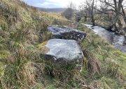
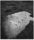
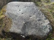
Borgie Well, Cambuslang, Lanarkshire

Sacred Well:  OS Grid Reference – NS 64412 60194
Getting Here

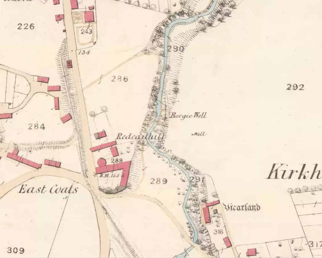
Borgie Well on the 1859 map

There must be an easier way to visit this site than the method I used.  Which was:  along Cambuslang’s Main Street (A724), turn up the B759 Greenlees Road for nearly 500 yards, turning left onto Vicarlands Road.  Notice the grass verge and steep slope immediately to your left.  Walk into the tree-lined gorge, following the left-side along the edges of the fencing.  About 150 yards down the steep glen, note the very denuded arc of stone-walling and rickety fencing on the other side of the burn.  That’s it! (broken glass and an excess of people’s domestic waste are all the way down; very difficult to reach, to say the least!)

Archaeology & History

Found in a dreadful state down the once-beautiful Borgie Glen, this is one of the most curious entries relating to sacred and healing springs of water anywhere in the British Isles.  Indeed, the traditions and folklore told of it seem to make the site unique, thanks to one fascinating factor…..which we’ll get to, shortly…..
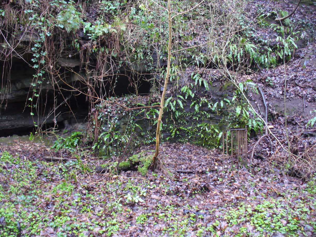
Remains of the Borgie Well

The name ‘Borgie’ is an oddity.  Local historians J.T.T. Brown (1884) and James Wilson (1925) wondered whether it had Gaelic, Saxon or Norse origins, with Brown thinking it may have been either a multiple of a simple bore-well, or else a title given it by a travelling minister from Borgue, in Kirkcudbright.  Mr Wilson took his etymology from the very far north where “there is a stream called the Borgie” (just below the Borgie souterrain).  This is said to be Nordic in origin, with

“borg, a fort or shelter, and -ie, a terminal denoting a stream. It is almost certain that our Borgie has the same origin; that is, ‘the fort or shelter by the stream.’”

The Borgie Well was described by a number of authors, each of whom spoke of its renown in the 19th century and earlier.  One of my favourite Glasgow writers, Hugh MacDonald (1860), had this to say about the place:

“There are several fine springs in the glen, at which groups of girls from the village, with their water pitchers, are generally congregated, lending an additional charm to the landscape, which is altogether of the most picturesque nature. One of these springs, called “the Borgie well,” is famous for the quality of its water, which, it is jocularly said, has a deteriorating influence on the wits of those who habitually use it.  Those who drink of the “Borgie,” we were informed by a gash old fellow who once helped us to a draught of it, are sure to turn “half daft,” and will never leave Cambuslang if they can help it.  However this may be, we can assure such of our readers as may venture to taste it that they will find a bicker of it a treat of no ordinary kind, more especially if they have threaded the mazes of the glen, as we have been doing, under the vertical radiance of a July sun.”
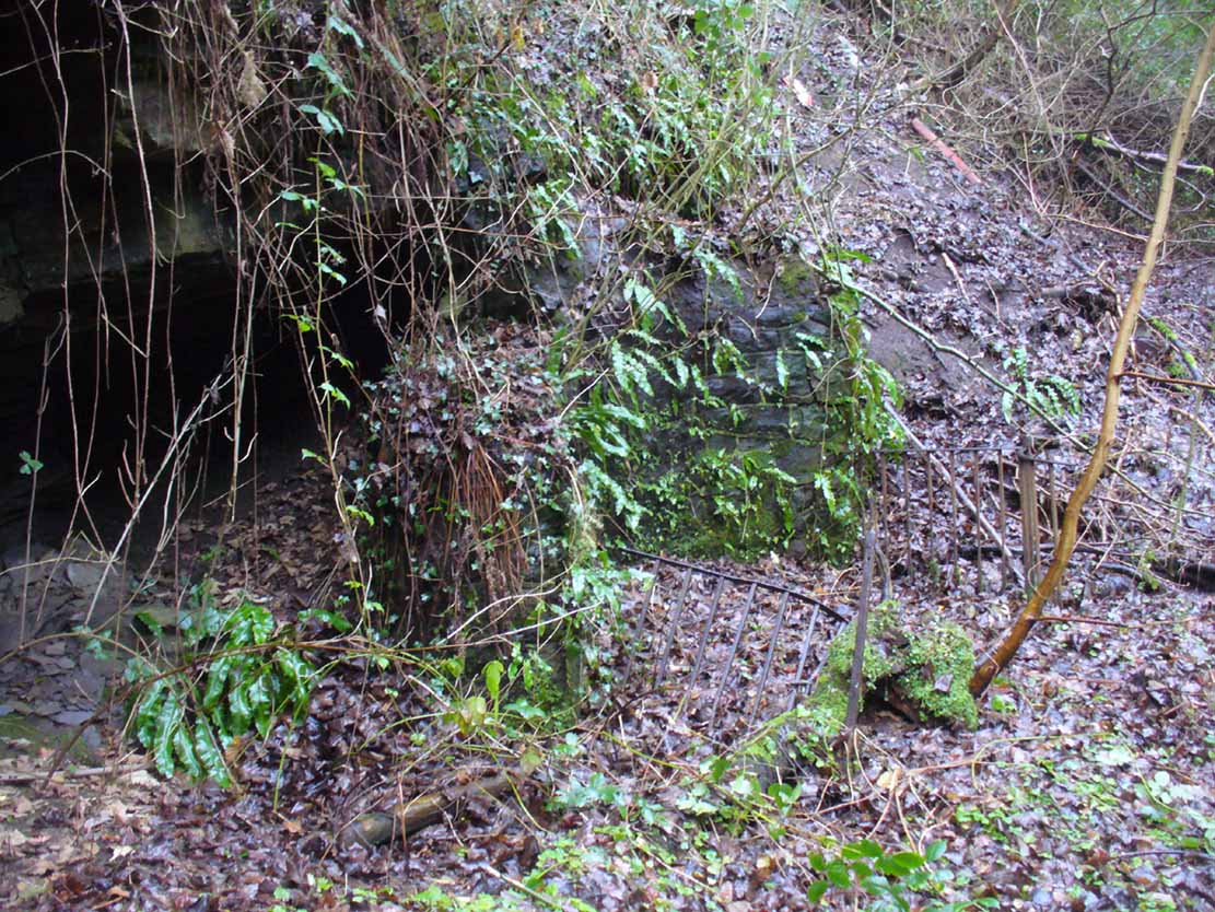
Borgie Well, looking south

It’s somewhat troublesome to reach, but a beautiful landscape indeed is where, today, only remnants of the Borgie Well exist.  A very eroded semi-circle of walling and iron bars protects what was once the waters of the well—which have long since fallen back to Earth.  Behind it, right behind it, overhangs the cliff and a small cave: a recess into the Earth with its very own feeling.  It has the look and feel of a witch’s or hermit’s den with distinct oracular properties.  This geomancy would not have gone unnoticed by our ancestors.  In this enclaved silence, the once bubbling waters beneath the cliffs give a feel of ancient genius loci—a memory still there, despite modernity.  Whether this crack in the Earth and its pure spring waters was some sort of Delphic Oracle in days gone by, only transpersonal ventures may retrieve… Perhaps…

In the 19th century a path took you into the glen from the north, and a commemorative plaque was erected here by a Dr Muirhead, where now lie ruins.  It read:

The Borgie Well here
Ran many a year.

Then comes the main verse :_

Wells wane away,
Brief, too, man’s stay,
Our race alone abides.
A s burns purl on
With mirth or moan,
Old Ocean with its tides,
Each longest day
Join hands and say
(Here where once flowed the well)
We hold the grip
Friends don’t let slip
The Bonny Borgie Dell.
1879.

At the base was carved an appeal to the local folk:

Boys, guard this well, and guard this stone,
Because, because, both are your own.

The plaque has long since gone; and according to the local historian J.T.T. Brown (1884), the waters went with it due to local mining operations around the same time.  But there was an additional rhyme sang of the Borgie Well which thankfully keeps the feel of its memory truly awake (to folk like me anyway!).  It is somewhat of a puzzle to interpret.  Spoken of from several centuries ago, it thankfully still prevails:

A drink 0′ the Borgie, a taste 0′ the weed,
Sets a’ the Cam’slang folks wrang in the heid.

Meaning simply, if you drink the waters of this well, you’ll get inebriated!   It’s the derivation of the word ‘weed’ that is intriguing here.  In Grant’s (1975) massive Scottish dialect work we are given several meanings. The most obvious is that the weed in the poem is, literally, a weed as we all know it.  But it also means ‘a fever’; also ‘to cut away’ or ‘thin out’; to carry off or remove (especially by death); as well as a shroud or sheet of cloth.  These meanings are found echoed, with slight variants, in the english dialect equivalent of Joseph Wright. (1905)  Hugh MacDonald told that the Enchanter’s Nightshade (Circaea lutetiana) grew hereby—which, initially, one might think could account for this curious rhyme.  But the Enchanter’s Nightshade has nothing to do with the psychoactive Nightshade family, well-known in the shamanistic practices of our forefathers.  However, in the old pages of one Folklore Society text, William Black (1883), in repeating the curious rhyme, told us:

“The Borgie well, at Cambuslang, near Glasgow, is credited with making mad those who drink from it; according to the local rhyme —

A drink of the Borgie, a bite of the weed,
Sets a’ the Cam’slang folk wrang in the head.”

The weed is the weedy fungi.”

A mushroom no less!  In John Bourke’s curious (1891) analysis of early mushroom use, he repeats Mr Black’s derivation.  If this ‘weed’ was indeed use of mushrooms that made the local folk “go mad” or “wrang in the head” (and if not – what was it?), it’s an early literary account of magic mushroom intoxication!  If this interpretation is correct, the likelihood is that the Borgie Well was a site used for ritual or social use of such intoxicants.  Many sites across the world were used by indigenous people for ritual intoxication, and this could be one of the last folk remnants of such usage here. We know that Scotland has its own version of cocaine, used extensively by our ancestors (even the Romans described it) and which was still being used by working Highlanders in the 20th century—but early descriptions of mind-affecting mushrooms are rare indeed!
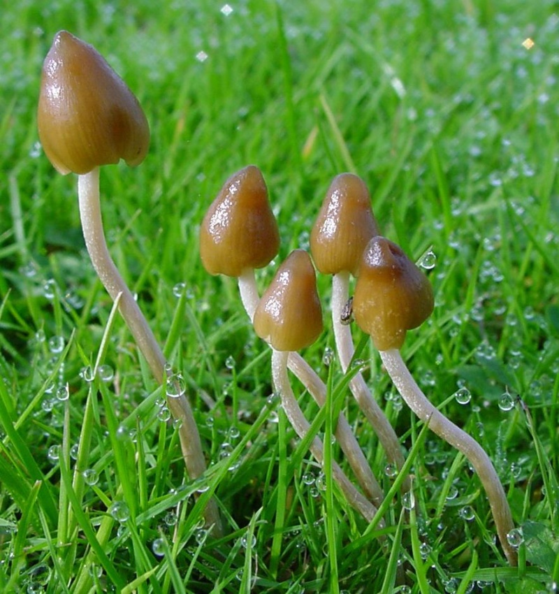
Psilocybe semilanceata
Amanita muscaria
Amanita muscaria

Mr Black gives no further folklore, nor the source of his information, other than to suggest that the madness incurred by the Well typified the people of Cambuslang!  “Weedy fungi” may have been ergot (Claviceps purpurea), but the incidence of the grasses upon which it primarily grows, rye, here seems unlikely—and the folklore would certainly have included the ‘death’ aspects which that fungus brings!  Fly agarics (Amanita muscaria) however, may have grown here.  Old birches are close by, which produce nice quantities of those beautiful fellas.  On the fields above the gorge, where now houses grow, Liberty Caps (Psilocybe semilanceata) may have profused—as they do in the field edges further out of town—but this species has no local cultural history known about from the early period.  We must, however, maintain a healthy scepticism about this interpretation—but at the same time we have to take into account the ‘intoxicating’ madness which the combination of the “waters and the weed” elicited.

One final note I have to make before closing this site entry:  despite the beautiful location, this small gorge is in a fucking disgraceful state.  Some of the people who live in the houses above the gorge should be fucking ashamed of themselves, dumping masses of their household rubbish and tons of broken glass into the glen.  If these people are Scottish, WTF are you doing polluting your own landscape like this?  This almost forgotten sacred site needs renewing and maintaining as an important part of your ancient heritage.  Have you no respect for your own land?!?

References:

  1. Armitage, Paul, The Ancient and Holy Wells of Glasgow, TNA 2017.
  2. Black, William George, Folk Medicine: A Chapter in the History of Culture, Folk-lore Society: London 1883.
  3. Brotchie, T.C.F., “Holy Wells in and Around Glasgow,” in Old Glasgow Club Transactions, volume 4, 1920.
  4. Brown, J.T.T., Cambuslang, James Maclehose: Glasgow 1884.
  5. Bourke, John G., Scatalogic Rites of All Nations, W.H. Lowdermilk: Washington 18981.
  6. Grant, William (ed.), The Scottish National Dictionary – volume 10, SNDA: Edinburgh 1975.
  7. Hansen, Harold A., The Witches’ Garden, Santa Cruz: Unity 1980.
  8. MacDonald, Hugh, Rambles round Glasgow, John Cameron: Glasgow 1860.
  9. MacKinlay, James M., Folklore of Scottish Lochs and Springs, William Hodge: Glasgow 1893.
  10. Morris, Ruth & Frank, Scottish Healing Wells, Alethea: Sandy 1982.
  11. Walker, J.R., ‘”Holy Wells” in Scotland”, in Proceedings of the Society of Antiquaries, Scotland, volume 17, 1883.
  12. Wilson, James A., A History of Cambuslang, Jackson Wylie 1925.
  13. Wright, Joseph, The English Dialect Dictionary – volume 6, Henry Frowde: Oxford 1905.

Acknowledgements:  Huge thanks again, in various ways, to Nina Harris for getting us here; and Paul Hornby, for reminding me of my literary sources when I needed them! Thanks too to Travis Brodick and his beautiful photo of the Amanita muscaria cluster.

© Paul Bennett, The Northern Antiquarian


Homer Well, Looe, Cornwall

Holy Well (lost):  OS Grid reference – SX 25 53

Archaeology & History

This curiously-named and long lost well would almost have us believe that the Greek poet and philosopher himself was a-wandering in this neck of the woods.  But that sadly wasn’t the case.  It seems to have been mentioned just once in Looe’s early Town Books:

“In 1621 that part of West Looe Down which lieth on the West part of the Homer Well, was let to rent, for two crops, at 6s.8d. per acre”

In Courtney & Couch’s (1880) Cornish dialect work, the word homer is said to mean “homeward”; this is also echoed in Wright’s (1905) magnum opus. It seems to imply that it was a drinking well used by folk traveling the short distance from Looe village, across the river and onto or over West Looe Down towards their cottage or farmhouse; akin to a refreshing resting place halfway home, so to speak.  Sometimes the word homeward can be taken to simply mean “at home,” in which case it would suggest that the Well was simply next to someone’s house.  We may never know…

References:

  1. Bond, Thomas, Topographical and Historical Sketches of the Boroughs of East and West Looe, J. Nichols: London 1823.
  2. Courtney M.A. & Couch, T.Q., Glossary of Words of Use in Cornwall, English Dialect Society: London 1880.
  3. Wright, Joseph, English Dialect Dictionary – volume 3, Henry Frowde: London 1905.

© Paul BennettThe Northern Antiquarian

Shotley Bridge, Consett, County Durham

Cist (destroyed):  OS Grid Reference – NZ 10 53

Archaeology & History

The location of what was, in all likelihood, a small Bronze Age burial on the edge of old Shotley Bridge (as it was in the mid-19th century) remains a mystery.  It’s likely that the position of the site  is now beneath someone’s house in the town.  Its existence was thankfully recorded in correspondence between a “Mr. John Dixon, of the  Engineer’s Office, Consett Ironworks,” and the great John Collingwood Bruce. Dixon’s letter dated October 13, 1856, told:

“I take the liberty of informing you of the discovery of a coffin, of some description or other, in a field near ShotleyBridge.  I have visited the place and enclose a sketch² made on the spot as it appeared when I saw it.  Some workmen were excavating sand and came upon it about a foot beneath the surface. The only remains that we can ascertain to have been in it, are a few pieces of bone, barely recog­nizable as such, and now in the hands of Dr.Renton.  I have not yet seen them.  He tells me that one fragment resembles a portion of a skull, but that they are in such small pieces it is difficult to say what they are.  I shall endeavour to get a piece — as, if the surface remains, I apprehend we shall be able to say whether they are human or not. Possibly it may never have been a human coffin —though from the paved bottom and the ap­pearance of great age the stones possess, and also the bearing NW and SE, I am inclined to think it must be one. The dry situation — a sloping hillside — would tend to preserve the remains of bones.  I cannot hear of any urns, or the fragments of any, having been found in it.  They may, if ever there were any, have been destroyed.  The coffin may have been opened before, and rifled — say hundreds of years ago.  It seems unaccountably short — as I believe the older ones are generally distinguished by their great size; but it may have been, and probably was, merely a receptacle for burnt remains, either in urns or not. The paving I mentioned had all disappeared when I saw it.  As it consisted of small stones, they had doubtfully been carried away.  Not being an antiquarian, or skilled in antiquarian lore, I cannot do more than form an idea about it, but shall be glad to hear your opinion at any time you may find it convenient.”

In a second letter, replying to Mr Bruce’s en­quiries, Dixon added that a piece of flint had been found amongst the debris which, he thought,

“might possibly turn out to be part of an ancient weapon; and if so, might lead to some solution of the question.”

As Dr. Bruce pointed out: many ancient British graves were not uncom­monly as short as three feet.  In so called “rude times it would seem that a grave was made much shorter than the body—which was doubled up, and thrust in.”  It was his opinion that the grave here was prehistoric.  We have to agree with him.  But where exactly was this place?  Does anyone know…?

References:

  1. Anon., “Discovery at Shotley Bridge,” in Proceedings Society of Antiquaries Newcastle-upon-Tyne, volume 1, no.22, 1856.
  2. The sketch seems to have been lost.

© Paul BennettThe Northern Antiquarian

Concraig, Muthill, Perthshire

Standing Stone:  OS Grid Reference – NN 85480 19503

Also Known as:

  1. Broadley
  2. Canmore ID 25285

Getting Here

Concraig on the 1863 map

Take the A822 road south out of Crieff and less than half a mile down, in a field on the east side of the road is the giant solitary standing stone of Dargill. On the opposite side of the road from here (roughly) is a small country lane. Go along here and past the third field on your left, park up.  Look down the fields for a coupla hundred yards and you’ll see the standing stone. Make your way there by following the field-edges.

Archaeology & History

Concraig stone, near Crieff

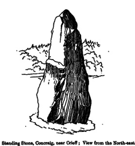
Closer to the larger town of Crieff than it is to the village of Muthill, this seven-foot tall standing stone, leaning at an angle to the north and with a small scatter of stones around its base, stands alone near the side of the field, feeling as if others once lived close by.  It’s set within a distinctly nurturing landscape, enclosed all round instead of shouting out to the hills, with that nourishing female quality, less commonly found than those stones on the high open moors.  The only real ‘opening’ into a wider landscape here was mentioned by the local writer Andrew Finlayson (2010), “to the distant east.”  Whether this possessed any astronomical-calendrical importance hasn’t yet been explored.

Concraig, looking south
Fred Coles 191 drawing
Fred Coles 1911 sketch

The stone was first highlighted on the 1863 Ordnance Survey map—and described in their Name Book as “a large upright Stone adjacent to and South-east of Broadley about 8 feet high and traditionally said to be either the remains of a Druidical Temple or in some way associated with the Druidical period”—but since then it hasn’t fared very well in antiquarian tomes.  Fred Coles (1911), as usual, noted it in one of his Perthshire surveys, but could find very little information from local people about the place, simply telling us that,

“in an open field about 300 yards to the north-west of Concraig, there stands this irregularly four-sided block of conglomerate schist… The stone measures 9 feet 3 inches round the base and stands 7 feet 3 inches in height.  About halfway up its eastern face it has been broken so as to leave a very distinct ledge.”

What appears to be cup-markings on the southern-face of the stone are just Nature’s handiwork.

References:

  1. Coles, Fred, “Report on Stone Circles Surveyed in Perthshire, Principally Strathearn” in Proceedings of the Society of Antiquaries, Scotland, volume 45, 1911.
  2. Finlayson, Andrew, The Stones of Strathearn, One Tree Island: Comrie 2010.

© Paul Bennett, The Northern Antiquarian


Corrie (1), Gartmore, Perthshire

Cup-and-Ring Stone:  OS Grid Reference – NS 49502 95052

Also Known as:

  1. Canmore ID 43472

Getting Here

The cup-and-ring stone

On the A81 road from Aberfoyle to Strathblane, about a mile south of Aberfoyle take the tiny right turn (keep your eyes peeled!) to Gartmore.  At the end of the village, turn right at the T-junction.  Just over a mile along the tiny road, just over the tiny road-bridge, turn right again up up the dead straight road to Drymen for nearly a mile and park up.  A dirt-track is on your right: walk along here for ¾-mile (1.2km) and in a large field on your left a huge rock sits (no carvings on it).  Keep walking on the track and where the field ends, a path to your left runs above a small burn.  Naathen, 150 yards along here, look down at the waters and there’s a clump of large rocks. Check ’em out!

Archaeology & History

Morris’ old photo (from PSAS 1967)

This stone and others were mentioned in MacNair’s (1973) essay in the popular history guide to the region, after it had seemingly been rediscovered a few years earlier by Ron Morris (1967; 1969), who listed it in his petroglyph catalogues.  It was originally located at the top of the slope above the burn, but was rolled down here shortly after Morris discovered the cup-and-rings on it.  The farmer at the time had made a bore-hole into the rock with the intention of blowing it up, but Morris found it just in time and the stone managed to survive!

Faint CnR’s just visible

It’s a large rock with a decent ornate design that was clearly visible when Morris surveyed it (see photo, right).  It comprises of, “a cup-and-two-rings, 18cm (7in) diameter, 6 cups-and-one-ring (2 of which are tangential) and at least 8 cups.  All rings are complete.  Greatest carving depth 2cm (¾in).”  There also appears to be a line of four or five small cup-marks running in a short line by one of the lower cup-and-rings, but these are very faint indeed.  The double cup-and-ring mentioned by Morris is the one at the top-centre in my photo, but the next cup-and-ring down may also be a double-ring.  At the top-right of the photo is where two cup-and-rings are conjoined.

Since being rolled down the slope to the side of the burn, the carving’s much more in the shadows and is more difficult to work out.  Sadly on the day when I visited here, Nature bestowed on me a wet and cloudy day, so the design was even more difficult to see, as my photos illustrate.

Morris (1981) told that “other stones in the immediate vicinity bear possible cup-marks,” and one of these may exist just a couple of stones away (Corrie 2), leaning up into the grasses: this is another rock that has been pushed down the slope and has curious natural cup-markings on it, with one or two that could be man-made, but we need a geomorphologist to have a look at it and tell us one way or the other.

References:

  1. Edlin, Herbert L. (ed.), Queen Elizabeth Forest Park, HMSO Edinburgh 1973.
  2. MacNair, A.S., “History,” in Edlin’s Queen Elizabeth Forest Park, HMSO 1973.
  3. Morris, Ronald W.B., “The cup-and-ring marks and similar sculptures of Scotland: a survey of the southern Counties,” in Proceedings of the Society of Antiquaries, Scotland, volume 98, 1967.
  4. Morris, Ronald W.B., “The Cup-and-Ring and Similar Early Sculptures of Scotland; Part 2 – The Rest of Scotland except Kintyre,” in Transactions of the Ancient Monuments Society, volume 16, 1969.
  5. Morris, Ronald W.B., The Prehistoric Rock Art of Southern Scotland, BAR: Oxford 1981.

© Paul BennettThe Northern Antiquarian

Balinshoe, Kirriemuir, Angus

Standing Stone (destroyed):  OS Grid Reference – NO 4164 5219

Also Known as:

  1. Canmore ID 33871
  2. The Stannin Stane of Benshie

Archaeology & History

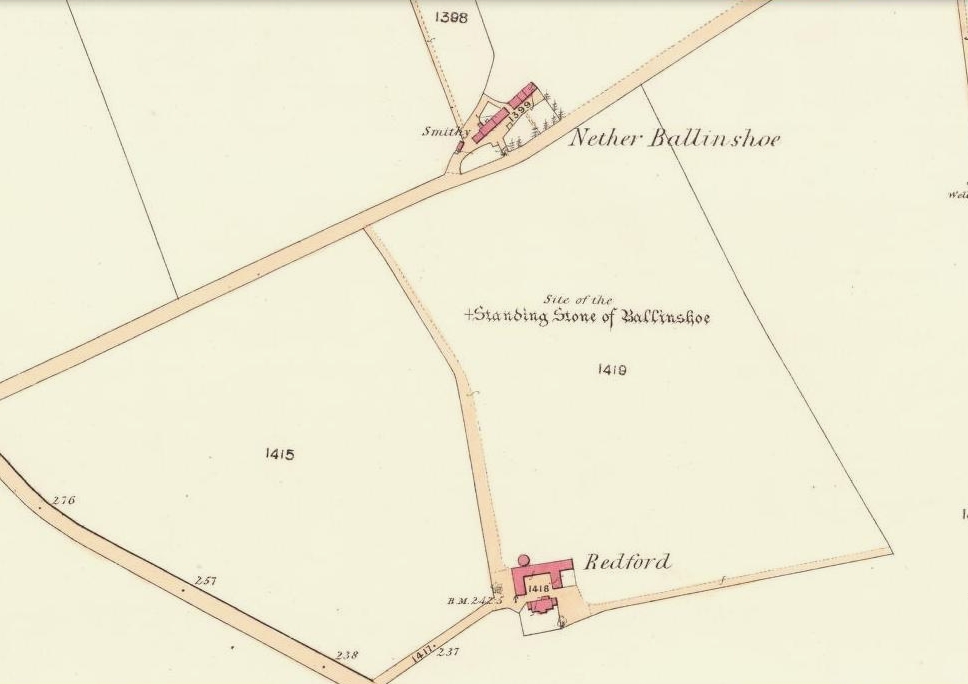
Site of the standing stone on 1865 OS-map
Stone on the 1865 OS-map

In a region that is full of prehistoric remains, we find here another example of another megalithic site that was sadly destroyed, not too long ago by the scale of things.  Found in association with a large prehistoric urn, we are thankful to have a couple of early local history accounts that describe the place.  The stone was obviously of some considerable height and bulk, though I can find no specific references to the dimensions of the monolith.  It was described effectively in the middle-half of the 19th century by Andrew Jervise (1853), who told us:

“‘The Stannin Stane of Benshie’, which stood for unknown ages…was demolished by gunpowder about half a century ago, and the spot is now covered by luxuriant crops of corn. This rude monument of antiquity is supposed to have been about twenty tons in weight; and at a considerable depth below it, a large clay urn, measuring about three feet in height and of corresponding circumference, was found containing a quantity of human bones and ashes.  Like its rude protector, however, the urn was broken to pieces; and, beyond the mere fact of its discovery, nothing authentic, as to either the style of its manufacture, or the precise nature or state of its contents, is preserved.”

More than 30 years later, A.J. Warden (1884) and then J.G. MacPherson (1885) all but copied Mr Jervise’s words, adding no further information.

From some reason, a small chapel dedicated to St. Ninian (NO 41567 51932) was built about 100 yards or so to the southwest of the old standing stone.  Its ruins are still to be seen. Whether this was an attempt to divert local people away from their animistic ecocentricism at the stone, into the more ecocidal egocentricism of the incoming christian cult (as was/is their common practice), we may never know for sure.

Folklore

The local name of this stone, ‘The Stannin Stane of Benshie’, indicates simply that this was “the standing stone at the hill of the faerie folk” (or variations thereof) and suggest it stood upon or next to a mound. I can find no immediate reference to stories of the little people here, and their whisper may have faded into unconscious memory.  Does anyone know more about this place?

References:

  1. Jervise, Andrew, The History and Traditions of the Land of the Lindsays in Angus and Mearns, Sutherland and Knox: Edinburgh 1853.
  2. MacPherson, J.G., Strathmore: Past and Present, S. Cowan: Perth 1885.
  3. Royal Commission on the Ancient & Historical Monuments of Scotland, The Archaeological Sites and Monuments of Central Angus, Angus District, Tayside Region, Edinburgh 1983.
  4. Warden, Alex J., Angus or Forfarshire: The Land and People – Descriptive and Historical – volume 4, Charles Alexander: Dundee 1884.

© Paul Bennett, The Northern Antiquarian


Ninewells, Caputh, Perthshire

Ring Cairn:  OS Grid Reference – NO 0757 4360

Also Known as:

  1. Canmore ID 27115
  2. Nine Wells

Getting Here

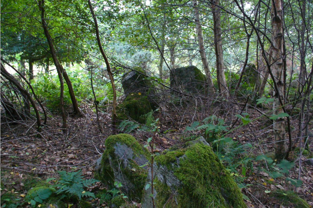
Outer edge of the overgrown Ninewells circle

From Dunkeld, head out for a mile or so on the long and winding A923 road, taking your first road right along the Craigie and Caputh road, south of the Loch of Lowes.  Go along here for about 2 miles, watching out for the little road to Black Hill on your left, where you can park up (if you hit a road junction, you’ve gone too far). Across the road, note the copse of trees.  Go in there along the walling for about 50-70 yards, past the curious gathering of rounded stones, then walk into the trees where the giant fir trees stand. You’re damn close!

Archaeology & History

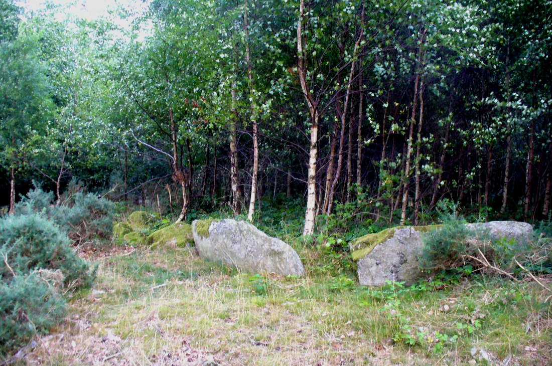
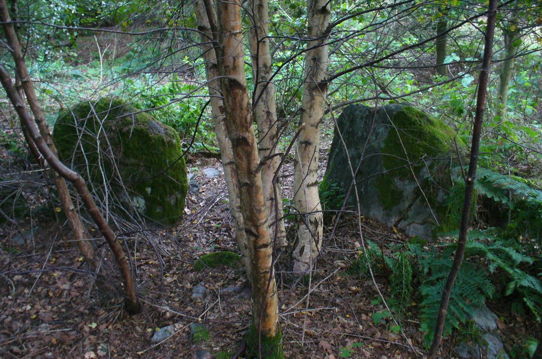
This is an excellent site, hiding away in a scattered copse of woodland, with young trees inside and very old ones in close proximity to its outer edge.  We visited the place for the first time in the middle of summer, not knowing anything about it, and found Nature had covered much of the place in Her usual clothes of fern, bramble, gorse and other vegetation.  Yet despite this, the site was superb!  In a very good state of preservation this ring of small stones is more than 30 feet across, though the stones making up the ring are only small.  Within the ring itself you’ll find many young birch trees growing over a mass of small rounded rocks, typical of cairn material such as found at other prehistoric sites of this nature up and down our northern counties, from the overgrown Roms Law, to Temple Wood and many others.  No evidence of internal burial or cist of any form was noted on our visit, nor mentioned in the Canmore survey.

Section of the Ninewells ring
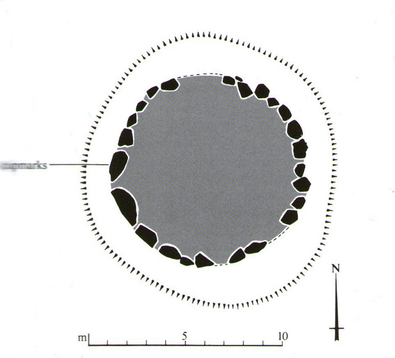
Plan of the Ninewells ring (after RCAHMS)

Although rightly classed as a cairn circle or ring-cairn, I’ve seen sites like this labelled as ‘stone circles’ in the past — and it’s easy to see why once you’re inside this!  If the internal scatter of cairn-material had been cleared in earlier centuries—as with many others—this site would be classed as a typical stone circle.  Curiously it hasn’t fared too well in archaeological surveys, but thankfully the Scottish Royal Commission (1994) lads included the site in theirs, telling us,

“This cairn measures 10m in diameter and 0.75m in height and has a near-complete kerb of large contiguous boulders and slabs set on edge.  The kerb is graded so that the largest, though not the tallest stones are situated in the southwestern quadrant, and one of the stones on the west bears four cupmarks.  Today the cairn material is roughly level with the top of the kerbstones, but there is no evidence to suggest that it has been heavily robbed and it was probably never much higher.  Concentric with the kerb there is an external platform about 0.2m high.  This type of feature is more usually associated with Clava ring-cairns and passage graves around Inverness, which are believed to be of late Neolithic date; but, despite the disturbance of the centre of the Ninewells cairn, there is no evidence of stones defining an internal court.”

Two of the largest stones

Some broken quartz stones were also found inside this ring.  The cup-marked stone on the west side of the circle has an entry of its own.  Whether or not the ‘opening’ or lack of stones in the north of the ring was intentional can only be known with certainty if an excavation happens here; suffice to say that North is the airt or direction most commonly representative of the Land of the Dead in many early northern cultures, which may explain this. A truly fascinating site…

The name ‘Ninewells’ derives from a cluster of healing springs of water that once flowed nearby.  Several legendary waters with this name can be found in this part of southern Perthshire.

References:

  1. Royal Commission on the Ancient & Historical Monuments of Scotland, South-East Perth: An Archaeological Landscape, HMSO: Edinburgh 1994.

© Paul Bennett, The Northern Antiquarian

Rocking Stone, Warley Moor, Halifax, West Yorkshire

Legendary Rock:  OS Grid Reference – SE 03399 30199

Also Known as:

  1. Sleepy Lowe

Getting Here

The old rocking stone, on the right
Looking east at the stone

From Denholme, take the A6033 Hebden Bridge road up, but shortly past the great bend turn off right up the steep road towards the moorland windmills until you reach the flat dirt-tracked road, past the reservoir below.  A coupla hundred yards past the track to the reservoir, take the footpath south into the tribbly grasslands and moor.  A few hundred yards down you’ll note the large rock outcrop ahead of you. The rocking stone is there!

Archaeology & History

The old rocking stone

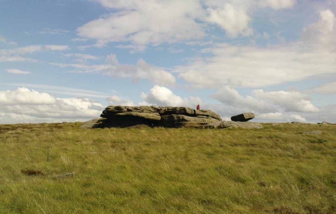
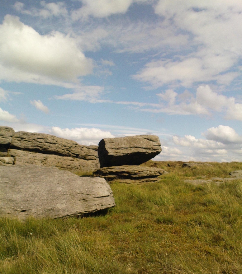
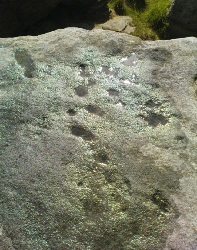
A small moorland arena with a neglected history. Many lost memories surround this site, with barely legible ruins from medieval and Victorian periods prevailing against scanty snippets of neolithic and Bronze Age rumours and remains.  The rocking stone here—which moves slightly with a bit of effort—sits amidst a gathering of other large rocks, some of which have debatable cup-markings on their smoothly eroded surfaces.

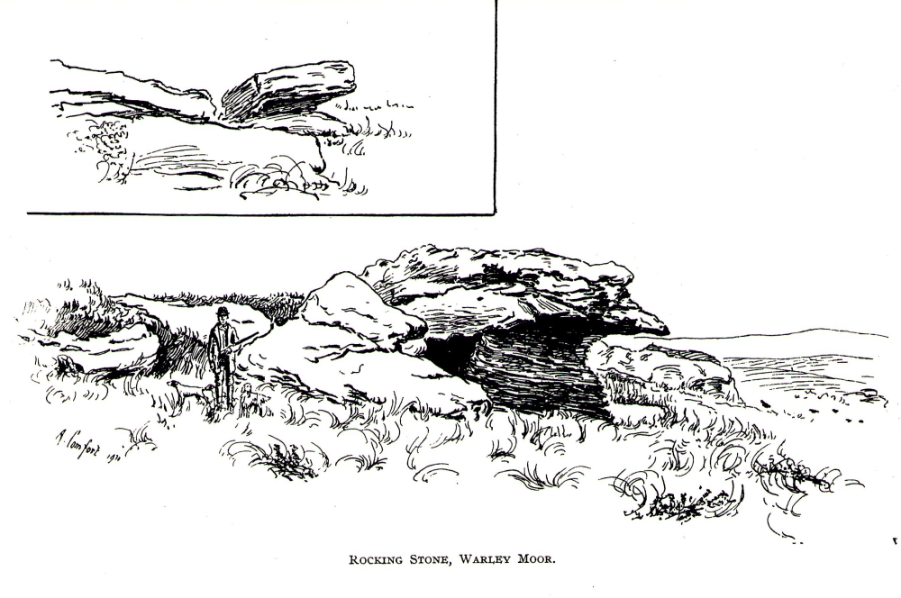
Our rocking stone, resting 1350 feet (411m) above seal level, was first mentioned in John Watson’s (1775) magnum opus, who gave a quite lengthy description of the site, telling us that,

“On a common called Saltonstall-moor, is what the country people call the Rocking-stone… The height of this on the west side (which is the highest) is, as I remember, about three yards and a half.  It is a large piece of rock, one end of which rests on several stones, between two of which is a pebble of a different grit, seemingly put there for a support, and so placed that it could not possibly be taken out without breaking, or removing the rocks, so that in all probability they have been laid together by art.  It ought to be observed, that the stone in question, from the form and position of it, could never be a rocking stone, though it is always distinguished by that name.  The true rocking stone appeared to me to lie a small distance from it, thrown off its centre.  The other part of this stone is laid upon a kind of pedestal, broad at the bottom, but narrow in the middle; and round this pedestal is a passage which, from every appearance, seems to have been formed by art, but for what purpose is the question.”

Dubious cupmarks
Dubious cups
Watson's 1775 drawing of the Rocking Stone
Watson’s 1775 drawing of the Rocking Stone

Watson then goes onto remark about other rocking stones in Cornwall and further afield with attendant “druid basins” on them, noting that there were also “rock basins” found here on Warley Moor, a few of which had been “worked into this rocking stone,” which he thought, “helps to prove that the Druids used it.”  And although these rock basins are large and numerous over several of the rocks on this plateau, like the cup-markings that also scatter the surfaces, they would seem to be Nature’s handiwork.

Turner's 1913 drawing
Turner’s 1913 drawing

Some 60 years later when the literary thief John Crabtree (1836) plagiarized Watson’s words verbatim into his much lesser tome, it seemed obvious he’d never ventured to explore the site.  But in the much more valuable historical expansion written by John Leyland around 1867, he at least visited the site and found the old stone, “still resting on its shady pedestal.” Later still, when Whiteley Turner (1913) ventured this way on one of his moorland bimbles, he added nothing more to the mythic history of these west-facing megaliths…

Folklore

Still reputed locally to have been a site used by the druids; a local newspaper account in the 1970s also told how local people thought this place to be “haunted by goblins.”

References:

  1. Bennett, Paul, The Old Stones of Elmet, Capall Bann: Milverton 2001.
  2. Crabtree, John, Concise History of the Parish and Vicarage of Halifax, Hartley & Walker: Halifax 1836.
  3. Leyland, F.A., The History and Antiquities of the Parish of Halifax, by the Reverend John Watson, M.A., R.Leyland: Halifax n.d. (c.1867).
  4. Smith, A.H., The Place-Names of the West Riding of Yorkshire – volume 3, Cambridge University Press 1961.
  5. Turner, Whiteley, A Spring-Time Saunter round and about Bronte Lane, Halifax Courier 1913.
  6. Watson, John, The History and Antiquities of the Parish of Halifax, T. Lowndes: London 1775.

© Paul BennettThe Northern Antiquarian


Bengengie North, Alva, Clackmannanshire

Enclosure:  OS Grid Reference – NN 86680 00601  

Getting Here

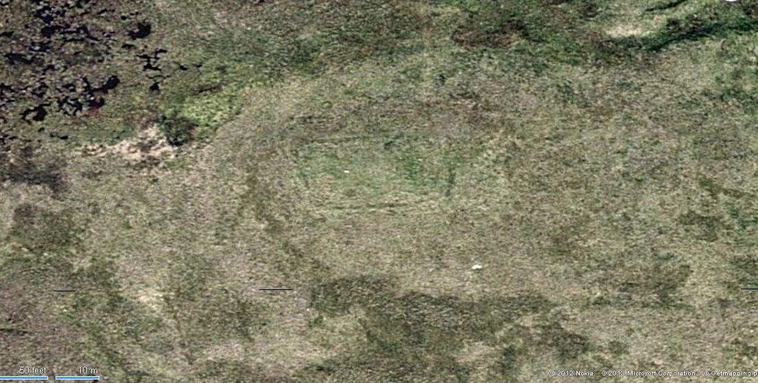
Aerial view of Bengenie enclosure

This really take a lot of effort to find. From Alva, go up through the graveyard past St. Serf’s Well, turning left and across cross the lane. A gate into the field takes you past Rhodders Farm then up the zigzagging track up the steep hill called The Nebit and into the Ochils. Where the track stops zigzagging, keep your eyes peeled for a left turn (west) about 1000ft up. Go along this, parallel above Alva Glen, for about 2 miles till you reach the sheep fanks. Naathen – go straight uphill towards Bengengie peak, steering to the right (north) side, avoiding the cliffs and onto the level moorland. Once there, you’ll see a rounded hillock a coupla hundred yards ahead. That’s the spot!

Archaeology & History

Southeastern corner of the ditch & bank

This is a bittova long hike to see a very overgrown site – but if you really enjoy the hills, it’s a good little side-track to visit.  I came across it recently on a long bimble over the Ochils, on my way back home after travelling to three of the Ochil peaks.  Walking carefully across the swampy heights of the Menstrie Moss, a rounded hillock north of Bengengie seemed to have the pimple of a cairn on its top—so I veered over to have a look.

The cairn was small and overgrown, with just a half-dozen rocks visible above ground, and a collection of others in the same pile beneath the heathland grasses.  It was obviously a man-made assemblage, but I couldn’t say for sure whether this was the grave of a person or someone’s favourite sheep a few centuries back!

Small cairn inside the enclosure

It was when I walked around the cairn to try and get some photos of it, that another very distinct feature—not immediately visible—stood out and gave this single cairn a series of additional ingredients that really brought this site to life!  For just a few yards east of the cairn I noticed an obvious ditch and outer embankment, running roughly north-south, which may have relevance to the pile of stones.  And so I walked along the edge of the embankment, for about 10 yards, only to find that it turned to the right and continued onwards, east-west, for some distance.  This then turned at a similar angle again about 30-35 yards along, and then again, and again, until I returned to where I had stood initially a few minutes earlier!

There was no doubt about it: this was a man-made, roughly rectangular-shaped enclosure, whose bank and ditch averaged 1-2 yards across.  The maximum height of the outer embankment is less than 3 feet.  Its eastern and western lengths measured roughly 17-18 yards long, and the longer lengths north and south were between 30 and 35 yards at the most.  The cairn feature that I’d initially noticed is found at the near-eastern edge of the enclosure. Apart from that, my initial ramble here indicated few other internal features that were visible, except several small stones.

Southern line of bank & ditch, running left to right
Eastern section of ditch & bank, looking north

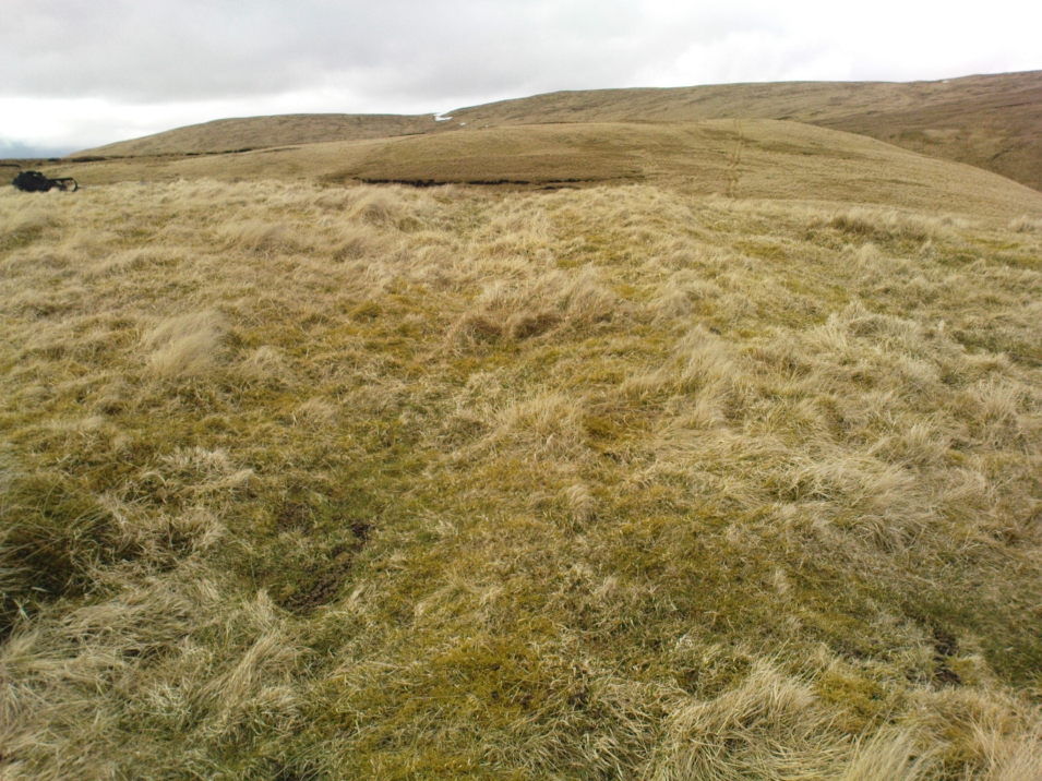
The great majority of the site is very overgrown and, as you can see, the photos of the ditch and bank constituting the enclosure are sadly not that easy to make out.  You can see it mostly by the colour changes of the vegetation, running in lines either across or up through the middle of the photos.  I need to get up there again and try get some better images sometime soon—and also to see if there are other features hiding away on the heights of these old hills, long since said to have been the abode of one of the great Pictish tribes (there is also a considerable mass of old faerie-lore in these hills, indicating considerable ancient activity of people whose cosmos was inhabited by spirits and forms long since forgotten in the consensus trance of most moderns).

As for the age of the enclosure: it’s difficult to say on first impression and I’m not keen on making a guess on this one.  It’s certainly old, as the overgrown vegetation clearly shows, both on the photos and when you see it first-hand.  It’s already been suggested by one graduate as possibly neolithic, but I’m a little sceptical about that, as its linearity isn’t consistent with neolithic features we know about in the mid-Pennines. However, this geographical arena is new landscape for me and so the possibility remains open until better, more competent investigation gives us a clearer time period.

© Paul BennettThe Northern Antiquarian

Craggish, Comrie, Perthshire

Standing Stones (destroyed):  OS Grid Reference – NN 7643 2086

Archaeology & History

Site shown on 1886 OS-map

Highlighted on the 1866 OS-map was an impressive cluster of standing stones that sadly met their demise sometime around at the end of the 19th century.  They were mentioned to “still exist” when the local writer Samuel Carment passed them in 1882, but had been destroyed by the time the Ordnance Survey lads resurveyed here in 1899.  Altogether there were at least six of them, standing aligned sharply northeast-southwest and were described in one of Fred Coles’ (1911) essays, who lamented their passing.  Listed in the stone row surveys by Burl (1993) and Thom (1990), the prime description we have of them was by Cole himself, who told:

“This site has also been wantonly bereft of its group of megaliths.  Up to so recent a date as 1891 there were several.  These were shown on the (Ordnance Survey map) as three in one line and two in another, on a field about one furlong NE of Craggish farmhouse, close to the road coming down from Ross, and nearly a quarter-mile NW of the ford across the Ruchil at Ruchilside.”

In Finlayson’s (2010) colourful survey of the local megaliths he told that the stones,

“Stood, by the road, in what is now ‘The Whinney Strip’: a boulder-strewn strip of land 20m wide dividing up otherwise flat and even grazing land.”

References:

  1. Burl, Aubrey, From Carnac to Callanish, Yale University Press 1993.
  2. Cole, Fred, “Report on Stone Circles Surveyed in Perthshire, Principally Strathearn,” in Proceedings of the Society of Antiquaries, Scotland, volume 45, 1911.
  3. Finlayson, Andrew, The Stones of Strathearn, One Tree Island: Comrie 2010.
  4. Thom, A., Thom, A.S. & Burl, Aubrey, Stone Rows and Standing Stones – 2 volumes, BAR: Oxford 1990.

Acknowledgments:  Big thanks for use of the early edition OS-map in this site profile, Reproduced with the kind permission of the National Library of Scotland

© Paul Bennett, The Northern Antiquarian