St. Margaret’s Stone, Dunfermline, Fife

Cup-Marked Stone:  OS Grid Reference – NT 10837 85060

Getting Here

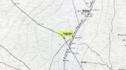
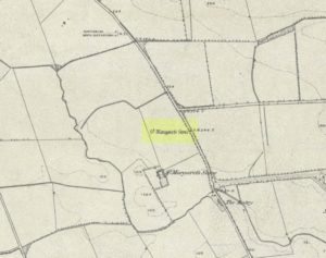
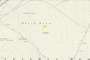
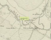
St Margarets Stone on 1856 OS-map

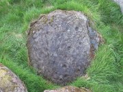
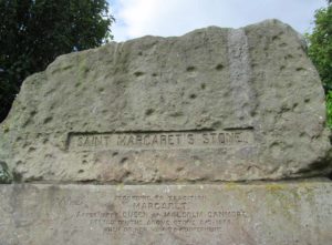
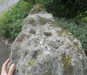
Take the A823 road out of Dunfermline south towards Rosyth. A half-mile before you hit the motorway roundabout, at the roundabout where Carnegie Avenue takes you east, turn west and park up along the road where the modern business park lives.  30-40 yards from the roundabout, set back on the pavement, you can’t really miss the huge flat slab of stone, covered in cup-markings, resting on a stone plinth with ‘St Margaret’s Stone’ stamped on it!

Archaeology & History

On the 1856 OS-map of this area, St Margaret’s Stone is shown at the roadside just above a farm of the same name, a short distance away from its present location.  In October 1879, Alexander Stewart (1889) told us that funds were raised and steps taken to properly fix and preserve this ancient ‘resting-place’ of Queen Margaret on the Queensferry Road.  It was quite a few years later before it was moved the few hundred yards further to its present location.

Cups on stone’s edge

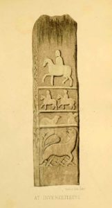
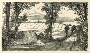
Early writers tell us that originally its position in the landscape was on the crest of one of the rises in the land between Dunfermline and the sea, making it visible for some considerable distance.  This would seem to have been a deliberate placement.  In my mind, and in accordance with the placement of many a prehistoric tomb, St Margaret’s Stone may originally have been part of a neolithic or Bronze age cairn, long since gone.  The size and shape of the rock implies it too, with similarities here of the impressive cist or gravestone found inside the Netherlargie North cairn at Kilmartin.  However, this wasn’t the thought of the prodigious Scottish historian, William Skene.  He thought that St Margaret’s Stone originally stood upright, being a Pictish-style standing stone that was mentioned in the first Statistical Account of the area.  The brilliant Scottish antiquarian, John Stuart (1856)—who gave us an illustration of the ‘standing stone’ in question—told us:

“It has been supposed by some that “St. Margaret’s Stone,” a block now lying on the side of the highway leading from Inverkeithing to Dunfermline, and about midway between these places, can be identified with the standing stone referred to in the Statistical Account.  Mr Skene has noted below a sketch of St. Margaret’s Stone:-  “The sculpture upon this stone has been lately chipped off in mere wantonness, so as to leave few traces of the subject recorded upon it.”  He farther states that it formerly stood erect, and was called “The Standing Stone.” According to Mr. Skene’s measurement, St. Margaret’s stone is about nine feet and a half in length, one foot in thickness, and four feet broad at the widest end, and broken off to a narrow point at the other.”

The missing ‘standing stone’

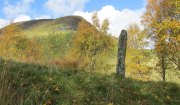
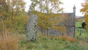
In this instance, Skene was confusing St Margaret’s Stone with the lost Pictish monolith (left) that used to exist nearby, which had carved horse figures and other memorial designs upon it and which he thought had faded away.  Whereas the large slab we are looking at here, and which Skene visited and measured, is covered on one side by a gathering of prehistoric cup-markings—much earlier than any Pictish or early christian carvings.  At first glance, it seems that some of these cups may well be natural, but it has to be said that some of them are distinctly man-made.  And if we were to believe the archaeo-accounts of the stone, the cupmarks are only to found on one side of the stone.  Which aint true.  As we can see here, a number of cupmarks run along the edge of the stone.  We cannot say for sure whether all of them are artificial, but they certainly look like it!  Also, on the other side of the flat surface, one or two single cups are visible.  It would be good if we could get an artist to give us a detailed impression of the prehistoric carvings without the modern engraving of St Margaret’s Stone etching on the main face. (is there anybody out there!?)

The Royal Commission (1933) lads visited the stone in 1925 and, several years later in their write-up, told us simply:

“This stone…stands with its main axis due north and south and measures 8 feet 6 inches, by 4 feet 7 inches, by 1 foot 6 inches.  On one side the entire surface is cup-marked, the markings varying in size from 1¼ inches to 3¼ inches and having an average depth of from ½ to ¾ inch.”

When the Scottish petroglyph writer and explorer, Ron Morris (1968) came to the site, he gave it an equally brief description, merely telling us:

“On standing stone (8 1/2 feet high, 4 1/2 feet wide), built in to roadside fence, over 80 cups, up to 4in in diam, 3/4in deep, some run together as rough dumbells.”

It’s well worth checking out!

Folklore

St Margarets Stone in 1825

When the Saxon Queen Margaret landed on the shores just west of Queensferry at Rosyth Castle (NT 1087 8200), legend reputes that she and her entourage made Her way north towards Dunfermline.  Halfway along the ancient track She rested at this large stone which, thereafter, gained the name by which we know it today.  It was said that Queen Margaret subsequently visited the stone on a regular basis for periods of solitude.  The tale probably has some germ of true in it.  Additional ingredients also told that,

“The large stone here is associated with St Margaret and was visited by women who hoped to conceive or sought a successful birth.  The eight-foot high stone is said to mark the resting place of St Margaret when she journeyed between Queensferry and Dunfermline.  Margaret had eight successful pregnancies and probably needed to rest quite a few times on her travels!”

The fertility aspects of the rock were not the only pre-christian virtues attached to it.  We also find that oft-cited motif of rocks moving of their own accord: in this case, as J.B. MacKie (1905) told us, local people had always

“been told that the stone rose from its bed and whirled thrice round in the air every time it heard the cock at the adjoining farm crow.”

Cocks crowing are symbolic of sunrise, obviously, and this lore may simply represent a folk memory of the spirit in/of the stone being animated at that time of day.  It’s a motif found at ancient sites all over the place!

References:

  1. Chalmers, Peter, Historical and Statistical Account of Dunfermline, William Blackwood: Edinburgh 1844.
  2. Fernie, John, A History of the Town and Parish of Dunfermline, John Miller: Dunfermline 1815.
  3. Henderson, Ebenezer, The Annals of Dunfermline, John Tweed: Glasgow 1879.
  4. MacKie, J.B., Margaret, Queen and Saint, Oliphant: Edinburgh 1905.
  5. Morris, Ronald W.B., “The cup-and-ring marks and similar sculptures of Scotland: a survey of the southern Counties – part 2,” in Proceedings of the Society of Antiquaries, Scotland, volume 100, 1968.
  6. Royal Commission Ancient & Historical Monuments of Scotland, Inventory of Monuments and Constructions in the Counties of Fife, Kinross, and Clackmannan. HMSO: Edinburgh 1933.
  7. Rupert-Jone, John A., Rosyth, A. Romanes: Dunfermline 1917.
  8. Stewart, Alexander, Reminiscences of Dunfermline and Neighbourhood, Scott Ferguson: Edinburgh 1889.
  9. Stuart, John, Sculptured Stones of Scotland – volume 1, Spalding Club: Aberdeen 1856.

© Paul Bennett, The Northern Antiquarian 


Flat Howe (1), Sleights Moor, Sleights, North Yorkshire

Tumulus:  OS Grid Reference – NZ 85483 04866

Also Known as:

  1. Flat Howe (north)

Getting Here

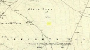
Flat Howe-1 on 1853 map

Along the A169 road that runs may miles from Whitby to Pickering, as you go through the small town of Sleights, the road gets steep for a mile or so, until you reach the moorland tops, where the road runs dead straight.  After 1.2 miles (1.93km) along the straight road, a small minor road is to your right.  Go along here for literally half-a-mile (0.8km) where you’ll see a small dirt-track on your right, with a locked gate.  There’s place to park here.  You’ll see the large rounded mound of Flat Howe-2 about 200 yards NE.  Head there, then another 250 yards north.  You’ve arrived!

Archaeology & History

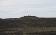
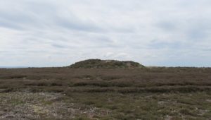
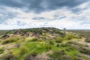
Of the two ‘Flat Howe’ burial mounds on Sleights Moor, this is the northern one of the two, being 250 yards (230m) away from its southern companion (at NZ 85510 04614).  It’s quite a big fella too – and so you’d expect there to be quite a bit of information about it.  But there isn’t!  No recorded excavation has taken place here, despite the top of the monument being cut into.  But this might have occurred when the Ordnance Survey lads built one of their triangulation pillars into the side of it.  Thankfully it’s not done too much damage.

I was quite surprised to find that even Frank Elgee (1912; 1930) had little to say about either of the two Flat Howes, simply mentioning them in passing in relation to the numerous other prehistoric tombs on these moors.  Despite this, the archaeologist L.V. Grinsell (1936) thought this site to be one of “the finest peristalith barrows I have ever seen.”  And this one in particular is still very impressive.

Flat Howe from the south
Flat Howe (by James Elkington)

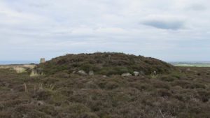
First shown on the 1853 OS-map, this large heather-covered mound of earth and stone is some six feet high and measures roughly 22 yards (20m) east-west by 19 yards (17.5m) north-south.  The tomb was originally constructed within a circle of reasonably large boulders, some of which were upright.  These can still be seen, mainly along the western and southern sides of the monument, although many have been dislodged over time and fallen at various angles, as you can see in the photo.  Whether or not these stones were erected first and then the mound built inside the ring, we do not know.  It’s the highest point in the landscape on Sleights Moor, with damn good views in all directions: an element that is common to many large prehistoric tombs, for obvious reasons.  Other tombs of similar size and probably similar periods in prehistory can be seen close by and on the skyline.  Whether this was a deliberate visual ingredient by our tribal ancestors is difficult to say, as the moors here were covered in scattered woodlands in prehistoric times.  Only detailed archaeo-botanical surveys would be able to tell us one way or the other.

Folklore

Flat Howe, with large stones defining its edge

Although we have nothing specific relating to this tomb, an olde creation myth told us that the local giants, Wade and his wife Bel, left their young son (whose name seems to have been forgotten) somewhere on Sleights Moor (which aint a big place).  It is worth narrating simply because it may have related to this tomb or its companion close by.  Giant legends have long been associated with the creation of many prehistoric tombs in this country and abroad.  The story was first written down by George Young (1817) in his magnum opus on Whitby and the tale was subsequently re-told by many others – Mrs Gutch (1901) for one:

“Young Wade, even when an infant, could throw a rock several tons weight to a vast distance; for one day when his mother was milking her cow near Swarthoue, the child, whom she had left on Sleights moor, became impatient for the breast, and seizing a stone of vast size, heaved it across the valley in wrath, and hit his mother with such violence, that though she was not materially hurt, her body made an impression on the stone which remained indelible, till the stone itself was broken up, a few years ago, to mend the highways!”

This rock was Bel’s Rock, whose exact location seems to have been lost.

References:

  1. Elgee, Frank, Early Man in Northeast Yorkshire, Frank Bellows: Gloucester 1930.
  2. Elgee, Frank, The Moorlands of North-Eastern Yorkshire, A. Brown: London 1912.
  3. Grinsell, Leslie V., The Ancient Burial Mounds of England, Methuen: London 1936.
  4. Gutch, Mrs, County Folk Lore – volume 2: Examples of Printed Folk-lore Concerning the North Riding of Yorkshire, York and the Ainsty, David Nutt: London 1901.
  5. Jeffrey, P. Shaw, Whitby Lore and Legend, Home: Whitby 1923.
  6. Roberts, Anthony, Sowers of Thunder, Rider: London 1978.
  7. Smith, A.H., The Place-Names of the North Riding of Yorkshire, Cambridge University Press 1928.
  8. Young, George, A History of Whitby and Streoneshalh Abbey – volume 2, Clarke & Medd: Whitby 1817.

AcknowledgementsA huge thanks to Lindsay Mitchell for getting us up to see this great tomb and its companion; and to James Elkington for use of the photograph.

LinksThe Megalithic Portal on Flat Howe

© Paul BennettThe Northern Antiquarian


Blakey Topping, Allerston, North Yorkshire

Sacred Hill:  OS Grid Reference – SE 8731 9377

Getting Here

Blakey Topping (James Elkington)

From Pickering, take the A169 towards Whitby. When you get to the Car Park at the ‘Hole-of-Horcum’ – (you can’t miss it), park the car and walk North along the side of the road towards Whitby. After 60 yds, take the track East. Follow this for approximately a mile until the track splits. Take the concrete track left towards the farmhouse of ‘Newgate Foot’. Go through the yard past the house on the right, and you will come to a stream and a gate and there, ahead of you, rises Blakey Topping…

Archaeology & History

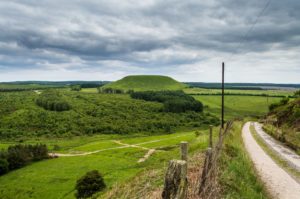
The giant hill of Blakey Topping was recorded as early as 1233 CE and in a simplistic style just means the ‘black mound’; but this derivation has additional ingredients, implying it as a ‘black meeting-place’ or moot.  Black in the etymological sense also implies ‘shining’ and it may also relate to the northern airt of black (meaning death, darkness, north, etc), when you’re stood at the ruined stone circle 400 yards to the south. But I’m speculating here…

Several 19th century antiquarians suggested there may have once been a cairn on top of the hill, but others who’ve explored this idea seem to have put it to bed.

Folklore

This great hill is well recognised amongst local people and, to this day, its animistic creation myths and other folklore elements are still spoken.  When the photographer James Elkington recently visited the nearby standing stones, he bumped into the old farmer who told him how his father had seen the faerie-folk on the hill many years back.  And its modern reputation as a gorgeous site adds to such lore, which dates way back.

In Frank & Harriett Elgee’s (1933) archaeology work, they narrated the old creation myth that local people used to tell of this great hill,

“A witch story related by a native 25 years ago attempts to explain two conspicuous natural features two miles apart on Pickering Moor; Blakey Topping, an isolated hill, and the Hole of Horcum, a deep basin-shaped valley. The local witch had sold her soul to the devil on the usual terms, but when he claimed it, she refused to give it up, and flew over the moors, with the devil in hot pursuit. Overtake her he could not, so he grabbed up a handful of earth and flung it at her. he missed his aim and she escaped.  The Hole of Horcum remains to prove where he tore up the earth and Blakey Topping where it fell to the ground.

“From our point of view the significance of this story lies in the fact that between the Hole and the Topping there is a Bronze Age settlement site at Blakey Farm, with its stone circle. The rough trackway leading from the Hole to the circle is known as the Old Wife’s Way, presumably also marking the witch’s flight. This, together with other Old Wife’s Ways, preserves as it were Bronze Age church tracks”.

Looking up from the SW (James Elkington)

A relative variation on this tells that the Hole of Horcum was made by the local giant, Wade. He was having a row with his wife, Bell, and got so angry that he scooped out a lump of earth and threw it at her.  The huge geological feature known as the Hole of Horcum is the dip left where he scooped out the earth, and Blakey topping, the clod itself, resting in situ where it landed.  A christian appropriation of the story replaces Wade and his wife with their ‘devil’: a puerile element unworthy of serious consideration.

In more recent times, the old geomancer Guy Ragland Phillips (1976; 1985) found that a number of alignments, or leys (known as a ‘node’), centred on Blakey Topping: twelve in all, reaching out and crossing numerous holy wells, prehistoric tumuli, standing stones, etc.  The precision of the alignments is questionable, yet the matter of the hill being a centre-point, or omphalos, would seem moreso than not.

References:

  1. Elgee, F. & H.W., The Archaeology of Yorkshire, Methuen: London 1933.
  2. Phillips, Guy Ragland, Brigantia, RKP: London 1976.
  3. Phillips, Guy Ragland, The Unpolluted God, Northern Lights: Pocklington 1987.
  4. Smith, A.H., The Place-Names of the North Riding of Yorkshire, Cambridge University Press 1928.

Links:

  1. Mountains, Myths and Moorlands

Acknowledgements:  Big thanks to the photographer, James Elkington, for use of his photos in this profile. Cheers mate.

© Paul Bennett & James ElkingtonThe Northern Antiquarian


Peace Stone, Port of Menteith, Stirlingshire

Cup-and-Ring Stone:  OS Grid Reference – NS 56413 99540

Also Known as:

  1. Canmore ID 44622
  2. Gartrenich
  3. Milling
  4. Menteith 1

Getting Here

Peace Stone cup-and-ring

The quickest way here is bedevilled with troublesome parking (and an unhelpful local at Malling Cottage).  That aside, roughly halfway along the A81 between the Braeval roundabout (near Aberfolye) and Port of Meneith, turn down the track at Malling, following it round for 300 yards through the farm, then another 500 yards or so until you reach a junction with a gate on your left. Walk down the track to your right, roughly alongside the Lake of Menteith, for nearly 700 yards until you reach the gate into the forestry commission land. Go thru the gate and turn immediate right, following the fence for about 200 yards where a clump of stones lives. You’re there!

Archaeology & History

The Peace Stone in 1899

This seemingly isolated petroglyph, known about by local people in the middle of the 19th century and earlier, was said to have been “held in great reverence.”  It was first mentioned in literary accounts in 1866, when the oral traditions about it were more important than any archaeocentricism.  But things change with the times: local people were kicked off their lands, old stories and knowledge of sites were lost, and the ‘discipline’ of archaeology was beginning to look at these curious carved rocks with puzzled minds.

The Peace Stone was described at some length and with considerable accuracy in Mr A.F. Hutchison’s (1893) gazetteer on the ancient stones of Stirlingshire.  It was one of the regions only known petroglyphs at that time and thankfully he gave us a good account of it, saying:

“On the west ride of the Lake of Menteith, about half a mile south from the farm-house of Malling, this stone is to be found, lying at the boundary of the arable land. The ground at the place rises into a slight eminence, on the top of which the stone lay till some seven or eight years ago, when a labourer took it into his head that a stone on which so much labour had evidently been spent must have been intended to cover something valuable. He proceeded to excavate the earth at the side with the intention of getting at the buried treasure, with the result that the stone slipped down into the hole which he had made, where it now lies.  It is quite possible, however, that an interment, if no treasure, might be found beside it on further research. The stone is roughly circular on the surface, measuring about 4 feet in diameter. It is entirely covered with cup and ring marks—22 cups in all—varying in size from an inch to two inches in diameter.  The cups and rings are very symmetrically formed. Nearly in the centre is a fine one surrounded by four circular grooves.  Others have incomplete triple and quadruple circles, with radial duct dividing them. There are other curious curves that sometimes interlace, and near the lower side of the stone are five or six cups with straight channels running out from them over the edge. This is an extremely interesting stone. It is unique in our neighbourhood, so far as I know, in showing these symmetrical carvings. They are now, however, much weather-worn.”
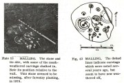
Ron Morris’ sketch & photo

When Alison Young (1938) came to write about the carving, she echoed Hutchison’s thought that the stone might originally have covered a tomb—but we simply don’t know and it should be treated as guesswork, as there are no known prehistoric tombs anywhere hereby.
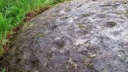
Close-up of faded cups

Years passed before the next archaeological visit – by which time the stone had been uprooted and moved, apparently “ploughed up by the Forestry Commission”, and when Ron Morris (1981) last sought it out found that “the stone was un-traceable”.  On a previous visit, before being moved, he found it to be,

“a cup-and-three-rings, 3 cups surrounded by two rings…and 6 cup-and-one-ring.  One of these and 2 cups form part of the design of the cup-and-three-rings.  There were also at least 7 other cups, and a number of grooves, some forming lines from a central cup, or a cup-mark, downhill.  Greatest diameter visible in 1977 30cm (12in) and depth of carving 3cm (1 in)… Many of the carvings are so weathered as to be visible only when wet in early morning or late evening.”

And when we visited the site a few days ago, the stunning sunlight that had followed us all day, sadly faded and disallowed us better photographs of the site.  Huge apologies…. But it’s worth visiting when the daylight’s good, perhaps when you’re exploring the huge number of brilliant petroglyphs at Ballochraggan and Nether Glenny on the hillside 1½ miles immediately north of this “outlier”, as Brouwer & van Veen (2009) called it.

Folklore

In a landscape bedevilled with stunning petroglyphs, traditions and folklore of them is all but gone; but the story of the Peace Stone was thankfully captured in words by Mr Dun (1866), who told us:

There is a curious prophecy connected with a stone situated near the ruins of the chapel of Arnchly, and which is worth recording.  From time immemorial this stone went under the name of the Peace Stone, and it was held in great reverence by the natives.  One Pharic McPharic, a noted Gaelic prophet, foretold that, in the course of time, this stone would be buried underground by two brothers, who, for their indiscretion, were to die childless. By-and-by the stone would rise to the surface, and by the time it was fairly above ground, a battle was to be fought on “Auchveity,” that is, “Betty’s Field.”  The battle was to be long and fierce, until “Gramoch-Cam” of Glenny, that is, “Graham of the one eye,” would sweep from the “Bay-wood” with his clan and decide the contest. After the battle, a large raven was to alight on the stone and drink the blood of the fallen. So much for the prophecy then; now for the fulfilment. About fifty years ago, two brothers (tenants of the farm of Arnchly), finding that the stone interfered with their agricultural labours, made a large trench, and had it put several feet below the surface. Very singular, indeed, both these men, although married, died without leaving any issue. With the labouring of the field for a number of years, the stone has actually made its appearance above ground, and there is at present living a descendant of the Grahams of Glenny who is blind of one eye, and the ravens are daily hovering over the devoted field. Tremble ye natives! and rivals of the “Hero Grahams,” keep an eye on Gramoch-Cam!

The name of Betty’s Field came from an earlier piece of folklore: where a prince out hunting a stag was caught in one of the deep bogs hereby, only to be rescued by a local lass.  In return for her help, she was given a large piece of land which was to bear her name.

References:

  1. Armit, Ian, “The Peace Stone (Port of Menteith parish),” in Discovery & Excavation Scotland, 1998.
  2. Brouwer, Jan & van Veen, Gus, Rock Art in the Menteith Hills, BRAC 2009.
  3. Dun, P., Summer at the Lake of Monteith, James Hedderwick: Glasgow 1866.
  4. Hutchison, A.F., “The Standing Stones and other Rude Monuments of Stirling District,” in Transactions Stirling Natural History & Antiquarian Society, volume 15, 1893.
  5. Hutchison, A.F., The Lake of Menteith: Its Islands and Vicinity with Historical Accounts of the Priory of Inchmahome and the Earldom of Menteith, Stirling 1899.
  6. Mallery, Garrick, “Pictographs of the North American Indians,” in Bureau of Ethnology of the Smithsonian Institution, volume 4, 1886.
  7. Morris, Ronald W.B., The Prehistoric Rock Art of Southern Scotland, BAR: Oxford 1981.
  8. van Hoek, Maarten, “Menteith (Port of Menteith parish) Rock Art Sites,” in Discovery Excavation Scotland, 1989.
  9. Young, Alison, “Cup-and ring Markings on Craig Ruenshin, with some Comparative Notes”, in Proceedings Society Antiquaries Scotland, vol. 72, 1938.

© Paul BennettThe Northern Antiquarian


Spittal of Glenshee, Kirkmichael, Perthshire

Standing Stone:  OS Grid Reference – NO 10865 70201

Also Known as:

  1. Canmore ID 29609

Getting Here

Spittal of Glenshee stone

Take to A93 road, north, between Blairgowrie and Braemar, keeping your eyes peeled many miles on, to turn left along the minor road as you approach the tiny Spittal of Glenshee hamlet. Just as you go over the ancient bridge, park up on your left, below the church.  Walk round the back of the church and you’ll see a large tree-covered mound.  Walk onto its top.

Archaeology & History

Stone marked on 1862 map

This quiet, almost hidden, six-foot tall standing stone on what initially seems to be a large fairy mound or tumulus at the back of the rude church, has been occluded from general view (in my opinion, deliberately) by the construction of the more debased christian edifice right in front of it.  But it detracts not from its gentle majesty once you reach its ancient body, atop of the old hill.

The stone is one in a cluster of prehistoric sites in and around this Glen of the Fairy Folk (as its name tells), where the rivers Shee and Beag converge.  If the church didn’t obstruct the view, some of the other sites would have been visible from here.

Folklore

The old stone, looking east

Folklore tells that when the christians came into the Glen to build a church—initially a half-mile or so to the east—the little people were much annoyed at the actions of the incomers, as it intruded on one of their sacred rings of stone close by.  By night they came out, and every stone that had been laid by the christians in the day was removed.  Each day the insensitive christians came and built their church without asking, and each night the little people removed it.  Eventually an agreement was made, and the fairies let them build the church next to this standing stone.  So goes the tale….

A veritable cluster of stories about Fingal, Ossian, Dermid and Grianne scatter this area, with many of them relating to ancient sites, but I’ve not found one directly relating to this stone.

References:

  1. Miller, T.D., Tales of a Highland Parish, Munro Press: Perth 1929.

© Paul BennettThe Northern Antiquarian


Mineral Well, Glen Lyon, Perthshire

Healing Well:  OS Grid Reference – NN 72110 47768

Also Known as:

  1. Iron Well

Getting Here

Mineral Well, Glen Lyon

From Fortingall village, head west and turn down into the incredible beauty that is Glen Lyon.  As you enter the trees, a half-mile along you pass the small gorge of MacGregor’s Leap in the river below.  2-300 yards pass this, keep your eyes peeled for an old small overgrown walled structure on the left-hand side of the road, barely above the road itself.  A large tree grows up above the tiny walled enclosure, within which are the unclear waters that trickle gently….

Archaeology & History

In previous centuries, this all-but-forgotten spring of water wasn’t just a medicinal spring, but was one of the countless sites where sympathetic magick was practised.  The old Highlanders would have had a name for the spirit residing at these waters, but it seems to have been lost.  The site is described in Alexander Stewart’s (1928) magnum opus on this stunning glen, where he wrote:

“Still a few yards more and Glenlyon’s famous mineral wishing well is seen gushing up, surrounded by its wall of rough stones now sadly in need of repair.  It has a stone shelf to receive the offerings of those who still retain a trace of superstition or like to uphold old customs as they partake of its waters.  The offerings usually consist of small pebbles, but occasionally something more valuable is found among them. The roadmen may clear that shelf as often as they like, but it is seldom empty for long.”

A local lady from Killin told us that she remembers the stone above the well still having offerings left on it 20-30 years ago. Hilary Wheater (1981) sketched it and called it the Iron Well.

Close-up of the waters (photo by Paul Hornby)
Hilary Wheater’s sketch

The waters in this small roadside well-house actually emerge some 50 yards up the steep hillside (recently deforested) and in parts have that distinct oily surface that typifies chalybeates, or iron-bearing springs – which this site is an example of.  Its medicinal properties would help to people with anaemia; to heal women just after childbirth; to aid those who’d been injured and lost blood; as well as to fortify the blood and stimulate the system.

Across the road from the well, Stewart (1928) told of a giant lime tree that was long known to be the meeting place for lovers (perhaps relating to the well?), and the name of the River Lyon here is the Poll-a-Chlaidheamh, or ‘the pool of the sword’, whose history and folklore fell prey to the ethnic cleansing of the english.

References:

  1. Stewart, Alexander, A Highland Parish, Alexander Maclaren: Glasgow 1928.
  2. Wheater, Hilary, Aberfeldy to Glenlyon, Appin Publications: Aberfeldy 1981.

© Paul BennettThe Northern Antiquarian


Clochoderick Stone, Kilbarchan, Renfrewshire

Rocking Stone:  OS Grid Reference – NS 37363 61280

Also Known as:

  1. Canmore ID 42329

Archaeology & History

The Clochoderick Stone

On the outer southern edge of Kilbarchan parish—right near the ancient boundary line itself—this giant stone of the druids is seems to be well-known by local folk.  Located about 40 yards away from the sacred ‘St Bride’s Burn’ (her ‘Well’ is several hundred yards to the west), it was known to have been a rocking stone in early traditions, but as Glaswegian antiquarian Frank Mercer told us, “the stone no longer moves.”  The creation myths underscoring its existence, as Robert Mackenzie (1902) told us, say

“This remarkable stone, thought by some to have been set up by the druids, and by others to have been carried hither by a glacier, is now believed to be the top of a buried lava cone rising through lavas of different kind.”

Clochoderick Stone on 1857 map

The site was highlighted on the first OS-map of the area in 1857, but the earliest mention of it seems to be as far back as 1204 CE, where it was named as Clochrodric and variants on that title several times in the 13th century.  It was suggested by the old place-name student, Sir H. Maxwell, to derive from ‘the Stone of Ryderch’, who was the ruler of Strathclyde in the 6th century.  He may be right.

Folklore

Folklore told that this stone was not only the place where the druids held office and dispensed justice, but that it was also the burial-place of the Strathclyde King, Ryderch Hael.

References

  1. Campsie, Alison, “Scotland’s Mysterious Rocking Stones,” in The Scotsman, 17 August, 2017.
  2. MacKenzie, Robert D., Kilbarchan: A Parish History, Alexander Gardner: Paisley 1902.

Acknowledgements:  Big thanks to Frank Mercer for use of his photos and catalytic inception for this site profile.

© Paul BennettThe Northern Antiquarian


Little Almscliffe, Stainburn, North Yorkshire

Cup-and-Ring Stone:  OS Grid Reference – SE 23242 52260

Also Known as:

  1. Little Almes Cliffe
  2. Little Almias Cliff Crag

Archaeology & History

Little Almscliffe Crag (photo by James Elkington)

The crags of Little Almscliffe are today peppered with many modern carvings, such as are found on many of our northern rock outcrops.  Yet upon its vertical eastern face is a much more ancient petroglyph – and one that seems to have been rediscovered in the middle of the 20th century.  When the great northern antiquarian William Grainge (1871) visited and wrote of this place, he told us that, “the top of the main rock bears…rock basins and channels, which point it out as having been a cairn or fire-station in the Druidic days; there are also two pyramidal rocks with indented and fluted summits on the western side of the large rock” – but he said nothing of any prehistoric carvings. Curiously , neither the great historian Harry Speight or Edmund Bogg saw anything here either.

Stuart Feather & Joe Davies here, c.1955
Cup&Ring, left of ‘door’ (photo by James Elkington)

This singular cup-and-ring design seems to have been reported first in E.S. Wood’s (1952) lengthy essay on the prehistory of Nidderdale. It was visited subsequently by the lads from Bradford’s Cartwight Hall Archaeology Group a few years later; and in the old photo here (right) you can see our northern petroglyph explorer Stuart Feather (with the pipe) and Joe Davis looking at the design.  In more recent times, Boughey & Vickerman (2003) added it in their survey of, telling briefly as usual:

“On sheltered E face of main crag above a cut-out hollow like a doorway is a cup with a ring; the top surface of the rock is very weathered and may have had carvings, including a cupless ring.”

Close up of design

Indeed… although the carving is to the left-side of the large hollow and not above it.  Scattered across the topmost sections of the Little Almscliffe themselves are a number of weather-worn cups and bowls, some of which may have authentic Bronze age pedigree, but the erosion has taken its toll on them and it’s difficult to say with any certainty these days.  But it’s important to remember that even Nature’s ‘bowls’ on rocks was deemed to have importance in traditional cultures: the most common motif being that rain-water gathered in them possessed curative properties.

References:

  1. Bennett, Paul, The Old Stones of Elmet, Capall Bann: Milverton 2001.
  2. Bogg, Edmund, From Eden Vale to the Plains of York, James Miles: Leeds 1895.
  3. Bogg, Edmund, Higher Wharfeland, James Miles: Leeds 1904
  4. Cowling, E.T., Rombald’s Way, William Walker: Otley 1946.
  5. Grainge, William, History & Topography of Harrogate and the Forest of Knaresborough, J.R. Smith: London 1871.
  6. Parkinson, Thomas, Lays and Leaves of the Forest, Kent & Co.: London 1882.

Acknowledgements:  Huge thanks to James Elkington for use of his fine photos on this site.

© Paul BennettThe Northern Antiquarian

Denoon Law, Glamis, Angus

Hill Fort: OS Grid Reference – NO 35464 44395

Also Known as:

  1. Canmore ID 32139
  2. Law of Denoon

Denoon Law on 1865 map

Getting Here

Travelling north through Balkeerie on the Newtyle/Glamis road, turn right onto the Denoon road and follow it to the T-junction.  Turn right and, a few hundred yards on to your left, the large hillfort of Denoon Law rises up to your left.  You can’t really miss it!

Archaeology & History

Denoon Law from Murleywell

Denoon Law is an impressively lush and green hill fort hidden away in the Sidlaw Hills, in the Denoon Glen, parallel to the Vale of Strathmore. It can be entered froma gap in the ramparts on the north side. Be careful of the precipitous drop from the south east side!

In the County Angus survey by the Royal Commission on the Ancient & Historical Monuments of Scotland (1983), they describes it thus:

This fort crowns the summit of Denoon Law, a steep-sided volcanic plug on the NW side of Denoon Glen, a narrow valley at the N end of the Sidlaw Hills. The fort is roughly D-shaped on plan with the chord of the D formed by a long straight rampart that stands above the precipitous SE flank of the hill. It measures 105m from NE to SW by 55m transversely within a rampart that measures up to 17m in thickness and over 5m in external height but is clearly of more than one phase. Where the differentiation is clear, the latest phase of rampart measures about 6m in thickness and overlies the remains of a much thicker earlier rampart. Intermittently visible at the SW end of the fort is an outer face to the later rampart, comprising drystone walling that has, in places, been displaced downslope by the weight of core material behind. This outer face comprises no more than four or five courses of thin sandstone slabs and, although what is currently visible will only be the top of the surviving wall-face, a wall constructed of such material cannot have stoodto  any great height and what we see today is likely to be the remains of some form of comparatively low revetment. In both the earlier and later ramparts there is very little evidence of stone within the core and it appears that the material (boulder clay) for both has largely been derived from several large quarries within the interior of the fort. At the SW corner of the fort most of the rampart has been removed, leaving only the lower part of the outer talus. The fort, or at least its latest phase, had two entrances, one on the NE and another on the NW, both of which are crossed by the remains of a narrow, later, wall that runs around the entire circuit of the fort and may be associated with at least some of the buildings within the interior.

Outwith the main rampart there is a series of three outer ramparts, again with very little evidence for the use of stone in their construction, which run from the edge of the very steep slope at the NE end of the fort, around the N side to the entrance on the NW. All three lines of defence have been reduced to little more than terraces, though there is no evidence for them ever having been cultivated. At the entrance on the NW, the terminals of these ramparts (on both sides of the entrance) are obscured below outwash deposits from the slope above. To the SW of the entrance it is not at all clear what the relationship is between the defences of the fort and the enclosure that occupies the rocky and extremely uneven SW flank of the hill. This enclosure, which has an entrance on the W, could be some form of annexe or it could represent the SW end of an enclosure that once took in both this area and the rest of the summit.

Within the interior of the fort there are the remains of at least nine rectangular buildings, two of them large and open-ended and each overlain by a smaller, later structure. The freestanding buildings are represented by the footings of walls with inner and outer stone faces; close to the entrance on the NE, however, there are two buildings represented by simple rectangular platforms cut into the rear scarp of one of the prehistoric quarries in one case and the hollow of the entrance passage in another. On the N flank of the hill, overlying the outer defences, there are a number of structures, either taking the form of subrectangular structures with walls (and in one case an entrance) or simple scoops into the slope.’

Entrance from the NW

David Dorward’s definition of the name Denoon is from the Gaelic:

‘dun obhainn (+ Scots law) – [hill of the] fort of the streamlet.’

The streamlet is the Ewnie Burn flowing south-east of the Law.

The lush green centre

Folklore

James Cargill Guthrie, in his The Vale of Strathmore: Its Scenes And Legends, gives the following story from an,

early time, weird-like, a legend’s muffled chime ‘.

The Hill of Denoon was at that remote period accounted sacred or haunted ground. It was the mythical abode of the elfins and fairies, and formerly a fitting haunt for their midnight revelries.

When the silvery moonbeams lovingly slept in dreamy beauty on the green slopes of the enchanted Hill, and the blue bells and the purple heather were wet with the dew of angels’ tears, arrayed in gossamer robes of bespangled gold, with wands of dazzling sheen and lances of magical bright-ness, would the troops of elfins flauntingly dance to the music of the zephyrs, until the shrill cry of the chanticleer put an end for the time to their mystical enchantments.

Suddenly, as in blue clouds of vapour, they noiselessly vanished away, no sound remaining to break the oppressive stillness, save that of the mountain rivulet, as it fretfully leapt from crag to crag, as if piteously regretting the mysterious departure of its ethereal visitors.

South-east rampart

Having forsworn the presence and companionship of the terrestrial inhabitants of earth, it was a sacred dictum in the code of the fairies that no habitation for human beings should be permitted to be built within the hallowed precincts of the enchanted ground. Unable of themselves to guard against such sacrilegious encroachment, they had recourse to the aid of, and formed a secret compact with the demons, or evil spirits, whose sole avocation consisted in doing mischief, and bringing trouble and misfortune on those under the ban of their displeasure. By this compact these evil spirits became solemnly bound to prevent any human habitation whatever from being erected on the hill, and to blast in the bud any attempts whensoever and by whomsoever made to break this implacable, unalterable decree.

It was about this time the alarm-note was sounded, as the Queen of the Fairies, who, with an eye more observant than the rest of her compeers, observed one evening in the moon-light, certain indications of the commencement of a human habitation. Horror and dismay were instantly pictured on the fair countenances of the masquerading troops of merry dancers as the awful truth was ominously revealed to them by the recent workmanship of human hands.

The sheer slope to the south-east

A council of war was immediately held, when it was determined to summon at once the guardian spirits to their aid and protection.

“By our sacred compact,” cried the Queen, “I command the immediate attendance of all the demons and evil spirits of the air, to avenge the insult now offered to the legions of Fairyland, and to punish the sacrilegious usurpers who dare infringe the sanctity of their mystical domains.”

These demons instantly obeyed the haughty summons, and, in the presence of those they had sworn to protect, they in a twinkling demolished the structure, hurling the well-proportioned foundations over the steep rock into the vale beneath !

The builder, doubtless very much surprised and chagrined when he returned to his work in the early dawn of the following morning, was sorely puzzled to account for the entire disappearance of the solid foundations of the great castle he intended to be erected on the Hill. He did not, however, waste much time, or use much philosophic argument, on the matter, and gave orders to prepare new foundation of even a more durable character.

The demons, to show their invincible power, and for the sake of more effect, allowed the new foundations to rise a degree higher than the former, before they gave out their fiat of destruction. In an instant, however, they were again demolished, and the builder this time gravely assigning some fatal shock of Nature as the cause of the catastrophe quietly resolved to repair the damage by instantly preparing new and still more solid foundations.

Additional and more highly skilled workmen were engaged, and everything for a time went favourably on, the walls of the castle rising grandly to view in all the solidity and beauty of the favourite architecture of the period.

Biding their time, the demons again ruthlessly swept away as with a whirlwind every vestige of the spacious halls, razing the solid massy foundations so effectually that not one stone was left upon another !

Things were now assuming a rather serious aspect for the poor builder, who, thinking that he had at last hit upon the true cause of these successive disasters, attributed his misfortunes to the influence of evil spirits. A man of courage and a match, as he imagined, for all the evil spirits of Pandemonium, supposing they were let loose at once against him by the Prince of Darkness, he unhesitatingly resolved to keep watch and ward on the following night, and to defy all the hosts of hell to prevent him rebuilding the projected edifice. The night expected came ; but, alas, alas !

His courage failed when on the blast
A demon swift came howling past,
Loud screeching wild and fearfully,
This ominous, dark, prophetic cry
“Build not on this enchanted ground !
‘Tis sacred all these hills around ;
Go build the castle in a bog,
Where it will neither shake nor shog !”‘

So, if you are planning to visit Denoon Law – remember: RESPECT THE FAERIES!

References:

  1. Guthrie, James Cargill, The Vale of Strathmore: Its Scenes And Legends, Edinburgh, William Patterson, 1875.
  2. Royal Commission on the Ancient and Historical Monuments of Scotland. The archaeological sites and monuments of Central Angus, Angus District, Tayside Region, The archaeological sites and monuments of Scotland series no 18. Edinburgh, 1983.
  3. Dorward, David, The Sidlaw Hills, Forfar, The Pinkfoot Press, 2004.

©Paul T Hornby 2018


Tun Well, Eccleshill, Bradford, West Yorkshire

Healing Well:  OS Grid Reference – SE 1822 3593

Also Known as:

  1. Tunny Well

Archaeology & History

Tun Well, on 1893 map

First mentioned in local history accounts from 1618—as the Tunwells—it was highlighted on the first OS-map of Eccleshill in 1851.  Located on the aptly-named Tunwell Lane, it was a deep well covered by a large flat slab of stone, at the back-end the old Victorian mill.  The stone was put there to prevent children falling into it.  Some old locals thought the name of the place derived from a ‘tun’, or hundred, meaning it to be a hundred feet deep; although as A.H. Smith (1961) tells, tun could equally relate it to be one of Eccleshill’s town wells, of which there were several.  It used to be one of the principal drinking supplies for the village and was said to rarely run dry.  In William Ranger’s (1854) survey, he told this to be one of the sites to which local people relied in times of drought, where the land-owner allowed local folk to collect their supplies.

Folklore

The old cobbled Tunwell Lane was long ago supposed to be the haunt of a phantom black dog: a visionary precursor of death and Underworld guardian. Its spirit came and went into the deep well.  I remember hearing tales of this when I was a young lad, as the old women who worked in the adjacent mills spoke of it.  The ghost of a so-called ‘white lady’ was also said to walk along Tunwell Lane.

In more recent times, Val Shepherd (2002) included this in her short survey of wells in the area as being on “an alignment” with Eccleshill’s Moor Well and Holy Well.  She thought “it may be part of a ley line”, but her alignment is inaccurate and doesn’t hit the spots.

References:

  1. Crapp, H.C. & Whitehead, Thomas, History of the Congregational Church at Eccleshill, Watmoughs: Idle 1938.
  2. Ranger, William, Report to the General Board of Health on a Preliminary Inquiry into the Sewerage, Drainage, and Supply of Water, and the Sanitary Condition of the Inhabitants of the Township of Eccleshill, George Eyre: London 1854.
  3. Shepherd, Val, Holy Wells of West Yorkshire and the Dales, Lepus: Bradford 2002.
  4. Smith, A.H., The Place-Names of the West Riding of Yorkshire – volume 3, Cambridge University Press 1961.

© Paul BennettThe Northern Antiquarian