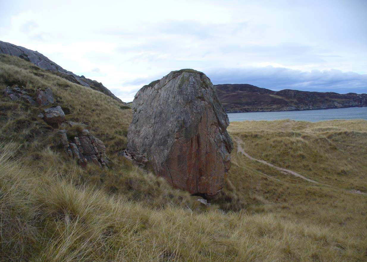
Clach na Foinne, Glen Lochay, Perthshire

Legendary Stone:  OS Grid Reference – NN 50 38

Also Known as:

  1. Clach an Dlogh
  2. Wart Stone

Archaeology & History

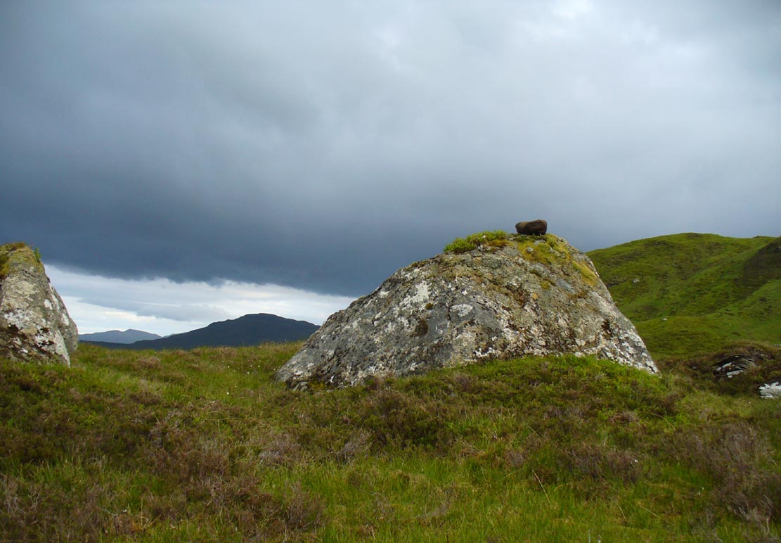
Wart Stone, looking south

There is no written history of this site; only the quiet murmurings of a few locals whose families go back to when the english came and destroyed the people and their lives in the 18th and 19th century in the ethnic cleansing we known as The Clearances.  As with the Darach nan Sith (the Oak of the Fairies) a few miles away, the local traditions were lost, and ancient monuments destroyed.  Thankfully, due to the remote location of this site, its status remains….

It is found 2000 feet up, near an old derelict village (english academic romancers term it as ‘sheilings’).  An ancient track and stone bridge runs over the burn nearby, place-names evidence tells of a prehistoric tomb a few hundred yards west, and there’s a dispersal of forgotten human evidences scattering the south-side of the mountain all along here.  The clach (stone) sits on the very top of a large earthfast rock; is an elongated loaf-sized smooth red-coloured stone, about 14 inches long and 8 inches wide, and of a different type and much heavier than the local rock hereby.  It is said to have been a healing stone, used in earlier times to cure warts and other ailments.

Folklore
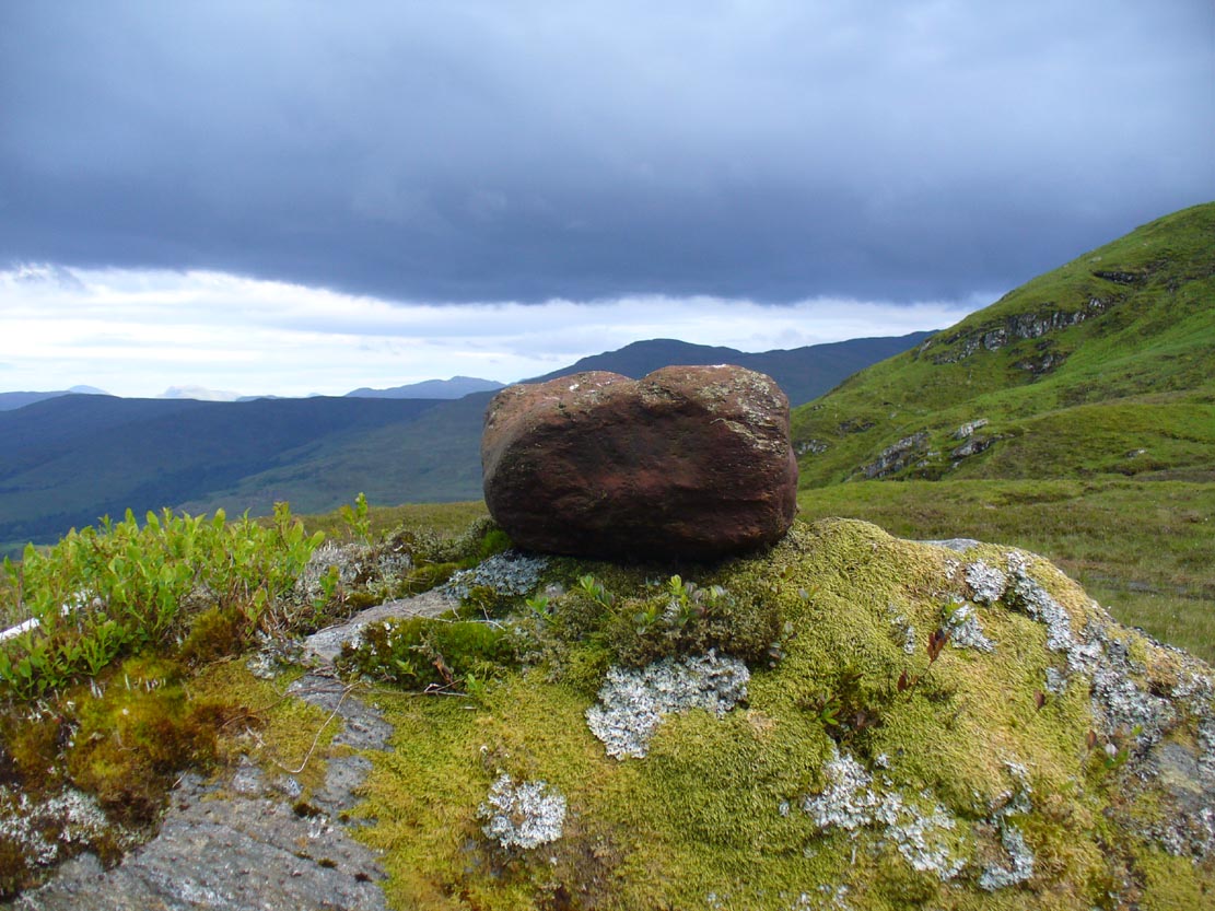
The Wart Stone itself

My first venture here was, like many in this area, amidst a dreaming.  Those who amble the hills properly, know what I mean.  I cut across the mountain slopes diagonally, zigzagging as usual, always off-path, resting by mossy stones and drinking the waters here and there.  My nose took me to the mass of giant rocks hedging into the higher regions of Allt Ghaordaidh: a pass betwixt the rounded giants of Meall Ghoaordie and Meall Cnap Laraich, where only eagles and Taoist romancers might roam.

The great rock comes upon you pretty easily.  Approaching it for the first time I wondered whether there might be petroglyphs on or around it, but the rich depth of lichens and its curious crowning elongated stone stopped any further thought on the matter.  The setting, the eagles, the colour of day and the fast waters close by, stole all such thoughts away.  In truth I must have walked back and forth and near-slept below the place for an hour or two before I gave way to rational focus!  And then my  curiosity got even more curious.

“This must be the place,” I mused, several times.

As you can see in the photo, a large natural earthfast boulder, six feet high or more, like a giant Badger Stone covered in centuries of primal lichens, has a large deep red-coloured stone on its very crown.  The stone is unlike any of the local rock and is very heavy.  I found this out when trying to prize it from its rocky mount, dislodging it slightly from the seeming aeons of vegetation that held it there.  But the moment I moved it, just an inch or so above its parent boulder, a quiet voice inside me rose sharply into focus.

“You shouldn’t have done that!”
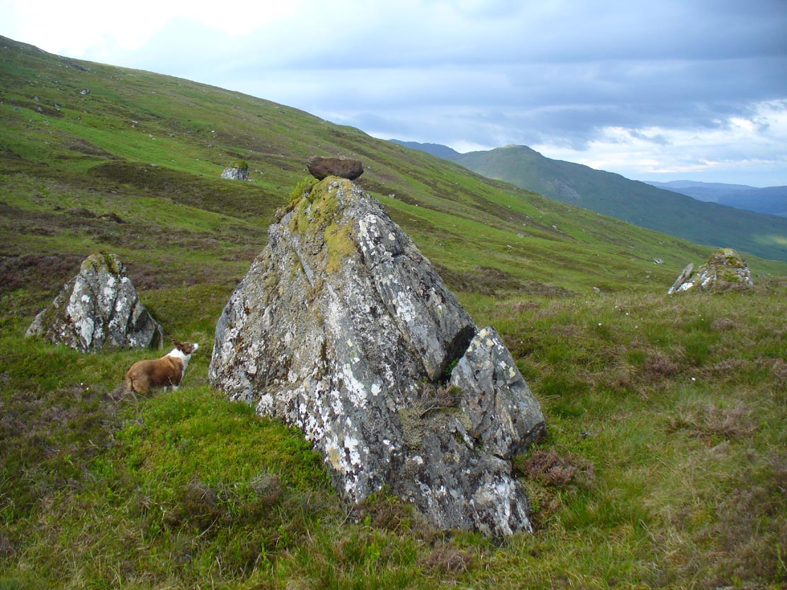
The Wart Stone. looking east

Quickly I set it back into place, shaking my head at what I’d done.  One of those curious feelings you get at these places sometimes wouldn’t leave me, however much I tried to shake it off.  …Silly though it may sound, the echoes inside kept saying over and over to me, “you’re gonna get warts now you’ve done that!” Logically, of course, that made no sense whatsoever.  I’d only ever had one wart in my life, a couple of decades ago.  And yet, a few days later, one of the little blighters emerged on my finger!  So there was only one thing for it!  If this was a Wart Stone, I should revisit it again and place my afflicted finger back onto the wart and ask it to be taken back into the stone.

A week or so later, I clambered all the way up the mountainside again and asked the place to forgive my stupidity and take back the wart.  Apologising to the spirit of the stone, I rubbed my finger on the curious coloured rock and, I have to be honest, didn’t know what to expect.

I spent the next few hours meandering here and there over the hills and cast the thought of the Wart Stone back into my unconscious.  But a few days later it had started shrinking – and within a week, had completely gone!  This faint relic of an older culture, this Clach na Foinne had performed its old ways again, as in animistic ages past…

© Paul BennettThe Northern Antiquarian 

The map could not be loaded. Please contact the site owner.


An Sithean, Lawers, Kenmore, Perthshire

Legendary Hill:  OS Grid Reference – NN 6806 3976

Getting Here

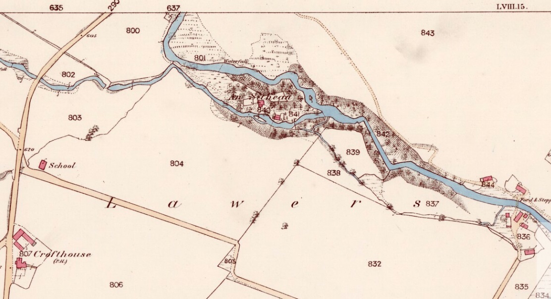
An Sithean on 1862 OS-map

Take the A827 road on the north-side of Loch Tay between Killin and Kenmore, and roughly halfway along you’ll find the tiny hamlet of Lawers.  Go down into the hamlet itself and, amidst the remains of the old trees where now are houses, nestled on a rise in the land with burns (streams) on either side, remains of the fairy mound of An Sithean still lives…

Folklore

Remnants of the legends of little people are legion in the Scottish mountains.  Sadly, many of them died when the English arrived and culled the population in ‘The Clearances’ of the 19th century – none moreso than in the area surrounding Loch Tay.  But thankfully, in the latter-half of the 19th century, a local man called James MacDiarmid (1910), took it upon himself to write down many of the old stories told by the remaining locals – as well as narrate those he remembered as a boy, as told by the elders around him.  Whilst tales of ‘fairies’ and other such creatures are thought by city-minds to be little other than fantasies, mountain-folk cosmologies differ greatly to those who are disconnected from the natural world.  Genius loci abound, and animism is the basic plinth integral to communities in the hills, where the world is much much more real.  This is one such tale…

“Not many years ago there lived in the neighbourhood of Killin a man who was in the habit of recounting his wonderful adventures with the white horse of the fairies.  When coming home one night from Kenmore market, and just as he was passing Sithean, Lawers, he heard most enchanting music proceeding from the knoll.  Unable to resist the temptation, he gradually went nearer and nearer the fairies’ place of abode, till at last he was fairly among them.  They received him most kindly, and on parting gave him one of their white horses to carry him home.  His steed went through the air at a speed almost equalling that of lightning, and in a few minutes he found himself above a house at Clifton, Tyndrum, some twenty-five miles westward from Lawers.  Happening to shout “ho!” when he was right above the chimney, the fairy horse threw him off its back, and down he dropped feet foremost through the wide, old-fashioned chimney, and alighted in the midst of a wedding party, much to their surprise and alarm. He continued in their pleasant company till daylight, when he returned home at his leisure, thanking the fairies for the pleasure they had so unexpectedly given him!”

Usually, tales such as this relate to the existence of prehistoric cairns or tumuli (burial sites), but no such archaeological remains have ever been known to live here.  Equally curious is how the man in this tale wasn’t kept in the timeless realms, beloved of faerie-land, where reveries with them would take decades from a man’s life, even though it only felt like one night.  This would imply

I’ve come across old locals who still speak, not just of the little-folk, but of other hauntings in this beautiful part of Loch Tay.  May the land not be cursed by the fools who put their idea of ‘development’ in front of the genius loci here; lest madness and ill-fortune will prevail…

References:

  1. MacDiarmid, James, “More Fragments of Breadalbane Folklore,” in Transactions of the Gaelic Society Inverness, volume 26, 1910.

© Paul Bennett, The Northern Antiquarian

The map could not be loaded. Please contact the site owner.

Holy Well, Didsbury, Manchester, Lancashire

Holy Well (destroyed?):  OS Grid Reference — SJ 8464 9036

Archaeology & History

In Henry Taylor’s gigantic survey on the Ancient Crosses and Holy Wells of Lancashire (1906), he told that “records of the existence of holy wells in this (district) are scanty in the extreme.”  Indeed.  He certainly missed this one which, it seems (if modern lore is correct), has sadly fallen prey to that sickness which those ghastly people call ‘progress’.  Cited to have been in or near the old graveyard of St. James church in the old village, this once ever-flowing spring of water was of great repute in earlier centuries, not only for general health, magick and traditions, but also supposedly in prolonging life itself!

One of the standard historians of Didsbury, Mr Fletcher Moss (1898), was of the view that this Well may have been the “origin of Didsbury, the place the Saxon settlers would choose first for their church and community.”  He may be right.  He told that,

“It was said ‘to be holy in papist times.’  Only last summer I several times saw three young ladies who came every morning to bathe their eyes and faces in it, saying, “It was good for sore eyes.”  I could not see anything the matter with their eyes, but that may have been my ignorance, or that they were already getting better. In the spring time or early in May the well has often been nearly choked with wild flowers, and pins have been put in for luck.  If rags or crutches were ever left there, it was when the water bubbled up in the roadway on the hillside.  The flow of it is lessened by drains or sewers, and now it is taken down in pipes.  The lane is enclosed with brick walls, and all the romance is gone; but in the longest drought or severest frost the water from the holy well has never failed, and though it may come from the churchyard, we and many others drink no other.”

In an earlier passage (Moss 1891), he talked about the longevity and good health of the local people and who credited the good water here:

“Like most of the old Didsbury folk who never bothered with doctors or change of air, Sam Gaskill, the last clerk, lived to be long past the fourscore years, for I remember him and others much older than he was, regularly going to the Holy Well for the water for their households.  As in patriarchal and primitive times the villagers went to the well or spring at eventide and tarried and talked while the water flowed.  It mattered nought to them that the water flowed from the churchyard, from the burial-place of their forefathers; they had always been healthy as their forefathers had been healthy, and they wanted no other water and would have no other; that always bubbled up fresh and sparkling in summer or winter, in drought or frost, and never failed.”

Nearby to the east, spirits of the dead were said to come from the old trees of Parrs Wood, long since destroyed by those self-righteous Industrialists…

References:

  1. Million, Ivor R., A History of Didsbury, E. J. Morten 1969
  2. Moss, Fletcher, Didisburye in the ’45, Cornish: Manchester 1891.
  3. Moss, Fletcher, Folklore, Old Customs and Tales of My Neighbours, privately printed: Manchester 1898.

Acknowledgements:  With big thanks to Bret Gaunt, Paul Hornby and Geraldine Dowsing for their input.

© Paul BennettThe Northern Antiquarian 

The map could not be loaded. Please contact the site owner.


St. Patrick’s Stone, Portpatrick, Wigtownshire

Cup-Marked Stone (destroyed):  OS Grid Reference – NX 0010 5411

Archaeology & History

Very little is known about this long-lost carving, whose primary information comes from the folklore records.  Apparently it was found on a rock a short distance south of the destroyed St. Patrick’s Well and the two sites seem to have had a traditional relationship with each other.  The carving had a foot-shaped motif on the rock, and a number of other cup-markings; but I can find no account as to whether the ‘foot’ carving possessed ‘toes’, as seen on the impressive Cochno Stone, north of Glasgow.  It may have been little more that the petroglyphic ‘feet’ seen on the recently discovered and aptly-named Footprint Stone, or those on the newly rediscovered Witches Stone; but we cannot discount it being larger, like the Footprint Stone of Dunadd.  If we could locate an early sketch of the stone, all would be revealed!   Sadly, as E.M.H. M’Kerlie (1916) told us,

“this rock was blasted at the time when the government essayed to make the harbour one of great importance”,

several years after the nearby holy well had been re-routed. Fucking idiots!  Any further info on this site would be most welcome.

Folklore

The local story that was told about St. Patrick creating these carvings seems to have been described first of all by Andrew Agnew (1864), who wrote:

“Once, when about to revisit his native land, he crossed the Channel at a stride, leaving the mark of his foot distinctly impressed on one of the rocks of the harbour; unfortunately, in making a new jetty, this interesting memento was destroyed.”

(The mention of the jetty would seem to imply that the carving was closer to the sea than the grid-reference cited above.) In another tale, St. Patrick rested his hand onto the same rock and the marks of his hand and fingers were left there.  This folklore motif is found across the world.  It relates to cosmological creation myths of indigenous spirits and deities in the tribes and cultures who narrate it.  In this instance, the myth of St Patrick replaced a much earlier mythic tale of another giant or deity, whose name we have lost.  Unless, of course, such petroglyphs were still being carved in Galloway by local people in the 4th-5th centuries.

A further tale of St Patrick, at Portpatrick, replaced a quite obvious shamanistic tale. When he journeyed back from Ireland to Galloway, Agnew again told us:

“Having preached to an assembly on the borders of Ayrshire, the barbarous people seized him, and, amidst shouts of savage glee, struck his head from his body in Glenapp.  The good man submitted meekly to the operation; but no sooner was it over than he picked up his own head, and, passing through the crowd, walked back to Portpatrick, but finding no boat ready to sail he boldly breasted the waves and swam across to the opposite shore, where he safely arrived (according to the unanimous testimony of Irishmen innumerable), holding his head between his teeth!”

Legends such this are found in shamanistic pantheons worldwide.  Shamans primary renown is their ability to travel and recover from the Lands of the Dead, always journeying into impossible and inhospitable arenas, with tales of being dismembered, beheaded, dying, and returning to life to help the tribe with whatever it was that required such a task (usually a healing function).  This story of St Patrick – and many other saints – are mere glosses onto the earlier animistic stories, then abridged as being better, more spiritually mature, more egocentric. But their roots are essentially animistic.

References:

  1. Agnew, Andrew, The Agnews of Lochnaw: The History of the Hereditary Sheriffs of Galloway, A. & C. Black: Edinburgh 1864.
  2. Agnew, Andrew, The Hereditary Sheriffs of Galloway – volume 1, David Douglas: Edinburgh 1893.
  3. Conway, Daniel, “Holy wells in Wigtonshire,” in Archaeological & Historical Collections Relating to Ayr & Wigton, volume 3, 1882.
  4. Harper, Malcolm MacLachan, Rambles in Galloway, Edmonston & Douglas: Edinburgh 1876.
  5. M’Kerlie, E.M.H., Pilgrim Spots in Galloway, Sands: Edinburgh 1916.
  6. MacKinlay, James M., Folklore of Scottish Lochs and Springs, William Hodge: Glasgow 1893.
  7. Morris, Ruth & Frank, Scottish Healing Wells, Alethea: Sandy 1982.
  8. Royal Commission Ancient & Historical Monuments of Scotland, Inventory of Monuments and Constructions in Galloway – County of Wigtown, HMSO: Edinburgh 1912.
  9. Walker, J. Russel, “‘Holy Wells’ in Scotland,” in Proceedings of the Society of Antiquaries of Scotland, vol.17 (New Series, volume 5), 1883.

© Paul BennettThe Northern Antiquarian 

The map could not be loaded. Please contact the site owner.


Witches Stone, Pittensorn, Murthly, Perthshire

Cup Marked Stone: OS Grid Reference — NO 0851 3881  

Getting Here

Witches Stone on 1867 map

Park up at Murthly village, follow the farm road west, opposite the Kinclaven junction up to the cross roads, and turn right and go past Douglasfield Farm, following the road as it bends to the left; then through the metal gates and walk on until you come to an earth bridge over the ditch to your left. Cross the bridge and the low-lying Witches Stone is about 30 yards on to your left by the drainage ditch.

Archaeology & History

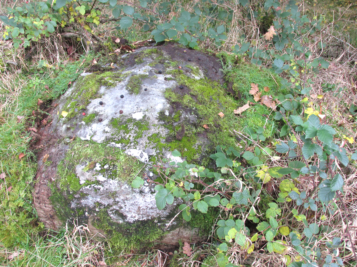
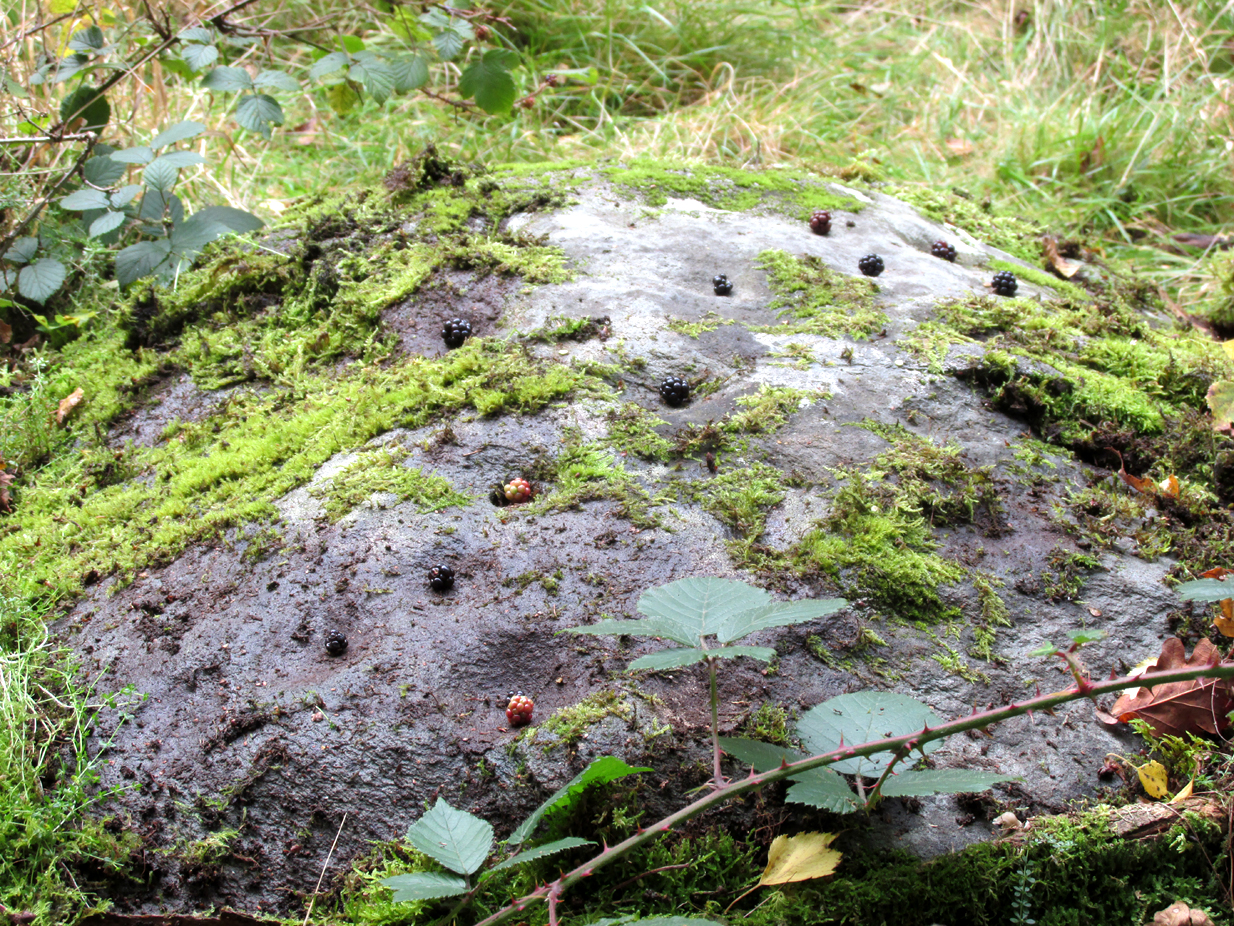
The stone with cupmarks highlighted in blackberries

Not recorded on the Canmore online database, the Witches Stone is a low-lying, domed, earthfast rock bearing at least 12 cup marks. One cup mark has been drilled at some time in the past. Did the land owner do this as a preliminary to blowing it up with gunpowder? There is an interesting story relating to the origin of the cup marks, and it seems the name of the rock and its folklore may point to its ritual significance having passed down through oral tradition from the Bronze Age to historical times.

Close-up of cups

Folklore

The mid-nineteenth century Ordnance Survey Name Book has the following record, attested by Sir W.D. Stewart, Mr. T. Cameron & Mr. J. Cameron:-

“A small rock nearly level with the ordinary ground surface, underneath which it is traditionally held that a large sum of money is buried. In order to test the truth of this tradition, it is said that some years ago a man commenced to excavate the soil around the rock in order, if possible, to secure the hidden treasure, while so employed, a small dog suddenly appeared on the top of the rock and desired the man to desist, assuring him at the same time that the reputed treasure was really there, but it was never intended that the eye of mortal should behold it. There are some marks on the rock which the superstitious tell you are the prints of this very sagacious dog’s paws.”

References:

  1. Ordnance Survey Name Book: Perthshire – volume 50, page 63, 1859-62.

© Paul Hornby 2017, The Northern Antiquarian

The map could not be loaded. Please contact the site owner.


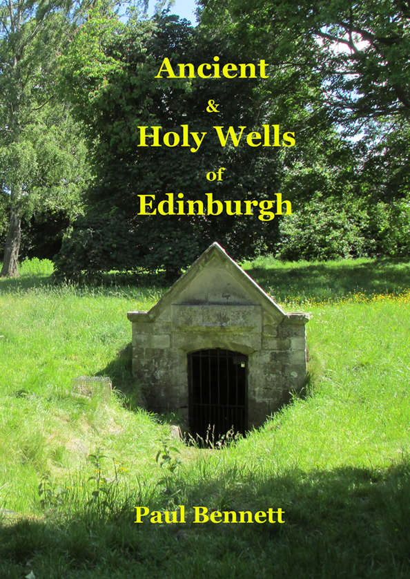
Ancient & Holy Wells of Edinburgh

Ancient & Holy Wells of Edinburgh

by

Paul Bennett

Northern Antiquarian: Alva 2017.  Kindle edition – 123 pages. 

Price – £4.99

This is the first detailed guide ever written on the holy wells and healing springs in and around the ancient city of Edinburgh, Scotland. Written in a simple A-Z gazetteer style, nearly 70 individual sites are described, each with their grid-reference location, history, folklore and medicinal properties where known. Although a number them have long since fallen prey to the expanse of Industrialism, many sites can still be visited by the modern historian, pilgrim, christian, pagan or tourist.

The book opens with two introductory chapters: the first explores the origin and nature of holy wells and what they meant to local people in earlier centuries; and the next is a comparative overview of water cults worldwide. It is an invaluable guide for any student or tourist who wants to look beneath the modern history of the city and get a taste of the more archaic customs that once belonged here…

Old Wife’s Stone, Batley, West Yorkshire

Standing Stone? (destroyed):  OS Grid Reference – SE 2428 2329

Archaeology & History

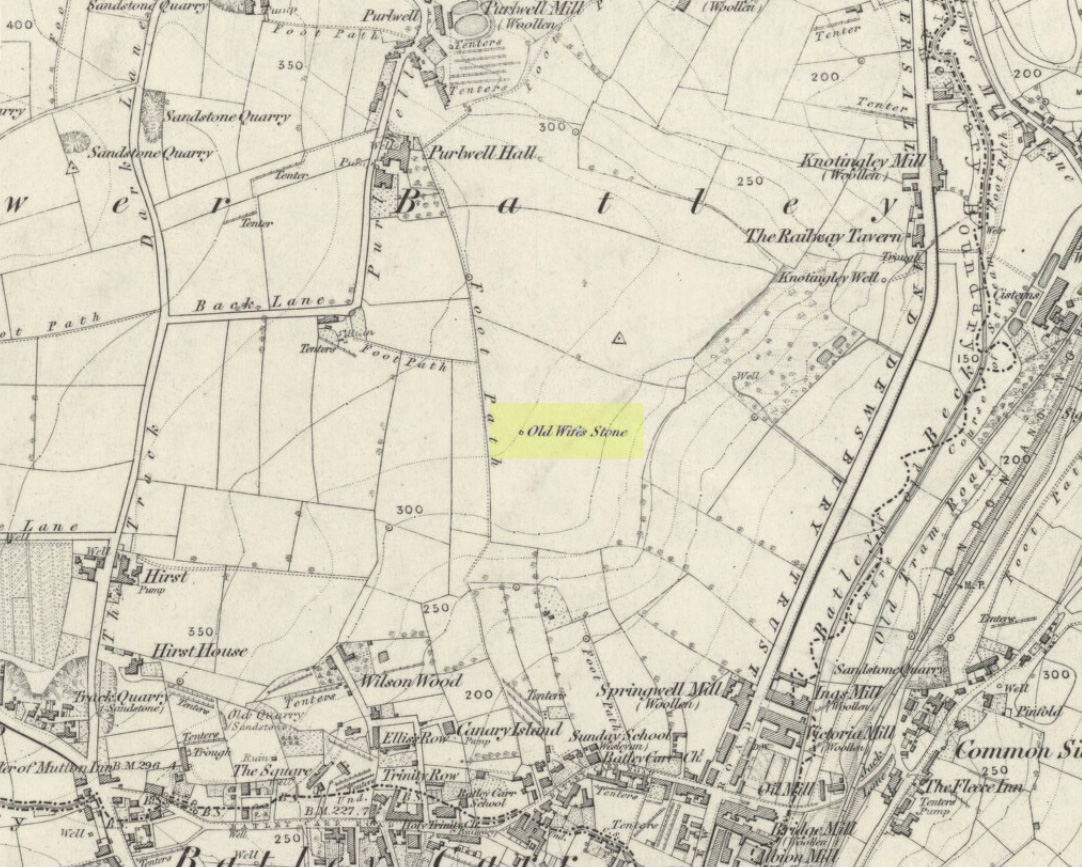
Old Wifes Stone on 1854 map

My first hint at the existence of this once valuable archaeological relic came as a result of me seeking out the history and folklore of some hitherto unknown, forgotten holy wells in the Batley and Dewsbury area.  I located the material I was looking for on the old wells, but my fortuitous discovery of this site, the Old Wife’s Stone, blew me away!

It was the place-name of ‘Carlinghow’ about one mile northwest of the grid-reference above that initially caught my attention.  From an antiquarian or occultist’s viewpoint, it’s intriguing on two counts: the first is the element ‘how‘ in Carlinghow, which can mean a variety of things, but across the Pennines tends to relate to either an ancient tribal or council meeting place, or a prehistoric burial cairn: an element that wasn’t lost in the giant archaeology survey of West Yorkshire by Faull & Moorhouse (1981).  But the first part of this place-name, ‘carling‘, was the exciting element to me; for it means ‘old woman,’ ‘old hag,’ ‘witch’ or cailleach!  The cailleach (to those who don’t know) was the prima mater: the Great Mother deity of our pre-christian British ancestors.  Meaning that Carlinghow hill was a hugely important sacred site no less—right in the heart of industrial West Yorkshire!  What is even more intriguing—or perhaps surprising—is that we have no record of such a powerful mythic creature anywhere in local folklore… Or so it first seemed…

Memory told me that no such prehistoric remains were recorded anywhere in that area—and certainly no prehistoric tombs.  I scoured through my library just to triple-check, and found the archaeological records as silent as I first thought.  Just to make sure I spent a day at the Central Library, where again I found nothing… So then I explored the region on the modern OS-maps, only to find that much of the area where the Carlinghow place-name existed was, surprisingly, still untouched by housing and similar modern pollutants. This was a great surprise to say the least.  And so to check for any potential archaeological sites which might once have been in the Carlinghow area, I turned to the large-scale 1850 OS-maps (6-inch to the mile).

This is when I came across the Old Wife’s Stone, marked in the middle of fields on the outskirts of old Batley.  There was no notice of it being a standing stone, or a simple boulder, or archaeological relic—nothing.  But its place-name compatriot of ‘Carlinghow’ was the rising hill about a mile to the northwest.  In days of olde, if Carlinghow was indeed the ‘burial tomb of the Old Woman’ or ‘meeting place of the cailleach’ (or whatever variants on the theme it may have been), it may have marked the setting sun on the longest day of the year if you had been standing at the Old Wife’s Stone – a midsummer sunset marker no less. (There are other ancient and legendary sites scattering northern England and beyond that are dedicated to the Cailleach, like the Old Woman Stone in Derbyshire, the Old Wife’s Neck in North Yorkshire, the Carlin Stone in Stirlingshire, the Old Woman Stone at Todmorden, Carlin Stone of Loch Elrig and many more.)

As if these curious ingredients weren’t enough to imply something existed in the heathen pantheon of Batley before the Industrialists swept away our indigenous history, we find echoes of the ‘Old Woman’ yet again, immediately east; this time where the animism of water and trees enfolded Her mythos in local rites and traditions, thankfully captured by the pens of several writers, and transmuted into another guise—but undeniably Her!  But that, as they say, is for another day and another site profile…

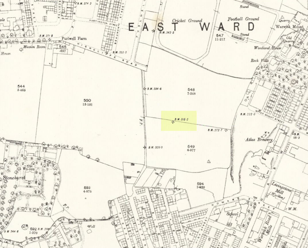
Position of stone in 1894

So is our Old Wife’s Stone (or for that matter, Carlinghow’s old tomb) still in evidence?  A school has been built where it was highlighted on the 1854 OS-map and, from the accounts of local people, seems to have long since disappeared.  The stone looks to have been incorporated into a length of walling, sometime between 1854 and 1888, and a bench-mark of “BM 318.2” carved onto it.  But when the Ordnance Survey lads re-surveyed the area in 1905, this had gone.  I have been unable to find any more information about this site and hope that, one day, a fellow antiquarian or occult historian might be able to unravel more of its forgotten mythic history.

References:

  1. Faull, M.L. & Moorhouse, S.A. (eds), West Yorkshire: An Archaeological Survey to 1500 AD – volume 1, WYMCC: Wakefield 1981.
  2. Goodall, Armitage, Place-Names of South-west Yorkshire, Cambridge University Press 1914.
  3. Keighley, J.J., ‘The Prehistoric Period’, in Faull & Moorhouse, 1981.
  4. o’ Crualaoich, Gearoid,  The Book of the Cailleach, Cork University Press 2004.
  5. Smith, A.H., English Place-Name Elements – volume 2, Cambridge University Press 1956.
  6. Smith, A.H., The Place-Names of the West Riding of Yorkshire – volume 2, Cambridge University Press 1961.
  7. Wright, Joseph, English Dialect Dictionary – volume 1, Henry Frowde: London 1898.

Acknowledgements:  Many thanks for the assistance of Simon Roadnight and Julia King in the Batley History Group.

© Paul Bennett, The Northern Antiquarian

The map could not be loaded. Please contact the site owner.


Tobair na h-oige, St. Kilda, Outer Hebrides

Sacred Well (lost):  OS Grid Reference – NA 100 000

Also Known as:

  1. Well of Eternal Youth

Folklore

An old story told in previous centuries by the indigenous folk of Hirta (St. Kilda) described a long-lost well that was thought to be an abode of the little people, known as the Well of Eternal Youth.  Not to be confused with the Well of Virtues near the Amazon’s House less than a mile west, the rough whereabouts of this site is cited by J. Sands (1878) in the folklore section of his otherwise historical account on these faraway Atlantic islands.  He wrote:

“Once on a time an old fellow, in going up Connagher with a sheep on his back, observed a Well which he had never seen or heard of before.  The water looked like cream, and was so tempting, that he knelt down and took a hearty drink.  To his surprise all the infirmities of age immediately left him, and all the vigour and activity of youth returned. He laid down the sheep to mark the spot, and ran down the hill to tell his neighbours. But when he came up again neither sheep nor well were to be found, nor has any one been able to find the Tobair na h-oige to this day.  Some say that if he had left a small bit of iron at the well—a brog with a tacket in it would have done quite well—the fairies would have been unable to take back their gift.”

Explorations of old maps and texts has failed to show with certainty where this legendary well may have been (the grid-ref is an approximation), but it was reported in Mrs Banks’ Scottish Calendar Customs (1937) to have been “issuing out of the face of a rock on the north-side of the east bay…only accesible by the inhabitants, no stranger daring to climb the steep rock.” Some of us would try!

References:

  1. Banks, M. MacLeod, British Calendar Customs: Scotland – volume 2, Folklore Society: London 1937.
  2. Sands, J., Out of the World; or Life in St. Kilda, Maclachlan & Stewart: Edinburgh 1878.

© Paul Bennett, The Northern Antiquarian

The map could not be loaded. Please contact the site owner.

Lady Fife’s Well, Leith, Midlothian

Holy Well? (destroyed):  OS Grid Reference – NT 27534 75794

Archaeology & History

Despite this site having a number of albeit brief literary references, from the early 19th century onwards, the history and traditions of this Well are very scant indeed.  It figures in various texts that detail the historical ‘Battle of Leith’, but there is little additional information in such tomes.  Even local history works pass it by with brevity.

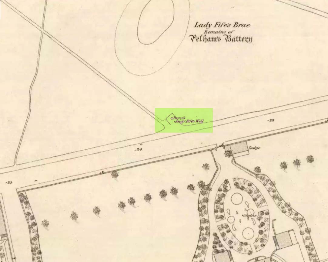
Lady Fifes Well on 1852 map
Lady Fifes Well on 1853 map

Its present name derives from the Countess of Fife who, in the 19th century, lived in the nearby mansion of Hermitage House (and who also grafted her name onto the nearby mound of Lady Fife’s Brae); but this title seems to have been grafted onto the earlier ‘Ladie Well’, implying it had a dedication to St. Mary or more probably an earlier heathen female spirit at the waters. Although it is shown on the OS-maps of 1852 and ’53, and described in Grant’s 1883 work as being there in his time, all subsequent maps after this date seem to indicate that it had gone.

All that we know is that the waters ran into a small stone trough and that Lady Fife enjoyed her evenings here, partaking of the waters.

References:

  1. Bennett, Paul, Ancient and Holy Wells of Edinburgh, TNA 2017.
  2. Campbell, Alexander, The History of Leith from the Earliest Times, William Reid: Leith 1827.
  3. Grant, James, Cassell’s Old and New Edinburgh – volume 3, Cassell, Petter Galpin: London 1883.
  4. Harris, Stuart, “The Fortifications and Siege of Leith,” in Proceedings Society of Antiquaries, Scotland, volume 121, 1991.
  5. Harris, Stuart, The Place-Names of Edinburgh: Their Origins and History, Gordon Wright: Edinburgh 1996.
  6. Hutchison, William, Tales, Traditions and Antiquities of Leith, Leith 1865.
  7. Maxwell, C.A., The Wars of England and Scotland, W.P. Nimmo: Edinburgh 1870.
  8. Russell, John, The Story of Leith, Nelson 1922.

© Paul Bennett, The Northern Antiquarian 

The map could not be loaded. Please contact the site owner.

Ringstone, Torrisdale Bay, Farr, Sutherland

Legendary Rock:  OS Grid Reference – NC 69128 61741

Getting Here

The Ringstone, Torrisdale Bay

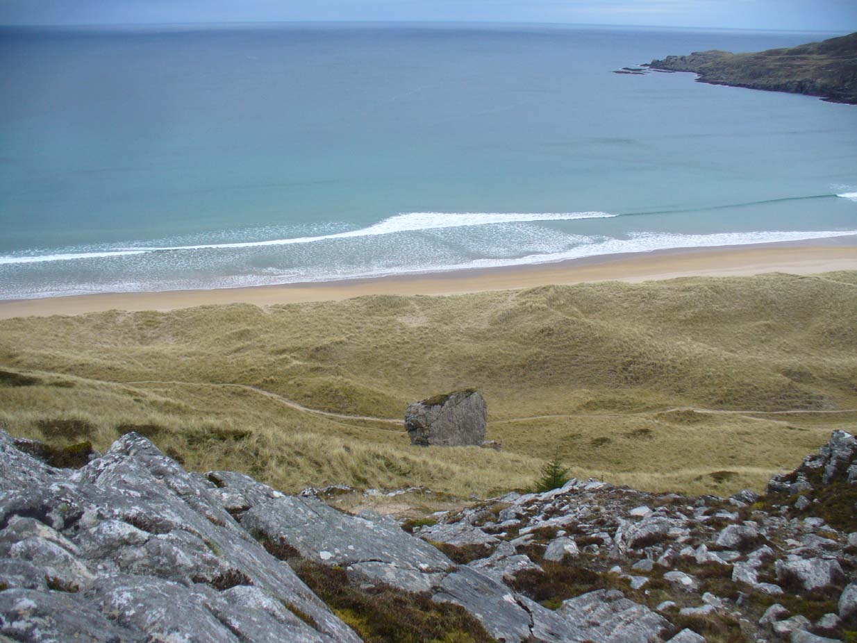
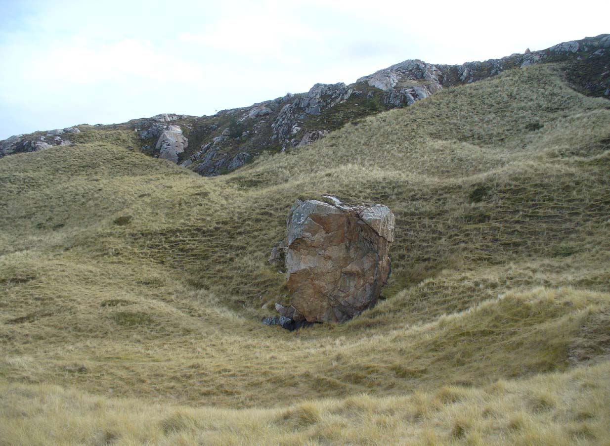
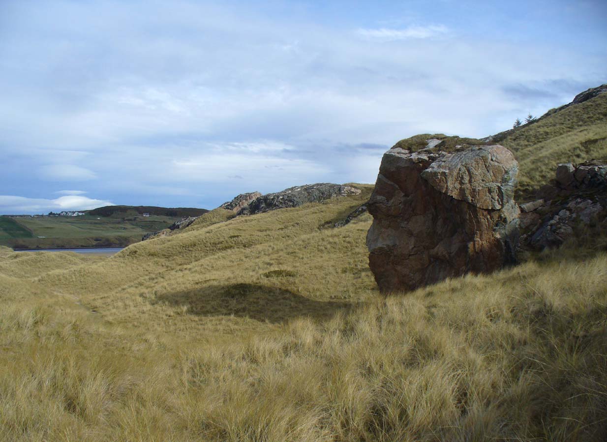
Along the A836 road between Tongue and Bettyhill, turn down towards Skerray at Borgie Bridge for 1.8 miles (2.87km) until you reach the little information sign at the roadside. Walk downhill and cross the little bridge and wander onto the west side of the beach.  You’re likely to end up daydreaming… so once you’ve re-focussed, head into the middle of the beach and walk up the steep-ish sand-banks to your right (south).  Once at the top, you’ll see a gigantic rock—the Ringstone—nearly as big as a house.

Folklore

This gigantic boulder is part of one of Sutherland’s archaic Creation Myths as they’re known: ancient stories recounted by archaic societies about the nature and origins of the world.  Such tales tend to be peopled by giants, gods, huge supernatural creatures, borne of chaos, eggs, darkness and primal oceans.  Thankfully we still find some examples of these tales in the northern and northwestern mountainous regions of Britain, as the Church and Industrialism never quite destroyed the hardcore communities—despite what they might like to tell you…

The face of the Ringstone
The Ringstone, gazing east

The following folktale was written by the local headmaster, Alan Temperley (1977), who wrote down many of the oral traditions in Scotland’s far north before they disappeared forever from the tongues of local people (as is sadly happening in these mountains) as they’re slowly, sadly, being erased by the influx of incomers with no connection nor sincere love of old tales and ways.  It is typical of stories found other large geological formations from aboriginal Australia, to Skye, to everywhere on Earth where people have settled.  Mr Temperley wrote:

“Many years ago there were two giants, the Naver giant from the river at Bettyhill, and the Aird giant from the hill above Skerray.  Normally they got on quite well, but one afternoon they became involved in a heated argument about some sheep and cattle, and both grew very angry.  The Aird giant was standing on top of the hill above Torrisdale bay with the animals grazing around him, and the Naver giant stormed across the river to the beach below.

“Those are my sheep,” he roared up the hill.

“No they’re not,” the Aird giant said. “At least not all of them.”

“You stole them. You’re a thief!”

“No I didn’t. They came up here themselves. Anyway, you owe me fifty sheep from last year.”

“You’re not only as thief, you’re a liar!” shouted the Naver giant.  If you don’t send them down this minute, I’ll come up and see to it myself.”

At this the Aird giant gave a disparaging laugh and made a rude face, and picking up a great boulder flung it down the hill at his friend.

The Naver giant was speechless with fury, and picking the stone up himself, hurled it back up the hillside, making a great hole in the ground.

The Aird giant saw things had gone far enough.

“I’ll send them back if you give me that silver ring you’re always wearing,” he said.

“Never!” roared his friend, his face all red and angry.

“Suit yourself then,” said the Aird giant, and picking the stone up again he tossed it back down the hill.

For long enough the rock kept flying between them, and in time the giant from Naver grew tired, because he was throwing it uphill all the time.

“Will you give me the ring now?” said the Aird giant.

For answer the Naver giant tried one more time to throw the stone up the hill, but it only got halfway, and rolled back down to the shore.

“Come on,” said the giant from Aird, for he wanted to be friends again. “Give me the ring, and I’ll let you have it back later.”

“No!” said the Naver giant from the bottom of the hill.  “I’ll never give it to you!” His eyes began to fill with tears.

“Oh, come on, please!” coaxed the Aird giant. “Just for a week.”

“Never, never, never!” shouted the giant from Naver, and pulling the ring from his finger he threw it on the ground and jammed the great boulder down on top of it.  Then he sat down on top of the stone and stared out to sea.  Every so often he sniffed, and his friend, looking down at his broad back, saw him lift the back of a hand to his eyes.

They never made friends again, and after a long time they both died.

The ring is still buried under the stone, and so far nobody has ever been able to shift it.”

The giant’s face, in profile

When I got back from visiting this immense rock a few weeks ago, a local lady Donna Murray asked me if I’d seen the face of the giant in the rock.  I hadn’t—as I was looking to see if the name ‘Ringstone’ related to any possible cup-and-rings on its surface, which it didn’t (although I didn’t clamber onto the top).  But in the many photos I took from all angles, Donna pointed out the blatant simulacra of the giant’s face when looking at it from the east.

However, on top of the slope above the Ringstone (not the Aird side), I did find a faint but distinct ‘Ringstone’ carving (without a central cupmark).  Whether this ever had any mythic relationship to the tale or the stone, we might never know.  The rocky terrain above Aird now needs to be looked at…

References:

  1. Eliade, Mircea, Patterns in Comparative Religion, Sheed & Ward: London 1958.
  2. Long, Charles H., “Cosmogony,” in Eliade, M., Encyclopedia of Religion – volume 4, MacMillan: New York 1987.
  3. MacLagan, David, Creation Myths: Man’s Introduction to the World, Thames & Hudson: London 1977.
  4. Temperley, Alan, Tales of the North Coast, Research Publishing Company: London 1977.

Acknowledgments:  Massive thanks again to Donna Murray, for her help and for putting up with me amidst my wanderings up in Torrisdale and district.

© Paul BennettThe Northern Antiquarian 2017

The map could not be loaded. Please contact the site owner.