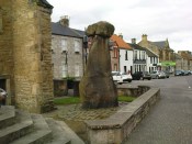
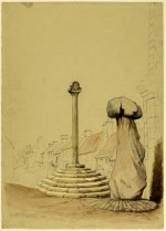
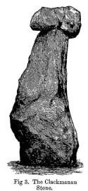
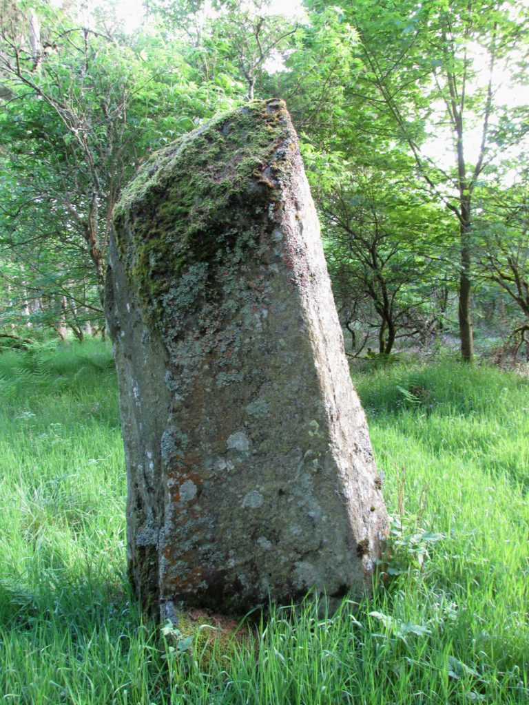
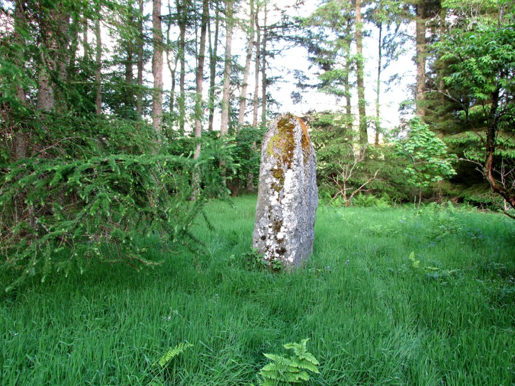
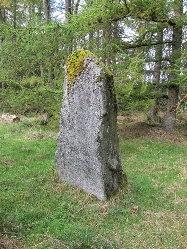
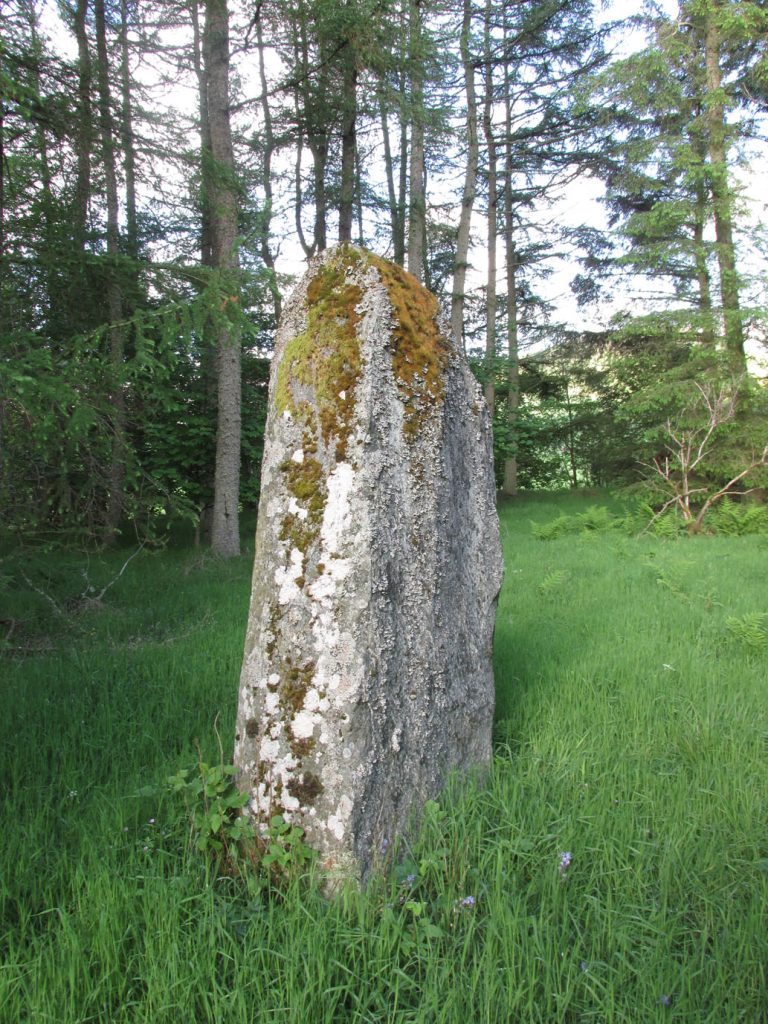
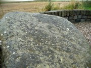
Clach na h-ealea, Clachan, Lismore, Argyll

Legendary Stone:  OS Grid Reference – NM 861 435

Also Known as:

  1. Clach na h-eala
  2. Stone of the Swan
  3. Swan Stone

Archaeology & History

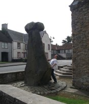
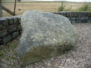
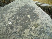
Although the lads at the Scottish Royal Commission (1974) initially described this site as a ‘Standing Stone’, it is in fact,

“an erratic boulder of granite roughly shaped in the form of a cross… It measures 0.8m in height, 0.6m in width at base, and 0.4m in width at the top…(and) the stone is supposed to have marked a boundary.”

The site was evidently of some mythic importance, as the great Cathedral of St. Moluag was built next to the stone — unless the giant cairn of Cnoc Aingil, 500 yards away, was to blame. A holy well of this saint’s name (an obvious heathen site beforehand) is also nearby.

Folklore

Although this stone was dedicated to swans, I’ve not found the story behind the name.  There were no buried swans here, but local tradition told that this old boulder could give sanctuary to anyone who touched it, or ran round it sunwise.  The Hebridean folklorist Otta Swire (1964) told that,

“anyone who claimed such sanctuary had his case considered by ‘the Elders.’ If they considered his plea justified, they ‘came out and walked sun-wise round the Swan Stone.’ If they did not approve of his right to sanctuary, they walked round it anti-clockwise and the man was then given over, not to his enemies, but ‘to Authority’ to be tried.”

This old tradition derives from well known pre-christian rites. Swire also reported that even in the 1960s here, “at funerals the coffin is always carried round the grave sun-wise before being laid in it.” An old cross placed in the Field of the Cross next to the stone was an attempt to tease folk away from heathen rites of the stone, but failed.

References:

  1. Royal Commission on the Ancient & Historical Monuments of Scotland, Argyll – volume 2: Lorn, RCAHMS: Edinburgh 1974.
  2. Swire, O.F., The Inner Hebrides and their Legends, Collins: London 1964.

© Paul BennettThe Northern Antiquarian

Kilry, Glen Isla, Angus

Standing Stone: OS Reference – NO 2432 5449

Also Known as:

  1. Canmore ID 31093

Getting Here

Take the B954 north from Alyth, and turn left onto the unclassified road at Craigisla House, turning right at Dykehead, then take the right fork at Faulds. Park up by the school about ¼ mile further on, and the stone is in a wooded glade on the opposite side of the road along a track to the left of ‘Standing Stone’ cottage.

Archaeology and History

Quoted in the Canmore database, A.J. Warden, writing in 1882, described the stone:

The standing stone on Broomhall estate is a large amorphous whinstone, standing in a small field near the confluence of the Kilry Burn and the River Isla.  It is c.7′ high and c. 10′ in circumference at the base. Tradition states that it commemorates a battle fought between the laird of Kilry and the Durwards of Peel.’

On the OS map the stone is aligned with the Pitmudie Stones and the Knowehead of Auldallan Stones to the north east.

References:

  1. Warden, A.J.,  Angus or Forfarshire: The Land and People, Descriptive and Historical – volume 3, Dundee 1880-5.

© Paul Hornby, The Northern Antiquarian


Girdle Stane, Dunnichen, Angus

Cup-and-Ring Stone:  OS Grid Reference – NO 52808 49737

John Sheriff's 1995 drawing of Girdle Stane

John Sheriff’s 1995 drawing of Girdle Stane

Also Known as:

  1. Canmore ID 34662
  2. Dunnichen 1
  3. Girdlestane
  4. The Girdle Stane of Dunnichen
  5. Girdle Stone

Getting Here

From The Square in Letham village, go north up Auldbar Road and out of the village for 0.6 miles (1km).  Shortly before reaching the road junction at the top, on the left-side of the road is a recess with a stone and a small aging plaque telling you that you’ve reached the Girdle Stane.

Archaeology & History

The Girdle Stane

The Girdle Stane

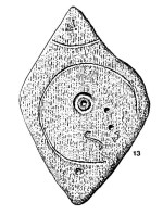
This cup-and-ring stone is not in its original position.  Although we know from Ordnance Survey records in the 1860s that it was located about 130 yards north of here, close to the road junction, even that is unlikely to have been its original position—but we know not where that might have been!  It is an undoubted multi-period carving, with the earliest section being our typical neolithic or Bronze Age cup-and-ring near the centre of the stone, with several outlying cup-marks toying with our intellect as per usual!  The central cup-and-ring may have an incised line running down out of it, although this isn’t highlighted on John Sheriff’s (1995) drawing of the stone.

Girdle Stane on 1865 map

Girdle Stane on 1865 map

Surrounding the central archetype, by some distance, is a much wider carved ring that almost reaches to defines the edges of the stone itself.  This large encircling motif and other features of the petroglyph—including a large elongated “S” and marks that were probably executed by the Ordnance Survey lads at the bottom corner—were ingredients which prompted Sir James Simpson (1867) to question the veracity of the Girdle Stane’s antiquity.  He wrote:

“The so-called ‘Girdle-stone’ in the…parish of Rescobie, about four feet long and three broad, is cut on its surface with two circles, the largest of which is above two feet and a half broad, and hence does not, I believe, belong to the class which we are considering in this essay”—

More recent "S"-shaped motif

More recent “S”-shaped motif

Close-up of cups, ring and lines

Close-up of cups, ring and lines

i.e., neolithic or Bronze Age petroglyphs.  And you can see his point!  My first impression when Prof Paul Hornby and I visited the site a few days ago, after the initial “that’s a cup-and-ring in the middle”, was to proclaim: “that bit’s much more recent, maybe Pictish?”  But it probably isn’t even Pictish.  This “more recent” carved element is a distinct large elongated “S”, which may have been marked onto it when the stone was used as a township boundary marker between the local parishes.  The grand historical writer Alex Warden (1882) talks about this in his magnum opus, saying:

“At the junction of two roads, a little to the northeastward of Letham, there is a rough boulder, about five feet long by three in breadth, having on its face a circle of about thirty inches in diameter, and another smaller circle about six inches across.  It is called the Girdle Stane of Dunnichen, from the larger circle resembling the utensil called the girdle, s.c. This stone marks the boundaries between the parishes of Dunnichen and Rescobie, also between the lands of Dunnichen and Ochterlony (Balmadies).  It is probably the Grey Stone referred to in a note on the marches of Dunnichen, about 1280.”

Folklore

The folklore of the stone indicates how its origins are rooted in prehistory, despite the later additional symbols.  Alex Warden (1882) tells the all-too-familiar creation myth, usually symptomatic of giant prehistoric cairns:

“Tradition says a witch was carrying this boulder from ‘the Crafts’ of Carmylie in her apron, when the strings broke, and the stone fell where it now lies.”

Carmyllie Hill is 5 miles (8km) to the south and is a place rich in fairy-lore and vandalized prehistoric sites.

References:

  1. Coutts, Herbert, Ancient Monuments of Tayside, Dundee Museum 1970.
  2. Kidd, Scott, The Churches of the Parish of Dunnichen, David Winter: Dundee 1995.
  3. Sherriff, John, “Prehistoric rock-carving in Angus,” in Tayside & Fife Archaeological Journal, volume 1, 1995.
  4. Simpson, James, Archaic Sculpturings of Cups, Circles, etc., Upon Stones and Rocks in Scotland, England and other Countries, Edmonston & Douglas: Edinburgh 1867.
  5. Warden, Alex J., Angus or Forfarshire – volume 3, Charles Alexander: Dundee 1882.

© Paul Bennett, The Northern Antiquarian


Ghaist Stane, Fern, Angus

Standing Stone:  OS Grid Reference – NO 4832 6173

Getting Here

Ghaist Stane on 1865 OS-map

Ghaist Stane on 1865 OS-map

Whichever route you take to reach this lovely hamlet, hiding away in deep greenery, when you get to the one and only road junction, where it goes downhill (towards the old church), look just above you just below the first tree.  All but covered in vegetation, the ruined stone lays down there. Climb up and see!

Archaeology & History

Tis up on the verge here

Tis up on the verge here

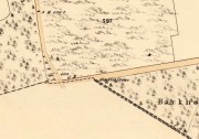
An exploration of this site was prompted when fellow antiquarian, Paul Hornby, came across the curious place-name of ‘Ghaist Stane’ when he was looking over some old Ordnance Survey maps of the region.  So we met up and took a venture over there!  Last highlighted on the 1865 map (when the old village was known as Fearn, not the modern spelling), even the Canmore lads had missed this one.  But it’s not easy to find….

After meandering back and forth by the village roadside, on the tops of the walls, into the field above, Paul eventually said, “Is that it?!” just above the roadside, almost buried in vegetation below the roots of a tree.  So I clambered back up and brushed some of the vegetation away – and there it was – in just the place that the old OS-map showed it to be (give or take a few yards).

The remains of the stone measure roughly 3 feet by 3 feet; with the present upper portion of the stone being of a lighter colour than the lower portion, indicating that this section of the stone was the portion that was underground when it was standing upright.  Its history is fragmentary, but we know that it was almost completely destroyed in the middle of the 19th century.  Notes from the Object Name Book of the region in 1861 told,

“The “Ghaist Stane”…formerly well known, is becoming little known from the stone having been recently blasted in making the Dike it now forms a part of, but it may be observed in the wall as a huge stone much larger than those beside it in the Dike. It does not project now from the side of the Road.”

Now the stone is almost entirely forgotten and lays covered, ignored, even by local people.  It could do with being resurrected and its heritage preserved before it disappears forever.

Folklore

The uncovered Ghaist Stane

The uncovered Ghaist Stane

The word “ghaist” is a regional dialect word meaning “a ghost or goblin”, inferring that the site was haunted.  And, considering the inherent animistic cultural psychology of the people here in earlier centuries, we must also consider the distinct possibility that the stone itself was the abode of a resident spirit, perhaps an ancestral one of a local chief, or queen, or elder of some sort.

In James Guthrie’s (1875) analysis of the folklore of Fern township, he told of the peculiarly odd violent brownies of the district and thought that they and the spirit of the Ghaist Stane were one and the same.

“In addition to the leading characteristics of Brownies in general the more prominent of these being, that they forded the rivers when their waters were at their highest, and that the sage femme always landed safely at the door of the sick wife—the brownies of Ferne are connected with scenes of cruelty and bloodshed.  This peculiarity would seem to indicate that the brownie and the ghaist of Feme, were one and the same.  The Ghaist Stane is in the vicinity of the church.   To this piece of isolated rock, it is said this disturber of the peace was often chained as a fitting punishment for his misdeeds, but tradition is silent as to the brownie being similarly dealt with, which strengthens the supposition that they were, in this quarter at least, generally regarded as one being.”

The spirit of the Ghaist Stane roamed far and wide in the district it seemed, and a long rhyme telling a tale of the ghaist was once well-known in the area which, thankfully, Mr Guthrie gave us in full:

THE GHAIST O’ FERNE-DEN

There liv’d a farmer in the North,
(I canna tell you when),
But just he had a famous farm
Nae far frae Feme-den.
I doubtna, sirs, ye a’ hae heard,
Baith women folks an’ men,
About a muckle, fearfu’ ghaist —
The ghaist o’ Ferne-den!
The muckle ghaist, the fearfu’ ghaist,
The ghaist o’ Ferne-den;
He wad hae wrought as muckle wark
As four-au’-twenty men!

Gin there was ony strae to thrash,
Or ony byres to clean,
He never thocht it muckle fash
0′ workin’ late at e’en!
Although the nicht was ne’er sae dark,
He scuddit through the glen,
An’ ran an errand in a crack —
The ghaist o’ Ferne-den!

Ane nicht the mistress o’the house
Fell sick an’ like to dee,—
“O! for a oanny wily wife!”
Wi’ micht an’ main, cried she!
The nicht was dark, an’ no a spark
Wad venture through the glen,
For fear that they micht meet the ghaist —
The ghaist o’ Ferne-den!

But ghaistie stood ahint the door,
An’ hearin’ a’ the strife,
He saw though they had men a score,
They soon wad tyne the wife!
Aff to the stable then he goes,
An’ saddles the auld mare,
An’ through the splash an’ slash he ran
As fast as ony hare!

He chappit at the Mammy’s door—
Says he — “mak’ haste an’ rise;
Put on your claise an’ come wi’ me,
An’ take ye nae surprise!”
“Where am I gaun?” quo’ the wife,
“Nae far, but through the glen —
Ye’re wantit to a farmer’s wife,
No far frae Ferne-den!”

He’s taen the Mammy by the hand
An’ set her on the pad,
Got on afore her an’ set aff
As though they baith were mad!
They climb’d the braes—they lap the burns—
An’ through the glush did plash:
They never minded stock nor stane,
Nor ony kind o’ trash!

As they were near their journey’s end
An’ scudden through the glen:
“Oh!” says the Mammy to the ghaist,
“Are we come near the den!
For oh! I’m feared we meet the ghaist!”
“Tush, weesht, ye fool! “quo’ he;
“For waur than ye ha’e i’ your arms,
This nicht ye winna see!”

When they cam to the farmer’s door
He set the Mammy down:—
“I’ve left the house but ae half hour—
I am a clever loon!
But step ye in an’ mind the wife
An’ see that a’ gae richt,
An’ I will tak ye hame again
At twal’ o’ clock at nicht!”

“What maks yer feet sae braid?” quo’ she,
“What maks yer een sae sair?”
Said he, — “I’ve wander’d mony a road
Without a horse or mare!
But gin they speir, wha’ brought ye here,
‘Cause they were scarce o’ men;
Just tell them that ye rade ahint
The ghaist o’ Ferne-den!”

References:

  1. Guthrie, James C., The Vale of Strathmore – Its Scenes and Legends, William Paterson: Edinburgh 1875.

© Paul BennettThe Northern Antiquarian


Water End Maypole, North Mymms, Hatfield, Hertfordshire

Maypole (removed):  OS Grid Reference – TL 2296 0410

Getting Here

On the east side of Warrengate Road, approached from Welham Green via Dixons Hill Road, or from Brookmans Park via Bradmore Lane.

Archaeology & History

o khy 01170

A 1920 photograph of the Public House. The Maypole was believed to have been in the garden grounds to the rear.

The exact position of the pole is not marked on the 1896 25″ OS map, as it is probable that it had been removed by the middle of the nineteenth century (like the majority of the permanent Hertfordshire maypoles), but local belief in the 1950s and 60s was that it had been in the garden of the Old Maypole (originally known as ‘The Maypole’) public house, which adjoined the smithy in Warrengate Road, Water End.  The public house is stated to have been built around 1520, with later additions, but is now a private house.

The population of Water End and nearby Welham Green was predominantly employed in agriculture, domestic service and straw plaiting, but the area’s proximity to London probably speeded the demise of the ancient traditions like maypole dancing .

Maypole North Mymms

The 1896 OS 25″ map, showing the garden ground to the rear of the public house

Doris Jones-Baker writes: “The old Hertfordshire maypoles, on May Day decorated with ribbons and a bunch of spring flowers at the top, were described as being ‘as high as the mast of a vessel of a hundred tons, painted often in a diagonal or spiral pattern from bottom to top in yellow and black, or often in vertical stripes of red, white and blue’”

Interestingly, the rear of the public house garden adjoins the Swallow Holes, a geological feature where the intermittent flowing waters of the Mimmshall Brook disappear into the chalk in as many as 15 sink holes. Hertfordshire has an ancient tradition of ‘woe-waters’ related to the local geology, where the flowing or not of a stream or spring was seen to herald ‘sorrow to come’. From personal memory the Mimmshall Brook is normally a dry stream bed which can in winter suddenly turn into a raging torrent, flooding the land behind The Old Maypole. Any tradition of it having been a woe-water has though been lost. But it is just possible that long ago the coming of May Day was also seen to herald the end of flooding of the Mimmshall Brook and may explain the siting of the pole.

The last year that people danced is not recorded, but the local maypole tradition continued; this writer remembers ribbon dancing as a very small child to a fiddle accompaniment around a maypole erected at the nearby, but long demolished Waterend C.E. Primary School, which closed in 1960.

Folklore

As well as Maypole dancing, Hertfordshire had a rich tradition of May day ritual and song, which despite the county’s proximity to London, survived long enough for some of it to be recorded for posterity. While there does not seem to be any ritual recorded for North Mymms, the following was recorded at nearby Hatfield. “On may morning, dressed in white and holding bunches of Hawthorn or, in late seasons, blackthorn blossoms the children sang door to door a local version of the May song, which began:

‘A bunch of May I bring unto you
And at your door I stand,
Come pull out your purse,
You’ll be none the worse
And give the poor Mayers some money….’”

References:

  1. North Mymms Local History Society, North Mymms Pictures From The Past, Welham Green, 2002
  2. Jones-Baker, Doris, The Folklore of Hertfordshire, B.T.Batsford, London, 1977
  3.  Kingsford, Peter, North Mymms People in Victorian Times, Brookmans Park, Hertfordshire, Privately Published, 1986

© Paul T. Hornby 2016 The Northern Antiquarian 


Gorrick’s Spring, Calverton, Buckinghamshire

Healing Well:  OS Grid Reference – SP 7880 3930

Getting Here

Take the Calverton Road out of Stoney Statford, then take the left hand road to Calverton and look for layby on the right near a copse.

Archaeology & History

Gorrick’s spring is an interesting site and perhaps the best of the county’s holy wells. The water flows from a rather worn lion’s head beneath a stone arch under the steps, and pours into a stone lined chamber repaired with concrete slabs. It is reached by a series of steps from the layby and beside the spring is a narrow and as Rattue (2003) states an uncomfortable seat.

Folklore

It is unclear where the name comes from but a local legend tells how a witch’s pupil gave the sight back to a Gypsy tinker. A rhyme states in Romance around Stoney Stratford quoted by Rattue (2003):

“When Gorrick’s Spring flows fast and clear,
Stoop down and drink, for health is here,
If Gorrick’s Spring shuld e’er run dry,
Beware, for pestilence is nigh.”

Interestingly it did run dry in 1996 as noted in the local Herald of 8th November 1996:

“It’s a mystery,” confessed Calverton resident Lucinda Lourie. She said she realised water levels were currently low, but older residents of the village remembered the spring running through the drought of 1976. She said one wag at Anglian Water had suggested the source of the spring may have been a burst pipe which the Anglian Water work had cured – unlikely since the spring is reputed to have been used by monks in the 13th century!”

An author named Bartley (1928) mentioned by Rattue (2003) in his Holy Wells of Buckinghamshire notes:

 “the monks of old….deemed the delicious waters of this wayside spring as sacred, possessing healing properties for all humans. Daily the holy Friar would hie to the mossy bank and reach the water with his ancient pitcher, and bear it homeward to his suffering flock”

As Rattue (2003) notes it appears unlikely that a friar would have visited the site as there  is no record of any religious institutions connected with the site.

Extracted and amended from the below post (which also discusses St Rumbold’s Well)

http://insearchofholywellsandhealingsprings.wordpress.com/2012/01/12/a-buckinghamshire-field-trip-gorricks-spring-and-st-rumbolds-well/

References:

    1. James Rattue (2003) Holy Wells of Buckinghamshire


Robin Hood & Little John, Castor, Cambridgeshire

‘Standing Stones’:  OS Grid Reference — TL 1395 9839

Also Known as:

  1. St. Edmund’s Stones

Archaeology & History

1885 OS-map of the site

1885 OS-map of the site

A curious and intriguing site with as many questions about its nature as there is its folklore.  Moved around by the conniving fuckwit politicians from Huntingdonshire, to Northants to Cambridge nowadays, one wonders where those fools will place it next!  Listed by a number of archaeologists as prehistoric standing stones, it seems pretty obvious from photos and the descriptions of many amateur students that—unless some original monoliths have been reworked a few centuries back—the narrative given by local historian W.H.B. Saunders (1888) outlines their more probable origin and history.  That’s not to say that the stones aren’t old—just not that olde…. Mr Saunders reasoned that they were dug and transported from more than 5 miles northwest of their present spot, telling that:

“Nothing can rob the stones of their undoubted antiquity.  The Barnack quarries have been exhausted for the last 600 years at least.  It is evident therefore, that the stones were placed in their present position at a time when the Barnack quarries were being worked.  That would be in the days of Robin Hood, and also when the Abbey of St. Edmund’s Bury, built of Barnack stone, was being erected.”

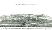
His words make sense when you look at the stature of the monoliths in question.  They’re cut and squared to the edges, with Robin Hood being the taller of the two stones, about 30 feet southwest of the Little John stone.  They have been written about quite extensively by historians down the centuries, from William Camden onwards.  One early account of the stones was written by Symon Gunton (1686) who told:

“I find in the charter of King Edward the confessor…that the abbot of Ramsey should give to the abbot and convent of Peterburgh 4000 eeles in the time of Lent, and in consideration thereof the abbot of Peterburgh should give to the abbot of Ramsey as much freestone from his pitts in Bernack, and as much ragstone from his pitts in Peterburgh as he should need.

“Nor did the abbot of Peterburgh from these pits furnish only that but other abbies also, as that of St. Edmunds-Bury: in memory whereof there are two long stones yet standing upon a balk in Castor-field, near unto Gunwade ferry; which erroneous tradition hath given out to be draughts of arrows from Alwalton church-yard thither; the one of Robin Hood, and the other of Little John; but the truth is, they were set up for witnesses, that the carriages of stone from Bernack to Gunwade-ferry, to be conveyed to S. Edmunds-Bury, might pass that way without paying toll; and in some old terriars they are called St. Edmund’s stones.  These stones are nicked in their tops after the manner of arrows, probably enough in memory of S. Edmund, who was shot to death with arrows by the Danes.  The balk they stand upon is still call’d St Edmund’s Balk.  They are supposed to be the petrify’d arrows of those two famous archers.”

Thom's sketch showing his midwinter alignment

Thom’s sketch showing his midwinter alignment

These traditions have subsequently been copied by all local historians.  So it is something of a curiosity to find our archaeologists—from Clarke (1960) and F.M. Pryor (1972) to Aubrey Burl (1993)—to cite these as prehistoric monoliths.  My suspicions as to their reasons relates to the folklore of the stones which are echoed at many truly prehistoric places like the Devil’s Arrows, etc.  The nature of the tale is an aboriginal creation myth, relating to the formation of sites as understood in animistic mythic structures.  But this archaeological misunderstanding brought the more scientific mathematical mind of Alexander Thom (1990:1) here in the 1980s where coincidence showed a common astronomical alignment.  Thom wrote:

“Clearly visible from the site, at an azimuth of 229°.22 is the lowest point of a low saddle on the horizon.  The col, Fig.1 (above), subtends an arc of about 0°.67 of azimuth, observed minimum altitude 0°.21.  For an estimated temperature of 44°F, correction for refraction at sunset is about 0°.54, and for solar and semi-diameter and parallax of respectively 0°.27 and 0°.002, the ‘observed’ declination is found to be -23°.92, which indicates a date of about 1860 BC.

“No presently obvious horizon marker was evident upon inspection of the open fields forming the horizon, but this does not mean that a foresight was never erected.  Without the evidence of a foresight it cannot be claimed that the two stones were placed for accurate calendrical reasons, but undoubtedly they indicate by themselves the winter solstice.”

The folklore may indicate the possibility that these two medieval standing stones replaced earlier ones, but no remains of such relics exist today.

References:

  1. Burl, Aubrey, From Carnac to Callanish, Yale University Press 1993.
  2. Clarke, R. Rainbird, East Anglia: Ancient Peoples and Places, Thames & Hudson: London 1960.
  3. Gover, J.E.B., Mawer, A. & Stenton, F.M., The Place-Names of Northamptonshire, Cambridge University Press 1975.
  4. Grinsell, Leslie V., Folklore of Prehistoric Sites in Britain, David & Charles: London 1976.
  5. Gunton, Symon, The History of the Church of Peterburgh, Richard Chiswell: London 1686.
  6. Mee, Arthur, Bedfordshire and Huntingdonshire, Hodder & Stoughton: London 1973.
  7. Morton, John, The Natural History of Northampton-shire; with Some Account of the Antiquities – 2 volumes, R. Knaplock: London 1712.
  8. Pryor, F.M., Prehistoric Man in the Nene Valley, Nene Valley Research: Peterborough 1972.
  9. Saunders, W.H.B., Legends and Traditions of Huntingdonshire, Simpkin Marshall: London 1888.
  10. Serjeantson, R.M. (ed.), The Victoria County History of Northamptonshire – volume 2, London 1906.
  11. Thom, Alexander, Thom, A.S. & Burl, Aubrey, Stone Rows and Standing Stones – volume 1, BAR: Oxford 1990.
  12. Thom, A.S., “A Solstitial Site near Peterborough,” in Journal of the History of Astronomy, 11, 1980.

© Paul Bennett, The Northern Antiquarian


Robin Hood & Little John Stones, Whitby, North Yorkshire

Standing Stones (destroyed?):  OS Grid Reference – NZ 9171 0952

Also Known as:

  1. Robin Hood’s Pillars

Archaeology & History

The 2 stones on 1853 map

The 2 stones on 1853 map

References to these old standing stones are scarce—at least in archaeology books anyway.  Even the usually diligent masters of Burl (1993) and Thom (1990) missed them!  But thankfully our folklorists and antiquarians with their keen interest in popular culture have written about these long lost monoliths, which could once be seen in fields just a mile or so south of Whitby town.

The earliest known account of the site is as the “Robyn-Hood-stone” in records dating from 1540 CE cited in the Cartularium Abbathiae de Whiteby (1881).  It was later described in land registers in 1713 and the fields in which they stood were—and still are—respectively known as Robin Hood’s Close and Little John’s Close.

These Whitby monoliths—like their namesakes in Northamptonshire— weren’t too big.  In Mr Young’s (1817) early description, when the stones were still visible, he told how Robin Hood’s stone was “a stone pillar about a foot square and four feet high”, and Little John’s Stone was “a similar pillar about two-and-a-half feet high.”  Mr J.C. Atkinson, the editor of the Cartularium (1881), also told that the two stones were “still in situ in the earlier part of the present century,” continuing:

“Both stones have now been removed, and are, I was informed, set up again near the enclosing fence of the field in which they stood. Almost beyond question , like the other monoliths of the district, they marked the site of ancient British interments.”

So—do the remains of these old stones still exist somewhere close by as J.C. Atkinson said, either in the walling, as a gatepost, or just pushed over and now covered in grass (like the long lost Thief Thorne standing stone near Addingham)?  Are any northern antiquarians living close by who might enable their rediscovery?

Folklore

A number of writers exploring the mythic histories of Robin Hood have included this site in their surveys, usually repeating the earlier creation myths about them that could be heard in popular culture.  The Whitby historian George Young (1817) told the tale:

“According to tradition, Robin Hood and his trusty mate, Little John, went to dine with one of the Abbots of Whitby, and, being desired by the Abbot to try how far each of them could shoot and arrow, they both shot from the top of the Abbey, and their arrows fell on the west side of Whitby Laithes, beside the lane leading from thence to Stainsacre; that of Robin Hood falling on the north side of the lane and that of Little John about a hundred feet further, on the south side of the lane.”

Whitby folklorist P.S. Jeffrey (1923) took this myth literally, saying how the distance of the arrows fired by the respective folk heroes was “scarcely credible, as the distance in each case is about a mile-and-a-half.”  However, the earlier historian Lionel Charlton (1779) thought the incredible feat quite credible!

The distance between the Abbey and the stones is 1.36 miles (2.2km); but it may be that the direction related in the tale was more important than the distance, as the alignment between the two sites runs northwest to southeast—or southeast to northwest, whichever you prefer!—and may relate to an early astro-archaeological alignment.  Might…..

References:

  1. Anonymous, “Robin Hood in Yorkshire“, in Yorkshire Folk-Lore Journal – volume 1, T.Harrison: Bingley 1888.
  2. Anonymous, “Whitby Arms,” in Yorkshire Folk-Lore Journal – volume 1, T.Harrison: Bingley 1888.
  3. Benedicti, Ordinis S., Cartularium Abbathiae de Whiteby – volume 2, Andrews: Durham 1881.
  4. Burl, Aubrey, From Carnac to Callanish, Yale University Press 1993.
  5. Charlton, Lionel, The History of Whitby and Whitby Abbey, T. Cadell: York 1779.
  6. Doel, Fran & Goeff, Robin Hood: Outlaw or Greenwood Myth, Tempus: Stroud 2000.
  7. Green, Barbara, The Outlaw Robin Hood – His Yorkshire Legend, KCS: Huddersfield 1992.
  8. Gutch, Mrs, County Folk-lore – volume 2: North Riding of Yorkshire, York and the Ainsty, David Nutt: London 1901.
  9. Jeffrey, P. Shaw, Whitby Lore and Legend, Whitby 1923.
  10. Mitchell, W.R., Exploring the Robin Hood Country, Dalesman: Clapham 1978.
  11. Parkinson, Thomas, Yorkshire Legends and Traditions – volume 2, Elliot Stock: London 1889.
  12. Thom, A., Thom, A.S. & Burl, Aubrey, Stone Rows and Standing Stones – 2 volumes, BAR: Oxford 1990.
  13. Young, George, The History of Whitby and Streoneshalh Abbey – volume 2, Clark & Medd: Whitby 1817.

© Paul Bennett, The Northern Antiquarian


St. Peter’s Well, York Minster, North Yorkshire

Holy Well:  OS Grid Reference – SE 6038 5219

Also Known as:

  1. Holy Well, York Minster

Archaeology & History

Old photo of the well

For people who like to visit the sacred sites that determined a cross-over from Earth-based animism to one which ceased sanctifying the Earth, this ancient water source in the cellars beneath York Minster would be a good example.  Sadly, the church has closed off access to this ancient heritage and you can no longer see it.  Yet despite the fact that the modern-day christians have closed off your encounter with this important heritage site (York Minster’s website doesn’t even mention its existence!), we should not forget its mythic history…

As you walk into the building (at some great expense, it has to be said), the location of the holy well is said to be at its more western end, albeit in the crypt underground—although there does seems to be some confusion with some authors about exactly where the well is positioned.

1850 sketch of well

The earliest account we hear of the place relates to when the northern tribal King Edwin, along with his sons Osfrid and Esfrid, came here to be “baptized” in the waters of this clear spring “on Easter day, April 12, 627” CE.  Immediately thereafter a small wooden chapel was constructed next to or above the well.  From then on, as the centuries passed, the renown of the well grew and eventually the magnificent ritual temple of York Minster was eventually built.  The waters eventually became dedicated to St. Peter and an annual festival occurred here soon after the Midsummer solstice on what became known as St. Peter’s Day (June 29).  After the year 1462, a secondary festival date was also given to the site by the Church and another annual celebration occurred here on October 1 too.  Its waters remained accessible to people for drinking, healing and rites throughout the centuries.  It is only now, in the 21st century, that its sacrality and spirit has been closed-off.  This is a situation that must be remedied!


In Mr Goole’s (1850) survey of York Minster, his architectural illustration of the building showed that the water from the well had been brought up onto the ground floor, on the southeast side of the inner cathedral building in the easternmost vestry, and named as St Peter’s Pump.  This is illustrated in the 1850 drawing above-left.

A whole series of early writers mention the well in earlier centuries—of whom a brief sample is given here.  When Celia Feinnes came here in the 17th century, she said that,

“In the vestry of York Minster there is a well of sweet spring water called St Peter’s Well ye saint of ye Church, so it is called St Peter’s Cathedral.” (Smith 1923)

Mr Torre (1719) gave it equal brevity, saying simply that,

“at the south-west corner thereof is a draw-well (called St. Peter’s Well) of very wholesome clear water much drunk by the common people.”

In R.C. Hope’s (1893) national survey of sacred wells, he told that

“There is a draw well with a stone cistern in the eastern part of the crypt of York Minster… The Crypt is about 40 feet by 35 feet.”

The well was even included in Murray’s Handbook to Yorkshire (1892) as being “in the southwest corner of the Minster.” William Smith (1923) included the site in his fine survey, telling his readers that,

“The water is excellent in quality, which in measure, so chemists say, is due to the lime washed into it by the rain from the walls of the Minster.  The water has for centuries been used for baptisms, and is so used today.  The well has now for some years been covered with a pump.”

Folklore

In Geoffrey of Monmouth’s famous early History, we find that King Arthur visited here. …And one final note, about which we know not for certain whether it was relevant to the holy well hiding in the crypt, but a fascinating heathen custom was enacted here in bygone days, almost above the spring.  Mistletoe, as Christina Hole (1950) told,

“was ceremonially carried to the cathedral on Christmas Eve and laid upon the high altar, after which a universal pardon and liberty for all was proclaimed at the four gates of the city for as long as the branch lay upon the altar.”

Mistletoe is one element that is known to have been sacred to the druids (not the present-day druids!) and was sacred to the ancient Scandinavians (who came here), and also possessed the powers of life and death in its prodigious folklore and phytochemistry.  Fascinating…

…to be continued…

References:

  1. Bord, Janet, Cures and Curses: Ritual and Cult at Holy Wells, HOAP: Wymeswold 2006.
  2. Gutch, Mrs, County Folk-lore volume 2 – North Riding of Yorkshire, York and the Ainsty, David Nutt: London 1901.
  3. Hole, Christina, English Custom and Usage, Batsford: London 1950.
  4. Hole, Christina, English Shrines and Sanctuaries, Batsford: London 1954.
  5. Hope, Robert Charles, Legendary Lore of the Holy Wells of England, Elliott Stock: London 1893.
  6. Murray, John, Handbook for Travellers in Yorkshire, J.Murray: London 1874.
  7. Parkinson, Thomas, Yorkshire Legends and Traditions, Elliot Stock: London 1888.
  8. Poole, G.A., An Historical and Descriptive Guide to York Cathedral and its Antiquities, R. Sunter: York 1850.
  9. Purey-Cust, A.P., York Minster, Isbister: London 1898.
  10. Rattue, James, The Living Stream: Holy Wells in Historical Context, Boydell: Woodbridge 1995.
  11. Smith, William, Ancient Springs and Streams of the East Riding of Yorkshire, A. Brown: Hull 1923.
  12. Torre, James, The Antiquities of York, York 1719.
  13. Whelan, Edna, “Holy Wells in Yorkshire – part 1,” in Source, No.3, November 1985.
  14. Whelan, Edna, The Magic and Mystery of Holy Wells, Capall Bann: Chieveley 2001.
  15. Whelan, Edna & Taylor, Ian, Yorkshire Holy Wells and Sacred Springs, Northern Lights: Dunnington 1989.

© Paul Bennett, The Northern Antiquarian

Pickel Well, Birstall, West Yorkshire

Sacred Well:  OS Grid Reference – SE 2180 2633

Archaeology & History

The Pickel Well at Monk Ings, 1847

The Pickel Well at Monk Ings, 1847

Seemingly built over in recent years, the Pickel Well was one of the main water supplies to the people of Gomersal and Birstall in earlier times.  Getting its name, probably, from the northern dialect word pikel or pickel, meaning “very heavy rain” (Joseph Wright [1903] associates it with the expression “raining cats and dogs”), this may be a description of the heavy flow of water which helped feed the large man-made ponds either side of the road.

The Monk Ings Field in which it was found, derives its name from the monks from Nostell Priory who lived here, centuries ago.  They would, no doubt, have drunk the water from this well.

Folklore

A very curious legend relates to this place. H.A.  Cadman (1930) told,

“that whenever a birth was expected in Great Gomersal, a pad-foot came out at night from the Monk Ing fields and shouted out, ‘Thee first or me first!’  This was said to be a warning to people not to go out.”

Padfoots were phantom black dogs, stories of which occur all over northern England and beyond.  They were ostensibly interpreted as omens of doom and bringers of Death.  This example at Gomersal is peculiar in that it is equated with birth, as well as giving warnings for local people to stay indoors, as is more usual.

Incidences of black dogs at wells are not uncommon. In West Yorkshire alone we find them haunting the waters at Low Moor, Idle, Thorp Arch, Eccleshill, Heaton and others.  Their nature is quite complex, but ostensibly derives from animistic cyclical notions of death and rebirth—hence their emergence sometimes from wells; and in this instance, presaging a local birth.

References:

  1. Cadman, H. Ashwell, Gomersal, Past and Present, Hunters Armley: Leeds 1930.
  2. Eliade, Mircea, Zalmoxis – The Vanishing God, University of Chicago Press 1972.
  3. Wright, Joseph (ed.), English Dialect Dictionary – volume 4, Henry Frowde: London 1903.

© Paul BennettThe Northern Antiquarian