MacBeth’s Stone, Belmont, Meigle, Perthshire

Standing Stone / Cup Marked Stone:  OS Grid Reference – NO 27997 43473

Also Known as:

  1. Canmore ID 30824
  2. Siward’s Stone
  3. Witches’ Stone

Getting Here

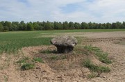
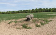
MacBeth's Stone, near Meigle

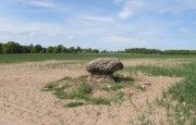
MacBeth’s Stone, near Meigle

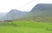
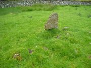
From the centre of Meigle village, you need to go along the country lane southwest towards the village of Ardler (do not go on the B954 road).  About three-quarter of a mile (1.25km) along—past the entrance to Belmont Castle—you’ll reach a small triangle of grass on your left, and a driveway into the trees.  Walk down here, past the first house—behind which is the stone in question.  A small path takes you through the trees and round to it.  You can’t really miss it!

Archaeology & History

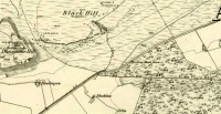
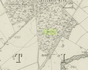
MacBeth Stone on 1st OS-map

MacBeth Stone on 1st OS-map

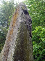
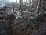
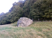
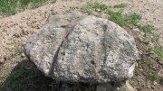
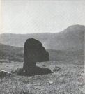
This is a magnificent site.  A giant of a stone.  Almost the effigy of a King, petrified, awaiting one day to awaken and get the people behind him!  It has that feel of awe and curiosity that some of us know very well at these less-visited, quieter megalithic places. Its title has been an interchange between the Scottish King MacBeth and the witches who played so much in his folklore, mixed into more realistic local traditions of other heathen medicine-women of olde…

The first account of this giant standing stone came from the travelling pen of Thomas Pennant (1776) who, in his meanderings to the various historical and legendary sites of Meigle district, wrote that

“In a field on the other side of the house is another monument to a hero of that day, to the memory of the brave young Seward, who fell, slain on the spot by MacBeth.  A stupendous stone marks the place; twelve feet high above ground, and eighteen feet and a half in girth in the thickest place.  The quantity below the surface of the Earth is only two feet eight inches; the weight. on accurate computation amounts to twenty tons; yet I have been assured that no stone of this species is to be found within twenty miles.”

It was visited by the Ordnance Survey lads in 1863, several years after one Thomas Wise (1855) had described the monolith in an article on the nearby hillfort of Dunsinane.  But little of any substance was said of the stone, and this is something that hasn’t changed for 150 years, despite the huge size of this erection!  Local historians make mention of it in their various travelogues, but the archaeologists haven’t really given the site the attention it deserves.  Even the Royal Commission (1994) report was scant; and apart from suggesting it to have a neolithic provenance, they merely wrote:

“Rectangular in cross-section, the stone tapers to a point some 3.6m above the ground; each of its sides is decorated with cupmarks, as many as forty occurring on the east face and twenty-four on the west.”
MacBeth Stone (Wise 1884)

MacBeth Stone (Wise 1884)

East face of MacBeth's Stone

East face of MacBeth’s Stone

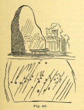
Thankfully, the fact that there are cup-markings on the stone has at least given it the attention it deserves amongst the petroglyph students.  The first account of the cup-markings seem to have come from the pen of Sir James Simpson (1867) who mentions them, albeit in passing, in his seminal work on the subject.  A few years later however, the same Thomas Wise visited MacBeth’s Stone again, and not only described the carvings, but gave us our first known illustration in his fascinating History of Paganism (1884).  He told it to be,

“A large boulder, some 12 tons in weight, situated within the policies of Belmont Castle, in Strathmore, Perthshire…is supposed to have been erected on the spot where MacBeth was slain.  Two feet above the ground this boulder has a belt of cups of different sizes, and in irregular groups.  None of these cups are surrounded by incised circles or gutters.  This boulder was probably intended for some sacred purpose, as it faces the SE.”

Running almost around the middle of the standing stone, on all four sides, are the great majority of the cup-markings (no rings or additional lines are visible).  They were very obviously etched into the stone after it had been erected, not before.  This is in stark contrast to the cup-and-rings found on the standing stones at Machrie, Kilmartin and elsewhere, where we know the carvings were done before the stones were stood upright.
Cup-narks on western face

Cup-narks on western face

Cups on the western face

Cups on the western face

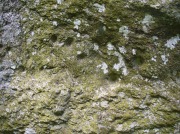
On the northern face of the stone is one possible cup-marking, and three of them are etched onto its south face; but the majority of them, forty, are on its western face, and twenty-five on its eastern side.  The great majority of them on the east and west sides occur roughly in the middle of the stone, almost like a ‘belt’ running across its body.  Those on the eastern face are difficult to discern as a thick layer of lichens covers this side, so there may be even more beneath the vegetation.

An increasingly notable element in the singular monoliths of this region, echoed again here, is that at least one side of the standing stone is smooth and flat—in the case of MacBeth’s Stone the flat face is the eastern one.  Whether this was a deliberate feature/ingredient in some of the standing stones, I do not know.  If there was such a deliberate reason, it would be good to know what it meant!

The 'face' in the top of the stone

The ‘face’ in the top of the stone

Close-up of Macbeth's face

Close-up of Macbeth’s face

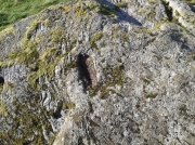
Another fascinating feature at this site was noticed by Nina Harris of ‘Organic Scotland’.  Meandering around the stone in and out of the trees, she called our attention to a fascinating simulacra when looking at the upper section of the monolith on its southern side.  At first it didn’t seem clear – but then, as usual, the more you looked, the more obvious it became.  A very distinct face, seemingly male, occurs naturally at the top of the stone and it continues as you walk around to its heavily cup-marked western side.  It’s quite unmistakable!  As such, it has to be posited: was this simulacra noticed by the people who erected this stone and seen as the spirit of the rock?  Did it even constitute the reason behind its association with some ancestral figure, whose spirit endured here and was petrified?  Such a query is neither unusual nor outlandish, as every culture on Earth relates to such spirit in stones where faces like this stand out.

But whatever your opinion on such matters, when you visit this site spend some time here, quietly.  Get into the feel of the place.  And above all, see what impression you get from the stony face above the body of the stone. Tis fascinating…..

Folklore

Known locally as being a gathering place of witches, the site is still frequented by old people at certain times of the year, at night.  The stone’s association with MacBeth comes, not from the King himself (whose death occurred many miles to the north), but one of his generals.  In James Guthrie’s (1875) huge work on the folklore of this region, he told that this giant

“erect block of whinstone, of nearly twenty tons in weight…(is) said to be monumental of one of his chief officers”,

which he thought perhaps gave the tale an “air of probability about it.”  But Guthrie didn’t know that this great upright was perhaps four thousand years older than the MacBeth tradition espoused!  However, as Nick Aitchison (1999) pointed out in his singular study of the historical MacBeth,

“another MacBeth was sheriff of Scone in the late twelfth century and it is possible that he, and not MacBeth, King of Scots, is commemorated in the name.”

He may be right.  Or it the name may simply have been grafted onto the stone replacing a more archaic relationship with some long forgotten heathen elder.  We might never know for sure.

When Geoff Holder (2006) wrote about the various MacBeth sites in this area, he remarked that the folklore of the local people was all down to the pen of one Sir John Sinclair, editor of the first Statistical Account of the area—but this is a gross and probably inaccurate generalization.  Nowhere in Holder’s work (or in any of his other tomes) does he outline the foundations of local people’s innate subjective animistic relationship to their landscape and its legends; preferring instead, as many uninformed social historians do, to depersonalise the human/landscape relationships, which were part and parcel of everyday life until the coming of the Industrial Revolution.  Fundamentally differing cultural, cosmological and psychological attributes spawned many of the old myths of our land, its megaliths and other prehistoric sites.  It aint rocket science!  Sadly, increasing numbers of folklore students are taking this “easy option” of denouncement, due to educational inabilities.  It’s about time researchers started taking such misdirected students to task!

References:

  1. Aitchison, Nick, MacBeth – Man and Myth, Sutton: Stroud 1999.
  2. Coutts, Herbert, Ancient Monuments of Tayside, Dundee Museum 1970.
  3. Guthrie, James C., The Vale of Strathmore – Its Scenes and Legends, William Paterson: Edinburgh 1875.
  4. Hazlitt, W.C., Faiths and Folklore: A Dictionary, Reeves & Turner: London 1905.
  5. Holder, Geoff, The Guide to Mysterious Perthshire, History Press 2006.
  6. MacNeill, F. Marian, The Silver Bough – volume 1, William MacLellan: Glasgow 1957.
  7. MacPherson, J.G., Strathmore: Past and Present, S. Cowan: Perth 1885.
  8. Michell, John, Simulacra, Thames & Hudson: London 1979.
  9. Pennant, Thomas, A Tour in Scotland and Voyage to the Hebrides – volume 2, London 1776.
  10. Royal Commission on the Ancient & Historical Monuments of Scotland, South-East Perth: An Archaeological Landscape, HMSO: Edinburgh 1994.
  11. Simpson, James, Archaic Sculpturings of Cups, Circles, etc., Upon Stones and Rocks in Scotland, England and other Countries, Edmonston & Douglas: Edinburgh 1867.
  12. Wise, Thomas A., “Notice of Recent Excavations in the Hill Fort of Dunsinane, Perthshire,” in Proceedings Society of Antiquaries, Scotland, volume 2, 1855.
  13. Wise, Thomas A., History of Paganism in Caledonia, Trubner: London 1884.

Acknowledgements:  With huge thanks to Paul Hornby for his help getting me to this impressive monolith; and to Nina Harris, for prompting some intriguing ideas.

© Paul BennettThe Northern Antiquarian


Long Man’s Grave, Abernyte, Perthshire

Tomb:  OS Grid Reference – NO 2218 3153

1867 OS-map of the site

1867 OS-map of the site

Also Known as:

  1. Canmore ID 30663
  2. Hoolmyre
  3. The Lang Man’s Grave
  4. MacBeth’s Grave

Archaeology & History

A little-known, but once important site in the mythic history of Scotland, this Long Man’s Grave was said to be the spot where MacBeth—described by Aitchison (1999) as “Scotland’s foremost King”—died.  It would seem that any remains of the stone which once stood here has gone.  When Robert Chambers (1827) told of the site, he said that

“At the bottom of Dunsinnan Hill, on the east side, and near the west end of a drystone wall which runs along the side of the road from Baledgarno, is a large stone about eight feet in length, beneath which MacBeth is said to have been interred.  It is usually called the Lang Man’s Graff, probably from a supposition that the stone was made to suit the length of the deceased.”

More than fifty years later when the Scottish historian Thomas Hunter (1883) wrote about the site, he thought that it had probably been a prehistoric one, telling that

“The tumulus, on being examined, proved to be a druidical stone that had toppled over, and no relic was discovered that could throw light on the tradition.”

Long Man's Grave on 1867 6-inch map

Long Man’s Grave on 1867 6-inch map

Site of the Long Mans Grave

Site of the Long Mans Grave

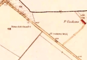
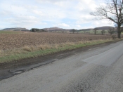
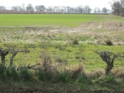
The site was shown on the earliest OS-maps of the region (as highlighted here), but we don’t know for certain about the exact nature of the site.  Although a bunch of lads from the Royal Commission popped along to see the place in 1969 and proclaimed (without excavation) that the stone was “probably a ‘grave slab’ and not a “standing stone” which has toppled over”, we have to treat their words with caution.  Close by are the remains of Bronze Age stone circles; above us we have the prehistoric hillfort of Dunsinane, with even older neolithic remains being found within it; and we also have neolithic rock art remains nearby; other prehistoric tombs, and plenty more besides…

Folklore

Echoing the early folklore of the site as narrated by local people, Hunter (1883) told that,

“the tradition of the district is that MacBeth, finding it impossible to escape from MacDuff, threw himself from the top of the (Dunsinane) Hill, was killed upon the rocks, and buried at the ‘Lang Man’s Grave’.”

References:

  1. Aitchison, Nick, MacBeth – Man and Myth, Sutton: Stroud 1999.
  2. Chambers, Robert, The Picture of Scotland – volume 2, William Tait: Edinburgh 1827.
  3. Hunter, Thomas, Woods, Forests and Estates of Perthshire, Henderson, Robertson & Hunter: Perth 1883.
  4. Melville, Lawrence, The Fair Land of Gowrie, W.Culross 1939.
  5. Pennant, Thomas, A Tour in Scotland and Voyage to the Hebrides – volume 2, London 1776.
  6. Royal Commission on Ancient & Historical Monuments, Scotland, South-East Perth: An Archaeological Landscape, HMSO: Edinburgh 1994.
  7. Sinclair, John, The Statistical Account of Scotland, 1797 – volume 11: South and East Perthshire, Kinross-shire, EP: Wakefield 1976.

© Paul BennettThe Northern Antiquarian


Witches Stone, St. Martin’s, Perthshire

‘Standing Stone’:  OS Grid Reference – NO 15927 31609

Also Known as:

  1. Canmore ID 28628

Getting Here

The Witches Stone of MacBeth

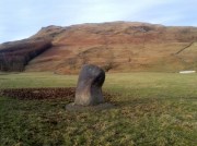
Going north-eastish from the city of Perth, take either the A93 or A94, turning west along the A93 a mile south of Guildtown, or east at Balbeggie on the A94, until you reach St. Martin’s hamlet and park up just below the church opposite the old cottages. Walk up the track below the cottages (not the one above them!) for ⅘-mile (1.35km) [past the ruined Cupar Stone Circle], and where the land has levelled out and in the huge flat field on your left, you’ll eventually reach a gate and see the odd-looking ‘rock’ about 250 yards away in the middle.

Archaeology & History

A fungal morel turned to stone

In a quiet and little-known parish that was once littered with about a dozen stone circles, there remains a most curious and fascinating stone which, in earlier days, was to be seen on the open moorlands at this spot.  The area was then forested and then the agriculturalists came with their farming and destroyed the forests, leaving the old stone as it presently stands, isolated, above the hamlet of St. Martin’s to the south.  Although it was described in the 19th century as being “four feet high”, it stands barely three feet tall, is very curiously-shaped—just like a morel mushroom from some angles—and in the middle of an extensive piece of flatland where the crops barely grow.

Witches Stone on 1866 map

Witches Stone, looking west

The stone was highlighted on the first OS-map of the parish in 1866, showing it in the woodland plantation of Eastmuir.  It may have been some sort of northern outlier related to the now-destroyed stone circle of Cupar 400 yards south; and if this was the case, its position in the landscape relative to the circle would give the Witches Stone an airt (virtue ascribed to cardinal directions) in the cycle of the year that relates to darkness and death. (Perhaps oddly—perhaps not—the name of parish St. Martin’s relates to that dark period in the calendar, as St. Martin’s day in the old calendar was Samhain or Halloween: old New Year’s Day, when the spirits of the dead moved across both land and skies.)

It was erroneously described by the Canmore lads as being little more than “a glacial erratic”, but the stone here is quite earthfast; and their idea that “its peculiar shape has probably been caused by wind erosion”, is also somewhat dubious considering the shape of other monoliths and megalithic rings in the region.  The stone has an appearance similar to some Bull Stones, where the animal was chained to rocks such as this and then baited by dogs, although I can find no such lore here. Indeed, the history and archaeology of the stone seems all but silent.  Its folklore however, would have the Shakespearian romanciers amongst you flocking to the place…

Deep grooves atop of the stone

The top of the stone has some very distinct and deep-cut lines running across it at angles, and has the appearance of being cut into at some time in the dim and distant past.  By whom, and for what reason, we cannot say.

Folklore

William Richie (1845) told us that in the 11th Century when Scotland was having to deal with the english disease of stealing land and spreading its violence, King MacBeth—whose castle stood within this parish at Cairnbeddie (NO 1498 3082)—took that advice of two witches, and that

“they met him one night at a place still called ‘the Witch Stane’ (where a remarkable stone still stands), about a mile from his old residence, and warned him to beware, ‘Till Birnam forest come to Dunsinane.’”

The 1860 Name Book told us that,

“The Moor where the witches met, which is in St. Martins Parish is yet pointed out by the country people, and there is a stone still preserved, which is called the Witches Stone.”

References:

  1. Scott, Aleander, St. Martin’s and Cambusmichael, Perth 1911.
  2. Richie, William, “St. Martins and Cambusmichael,” in New Statistical Account of Scotland – volume 10: Perthshire, William Blackwood: Edinburgh 1845.

Acknowledgements:  Huge thanks to Prof Paul Hornby for showing me this site. Cheers matey!

© Paul BennettThe Northern Antiquarian


The Bhacain, Cashlie, Glen Lyon, Perthshire

Standing Stone:  OS Grid Reference – NN 48367 41706

Also Known as:

  1. The Bhacan
  2. Canmore ID 23977
  3. Cona Bhacain
  4. Testing Stone of the Fianna

Getting Here

The Bhacain on the 1867 map

The Bhacain on the 1867 map

Whether you take the road west from Fortingall, or over the heights from Loch Tay, when you reach Meggernie Castle just keep going west for a few more miles.  Keep going past the large Stronuich reservoir on your left and you’re getting close.  Go past Caisteal Mhic Neill and the trees at Cashlie House for another 5-600 yards and where the track crosses the river Lyon, park up just past it.  Ahead of you in the field on the left of the road, nearer the riverside, is where you need to look.

Archaeology & History

The mound & its small stone

The mound & its small stone

One of the most peculiar and unique sites in the British Isles is this remote small upright stone, known locally as The Bhacain.  Standing upon a small mound in the field immediately east of one of Finn’s legendary ‘forts’ (a dun or a broch) called Caisteal Cona Bhacain, this curious monolith, less than two feet tall, has a thin upright stem with a much enlarged rounded end to it.  Some might even ascribe it as phallic—although local traditions of the stone relate it as a truth-sayer of a young girl’s virginity!

Its position on top of the small mound is intriguing, giving it the impression of being atop of a tumulus; and there is also the scatter of small stones surrounding the upright just beneath the surface (as evidenced in one of the photos), making it possible that the stone is an ancient burial marker.  If this is ever shown to be true, the likelihood is that the stone marks the grave of a hound, as the tradition of this spot implies.  No excavation has ever occurred here, so the precise nature of the stone (and the mound) has yet to be ascertained; but knowing the longevity of some oral traditions in these Highland glens, the idea of it being the burial-place of a dog is anything but far-fetched.

Duncan Fraser's old photo

Duncan Fraser’s old photo

The Bhacain & its stony pile

The Bhacain & its stony pile

If the stone is contemporaneous with the associated ‘duns’ close by, this would be a late standing stone, probably erected in the Iron Age.  We can certainly see, quite plainly from the erosion on the stone, that this is not neolithic or Bronze Age in origin.  A decent examination of the important sites hereby is long overdue…

Folklore

The Bhacain, looking south

The Bhacain, looking south

The folklore and traditions attached to this site are numerous when you consider how small it is.  Much of this relates to the fact that animistic cosmologies in the Highlands were retained until very recently, stretching way back.  Accounts from the 19th and 20th centuries tell of people still frequenting this and other sites, at sunrise, or full moons, as such things were still very much integral parts of rural life.  When the local historian Duncan Fraser (1973) wrote about The Bhacain in his fine work on this area, he told much about the traditions of the great warrior King Fionn and his activities hereby:

“Another traditional link with the warrior King is the Bhacain, on a mound beside the road, far up the glen.  Only a stone’s throw from one of the forts, it is about two feet high and shaped like the head of a dog.  This is said to have been the stake to which the Fians tethered their staghounds with leather thongs, when they returned from the chase.  And there were times, no doubt, when Fionn’s own dog, Bran was among them, with its yellow paws and its black flanks and its chain of pure gold.  It was the best hunting dog that ever lived.  And there was its brother, the dreaded Grey Hound, that used to roam on its own in the Great Glen, tearing its victims limb from limb, until it too abandoned its wildness and became one of the hounds of the Fians.  They say that the dogs’ food was thrown to them from the top of Caisteal Coin-a-bhacain, the castle of the dog’s stake, upwards of seventy yards to the west.  And any dog that failed to catch its supper was turned out of the pack.

“Time did not allow the Bhacain to become inanimate like other stones.  Even in comparatively recent times it was still regarded with superstitious awe.  A retired schoolmaster of Fortingall recorded eighty years ago that it was said to have a mysterious effect on those who crept under its head.  And old folk in the glen will tell you that those who did so were girls.  It had become the glen folk’s yardstick of virginity.  In the late eighteenth century, when the girls returned from gathering the harvest in the ungodly Lowlands, under the stone they went.  It was better than all your modern pills.”

In Hilary Wheater’s (1981) fine work on the history of the region, he told that “no youth was permitted into the fighting body of the Clan until he could lift the Bodach Stone onto the boulder beside it.”  This tradition gave the Bhacain another name, the Testing Stone of the Fianna.

References:

  1. Burke, Peter, Popular Culture in Early Modern Europe, Scolar Press: Aldershot 1994.
  2. Fraser, Duncan, Highland Perthshire, Standard Press: Montrose 1973.
  3. McKerracher, Archie, Perthshire in History and Legend, John Donald: Edinburgh 1988.
  4. Stewart, Alexander, A Highland Parish; or, The History of Fortingall, Alex MacLaren: Glasgow 1928.
  5. Wheater, Hilary, Aberfeldy to Glenlyon, Appin Publications: Aberfeldy 1981.

© Paul BennettThe Northern Antiquarian


Giant’s Stone, Tweedsmuir, Peeblesshire

Standing Stones:  OS Grid Reference – NT 0953 2398

Also Known as:

  1. Canmore ID 48527
  2. Menzion Farm

Getting Here

The small Giant's Stone

The small Giant’s Stone

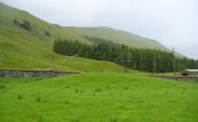
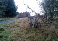
Take the long long A701 road betwixt Moffat and Penicuik, and in the middle, somewhere, keeps your eyes attentive to the Tweedsmuir hamlet, across the small bridge almost lost in the expanse of old hills.  Once over the bridge, park up by the edge of the forest.  Walk along the small road that follows the riverside – and after a few hundred yards you’ll see, either side of the small road, three stones. Our “giant” is the tallest of the smallests here, right by forestside.

Archaeology & History

Giant's Stone & Grave on 1865 OS-map

Giant’s Stone & Grave on 1865 OS-map

Hiding away in the Back-of-Beyond, amidst a small cluster of other small megalithic remains, sleeps this quiet standing stone and its companions – three of them altogether, almost lost to anyone but old locals, whose tongues have sadly all but died.  Very little has been written about the place in any archaeology tomes and the earliest mention of the site seems to have been in the Second Statistical Account of 1845, when the surveyors told:

“Close by the road leading from the church to Menzion House, there are the remains of a Druidical temple or Pictish court of justice. Only one stone is left of a number similar in appearance and size which stood together, and which have been removed for the purpose of dike-building, &c. It is called the Standing Stone, and is five feet above the surface of the earth.”

Stone 2, across the road

Stone 2, across the road

More than a century later, the Royal Commission (1967) lads got round to checking the place out, but there seems to be some slight confusion as to what they recorded and the situation as it stands today.  The present Royal Commission lads reports the existence of what they call the Menzion Stones: quite separate standing stones—although ‘fallen’—just a short distance from the Giant’s Stone (Canmore ID 48561), citing them as described in the Peeblesshire (1967) survey which, oddly, neither includes nor names the Giant’s Stone which is only yards away.  It seems safe to assume that the respective Royal Commission inspectors have made erroneous judgements here, brought about due to the repositioning of the original Giant’s Stone when the Forestry Commission afflicted the place and, it seems, damaged the site.  It’s difficult to say with any certainty—but there are definitely some official errors in the description of this site.  Anyway, if we assume that the ‘Menzion’ standing stones in the Peeblesshire Inventory were actually the Giant’s Stone and its companions, this is how they reported it following a visit here in 1956:

“A quarter of a mile NE of Menzion farmhouse, the road to Tweedsmuir passes between two standing stones. The more northerly stone, situated 10 yds W of the roadway measures about 2 ft. 3 in square at ground level and stands to a height of 2 ft 6 in. The other stone is 25 yds SE of the first and 12 yds E of the roadway. It, too, is almost square on plan, measuring about 2 ft 2 in along each side at ground level, and stands to a height of 2 ft.”

Even more peculiar is that today we have three standing stones at this spot!  Like those at Perthshire’s Tigh nam Bodach, perhaps the metamorphosized spirit of the site is reproducing!

Folklore

In the very same Second Statistical Account (1845) was recounted the folklore of the largest stone, which had obviously been told them by local folk.  Twas said that,

“From behind it, a person of diminutive stature, known by the name of Little John, discharged an arrow at the head of a freebooter of formidable dimension who greatly annoyed the peaceful inhabitants, and who, though on the opposite side of the Tweed, was unable to elude the deadly stroke.”

Folklorists Janet & Colin Bord narrated a variation on the above story, telling that,

“This stone and the two nearby mark the place where Jack the Giant Killer despatched his last victim. Jack hid behind the Giant’s Stone to shoot, but unfortunately the mortally wounded giant managed to get a punch in and Jack was himself killed. The stone now acts as his gravestone.”

All three stones together

All three stones together

Invariably, references to “giants” in folklore—be it in mountains or standing stones—indicates early Creation Myth stories that tell about the origin of the given site.  In the case of this standing stone and its companions, and the related Giant’s Grave tomb 320 yards WNW across the River Tweed, it would seem to indicate a folk memory of the hero-figure or giant who was buried here thousands of years ago, and whose spirit inhabits the stone.  This motif is widespread and very archaic.

References:

  1. Bord, Janet & Colin, Atlas of Magical Britain, Sidgwick & Jackson: London 1990.
  2. Eliade, Mircea, A History of Religious Ideas – volume 1, University of Chicago Press 1978.
  3. Johnson, Walter, Folk Memory, Oxford University Press 1908.
  4. Maclagan, David, Creation Myths, Thames & Hudson: London 1977.
  5. Roberts, Anthony, Sowers of Thunder, Rider: London 1978.
  6. Royal Commission on the Ancient & Historical Monuments, Scotland, Peeblesshire – volume 1, Aberdeen University Press 1967.

© Paul BennettThe Northern Antiquarian


Giant’s Grave, Tweedsmuir, Peeblesshire

Tumulus (destroyed):  OS Grid Reference – NT 0925 2410

Also Known as:

  1. Canmore ID 48535

Archaeology & History

Giant's Grave & Stone on 1865 OS-map

Giant’s Grave & Stone on 1865 OS-map

Marked on the 1865 OS-map as a “tumulus”, it was destroyed by some idiot in 1818 due to some basic lacking; but we can see from the old map how close it was to the Giant’s Stone on the south-side of the River Tweed, to which it may have had an archaeological connection with.  When it was destroyed, the New Statistical Account in 1845 described there being a six-foot long stone coffin (cist) beneath the tumulus, containing the usual burial urn.

Folklore

When the 18th century writer Alexander Pennecuik (1715) wrote about this old tomb, he narrated the tradition of the site as told him by the local people, telling:

“….upon the head of a burn on the south side of Tweed, stands the old-house of Hawkshaw, belonging (to) Porteous, from a numerous race of Ancestor’s Chiefs of that surname.  Over against the foot of Hawkshaw-Burn in a Kairn beside the High road is the Giants Grave, so called from a huge and mighty Fellow, that robbed all on the way, but was at length from a Mount in the over side of the River supprised and shor to Death as Tradition goes.”

References:

  1. Pennecuik, Alexander, A Geographical, Historical Description of the Shire at Tweeddale, John Moncur: Edinburgh 1715.
  2. Royal Commission on the Ancient & Historical Monuments, Scotland, Peeblesshire – volume 1, Aberdeen University Press 1967.

© Paul BennettThe Northern Antiquarian


St. Anne’s Well, Strathaven, Lanarkshire

Holy Well:  OS Grid Reference – NS 7039 4438

Archaeology & History

St Anne's Well on 1865 map

St Anne’s Well on 1865 map

Long since lost it would seem, in a search for this legendary site over the weekend with Gordon, Aisha and Lara, I’m still not certain of the actual status of the site.  Although we found a very fresh water supply still running not far from where the old OS-map showed the original holy well to be, it may be a completely different water source.

There are hardly any references to the spring and those that exist are scant.  In the early 1860s, St. Ane’s Well was mentioned briefly in the Object Name Book of the area:

“This is a good spring well in the southern part of the town of Strathaven.  It is commonly called Tun’s (Tan’s?) Well, but this is an abbreviation of the name.”

Lara plays at a nearby well

Lara plays at a nearby well

Looking down on the waters

Looking down on the waters

More recently, thanks to a communication from the local historian Robert Currie, more information has come to light about the well.  It was described in the local history work by Mary Gebbie (1880).  Mr Currie told me:

“In her Sketches of Avondale and Strathaven…we read: “In a lane off Tod’s Hill was the famous Tann’s Well – obviously a corruption of the celebrated water saint, St. Anne. This spring has within a few years completely dried up. Access was easily had from the castle to it, over the draw-bridge, which is said to have rested on the ledge of the ground and rock on which the fifth house is built south of the bridge. Before this aperture was built up, the inhabitants around took advantage of the pathway for drawing water from the Pomillion, at a place called the Fairy Pool. A little above this comes the Dove Castle; and a half a mile further out is the Gallow Hill.”

He continued:

“That said, the current siting of St. Anne’s Well is located on Lesmahagow Road with (the) site being almost opposite the Council houses bordering on Station Road (there is currently a mini-roundabout near the locus). In recent years the site has become obscured but in my own living memory there was once a plaque authenticating the site and with a garden seat thereby.”

In searching through their own library, Mr Currie and his wife came across more about the site in William Downie’s (1979) book on Strathaven, in which he wrote:

“A small lane off Todshill went down to a cluster of houses called St. Anne’s Well nestling on the sloping ground beside the mill dam. In 1911 these houses were acquired and demolished by the Town Improvement Committee. A row of houses backing backing on to Powmillon Burn were also demolished at the same time and a retaining wall with railings erected, so opening up a very fine view of the castle and burn etc.”

The dedication here to the mythic figure of St. Anne (mother of the Virgin Mary and grandmother of Jesus) is isolated and mysterious.  No church is dedicated to her in the area, nor other relative christian remains.  Her appearance in Strathaven is something of an oddity.  There was a Duchess ‘Ann’ Hamilton of Strathaven Castle who lived 200 yards away at Strathaven Castle on the other side of the river that might have given her name to the well, but this is very unlikely.  More probable is that St. Anne was used as the mythic figure who covered an earlier dedication to the prima mater, or Cailleach—although there are no remains that relate to Her either.  However, the existence of St Mary’s church and an associated well to the north, along with a burn dedicated to a “maiden” in the same parish to the northwest add to the cailleach’s potential…..but all tales of Her have seemingly been forgotten.

…So it seems that the spring of water that Lara, Aisha, Gordon and I came across was obviously not the same place, but exists just below the roadside where the disused railway line is.  It’s close to St Anne’s Well – but is not the same water source.

References:

  1. Downie, Fleming, A History of Avondale and Strathaven, Eric Moore: Glasgow 1979.
  2. Gebbie, Mary, Sketches of the Town of Strathavon and Parish of Avondale: Historical & Traditional, John Menzies: Edinburgh 1880.

Links:

  1. Strathaven Past & Present

Acknowledgements:  Considerable thanks must be given to Robert Currie, BA Hons, who sent us additional information enabling a more informative and accurate site profile for this holy well.  Thanks Bob! Also huge thanks again to Aisha Domleo, Lara Domleo, Unabel Gordon and their frobbling Leonidus!

© Paul BennettThe Northern Antiquarian


Carra Bhroin, Lochboisdale, South Uist

Standing Stone:  OS Grid Reference – NF 8117 2248

Also Known as:

  1. Canmore ID 10138
  2. Carragh broin

Archaeology & History

The nature of this site seems a little disputed.  Shown on modern OS-maps and cited as being visited and seen in April 1967, the Canmore website also describes it in the present tense — but when I.A. Crawford (1965) wrote of this site he told that, “this standing stone…has been destroyed in fencing operations” — i.e., building a fence or wall, not some doods having a fencing fight!

Equally curious would be the stature of the site; as in the Royal Commission report (1928), the stone was told to be only 2-feet tall — which would mean that if this site is included as an authentic archaeological site, then we’re gonna have to double or treble the number of standing stone sites nationally!  There are masses of ‘monoliths’ two-feet tall and above which are in the ‘natural’ category.  But this stone, for whatever reason (the folklore probably), has been granted the providence as an authentic standing stone.

Folklore

Tradition told that this old stone was “alleged to mark a battle site” in ancient days.  The variation on this theme tells that the stone marked the grave of a man who was slewn in battle here.  Seems likely that there will be prehistoric tombs nearby…

References:

  1. Crawford, I.A., ‘Carra Bhroin, S.Uist,’ in Discovery & Excavation in Scotland, 1965, SRG & CBA 1965.
  2. Royal Commission on the Ancient & Historical Monuments & Constructions of Scotland, Inventory of Monuments and Constructions in the Outer Hebrides, Skye and the Small Isles, HMSO: Edinburgh 1928.

© Paul BennettThe Northern Antiquarian


Weeping Stone, Fladaigh Chuain, Skye

Legendary Rock: OS Grid Reference – NG 3638 8091

Getting Here

Unless you’ve got your own boat, forget it!  This one’s miles out on the isolated uninhabited island of Fladda-chuain about 5 miles off the northwest tip from Duntulm, Trotternish.  I wouldn’t mind a coupla weeks alone on the isle though – if anyone can get me there!

Archaeology & History

This little rocky island was allegedly another one of the many visiting places that St. Columba frequented in his copious ventures, trying to sell his new religion to local people wherever he went.  Here he came to the legendary clach known as the Weeping Stone: a place of reverence to the druids and indigenous people.  But St Columba came here to christianize the rituals that were had at the site; and, eventually, he was allowed to build a  small stone chapel close by.

Folklore

In Otta Swire’s (1961) excellent work on the folklore and history of the Isle of Skye, she wrote:

“In Duntulm Bay lies Tulm Island and beyond it, in clear weather, Fladdachuan, Fladda of the Ocean, can be seen. In olden times this was a sacred spot, held by many to be Tir-nan-Og, the Isle of Perpetual Youth, which lay in the west; here it is always summer and the sun never sets. The puffins recognized its sacred nature and never began any venture until they had circled the island three times sunwise; this they did also on arriving in Skye and before leaving it. It was held by some to be the reason why in Skye people used to turn three times sunwise before starting a new enterprise. The Druids held it in veneration and St. Columba caused a chapel to be built there. On its altar lay a black stone which some say was the original altar stone of the Druids and which was known as the Weeping Stone because it was always wet. Until fairly recently fishermen used to land on the island and pour three handfuls of seawater on the stone to procure favourable winds or to stop bad floods. The Weeping Stone no longer exists, or at least is no longer to be found where the altar once stood.”

I can’t find anything more about this place.  Does anyone know owt more about it?

References:

  1. Swire, Otta F., Skye: The Island and its Legends, Blackie & Son: Glasgow 1961.

© Paul BennettThe Northern Antiquarian


Temple of Anaitis, Lusta, Waternish, Skye

‘Stone Circle’: OS Grid Reference – NG 2725 5273

Also Known as:

  1. Annait
  2. Temple of Annait

Getting Here

1880 map of Anaitis

1880 map of Anaitis

Otta Swire (1961) told how to find this place, thus: “The Waternish road turns off to the north at Fairy Bridge, whence it runs along the valley of the Bay river. On the left of the road, though at some little distance from it, where the river cleaves its way through a gorge to the sea, stands the mound which is now all that remains of the ‘Temple of Anaitis’ (so called).”

Archaeology & History

This is a curious place, full of archaeological potential if the folklore and history records are owt to go by, yet little of any substance remains to substantiate what may have been an important stone circle or other heathen site in earlier times. It seems to have been described first of all in the famous Hebridean journeys of Boswell and Johnson in the late 18th century.  Amidst his insulting description of both the landscape and local people, on Friday 17th September 1773, James Boswell visited the site and told:

“The weather this day was rather better than any that we had since we came to Dunvegan. Mr M’Queen had often mentioned a curious piece of antiquity near this which he called a temple of the goddess Anaitis.  Having often talked of going to see it, he and I set out after breakfast, attended by his servant, a fellow quite like a savage.  I must observe here, that in Skye there seems to be much idleness; for men and boys follow you, as colts follow passengers upon a road. The usual figure of a Sky boy, is a lown with bare legs and feet, a dirty kilt, ragged coat and waistcoat, a bare head, and a stick in his hand, which, I suppose, is partly to help the lazy rogue to walk, partly to serve as a kind of a defensive weapon. We walked what is called two miles, but is probably four, from the castle, till we came to the sacred place. The country around is a black dreary moor on all sides, except to the sea-coast, towards which there is a view through a valley, and the farm of Bay shews some good land. The place itself is green ground, being well drained, by means of a deep glen on each side, in both of which there runs a rivulet with a good quantity of water, forming several cascades, which make a considerable appearance and sound.  The first thing we came to was an earthen mound, or dyke, extending from the one precipice to the other.  A little farther on, was a strong stone-wall, not high, but very thick, extending in the same manner.  On the outside of it were the ruins of two houses, one on each side of the entry or gate to it. The wall is built all along of uncemented stones, but of so large a size as to make a very firm and durable rampart. It has been built all about the consecrated ground, except where the precipice is deep enough to form an enclosure of itself. The sacred spot contains more than two acres. There are within it the ruins of many houses, none of them large, a cairn, and many graves marked by clusters of stones. Mr M’Queen insisted that the ruin of a small building, standing east and west, was actually the temple of the goddess Anaitis, where her statue was kept, and from whence processions were made to wash it in one of the brooks. There is, it must be owned, a hollow road visible for a good way from the entrance; but Mr M’Queen, with the keen eye of an antiquary, traced it much farther than I could perceive it. There is not above a foot and a half in height of the walls now remaining; and the whole extent of the building was never, I imagine, greater than an ordinary Highland house. Mr M’Queen has collected a great deal of learning on the subject of the temple of Anaitis; and I had endeavoured, in my journal, to state such particulars as might give some idea of it, and of the surrounding scenery” —
But in all honesty it seems Mr Johnson was either too lazy to write about the place, or simply didn’t actually get there, in spite of what he alleged!  But later that evening, Boswell dined with the same Mr MacQueen, who told him more of this site.  In the typically pedantic tone of english supremacy (which still prevails in some idiots who visit these lands), he continued by saying:

“Mr Macqueen had laid stress on the name given to the place by the country people, Ainnit; and added, ” I knew not what to make of this piece of antiquity, till I met with the Anaitidis delubrum in Lydia, mentioned by Pausanias and the elder Pliny.”  Dr. Johnson, with his usual acuteness, examined Mr Macqueen as to the meaning of the word Ainnit, in Erse, and it proved to be a water-place, or a place near water, “which,” said Mr. Macqueen, “agrees with all the descriptions of the temples of that goddess, which were situated near rivers, that there might be water to wash the statue.”

There ensued a discussion between Mr MacQueen and Samuel Johnson about the etymology of ‘Anaitis’, with one thinking it was of a goddess, and another that it represented an early christian site.  To this day it is difficult to say what the word means with any certainty.  In W.J. Watson’s (1993) fine work he tells us,

Andoit, now annaid, has been already explained as a patron saint’s church, or a church that contains the relics of the founder.  This is the meaning in Ireland and it is all we have to go upon.  How far it is held with regard to Scotland is hard to say… They are often in places  that are now, and must always have been, rather remote and out of the way.  It is very rarely indeed that an Annat can be associated with any particular saint, nor have I met any traditions connected with them.  But wherever there is an Annat there are traces of an ancient chapel or cemetery, or both; very often, too, the Annat adjoins a fine well or stream…”
The great Skye historian and folklorist Otta Swire (1961) also wrote about this mysterious site, mainly echoing what’s said above, but also adding:

“This name of Annait or Annat is found all over Scotland. It has been interpreted as meaning the ‘Water-place’ from Celtic ‘An’ = water, because many are near water. Others suggest ‘Ann’ = a circle (Celtic) and claim that most Annats are near standing stones. The most-favoured derivation seems to be from Ann, the Irish mother of the Gods, and those who hold this view claim that the Annats are always near a revered spot, where either a mother-church or the cell of a patron saint once stood. Probably Annat does, in fact, come from an older, pre-Celtic tongue, and belongs to an older people whose ancient worship it may well commemorate. The curious shape of the Waternish Temple of Anaitis and its survival make it seem likely that it was something of importance in its day, built with more than usual care and skill. Perhaps the Temple tradition is correct – but whose, if so, and to what gods? One cannot help wondering if cats played any part in its ritual, and if so, if any faint memory remains, for the nickname of the people of this wing was ‘Na Caits’ = The Cats, and not far off, by one of the tributary burns on the right of the roadway, there stands a small cairn, crowned by a long, sharp stone somewhat resembling a huge claw. This is the ‘Cats’ Cairn’.”
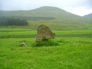
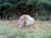
The Cats’ Cairn (NG271526) is said to mark the grave of a young boy from the 18th century, who was buried where he died and its story is told elsewhere on TNA.  Another example of the Annait place-name can be found elsewhere on Skye at the megalithic site, Clach na h’annait.

References:

  1. Boswell, James, The Journal of a Tour to the Hebrides with Samuel Johnson, National Illustrated Library: London 1899.
  2. Swire, Otta F., Skye: The Island and its Legends, Blackie: Glasgow 1961.
  3. Watson, W.J., The History of the Celtic Place-Names of Scotland, Birlinn: Edinburgh 1993.

© Paul BennettThe Northern Antiquarian