Woman’s Stone, Kirkmichael, Banffshire

Legendary Rock (lost):  OS Grid Reference –NJ 010 030

Also Known as:

  1. Cairn Gorm
  2. Canmore ID 15670

Archaeology & History

The exact location of this site seems privy to a select few and has remained that way since its existence appeared in print in the 19th century.  It was first mentioned by Arthur Mitchell (1874) following a holiday that he’d had in the area in the early 1870s.  He’d visited a petroglyph at Laggan with a Mr David Ross and when he returned home received a letter from him that told how,

“he had heard from Mr M’Bain of Auchterblair of two huge granite boulders, situated on a shelving rock over an abyss on the Loch Avon side of Cairngorm, with hand-made cups on them about a foot wide and correspondingly deep.”

They were subsequently visited by Thomas Wise (1884) a few years later, who told how these huge granite boulders were,

“20 feet in height,” upon which “there are four basins, 1 foot, or 1 foot and a-half long, and 6 inches wide at the top, rounding off to 1 inch in the bottom.”

Initially Mr Mitchell (1874) was cautious in associating these carved basins with cup-marked stones—and indeed, we concur with this—but seemed to have changed his opinion when he wrote about them a few years later (Mitchell 1881).  But it’s the folklore attached to this site that intrigued him – and myself…

Folklore

The traditions attached to this site will be recognised by all students of animism and folklore.  Arthur Mitchell (1874) was informed how the carved bowls in the stone helped infertile women and how “sitting on (them) is said to be efficacious in cases of barrenness.” Their importance was highlighted in the fact that there had been “pilgrimages to them undertaken within the memory of people still living.”

This was affirmed by Thomas Wise (1884) who told that,

“They are supposed to be efficacious in barrenness, and people still living remember pilgrims coming to sit upon them for some time, that they might obtain what they wished.  A visit to them was by no means an easy task, as the ascent was difficult, and to sit on them required a steady head, as they are on the brink of a rock overhanging a precipice.  These basins are the “woman’s stone” mentioned by Tennant.  They are supposed to be the resting place or throne of a certain fairy queen; but however efficacious they may have been, they have lost much of their celebrity; and as the shepherd, who acted as guide to the pilgrims, is dead, and has left no successor, they are now rarely visited.”

Does anyone know the whereabouts of this heathen magickal site?  If you happen to find it, see if you can get a good photo or two and let us know on our Facebook group.

References:

  1. Mitchell, Arthur, “Vacation Notes in Cromar, Burghead and Strathspey,” in Proceedings of the Society of Antiquaries Scotland, volume 10, 1874.
  2. Mitchell, Arthur, The Past in the Present, Harper: New York 1881.
  3. Wise, Thomas, A., History of Paganism in Caledonia, Trubner: London 1884.

© Paul BennettThe Northern Antiquarian

Cotterton, Moulin, Perthshire

Standing Stone:  OS Grid-Reference – NO 03818 63692

Also Known as:

  1. Straloch

Getting Here

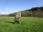
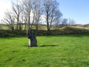
Cotterton standing stone

Along the A924 road, just over 4 miles (6.6km) NW from Kirkmichael, or about 8 miles (13km) NE from Pitlochry, you’ll hit the large farmhouse of Straloch.  You’ve really gotta keep your eyes peeled!  A few hundred yards west of Straloch itself, a small parking spot is on the south-side of the road, above the river.  From this parking spot, walk a few yards to the fence that overlooks the river and look into the field below you, where you’ll see the stone.  If y’ walk down the slope, you’ll see a gate on the right that leads you into the field.

Archaeology & History

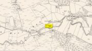
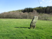
First shown on the 1900 OS-map of the area, this petrified hunchbacked witch-of-a-stone stands on the flat grassland plain (previously scattered woodland when first raised) forty yards from the River Brerachan: a proximity characteristic found at many of the stones along Strathardle.

Cotterton stone 1900 map
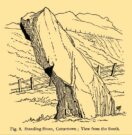
Fred Coles’ sketch

Descriptions of the site prior to 1900 seem non-existent (does anyone know otherwise?).  It was the brilliant antiquarian Fred Coles (1908) who, it seems, was the first to mention the old stone — whose very crooked appearance had an unusual effect on him, saying how “such a decided leaning over towards the north…almost make one uneasy when standing beside it”!  It didn’t have that effect on me, but I was mightily impressed by both its appearance and curious hunched gait.  Twas one of those monoliths that had a distinct ‘feel’ about it, which many people report at such places up and down the country.  Whether it was its position by the river, or the color of the landscape, or the silence, or the shape of the stone, or combinations of them all—which ever it was, there was almost a sense of genius loci residing here…

But in that other world of pragmatic measurements, as Mr Coles told us:

“The Stone is at the base an oblong in shape, measuring 14 inches on its east end, 2 feet 7 inches along its south side, 17 inches at the west, and 3 feet 6 inches on its north side—a girth, therefore, of 8 feet 8 inches.  At the middle its dimensions are the same, but the top is rather less.   At its N.E. apex the Stone is 7 feet 8 inches clear of the ground, and at the west edge 7 feet.  In the illustration…I have shown the monolith from the south, with the craggy profile of Menachban in the background.”

The stone was mentioned in passing in Hugh Mitchell’s (1923) local survey.  A few years later in John Dixon’s (1925) account he repeated the dimensions of the stone that Coles had cited; and although he found there to be no known traditions of the place, he conjectured how it may have been connected with the numerous battles “that in former days occurred along this entrance to the Highlands.”

It’s a damn good site is this.  All you megalith hunters will love it!

References:

  1. Anonymous, Notes on Strathardle, Strathardle 1880.
  2. Coles, Fred, “Report on Stone Circles Surveyed in Perthshire – Northeastern Section,” in Proceedings of the Society of Antiquaries of Scotland, volume 42, 1908.
  3. Dixon, John H., Pitlochry, Past and Present, L. Mackay: Pitlochry 1925.
  4. Mitchell, Hugh, Pitlochry District: Its Topography, Archaeology and History, L. Mackay: Pitlochry 1923.

© Paul BennettThe Northern Antiquarian

Spittal of Glenshee, Kirkmichael, Perthshire

Standing Stone:  OS Grid Reference – NO 10865 70201

Also Known as:

  1. Canmore ID 29609

Getting Here

Spittal of Glenshee stone

Take to A93 road, north, between Blairgowrie and Braemar, keeping your eyes peeled many miles on, to turn left along the minor road as you approach the tiny Spittal of Glenshee hamlet. Just as you go over the ancient bridge, park up on your left, below the church.  Walk round the back of the church and you’ll see a large tree-covered mound.  Walk onto its top.

Archaeology & History

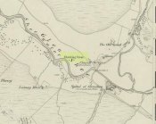
Stone marked on 1862 map

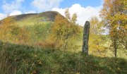
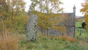
This quiet, almost hidden, six-foot tall standing stone on what initially seems to be a large fairy mound or tumulus at the back of the rude church, has been occluded from general view (in my opinion, deliberately) by the construction of the more debased christian edifice right in front of it.  But it detracts not from its gentle majesty once you reach its ancient body, atop of the old hill.

The stone is one in a cluster of prehistoric sites in and around this Glen of the Fairy Folk (as its name tells), where the rivers Shee and Beag converge.  If the church didn’t obstruct the view, some of the other sites would have been visible from here.

Folklore

The old stone, looking east

Folklore tells that when the christians came into the Glen to build a church—initially a half-mile or so to the east—the little people were much annoyed at the actions of the incomers, as it intruded on one of their sacred rings of stone close by.  By night they came out, and every stone that had been laid by the christians in the day was removed.  Each day the insensitive christians came and built their church without asking, and each night the little people removed it.  Eventually an agreement was made, and the fairies let them build the church next to this standing stone.  So goes the tale….

A veritable cluster of stories about Fingal, Ossian, Dermid and Grianne scatter this area, with many of them relating to ancient sites, but I’ve not found one directly relating to this stone.

References:

  1. Miller, T.D., Tales of a Highland Parish, Munro Press: Perth 1929.

© Paul BennettThe Northern Antiquarian


Tom-a-Clachan, Kirkmichael, Perthshire

Stone Circle (destroyed):  OS Grid Reference – NO 0808 5985

Archaeology & History

Kirkmichael parish was an area that was described by George Chalmers (1887) as possessing “a vast body of Druid remains,” there being “a number of Druid cairns in the vicinity of Druidical circles.”  As we know, the term ‘druid’ has long fallen out of favour; and with it in this area, the sites themselves have taken a similar fate.

Found just south of the village, on raised ground 100 yards west of the river, this stone circle is not listed in any of the archaeological catalogues, but its existence was thankfully recorded in one of the essays by regional historian Charles Fergusson.  He told us that,

“one of these Druidical circles stood at Tom-a-Chlachan — the Hillock of Stones — where the Manse of Kirkmichael now stands, and there two thousand years ago our rude ancestors worshipped, according to their faith, in their circle of stones; and there, as elsewhere, when the pioneers of Christianity came to the district, they found it expedient to place their new church where the old circle of stones had stood, so the first church of St Michael was reared where the old clachan stood, on what the natives already considered holy ground.”

In the same tradition (but this time, without the destruction), on the other side of the River Ardle from here, what was once known as a heathen well later became known as the Priest’s Well.

References:

  1. Chalmers, George, Caledonia – volume 1, Alexander Gardner: Glasgow 1887.
  2. Fergusson, Charles, “Sketches of the Early History, Legends and Traditions of Strathardle and its Glens – part 5,” in Transactions of Gaelic Society Inverness, volume 21, 1899.

© Paul BennettThe Northern Antiquarian


Balnabroich, Kirkmichael, Perthshire

Standing Stone:  OS Grid Reference – NO 09175 56752

Also Known as:

  1. Canmore ID 27267

Getting Here

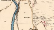
1867 OS-map showing the stone

1867 OS-map showing the stone

Take the A924 road north of Blairgowrie, between Pitlochry and Bridge of Cally and, about 4.6 miles (7.5km) along, roughly halfway between Ballintuim and Kirkmichael, in the field by the roadside immediately west, you’ll see this conspicuous upright stone standing all alone – unless the cattle are meandering slowly around it!

Archaeology & History

This single monolith that stands today as a cattle rubbing post, may at one time in its distant past have been related to the present pair of standing stones hiding in the small remain of trees 148 yards (135.5m) to the south; although neither Aubrey Burl (1993) nor Alexander Thom (1990) ascribe the stone such an association in their relative tomes on aligned stone rows.

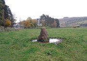
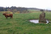
Balnabroich stone, looking south

Balnabroich stone, looking south

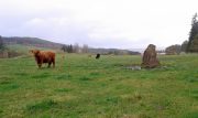
Balnabroich stone, looking west

Balnabroich stone, looking west

When the great standing stone lover Fred Coles (1908) came here, he was as reliable as ever in his subsequent exposition of the place – and despite getting his measurements slightly out he told us almost liltingly, like an antiquarian Uncle Monty stroking his megaliths, that

“At a point almost 176 yards due north of (the) two stones is a tallish and unshapely monolith standing but a few yards west of the main road.  Its most notable feature is the extreme irregularity of its shape.  If any proof were needed to show how uncritical were the people who raised such stones, how totally devoid of any regard for symmetry or neatness of contour in the monoliths they set up, surely the ground-plan of this block of rent and riven quartz-veined whinstone, fissured and uncouth in all its parts, would supply it.

“The contour here shown was measured by laying down an irregular rhomboidal figure, and from each of its sides measuring by offsets to the depths 0f the curves which are so prominent on the north, the northwest and the southeast sides.  The ground-plan this obtained shows that, taken between their prominent angles, the four sides measure almost exactly 3 feet each, and the main long axis of the stone which lies due east and west and measures 4 feet 6 inches.  The monolith stands 5 feet 8 inches above the ground and…appear to have been unconnected with circles, so far at least as it was possible to glean any information.”

References:

  1. Coles, Fred, “Report on Stone Circles Surveyed in Perthshire – Northeastern Section,” in Proceedings of the Society of Antiquaries of Scotland, volume 42, 1908.
  2. Royal Commission on the Ancient & Historical Monuments of Scotland, North-East Perth: An Archaeological Landscape, HMSO: Edinburgh 1990.

© Paul BennettThe Northern Antiquarian

Balnabroich stone