Cowcliffe Cross, Fartown, Huddersfield, West Yorkshire

Cross:  OS Grid Reference – SE 13949 18935
Getting Here

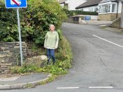
Lizzi by the cross-base

Nice ‘n easy: from Huddersfield central, take the A641 road north to Brighouse, but barely a half-mile out of town turn left up the Halifax Old Road.  Go on here for nearly a mile, then keep your eyes peeled for the aptly-named South Cross Road on your right.  Go up here all the way to the end where it meets with Cowcliffe Hill Road.  Here, at the junction, right by the roadside at the edge of the wall, is the remains of the old cross-base, all but covered in vegetation.  You’ll see it.

Archaeology & History

The little-known remains of a post-medieval cross base can still be seen, albeit very overgrown, right by the roadside.  The upstanding stone cross that once stood upon it has long since gone (perhaps broken up and built into the wall).  It may have been one of two such crosses relatively close to each other: as this one is found at South Cross Road, there may have been another one at the nearby North Cross Road, but history seems to be silent on the matter.
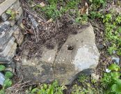
Top of the cross-base

The cross-base itself has several holes cut into it where the standing stone cross was fixed upright.  Very little seems to be known about this monument.  George Redmonds (2008) told simply that, “the base of a cross survives on Cowcliffe Hill Road, no doubt marking the ancient crossroads. It explains the names North and South Cross Roads.”  He added that, “The base of the cross survives, partly hidden in the undergrowth, and it is the only visible evidence we have of several similar crosses in the township.”

References:

  1. Redmonds, George, Place-Names of Huddersfield, GR Books: Huddersfield 2008.

Acknowledgements:  Huge thanks to Liz Sykes for helping out big-time to uncover the base from beneath the mass of herbage.

© Paul BennettThe Northern Antiquarian

Oldfield Hill, Meltham, West Yorkshire

Enclosure:  OS Grid Reference – SE 0874 1009

Getting Here

Oldfield enclosure in the field below

From the crossroads at the centre of Meltham, near the church, take the Wessenden Head Road up out of town for about a mile.  Keep your eyes peeled to right (north) for the track leading downhill to Oldfield Hall or Farm.  As you go down the track you’ll see a small cluster of hawthorns running along a small ridge 100 yards or so ahead, at the end of the field, with some line of embankment. This is on the right of the track and is the Oldfield enclosure!

Archaeology & History

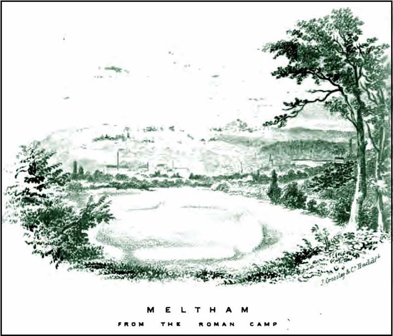
The remains of this large quadrangular settlement were first described as of ‘Roman’ origin in Mr Morehouse’s History of Kirkburton (1861), where he told that,

“In the…township of Meltham are the remains of a Roman encampment, on the moor below West Nab, a short distance to the left of the road which leads thence to the village…forming nearly a square of about four chains.  When I visited the place about twenty years since, in company with the owner and other friends, the whole was very distinct and perfect. This piece of ground has since been brought into cultivation, yet the trenches are still visible.  This encampment would appear only to have been made to supply some temporary emergency.”

Joseph Hughes old drawing of the ‘Roman’ camp
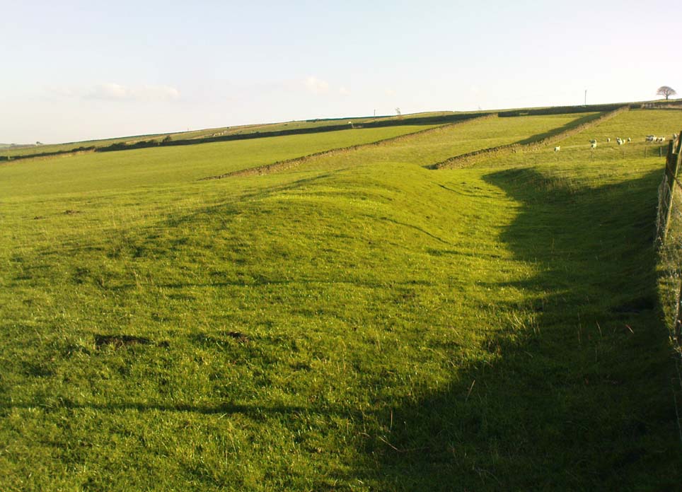
Western embankment & ditch

But Mr Morehouse’s speculation of its Roman origin and function are known to be untrue.  The site is in fact of Iron Age origin and was probably in semi-permanent use for long periods between Spring and Autumn. But the ‘Roman’ nature of the site was echoed a few years later, albeit briefly, in Mr Hughes’ History of Meltham (1866), where he told that “querns or hand-mills for grinding corn were found” at the site.

In 1909, the Saddleworth antiquarian Ammon Wrigley excavated the site but found little that could enable a correct dating of the enclosure. It was explored again a few years later by Ian Richmond and then again by J.P. Toomey in the 1960s.  Bernard Barnes (1982) summarised their respective findings, telling:

“Rampart of rubble and earth 7 feet wide faced with drystone walling; original height c.10 feet; V-shaped rock-cut ditch, 5½ feet deep and 6 feet wide, and a counterscarp bank similar to inner rampart with drystone revetment surviving to 4 courses.  Northeast entrance had double timber gateway.  Pre-rampart palisade trench on at least 2 sides of the enclosure with vertical posts 2 feet apart.  Finds include 2 stone discs, rough out beehive quern, iron slag and very small fragments of pottery.  Site dated to Iron Age.”

Another enclosure of similar period can be found a few hundred yards to the south.

…to be continued…

References:

  1. Abraham, John Harris, Hidden Prehistory around the North West, Kindle 2012.
  2. Barnes, Bernard, Man and the Changing Landscape, Eaton: Merseyside 1982.
  3. Bennett, Paul, The Old Stones of Elmet, Capall Bann: Milverton 2001.
  4. Hughes, Joseph, The History of the Township of Meltham, John Russell Smith: London 1866.
  5. Morehouse, Henry James, The History and Topography of the Parish of Kirkburton, H. Roebuck: Huddersfield 1861.
  6. Toomey, J.P., An Iron Age Enclosure at Oldfield Hill, Meltham, Brigantian: Huddersfield 1976.

© Paul Bennett, The Northern Antiquarian

Rocking Stone, Golcar, West Yorkshire

Legendary Rock (destroyed):  OS Grid Reference – SE 076 163

Also Known as:

  1. Holed Stone
  2. Holy Stone
  3. Whole Stone

Archaeology & History

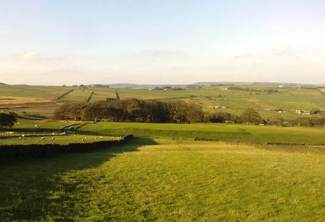
Like many old rocking stones, this was destroyed due to quarrying operations many years ago and sadly, I believe, we have no illustrations of the place to show the site.  This legendary site—also known as the ‘Holed’ or ‘Holy Stone’—is preserved in the place-name of Rocking Stone Hill and, unlike many other alleged rocking stones, actually swayed to and fro if the old records are owt to go by.  Not far away (and also destroyed some 200 years back) were two stone circles which probably had some mythic relationship to this legendary rock.

The stone was first described by John Watson in his monumental History of Halifax (1775), where he told that is was,

“so situated as to be a boundary mark, dividing the two townships of Golcar and Slaightwait in the Parish of Huddersfield, adjoining to the Parish of Halifax on Wholestone Moor.  The stone as measured by the late Thomas Perceval, or Royton…is 10½ feet long, 9ft 4in or 5in broad, and 5ft 3in thick.  Its weight…is 18 tons, 190lbs.  It rests on so small a centre, that at one particular point, a man may cause it to rock; though some years ago it was damaged a little, in this respect, by some masons, who endeavoured, but in vain, to throw it off its centre, in order to discover the principle on which so large a weight was made to move.”

Mr John Crabtree (1836) included it in his survey, and it was illustrated on the very first Ordnance Survey map in the 1840s where it was described as ‘Supposed Druidical’.  But the old stone sadly didn’t last much longer.  Once the self-righteous Industrialists got here, round about the year 1886, the Rocking Stone was destroyed by quarrying operations.  All that remains of the place today is a small cluster of place-names..

Folklore

Thought by Watson (1775) and his contemporaries to have had druidic associations (without evidence), when Philip Ahier (1942) came exploring this area in 1936, he came upon “an old resident (who) informed me that he had sat upon the stone when a youth and had caused it to rock.”

References:

  1. Ahier, Philip, The Legends and Traditions of Huddersfield and District, Advertiser Press: Huddersfield 1942.
  2. Bennett, Paul, The Old Stones of Elmet, Capall Bann: Milverton 2001.
  3. Crabtree, John, Concise History of the Parish & Vicarage of Halifax, Hartley & Walker: Halifax 1836.
  4. Watson, John, The History and Antiquities of the Parish of Halifax, T. Lowndes: London 1775.

© Paul Bennett, The Northern Antiquarian 

Castle Hill, Kirklees, Brighouse, West Yorkshire

Enclosure:  OS Grid Reference – SE 173 216

Getting Here

Along the Brighouse to Mirfield A644 road, a half-mile east of M62’s junction 25 on Wakefield Road, note the woodland on your left-hand side, above the walling.  Although on allegedly private land, you can approach by hopping over the wall by the main road into the woods. Wander up the slope until it levels out and, just at the edge of the tree-line, past the brilliant overgrown folly amidst a mass of rhododendrons, you’ll see the denuded edges of this earthwork.  Though you might need a bitta patience seeking it out…

Archaeology & History

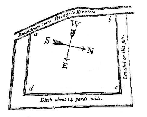
Very first sketch of this site (John Watson, 1775)

The remains of this low earthwork is found on the private land of Kirklees Hall and appointment is supposed to be made to explore, both this and the more famous Robin Hood’s Grave, a few hundred yards away. But if you can’t be bothered with that and find this little-known earthwork, you’ll see that it’s roughly squared in shape, though pretty overgrown.  In Bernard Barnes’ survey (1982) he described it as a “square or five sided enclosure, 2-3 acres in size, with bank and external ditch”, wondering whether it was used to enclosure cattle and stretching its possible origin between the Iron Age to the medieval.

Although the classical Roman archaeologist Ian Richmond (1925) believed the site to be from that period, the archaeologist J.J. Keighley thought that the site was “more likely to be Iron Age than Roman.”  He wrote:

“The earthwork in Kirklees Park is a square or five-sided enclosure with bank and external ditch… The site lies on Richmond’s trans-Pennine route.  According to Armitage and Montgomerie, the earthwork is 0.5 hectares in area, but it is actually nearer 0.8 to 1.2 hectares.  They compare its construction with the fort at Wincobank (South Yorkshire), stating that the bank on the counterscarp when excavated, revealed “a very rudely composed wall of undressed dry stone.”

Earlier local writers such as John Watson (1775) — whose early sketch of the site is reproduced above — and others also opted for the Roman date.  But, unless you’re a bit of an earthwork fanatic, this site may not be too much your cuppa tea. If you are gonna check this out though, make sure you check out Robin Hood’s old tomb in the trees not far away. Very odd.

References:

  1. Barnes, Bernard, Man and the Changing Landscape, Merseyside County Council & University of Liverpool 1982.
  2. Keighley, J.J., “The Prehistoric Period,” in West Yorkshire: An Archaeological Survey to AD 1500 (WYMCC: Wakefield 1981).
  3. Richmond, I.A., Huddersfield in Roman Times, Tolson Memorial Museum: Huddersfield 1925.
  4. Watson, John, The History and Antiquities of Halifax, J. Lowndes: London 1775.

© Paul Bennett, The Northern Antiquarian

Slaithwaite Cross, West Yorkshire

Cross:  OS Grid Reference – SE 077 139?

Archaeology & History

The great Huddersfield historian, Philip Ahier (1948), in describing the lack of documentary evidence for several crosses in the neighbouring region, “at Deighton, Cowcliffe, Marsh and Golcar,” found out that,

“One did exist at Slaithwaite in front of the Manor House in the early past of the last century.  In March 1931, the base of this cross, commonly known as the Dial Stone, was removed to Doughlas in the Isle of Man, where it rested in the garden of Mr Harry Wood; in August 1939, it was brought back to Slaithwaite and now stands in the Recreation Park.”

However, this site differs from another two that I’ve found records for on the outskirts of this township.  Does anyone know what became of this old stone cross?  Izzit still about?  Its folk-name of the Dial Stone may make it a little easier to locate — but at the same time it does bring up the query, Why was it called that?

References:

  1. Ahier, Philip, The Story of the Three Parish Churches of St. Peter the Apostle, Huddersfield – volume 1, Advertiser Press: Huddersfield 1948.

© Paul Bennett, The Northern Antiquarian