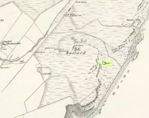
Cup-and-Ring Standing Stone: OS Grid Reference – NR 6928 4184
Also Known as:
- Canmore ID 38589
- Gaigean
Archaeology & History
This lovely-looking 5-foot tall standing stone, marking an old boundary line in the Muasdale parish, is a curious one with elongated cups, some of which have the appearance of natural beach-side erosion caused by molluscs — unlikely though it may be. It first appears to have been described in an early PSAS article by Duncan Colville (1930), who told us:
“The writer was informed by the Rev. D.J. MacDonald, the minister of the parish, of the existence of this cup-marked stone forming a gatepost in the boundary wall between the arable and hill ground on the farm of Gaigean. The gate referred to is situated on the top of a steep bank on the south side of a small stream, a short distance uphill to the east of the farm steading of Gaigean. The front of a stone is now set an angle of about 45° to the ground facing almost southwest (105° magnetic across the face). Underneath the stone is another boulder similar in size, with several smaller stones wedged between the two, thus preventing further inspection.”

Some years later when the Scottish Royal Commission (1971) lads described the site in their Kintyre survey (monument no.97), they gave a more detailed description of the cup-and-rings, saying:
“The markings consist largely of plain cups, but one cup is accompanied by a partial single ring which measures 0.11m across. At the foot of the lower half of the stone four cups linked by broad gutters form a curious branched pattern, and a similar combination of three cups and gutters occurs in the upper half, while in two other instances a pair of cups are joined by a short straight channel to form a dumb-bell figure. The remainder of the markings comprise twelve oblong or kidney-shaped hollows measuring up to 0.15m in length by 0.064m in breadth, and thirty-one plain cups ranging from 0.038m to 0.076m in diameter, the largest being 0.019m deep.”
References:
- Colville, Duncan, “Notes on the Standing Stones of Kintyre” in Proceedings of the Society of Antiquaries, Scotland, volume 64, 1929-30.
- Royal Commission on the Ancient & Historical Monuments of Scotland, Argyll – volume 1: Kintyre, HMSO: Edinburgh 1971.
© Paul Bennett, The Northern Antiquarian

