Culhawk Hill, Kirriemuir, Angus

Stone Circle:  OS Grid Reference – NO 3530 5620

Also Known as:

  1. Canmore ID 32209

Getting Here

The largest stone in the ring

From Kirriemuir central, head up the Kinnordy road, going straight across the main road and continuing past the Kinnordy turn-off for just over a mile towards Mearns, stopping where a small copse of trees appears on your left.  From here, walk along the track to the west. It goes gradually uphill, cutting through a small cleft with a hillfort on the north and a cairn circle on the south until, ⅔-mile along, you reach the moorland.  Keep going on the same path for another ½-mile west where the grasslands level out.  Here, on the flat bit between the two hills, a small incomplete ring of stones lives, with one stone sticking out.  You’ll find it!

Archaeology & History

This is a curious site on several levels—not least, that its definition as a ‘stone circle’ is a fragile one; although to be honest, we do find here a large unfinished arc of stones in what looks like either an unfinished ring, or a deliberately constructed large arc.  But you won’t find it in the standard megalithic gazetteers of Burl, Barnatt or Thom as it was only relocated in the 1980s by local researchers Sherriff and MacKnight. (1985)  They didn’t have much to say about it either, simply telling that they’d found,

“A stone setting representing the remains of either a denuded cairn or a stone circle lies in the saddle between Culhawk Hill and Castle Hill. One erect and 4 prone boulders describe a portion of a roughly circular site some 10m in diameter.”

Arc of fallen stones, looking NE

Faint low ring, looking W

This is roughly the gist of it, with the largest and most prominent of the stones—barely three feet tall—standing on the western side (this is the stone which draws your attention – otherwise you’d never even notice it).  The rest of the stones seem to have been knocked down some time ago.  A barely discernible embankment constructed around the edge of the ring can be seen around the northern side.  It seems unlikely that it was a cairn, as no inner piles of stones were in evidence when we visited the site.  It may be a large hut circle.  But in truth it could do with an excavation so that we can suss out its exact nature.  Beneath the grasses we found an additional stone to those counted by Sherriff & MacKnight; but more intriguing is what Frank Mercer and I found before we even reached the small circle….

Trackway leading to the circle

More visibly distinct than the ring itself were two artificial raised embankments, running parallel with each other 3-4 yards apart.  The raised edges of these embankments were about a yard across, on both sides, with the inner area slightly lower than the outlying natural background.  These distinct linear earthworks are, quite simply, an early medieval or prehistoric trackway—and it leads directly into the circle!  It’s quite unmistakable and is clearly visible as it drops down the slope to the south and away into the fields below.  Sadly when we found it last week, darkness was falling and so we didn’t trace the trackway any further.  But the most notable thing was that it stopped at the circle and did not continue on its northern side, implying that it was constructed with the circle as its deliberate focal point.  The trackway and its embankments are roughly the same size as other recognized prehistoric routes, such as Elkington’s Track on Ilkley Moor and the other ancient causeway that runs past the prehistoric ring known as Roms Law.

Regarding the ring of stones: unless you’re a real megalith fanatic, you’ll probably be disappointed by what you see here.  It’s a bittova long wander to something that may once have been just a hut circle, but the avenue leading up to it is something else – and much more intriguing!

References:

  1. Sherriff, John R. & MacKnight, O., “Culhawk Hill (Kirriemuir p): Stone Setting,” in Discovery & Excavation Scotland, 1985.

Acknowledgements:  Thanks as always to Nina Harris and Frank Mercer; and to Paul Hornby for use of his photos.

© Paul BennettThe Northern Antiquarian


Rocking Stones, Kirriemuir, Angus

Legendary Rocks (destroyed):  OS Grid Reference – NO 3813 5496

Archaeology & History

Like many rocking stones across the British Isles that were written about by early 18th and 19th century authors, the ones at Kirriemuir have fallen prey to the vandalism of those people (christians, Industrialists and other self-righteous fools) that has so blighted our heritage, and ancestral history, with an intolerance of indigenous beliefs and remarkable geological formations.  But, I suppose, at least we have a record of them, which at least in some way gives us the ability to add further our knowledge of the traditional practices of our peasant ancestors and their perception of the landscape.

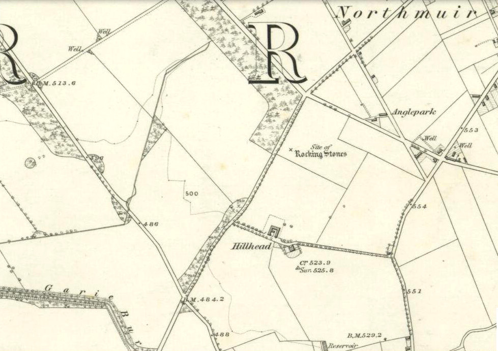
Rocking stones shown on 1865 6-inch OS-map
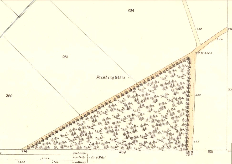
Rocking stones shown on 1865 25-inch OS-map

The exact location of the legendary rocks were highlighted on early Ordnance Survey maps, thankfully; and there were in fact two rocking stones here, very close to each other by the sound of it.  Mentioned only in passing by E.S. Valentine (1912), the place was best described in A.J. Warden’s (1884) massive history work on the region. He told that:

“On the top of the Hillhead, Kirriemuir, there were two fine specimens of these interesting memorials, upon which the dwellers in the district looked with wonder and awe.  These time honoured monuments of a long past age were, in 1843, blasted with gunpowder, and the shattered pieces used in building dykes and forming drains, to the deep regret of antiquarians, and of the inhabitants of the district. …These stone memorials of a remote age are thus described by the Rev., T. Easton, D.D., in the new Statistical Account of the parish — ‘The one of them is a block of whinstone, nearly oval, and is three feet three inches in height, and four feet ten inches in breadth. The other, of Lintrathen porphyry, is two feet in height, eight feet in length, and five feet in breadth.’ He gives no description of the bases upon which the magic pivots moved, or other details of them.”

About a half-mile east you would have looked across at the large standing stone on Kirriemuir Hill, which legend asserts was once a stone circle (it too, destroyed).   If anyone has any further information about these old stones, please let us know…

References:

  1. Valentine, E.S., Forfarshire, Cambridge University Press 1912.
  2. Warden, Alex J., Angus or Forfarshire: The Land and People – Descriptive and Historical – volumes 1 & 4, Charles Alexander: Dundee 1880-1884.

© Paul Bennett, The Northern Antiquarian


Caddam, Kirriemuir, Angus

Stone Circle (remains of):  OS Grid Reference – NO 3848 5625

Also Known as:

  1. Caldhame
  2. Canmore ID 32196
1865 OS-map showing the stone

Getting Here

From Kirriemuir centre, take the B956 out of town until you hit the B955. Head north along this road until the houses are behind you. You’ll pass a woodland on your left straight away and as the road starts to bend right, take the first small road on your left. Go along here for about 150 yards and stop. Look into the fields across the road and there it is!

Archaeology & History

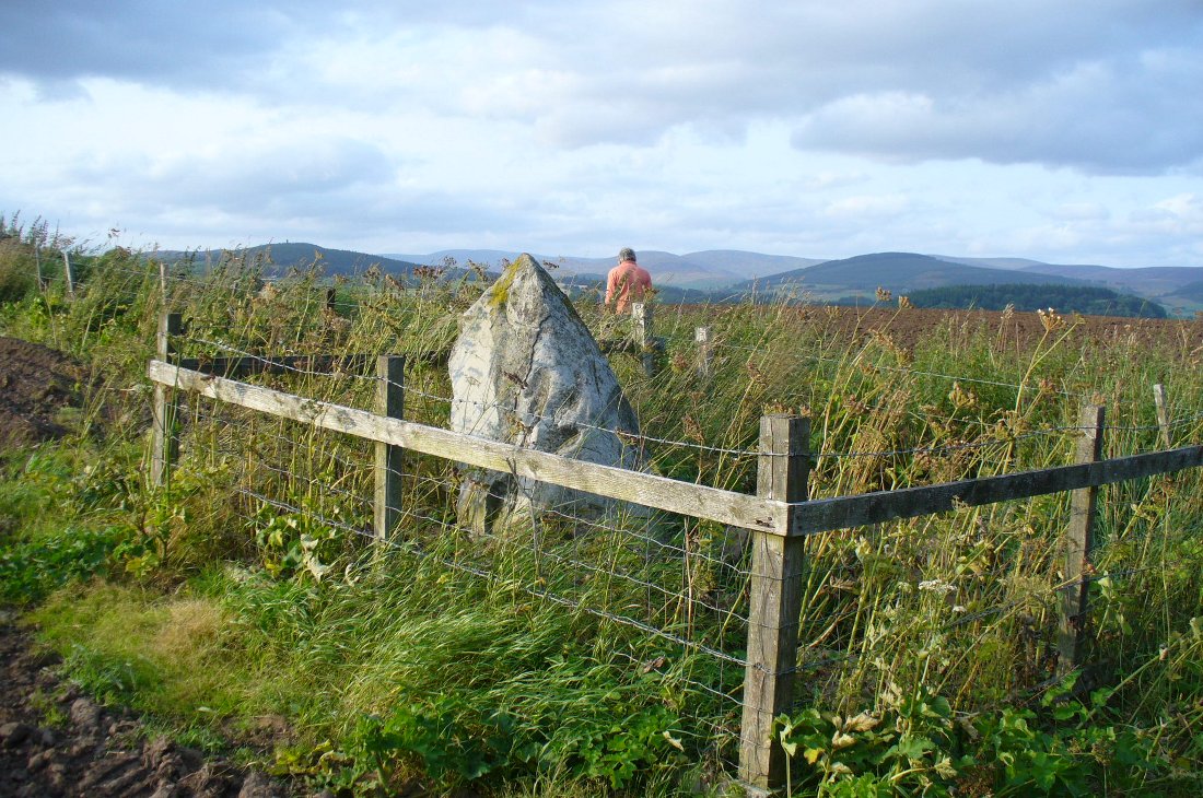
Caddam stone, looking north

The small standing stone we see here today, within in a small fenced enclosure by the wall-side, was highlighted on the 1865 OS-map in exactly this position.  However, its earlier history seems much more intriguing – and at least one account tells us how this solitary stone was once part of something much bigger—implying that it was of some considerable important to our ancestors.  In A.J. Warden’s (1884) magnum opus on the history of this region he told that,

“A circle of stones was discovered in trenching a field at Caldhame, a little to the north of (Kirriemuir) town. It was over sixty feet in diameter, and in the centre was a large standing stone. The circle was removed, but the centre stone was left.”

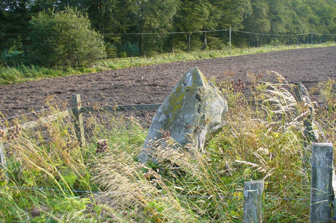
The Caddam stone, looking SW

Another local writer later reported that there were remains of six stones in the field immediately below the remaining upright, but these have since disappeared. The descriptions seem to imply that the stone was a part of a burial complex of some sort.  Sadly, all we see today is this one remaining upright: some 5 feet tall, but looking shorter as it leans to its side, seemingly ready to fall.  Do any local people know anything more about this place?

References:

  1. Royal Commission on the Ancient and Historical Monuments of Scotland, The Archaeological Sites & Monuments of Central Angus, Angus District, Tayside Region, HMSO: Edinburgh 1983.
  2. Warden, Alex J., Angus or Forfarshire: The Land and People – Descriptive and Historical – volume 4, Charles Alexander: Dundee 1884.

© Paul Bennett, The Northern Antiquarian