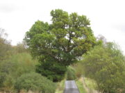
Fairy Oak, Killin, Perthshire

Legendary Tree:  OS Grid Reference – NN 57 33

  1. Coin Tree

Folklore

The Fairy Oak of Killin

Nothing has previously been written of this site.  Its existence came to light during one of umpteen enquiries I’d made with a well-known and very respected local lady, born and bred in Killin (sadly, a dying breed), who is known as a fount of knowledge regarding the history of the area.  We were talking about the ancient sites and folklore of the neighbourhood and, amidst being her usual helpful self she asked, “have you been to the Coin Tree?  The place where we leave offerings to the spirit of the place?”

I hadn’t.

“No, I’ve never heard of the place.”

“We keep it quiet, ” she said, “for obvious reasons.”

I knew what she meant.  The Fairy Tree at Aberfoyle is a case in point: littered with plastic pentagrams, children’s toys and so-called “offerings” of all kinds that have made it little more than a dumping ground for pseudo-pagans and new-age nuts that needs to be cleaned regularly by local folk.

Anyhow, our informant proceeded to give us directions to find the place, going out of the village, but asked that if we were to write about it, to keep its location quiet, “as the place is still used by us”—i.e., old locals.  After a slow trek along one of the roads out of the village we saw nothing that stood out.  Eventually we came across a fella relaxing in his garden and asked him if he knew anything about an old tree where offerings were made.  He gave us that look that olde locals do, to work out whether you’re a tourist or not and, after telling him what we’d been told and who had told us —that seemed to do the trick!

“You’d mean the Fairy Oak I s’ppose?  Aye,” he said, “gerrin the car and I’ll drive y’ down to it.”

So we did.  A short distance back along the road that we’d come down he stopped and walked along a to large oak tree beside the road.  We’d walked straight past it—but in truth it’s not a conspicuous tree and unless you were shown where it was, you’d miss it as easily as we did (and I’m usually damn good at finding such things!).  We thanked the fella for taking us to see it and he drove back home to leave us with out thoughts.
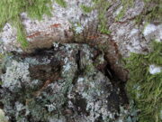
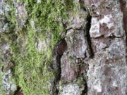
More coins as offerings
Coins for the little people

Embedded into the tree—some of them barely visible where the bark had grown over them—were clusters of old coins all around its trunk; some of them very old.  These had been inserted into the tree as offerings in the hope that the little people, or the genius loci would bring aid to that which was asked of it.

In a field across the road there’s a large “fairy-mound” hillock: one of Nature’s creations, but just the sort of place where many little people are said to live in many an old folk-tale.  Some such mounds are old tumuli, but this aint one of them.  It’s possible that it had some relationship with the tree where the fairy folk are said to reside but, if it did, our informants didn’t seem to know.

The important thing to recognise here is that in some of the small villages and hamlet in our mountains, practices and beliefs of a world long lost in suburbia are still alive here and there… But even these are dying out fast, as most incomers have no real attachment to the landscape that surrounds them.  Simply put: they see themselves as apart from the landscape as opposed to being a part of it.

© Paul BennettThe Northern Antiquarian 

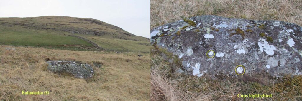
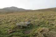
Balnasuim (3), Kenmore, Perthshire

Cup-Marked Stone:  OS Grid Reference – NN 66075 39622

Getting Here

Take the directions to the Balnasuim (1) carving, then up and across to Balnasuim (2).  From here, walk diagonally uphill to your right (NE) for about 150 yards and head to the the very top-corner of this field.  You’ll see the large embedded rock emerging out of the ground, just ten yards away from a small stream.  You’re there!

Archaeology & History

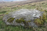
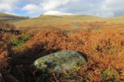
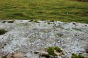
As Officer Barbrady likes to put it, “move along people, there’s nothing to see here!“—and that’s really the case with this, another of Balnasuim’s petroglyphs.  This lichen-encrusted rock has just two simple cup-marks, barely visible when the daylight’s poor – and it’s almost as disappointing when the day is good!  In all honesty, in wilfully visiting this site and its geographical compatriots, I can sincerely understand how people can tell us petroglyph-nuts that we “really have nothing better to do” with our time!

© Paul BennettThe Northern Antiquarian

Balnasuim (1), Kenmore, Perthshire

Cup-Marked Stone:  OS Grid Reference – NN 65813 39268 

Getting Here

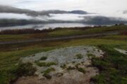
Balnasuim (1), beneath Ben Lawers

From Killin, take the A827 road to Kenmore. 6 miles along, on your right, is the track down to the Big Shed at Tombreck.  Keep on the A827 for exactly ⅓-mile (0.53km), and opposite the driveway to Craggantoul is a small parking spot.  A few yards on the road, over the burn, go thru the gate on your left.  From here, follow the straight line of walling uphill and 20 yards before reaching Cragganester (9) carving, follow the line of fencing right (ENE) until you hit the wall more than 350 yards away.  From here, follow the walling uphlil 350 yards where it turns a right-angle west.  About 50 yards east of the right-angled wall, look around…

Archaeology & History

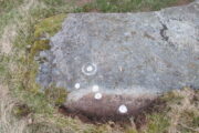
3 faint cups in an arc

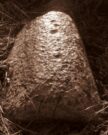
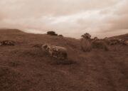
As with the other carvings up here at Balnasuim, there is little to look at unless you’re one of the ardent petroglyphic crazies!  On this small rounded stone, cushioned beneath the skylines of Ben Lawers and Meall Odhar, are at least three cupmarks in a rough arc running from the northern part of the stone, with the most pronounced of them being close to the northern edge of the rock.  The others are very shallow and can be difficult to make out in poor sunlight.  A possible fourth cupmark with a short protruding line may exist close to the SE part of the stone.  The Balnasuim (2) carving is 305 yards (279m) to the NE.

© Paul BennettThe Northern Antiquarian

Balnasuim (2), Kenmore, Perthshire

Cup-and-Ring Stone:  OS Grid Reference – NN 65965 39521

Getting Here

Balnasuim (2), looking N

From Killin, take the A827 road to Kenmore. 6 miles along, on your right, is the track down to the Big Shed at Tombreck.  Keep on the A827 for exactly ⅓-mile (0.53km), and opposite the driveway to Craggantoul is a small parking spot.  A few yards on the road, over the burn, go thru the gate on your left.  From here, follow the straight line of walling up past Cragganester (9) carving, following the burn uphill parallel to the copse of trees until, after about 800 yards, you reach the wall.  From here, walk towards the rounded hill of Meall Odhar and, after about 450 yards, you’ll notice it meets a line of walling that runs downhill.  Keep walking along, past this, but after 150 yards, go into the field on your right and walk downhill for about 100 yards.  Look around!

Archaeology & History

Despite the climb, plus its description as a ‘cup-and-ring’ stone, this petroglyph is somewhat of a disappointment.  An elongated stone, half-covered in earth faces south towards Loch Tay and the mountains across, with a series of very eroded cup-marks.

Cup-marks on SW side
Cup-and-ring on NE side

They are separated into two small groups.  At the southwest side of the rock we can see three or four faded cup-marks.  The middle of the rock seems devoid of anything, but on its more northeastern side we find four more cups in close attendance to a standard cup-and-ring motif.  That’s about it!  The Balnasuim (1) carving can be found 305 yards (279m) to the southwest.


© Paul BennettThe Northern Antiquarian

Cragganester (11), Kenmore, Perthshire

Cup-Marked Stone:  OS Grid Reference – NN 65858 38750

Getting Here

Cragganster 11 in situ

From Killin, take the A827 road to Kenmore. 6 miles along, on your right, is the track down to the Big Shed at Tombreck.  Keep on the A827 for exactly ⅓-mile (0.53km), and opposite the driveway to Craggantoul is a small parking spot.  A few yards on the road, over the burn, go thru the gate on your left.  Follow the straight line of walling up for 400 yards it meets where another line of walling running right (E), into the boggy pasture-lands. Walk along here for roughly another 400 yards then go up the slope as if walking up Ben Lawers (N).  You’ll come to 2 large boulders next to each other where the slope levels out.  It’s the one on your left!

Archaeology & History

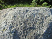
This carving is really for the purists amongst you.  It’s like most of the carvings along this contour line in that the design is simplistic.  Consisting of at least nine cups all on top of the stone, they can be difficult to see amidst the rough garnet and lichen-encrusted rock.

Cupmarks on its west face
Looking down on the cups

On one of our visits here, when the light cut across the surface at a lower angle, it seemed as if one of the cups had a faint ring around it; but it looked as if the outline of it had been started, but then for some reason the ring was never actually carved.  This outline is very faint.  We’ve found examples of this at two of the Duncroisk carvings, several miles to the west, where the faintest trace of a ring was outlined, but never carved.  Of the cup-marks: five of them are carved on the east-side of the rock and are pretty easy to see (with the ring around one of them), whilst the other four—slightly more difficult to make out—are on its west side.  A couple of hundred yards north you can see the Cragganester 10 carving.

© Paul BennettThe Northern Antiquarian

St. Fillan’s Tree, Killin, Perthshire

Sacred Tree (destroyed):  OS Grid Reference – NN 5708 3249

  1. St Fillan’s Ash

Archaeology & History

Long since gone, this great olde ash tree could once be found on the south side of Killin’s Mill building, close to the bridge at the Falls of Dochart.  It was deemed to be ‘sacred’ by local people – just as all trees were, once upon a long time ago.

In John Shearer’s (1883) wonderful book on the ancient ways of the Perthshire people, he described the tree as being adjacent to the earthfast rock known as St. Fillan’s Seat:

“At the side of it grows a large ash tree which is held sacred by the natives as no person will burn any of the branches although fallen to the ground nor destroy them in any manner.  However, there was one who had the hardihood to take one of the branches for a caber to repair his house.  Strange to tell the first fire that was kindled burned it to the ground as a punishment for this impious sacrilege.  Of course no person since has troubled it or taken any of the wood.  The branches that fall lie till they rot.”

The brilliant Killin historian, W.G. Gillies (1938) reported that the tree was still standing until it was “blown down by a gale in 1893″—but it didn’t quite kill it off for good; for in September 1911, C.G. Cash visited Killin and this was one of the many places he looked for and, despite local folk telling him about the more famous St Fillan Stones (still in existence and found at the Mill), he saw the last remnants of this great Ash, telling simply that,

“the mere dead stump of St Fillan’s Ash-tree still stands against the south post of the mill gate.  And quite near it is a young ash, said to be its descendant.  This younger tree has an out-curving branch that was said to have been the gallows-branch in olden days; but it is obviously too young and too weak.”

…So, does anyone know precisely which is the “descendant” of St. Fillan’s Ash and where happens it to be growing?

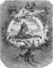
In Norse myth, the ash tree Yggdrasil was the tree of Odin and was one of the primal ingredients in their Creation myths.  It stood at the centre of the cosmos: an axis mundi no less, linking the many worlds and was the abode of the gods.  Its mythologies are extensive.  In Scotland, the myths of the ash are not so well known, but there’s little doubt that it possessed a sanctity and certainly has many traditions of it own, which are unfortunately outside the remit of this site profile.

References:

  1. Cash, C.G., “Archaeological Gleanings from Killin,” in Proceedings of the Society of Antiquaries of Scotland, volume 46, 1912.
  2. Elders, E A., “Saintly stones in a Perthshire village,” in Country Life, December 1962.
  3. Gillies, William A., In Famed Breadalbane, Munro Press: Perth 1938.
  4. Shearer, John, Antiquities of Strathearn, D. Phillips: Crieff 1883.

© Paul BennettThe Northern Antiquarian

Cragganester (3), Kenmore, Perthshire

Cup-Marked Stone – NN 65632 38144

Getting Here

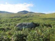
The rock in the landscape

From Killin, take the A827 road to Kenmore. 6 miles along, on your right, is the track down to the Big Shed at Tombreck.  Keep on the A827 for exactly ⅓-mile (0.53km), and opposite the driveway to Craggantoul is a small parking spot.  A few yards on the road, over the burn, go thru the gate on your left and walk up the path for less than 100 yards. The stone is just a coupla yards on your right (if you reach the derelict tractor, you’ve gone about 10 yards past the stone).

Archaeology & History

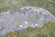
Cupmarks along the top

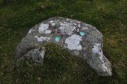
This is another one of the many simple cup-marked petroglyphs scattering the Cragganester and Tombreck regions beneath the slope of Ben Lawers.  It’s an elongated, smoothly-shaped ‘female’ stone, aligned north-south, possessing four distinct cups along its crown: three in a small line at the south-end of the stone and a single one close to the north end.  However between these is what may be another, shallow fifth cupmark—but this is uncertain.

One notable feature here is that the rock is encrusted with small garnets.  This geological ingredient isn’t uncommon in this area, and we’ve found that quite a proportion of the petroglyphs hereby possess this feature.  It was probably of some importance to the people who carved them.

Acknowledgements:  Thanks to Paul Hornby for use of his photograph.

© Paul BennettThe Northern Antiquarian


Cragganester (19), Kenmore, Perthshire

Cup-Marked Stone:  OS Grid Reference – NN 66627 38647

Getting Here

Cragganester 19 stone

Although you could just as well follow the directions to reach the Cragganester 22 carving (exactly 100 yards away), it’s probably easier to get there from where the track leads down to Balnasuim, but there’s nowhere to park any vehicle here—unless you’re on a bike!  Across the road from the Balnasuim track is a gate.  Go thru this and then follow the fence immediately on your left, running parallel with the road for roughly 250 yards (218m), until you reach a denuded wall that runs onto the hillside above you.  Follow this up for roughly 200 yards (96m) until you reach a grass-lined track.  Walk to your left and keep your eyes peeled for a reasonably large rounded boulder next to the track 40 yards on.  That’s it!

Archaeology & History

2 cupmarks highlighted

This is one of the many simplistic petroglyphs in the Cragganester complex, probably only of interest to the fanatics amongst you!  There are two distinct cup-marks on this nice rounded ‘female’ stone, one near the top and one near the middle, amidst the olde lichen growth.  Loch Tay stretches along the glen below here, but only a portion of it is visible nowadays.  In times gone by, tree growth probably prevented any vision of the waters below…

© Paul BennettThe Northern Antiquarian


Cragganester (22), Kenmore, Perthshire

Cup-Marked Stone:  OS Grid Reference – NN 66585 38564

Getting Here

Looking across Loch Tay

It’s a bittova pain-in-the-arse to reach this and its associated carvings, as there’s little place to park along here.  The easiest is to park 600 yards east of Tombreck at the spot just by the small bridge at Craggantoul.  Keep your eyes truly peeled!  From here, walk along the road for ⅔-mile where you’ll hit a gate taking you onto the boggy hillside.  Go diagonally up here for 150 yards where you’ll hit an overgrown track and small disused quarry.  Some 50 yards along you’ll see a small rock outcrop on your left (as if you’re going back to the road).  That’s the spot!

Archaeology & History

Close-up of cupmark

Not previously recorded, this simple petroglyph on a small rock outcrop—barely 50 yards above the A827 Killin-Kenmore road—comprises of one clear cup-mark prominently etched near the middle of the upper surface; and another possible cup on the left (eastern) section of the rock.  Cragganester carvings 19 and 20 are respectively about 100 yards NE and NW of here but, like other carvings nearby, is only gonna be of interest to the fanatic nutters out there!

© Paul BennettThe Northern Antiquarian

St Fillan’s Chair, Killin, Perthshire

Sacred Stone: OS Grid Reference – NN 56432 32010

Getting Here

Take the road to Auchlyne from Killin which follows the north side of the River Dochart, and on the edge of the village the stone will be seen on the left hand side behind a hedge, opposite the entrance to ‘Springburn’.

Archaeology & History 

The chair is mentioned in Rev. Gillies’ exemplary work, In Famed Breadalbane (1938):

St. Fillan would appear to have had a great liking for stone seats.  Besides the one already mentioned…there is..a..flat stone on the top of a knoll about a mile to the west of the village, and on the north side of the river, on which he is said to have sat and taught

St Fillan’s Chair, ‘twixt road and river
The ‘seat’, facing the River Dochart

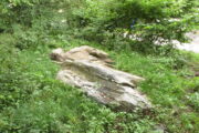
Two local ladies told us that the Chair had recently been uncovered from the vegetation. It is a flattish earth-fast slab of rock, which has on the right hand side a seat indentation, which faces the river bank about 12 feet away. Its proximity to the river bank would seem to limit its use as a preaching pulpit, and yet, well over a millennium after the death of Fillan, his ‘Chair’ is still remembered. Did the Chair serve another purpose, a purpose that long preceded Fillan and Christianity?

Here at Killin we are in an area of Scotland where Christianity was for long a veil worn very lightly over long-held ancient animistic beliefs and customs. Indeed in the early nineteenth century, missionaries were sent in the face of considerable local opposition by the Haldanes into Gaelic speaking Breadalbane to try to convert the locals to Christianity.

St Fillan and other saints had it seems become the named facilitators for healing at ancient places on behalf of the incoming religion from the Middle East.  To the west of Killin, there are the St Fillan’s Pools at Auchtertyre near Tyndrum, where he is reputed to have cured madness but which continued to be used for that purpose until the late eighteenth century at least.  There are stones for preventing measles and whooping cough near Killin that are still known and pointed out.  So what of our chair?

There is a nineteenth century story of a chair of St Fiacre (Irish born like Fillan) at the village church of St Fiacre near Monceaux in France being used to ‘confer fecundity upon women who sit upon it ‘.  The shape and proximity to the river may otherwise suggest St Fillan’s Chair was a birthing Chair?  Maybe some very old locals still know the true story of this Chair, but would they tell it?

References:

  1. Anon., Phallic Worship – a Description of the Mysteries of the Sex Worship of the Ancients, privately Printed: London 1880.
  2. Calder, Walter, Lawers, Lochtayside: A Historical Sketch, Macduff, Cunning & Watson, c.1930.
  3. Gillies, William, In Famed Breadalbane, Munro: Perth 1938.

© Paul T Hornby 2020