Dunadd Basin, Kilmichael Glassary, Argyll

Cup-and-Ring Stone:  OS Grid Reference – NR 83667 93576

Also Known as:

  1. Canmore ID 212008
  2. Dunadd 2a (Morris)

Getting Here

First sight of Dunadd's basin
First sight of Dunadd’s basin

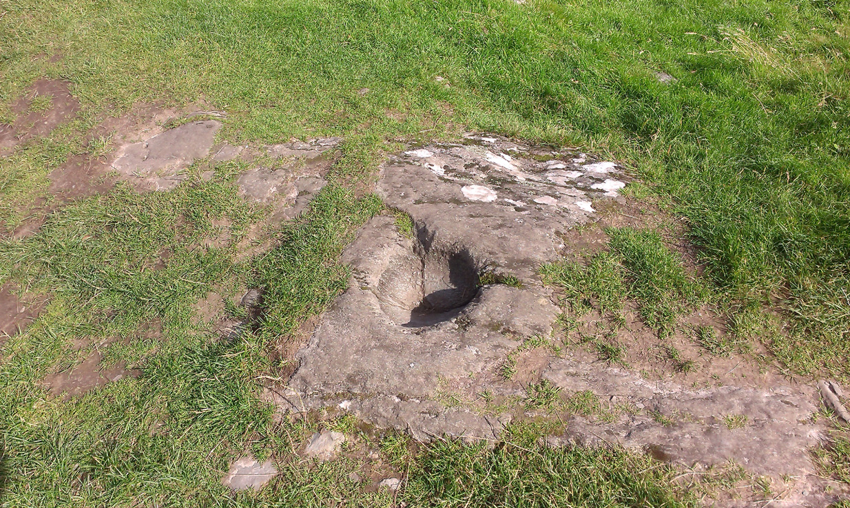
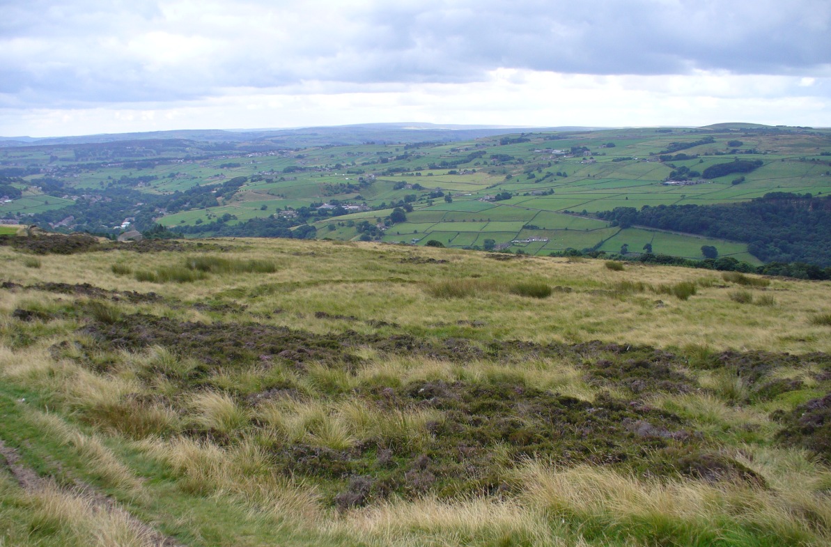
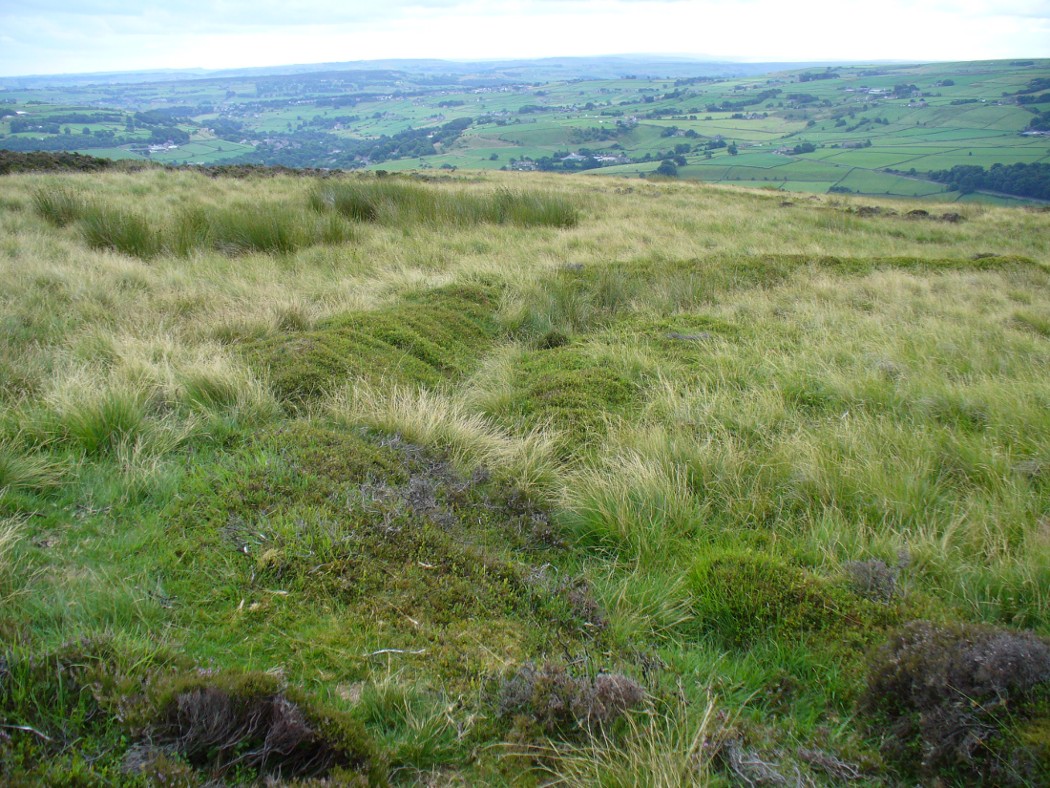
From Lochgilphead, take the A816 road north for several miles (towards the megalithic paradise of Kilmartin), keeping your eyes peeled for the road-signs saying “Dunadd.”  Turn left and park-up a few hundred yards down. Go through the gate and walk up Dunadd.  Just before the flattened plateau at the top you’ll come across a length of smooth stone, adjacent to the Dunnad Footprint Stone, with a deep large circular ‘bowl’ cut deep into the rock.   That’s the spot!

Archaeology & History

Basin with surrounding faint ring
Basin with encircling faint ring

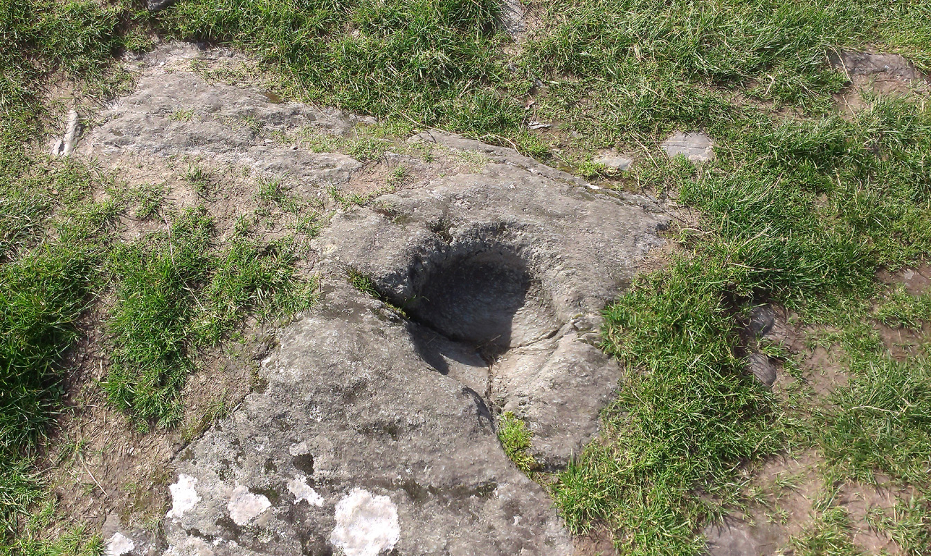
This large ‘bowl’ or basin just below the top of Dunadd—next to the other carvings of footprint, Ogham and boar—is speculated by many to have been a part of the kingship rituals that were alleged to have occurred up here, going way back.  But please remember that ‘kingship’ as it was in ages past has nothing to do with the touristy nonsense that prevails in the UK today.  Kingship in its early forms relates to rituals for the benefit of the tribe/society, in many cases resulting in sacrifices. (see Frazer 1972; Hocart 1927; Quigley 2005, etc)  This is quite probably what occurred at Dunadd.  But whether this curious deep bowl with its semi-circular carved ring had anything to do with the kingship rites, we simply don’t know.

An early description of the Dunadd Basin is in Mr Thomas’ (1879) essay on the hill itself.  It was a brief note:

“About four yards southwards from the (Dunadd) footmark is a smooth-polished and circular rock basin cut in the living rock; it is 11 inches in diameter and 8 inches deep.”

There is no mention of the incomplete ring which, though faded, can be seen to surround two-thirds of the hollow.  And as Dunadd was used by people until medieval times (Lane & Campbell 2000) it not only begs the question: when was it carved; but also: was the myth behind this petroglyph still alive?  We’ll probably never know.

The Royal Commission lads (1988) said the following:

“The rock-cut basin measures 0.25m in diameter by 0.14m in depth, and is bisected by a crack.  It is surrounded by a shallow pecked ring about 40mm in width, but parts of this have been worn away, especially to the S where the path from (the) enclosure passes the basin.”

Folklore

...and from another angle
…and from another angle

The basin here was said by the incoming priest R.J. Mapleton (1860) to be entirely natural in origin; though he also noted how Dunadd was known by local people to be the meeting place of witches and the hill of the fairies, whose amblings in this wondrous landscape are legion. Legends and history intermingle upon and around Dunadd.  Separating one from the others can be troublesome as Irish and Scottish Kings, their families and the druids were here.  One such character was the ever-present Ossian.  Mapleton told:

“From these ancient tales we turn to a much later period of romance, when Finn and his companions had developed into extraordinary and magical proportions; a story is current that when Ossian abode at Dunadd, he was on a day hunting by Lochfyneside; a stag, which his dogs had brought to bay, charged him; Ossian turned and fled. On coming to the hill above Kilmichael village, he leapt clean across the valley to the top of Rudal hill, and a second spring brought him to the top of Dunadd.  But on landing on Dunadd he fell on his knee, and stretched out his hands to prevent himself from falling backwards.  ‘The mark of a right foot is still pointed out on Rudal hill, and that of the left is quite visible on Dunadd, with impressions of the knee and fingers.'”

As Mr Thomas clarifies: “The footmark is that of the right foot, and the adjacent rock-basin is the fabulous impression of a knee.”

References:

  1. Bord, Janet, Footprints in Stone, Heart of Albion Press 2004.
  2. Campbell, Marion, Mid-Argyll: An Archaeological Guide, Dolphin Press: Glenrothes 1984.
  3. Campbell, M. & Sanderman, M., “Mid-Argyll: An Archaeological Survey,”  in Proceedings of the Society Antiquaries, Scotland, volume 95, 1962.
  4. Craw, J.H. “Excavations at Dunadd and other Sites,” in Proceedings of the Society Antiquaries, Scotland, volume 64, 1930.
  5. Lane, Alan & Campbell, Ewan, Dunadd: An Early Dalriadic Capital, Oxbow: Oxford 2000.
  6. Mapleton, R.J., Handbook for Ardrishaig Crinan Loch Awe and Pass of Brandir, n.p. 1860.
  7. Morris, Ronald W.B., The Prehistoric Rock Art of Argyll, Dolphin Press: Poole 1977.
  8. Royal Commission on the Ancient & Historical Monuments of Scotland, Argyll – Volume 6: Mid-Argyll and Cowal, HMSO: Edinburgh 1988.
  9. Thomas, F.W.K., “Dunadd, Glassary, Argyleshire: The Place of Inauguaration of the Dalriadic Kings,” in Proceedings of the Society Antiquaries, Scotland, volume 13, 1879.

© Paul Bennett, The Northern Antiquarian 

The map could not be loaded. Please contact the site owner.


Elkington’s Track, Burley Moor, West Yorkshire

Prehistoric Trackway:  OS Grid Reference – SE 13169 44111 to SE 13321 44172

Getting Here

Mr Elkington's newly uncovered prehistoric track
Mr Elkington’s newly uncovered prehistoric track

Get yourself to the Roms Law circle, by hook or by crook.  Then take the long almost straight footpath south, as if you’re heading to the very damaged Horncliffe Well (thanks to Yorkshire Water).  You’ll notice the fencing that runs parallel to the path eventually.  Nearly 400 yards along the parallel fenced line you reach the first decent-sized stream.  From here, walk upstream, keeping to its northern edges for another 300 yards—then walk 10-20 yards into the heather.  You’re damn close!

Archaeology & History

The site is named after Mr James Elkington who recently rediscovered this previously unmapped prehistoric trackway, close to where Burley Moor meets the western edge of Hawksworth Moor, on the greater Rombald’s complex.  And it’s a bloody good find if I might say so myself!  But, like so many sites covering the Rombald’s complex, it begs more questions than it answers.

2014 aerial view showing outline of trackway
2002 aerial view of trackway

The trackway is consistent in architectural design and dimensions with at least six of the eight prehistoric trackways that I’m aware of on these moors — none of which have ever been adequately mapped nor investigated by regional archaeologists (thankfully, there are folk like us around!).  This ninth trackway, upon initial investigation, may be the shortest of them all up here.

Section of large stones marking the track
Overgrown section of track-edge

Elkington’s Track seems to begin its route about 10-20 yards north of the once large, fast-flowing stream of the Middle Beck—which in itself seems curious.  No trace of any trackway seems evident on the other side of this stream and there are no other prehistoric remains accounting for why it should begin or end here…

Walking along the track, it heads northeast for 80 yards, with low lines of raised parallel walling 4-5 yards apart defining the avenue, before it begins to gradually bend round in a more easterly direction.  Thirty yards along this more easterly alignment, in the southern walled section, lays an eroded stone (SE 13255 44165) that seems to have stood upright in the not-too-distant past.  It seems to mark an opening or gap in the walled trackway and a large scatter of small stones, akin to the denuded remains of a cairn is evident just below the track at this point.  The raised embankment of the trackway keeps heading east, towards the line of Hawksworth Moor boundary stones.

More long line of walled edges
Looking NE up the track

Upon initial investigation, the trackway was visible for a minimum of 185 yards (169.4m) in length, whereafter any immediate trace of it disappeared into the ancient peat.  However, aerial views of it on GoogleEarth indicate a faint extension of the track, but these are difficult to apprehend at ground-level.  There is every possibility that this trackway eventually meets up with one of the four other prehistoric trackways near the Great Skirtful of Stones giant tomb, or even the North Road running past Roms Law—but until this can be ascertained, the trackway must be defined on its own merits.  Further heather-burning on the moors at either end would obviously enable a great examination of the remains.

In the event that the southernmost point of this trackway does begin above the Middle Beck stream, as seems apparent, we may be looking at a ceremonial trackway and not just a ‘road’ as we define them in the modern parlance of homo-profanus culture.  Think of it as a small version of The Avenue trackway that runs from Stonehenge outwards, past the Heel Stone and eventually bending down to the River Avon. (Burl 2006)  Y’ just never know…..

References:

  1. Burl, Aubrey, A Brief History of Stonehenge, Constable: London 2006.
  2. Cowling, Eric T., Rombald’s Way, William Walker: Otley 1946.
  3. Raistrick, Arthur, Green Tracks on the Pennines, Dalesman: Clapham 1962.
  4. Wright, Geoffrey N., Roads and Trackways of the Yorkshire Dales, Moorland: 1985.

© Paul Bennett, The Northern Antiquarian

The map could not be loaded. Please contact the site owner.


Glen Cochill 1, Little Dunkeld, Perthshire

Enclosure:  OS Grid Reference – NN 90732 41196

Aerial view shows outline of enclosure

Also Known as:

  1. Canmore ID 26252
  2. Southern Enclosure

Getting Here

Take the directions to find the Carn Ban giant cairn.  Once there, you’re in the middle of the enclosure—or near enough!

Archaeology & History

This is one of several very large extensive prehistoric enclosures that stretch across the undulating rocky plains of this wild moorland, high up below the mountain-tops south of Aberfeldy.   Although humans are scarce up here nowadays, in ancient times it was a very different ballgame.

Internal line of walling
Eastern edge walls
Eastern edge walls

Extensive and well constructed walling, measuring an average of 2-3 yards across and several feet high in places, encircles the giant White Cairn some distance away from it, running for a third-of-a-mile (0.5km) in a contorted oval shape.  The walling is pretty much continuous except for where the modern tracks have destroyed two sections of it (and other monuments within) and where entrances or ‘doors’ allowed access on the west, north and eastern sides.  The circuitous route of the walls  appears to start and end at a small unnamed stream at its southern end.

Outer northeastern walling

Inside the perimeter walls, there are scattered examples of simple hut circles and cairns—some singular, others for families, and others that may be clearance cairns. It’s difficult to say without excavations.  On the top northwestern side of the enclosure there is another, smaller enclosure attached to the main mass—seemingly earlier in construction than the giant creature its attached to—which overlooks the curious Shaman’s Lodge double hut-circle 75 yards to the west.  This and much of the internal area was, when we visited, covered in extensive and deep heather, so we couldn’t get a clear picture of the entire site.

We might never know exactly how many people used this site, but we can say with some certainty, due to the remains found inside and around the place, that it was used by lots of  people over many centuries, not just for what modern homo-profanus defines as ‘utilitarian’ purposes, but also important rituals were practised herein (though we are looking at an ahistorical period before the boundary of ‘sacred’ and ‘profane’ had been defined).

For antiquarians and explorers, this region is a must!  A weekend of sleeping rough up here might well be in order!

References:

  1.  Stewart, Margaret E.C., “Strath Tay in the Second Millenium BC – A Field Survey”, in Proceedings Society Antiquaries Scotland, volume 92, 1961

Acknowledgements:  Huge thanks again to Paul Hornby for his assistance with site inspection, and additional use of his photos.

© Paul Bennett, The Northern Antiquarian

The map could not be loaded. Please contact the site owner.


Douky Bottom, Arncliffe, North Yorkshire

Settlement:  OS Grid Reference – SD 95203 69067

Getting Here

Aerial view of settlement

Go up the B6160 road, heading for Kilnsey Crag.  A few hundred yards past the famous crags, take the little road to Arncliffe.  About a mile up, where you reach the second building on the left-side of the road, walk up behind here, up the steep fields and towards the craggy heights above.  Keep right uphill till you see the cluster of cairns on the peak above; but before reaching them, walk over the rocky landscape to your left (southeast) and you’ll eventually see an excess of straight walling a coupla hundred yards away. That’s it!

Archaeology & History

A bittova climb to get here – but well worth it in the end.  On a spur of land amidst the outstanding limestone plateaux less than a mile south of Arncliffe village, rising near the silent ghostly cairns upon Knotts ridge above it, we come across an extensive prehistoric settlement complex.  It is one of many in this upland region.

Looking south at the settlement
Knott cairns above the settlement

Poorly described (if at all) by official archaeology websites, this place is big!  All that we can see today at ground level are lines of very extensive lines of enclosure walling, between one and three feet high, intersecting each other and forming very large rectangles growing further and further out from each other towards the western scree.  Much of the walled structures are in good condition if they are prehistoric, as presumed by archaeologists; but it seems obvious that the site was in continuous use by local people for domestic and agricultural purposes all through medieval and later periods.

One of the settlement hut circles
Raised lines of ancient walling

The longest stretch of visible walling runs from northeast to southwest and measures 175 yards long (160m), with several stretches of parallel walling splitting the settlement into different sections of large enclosures all attached to each other.  These parallel walls measure a maximum of 54 yards (49.5m) and run northwest to southeast.  The aerial image of the site shows the structures very clearly in some parts.  Others are more vague and some are difficult to see at ground level.  But the settlement as a whole cannot be missed.  Several hut circles have been built inside the main rectangular enclosures, with two others faintly visible on the outer edges.

As far as I’m aware, no excavations have taken place here, so we are still grasping at periodic straws when it comes to dating the place.  When Arthur Raistrick (1929) wrote his article about the associated enclosures like that at Blue Scar, a short distance to the east, he thought them to be Iron Age in origin.  He may well right.  A singular enclosure circle can be found a few hundred yards to the south.

References:

  1. Elgee, Frank & Harriet, The Archaeology of Yorkshire, Methuen: London 1933.
  2. Raistrick, Arthur & Chapman, S.E., ‘The Lynchet Groups of Upper Wharfedale, Yorkshire,’ in Antiquity, volume 3, 1929.

© Paul Bennett, The Northern Antiquarian

The map could not be loaded. Please contact the site owner.


Douky Bottom Ring, Arncliffe, North Yorkshire

Enclosure:  OS Grid Reference – SD 95126 68887

Also Known as

  1. Dowkerbottom

Getting Here

Douky Bottom Ring
Douky Bottom Ring

Go up the B6160 road, heading for Kilnsey Crag.  A few hundred yards past here, take the road to Arncliffe and, several hundred yards along, keep yer eyes peeled for the (usually) decent craggy dry stream bed on your left (west). Follow this upstream till you hit the large cave, continuing uphill above the crags, following the steep walling upwards to the next set of crags.  Above these, another long straight line of walling continues in the same direction you’ve been walking. Follow this along until it meets up with another large line of walling, heading NE.  Walk along here till this wall changes direction NE, but here you need to walk across the grasses westwards, past the large cave for another 100 yards.  You’ll find it!

Archaeology & History

This is a simple but well-preserved circular monument, probably constructed in the Iron Age, just 100 yards past the incredible Douky Bottom cave (in which various prehistoric remains have been found).  No excavations appear to have been made here, yet the near-perfect ring is in very good condition indeed.  The monument consists of thousands of small stones – taken from the huge scree immediately behind the structure – whose uppermost visible mass overlays a much older and larger pile of stones, all of roughly the same size.

Douky Bottom ring, looking NE

The ring is less than 10 yards across and gives the impression of it being a large hut circle—which it may or may not be.  Without an excavation we cannot know its function with any certainty.  Other, much larger prehistoric enclosures and settlements are close by, mainly to the northeast; and you have the truly bizarre rock piles on the ghostly horizon crags, whose histories are quiet indeed….  For any antiquarians amongst you who’d like a good day out, give this region a try!  It’s a truly intriguing arena with much much more hiding away than any of the archaeology records can tell you about.

Acknowledgements:  Many many thanks to James Elkington for guiding us to the sites in this region.

© Paul Bennett, The Northern Antiquarian

The map could not be loaded. Please contact the site owner.


Cock Howe, Skelton Moor, Marske, North Yorkshire

Cairn:  OS Grid Reference – NZ 0811 0063

Getting Here

Cock Howe1 cairn

Take the minor high road between the hamlets of Marske and Fremington (up Hard Stiles from Marske side), turning up Stelling Road at the crossroads, and ⅔-mile (1.1km) along, turn right up Helwith Road. ¾-mile (1.2km) along, on the right, walk thru the gate onto the moor following the walling.  Nearly 400 yards on you meet a junction of walling: walk past this until you reach the next line of walling and then follow it northeast for just over 500 yards. Once there, look for the mounds in the heather immediately south, less than 50 yards away.

Archaeology & History

This is one of the “isolated cairns of fair size” mentioned in passing by Tim Laurie (1985) in his survey of the massive settlement and field systems scattering this gorgeous moorland arena.  It is one amongst a scatter of several in and around the eastern height of Cock Howe hill on the south side of Skelton Moor.  The area has sadly been scarred by an excess of old lime mines—many of which are visible close by—damaging with some severity the excess of prehistoric remains on these moors, none of which have yet been excavated in any detail.  This cairn included.

More cairns to the rear

Even though much of the heather here had been burnt back when James Elkington and I visited the place recently, the pile of stones was still very embedded into the peat.  The moorland rabbits had dislodged some of the stones, highlighting the mass of rocks much better.  It stands nearly a metre high and is roughly 7 yards by 8 yards in diameter from edge to edge, structurally similar to the many Bronze Age cairns scattering Rombalds Moor, Askwith Moor and other Yorkshire clusters.  A second cairn of similar size and stature exists some 30 yards to the southeast (visible on one of the photos).

For anyone who might visit this site, the most impressive features hereby are the huge settlement remains scattering the moors just north of the wall a few yards away.  When the heather has been burnt back, a veritable prehistoric city unfolds before your eyes, with extensive lengths of walling, hut circles and what can only be described as huge halls, in which tribal meetings probably occurred – much of it in superb condition!  Well worth visiting.

References:

  1. Laurie, T.C., “Early Land Division and Settlement in Swaledale,” in Upland Settlement in Britain: the Second Millennium B.C. and After, ed. Don Spratt and Colin Burgess, BAR British Series 143, 1985.
  2. Martlew, R.D., Prehistory in the Yorkshire Dales, YDLRT: York 2011.

© Paul BennettThe Northern Antiquarian

The map could not be loaded. Please contact the site owner.


Creich Manse, Brunton, Fife

Ring Cairn:  OS Grid Reference – NO 31894 21041

Also Known as:

  1. Canmore ID 31819

Getting Here

The small double-ring of Creich Circle

A variety of ways to get here, all depending on which directions you’re coming from, obviously! Simply get to the sleepy old hamlet of Brunton, SW of Creich Castle ruins, and at the north end of the village where the road hits a T-junction, turn left and stop at the next house (hidden amongst trees) a coupla hundred yards along on the right-hand side.  Knock on the door of The Manse (marked as such on the OS-maps) and ask. The fella who we met here, Liam, was very helpful and guided us to the site up the far end of his garden.

Archaeology & History

The small central ring

A truly fascinating and enigmatic arena for a host of reasons. The small and well-preserved ring of stones up the slope behind Creich Manse — looked after and recently cleared of covering vegetation by the present tenant — wasn’t born here, but originally lived more than a mile to the southwest, on the grounds of Luthrie House near the OS grid-reference NO 313 195.

Curiously omitted from the giant surveys of Aubrey Burl (2000) and other modern academics, the place was first  mentioned in the New Statistical Account of the parish by Alexander Lawson.  It told that in 1816 “trenching operations” were being undertaken in Luthrie village when, at some point, the men came across a curious group of stones that seemed to have faint carvings upon them — in the centre of a ring of stones!  The land-owner and parish minister were called to the site and they found that a double stone circle had been unearthed.  The account told:

“In the centre was placed, in an upright position, a cylindrical sandstone, one foot two inches high, and having the diameter of its base one foot.  Around this stone, as a centre, at the distance of three feet, were sixteen other stones, placed also in an upright position, and in the form of a circle.  The stones of which it was composed were of various sizes, from fifteen to twenty inches in height; from eight to eighteen in breadth, and from four to nine in thickness.  Due south of the centre, and between it and the inner circle, there were placed in a horizontal position, two stones containing hieroglyphics in alto relievo, very entire.  The remaining space between the centre and the circle was laid with pavement.  At the distance of seven feet and a half from the same central pillar, there was another circle of stones, thirty-two in number, placed in an upright position, and very much resembling those of the inner circle.  The stones in both circles were placed close together.  Between the circles there was neither pavement nor stone of any description.  Neither were perfect circles, the diameter of one from north to south, being fifteen feet one inch, while its diameter from east to west was only fourteen feet nine inches; in the same manner, the diameter of the other, from east to west, was five feet ten inches, while from north to south it was it was six feet one inch.”

Ground-plan of the Creich ring
Creich ring, looking west

The account went on to describe there being a deposit of “burned human bones and charcoal” at the centre, below the larger of the two petroglyphs.  Additionally, one of those peculiarly common traits found at a number of megalithic remains related to the construction of the inner and outer circles of stone. The Royal Commission (1933) lads pointed it out, saying,

“It is remarkable that all the stones of the inner circle were of sandstone, which is not found nearer than Cupar, seven miles away, while those of the outer circle were of the local whinstone.”

Another description of the site was given in James Campbell’s (1899) updated and revised magnum opus on the parish of Balmerino, where some additional remarks were made about the petroglyphs.  He told:

“Under one of the sculptured stones were found small burnt human bones and ashes. They were not enclosed in a cist, nor was there any building under the surface. Certain of the figures cut on one of the slabs of this monument are very similar to the figures on the sculptured slab of the one already mentioned. There are what appear to be representations of the soles of a pair of shoes, a circle with a cross within it — the limbs of the cross being: at right angles to each other — which may be intended to represent a wheel. On one of the stones is the figure of a spade. What the other figures represent is more uncertain. The sculptures raise difficult questions in regard to the time of the erection of these monuments. It is evident that cremation had been then practised at Creich, though the degree of culture and art indicated by the sculptures seems to point to a time subsequent to the abolition of this pagan custom elsewhere.”

Creich Circle petroglyphs
Creich Ring, looking east

The carvings illustrated here are pretty unique in terms of them being standard prehistoric petroglyphs, as they seem to comprise more of a mix of Iron Age and Romano-British designs – though potentially we must take into account that they could be a form of Pictish.  This region is littered with the remains of Picts, in place-names, folklore and archaeology.  As such, it would be very helpful if  someone qualified in Pictish studies could examine these designs.  We do find petroglyphs of similar forms to this in Bronze Age Scandinavia and Iberia − but not Fife!

Folklore

In the only account of any folklore relating to this site, James Campbell (1867) told that local people said the place was “supposed to have marked the tombs of distinguished chiefs.”

…to be continued…

References:

  1. Burl, Aubrey, The Stone Circles of Britain, Ireland and Brittany, Yale University Press 2000.
  2. Campbell, James, Balmerino and its Abbey – Volume 1, William Blackwood: Edinburgh 1899.
  3. Lawson, Alexander, “Ancient Circles of Stone Discovered Under Ground in the Parish of Creich,” in Edinburgh Magazine and Literary Miscellany, November 1817.
  4. Lawson, Alexander, “Notes of Urns and Sepulchral Monuments Discovered at Various Times in the Parish of Creich, Fifeshire,” in Proceedings of the Society of Antiquaries, Scotland, volume 7,
  5. Royal Commission on the Ancient & Historical Monuments of Scotland, Fife, Kinross and Clackmannan, HMSO: Edinburgh 1933.

© Paul Bennett, The Northern Antiquarian

The map could not be loaded. Please contact the site owner.


Church Field, North Ockendon, Essex

Church Field, N.Ockendon mapTumuli (destroyed): OS Grid-Reference – TQ 618 850

Also Known as:

  1. Monument No. 414124

Archaeology & History

Lay out of destroyed tumuli

As with many prehistoric sites, this too was unearthed and seemingly destroyed in the 19th century. Although it seems that nothing now remains of the place, the english archaeological fraternity have the site listed as a “Romano-British site”, which seems reasonable; although the lay-out of the barrows or tumuli described and portrayed in the sketch here give a more traditional Bronze Age look. But we may never know for sure.  Thankfully a fellow antiquarian called Walter Field (1863) was on hand to make a record of the place before its final destruction.  In a short paper he wrote for the Essex Archaeological Society, he told that:

“In the Spring of 1858, a number of labourers were employed in trenching some fields belonging to Holme Farm, forming part of a large tract of land called Bulphan Fen, and situated about a mile-and-a-half west of the village of North Ockenden.  In the course of their operations they found a number of beds of dark soil, in which were a large quantity of bones, supposed at first to be human, together with fragments of pottery and pieces of charcoal.  It was the general belief among the workmen that the field had been the scene of some great battle, a belief supported by some local traditions.  One thing seems certain, that it is the site of a Roman or early British Burial Ground, extending over a space of about sixteen acres; but whether it marks the battlefield of one of those many great struggles which took place in this county between the Britons and Romans, or whether it denotes the peaceful cemetery of a Roman Station, it is perhaps not very easy to determine.

“The little evidence, however, which the plough and the harrow have left remaining, seems in favour of the latter. The regular and almost equidistant arrangement of the lines of dark soil in many parts, and the many fragments of cinerary urns found in nearly all of them, seem to indicate rather the orderly interment of a cemetery, than the more hasty burial of a battle-field; but this is by no means conclusive.

“The graves are at once discernible from the surrounding soil, the natural soil being a yellow clay, whilst the earth of the graves is nearly black.  It is impossible, with any accuracy, to trace the exact forms of the graves, some appear to be circular, and to vary in size from 10 to 40 feet in circumference, others appear to be of an oblong form; one grave is much larger than the rest, and is of about 60 feet in length and 20 in width.  There are doubtless more of these graves in the bordering fields.  It is worthy of note that a neighbouring meadow is called the Church Field, and a portion of the land on which these discoveries were made is still called Ruin Field.  Both these names, probably, have reference to the formerly uneven sur&ce of the ground, caused by a great number of burial mounds.  The fragments of Pottery vary much in their character, some being of the very rudest workmanship, whilst others have been more carefully manufactured; and a few small pieces of Samian Ware were found; mingled with them, were the bones of different animals — the horse, the deer, the boar, etc., but no human bones; much of the earth, stones, and pieces of wood bear evident marks of the action of fire; beyond these there was nothing found, except a portion of a flint arrow-head and a part of a hand mill stone.  Not a single coin or piece of metal was discovered.  The circumstances that all the fragments of pottery, and nearly all the bones of animals, are broken up into small pieces lying equally at the bottom as at the top of the dark soil, and that the graves are about three feet deep, narrow at the bottom and widening to the surface, lead me to think that the present graves are only the trenches of the original barrows, but that the field has been gradually levelled for agricultural purposes, and that the plough and the spade have in process of time filled up the original trenches with the soil, urns, bones, &c., of the burial mound.”

References:

  1. Field, Walter, “Discovery of British and Roman Remains at North Ockenden and White Notley,” in Transactions of the Essex Archaeological Society, volume 2, 1863.

This site entry is dedicated to Sarah Hunt, once of North Ockendon, wherever she may be…

© Paul Bennett, The Northern Antiquarian

The map could not be loaded. Please contact the site owner.


Foster Clough Delph, Midgley Moor, West Yorkshire

Enclosure:  OS Grid Reference – SE 0234 2708

Getting Here

Near the centre of this photo, the large 'ring' can be seen
Near the centre of this photo, the large ‘ring’ can be seen

From Midgley go west along Height Road and take the track up on your right, at the tree-lined bend, up Foster Clough and onto the moor as if you’re gonna go to Churn Milk Joan.  As you reach the footpath at the quarries up the hill, go to the top of them and take the small footpath where the land levels-out and head east towards the walling.  Just a hundred yards or so before the walling, keep your eyes peeled, cos you’re damn close!

Archaeology & History

Best seen when looking down from the slopes above, this is a fascinating site that is lucky to still be here!  For just a few yards to the west are extensive quarry works that could easily have destroyed the place had they continued.  But thankfully we have here a near-perfect circular enclosure: measuring roughly 27 yards in diameter east-west, and about 25 yards north-south, the circumference around the outer-edge is approximately 82 yards (75m).  It has all the appearance of an overgrown henge monument, with an outer bank and inner ditch, then a central flat arena—and it may indeed be such a monument—but until we have a decent excavation of the site, we’ll stick to calling it a simple enclosure—which it is!

Eastern arc of bank & ditch

The outer bank is very much overgrown, but as it runs round and defines this site, it measures 1-2 feet high most of the way, except on the westernmost spot, where it seems there may be an ‘entrance’.  The inner ditch is only a couple of feet deep, again all the way round the monument.  The internal level of the site is pretty flat, like most henges; but there seems to be a small central ‘cairn’ of some sort in the middle.  Again, this is very overgrown by our traditional moorland vegetation.

Aerial image, 2009
Aerial image, 2009
Aerial image, 2006
Aerial image, 2006

So what is it exactly?  An enclosure, a settlement, or even (as local research student John Billingsley once suggested) a henge?  Tis difficult to say for sure without further and more detailed archaeological excavation.  My estimate is that the site is either Bronze- or Iron-Age in nature, and is definitely an ‘enclosure’ of some sort.  We have located other prehistoric sites on the slopes just above here to the north, like the Crow Hill cairn circle and accompanying tumulus, remains of a neolithic settlement and a number of other small single cairns that are only visible when the heather has been burnt back.  If you intend to explore any of the ancient sites sites on this moor, check this one out!

References:

  1. Bennett, Paul, The Old Stones of Elmet, Capall Bann: Milverton 2001.

© Paul Bennett, The Northern Antiquarian

The map could not be loaded. Please contact the site owner.


Bartlow Hills, Bartlow, Cambridgeshire

Tumuli:  OS Grid Reference – TL 586 449

Also Known as:

  1. The Three Hills

Getting Here

1916 photo of Bartlow Hills

The best way to get here (when we went anyway, quite a few years back now), was via the old church . At the entrance to the church there was a signpost to the tumuli. Take the footpath to the left of the building and walk about 200 yards. Once you go under the railway bridge and into the trees, walk left and the overgrown mounds appear in front of you!

Archaeology & History

Thought to the largest Romano-British barrows in England, this was an incredible clump of giant burial mounds which, in more recent years, have been allowed to fall into neglect.  Although a railway was built through this clump, it bypassed the main tumuli—and in doing so uncovered another cemetery!  Four large barrows still remain and access, though alleged by some of those southern-types to be on private land, didn’t stop our foray here.  The usual “private” signs showing just how unwelcoming some of them are, just made us Northerners more determined to find ’em!  But that aside…

18th century drawing of the hills
1916 map & plan
1916 map & plan

Although nowadays classed as being in Cambridgeshire, when the Royal Commission lads visited the site and described it in their Inventory (1916), the mounds were in the parish of Ashdon on the northern edge of Essex. But now it comes under the parish of Bartlow in Cambridgeshire—which seem sensible, as the word ‘bartlow’ itself stems from these very monuments. As the regional place-name expert P.H. Reaney (1943) told, Bartlow means,

“‘(At) the mounds of the birch trees,’ OE (æt) beorca-hlãwum, (from the verb) beorc, hlaw, i.e., the great Bartlow Hills tumuli which dominate the church and village.”

Described as early as 1232 CE as Berkelawe, these hills were opened in the middle of the 19th century and found to possess a mass of Roman remains.  A number of articles in the journals of the period gave extensive descriptions of what was uncovered, but they are summed up nicely in the Essex Royal Commission (1916) report, which told:

“The principal monuments are the Bartlow Hills, which lie…at the extreme N.E. of the parish. They form (or formed) two parallel rows, running nearly N. and S.  The eastern row consists of four large steep-sided mounds, in shape truncated cones, the largest 40 ft. high and 145 ft. in diameter; since 1760 three of the mounds have been planted with trees.  The western row is now less clear: originally, it consisted of at least three small mounds, as was proved by digging in 1832; only two can now be faintly traced. Excavations, chiefly in 1832-40, have shown that all seven mounds contained at the centre regularly walled graves, within which was very costly grave-furniture of glass, decorated bronze, and enamel; almost all these ornaments were destroyed in a fire at Easton Lodge in 1847.  The graves seem to belong to the end of the first and beginning of the second century and were doubtless built for Romanized British nobles of the district. The particular method of burial occurs especially in eastern England and in Belgium, and is native, not Roman, by origin.

“…Other burials have been noticed near the Hills — one with a flint axe and knife, presumably prehistoric.  A small dwelling-house was found in 1852 about 100 yards E. of the Hills — mainly, if not wholly, within the Cambridgeshire border — but nothing of it is now visible on the surface.”

Section & sizes of the tumuli, 1916

The sites are very impressive indeed, though as we can see from the old images, when they were clear of trees they stood out much clearer.

Folklore

Old fairs used to be held at the Bartlow Hills, whose origin goes way back.  There is also a curious custom which probably originated in some way from traditional beating of the bounds of the local township boundaries, narrated by folklorist Enid Porter. (1969)  Throughout the region she reported how “skipping was performed on Good Friday”.  It commenced at 10am and would continue into the evening. Porter wrote:

“An eighty year old woman of Linton recalled in the 1930s that in her youth the villagers of Linton and Hadstock used to skip on Good Friday to Bartlow Hills to join in the fun of the fair held there.”

An early legend uncovered from archives by Leslie Grinsell told that here could be found a “treasure chest said to have been concealed by Oliver Cromwell in the barrows known as the Three Hills, or in pits near them.”

…to be continued…

References:

  1. Porter, Enid, Cambridgeshire Customs and Folklore, RKP: London 1969.
  2. Reaney, P.H., The Place-Names of Cambridgeshire and the Isle of Ely, Cambridge University Press 1943.
  3. Royal Commission on Historical Monuments, England, An Inventory into the Historical Monuments in Essex – volume 1, HMSO: London 1916.

© Paul Bennett, The Northern Antiquarian

The map could not be loaded. Please contact the site owner.