Horse Close Hill, Skipton, North Yorkshire

Enclosure / Settlement:  OS Grid Reference – SD 9966 5046

Also Known as:

  1. Cawder Hall Enclosure
  2. MNY21002
  3. Scheduled Monument 29151

Getting Here

From Skipton town centre follow the A6131 road south, out of town, for less than a mile, and turn left up Cawder Lane. Avoid following the road into the housing, instead bearing up the country lane to your left.  Just before reaching the farmhouses 200 yards up, note the stony hilltop above you on your left (up behind Horse Close Farm).  Walk up there for 250 yards NE and you’ll find it!

Archaeology & History

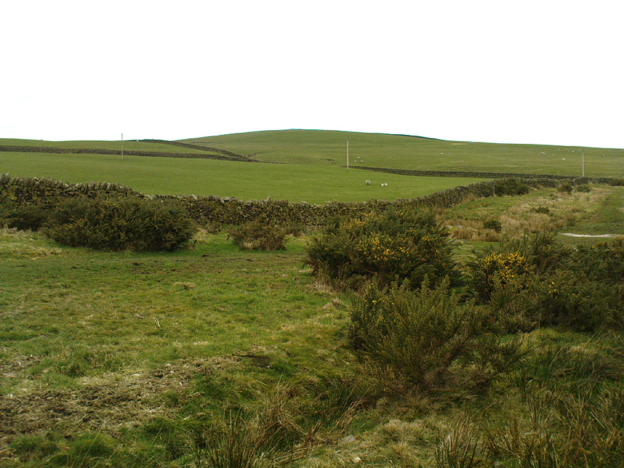
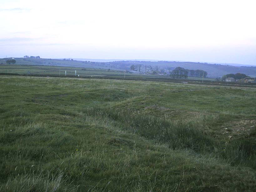
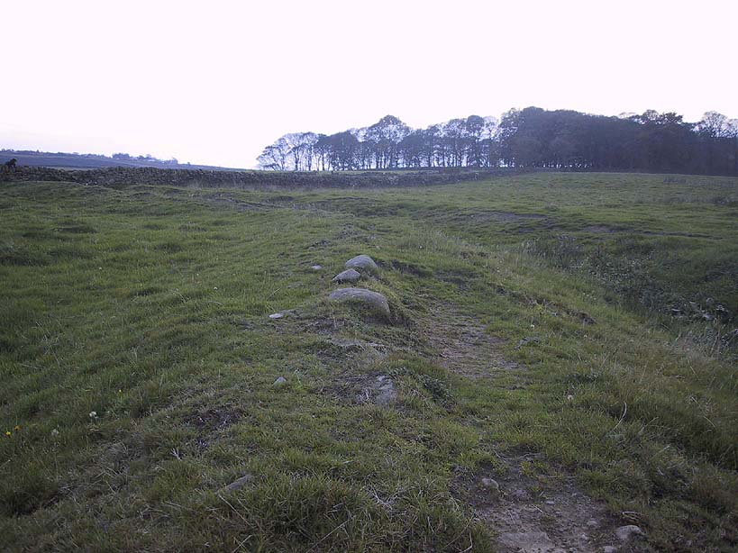
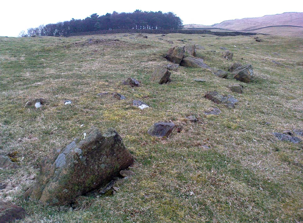
Horse Hill enclosure, looking west

This is an impressive site.  I’d say very impressive! (but I’m easily pleased)  Oddly however, I can’t find a damn thing about this place in any of my archaeo-records and it appears (as far as I’m aware) that no survey has ever been made of it.  Which is bloody incredible!  Indeed, the only archaeological notes that appear to exist about this very impressive and well-preserved Iron Age enclosure, states, “Subcircular enclosed settlement on Horse Close Hill 250m north of Horse Close Farm.”  That’s it!  Nothing else!  So I’m afraid you’ve only got my crappy description of it to go on for the time being…

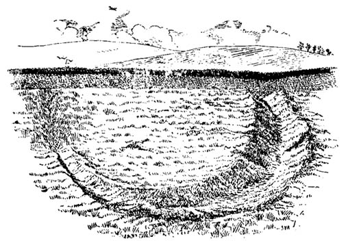
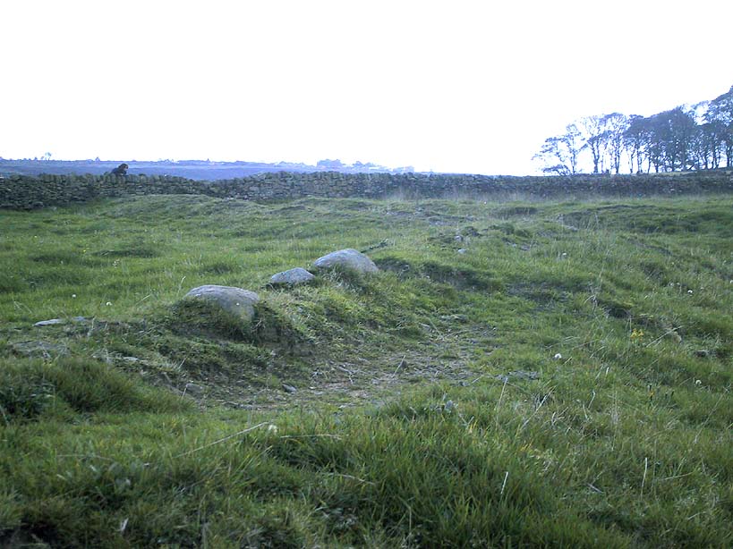
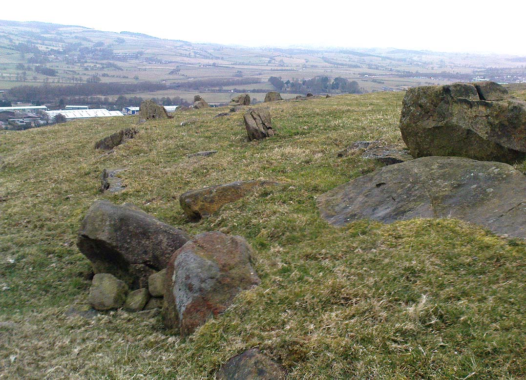
As the aerial image below shows, this is a large oval-shaped enclosure, defined primarily by an almost complete ring of double walling arranged around this hilltop site.  Measuring approximately 78 yards (71m) north-south, and nearly 75 yards (70m) along its longer east-west axis, with a circumference of about 235 yards (215m), many of the upright stones which define its edges stand between 1-3 feet in height.  Some of these stones have obviously been moved into position by the lads who built the structure, but the site has also taken advantage of a number of large earthfast boulders in its construction.

If you walk around the edges of the walled enclosure, almost every bit of it is clearly visible.  Between the defining inner and outer walling of the structure we find sections of the site packed with smaller stones, giving the impression that it may once have been filled all round, making the walls thick strong defensive ones.  But without a more detailed investigation, we’ll never really know…

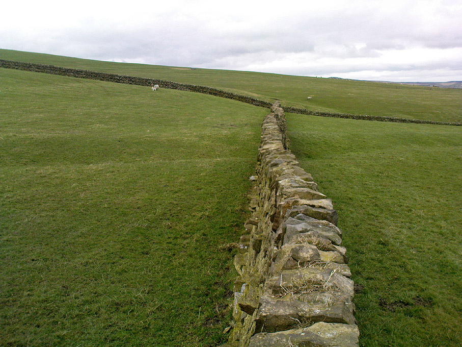
Horse Close settlement, looking NE
Aerial view of enclosure

It is clearly very similar in structure, and probably date, to the well-known Brackenhall circle on Shipley Glen, near Baildon (though the nature of the Brackenhall site has long been a topic of controversy).  And, as with the Brackenhall site, a number of cup-and-ring stones are found close by — including the Great Wood Laithe carving in the field immediately below on the west side.  I’ve also found a similar structure to this on the hills above Steeton, a few miles to the south (though it’s not as well-defined as this one).

Although the site is mainly defined by its oval walling, we also find other stretches of walling that run outwards from the central site: one in particular running northeast for 35 yards out towards a small standing-stone further up the field.  Other curious earthworks and remains scatter the fields on the eastern sides of this main feature, which the helpful farmer here pointed out to us.

© Paul Bennett, The Northern Antiquarian


Swinston Hill, Dinnington, South Yorkshire

Settlement:  OS Grid Reference – SK 5395 8460

Archaeology & History

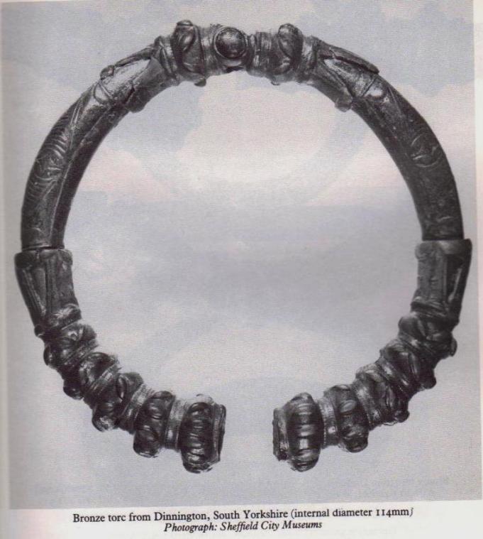
Bronze Torc found at site
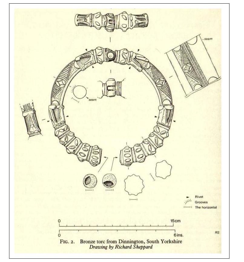
Details drawn by R.Sheppard

In August, 1984, a Mr James Rickett was out with his metal-detector, scanning the Swinston woodland area south of Dinnington, when he was fortunate to locate a superb, ornamental ‘Celtic’-design bronze torc, thought to be of Romano-British origin, and believed to have been made in either the 1st or 2nd century AD.  Following Mr Rickett’s discovery, a small team from the Sheffield City Museum and the South Yorkshire Archaeoloogy Unit got off their backsides and did a survey of the region where the torc had been found —and they weren’t to be disappointed!

An initial assumption based on place-name evidences led them to believe that a settlement of the Saxon period may once have been here; but their investigations

“located the earthworks of a sub-rectangular enclosure, 40m by 25m, and possible fields about 140m south of the discovery site (South Yorkshire SMR record no.PI3021).  The enclosure is sub-divided into a smaller and a larger compound with no surface evidence for ditches associated with the stony banks, which enclose a total area of about 0.1 hectares.  In both size and shape it compares closely with the class of very numerous small ditched enclosures… The origins of some may lie in the late Iron Age, but fieldwork and excavation have produced predominantly Romano-British material. Other local metal detector finds, some from this enclosure, include first- to fourth-century Romano-British material.”

References:

  1. Beswick, Pauline, Megaw, M.R., Megaw, J.V.S. & Northover, Peter, “A Decorated Late Iron Age Torc from Dinnington, South Yorkshire,” in The Antiquaries Journal, 70:1, 1990.

© Paul Bennett, The Northern Antiquarian


Catstones Ring, Harden, West Yorkshire

Earthworks:  OS Grid Reference – SE 0680 3808

Also Known as:

  1. Blood Dykes

Getting Here

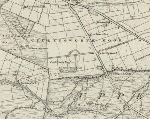
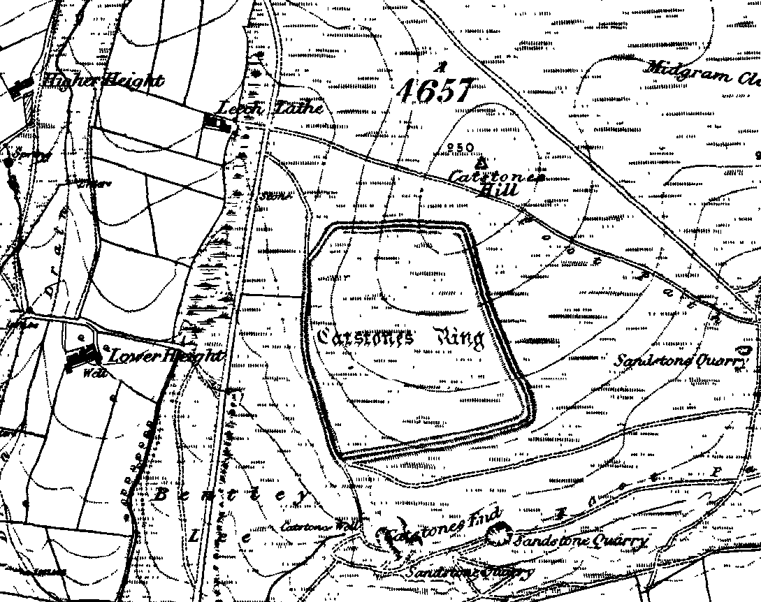
Catstones Ring on 1852 OS-map

Various ways here. From Keighley, go up the Halifax Road, first left after the Ingrow West train station, uphill, then up the long zizaggy road till you hit the pub at the crossroads.  Park up and walk along the road in front of the pub for 1-200 yards and look at the hill above you! Alternatively, from Bingley go up to Harden on the B6429 and literally just where the village ends, there’s a small right-turn (if you’re going past the fields on either side, you’ve just missed the turning!). Go up there till the road reaches the top and stop! Catstones Hill is in the heather over the wall on your left!

Archaeology & History

A somewhat anomalous earthwork site, with lots of archaeohistorical speculation behind it, but no firm conclusion as to its precise nature as yet.  Defined variously as an earthwork, an enclosure (for both people and cattle!) and a settlement by respective archaeologists over the years, there is little to be seen of the place on the ground and it doesn’t tend to bring raptures of delight to the common antiquarian. When William Keighley (1858) described this place, Catstones Ring was,

“enclosed on three sides by a considerable bank of earth, and bears evident marks of the plough. The country people believe it to have been an intrenchment or camp.”

Mrs Ella Armitage (1905) thought this site may have been “a prehistoric fort,” but said little more about it.  In the same year however, Mr Butler Wood (1905) gave us a much better account of the place, describing Catstones Ring as “the most striking earthwork in the neighbourhood of Bradford.”  His broader description told that:

“It encloses the crest and slope of a hill, and measures 266 yards on the east side (which is perfect), and 100 yards on the north side; the latter, however, being traceable at least 100 yards further across cultivated fields.  The south side is almost obliterated by quarries, while the western portion has disappeared altogether.  The fosse which surrounded this fine fortification is still visible on the eastern side.”

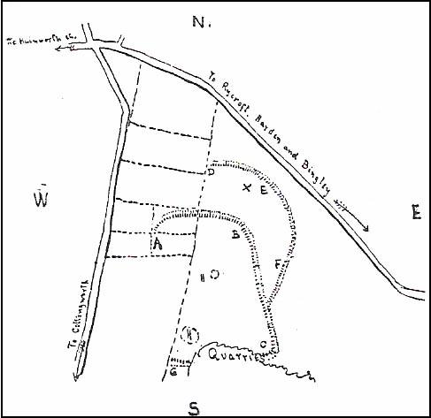
A couple of years later two short notes were made of the site in Forshaw’s Yorkshire Notes and Queries.  Peter Craik (1907) of Keighley described the dimensions of the main ring as being “110 x 320 yards (rough guess),” and he also described finding the remains of a cairn in the outer dyke section (marked as ‘X’ on Craik’s diagram, below).  On the nature of the site, he wrote:

“Catstones would appear to have been built as a defence against invasion from the south, for in contrast to the early defensible approach from that direction is the fact that to the  north lies the undulating expanse of Harden Moor, which for the most part is on a level with the ring, even the highest point in the immediate vicinity being without the main circle, though enclosed in a minor outwork.  The large extent of the ring makes it rather difficult to believe that enough men could be collected in the immediate neighbourhood to man the lines satisfactorily; and again as a shelter for cattle, etc, in time of war it does not appear to be well designed, for most of the interior would be commanded within easy range of arrows.  Certain old excavations exist within the ring; probably they were made in search of gravel or some such material, but is this conjecture certain?  Can they possibly mark the site of dwellings?”

J.J. Brigg (1907) followed up Craik’s short piece with the suggestion that the site was Roman in origin, saying:

“In showing the 6in map to Professor Bosanquet of Liverpool…he said there was no reason why it should not be Roman, merely because there is no masonry.  The Roman legions went into laager* every night, and it is quite possible that some very large body of soldiers halting there for the night might have thrown up an earthwork and planted thereon the stakes which they always carried with them for that purpose.”

But I think this is most unlikely.  Very little has been found here to give us a better idea of dates and function; and in a limited excavation here in 1962, no artifacts of any kind were located.  A little more recently, J.J. Keighley (1981) has suggested the site to be Iron Age in date, describing it as one of the most impressive sites of its kind in the region. The Catstones Ring is “a 6.5 hectare quadrangular ditched enclosure,” he wrote, which he thought had been much destroyed by the adjacent quarrying.

“Aerial photographs taken by the County Archaeology Unit in 1977 however, shows that the southeastern corner of the enclosure and parts of its southern ditch survived the quarrying. Villy (1921) observed an outwork to the north of the main enclosure, which was visible on aerial photographs taken in 1948, and the 1977 aerial photographs…show a possible annexe attached to the outside of the northeastern corner of the main enclosure.”

P. Craik’s 1907 drawing

This extended section of Catstones’ main earthworks were, in fact, first described in the article by Peter Craik (1907), as shown in the hand-drawn plan of the site here.  And in all honesty, virtually nowt’s been done since these early antiquarians diggings and essays.  The information from the present day Sites and Monuments Record says that the site is a “late prehistoric enclosed settlement” and that quarrying has destroyed much of the west side.

Folklore

Harry Speight (1892) reported the earthworks here to have been a site where a great battle once took place, between the local people and the early Scottish tribes.

References:

  1. Armitage, E., ‘The Non-Sepulchral Earthworks of Yorkshire,’ in Bradford Antiquary, New Series 2, 1905.
  2. Bennett, Paul, The Old Stones of Elmet, Capall Bann: Milverton 2001.
  3. Brigg, John J., “Catstones Ring,” in C.F. Forshaw’s Yorkshire Notes & Queries, volume 3 (H.C. Derwent: Bradford 1907).
  4. Craik, Peter, “Catstones Ring,” in C.F. Forshaw’s Yorkshire Notes & Queries, volume 3 (H.C. Derwent: Bradford 1907).
  5. Keighley, J.J., “The Prehistoric Period,” in Faull & Moorhouse’s, West Yorkshire: An Archaeological Survey to AD 1500 (WYMCC: Wakefield 1981).
  6. Keighley, William, Keighley, Past and Present, R. Aked: Keighley 1858.
  7. Speight, Harry, Chronicles and Stories of Old Bingley, Elliott Stock: London 1892.
  8. Villy, Francis, Some Intrenchments of Large Size in the Keighley District, Keighley 1908.
  9. Villy, Francis, “The Slag-Heaps of Harden,” in Bradford Antiquary, volume 6, 1921.
  10. Wood, Butler, ‘Pre-Historic Antiquities of the Bradford District,’ in Bradford Antiquary, New Series 2, 1905.

* a formation of armoured vehicles used for quick resupply or refueling.

© Paul Bennett, The Northern Antiquarian


Dun Chathach, Connel, Argyll

Hillfort: OS Grid Reference – NM 9674 3401

Also known as:

  1. Canmore ID 23261
  2. Dun Cathich

Getting Here

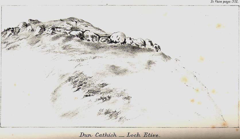
Dun Chathach (drawn by Miss J. Knox Smith 1885)

Go up from Oban on the A85, past Connel and towards Taynuilt, keeping your eye out for where the train-line crosses the road. Just before this is a small road on your left leading down to the sea, with the train line running parallel all the way down. Go right to the end and then look up to the rocky rise a coupla hundred yards on where the train line runs out of view round the coastal edge. That’s it!

Archaeology & History

When Scottish writer and historian R. Angus Smith (1885) first saw this, the close arrangement and size of the stones that make up the edges of this dun made him think this was actually a stone circle up here.  Sadly it wasn’t to be.  Following an examination of the site in 1969 by members of the Scottish Royal Commission (Argyll – Volume 2, 1975), they described Dun Chathach as,

“circular in plan…measuring 18.3 metres in diameter externally. The wall, which has been about 3.4 metres in average thickness, is now reduced to a low grass-grown stony bank, but considerable stretches of the outer face are still visible in situ. Many of the facing stones, which lie as much as 1.6 metres below the level of the summit, are of massive proportions, the largest measuring 1.4 metres by 1.3 metres and 1 metre high. It is uncertain which of the three gaps now visible in the wall indicates the site of the original entrance.”

Folklore

Legend has it that this was a hill of battles.  It was also said by R. Angus Smith (1885) to “have been used as one of a chain of beacons,” with the next fire on being lit upon a small hill nearer Connel called Tom na h-aire, ‘the mound of watching.’

References:

  1. Royal Commission on the Ancient & Historical Monuments, Scotland, Argyll- volume 2, HMSO: 1974.
  2. Smith, R. Angus, Loch Etive and the Sons of Uisnach, Alexander Gardner: London & Paisley 1885.

© Paul Bennett, The Northern Antiquarian

Studfold Ring, Ampleforth, North Yorkshire

Enclosure / Settlement:  OS Grid Reference — SE 58122 79855

Also Known as:

  1. Studford Ring

Getting Here

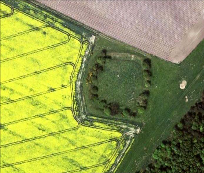
Studfold Ring from above

Pretty easy to find.  From Ampleforth town centre, go left at the T-junction and 100 yards on a footpath takes you up into the sloping fields above the town. Follow the footpath up (avoiding the fall into the small wooded valley on your left) and keep going across the fields. Follow the path towards the point of the woodland on the level, then walk along its edge until you see a rounded copse of trees on your left, with a surrounding ditch. You’ve found it! (if you hit the road, turn back & walk 100 yards)

Archaeology & History

Thought to have been first constructed in the late Bronze Age period, in 1963 R.H. Hayes described this site as being “the finest enclosure type of earthwork in the district,” telling:

“It is roughly quadrangular, some 54 yards across, rampart to rampart, with internal ditch 12ft wide and in places still 4ft in depth. The rampart is 24-26ft wide and 9-10ft high above the bottom of the ditch. It is of earth and rubble with an entrance 9ft wide on the ESE. One gets the impression that the central area is a araised platform above the level of the surrounding moor.”

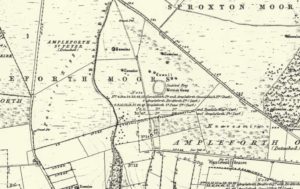
Studfold Ring on 1856 OS-map

At the time of Hayes’ description, conclusions about the purpose of this site were difficult. He drew parallels between this and two other sites in northeast Yorkshire: one on Great Ayton Moor and another near Borrowby on Newton Mulgrave Moor.

On the outside of the ‘enclosure’ he described “a curious turf (?) bank 6ft wide and 2ft high which curves around the tumuli to the northeast, following the ditch of one of them, thence to another mound 32ft in diameter north of the Ring, whence it turns due west and runs towards a dewpond in the junction of three turf walls,” finally adding, “It could be connected with ancient cultivation.”

According to Eilert Ekwall (1922), the name Studfold probably derives from,

“‘Stodfalod’, which is a common name for old Roman (or other) enclosures. The name indicates that the Anglo-Saxons often used such old enclosures for horsefolds.”

Place-name master A.H. Smith (1956) reinforces this and tells us the dates of this name are even later; describing,

stod-fald OE, ‘a stud-fold, a horse enclosure’; the word is often applied to ancient enclosures which the Anglo-Saxons used for horse-folds.”

Modern archaeo’s have added the etymologist’s notion of a ‘horse enclosure’ onto their summaries of the site in recent years.

…to be continued…

References:

  1. Ekwall, Eilert, The Place-Names of Lancashire, Manchester University Press 1922.
  2. Hayes, R.H. ‘Archaeology: Dikes and Earthworks,’ in J. McDonnell’s A History of Helmsley, Rievaulx and District, Stonegate Press: York 1963.
  3. Smith, A.H. English Place-Name Elements, II, Cambridge University Press 1956.
  4. White, Stanhope, The North York Moors: An Introduction, Dalesman: Clapham 1979.

Acknowledgements:  Huge thanks to Martin Dawes for correcting my initial erroneous route to the site.

© Paul Bennett, The Northern Antiquarian 


The Bastard, Campbeltown, Argyll

Hillfort / Dun:  OS Grid Reference – NR 7612 1220

Also Known as:

  1. Canmore ID 38722
  2. Dun Bastard

Getting Here

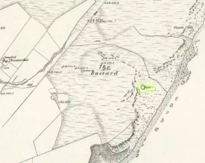
The Bastard on 1869 map

Pretty easy.  From Campbeltown, follow the coastal round south for about 8 miles, past the TV masts on the skyline and the hamlet of Feochaig, where you’ll see the large rounded hill on your left near the coast: that’s The Bastard!  Go onto the hill’s eastern sides and drop down the steep slope towards the large bend in the burn where its remains are on a ridge close to the cliffs overlooking the sea.  The ruins are pretty faint but if you scout around, you’ll find it.

Archaeology & History

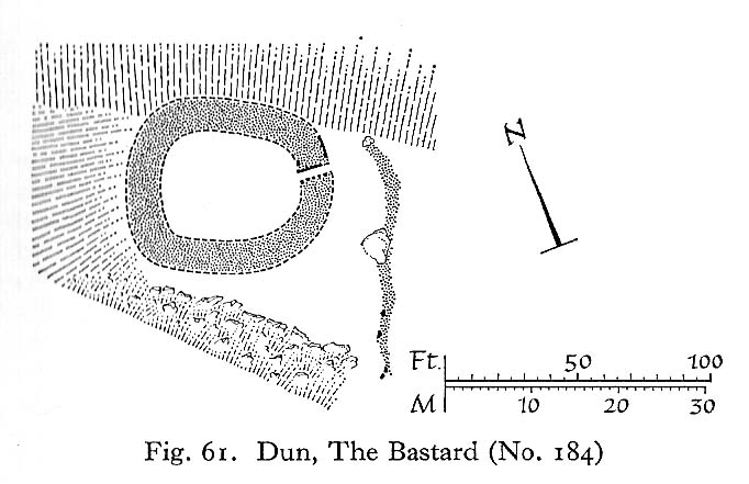
I couldn’t believe it when I found this one – so had to get the notes to the site and add what I could find!  When the fellas from the Scottish Royal Commission checked the place in 1960, they described,

“On a narrow shelf halfway down the east flank of the hill named The Bastard there are the remains of a dun…  Oval in plan, the dun measures about 15m by 12m internally and is entered from the east, where a stretch of the outer face is visible. Here the wall is 4m thick on either side of a straight passageway, 0.9m wide, which exhibits no trace of door-checks.”

The Bastard (RCAHMS 1971)

There are other remains a few yards to the southeast of the main structure which are thought to be “remains of an outer wall…about 1.2m in thickness, which has been drawn across the shelf to provide additional protection for the entrance”, more probably from the weather conditions than invasive incoming humans.

To the immediate north we have a mythic-sounding Giant’s Seat (just above the natural arch) and west is the abode of the fairy folk – but I aint checked out the tales behind them yet.

References:

  1. Royal Commission Ancient & Historic Monuments, Scotland, Argyll – Volume 1: Kintyre, HMSO 1971.

© Paul Bennett, The Northern Antiquarian


Caratacus Stone, Winsford, Somerset

‘Standing Stone’:  OS Grid Reference – SS 8896 3355

Getting Here

You can’t really miss this.  Take the road south from Winsford, up the steep hill onto the moors and before you reach the crossroads, look up across the slope on your left where you’ll see a small building on its own.  Go there!

Archaeology & History

A curious upright monolith more than five feet long (though some of this is embedded in the ground) with the words ‘CARAACI NEPVS’ carved on one side, is strangely closetted in a silly ‘house’ of its own on the moortops!  But the origins and history of the stone are contentious.  Some proclaim it as prehistoric, others Romano-British, and others as being from the Dark Ages.  In the 1960s and ’70s, archaeological tradition had its origins in the Romano-British period, and certainly the carved lettering on the sides of the stone seem to indicate a Roman provenance; but as the great Exmoor historian S.H. Burton (1974) told,

“It is possible that the stone was erected hundreds of years before it was inscribed, and the existence of an ancient trackway alongside, leading to the Barle, strengthens this possibility.  But, like most things about the Caratacus Stone, this is guesswork.”

We know it stood here in the 13th century as it was described in perambulation records of 1219 and 1279 AD; but it’s more than likely to be a monolith erected in the Dark Ages.  Grinsell (1970) however is a little more cautious, telling:

“The likelihood of the person in whose memeory this stone was raised claiming kinship with the Caratacus who was the arch-enemy of Rome, c. AD 45-50, has on more than one occasion been questioned.  It is, however, too tempting to be abandoned by the present writer.”

The carving on the stone was deciphered by the legendary Prof. John Rhys at the end of the 1800s, telling it to have been Carataci Nepos, the Kinsman of Caratacus (and variants thereof), who held out against the Romans in south Wales until AD 50.  The old Celtic writer, R.A.S. Macalister, thought the stone to have been dedicated to a local christian hero, St. Carantoc, but this notion has been generally dismissed.

Folklore

The old stone is said to be a site where buried treasure exists — though none has ever been found.  There is also an old tradition that “ghostly horses and waggons rumble towards the stone at midnight” — but this as likely relates to its proximity with the old crossroads a short distance away.

References:

  1. Burton, S.H., Exmoor, Hale: London 1974.
  2. Grinsell, L.V., The Archaeology of Exmoor, David & Charles: Newton Abbot 1970.
  3. Page, John Lloyd Warden, An Exploration of Exmoor and the Hill Country of West Somerset, Seeley 1890.
  4. Vowles, Alfred, History of the Caratacus Stone, privately printed 1939.

© Paul BennettThe Northern Antiquarian


Holed Stone, West Overton, Wiltshire

Enclosure & Stone:  OS Grid Reference – SU 1285 7151

Aerial image of site

Getting Here

Follow the same directions to reach the Polisher Stone at the top-end of Overton Down as it meets Fyfield Down. From here, walk down the slope for 100 yards or so where you’ll notice, just above the long grassy level, a line of ancient walling running nearly east to west.  It’s very close to the yellow marker in the attached aerial image shot to the right. If you walk along this line of walling you’ll find it.

Archaeology & History

Overton’s Holed Stone

As I’ve only been here once, and briefly — under the guidance of the Avebury expert Pete Glastonbury — my bearings on this site may need revising.  There are two distinct sections of walling here: one has been excavated by Peter Fowler and his team; the other hasn’t. (correct me if I’m wrong Pete)  And in Fowler’s (2000) fine survey of this area he does not describe this very distinct holed-stone in the line of walling, or adjacent “linear ditch F4”, as it was called.  But then, many archaeologists don’t tend to find items such as these of any interest (unless their education stretches to other arenas, which isn’t usually the case). But the stone seems to be in a section of walling that isn’t in their survey; standing out in aerial imagery as a less well-defined, but still obvious line of walling that is closer to the fence, 70-80 yards north, with a decidedly Iron-Age look about it!

But, precision aside! — as you can see in the photos, the holed stone here isn’t very tall — less than 2 feet high; though we don’t know how deep the stone is set into the ground.  This spot is on my “must visit again” list for the next time we’re down here!

Folklore

Veritable vagabonds, Mikki, June, PeteG & Geoff, readying themselves for fertility rites!

There’s nowt specific to this stone, nor line of walling, nor settlement (as far as I know), but it seems right to mention the fact that in British and European folklore and peasant traditions, that holed stones just like the one found here have always been imbued with aspects of fertility — for obvious reasons. Others like this have also acquired portentous abilities; whilst others have become places where deeds and bonds were struck, with the stone playing ‘witness’ to promises made.

References:

  1. Fowler, Peter, Landscape Plotted and Pierced: Landscape History and Local Archaeology in Fyfield and Overton, Wiltshire, Society of Antiquaries: London 2000.

© Paul Bennett, The Northern Antiquarian


Black Hill Enclosure, Middleton Moor, North Yorkshire

Enclosure:  OS Grid Reference – SE 11757 51949

Getting Here

Just below Black Hill in the Middleton Moor Enclosure, little more than 10 yards east of the footpath on the east side of Loftshaw Gill, the slope drops down and into a slight ‘bowl’ in the landscape.  Here it is!

Archaeology & History

This is a previously undiscovered prehistoric settlement, enclosure, or something along those lines!  We came across it in April 2005 and is found amidst the mixed heather and bracken and has a scattering of small stones, as if in the wake of a dried stream from bygone times.  But whatever stream might once have been here, it’s long since fallen back to Earth — but at a point where a few rushes (Juncus conglomeratus) can be seen we find the aged remains of a large oval enclosure.

Similar in form to the other remains located up here by Eric Cowling (1946) in the 1930s and ’40s, when Richard Stroud and I first found this, structural remains of distinct lengths of walling were visible – but once the vegetation started growing back here again, it was almost impossible to discern.

Faint remains of enclosure walling

The main archaeological remains comprises of an oval-shaped structure, with what seemed liked a distinct Bronze Age note stamped on the walling — though it could be earlier, but without excavation it’s impossible to say. Most of the walling was just above ground-level, making it difficult to appreciate in the photo. It measures approximately 40 feet north-south and 33 feet east-west. The walling itself averages between 18-24 inches wide and was no more than one-foot tall at the highest.  Near the middle of the enclosure there were further sections of walling indicating different ‘rooms’ in the overall structure of things here.

Like I say, we unfortunately couldn’t get a decent image of this site cos the vegetation was already covering it up. So if you wanna see it, gerrup there soon after the heather burning’s been done here — otherwise it’s gonna be at least another year before you getta chance to see anything.  In Richard Stroud’s photo here, you’re looking at the bottom curve of the enclosure. You can just make out the line of walling near the centre of the picture, and two-thirds the way to the right you can see the enclosure wall curve closer to the bottom of the photo. (the site obviously requires a much better assessment from someone far more competent than me!)

References:

  1. Cowling, E.T., Rombald’s Way, William Walker: Otley 1946.

© Paul Bennett, The Northern Antiquarian


The Polisher, West Overton, Wiltshire

‘Standing Stone’:  OS Grid Reference – SU 12828 71508

Also Known as:

  1. OD II (Fowler)
  2. Parsons Penning Stone
  3. The Polissoir

Getting Here

The Polisher at rest

We were graciously guided to this spot by local archaeological authority, Pete Glastonbury — which is good, cos otherwise it’d have probably taken us all day to find the damn thing!  Best way to get here is out of the Avebury circle, east, up for about a mile up the Herepath or Green Street till you hit the ancient track of the Ridgeway.  Turn left and walk up the gentle slope for another 350 yards or so, then note the footpath on your right.  Go down the slope for about 150 yards, keeping your eyes peeled for the smooth rock with the slits in it, not far from the Holed Stone!

Archaeology & History

Although classified on the Wiltshire Sites & Monuments Record as an “unclassified feature,” this is one of a number of whetstones (as we call ’em up North) that feature in various settings in and around the Avebury region: literally, a rock used for sharpening axes, daggers and other metallic artifacts. First rediscovered in the spring of 1963 by a Mr Inigo Jones when he was out exploring the many rocks hereby for rare lichens and any more cup-markings like the one at nearby Fyfield Down, the site we see today is merely a long piece of stone with five or six long lines or grooves cut into the top-end, along which the ancient weapons and tools slid and cut into the rock, sharpening them.

It was thought until recently that this was the prime function of this stone; but following excavation work done here by Pete Fowler and his team in 1963, it seems that the stone actually stood upright!  Digs were made on three sides of the stone and some earlier disturbance seemed apparent:

“The material appeared to be redeposited on top of an earlier ground surface, inferentially of medieval or earlier date.  At the north end of the sarsen bench, the lip of a pit or trench was partly excavated.  It showed clearly in plan as a feature dug into the top of an undated surface level with the disturbed top of the clay-with-flints; it was filled with flinty, clayey humus similar to that through which it was cut.  In the top of that fill was a heavily weathered sarsen, c 0.6m by 0.45m, and a cluster of smaller, broken sarsen stones.  The hole was at least 0.45m deep, its bottom as excavated marked by an increase in the density of flints.  The evidence, though incomplete, suggested very strongly that the feature was part of a hole dug to take the pollisoir as an upright stone.” (my italics, Ed)

In the same dig, a medieval coin of King John (1199-1216) and the remains of a medieval horseshoe were found beneath the stone, giving Fowler and his team the notion that the stone had been split and pushed over at this period.  Consistent evidence of activity from the neolithic period onwards was expected and found here.

In Lacaille’s (1963) original description of the site, he gave a most accurate description of the dimensions of the stone and its incisions.  Highlighting its proximity to a cluster of other stones, as well as being close to a wide ditch, Lacaille’s measurements were thus:

“From 1ft (0.31m) above ground at its south end the regular surface of the sarsen slopes to the grass, its main axis being aligned about 15° west of the true north and south line.  In length the stone measures 5ft 6in (1.68m) above the grass, and 2ft 10in (0.86m) in width.

“Closely grouped in the south-eastern corner of the sarsen there are six hollows.  In plan the largest and southernmost is of long elliptical shape, 1ft 8in (0.5m) long and 9in (0.23m) at widest and 1in (0.0254m) deep.  From its wider end near the eastern long margin there protrudes a short groove.  Beside this, and curving slightly inward, there is another groove, 1¼in (0.028m) wide and ½in (0.013m) deep.  It is as long as the large basin-like cavity.  Next to it there runs one of similar length and width, but of only half the depth.  In turn, a third groove, ½in (0.013m) wide, 1ft 8in (0.5m) long, has been worn at right angles to the long edge but to a much deeper hollow than its companions.  At 2in (o.051m) to the north a lesser version of the main basin occurs.  Like this it measures 1ft 8in (0.5m) in length, but is only 2¼in (0.058m) wide and ¾in (0.016m) deep.  Vague in places over its interior length of 10in (0.25m), but attaining a maximum width of 1¼in (0.028m), a last hollowing shows faintly at both ends and nowhere deeper than 1/8in (0.0032m).”

The Polisher & its marks
Celoria & Lacaille’s 1963 drawing of the stone

It appears that this fallen standing stone was being used to sharpen knives and axes whilst it stood upright and, in all probability, as a result of this ability would have been possessed of magickal properties to our ancestors.  Metalwork was an important province of shamanism and smiths, whose practices were deeply enmeshed in the very creation of mythical cosmologies.  Hence, the simple act nowadays of sharpening metal tools onto rocks would not have been a mere profanity to the people who came and used this stone to re-empower their weapons, but would have been entwined within a magickal cosmology.  The spirit inherent in this stone would likely have been named and recognised.  Today it is forgotten…

It also seems that this standing stone was part of some ancient walling.  Aerial views clearly show it along the line of some sort of enclosure that runs down the slope, along the bottom and back up and around.  In the same stretch of this enclosure walling we find the Holed Stone a little further down the slope.  And holed stones, as any student of folklore and occult history will tell you, have long-established magickal properties of their own…

References:

  1. Fowler, Peter, Landscape Plotted and Pierced: Landscape History and Local Archaeology in Fyfield and Overton, Wiltshire, Society of Antiquaries: London 2000.
  2. Grigson, Geoffrey, The Shell Country Alphabet, Michael Joseph: London 1966.
  3. Lacaille, A.D., ‘Three Grinding Stones,’ in Antiquity Journal, volume 43, 1963.
  4. Watts, Ken, “Fyfield and Overton Downs, Wiltshire: A Prehistoric and Historic Landscape,” in 3rd Stone, no. 33, January-March 1999.

Links:

  1. The Polisher – on The Megalithic Portal

© Paul Bennett, The Northern Antiquarian