Lady’s Well, Kincardine, Ross & Cromarty

Holy Well (lost):  OS Grid Reference – NH 6072 8954

Archaeology & History

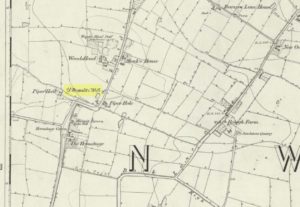
Site shown on 1879 map

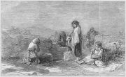
First highlighted on the 1879 Ordnance Survey map, information on this site is sparse, save for those reliable Statistical Accounts and Name Books, which simply give us its location.  The only context that our Old Statistical lads gave us was its relationship and proximity to a castle, “the most ancient residence” of the Clan Ross Highland Chiefs which could “be seen in a beautiful field between the church and the sea side.”  At the end of this field is “a steep bank, hanging over the sea at high water called the ‘Bank of the Gate’, and at the bottom there is a spring of excellent water, called the Lady’s Well.”

The water’s dedication to Our Lady was obviously grafted onto it by those in the church above, glossing over, no doubt, earlier dedications by local people, whose practices seem to have been lost.  The site was included in the regional Name Book of the Ordnance Survey doods who, it seems, merely copied the notes about the place from the old Statistical Account.  In what seems to have been their last visit, no trace of the well was evident.  They concluded it “was under water at time of visit.”

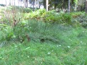
It would be good to hear from local folk if this sacred site can still be found at the tree-line just above the sea, or whether Nature has taken it away from Her animals.

References:

  1. Gallie, Andrew, “Parish of Kincardine,” in Statistical Account of Scotland – volume 3 (edited by John Sinclair), William Creech: Edinburgh 1792.

Acknowledgements:  Big thanks for use of the early edition OS-map in this site profile, Reproduced with the kind permission of the National Library of Scotland

© Paul BennettThe Northern Antiquarian

Organn Well, Pontefract, West Yorkshire

Healing Well (destroyed):  OS Grid Reference – SE 45 21

Archaeology & History

The waters of the once-renowned Organn Well goes down in history as being one of the first wells in Britain whose waters were used in a town pump.  Written minutes from an early council meeting described how people gathered in the market place to discuss the objective of making such a pump in the times of Queen Elizabeth 1, in 1571.  It was completed a year later and, some 450 years on, this old relic can still be seen.  The Well used to be found off Penny Lane (now Wakefield Road), some 4-500 yards to the southwest and as such it’s exact position has been difficult to locate.  But the fact that the waters were piped such a distance strongly suggests that the water supply from the Well was damn good – and most probably damn refreshing too!  The old charter told us, in that wonderfully dyslexic manner of the period,

…that a conduit in the Markett Place with lead pipes leading to water from Organ Well to the said conduit shall bee cleansed and repayred at the charge and contribution of severall inhabitants of the Towne and espetially by those that fetch water from the same conduit. And according to the auncient custome of the said Towne, whoe shall not beare theire p’t of the chardge p’portionable to what water they from the same at the discretion of the Majo’ for the time being and his brethren shall be debarred from the benefitt of the said conduit except they shall be poore people.  And likewise that none shall receive any water from the said conduite for to brewe or steep barley w’thall at such time or times as others have need the same for meat water and water to washe w’hall, but onely at such times as there is water to spare over and besides what is convenient for meat and washing.”

More than two hundred years later the water pump was in dire need of attention, as George Fox (1827) told:

“Being in a ruinous state about the year 1810 and the supplies of water being insufficient for the public use; a clause was inserted in the act of parliament… wherein the pump, its pipes, and all other appurtenances belonging to it were vested in the power of the commissioners of the streets, who where bound to see it kept in proper repair.”

And so the water from the Organn Well continued to supply the townsfolk.

The etymology of this well—along with another of the same name near Harrogate—truly puzzled me for a long time; that was until I came across, quite by accident, records from early texts on herbalism.  As a result, it seems very likely that it derives its name from the old English ‘organe,’ which, according to Stracke (1974) and others relates to both varieties of the indigenous herb marjoram (Origanum vulgare and O.marjorana) — a grand medicinal plant that’s pretty common in northern England (I used to go out gathering it each year in my younger days).  There were obviously profuse supplies of this herb growing in and around the well and, as all good herbalists will tell you, when they grow by an old spring or well, their medicinal properties are much better than normal.  The waters and the plant obviously had a good symbiosis; or, as the old women who’d collect the waters and the herbs in days prior to the pump would have told us, “the spirits of the water here are good”…

References:

    1. Fox, George, The History of Pontefract in Yorkshire, J.Fox: Pontefract 1827.
    2. Padgett, Lorenzo, Chronicles of Old Pontefract, Oswald Homes: Pontefract 1905.
    3. Stracke, J. Richard (ed.), The Laud Herbal Glossary, Rodopi: Amsterdam 1974.

© Paul BennettThe Northern Antiquarian

St. Ann’s Well, Welton, East Yorkshire

Holy Well:  OS Grid Reference – SE 9622 2709

Archaeology & History

Shown on the early 25-inch-to-the-mile Ordnance Survey map of the area, this is a frustrating site.  In Thompson’s (1870) early history of Welton village, he says very little about this place, other than:

“Then there is Saint Ann’s Well, which supplies Welton House with spring water.”

Site shown on 1890 map

Even worse is the fact that in William Smith’s (1923) survey of East Yorkshire holy wells, he merely copies Thompson; and in Jeremy Harte’s magnum opus he does exactly the same thing!  Not good.  Thankfully the local artist and singer, Gaynor Perry, helped us out big time!  She grew up in this area and used to play here when she was young, but at the time she had no idea that the well where she’d played had any magical traditions attached to it.  This discovery happened many years later.  Regarding the present condition of the well (as of 2017), she told:

“The well has been covered with stone slabs for a long time (and) a tree has tried to grow over it.  It has been sheltered here over the years in the grounds of Welton House, a large estate which was demolished in 1952.”

The well can still be seen in the small copse of trees immediately north of St Anne’s College.  There is the possibility that this holy well gave its name to the village of Welton itself.  First mentioned in 1080 CE, the place-name means “the well near the farm,” (Smith 1937) although there is no direct linguistic association with St. Anne, so we don’t know for sure.

Folklore

St. Anne is a curious saintly figure and one of my personal favourites.  St Anne (saint’s day – July 26) was a giant in early christian and Islamic myths.  An apocryphal figure, She was the Great Mother of the mother of Christ—the Virgin Mary—and was Herself a Virgin until, in Her old age, after seeing a bird feeding a chick, decided She wanted a child and so eventually gave birth to Mary.  An old woman giving birth when the Springtime appears (when birds and other animals become fertile) is the same motif found in the lore of the Cailleach in Ireland and Scotland (and parts of northern England).  A pre-christian mythos was obviously at play here in bygone times…

References:

  1. Harte, Jeremy, English Holy Wells – volume 2, HOAP: Wymeswold 2008.
  2. Smith, A.H., The Place-Names of the East Riding of Yorkshire and York, Cambridge University Press 1937.
  3. Smith, William, Ancient Springs and Streams of the East Riding of Yorkshire, A. Brown: Hull 1923.
  4. Thompson, Thomas, Researches into the History of Welton and its Neighbourhood, Leng & Co.: Kingston-upon-Hull 1870.

Links:

  1. Gaynor Perry:  St Anne’s Well

© Paul BennettThe Northern Antiquarian

St. Ann’s Well, Harrogate, North Yorkshire

Holy Well (lost):  OS Grid Reference – SE 298 548

Archaeology & History

Very little is now known about this sacred site that was once found “a few hundred yards east from the New Church at Low Harrogate.” (Hunter 1830)  Even most of travellers and medical experts who wrote about the numerous Harrogate wells in the 18th and 19th century bypassed its quietude; and by the time Mr Hunter wrote about it in his great descriptive catalogue, its healing or medicinal qualities had been forgotten.

He told that “the spirit in the water…or that with which it is infused, has long been most actively engaged in adding real or fancied comforts to the (Harrogate) Fair, and is now in much more general use” than the two other holy wells in the town. It was, he said, “the best water for making tea and more extensively used for that purpose than any in the neighborhood of Harrogate.”  It would also appear to have been built over at some time in the not-too-distant past…

Folklore

St Ann (saint’s day – July 26) was a giant in early christian and Islamic myths.  An apocryphal figure, She was the Great Mother of the mother of Christ—the Virgin Mary—and was Herself a Virgin until, in Her old age, after seeing a bird feeding a chick, decided She wanted a child and so eventually gave birth to Mary.  An old woman giving birth when the Springtime appears (when birds and other animals become fertile) is the same motif found in the lore of the Cailleach in Ireland and Scotland (and parts of northern England).  Pre-christian lore at this old well would seem evident here.

References:

  1. Hunter, Adam, The Waters of Harrogate and its Vicinity, Langdale: Harrogate 1830.

© Paul BennettThe Northern Antiquarian

St. Tredwell’s Loch, Papa Westray, Orkney Isles

Sacred Loch:  OS Grid Reference – HY 495 509

Folklore

I’ve already added a site-profile of the standing stones that used to be close to this loch, and added to it the folklore below; but I realised that for students of water-lore, a separate profile for the loch itself is needed.  For those of you who are not into water-lore, I hope you can forgive this repetition.

The loch, its associated chapel and the standing stones were visited at the end of the 17th century by John Brand, who gave a good account of the rituals performed by local people at the time.  They regarded the waters here as very special indeed, with great medicinal powers.  The loch had sense of sacrality whose nature was intimately tied to the repetition and regeneration of the seasons, valorizing the healing function of the waters.

By the edge of the loch stood St Tredwell’s church, outside of which was a cairn of stones.  When people visited here to be cured of their various ailments, they would pick up one of them and cast it into the loch as an offering (some folk would cast money), so that its waters would heal their illness.  According to Mr Brand and the local minister, such cures were numerous.  The narrative is truly fascinating.  Brand told us that,

“nigh to the east end of which this chapel is, is held by the people as medicinal, whereupon many diseased and infirm persons resort to it, some saying that thereby they have got good; as a certain gentleman’s sister upon the isle, who was not able to go to this loch without help, yet returned without it; as likewise a gentleman in the country who was much distressed wifh sore eyes, went to this loch, and washing there became sound and whole, though he had been at much pains and expense to cure them formerly.  With both which persons he who was minister of the place for many years was well acquainted, and told us that he saw them both before and after the cure.  The present minister of Westra told me that such as are able to walk, use to go so many times about the loch as they think will perfect the cure, before they make any use of the water, and that without speaking to any, for they believe that if they speak this will marr the cure: also he told that on a certain morning not long since he went to this loch and found six so making their circuit, whom with some difficulty he obliging to speak, said to him they came there for their cure.”

For the curing of sore eyes, the loch was specifically resorted to at Easter and during Lent.  Traditions such as these are found at other lochs in Scotland and at lakes in many other parts of the world.

Another interesting feature related to the element of Kingship; for the waters of the loch were said to turn red when anything important was going to happen to a member of the royal family.

St Tredwell herself—also known as St. Triduana—has her saints day on October 8.

References:

  1. Banks, M. MacLeod, British Calendar Customs: Orkney and Shetland, Folk-lore Society: London 1946.
  2. Black, G.F., Examples of Printed Folk-lore Concerning the Orkney and Shetland Islands, Folk-Lore Society: London 1901.
  3. Brand, John, A Brief Description of Orkney, Zetland, Pightland Firth and Caithness, George Mosman: Edinburgh 1701.
  4. Eliade, Mircea, The Sacred and the Profane, Harcourt: New York 1959.
  5. Fergusson, Robert M., Rambling Sketches in the Far North, Simpkin Marshall: London 1883.
  6. MacKinlay, James M., Influence of the Pre-Reformation Church on Scottish Place-Names, William Blackwood: Edinburgh 1904.

© Paul BennettThe Northern Antiquarian

Chapel Well, Berryhill, Bankfoot, Perthshire

Holy Well (destroyed):  OS Grid Reference – NO 02179 34749

Also Known as:

  1. Beltane Well
  2. Canmore ID 27045

Getting Here

The reeds mark the spot

I accessed the site by parking up at Little Tullybelton, walking up the hill and crossing into the field on the left just north of the wood, then walking due west (crossing barbed wire fences) until dropping down into the valley of the Ordie Burn and following the track into the wood, then, noting where the burn crosses south of the old stone wall. The site of the well is marked by some tussocks of cotton grass. Don’t confuse with a patch of nettles and docks 2-300 hundred yards east where you enter the wood.

Archaeology & History

This well was destroyed about 170 years ago and the site of it is quite hard to find as the land has been turned over to forestry. It was near a chapel and burial ground that were also destroyed by the farmer of the time. The old wall formed part of the boundary of the detached portion or enclave of the neighbouring parish of Methven.

The Reverend Thomas Nelson, Minister of the Parish of Auchtergaven, has this to say in the New Statistical Account of 1845:

‘Superstition formerly invested St Bryde’s, and Chapel Well, and perhaps some others, with a sacred character, and made then places of resort for pious purposes.

‘On the south march of Berryhill Farm, in the same lands of Tullybeagles, there is the site of.. a chapel, where there was a burying-place, where human bones have been recently dug up; and, till of late, the people in the neighbourhood used, on the first Sabbath of May, to drink out of the Holy Well there. This sacred place is on the banks of the Ordie.’

The OS Name Book has the following entry regarding the Well:

‘The site of a Holy Well which has been traditionally associated with the adjacent chapel. The water of this well is now carried by a covered drain into the adjacent stream, and the well filled in‘.

And this regarding the Chapel:

‘The site of an ancient chapel on the north bank of the Ordie Burn, the chapel was demolished and the graveyard rooted up some years ago by the present tenant of the farm, who has pointed out the site, the dedicatory name is not known‘.

Site shown on 1867 map
Ancient track to chapel & well

I could find no evidence of the culvert which discharges the waters of the Well into the Burn. What does seem to have been missed is the survival of part of the ancient sunken roadway or pilgrim path to the site, which is still clearly visible.  The fact that it was visited by locals on the first Sabbath in May would point to it having originally been a Beltane well, and therefore of pre-Christian origin.

References:

  1. The New Statistical Account for Auchtergaven, Perthshire, 1845
  2. Ordnance Survey Name Books for Perthshire, 1859-6

© Paul T Hornby 2018


St. Oswald’s Well, Winwick, Cheshire

Holy Well:  OS Grid Reference – SJ 6072 9408

Folklore

St Oswalds Well on 1849 map

In the old Hundred of West Derby in what was once Lancashire (them there political types shifting boundaries for their own greasy deeds) still remains to this day the trickling remains of old Oswald’s sacred spring, close to the Hermitage Green, which is thought to have gained its named after just such a hermit living hereby and who, no doubt, frequented or looked after this holy well for both refreshment and spiritual sustenance.

Named after the once-pagan King of Northumbria — who was later patronized and regressed to the cultus of a saint — the well was said to be close to an ancient palace, which was later moved when the King regressed into christendom.  The well itself was said to have been created through the tradition that the very Earth here possessed healing powers so renowned that people came from many miles to collect and take it for its sacred and medicinal qualities.  In Henry Taylor’s (1906) magnum opus he told:

“A writer in The Antiquary twenty years ago (vol.3, p.261) described it as having a very modest appearance for so famous a spot, looking merely like a hole into the hillside.  The writer goes on to say, “Passing through a small cottage garden, a well-trodden path leads to the well, which is merely a fosse, as described by Bede, and, situated as it is at the bottom of a tolerable declivity, derives its supply from the drainage of the upper ground rather than from any spring.  The water is not very bright, but the well is substantially walled inside, and two or three deeply worn steps lead to the water.”

“The Venerable Bede gives an account of numerous miracles which took place at St. Oswald’s Well.  He says: “After which period Oswald was killed in a great battle by the same Pagan nation and Pagan King of the Mercians who had slain his predecessor Edwin at a place called in the English tongue Maserfield in the 38th year of his age on the 5th day of the month of August.  How great his faith was towards God, and how remarkable his devotion, has been made evident by miracles since his death; for in the place where he was killed by the pagans…infirm men and cattle are healed to this day.  Whereupon many took up the very dust of the place where his body fell, and putting it into water did much good with it to their friends who were sick.  This custom came so much into use, that the earth being carried away by degrees, there remained a hole as deep as the height of a man… Many miracles are said to have been wrought in that place, or with the earth carried from thence; but we have thought it sufficient to mention two, which we heard from our ancestors.””

References:

  1. Taylor, Henry, The Ancient Crosses and Holy Wells of Lancashire, Sherratt & Hughes: Manchester 1906.

© Paul Bennett, The Northern Antiquarian


Shorey Well, Burnley, Lancashire

Healing Well:  OS Grid Reference – SD 844 330

Also Known as:

  1. St. Audry’s Well
  2. Whitaker’s Well
  3. Whittaker’s Well

Archaeology & History

Shorey Well, Burnley (T.Ormerod, 1906)

Recently a good turn of fortune has brought about the discovery of a number of previously unpublished manuscripts detailing a number of prehistoric remains, holy wells and old stone crosses that existed in and around east Lancashire, Burnley, Cliviger and Todmorden.  Many of these papers are the all-but-lost writings of historian and antiquarian Clifford Byrne of Nelson.  Having never previously been published, I think his works deserve greater attention and so I’ll be slowly, gradually, sticking them on the internet and give them the wider audience they deserve.  Not all of his notions are necessarily accurate, but the extent of this mans local history knowledge on the sites he describes in his essays is considerable.  The following is his short essay—with minimal editing—on this all-but-forgotten site:

“Shorey Well, or rather its stone housing, was originally situated in the bank of the River Brun slightly upstream of the parish church at Burnley, at a spot now within the grounds of the Burnley Technical College.  From within the stone housing issued the spring proper, which then ran down the brookside into the river.

“From time immemorial until the late 19th century, Shorey Well supplied part of the town of Burnley with its drinking water, then the water was impounded into a pipe and the stone housing removed to a place of safety.  This housing was thought by our Victorian forebears to have sufficient merit to save it for posterity, and this act I feel implies more than a certain interest in the old stones which I suggest the movers of the Well probably did not themselves fully understand, and it is with this concept that I hope now to deal.

“The present location of the stones of Shorey Well is in the little triangle of greenery outside Prestige Ltd at Burnley.  This spot is bounded on Colne Road and Bank Parade.  Behind it squats the base of Burnley Market Cross and the remains of the stocks with — a little to one side — the shaft of the Godley Lane Cross standing out of a huge square pedestal.

“An old map in Burnley Library shows Shorey Well in situ with a well-defined row of stepping stones crossing the river directly in front.  This line of stones went to the site of a still existing property called Shorey Fold — a spot that was probably once called St. Audry’s Fold, as we shall see.

“Godly Lane Cross is an Anglo-Saxon monolith with a somewhat damaged head.  This damage was probably done around the time of the Reformation in the 16th century, when the anti-Catholic movement was at its height.  The name Godly implies a god-like, or god-inspired or religious tone to the area, and Godly Lane — now Ormerod Road — certainly lived up to its name for there stood the parish church, the Cross itself, the Market Cross, another cross dedicated to a priest in the 16th century and now standing in the rear of Townley Hall, “Foldy’s Cross”, with nearby Shorey Well.

“There is a strong possibility that the Godly Lane Cross — sometimes called the Paulinus Cross — was a preaching cross and that it also marked the way to Shorey Well which issued close by.

“No one to the knowledge of the writer has attempted to explain the name Shorey Well.  I therefore suggest that the Well was used for baptism and that it was dedicated to St. Audry.  The parish church was erected prior to the Reformation and thus certainly had its Holy Well close by, from which the priests obtained water for baptism and blessings, etc.  Because of its propitious nature and close proximity to the church, such a Well would almost certainly have been the Shorey Spring.

“A study of the name may be fruitful.  Holy wells are almost always dedicated to some christian saint.  However, many of them have undergone a slight change in name over the centuries, so that it is not always easy to recognise the dedication.  For instance, the Ransible Well near Colne was dedicated to Our Lady of Ransome, or the Virgin Mary; Stellern Well was dedicated to St. Helen; Maudlin Well near Lathom House was dedicated to St. Mary Magdalen; Pewter Well at Sabden  would be St. Peter’s Well; Mattus Well at Sawley Abbey is St. Matthew’s Well; whilst Cooks Well at Colne was surely dedicated to St. Luke the physician.  Thus Shorey Well in the same context is almost certainly dedicated to St. Audry, and this saint we find was one of the most revered saints in Anglo-Saxon times, from which date the Godly Lane Cross stems.

“The close proximity of church, well and cross surely imply that one showed the way to the other, and that all three were at one period of time one unit: the Cross being a preaching place prior to the Church, and the holy well being a place of baptism and healing.”

Mr Byrne’s etymological reasoning may or may not be right here (Mr Ekwall says nothing in his place-name survey and I’m unaware of local dialect analysis that may account for the word), but the description of this and numerous other lost and forgotten sites in his various papers is hugely worthwhile and is a source of considerable study for us over the coming months.

Ormerod (1906) described the site in his tome, but even in his day this once great well with its “abundance of sparkling water” was “disused and neglected.” (the image above is taken from his work) However, as if to dispel any notions of an earlier saintly dedication, we find that in Walter Bennett’s (1948) magnum opus, the site had a more prosaic title in bygone years:

“Whittaker’s Well, or Shorey Well as it was later known, was situated on the riverbank opposite Dawson Square, and was apparently the only public source of drinking water for the inhabitants of tge Top o’ th’ Town.”

References:

  1. Bennett, Walter, The History of Burnley – volume 3, Burnley Corporation 1948.
  2. Byrne, Clifford H., “A Short Study of Shorey Well, Burnley,” unpublished manuscript 1976.
  3. Ormerod, T., Calderdale, Lupton Bros: Burnley 1906.

© Paul Bennett, The Northern Antiquarian 


St. Patrick’s Well, Heysham, Lancashire

Holy Well:  OS Grid Reference – SD 4109 6159

Getting Here

From Heysham village centre by the little roundabout, go down the gorgeous olde-worlde Main Street for about 150 yards, keeping your eyes peeled for the little track up to the tree-lined church of St. Peter.  Just before going up the path to the church, set back at the roadside, you’ll see an old pump in an arch in the walling.  That’s St. Patrick’s Well!

St.Patrick’s Well, Heysham

Archaeology & History

Not to be confused with another St. Patrick’s Well a few miles north of here, little has been said of this old holy well in literary tomes (even Henry Taylor’s (1906) magnum opus missed it!)  Sadly the waters here have long since been diverted (which violates religious tradition, quite frankly), and all we see today is an old iron water-pump set inside a stone arch, beneath which – I presume – the waters once ran.  An old plaque on the site of this ancient well tells:

“This is one of two holy wells in Heysham village (the other, Sainty Well, is on private property and covered over), whose dedications are long since lost.  Latterly the water from this well was used for utilitarian gardening purposes within the confines of the old rectory.

“Previously the well had fallen into disuse, suffered from surface contamination and became rubble-filled when the bank above gave way in the mid-1800s.  In the early 1900s, the well-head was again rebuilt and the well itself was cleaned and made safe by capping with concrete.  Recently (May 2002) the well-head has been refurbished and water artificially introduced, thus turning a derelict area into a feature of the village.”

It would be good if local people could complain to the regional water authority and make them redirect the waters beneath the well, back to the surface, to allow devotees — both Christian and otherwise — to partake of the holy blood sanctified by St. Patrick many centuries ago.  And without fluoride or other unholy chemical compounds that desecrate our waters.  Just the sacred waters of God’s Earth please!

Folklore

This is one of the many places in the British Isles where St. Patrick was said to have landed after he’d converted all the Irish into the christian cult!  One of the traditions was that St. Patrick said the well would never run dry — which was shown to be untrue when the waters were filled in with rubble in the 19th century.  The same saint also used the waters from the well to baptise and convert the peasants of his time.

References:

  1. Quick, R.C., Morecambe and Heysham, Past and Present, Morecambe Times 1962.

© Paul Bennett, The Northern Antiquarian