Castle Craig, Tillicoultry, Clackmannanshire

‘Fort’ (destroyed):  OS Grid Reference – NS 9116 9769

Also Known as:

  1. Canmore ID 48294

Archaeology & History

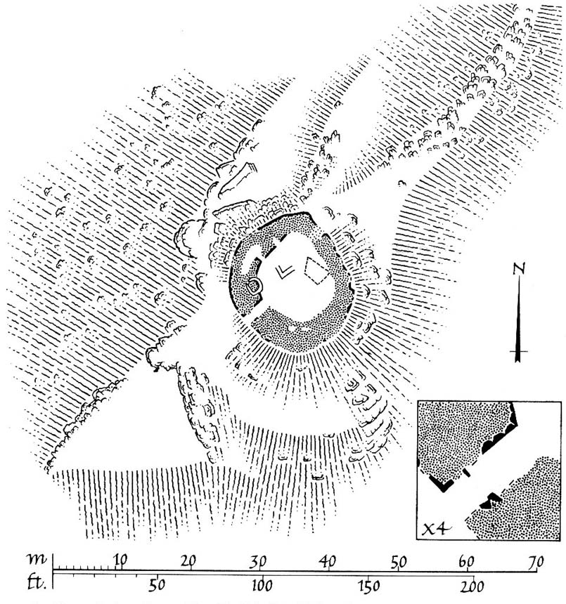
This ancient fort could once be seen in the ancient woodlands on the western side of the Mill Glen, above the village, going into the Ochils—but it was completely destroyed, as usual, by the Industrialists when they quarried the entire structure out of existence.  It was a big thing too, by all accounts.  When Stewart Cruden (1964) saw it, shortly before its final demise, it was still impressive to look at.  He told that the fort consisted of a deep rock-cut ditch with a stone wall on the inside and the remains of a stony rampart on the outside.  Although damaged it still measured 300 feet across.  Its interior contained an almost precise circular enclosure, more than eighty feet across inside the remains of a large stone wall some twelve feet thick.

Nearly a hundred years earlier, Miss Christian MacLagan (1875) told it to be much bigger!  Not only did she report how locals remembered a stone roof on top, but it possessed three concentric circular walls, thirty-five apart, with the central area eighty feet in diameter—much as Cruden later reported.  However, even in MacLagan’s day, she told how many of the stones from the fort were being used to construct sheepfolds.  This destruction was being lamented by the local historian William Gibson (1883), who wrote:

“On the west side of the burn, and overtopping the village, stands the beautiful Castle Craig, wooded to the top, and on which stood, in ancient times, a round Pictish fortress, the traces of which can still be distinctly seen. This craig is, I think, one of the most picturesque objects on the Alva estate, and it is a very great pity that it should be so disfigured by the extensive quarrying operations that are being at present carried on at it.”

On the top of the quarry edges can still be found old walled remains crumbling at the edge of the huge cliffs, but these are unlikely to have been attached to the ancient fortress, and may just be the fragmentary memories of the sheepfolds built from the old fort.

Folklore

Tradition told that this was one of the old forts of the Picts who lived in the Ochils.  If it was a fort, then the Pictish tradition is probably true.  Old lore also told that some of the stones from the fort were used in the construction of Stirling Castle, 7.8 miles (12.6km) to the west.

References:

  1. Corbett, L., et al., The Ochil Hills, Forth Naturalist & Historian 1994.
  2. Cruden, Stewart H., “Castle Craig, Tillicoultry,” in Discovery & Excavation Scotland, 1964.
  3. Feacham, Richard, Guide to Prehistoric Scotland, Batsford: London 1977.
  4. Gibson, William, Reminiscences of Dollar, Tillicoultry and other Districts Adjoining the Ochils, Andrew Elliot 1883.
  5. Maclagan, Christian, The Hill Forts, Stone Circles and other Structural Remains of Ancient Scotland, Edinburgh 1875.
  6. Royal Commission on the Ancient & Historical Monuments, Scotland, Inventory of Monuments and Constructions in the Counties of Fife, Kinross and Clackmannan, HMSO: Edinburgh 1933.
  7. Royal Commission on the Ancient & Historical Monuments, Scotland, The Archaeological Sites and Monuments of Clackmannan District and Falkirk District, Society of Antiquaries of Scotland 1978.
  8. Watson, Angus, The Ochils: Placenames, History, Tradition, PKDC: Perth 1995.

© Paul BennettThe Northern Antiquarian


White Caterthun Carving, Menmuir, Angus

Cup-Marked Stone:  OS Grid Reference – NO 54671 66022

Also Known as:

  1. Canmore ID 35007

Getting Here

White CaterthunCR01

The carving below the walling

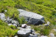
Many ways here, but from the nearest town of Brechin, take the minor north road out of town (not the B966) to Little Brechin, heading roughly north to the renowned hillforts of White and Brown Cathertun (ask a local if needs be).  Park up and walk up the slope to White Cathertun, following the immense walling around to the right.  Near where you reach the opposite side of the hillfort, look down the rocky slopes for a large boulder, just on the edge of the walling.  You’ll find it!

Archaeology & History

Although Canmore include this cup-marked stone in the site-profile of the incredible White Caterthun hillfort, it should really have an entry of its own, as it’s age and nature very probably pre-date the construction of the giant fortress.  But, this aside, if you’re visiting the hillfort (an incredible place!), at least give this heavily cup-marked stone your attention too.

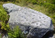
Looking across the carving

Looking across the carving

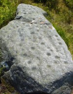
Close-up of the main cups

Close-up of the main cups

Probably neolithic in origin, there was a small portable cup-marked companion found 30 yards away, suggesting perhaps that a cairn might once have stood on this hilltop—but tradition is silent on the matter.  No other petroglyphs of any note have been located nearby, which is unusual.  In all probability other carvings remain undiscovered, particularly in the hills immediately to the north.

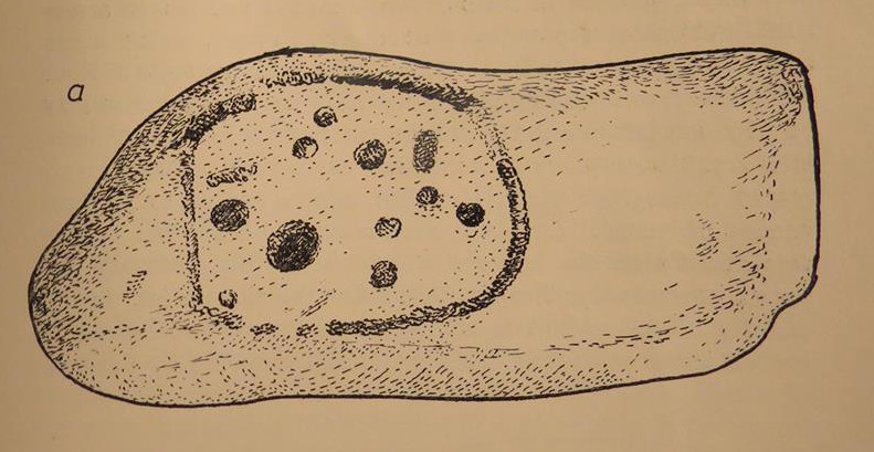
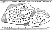
Consisting of around 80 cup-marks, several of which appear linked by carved lines, the stone has been bound together with concrete and metal bolts after some idiot damaged it in the 19th century.  It was first described by Miss Christian Maclagan (1875) in her stunning megalithic survey of the period.  She wrote:

“To Sir James Simpson’s list of cup-markings we are able to add the one at the Caterthun, on a large block 6 feet long, which is quite covered with very distinctly cut cup-markings.  It is a block of basalt…and the cups are so very clear and sharp in their lines that their freshness can only be accounted for by the stone having lain with the markings buried in the ground.  This curious stone has been quite recently broken in two.  It is a pity to see it so destroyed, because it is valuable to the antiquary in helping to establish a very remote antiquity for the fortification.  It lies on the north side of the fort, among a chaos of stones, having probably once formed the side of a gateway.”

A few years later the late great J. Romilly Allen (1882) visited the site and gave us his description, telling:

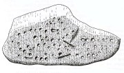
“On the west side (of the hillfort), 10 yards north of the boundary of the fir plantation that covers one-half of the hill is a cup-marked boulder… The stone has been broken in two, and one portion of it lies at the foot of the stone rampart just above the first outer ditch, whilst the other half has been rolled down the hill by some mischievous person with more muscles than brains, and is to be found immediately below, where its further progress was arrested by coming in contact with the outermost wall.  The two fragments when placed together measure 6 feet 9 inches long by 3 feet wide, and 1 foot 9 inches thick.  The stone is greenish quartzose slate, and on its upper surface are carved eighty cups, varying from 1½ to 2½ inches diameter.  In two cases two cups are united into one by a connecting groove.”

J. Sherriff's 1995 drawing

J. Sherriff’s 1995 drawing

J.R. Allen's 1882 drawing

J.R. Allen’s 1882 drawing

The most recent description and illustration of the stone is in John Sherriff’s (1995) survey. When we visited the carving recently we noticed three cup-marks etched onto the side of the stone, with a possible carved line running above one of them—but due to the bright sunlight on of the day of our visit, it was difficult to say whether this was a geological in nature or not (bright daylight can hamper good visibility of many carvings).  Check it out!

References:

  1. Allen, J. Romilly, “Notes on some Undescribed Stones with Cup Markings in Scotland,” in Proceedings of the Society of Antiquaries Scotland, volume 16, 1882.
  2. Kenworthy, J., “White Caterthun: Cup-Marked Stone”, in Discovery & Excavation, Scotland, 1980.
  3. MacLagan, Christian, The Hill Forts, Stone Circles and other Structural Remains of Ancient Scotland, Edmonston & Douglas: Edinburgh 1875.
  4. Sherriff, John, “Prehistoric Rock-Carvings in Angus,” in Tayside & Fife Archaeological Journal, volume 1, 1995.

© Paul BennettThe Northern Antiquarian


Manor Farm, Bolnhurst, Bedfordshire

Hillfort:  OS Grid Reference – TL 0849 5985

Also Known as:

  1. The Camp

Archaeology & History

Wadmore's 1920 groundplan

Wadmore’s 1920 groundplan

This much disturbed Iron Age ‘hillfort’ is effectively a large enclosure of Iron Age origin, much ruined by farming and subsequent landscape alterations through the centuries, with much of it re-fashioned as a medieval moat more than a thousand years after first being built.  Even when the site was visited and described in Mr Wadmore’s (1920) fascinating work he told of the variants in its apparent construction phases:

“This large earthwork is situated on flat level ground, a few yards off the Bedford-Kimbolton Road, at the VIIth milestone out of Bedford.  In shape it is very irregular and presents little to aid one in arriving at an estimate of its original form, except the construction of its defensive lines, which are of two totally different characters and suggest that a comparatively modern manor has been added to an older work.

“The portion which I take to be the older, lies to the south, and is contained on this and the western side, as far as and including the great sweep bending east, by a strong vallum with a parapet and external fosse.

“The modern portion appears to me to commence between the east and west faces where the lines run north, and are purely the remains of a fosse without any indication of a parapet.  The extension of these lines, so far as can be traced, would tend to prove that the work occupied both sides of the road; but such a fact should not prejudice one’s view concerning the work as a whole….”

Section of the earthworks drawn by Wadmore

Section of the earthworks drawn by Wadmore

Adding with a good sense of humility that, “I am quite willing to admit that I may be mistaken, as the matter is entirely speculative.”  But modern archaeological analysis tends to prove that much of Wadmore’s words were correct and the remaining northern section of these earthworks is where the medieval moated section was built.  Roman remains and other period artifacts have also been unearthed in and around the site.

A few hundred yards southwest of the hillfort we find a place called Greenbury Farm.  This place was known in the 14th century as ‘Grymesbury’, which has been taken by some students as relating to the Norse deity, Grim.  However, Mawer & Stenton (1926) point out that in this instance,

“The Grym family had a holding in Bolnhurst in 1302 and bury is here used in the manorial sense. Hence ‘Grym’s Manor.’”

References:

  1. Mawer, A. & Stenton, F.M., The Place-Names of Bedfordshire and Huntingdonshire, Cambridge University Press 1926.
  2. Wadmore, Beauchamp, The Earthworks of Bedfordshire, Bedfordshire Standard: Bedford 1920.

© Paul BennettThe Northern Antiquarian 2016


Abbey Craig, Stirling, Stirlingshire

Hillfort:  OS Grid Reference – NS 8094 9566

Also Known as:

  1. Canmore ID 47113
  2. Wallace Monument Fort

Getting Here

Abbey Craig on 1866 map

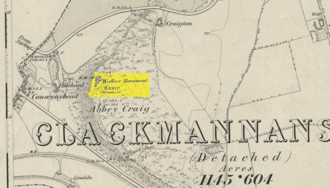
Most folk visiting here are coming from Stirling city.  There are various buses to get here, which head out over Stirling Bridge along Causewayhead Road (the A9) for half-a-mile where, at the roundabout and the William Wallace pub, go straight across up the minor road, zigzagging back on itself, until you reach the signs for the Wallace Monument.  Follow the well-defined footpath and, once on top of the hill, walk round the back of the mightily impressive tower.

Archaeology & History

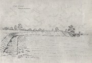
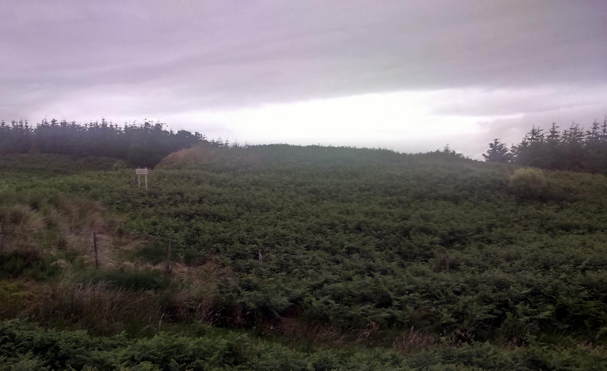
Located right where the impressive Wallace Monument proudly stands, this prehistoric precursor to Sir William Wallace’s memory was where Scotland’s legendary hero and his men cast a clear and easy view over Bannockburn, where the halfwit english came for a fight—and deservedly lost!   The structures that used to be inside the now denuded hillfort would, no doubt, have been used by Wallace’s men; but much of those prehistoric remains have now been destroyed.  The visible remains of the fort can be seen round the back of the Wallace Monument: elongated rises of overgrown walling that run almost all the way round, getting slightly higher as you approach the more northern edges, like a semi-circular enclosure.

Royal Commission plan
Abbey Craig – and the great Wallace Monument

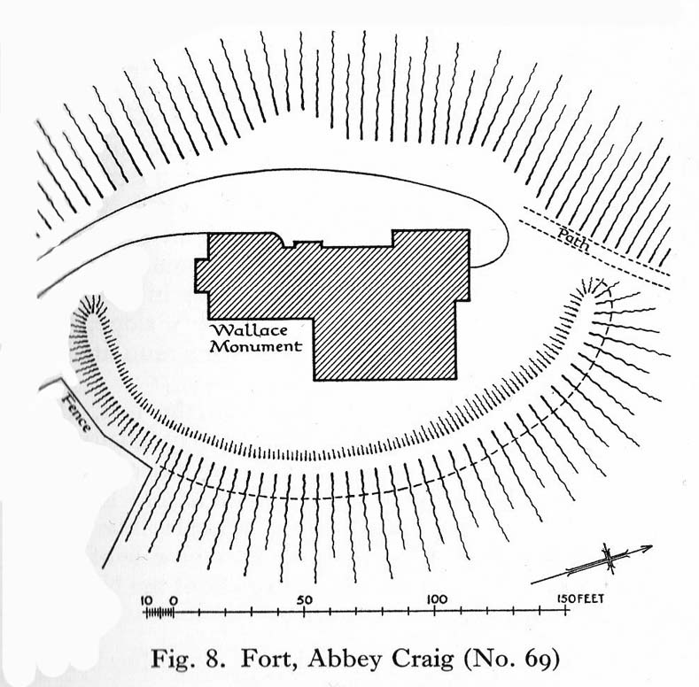
The site was described very briefly in William Nimmo’s (1880) early survey of the area, where he told that in 1784, “eleven brazen spears were found on the Abbey Craig, by a Mr Harley”, which he thought came from the time when the earlier ‘castle’ stood here.  He was probably right.  Many years later, the prehistoric remains were included in the county survey of archaeological sites by the Royal Commission lads (1963), who told that, near the north end of the summit of Abbey Craig,

“there is a fort which has been damaged by the construction within it of the Wallace Monument.  All that remains is a substantial turf-covered bank, cresentic on plan and 260ft in length, the ends of which lie close to the brink of the precipice that forms the west face of the hill.  The bank stands to a maximum height of 5ft above the level of the interior and presumably represents a ruined timber-laced wall, since numerous pieces of vitrified stone have been found on the slopes immediately below it.

The entrance to the fort presumably lay between one end of the bank and the lip of the precipice, but both the areas concerned have been disturbed by the construction of the modern approaches.  The interior of the fort measures about 175ft from north to south, by about 125ft transversely and the interior is featureless.”

The fort was probably built sometime in the early Iron Age; so the next time you visit this fine spot, check the remains out round the back of the tower—and remember that our ancestors were living up here 2500 years ago!

References:

  1. Aitchison, N.B., “Abbey Craig Rampart’, in Discovery & Excavation, Scotland, 1981.
  2. Feacham, Richard W., Guide to Prehistoric Scotland, Batsford: London 1977.
  3. Hogg, A.H.A., British Hill-Forts: An Index, BAR: Oxford 1979.
  4. Nimmo, William, The History of Stirlingshire – volume 1 (3rd edition), T.D. Morison: London 1880.
  5. Royal Commission on the Ancient & Historical Monuments Scotland, Stirling –  volume 1, HMSO: Edinburgh 1963.
  6. Royal Commission on the Ancient & Historical Monuments of Scotland, Archaeological Sites and Monuments of Stirling District, Central Region, Society of Antiquaries of Scotland 1979.

© Paul Bennett, The Northern Antiquarian

Castlehill Wood, St Ninians, Stirling, Stirlingshire

Dun:  OS Grid Reference – NS 75074 90902

Also Known as: 

  1. Canmore ID 46233
  2. Castlehill Wood

Getting Here

In ghostly mist and bracken

Take the Gateside Road from St Ninians or Polmaise Road out of Torbrex across the M9, heading out west onto the southern moors of Touch Hills, passing the Wallstale dun in the trees and then the Castlehill dun just off the road.  Keep going uphill for just over half-a-mile, keeping your eyes peeled on the right for where the MOD lads play some of their war-games.  Walk along the track here, following the line of the woods, until it gets to the spot where it doubles back on itself.  Just here, about 30 yards in front of you, a rounded walled knoll gives the game away!

Archaeology & History

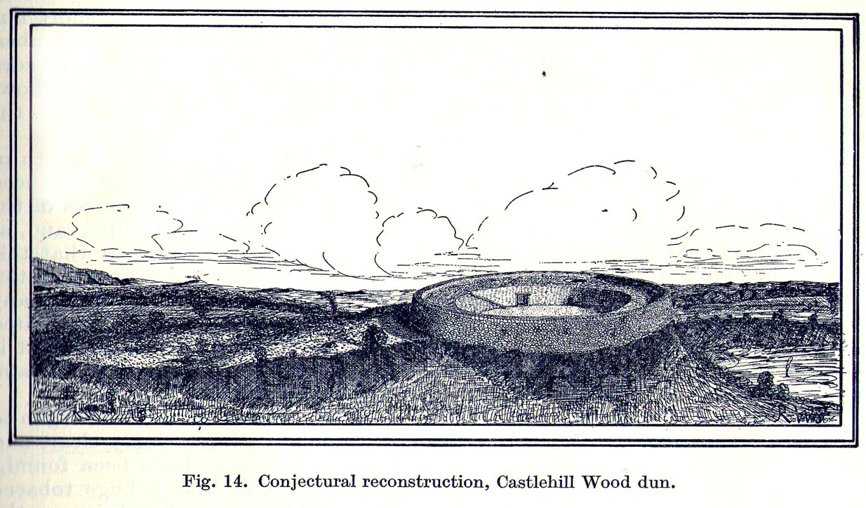
Artists impression of the reconstructed site (PSAS 1959)

An impressive-looking site, not too far off the moorland road, it is one of more than half a dozen hillforts and duns found to the west of Stirling, all of them relatively close to each other—showing that a lot of human activity was going on here in the Iron Age and, probably, much earlier.  Looking like a cross between a broch and a traditional hillfort, the site is best visited in the Winter and Spring months before the bracken starts to encroach and cover it.

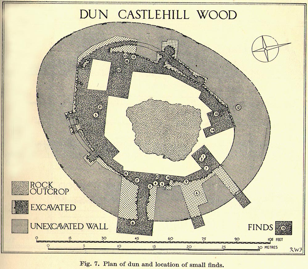
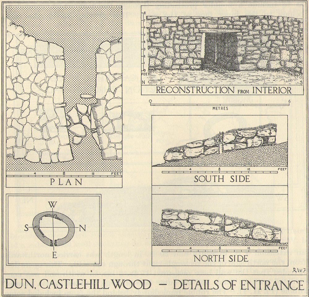
Officially rediscovered in 1952 and excavated three years later, it was thought to have been built in the 1st century AD and used for a few hundred years thereafter.  As you walk up to the eastern edge of the monument, a large entrance, 4½ wide, allows you into the large open space within.  From here, and walking around both the inner and outer walls, you get an idea of the huge amount of work it must have taken to build this structure.  The walls alone which constitute the main of Castlewood Dun are, on average, 16 feet thick!  The Royal Commission report for the area (summarizing the archaeological work of F.W. Feacham in the ’50s) gives the basic architectural features of the place:

“The dun is oval in plan…and measures 75ft from NE to SW, transversely within a drystone wall 16ft thick.  The faces of the wall are composed of large, angular blocks, and the core of boulders, small rubble and earth.  The entrance in the E arc, is provided with door-checks.  Within these, the passage measures 4ft 6in in width, and outside them 3ft 9in.  A few paving-stones were laid to level the rough rock surface of the passage-floor.  Traces of what might have been the bottom step of a stair, rising up the inner face of the wall, were found at a point 8ft N of the entrance.  The dun had no mural stair or galleries, but two sets of mural chambers were located, one in the W and the other in the S acr of the wall.  The former consisted of an entrance-passage, 6ft in length, which varied in width from 2ft at the outer to 3ft at the inner end, where it opened into a circular chamber 4ft in diameter.  From either side of the passage a narrow duct or flue, about 19ft in length and 1ft 6in in width, led off obliquely through the core of the wall to debouch into the interior of the dun.  The construction in the S arc consisted of a similar passage, one flue and a smaller chamber.  Ash and a clinker of very light weight were found in the form of deposits in both passages and all the flues. …The excavator suggested they might have been corn-drying installations.”

Groundplan of site (PSAS 1959)
Entrance details (PSAS 1959)

Apart from a small piece of Roman glass, quern fragments, anvils stones and a pot lid, the excavators found very little inside the dun—not even any hearths.  The walling on the southwest and western edges was built onto a small cliff, making access slightly difficult from that side.

From the site itself, views are excellent, particularly in an arc through the north, east and southeast, with the western skylines being only a short distance away.  This enabled relatively easy tribal communication with people at the other brochs, duns and forts in the area, across an otherwise large but difficult landscape in prehistoric times.  A few hundred yards to the northeast, on the other side of the recently planted tree-farm (forestry plantation), a large D-shaped structure—possibly Iron Age, possibly medieval— is accompanied by lines of ancient walling running down the slopes.

References:

  1. Feachem, R W., “Castlehill Wood Dun, Stirlingshire“, in Proceedings Society Antiquaries, Scotland, volume 90, 1959.
  2. Feachem, R W., “Castlehill Wood, Polmaise”, in Discovery & Excavation Scotland, 1955.
  3. MacKie, E W. “English Migrants and Scottish Brochs’, in Glasgow Archaeological Journal, volume 2, 1971.
  4. Royal Commission on the Ancient & Historical Monuments Scotland, Stirling – volume 1, HMSO: Edinburgh 1963.
  5. Royal Commission Ancient & Historical Monuments, Scotland, Archaeological Sites and Monuments of Stirling District, Central Region, Edinburgh 1979.

© Paul Bennett, The Northern Antiquarian 

Winsbury Hill, Marksbury, Somerset

Enclosure (destroyed):  OS Grid Reference – ST 6706 6307

Also Known as:

  1. Windsbury Hill

Archaeology & History

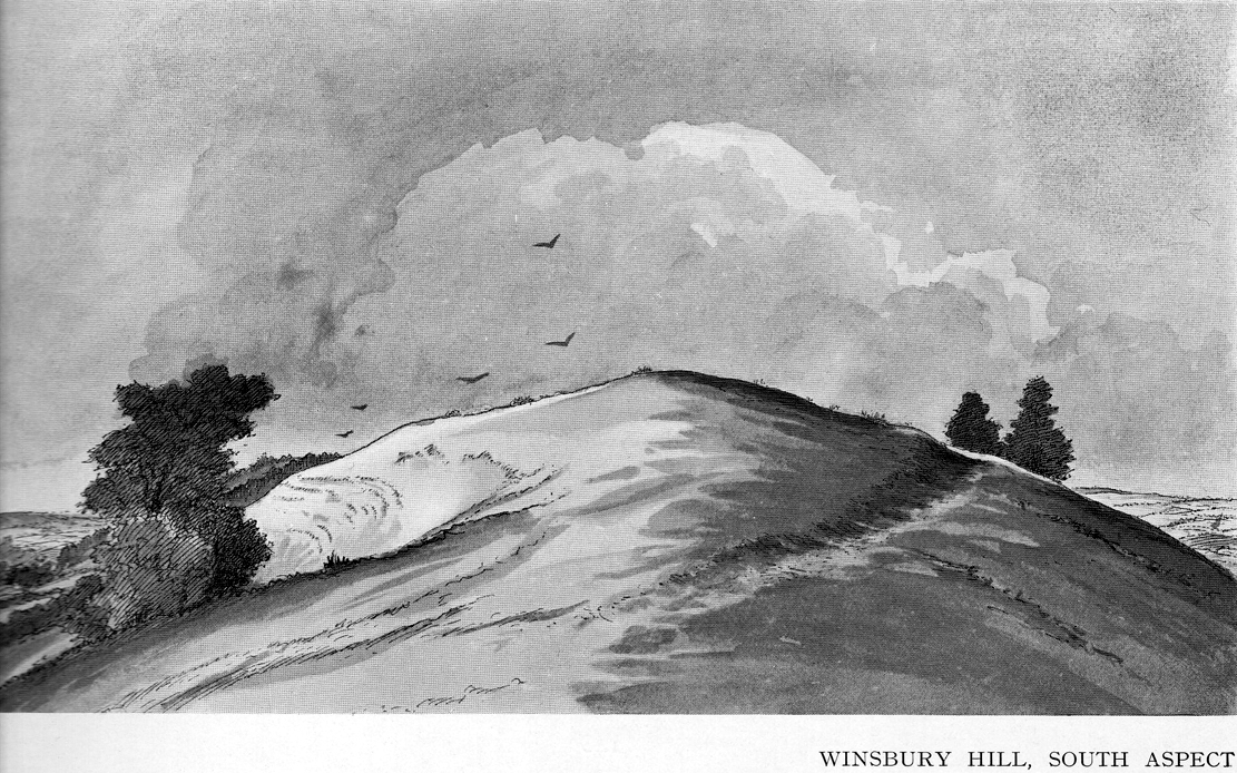
Winsbury Hill earthworks

Apparently, all traces of the possible prehistoric camp or enclosure that were located by Edward Burrow in the 1920s, seems to have vanished.  Very little remained of it even then.  Lower down the slopes are a distinct series of ancient lynchets (or cultivation terraces), which may date back to the Iron Age—these are clearly visible on the eastern and western sides.  Mr Burrow’s (1924) account of the site was as follows:

“Just south of Stantonbury Camp, near Bath, on the adjoining height known as Winsbury Hill, I have traced the almost obliterated remains of a ditch running round the shoulder of the hill, which I have indicated on my drawing. (above)

“On the south and eastern slopes of this prominent hill there are various terraces and scarps, which would repay further investigation.  Possibly Winsbury was fortified as an outlier of the more pronounced Stantonbury Camp, standing directly on the line of the Wansdyke, which runs across the valley towards English Combe.”

References:

  1. Burrow, Edward J., Ancient Earthworks and Camps of Somerset, E.J. burrow: Cheltenham 1924.

© Paul Bennett, The Northern Antiquarian

Ball Cross Carving 02, Bakewell, Derbyshire

Cup-and-Ring Stone:  OS Grid Reference – SK 231 691

Archaeology & History

Ball Cross 2 Carving (after Beckensall)

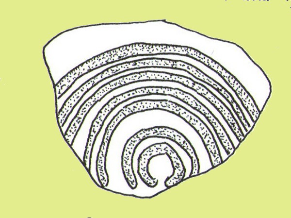
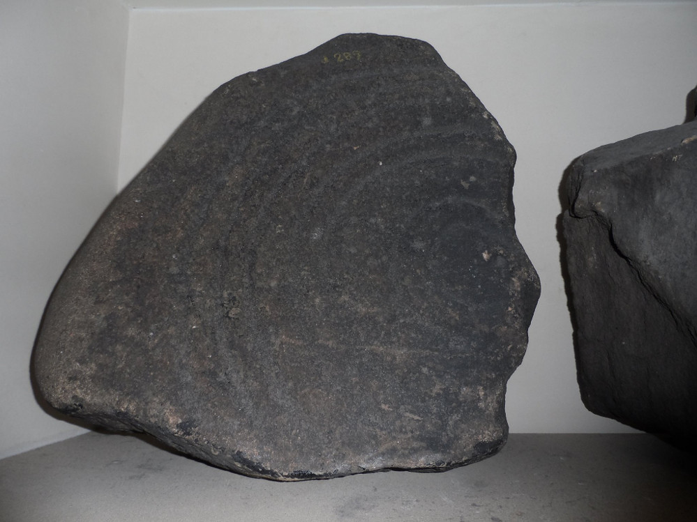
One of three carvings that were located inside the walling of the Ball Cross hillfort during excavations here in the early 1950s by J. Stanley. (1954)  Each carving is distinctly unlike the other in design (see Ball Cross 1 and Ball Cross 3) and it’s highly probable that they were incorporated into the Iron Age structure with their original mythic functions—of neolithic or Bronze Age origin—disused. It is not unlikely that this and its compatriots were originally found in association with the nearby prehistoric tombs.

Ball Cross 2 Carving (photo by Dean Thom)

The broken piece of rock consists of a broken section of an almost archetypal ‘cup-and-ring’—although with this design, no central ‘cup’ occurs: a pattern found at several other multiple-ring stones, like the Grey Stone near Leeds.  Although Stan Beckensall (1999) described this to have “8 concentric rings”, his drawing and the photo here by Dean Thom, clearly show only seven such ‘rings’.  The carving presently lives in a protective box in Sheffield Museum (though beware the listing they give of the designs, as some are incorrect).

References:

  1. Barnatt, John & Reeder, Phil, “Prehistoric Rock Art in the Peak District,” in Derbyshire Archaeological Journal, 102, 1982.
  2. Beckensall, Stan, British Prehistoric Rock Art, Tempus: Stroud 1999.
  3. Beckensall, Stan, Circles in Stone: A British Prehistoric Mystery, Tempus: Stroud 2006.
  4. Cooper, Ali, Archaeology Walks in the Peak District, Sigma: Wilmslow 2010.
  5. Morgan, Victorian & Paul, Rock Around the Peak, Sigma: Wilmslow 2001.
  6. Stanley, J., “An Iron Age fort at Ball Cross Farm, Bakewell,” in Derbyshire Archaeological Journal, volume 74, 1954.

Acknowledgements:  HUGE thanks to Dean Thom for the use of his photo, plus helpful references on this site.

© Paul Bennett, The Northern Antiquarian

Ball Cross Carving 01, Bakewell, Derbyshire

Cup-and-Ring Stone:  OS Grid Reference – SK 2310 6911

Archaeology & History

Ball Cross 01 Carving (photo © Dean Thom)

This is another carving (one of three here) that was removed from its landscape setting when found during excavations of the Iron Age hillfort of Ball Cross in the 1950s, and then placed into a box in Sheffield Museum, decontextualizing it and leaving future researchers slightly in the dark as to its possible nature.  In removing the carving from its site, the stone was left with additional scratches and grooves slightly damaging the stone.  Not good!

Ball Cross Carving (after Beckensall)
Ball Cross Carving (after A. Cooper)

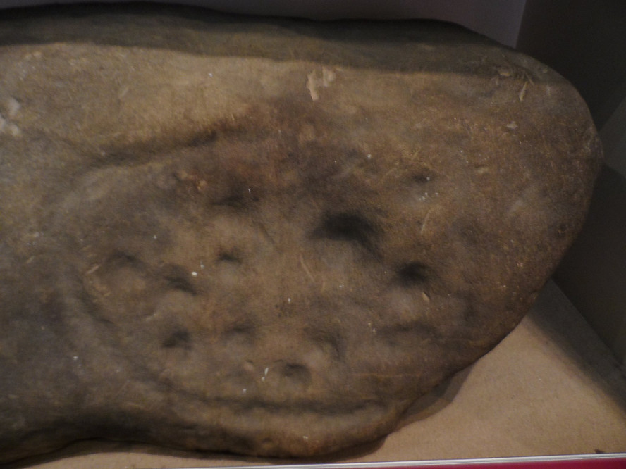
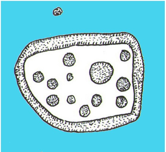
Although unlike the Ball Cross 2 and 3 carvings, the design here is structurally very similar to that found east of Gardoms Edge, with this one comprising of a large unbroken carved oval, with at least twelve cup-marks inside.  Or as Beckensall (1999) described, it “has 12 cups inside a flattened ring.”  Again, like the Gardoms Edge carving, a single cup-mark was etched outside of the enclosed ring. It was found with its companion carvings built into the main walled structure of the hillfort.  It’s unlikely that the stones date from the same age as the hillfort: more probable that they were re-used in the structure, with their mythic nature perhaps already long forgotten…

References:

  1. Barnatt, John & Reeder, Phil, “Prehistoric Rock Art in the Peak District,” in Derbyshire Archaeological Journal, 102, 1982.
  2. Beckensall, Stan, British Prehistoric Rock Art, Tempus: Stroud 1999.
  3. Beckensall, Stan, Circles in Stone: A British Prehistoric Mystery, Tempus: Stroud 2006.
  4. Cooper, Ali, Archaeology Walks in the Peak District, Sigma: Wilmslow 2010.
  5. Morgan, Victorian & Paul, Rock Around the Peak, Sigma: Wilmslow 2001.
  6. Stanley, J., “An Iron Age fort at Ball Cross Farm, Bakewell,” in Derbyshire Archaeological Journal, volume 74, 1954.

Acknowledgements:  HUGE thanks to Dean Thom for the use of his photo, plus helpful data on this site.

© Paul Bennett, The Northern Antiquarian

Caisteal Nan Coin Dubh, Craobh Haven, Argyll

Dun:  OS Grid Reference – NM 8000 0763

Also Known as:

  1. Canmore ID 22744

Archaeology & History

Caisteal Nan Coin Dubh (after RCAHMS 1988)

Up above the roadside leading down the gorgeous Craobh Haven road, we not only find remains of a previously unrecorded standing stone, but we see this little-known overgrown fort that has been described as a “galleried dun” by the Royal Commission (1988) lads.  Known in folk tradition as the “castle of the black dogs” and an important place in the great legends of the Finns, in archaeological terms the Royal Commission described the site as:

“Oval in plan, the dun measures about 13m by 10m within a wall which varies from 3m to 4m in thickness.  Considerable stretches of the outer face survive and on the N it rises to a height of 1.7m in ten rough courses; the inner face is less well preserved, but a long stretch is visible on the NW.  There are traces of a gallery within the thickness of the wall on the NW; it was entered through a narrow passage, the S-side wall of which it stands to a height of 0.4m in three courses.  A second break in the line of the inner face, 2.5m to the NE, is either another entrance to the gallery or the entrance to a second chamber.  Depressions in the thickness of the wall on the S may indicate the presence of yet another intramural feature.  The entrance to the dun lies on the WSW; it measures about 1m in width at the outer end, 1.8m at the inner end, and is checked for a door 1m from the exterior.  On the NE there is a short stretch of facing at right-angles to the line of the wall, and this may be a straight-joint similar to that at Castle Dounie…or one side of a postern gate. In the interior there are the remains of at least two animal-pens and a modern rectilinear cairn. There is no trace of the midden-deposit noted by Campbell & Sandemann to the W of the dun, and the cairns and stretches of field-walling on the N flank of the ridge are of relatively recent date.”

Folklore

Close to a little-known cailleach site, this ruined fortress was one of the many places which the illustrious historian and folklorist Archibald Campbell told about in his awesome series of Waifs and Strays of Celtic Tradition (1889).  The tale of the fort was known to local people as “The Fight between Bran and Foir and is as follows:

“The black dog, Foir, was the brother of Bran, the far-famed hound of Fionn. Foir was taken early from his dam, and was afterwards nurtured by a band of fair women, who acted as his nurses. He grew up into a handsome hound, which had no equal, in the chase or in fight, in the distant North. His owner, Eubhan Oisein, the black-haired, red-cheeked, fair-skinned young Prince of Innis Torc (Orkney ?) was proud, as well he might be, of his unrivalled hound. Having no further victories to win in the North, his master determined to try him against the strongest dogs in the packs of the Feinne.

“He left home, descended by Lochawe, and entered Craignish through Glen Doan. Before his arrival, the Fienne, after spending the day in the chase, encamped for the night in the upper end of Craignish. Next day Fionn arose before sunrise, and saw a young man, wrapped in a red mantle and leading a black dog, approaching towards him at a rapid pace. The stranger soon drew near, and at once declared his object in coming. He wanted a dog-fight, and so impatient was he to have it, and so restless by reason of his impatience, that he suffered not his shadow to dwell a moment on one spot.

“Fifty of the best hounds of the Feinne were slipped at last, but the black dog killed them all one by one. A second and then a third fifty were uncoupled, but the strange dog disposed of them as easily as he did of the first.

“Fionn now saw that all the dogs of the Feinne were in serious danger of being annihilated, and therefore he turned round and cast an angry look on his own great dog Bran. In a moment Bran’s hair stood on end, his eyes darted fire, and he leaped the full length of his golden chain in his eagerness for the fight. But something else besides the casting of an angry look was still to be done to rouse the fierce hound’s temper to its highest pitch.

“He was placed nose to nose with his rival, and then his golden chain was unclasped. The two hounds, brothers by blood, but now champions on opposite sides, at once closed in deadly fight; but for an adequate description of the struggle between them the reader must consult the bards. See the “Lay of the Black Dog”, in Islay’s Leabhar na Feinne, the McCallum’s Ancient Poetry, etc.

“The contest lasted from morning to evening, and victory remained, almost to the close, uncertain; but in the end Bran vanquished Foir, and, by killing the latter, amply revenged the death of the three fifties. The Feinne buried their own dogs, and the stranger, with a sore heart, laid his black hound in the narrow clay bed.

“This great dog-fight, so celebrated in Gaelic lore, is said to have been fought at Lergychony, in Craignish. It is further said that the place was called Learg-a-choinnimh, or the “Plateau of Meeting”, because it was there the two hounds met in fight. There are, of course, many other places in the Highlands which claim the honour of being the scene of this legendary contest.”

References:

  1. Campbell, Archibald, Waifs and Strays of Celtic Tradition – volume 1, David Nutt: London 1889.
  2. Royal Commission on the Ancient & Historical Monuments of Scotland, Argyll – Volume 6: Mid-Argyll and Cowal, HMSO: Edinburgh 1988.

© Paul Bennett, The Northern Antiquarian

Castle Hill, Culross, Fife

Hillfort: OS Grid Reference – NS 97105 89923

Getting Here

A gorgeous setting, in the trees

Take the A907 road between Clackmannan and Comrie and, close to Bogside Farm at the roadside, but on the other side of the road where the bridge crosses a burn, take the dirt-track uphill and into the woodland. About 300 yards up (before you hit the signs pointing you to the farm) , walk uphill into the trees on your left until the ground levels out. Look around! (and best visited between December and May, before the bracken covers the place)

Archaeology & History

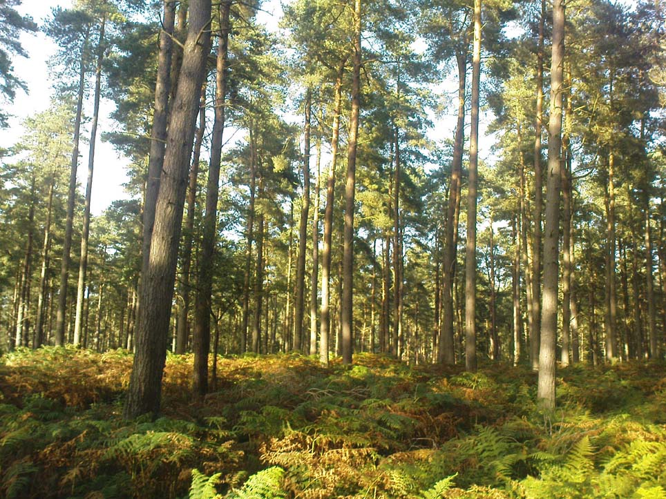
Visiting this site is pleasure in itself. Situated in an open forest, with traditional pine trees in abundance, there are scattered amidst the edges of this large oval-shaped Iron Age structure, the aged boughs of ash and beech, centuries old, along its edges and throughout the woods. It is a truly superb setting! When visited by the Royal Commission lads in April, 1925, they found the remains here in good condition. A few years later in their impressive Inventory, they told:

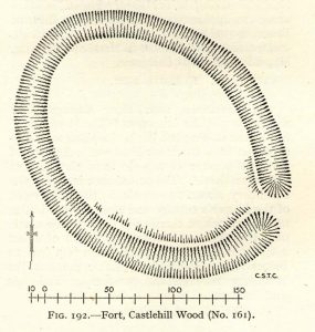
“In Castlehill Wood, about 250 yards to the southwest of Bogside Railway Station, and at an elevation of 200 feet above sea-level, is a small plateau of very regular oval form with its major axis northwest and southeast. It is surrounded by a single ditch, the well-marked enclosure thus produced having a maximum measurement of 185 by 135 feet. At the southeast the ditch has been left uncut in order to provide a passage for entrance. This passage has been about 20 feet wide, and at its inner end there are on either side faint traces of a low mound, which in all probability once ran right round the edge of the enclosure and which may have been palisaded.”

RCHAMS 1933 plan of site

Sadly when I came here a few days ago, much of the was very overgrown with bracken and other vegetation, making it impossible to see the site properly and preventing any decent photos. We’ll go back here in a few months time to get better images!

Folklore

This site was mentioned, albeit briefly, in David Beveridge’s (1885) magnum opus on the history of Culross.  With equal brevity he noted several standing stones in the region, saying how tradition afforded them a Danish origin.  This site was the same for

“a tradition prevails that after the battle of Inverkeithing the Danish army or a portion of it retreated to a station in the north of Culross parish, where they erected the earthwork or camp of Castlehill, still existing near the Burrowine Farm.”

References:

  1. Beveridge, David, Culross and Tulliallan: Its History and Antiquities – volume 1, William Blackwood: Edinburgh 1885.
  2. Royal Commission on the Ancient & Historical Monuments, Scotland, Inventory of Monuments and Constructions in the Counties of Fife, Kinross and Clackmannan, HMSO: Edinburgh 1933.

© Paul Bennett, The Northern Antiquarian