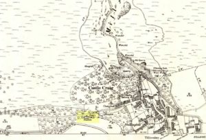
Castle Craig, Tillicoultry, Clackmannanshire

‘Fort’ (destroyed):  OS Grid Reference – NS 9116 9769

Also Known as:

  1. Canmore ID 48294

Archaeology & History

This ancient fort could once be seen in the ancient woodlands on the western side of the Mill Glen, above the village, going into the Ochils—but it was completely destroyed, as usual, by the Industrialists when they quarried the entire structure out of existence.  It was a big thing too, by all accounts.  When Stewart Cruden (1964) saw it, shortly before its final demise, it was still impressive to look at.  He told that the fort consisted of a deep rock-cut ditch with a stone wall on the inside and the remains of a stony rampart on the outside.  Although damaged it still measured 300 feet across.  Its interior contained an almost precise circular enclosure, more than eighty feet across inside the remains of a large stone wall some twelve feet thick.

Nearly a hundred years earlier, Miss Christian MacLagan (1875) told it to be much bigger!  Not only did she report how locals remembered a stone roof on top, but it possessed three concentric circular walls, thirty-five apart, with the central area eighty feet in diameter—much as Cruden later reported.  However, even in MacLagan’s day, she told how many of the stones from the fort were being used to construct sheepfolds.  This destruction was being lamented by the local historian William Gibson (1883), who wrote:

“On the west side of the burn, and overtopping the village, stands the beautiful Castle Craig, wooded to the top, and on which stood, in ancient times, a round Pictish fortress, the traces of which can still be distinctly seen. This craig is, I think, one of the most picturesque objects on the Alva estate, and it is a very great pity that it should be so disfigured by the extensive quarrying operations that are being at present carried on at it.”

On the top of the quarry edges can still be found old walled remains crumbling at the edge of the huge cliffs, but these are unlikely to have been attached to the ancient fortress, and may just be the fragmentary memories of the sheepfolds built from the old fort.

Folklore

Tradition told that this was one of the old forts of the Picts who lived in the Ochils.  If it was a fort, then the Pictish tradition is probably true.  Old lore also told that some of the stones from the fort were used in the construction of Stirling Castle, 7.8 miles (12.6km) to the west.

References:

  1. Corbett, L., et al., The Ochil Hills, Forth Naturalist & Historian 1994.
  2. Cruden, Stewart H., “Castle Craig, Tillicoultry,” in Discovery & Excavation Scotland, 1964.
  3. Feacham, Richard, Guide to Prehistoric Scotland, Batsford: London 1977.
  4. Gibson, William, Reminiscences of Dollar, Tillicoultry and other Districts Adjoining the Ochils, Andrew Elliot 1883.
  5. Maclagan, Christian, The Hill Forts, Stone Circles and other Structural Remains of Ancient Scotland, Edinburgh 1875.
  6. Royal Commission on the Ancient & Historical Monuments, Scotland, Inventory of Monuments and Constructions in the Counties of Fife, Kinross and Clackmannan, HMSO: Edinburgh 1933.
  7. Royal Commission on the Ancient & Historical Monuments, Scotland, The Archaeological Sites and Monuments of Clackmannan District and Falkirk District, Society of Antiquaries of Scotland 1978.
  8. Watson, Angus, The Ochils: Placenames, History, Tradition, PKDC: Perth 1995.

© Paul BennettThe Northern Antiquarian


Moir’s Well, Dollar, Clackmannanshire

Healing Well:  OS Grid Reference – NS 96535 98711

Getting Here

Moirs Well on 1866 OS-map

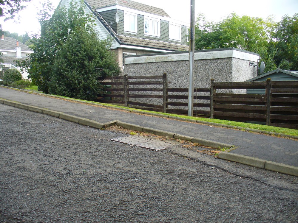
Go up the road alongside the Dollar Burn, turning right, up the steep hill as if heading to the Wizard’s Stone and the impressive Castleton monolith, a mile further along.  Before reaching the Wizard’s Stone, keep your eyes peeled on the right for the street-name, ‘Moir’s Well’.  From here, walk up the road less than another 100 yards and till you reach the water-cover.

Archaeology & History

Site of the old Muir's Well
Site of the old Muir’s Well

There is little known about any history of this now-covered old well, halfway up the steep slope towards Lochy Launds.  It was noted by Ordnance Survey in 1861 and subsequently published on the earliest OS-map a few years later. It was obviously a wayside well for those venturing up the steep hill and used to have an old stone trough into which the waters ran.  Although we don’t know for certain, the etymology of the well probably comes from the surname Muir, which according to William Gibson (1883) was common in the old village.

People living in the houses below here, told us that after heavy rains their gardens become very boggy, which is probably due to the sub-surface water from Muir’s Well.  Tis good to know that the waters are still finding their way out!

References:

  1. Gibson, William, Reminiscences of Dollar, Tillicoultry and other Districts Adjoining the Ochils, Andrew Elliot 1883.

© Paul Bennett, The Northern Antiquarian


Castle Campbell, Dollar, Clackmannanshire

Cup-Marked Stone:  OS Grid Reference – NS 9613 9928  —  NEW FIND

Getting Here

Cup-markings at Castle Campbell

From Dollar, take the steep road up to Castle Campbell (ask a local if you get lost).  When you’ve got into the building and paid your fiver, walk straight forward as if you’re heading to the front gardens, but stay within the castle by walking left on the inner-front section of the building, all the way along to the dark room in the far corner at the end of the path.  Just before you walk into the end room, look at the ground rock beneath your feet.

Archaeology & History

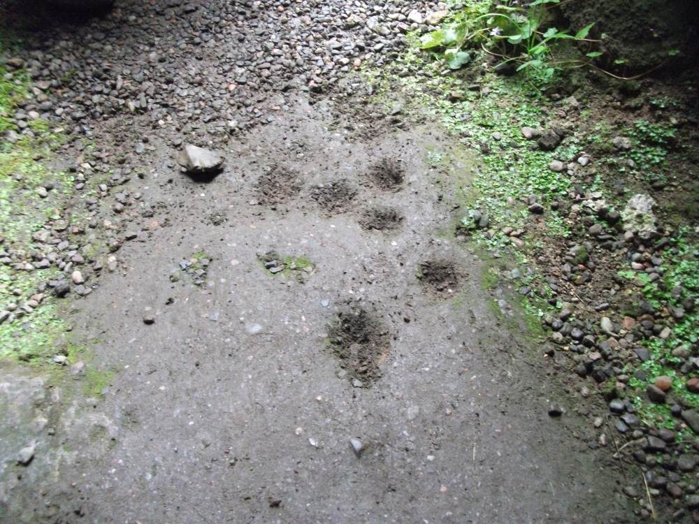
My first and only visit to the superb half-restored ruins of Castle Campbell was in the company of the author Marion Woolley.  It was a damn good day and the castle here is really worth checking out!  But as Marion and I wandered the grounds and internal remains, my eyes caught sight of what looked like a cluster of cup-markings, never previously recorded, on a section of earthfast rock over which a section of the Castle had been built.

A distinct arc of at least four cup-marks was accompanied with outlying single cups on either side of it.  Beneath the gravel it seemed that more were waiting to be be unearthed—but we left them alone.  As you can see in the photo here, the cup-marks seem typical of those we find in their thousands across northern Britain.  However, the rock hereby is volcanic and conglomerate and may be the result of such natural processes.  I’m truly not sure.  A local archaeologist in Stirling thought the carving looked authentic – but we need to return here and brush off the rest of the gravel to see in greater detail the extent of the cups.  There seemed to be more of them hiding at the edges.

If anyone finds out more about this, or gets some better photos, or ascertains this as a simple geophysical artifact, please lemme know.

© Paul Bennett, The Northern Antiquarian

Alva Church, Alva, Clackmannanshire

Standing Stones:  OS Grid Reference – NS 88812 97235

Getting Here

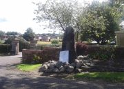
Alva’s standing stone

Go on the A91 through Alva, eastwards, and just before you go out of the town, note the small road on your left up to the graveyard.  As you go into the graveyard, keep your eyes peeled on your left-hand side.  You can’t really miss it!

Archaeology & History

Reported as “lost” or “destroyed” in many official reports, one of at least two standing stones that were reported in the Old Statistical Account of 1795 can still be found at the bottom of the graveyard, adjacent to the old holy well of St. Serf, at the edge of Alva town  Very little has been written about it, and when it was mentioned in the OSA, the stones were only added in a foot note to the impressive stone cross on the outskirts of Alloa, saying:

“There are two stones resembling this one, in the neighbouring parish of Alva, at no great distance from the church, but not close to one another. They are both near the foot of the Ochils.”

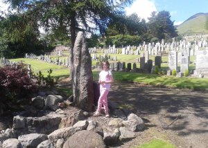
A little person by its side
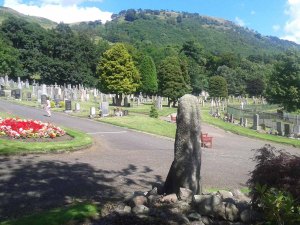
From the stone, looking NE

When some of the lads from the Scottish Royal Commission came here in July 1927, they could find no remains of any such standing stones and simply reported that they “no longer exist.” However, as visitors can plainly see, a tall upright standing stone still remains here, albeit repositioned by the good local people of Alva several decades ago.  Standing more than seven-feet tall, the stone is very weather-worn on one side, with a plaque at the bottom.

References:

  1. Royal Commission on the Ancient & Historical Monuments, Scotland, Inventory of Monuments and Constructions in the Counties of Fife, Kinross and Clackmannan, HMSO: Edinburgh 1933.

© Paul Bennett, The Northern Antiquarian 
Lady’s Well, Tillicoultry, Clackmannanshire

Holy Well:  OS Grid Reference – NS 91105 97510

Also Known as:

  1. Ladies Well
  2. Our Lady’s Well

Getting Here

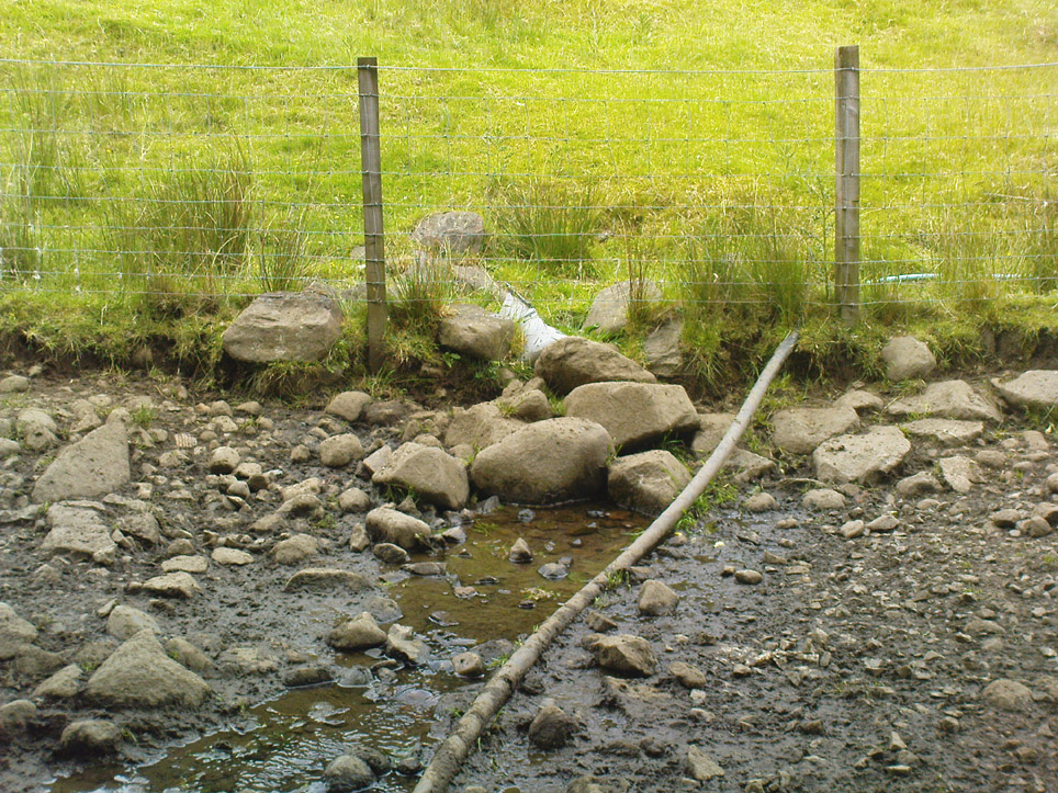
The old spring of Lady’s Well

From the main road running through the town, head west towards Alva, and where the golf course begins, take the footpath uphill at its edge which heads towards the giant quarry.  Where the dirt-track begins, keep walking along the edge of golf course, noting that where the open field starts, a gate on your right.  Go through this, and walk up the side of the fence for some 30 yards, then go through the large gate.  10 yards in front of you, note the small stream crossing the track, and a scatter of overgrown rocks just on the other side of the wire fence. You’re here!

Archaeology & History

Thought by Angus Watson (1995) to have been possibly dedicated to ‘Our Lady’: in this context it’s difficult to know whether the dedication was to the christian Virgin, or to the heathen ‘Lady Alva’, whose web of snow and other natural garments clothe the mountains and glens of the Ochils hereby.

The first account of the place seems to be in William Gibson’s Reminiscences (1883) where he told that,

“In the year 1839, a Mr John Henderson built the only woollen mill…the water for the steam engine of which was got from the Ladies Well”,

Ladys Well on 1899 map

which was barely 100 yards to the west.  It was later highlighted on the OS-map in 1899 with an associated ‘fountain’, right by the track-side.  A water-pumping station shown at the same time on another map was, of course, the one that was built to supply the mill with water.

The present water source is slightly higher in the field than when it was shown on the early OS-maps, and it does still flow continuously—although the source is much neglected and could do with being recovered: as the photo here shows, an ugly pipe appears to be taking much of the healing waters which are now mainly feeding a large pond in the garden just below.

References:

  1. Gibson, William, Reminiscences of Dollar and Tillicoultry, Andrew Elliot: Edinburgh 1883.
  2. Watson, Angus, The Ochils: Placenames, History, Tradition, Perth & Kinross Libraries 1995.

© Paul Bennett, The Northern Antiquarian