Blarnaboard (3), Gartmore, Perthshire

Cup-and-Ring Stone:  OS Grid Reference – NS 51084 97979
Getting Here

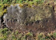
Blarnaboard (3) carving

On the A81 road from Aberfoyle to Strathblane, about a mile south of Aberfoyle take the tiny right turn (keep your eyes peeled!) to Gartmore.  Along the tiny curving road for exactly 1km (0.61 miles), where the road has straightened out there’s a small dirt-track with a parking spot along it. A few hundred yards along there’s a crossroads of dirt-tracks: walk to your left (SW) for nearly a mile (or exactly 1.5km) keeping your eyes peeled for a small distinct footpath leading down-slope on your left. Walk along this undulating path for just over 200 yards till you go through the gate, then walk immediately to your right down the side of the fence in the field for about 20 yards.  Y’ can’t miss it!

Archaeology & History
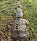
Blarnaboard (3), NE-SW

Located on the land of the early bards of Gartmore, we could speculate that those early orators told tales of, and from this old stone—but that’s all it would be: dreamy speculation.  Instead, passing that aside, the petroglyph itself brings us a feast to drool over!
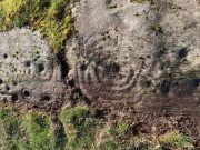
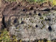
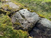
Made up of four distinct carved sections of almost interconnecting rock, this flat thin line of stone is covered with an impressive array of cups and multiple rings.  Running downhill in a northeast to southwest line, it would appear to have been written about for the first time by Lorna Main (1988) who subsequently described it in the usual archaeological shorthand, simply telling that,

“There are at last 28 cups, 3 cup and one ring, 4 cup and two rings, 2 cup and three rings, 1 cup and five rings and 1 cup and seven rings.”
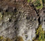
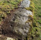
Multiple ringed element
Section 1 overview

…But, as usual, there’s much more to be said of it than that.  Of the four sections, we’ll start at the uppermost northeastern section and work down the sloping ridge, looking at the respective symbols as we go.  Section 1 has the largest surface area, but isn’t the most decorated of the bunch.  Nonetheless, what we find here is impressive. About a dozen single cup-marks of various ages are scattered over the surface in what initially seems to be no recognizable order; these are accompanied by two single cup-and-rings: one of which could be said to be of standard size and form, whilst the other has a much larger and broken ring, near the middle of the rock, about 12 inches across.  This larger ring has two or three of the cup-marks incorporated into its outer edges.  The most impressive element of Section 1 is the large multiple-ringed design, five in all, radiating outwards or funneling inwards (depending on what was intended) around a central cup.  The outer ring of this is incomplete.
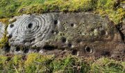
Impressive cup & 7 rings
Scatter of cups & rings

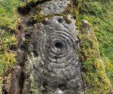
Section 2 is the most visually impressive of all the Blarnaboard (3) carvings: almost an evolutionary development of what we see on the first part.  A 2-dimensional panorama shows off a distinct cup-and-ring close to the edge of the soil, and there’s a somewhat wonky incomplete cup with double-ring below it.  A very clear cup-mark to the right of this has another faint incomplete double-ring round it—but this is hard to see. The same cannot be said of the cup with seven concentric rings surrounding it! (the outer two of these are incomplete)  As I walked round and round this section, drooling somewhat, it became obvious that a number of well-defined cup-marks had been carved around the outer edges of the rings, deliberately creating an eighth ring comprised purely of cup-marks.  It gave me the impression of it representing heavenly bodies revolving around the central Pole Star; but also of it defining the movement of the Moon through the heavens during a calendar year. (the astronomy of my youth still comes through at times!)
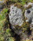
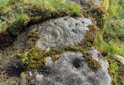
Section 3 carving
Faint double cup-and-ring

By comparison, the third and smallest section of Blarnaboard (3) almost pales into insignificance, possessing a mere cup-and-double-ring—and a  very faint one at that.  From a certain angle it looked like it possessed a third ring, but this was probably more to do with me wanting to see more than there is!  Just below this double-ring, a single cup has what might have once been another incomplete ring round it—but we’d need the computer graphic students among you to suss that bit out!  You can’t make it out on the photos here, sadly…
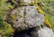
Section 4 carving
Faint double-arc, lower cup

The fourth section is the most visually unimpressive of the entire cluster and was probably carved much later than the rest.  The poor little fella has just five single cup-marks, with a sixth at the top-corner or northeastern part with what seems to be a small carved double-arc, or partial lozenge, that was started and never finished.

A couple of other exposed sections of stone running a few more yards further down the same line have no carvings on them—but there may well be more to this petroglyph hiding beneath the turf, which covers quite a large area.  I have no doubt that other unrecorded carvings exist in close by, but due to excessive forestry plantations all around here, they’ll either be covered over or will have been destroyed.  Don’t let this put you off looking for others though!
Cup-and-five-rings
Cup-and-seven rings

An interesting feature of this long line of stone is its potential alignment.  When we were photographing the site, a local man came over and got chatting with us.  He knew of the carving and had been here many times and told us that his wife had looked at this one and found it aligned with another cup-and-ring on the south-side of Blarnaboard farm and another one (officially unrecorded) even further along.  I checked this when I got home and found that this long line of petroglyphs did indeed line up with the Blarnaboard farm carving, perfectly.  Whether this was intentional and/or possesses an astronomical function, we might never know.  The third carving along the line has yet to be located.  I must emphasize however, that the relationship between earthfast petroglyphs and alignments is very rare and, where found, is little more than fortuitous.  But when we find cup-markings on alignments of standing stones and other prehistoric monuments, the relationship seems to be much more intentional and would have had a specific mythic function.

If y’ follow the fence-line from this carving down to the small burn, on the other side is the much less impressive Blarnaboard (2) cup-marked stone.

Folklore

Prior to Lorna Main’s (1988) short note on this petroglyph, local people had long known about the carving.  As late as the 20th century, people with fevers were brought to this stone in the early morning to be cured of the illness.  The idea was that medicinal herbs were collected and placed in some of the cup-marks, which were used like a mortar and pestle to prepare the plants.  This healing magick, spoken of by some of the old folk in Aberfoyle, was known to them as children, who’d been told of this by their elders and, of course, by the elders before them.

There is also a tradition that some of the stone that makes up the curious moondial (not sundial) that can be seen at the back of the church in Gartmore village nearly a mile to the southeast, originally came from here.

References:

  1. Main, L., “Blarnaboard (Aberfoyle parish), Cup and Ring Marked Outcrop,” in Discovery & Excavation Scotland, 1988.

Acknowledgements:  Huge thanks for use of the Ordnance Survey map in this site profile, reproduced with the kind permission of the National Library of Scotland

© Paul BennettThe Northern Antiquarian

Organn Well, Pontefract, West Yorkshire

Healing Well (destroyed):  OS Grid Reference – SE 45 21

Archaeology & History

The waters of the once-renowned Organn Well goes down in history as being one of the first wells in Britain whose waters were used in a town pump.  Written minutes from an early council meeting described how people gathered in the market place to discuss the objective of making such a pump in the times of Queen Elizabeth 1, in 1571.  It was completed a year later and, some 450 years on, this old relic can still be seen.  The Well used to be found off Penny Lane (now Wakefield Road), some 4-500 yards to the southwest and as such it’s exact position has been difficult to locate.  But the fact that the waters were piped such a distance strongly suggests that the water supply from the Well was damn good – and most probably damn refreshing too!  The old charter told us, in that wonderfully dyslexic manner of the period,

…that a conduit in the Markett Place with lead pipes leading to water from Organ Well to the said conduit shall bee cleansed and repayred at the charge and contribution of severall inhabitants of the Towne and espetially by those that fetch water from the same conduit. And according to the auncient custome of the said Towne, whoe shall not beare theire p’t of the chardge p’portionable to what water they from the same at the discretion of the Majo’ for the time being and his brethren shall be debarred from the benefitt of the said conduit except they shall be poore people.  And likewise that none shall receive any water from the said conduite for to brewe or steep barley w’thall at such time or times as others have need the same for meat water and water to washe w’hall, but onely at such times as there is water to spare over and besides what is convenient for meat and washing.”

More than two hundred years later the water pump was in dire need of attention, as George Fox (1827) told:

“Being in a ruinous state about the year 1810 and the supplies of water being insufficient for the public use; a clause was inserted in the act of parliament… wherein the pump, its pipes, and all other appurtenances belonging to it were vested in the power of the commissioners of the streets, who where bound to see it kept in proper repair.”

And so the water from the Organn Well continued to supply the townsfolk.

The etymology of this well—along with another of the same name near Harrogate—truly puzzled me for a long time; that was until I came across, quite by accident, records from early texts on herbalism.  As a result, it seems very likely that it derives its name from the old English ‘organe,’ which, according to Stracke (1974) and others relates to both varieties of the indigenous herb marjoram (Origanum vulgare and O.marjorana) — a grand medicinal plant that’s pretty common in northern England (I used to go out gathering it each year in my younger days).  There were obviously profuse supplies of this herb growing in and around the well and, as all good herbalists will tell you, when they grow by an old spring or well, their medicinal properties are much better than normal.  The waters and the plant obviously had a good symbiosis; or, as the old women who’d collect the waters and the herbs in days prior to the pump would have told us, “the spirits of the water here are good”…

References:

    1. Fox, George, The History of Pontefract in Yorkshire, J.Fox: Pontefract 1827.
    2. Padgett, Lorenzo, Chronicles of Old Pontefract, Oswald Homes: Pontefract 1905.
    3. Stracke, J. Richard (ed.), The Laud Herbal Glossary, Rodopi: Amsterdam 1974.

© Paul BennettThe Northern Antiquarian

Horse Well, Duddingston, Edinburgh, Midlothian

Healing Well:  OS Grid Reference – NT 28198 72642

Getting Here

Horse Well on 1852 map

Get to the Delf Well from Duddingston and keep walking along the lochside road for 60-70 yards, where you go through the black metal gate in the fence on your left.  Walk down the slope just a few yards and (drought dependent!) you’ll see an initial damp patch where the well used to arise 150 years ago; just a few yards further down the slope is the more notable spring water of the Horse Well below you.

Archaeology & History

The site is shown on the 1852 map of the area where it was later “capped” and used by the old local water authority.  Thankfully the water has managed to escape and is once more feeding the birds and the land, running into the loch below.  When we arrived here, a crow was drinking from the waters.

Horse Well & its herbs

Although you’d expect that this was once a watering-place for horses, the name of the well may relate to the Scottish folk-name of the herb Veronica beccabunga, generally known as Brooklime or European Speedwell, but locally called Horse-well grass—some of which seemed to be growing in the watery spring amidst the other plants.  As a herb it was used in the treatment of scurvy.  The history of the well however, seems all but forgotten…

References:

  1. Bennett, Paul, Ancient and Holy Wells of Edinburgh, TNA: Alva 2017.
  2. Grant, William (ed.), Scottish National Dictionary – volume 5, SNDA: Edinburgh 1958.

© Paul BennettThe Northern Antiquarian


Borgie Well, Cambuslang, Lanarkshire

Sacred Well:  OS Grid Reference – NS 64412 60194

Getting Here

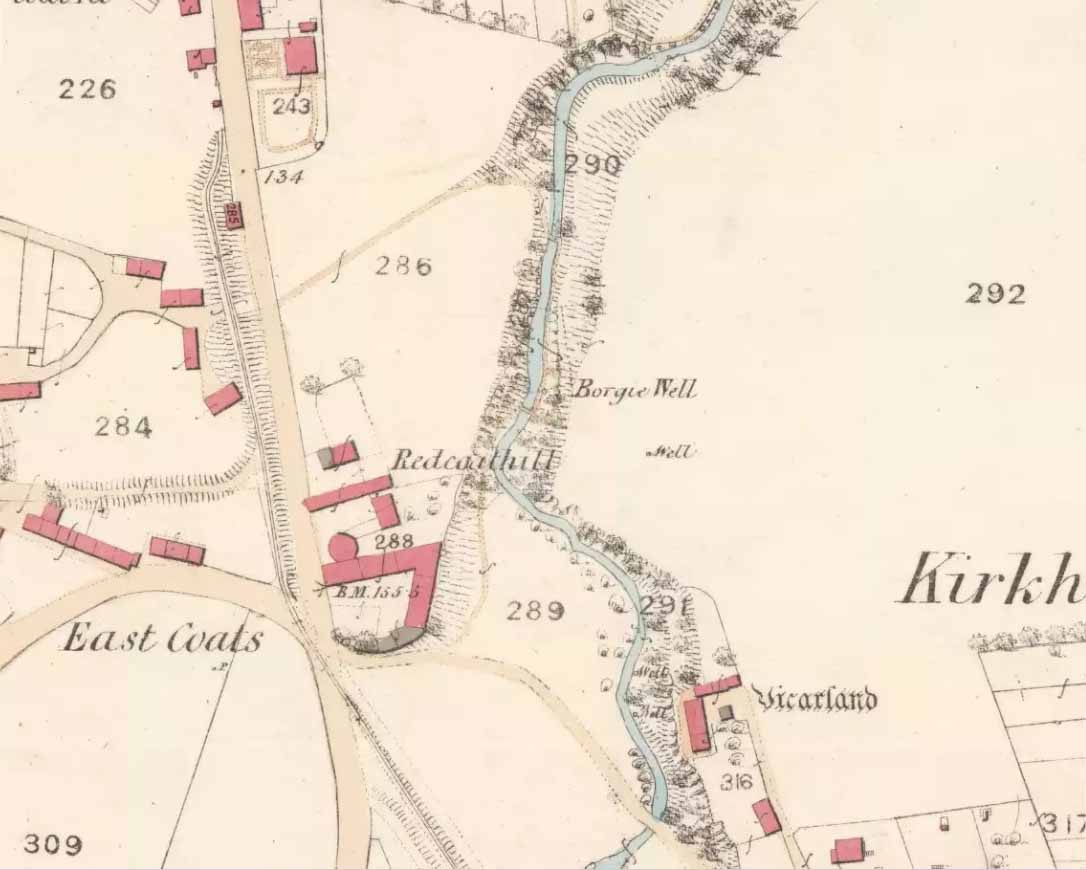
Borgie Well on the 1859 map

There must be an easier way to visit this site than the method I used.  Which was:  along Cambuslang’s Main Street (A724), turn up the B759 Greenlees Road for nearly 500 yards, turning left onto Vicarlands Road.  Notice the grass verge and steep slope immediately to your left.  Walk into the tree-lined gorge, following the left-side along the edges of the fencing.  About 150 yards down the steep glen, note the very denuded arc of stone-walling and rickety fencing on the other side of the burn.  That’s it! (broken glass and an excess of people’s domestic waste are all the way down; very difficult to reach, to say the least!)

Archaeology & History

Found in a dreadful state down the once-beautiful Borgie Glen, this is one of the most curious entries relating to sacred and healing springs of water anywhere in the British Isles.  Indeed, the traditions and folklore told of it seem to make the site unique, thanks to one fascinating factor…..which we’ll get to, shortly…..

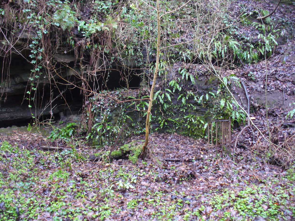
Remains of the Borgie Well

The name ‘Borgie’ is an oddity.  Local historians J.T.T. Brown (1884) and James Wilson (1925) wondered whether it had Gaelic, Saxon or Norse origins, with Brown thinking it may have been either a multiple of a simple bore-well, or else a title given it by a travelling minister from Borgue, in Kirkcudbright.  Mr Wilson took his etymology from the very far north where “there is a stream called the Borgie” (just below the Borgie souterrain).  This is said to be Nordic in origin, with

“borg, a fort or shelter, and -ie, a terminal denoting a stream. It is almost certain that our Borgie has the same origin; that is, ‘the fort or shelter by the stream.’”

The Borgie Well was described by a number of authors, each of whom spoke of its renown in the 19th century and earlier.  One of my favourite Glasgow writers, Hugh MacDonald (1860), had this to say about the place:

“There are several fine springs in the glen, at which groups of girls from the village, with their water pitchers, are generally congregated, lending an additional charm to the landscape, which is altogether of the most picturesque nature. One of these springs, called “the Borgie well,” is famous for the quality of its water, which, it is jocularly said, has a deteriorating influence on the wits of those who habitually use it.  Those who drink of the “Borgie,” we were informed by a gash old fellow who once helped us to a draught of it, are sure to turn “half daft,” and will never leave Cambuslang if they can help it.  However this may be, we can assure such of our readers as may venture to taste it that they will find a bicker of it a treat of no ordinary kind, more especially if they have threaded the mazes of the glen, as we have been doing, under the vertical radiance of a July sun.”

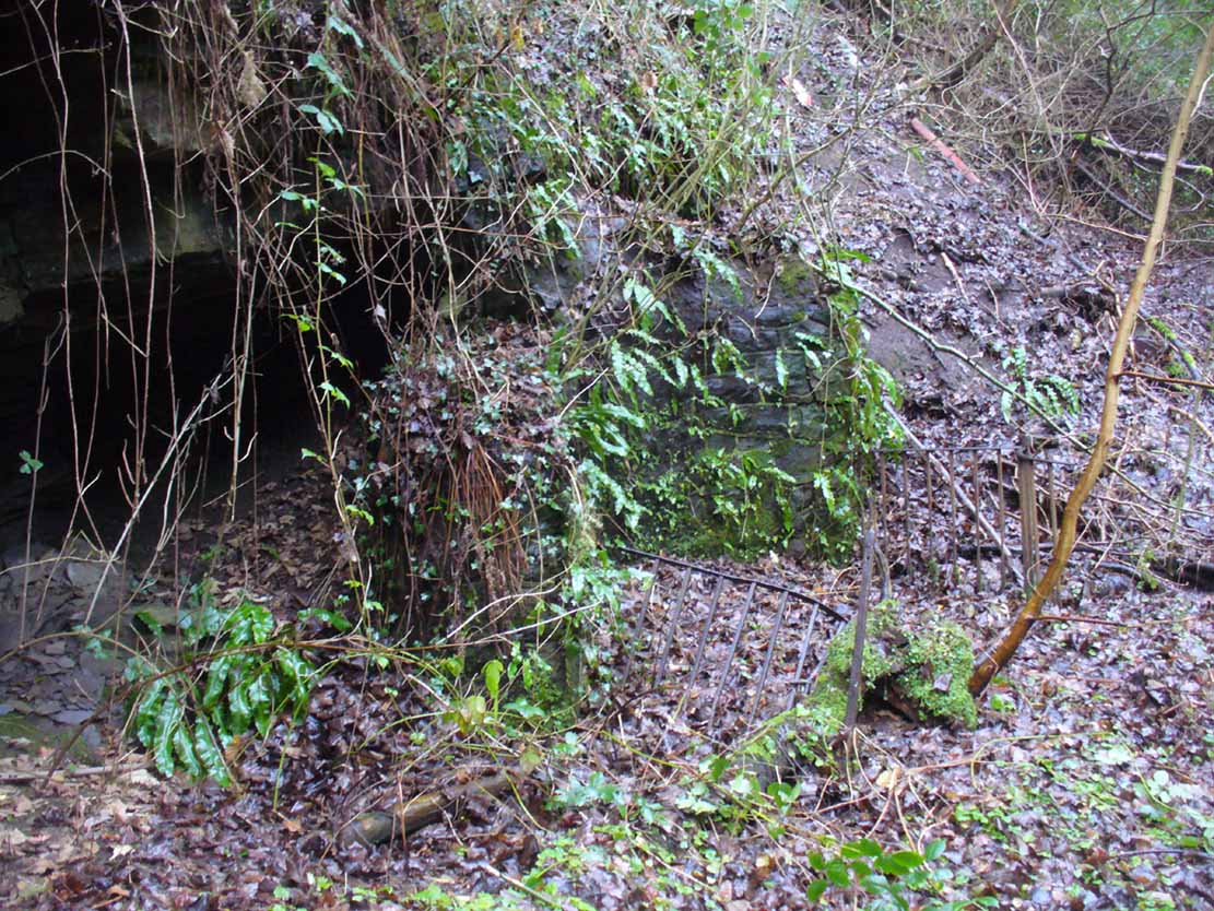
Borgie Well, looking south

It’s somewhat troublesome to reach, but a beautiful landscape indeed is where, today, only remnants of the Borgie Well exist.  A very eroded semi-circle of walling and iron bars protects what was once the waters of the well—which have long since fallen back to Earth.  Behind it, right behind it, overhangs the cliff and a small cave: a recess into the Earth with its very own feeling.  It has the look and feel of a witch’s or hermit’s den with distinct oracular properties.  This geomancy would not have gone unnoticed by our ancestors.  In this enclaved silence, the once bubbling waters beneath the cliffs give a feel of ancient genius loci—a memory still there, despite modernity.  Whether this crack in the Earth and its pure spring waters was some sort of Delphic Oracle in days gone by, only transpersonal ventures may retrieve… Perhaps…

In the 19th century a path took you into the glen from the north, and a commemorative plaque was erected here by a Dr Muirhead, where now lie ruins.  It read:

The Borgie Well here
Ran many a year.

Then comes the main verse :_

Wells wane away,
Brief, too, man’s stay,
Our race alone abides.
A s burns purl on
With mirth or moan,
Old Ocean with its tides,
Each longest day
Join hands and say
(Here where once flowed the well)
We hold the grip
Friends don’t let slip
The Bonny Borgie Dell.
1879.

At the base was carved an appeal to the local folk:

Boys, guard this well, and guard this stone,
Because, because, both are your own.

The plaque has long since gone; and according to the local historian J.T.T. Brown (1884), the waters went with it due to local mining operations around the same time.  But there was an additional rhyme sang of the Borgie Well which thankfully keeps the feel of its memory truly awake (to folk like me anyway!).  It is somewhat of a puzzle to interpret.  Spoken of from several centuries ago, it thankfully still prevails:

A drink 0′ the Borgie, a taste 0′ the weed,
Sets a’ the Cam’slang folks wrang in the heid.

Meaning simply, if you drink the waters of this well, you’ll get inebriated!   It’s the derivation of the word ‘weed’ that is intriguing here.  In Grant’s (1975) massive Scottish dialect work we are given several meanings. The most obvious is that the weed in the poem is, literally, a weed as we all know it.  But it also means ‘a fever’; also ‘to cut away’ or ‘thin out’; to carry off or remove (especially by death); as well as a shroud or sheet of cloth.  These meanings are found echoed, with slight variants, in the english dialect equivalent of Joseph Wright. (1905)  Hugh MacDonald told that the Enchanter’s Nightshade (Circaea lutetiana) grew hereby—which, initially, one might think could account for this curious rhyme.  But the Enchanter’s Nightshade has nothing to do with the psychoactive Nightshade family, well-known in the shamanistic practices of our forefathers.  However, in the old pages of one Folklore Society text, William Black (1883), in repeating the curious rhyme, told us:

“The Borgie well, at Cambuslang, near Glasgow, is credited with making mad those who drink from it; according to the local rhyme —

A drink of the Borgie, a bite of the weed,
Sets a’ the Cam’slang folk wrang in the head.”

The weed is the weedy fungi.”

A mushroom no less!  In John Bourke’s curious (1891) analysis of early mushroom use, he repeats Mr Black’s derivation.  If this ‘weed’ was indeed use of mushrooms that made the local folk “go mad” or “wrang in the head” (and if not – what was it?), it’s an early literary account of magic mushroom intoxication!  If this interpretation is correct, the likelihood is that the Borgie Well was a site used for ritual or social use of such intoxicants.  Many sites across the world were used by indigenous people for ritual intoxication, and this could be one of the last folk remnants of such usage here. We know that Scotland has its own version of cocaine, used extensively by our ancestors (even the Romans described it) and which was still being used by working Highlanders in the 20th century—but early descriptions of mind-affecting mushrooms are rare indeed!

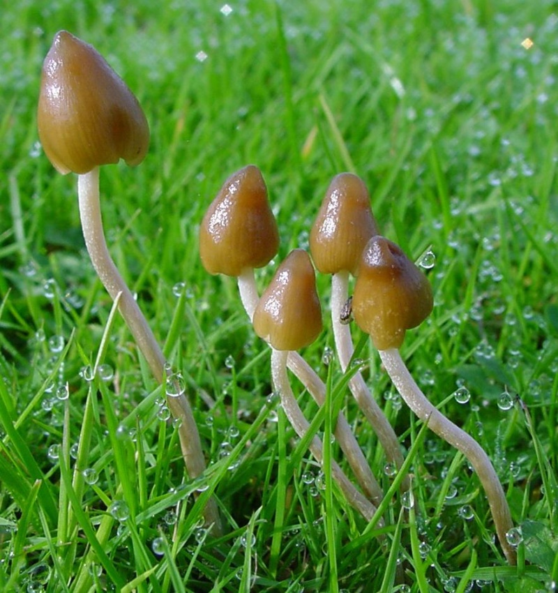
Psilocybe semilanceata
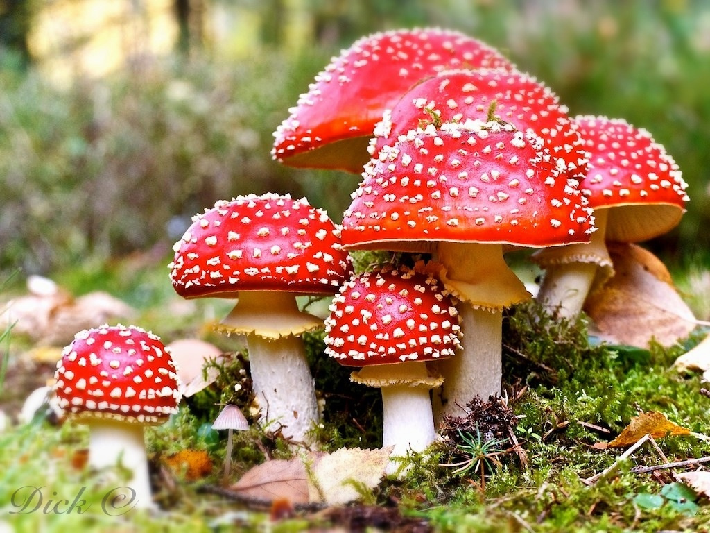
Amanita muscaria
Amanita muscaria

Mr Black gives no further folklore, nor the source of his information, other than to suggest that the madness incurred by the Well typified the people of Cambuslang!  “Weedy fungi” may have been ergot (Claviceps purpurea), but the incidence of the grasses upon which it primarily grows, rye, here seems unlikely—and the folklore would certainly have included the ‘death’ aspects which that fungus brings!  Fly agarics (Amanita muscaria) however, may have grown here.  Old birches are close by, which produce nice quantities of those beautiful fellas.  On the fields above the gorge, where now houses grow, Liberty Caps (Psilocybe semilanceata) may have profused—as they do in the field edges further out of town—but this species has no local cultural history known about from the early period.  We must, however, maintain a healthy scepticism about this interpretation—but at the same time we have to take into account the ‘intoxicating’ madness which the combination of the “waters and the weed” elicited.

One final note I have to make before closing this site entry:  despite the beautiful location, this small gorge is in a fucking disgraceful state.  Some of the people who live in the houses above the gorge should be fucking ashamed of themselves, dumping masses of their household rubbish and tons of broken glass into the glen.  If these people are Scottish, WTF are you doing polluting your own landscape like this?  This almost forgotten sacred site needs renewing and maintaining as an important part of your ancient heritage.  Have you no respect for your own land?!?

References:

  1. Armitage, Paul, The Ancient and Holy Wells of Glasgow, TNA 2017.
  2. Black, William George, Folk Medicine: A Chapter in the History of Culture, Folk-lore Society: London 1883.
  3. Brotchie, T.C.F., “Holy Wells in and Around Glasgow,” in Old Glasgow Club Transactions, volume 4, 1920.
  4. Brown, J.T.T., Cambuslang, James Maclehose: Glasgow 1884.
  5. Bourke, John G., Scatalogic Rites of All Nations, W.H. Lowdermilk: Washington 18981.
  6. Grant, William (ed.), The Scottish National Dictionary – volume 10, SNDA: Edinburgh 1975.
  7. Hansen, Harold A., The Witches’ Garden, Santa Cruz: Unity 1980.
  8. MacDonald, Hugh, Rambles round Glasgow, John Cameron: Glasgow 1860.
  9. MacKinlay, James M., Folklore of Scottish Lochs and Springs, William Hodge: Glasgow 1893.
  10. Morris, Ruth & Frank, Scottish Healing Wells, Alethea: Sandy 1982.
  11. Walker, J.R., ‘”Holy Wells” in Scotland”, in Proceedings of the Society of Antiquaries, Scotland, volume 17, 1883.
  12. Wilson, James A., A History of Cambuslang, Jackson Wylie 1925.
  13. Wright, Joseph, The English Dialect Dictionary – volume 6, Henry Frowde: Oxford 1905.

Acknowledgements:  Huge thanks again, in various ways, to Nina Harris for getting us here; and Paul Hornby, for reminding me of my literary sources when I needed them! Thanks too to Travis Brodick and his beautiful photo of the Amanita muscaria cluster.

© Paul Bennett, The Northern Antiquarian


Marriage Well, Carmyle, Lanarkshire

Sacred Well:  OS Grid Reference – NS 66765 62063

Getting Here

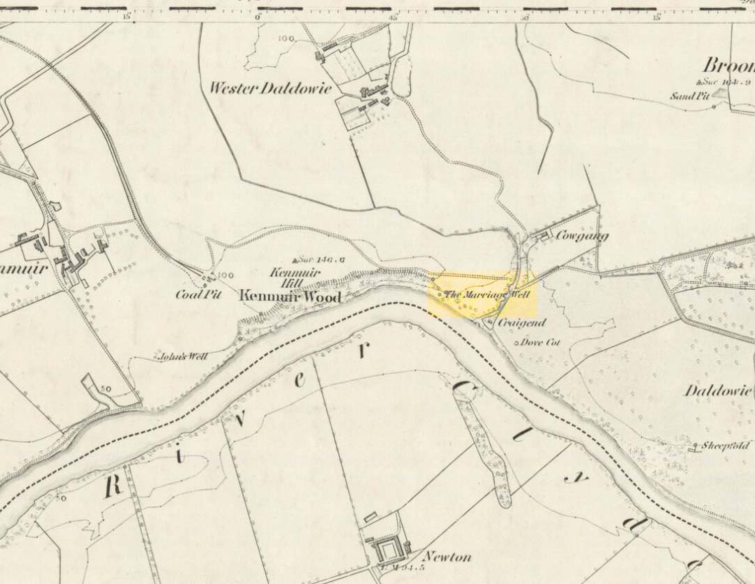
Marriage Well on 1864 map

Get onto the A763 road several miles east of Glasgow city centre and go along Gardenside Avenue onto the Carmyle estate. A few hundred yards on, turn right down Carmyle Avenue, then left onto River Road. Follow the footpath along the edge of the River Clyde for nearly a mile—past the recently destroyed John’s Well—until you hit the remnants of Kenmuir Woods. You’ll reach some large polluted pools and when you reach the gap between the first and second pool, walk into the trees above the river and the Well is there.

Archaeology & History

The decaying remains of this old well can still be seen, incredibly, in the small copse of trees that are Kenmuir Woods, just a few yards above the River Clyde, 160 yards below the M8 and the same distance west of the Daldowie sewage treatment works, with polluted water treatment pools just yards away!  Not the sort of place you’d take a partner for any sort of marriage ceremony whatsoever nowadays!  But it wasn’t always like this of course. Only since the Industrialists stamped their mark…

When Hugh MacDonald (1860) wrote the finest narrative of this arena in the middle of the 19th century, his evocative words painted the entire landscape with a veil untouched since his days.  Indeed, it is truly like another world compared to the sacrilege of what we see today:

“It is a wild and bosky scene, covered with a picturesque profusion of timber, and is the habitat of flowers innumerable. The weaver herbalists of Camlachie and Parkhead find it a perfect storehouse of medicinal rarities; and on Sundays they may be seen in sickly groups prying into every green recess in search of plants which old Culpepper would have loved for their rare qualities, or carrying them home in odorous bundles, confident of having obtained a mastery over “all the ills that flesh is heir to.” The botanist may also occasionally be seen lurking here, vasculum in hand, or on bended knee, examining the structure of some strange flower. But even the mere general lover of flowers will here find much to reward his attention.  At present the May-flower (Caltha palustris), the wild hyacinth, the craw-flower of Tannahill, the red campion (Lychnis dioica), the odorous woodruff (Asperula oderata), the globe-flower or lucken gowan (Trollius europœus), and many others are in full bloom, and so thickly strewn that even as the poet says, “You cannot see the grass for flowers.”

“At the foot of the bank, near its upper extremity, there is a fine spring, which is known by the name of the ‘Marriage Well,’ from a couple of curiously united trees which rise at its side and fling their shadows over its breast. To this spot, in other days, came wedding parties, on the day after marriage, to drink of the crystal water, and, in a cup of the mountain-dew, to pledge long life and happiness to the loving pair whom, on the previous day, old Hymen had made one in the bands which death alone can sever.  After imbibing a draught of the sacred fluid from the cup of Diogenes, we rest a brief space on the margin of the well.”

One wonders how far back in time the attribution of ‘Marriage Well’ from the animism of the trees went; and whether marriage ceremonies were performed here, quietly, away from the prying eyes of the Church and invading english in centuries much earlier under the guidance of the Moon.  It’s probable…

Nature’s cloak was still intact here when, many years after Hugh MacDonald’s visit, the local writer Dan McAleer (1930) informed us that,

“Shy bridesmaids and their groomsmen used to visit after a wedding to drink the mystic waters of the Marriage Well.  Certain places about the woods were well adapted for picnics, etc. After tea and refreshments the lads and lassies passed hours in amusement trying to step over the well and anyone soiling the water in any way while stepping across it would not get married that year.”

Much of the beauty of the landscape and Her waters, and the rich romance that arises from Her cyclical forms are long gone from here now… Cold ‘progress’ bereft of the necessity of Nature’s sanctity is no progress at all…  Although the genius loci of the place may have long since gone, at the very least the regional council—or decent locals, if the council can’t be arsed—could erect some memorial and save the failing Marriage Well from what seems to be its close and final demise….

References:

  1. Carpenter, Edward, Civilization: Its Cause and Cure, George Allen & Unwin: New York 1914.
  2. McAleer, Dan, A Sketch of Shettleston, 1930.
  3. McDonald, Hugh, Rambles round Glasgow, John Cameron: Glasgow 1860.
  4. Michell, John, The Earth Spirit: Its Ways, Shrines and Mysteries, Thames & Hudson: London 1975.
  5. Michell, John, Simulacra, Thames & Hudson: London 1979.
  6. Morris, Ruth & Frank, Scottish Healing Wells, Alethea: Sandy 1982.

© Paul Bennett, The Northern Antiquarian 


Well of the Whooping-Cough, Killin, Perthshire

Legendary Stone & Healing Well (lost):  OS Grid Reference – NN 579 323

Also Known as:

  1. Fuaran na Druidh Chasad
  2. Whooping Cough Well

Archaeology & History

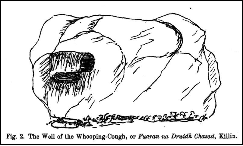
“Well of the Whooping Cough” stone, near Killin

The grid-reference given for this site is only an approximation based on the description given by Hugh MacMillan (1884), below.  The exact whereabouts of the place remains forgotten, but based on the story we have of the place it would be great if we could locate it and — as far as I’m concerned — be highlighted and preserved as an important spot in the history of religious and social history for the people of Killin and the wider mountain community.  The region here was well populated all along the northern and southern sides of the adjacent Loch Tay before the coming of the Highland Clearances (Prebble 1963), and so the lore which MacMillan describes below was very likely of truly ancient pedigree.

Not to be confused with a site of the same name (and attributes) as the healing well at Balquhidder, this site comprises of a large stone, typical of the region, covered in that delicious carpet of old mosses and lichen bestowed by the aged love from Nature that bedecks much of the hidden sites in the area.  Upon one side of the rock was a large hollow, in which water was always collected: of both dew and rain and the breath of low clouds, within which were great medicinal virtues long known of by local people.  Foreign or shallow archaeologists would denounce this rock and its virtues as little more than the superstitious beliefs of an uneducated people living in uneducated times, but such derision is simply foolish words from pretentious souls who know little of the real world.  For the attributes and mythic elements at this old stone is another example of living animism: vitally important ingredients in the spiritual background and nourishment of a people not yet overcome by the degrading influence of homo-profanus.  Here we still find the living principles of the natural world, sleeping away in the consensus trance of modern folk…

Folklore

The stone and its ‘healing well’ are not mentioned in the standard Scottish texts on holy wells (MacKinlay 1893; Morris 1982) and we have to rely solely on Hugh MacMillan’s first-person account of the place from the latter-half of the 19th century.  He told that the stone was to be found “in the woods of Auchmore at Killin,” some twelve miles from a similar curative rock at Fearnan called the Clach-na Cruich:

“This stone is called Fuaran na Druidh Chasad, or the Well of the Whooping-Cough.  I heard of it incidentally last year in Paisley from a native of Killin, who remembered vividly when a boy having been taken to drink the water in the cavity of the stone, in order to cure the whooping-cough, from which he was suffering at the time.  Happening to be in Killin lately, enjoying a few days’ holiday, I made inquiries in the village; but though some of the older inhabitants remembered having heard of the stone, and the remarkable practice connected with it, I could not get any one to describe the exact locality of it to me, so completely has the superstition passed away from the mind of the present generation.  I went twice in search of the stone; and though, as I afterwards found, I had been within a very short distance of it unawares on both occasions, I was unsuccessful in finding it. At last I met an old man, and after some search we found the stone, and he identified it.

“I understood then what had puzzled me before, viz., why it should have been called Fuaran or Well, for I had supposed it had a cavity in a stone like that at Fernan. It was indeed a cavity; but it was in the projecting side of the stone, not on its top surface. It consisted of a deep basin penetrating through a dark cave-like arched recess into the heart of the stone.  It was difficult to tell whether it was natural or artificial, for it might well have been either, and was possibly’ both; the original cavity having been a mere freak of nature — a weather-worn hole — afterwards perhaps enlarged by some superstitious hand, and adapted to the purpose for which it was used.  Its sides were covered with green cushions of moss; and the quantity of water in the cavity was very considerable, amounting probably to three gallons or more.  Indeed, so natural did it look, so like a fountain, that my guide asserted that it was a well formed by the water of on underground spring bubbling up through the rock.  I said to him, “Then why does it not flow over?”  That circumstance he seemed to regard as a part of its miraculous character to be taken on trust. I put my hand into it, and felt all round the cavity where the water lay, and found, as was self-evident, that its source of supply was from above and not from below; that the basin was simply filled with rain water, which was prevented from being evaporated by the depth of the cavity, and the fact that a large part of it was within the arched recess in the stone, where the sun could not get access to it.  I was told that it was never known to be dry — a circumstance which I could well believe from its peculiar construction.

“The stone, which was a rough irregular boulder, somewhat square-shaped, of mica schist, with veins of quartz running through it, about 8 feet long and 5 feet high, was covered almost completely with luxuriant moss and lichen; and my time being limited, I did not examine it particularly for traces of cup-marks.  There were several other stones of nearly the same size in the vicinity, but there was no evidence, so far as I could see, of any sepulchral or religious structure in the place.  There is indeed a small, though well-formed and compact so-called Druidical circle, consisting of some seven or eight tall massive stones, with a few faint cup-marks on one of them, all standing upright within a short distance on the meadow near Kinnell House, the ancestral seat of the Macnabs, and it is a reasonable supposition that the Fountain of the Whooping-Cough may have had some connection in ancient times with this prehistoric structure in its immediate neighbourhood; for, unlike the cavity in the stone at Fernan, the peculiar shape of the cavity in this stone precluded its ever having been used as a mortar, and apparently it has never been used for any other purpose than that which it has so long served.  There can be no doubt that the fountain dates from a remote antiquity; and the superstition connected with it has survived in the locality for many ages. It has now passed away completely, and the old stone is utterly neglected. The path leading to it, which. used to be constantly frequented, is now almost obliterated. This has come about within the last thirty years, and one of the principal causes of its being forgotten is that its site is now part of the private policies of Auchmore. The landlady of the house at Killin, where I resided, remembered distinctly having been brought to the stone to be cured of the whooping-cough; and, at the foot of it, there are still two flat stones that were used as steps to enable children to reach up to the level of the fountain, so as to drink its healing waters; but they are now almost hidden by the rank growth of grass and moss.  There is more verisimilitude about the supposititious cures effected at this fountain than about those connected with the stone at Fernan; for one of the best remedies for the whooping-cough, it is well known, is change of air, and this the little patient would undoubtedly get, who was brought, it may be, a considerable distance to this spot. I am led to understand that, in connection with the cure, the ceremonial turn called “Deseul” was performed. The patient was required, before drinking the water, to go round the stone three times in a right-hand direction, which may be regarded as an act of solar adoration. This practice lingered long in this as in other parts of the Highlands, and the “deseul” was religiously performed round homesteads, newly-married couples, infants before baptism, patients to be cured, and persons to whom good success in some enterprise was wished; while the “Tuathseul,” or the unhallowed turn to the left, was also performed in cases of the imprecation of evil.”

Should anyone know the whereabouts of this fascinating healing stone and its waters, please let us know!

References:

  1. MacKinlay, James M., Folklore of Scottish Lochs and Springs, William Hodge: Glasgow 1893.
  2. MacMillan, Hugh, ‘Notice of Two Boulders having Rain-Filled Cavities on the Shores of Loch Tay, Formerly Associated with the Cure of Disease,’ in Proceedings of the Society of Antiquaries of Scotland 18, 1884.
  3. Morris, Ruth & Frank, Scottish Healing Wells, Alethea: Sandy 1982.
  4. Prebble, John, The Highland Clearances, Secker & Warburg: London 1963.

© Paul Bennett, The Northern Antiquarian