Druid’s Oak, Caton, Lancashire

Legendary Tree:  OS Grid Reference — SD 5297 6467

Also Known as:

  1. Caton Oak
  2. Fish Stones Oak

Getting Here

The Druid's or Caton Oak
The Druid’s or Caton Oak

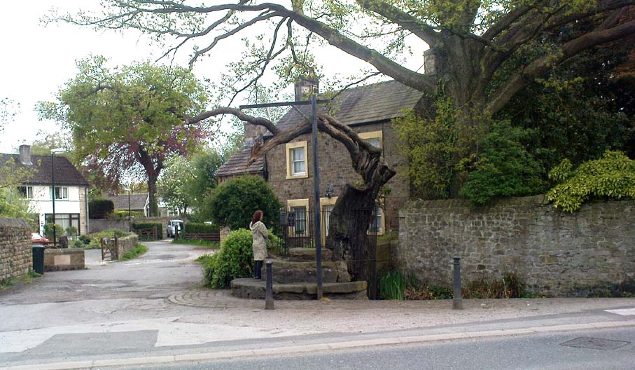
Dead easy! Near the western end of Caton village, right on the edge of the main road (A683) running through the village (south-side of the road), enclosed by railings, you’ll see the remains of this ancient tree, just by the side of the stream.  Keep your eyes peeled!

Archaeology & History

The small scruffy-looking remnant of an oak standing here by the roadside in Caton village, surrounded by protective railings, is the dying remnants of the old tree, standing upon the sandstone steps which were known as the Fish Stones: a curious monument that has been listed as a protected monument by the Dept of National Heritage.  A small plaque on the side tells:

“The three semi-circular sandstone steps, shaded by the oak tree, were used in medieval times by the monks of Cockersand Abbey to display and sell fish caught from the River Lune.  The ancient oak tree, reputed to date back to the time of the druids, and the Fish Stones, have become a landmark and Symbol of Caton.”
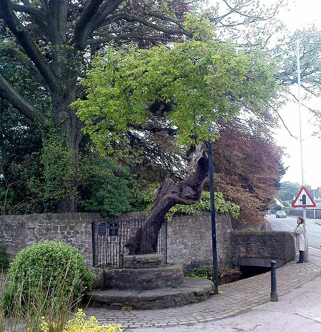
Druid's Oak, Caton
Druid’s Oak, Caton

This was probably the local moot spot for villagers and those living in outlying farms and hills in medieval times.  No doubt a market of some sort was also once here; perhaps even an old cross, as the Fish Stones have all the appearance of some village cross steps.  I’ve found little else about this old tree, nor any folklore (but aint looked too hard if truth be had!).  There’s surely more to be said about this once sacred tree.

More sites related in folklore to druids can be found not too far away at the collapsed cairn near Bordley; the Druid’s Altar and nearby Druid’s Well on the outskirts of Bingley; the Druid’s Stone of Bungay in Suffolk and many more…

© Paul Bennett, The Northern Antiquarian 


Old Woman’s Well, Guisborough, North Yorkshire

Holy Well (lost): OS Grid Reference – NZ 610 180

Getting Here

The grid reference here is an approximation, but the old well was definitely somewhere very close by, as evidenced by the place-name of the farmhouse. But if you wanna get here and wander about in the hope that you can re-locate this once sacred water source, go up the B1269 road north of Guisborough for about a mile. Carling Howe farmhouse is on the left-hand side of the road. Obviously the old well is somewhere close by…

Archaeology & History

The information I have of this site comes from old place-name listings. I found the reference in the directory for North Yorkshire by A.H. Smith (1928), in his entry for the etymology of ‘Carling Howe’ at Guisborough.  Smith ascribes the references of ‘Kerlinghou’ (which itself appears to have been lost) to mean the ‘Old woman’s mound’ and variants thereof, also saying, “There is an unidentified place in this township called Kerlingkelde,” (12th century ref. Guisborough Cartulary)—the ‘Old Woman’s Well’.  Very commonly in this part of Yorkshire—as at many other locations in northern England—a hou or howe (and variants thereof) relates to a prehistoric tomb – which is probably what we had here: a prehistoric Old Woman’s Grave with an associated Old Woman’s Well in close attendance.

The ‘old woman’ element in this name very probably relates to that primal mythic deity, the cailleach, the great prima mater of indigenous heathen folk, beloved mainly in Scottish and Irish lore, where her copious name and tales resonate to this day. This “well of the Old Woman, or cailleach“, would have been a place of particular importance in the mythic cosmology of our ancestors, but its precise whereabouts seems forgotten. There is a plentiful supply of water around Carling Howe Farm, one or more of which may once have been the site of this well. However, a lot of quarrying operations occurred here in the not-too-distant past, and this may have irreparably damaged our ability to accurately find the site – though perhaps a perusal of old field-maps could be productive.

It would also be good if we could locate the original whereabouts of the old tomb here which gave the place its name – the ‘Carling Howe’.  Other ‘howe’ sites in East and North Yorkshire turn out to be prehistoric burials and I have little doubt that the same occurred here.

References:

  1. o’ Crualaoich, Gearoid, The Book of the Cailleach, Cork University Press 2003.
  2. Smith, A.H., The Place-Names of the North Riding of Yorkshire, Cambridge University Press 1928.

© Paul Bennett, The Northern Antiquarian


Creag na Cailleach, Killin, Perthshire

Sacred Mountain:  OS Grid Reference – NN 5640 3715

Also known as:

  1. Creag na Caillich

Getting Here

Another silly-sounding directional pointer!  Get to the now tourist-infested town of Killin (best in Winter, when the town is quiet and you get to know the locals a lot better) and travel through it as if you’re going to follow Loch Tay up its western side.  As you’re going out of the village towards the Bridge of Lochay Hotel (an excellent place), you’ll see an amphitheatre of mountains in the background.  The tallest of the hills on the left is where you’re heading.  Go straight up the hillside and follow your nose!

Creag na Cailleach, Perthshire
Creag na Cailleach, Killin

The hill guards the entrance to the legendary Glen Lochay (Valley of the Black Goddess).  There are many ways to climb her, but my first venture here took me up the waterfalls and steepish burn of Allt na Ceardaich.  Once on the level, I found myself surrounded by that amphitheatre I mentioned, from which – on my first visit – I took up the sheer face of this great mountain. (to be honest it’s nowt special if you’re into mountaineering and stuff) From the tops you’ve got a damn good view all round.  But respect this old hill, as danger awakens to idiots who would think themselves champions.

Folklore

Here, where axes were quarried by ancient man from beneath Her rocky slopes, this ‘Hill of the Old Woman’, or ‘Hag’, was one of the abodes of the primal Mother Goddess in olden times, so says her name.  Her ‘dark’ aspect seemed manifest one time when I climbed her with a rather stupid man in tow.  Following one of the streams back into the valley below, he thought it wise to copy my gazelle-nature as I sprang without thought, quickly, from rock to rock, bouncing at speed down the fast-flowing stream  (which takes a lotta weird practice and very strong ankles!), in spite of the advice to do otherwise – and in doing so he broke his leg in three places and, to make it worse, had to spend the night there in complete agony!

Don’t tell me there’s no ‘dark’ goddess to some of these great places!

Axe production has been found to have occurred as early as 2500 BC.  There have been numerous flint finds hereabouts aswell – but considering this is a mountain, you’d expect to find something on or about Her slopes!

I’ve just been back up here as the first good snow fell upon the hills and the white cover brought the elements out of her form in a way I’d not seen before.  Tis a wonderful place the Creag na Cailleach; and, it seems, a site that played a now forgotten part in the ancient name of the glen, Lochay, which was the living abode of the Black Goddess in more archaic days.  Twouldst be good to hear some of the authentic old stories from old locals that were once known of this ancient deity in the glens.  If anyone knows of such tales, let us know before they are lost forever…

References:

  1. Ritchie, P.R., ‘The Stone Implement Trade in Third Millenium Scotland,’ in Coles & Simpson’s, Studies in Ancient Europe, Leicester University Press 1968.

Acknowledgements:  Huge thanks to Lindsay Campbell for her hospitality, food and roof hereby.

© Paul Bennett, The Northern Antiquarian


Simon’s Seat, Skyreholme, North Yorkshire

Sacred Hill:  OS Grid Reference – SE 0788 5981

Getting Here

Simon’s Seat in the centre & the Lord’s Seat immediately east

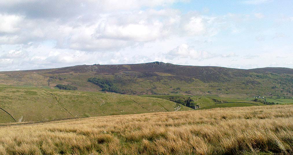
Tons of ways here.   To those who drive, take the Grassington-Pateley Bridge (B6265) road and a couple of miles past the village of Hebden, you’ll see the high rocks climbing on your southern horizon, with another group of rocks a few hundred yards along the same ridge.  That’s it!

Archaeology & History

This is an awesome site, full of raw power. It commands a brilliant view all round, but it is the north which truly draws the eye’s attention. Beneath the great drop of this huge outcrop is the haunted and legendary Troller’s Ghyll. The scent of as yet undisclosed neolithic and Bronze Age sites purrs from the moors all round you and there can be little doubt that this was a place of important magick in ancient days.

What seems to be several cup-markings on one of the topmost rocks are, to me, authentic. Harry Speight mentioned them in his 1892 work on the Craven and Northwest Yorkshire Highlands – but there are a number of other rocks in this giant outcrop with “possibles” on them.

Folklore

The name of this great rock outcrop has long been a puzzle to historians and place-name experts.  One tale that was told of Simon’s Seat to the travelling pen of one Frederic Montagu in 1838, told that,

“It was upon the top of this mountain that an infant was found by a shepherd, who took it to his home, and after feeding and clothing it, he had the child named Simon; being himself but a poor man, he was unable to maintain the foundling, when it was ultimately agreed to by the shepherds, that the child should be kept “amang ’em.”  The child was called Simon Amangham and the descendants of this child are now living in Wharfedale.”

The usually sober pen of Mr Speight thinks this to have been one the high places of druidic worship, named after the legendary Simon Druid. “It is however, hardly likely,” he wrote, “that he ever sat there himself, but was probably represented by some druidical soothsayer on whom his mystic gifts descended.”

I’ve gotta say, I think there’s something distinctly true about those lines. Visit this place a few times, alone, during the week, or at night – when there’s no tourists about – and tell me it isn’t…

References:

  1. Bogg, Edmund, Higher Wharfeland, James Miles: Leeds 1904.
  2. Montagu, Frederic, Gleanings in Craven, Simpkin Marshall: London 1838.
  3. Speight, Harry, The Craven and Northwest Yorkshire Highlands, Elliott Stock: London 1892.

© Paul Bennett, The Northern Antiquarian


Badger Wells Cairn, Pendle Hill, Lancashire

Cairn:  OS Grid Reference – SD 783 396

Getting Here

Start at the Nick of Pendle and walk up the footpath towards the denuded Apronful of Stones’ cairn.  Keep going up the hill for another 300 yards or so, just past where there’s a path that turns-off towards the ritual Deer Stones. As you walk upwards, in front of you you’ll see the tell-tale sign of many small stones scattered in their tell-tale manner, rising up at the edge of the footpath. This is it!

Archaeology & History

This was the third in a group of previously unrecognized giant cairns that I found in August 2006 (it certainly wasn’t in the archaeology records anyway), all on the south side of our legendary Pendle Hill — and it’s bloody huge!  However, unlike the other two (the Devil’s Apronful and the Lower Apronful of Stones, further down the slopes), this one doesn’t seem as certain as the other two, but it’s still worth including here and cannot be discounted until a decent archaeological assessment has been made.

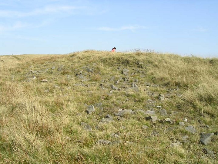
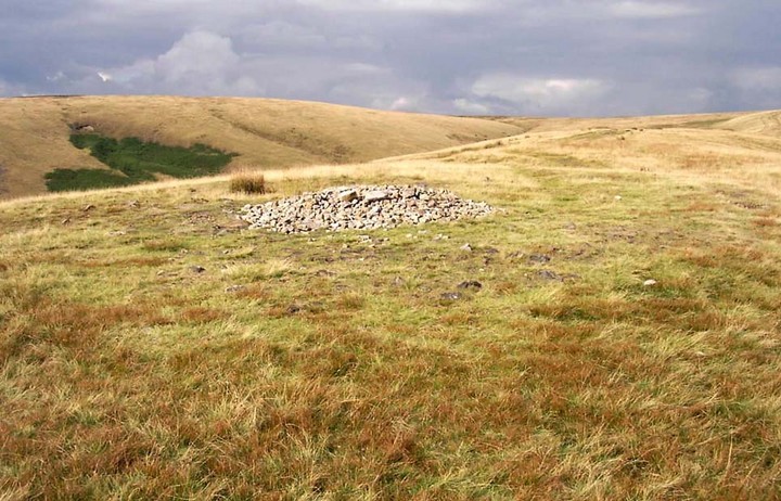
Looking up to the height of the Badger Wells Cairn
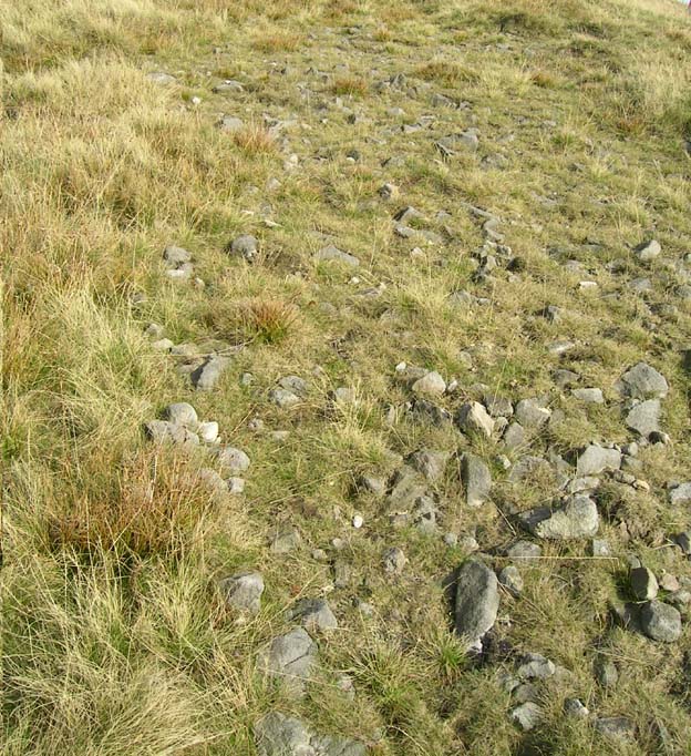
Section of the surface remains, showing thousands of stones

Just like its companion cairns, although it’s covered over with much soil and grasses, all round the edges are hundreds of small stones and rocks, of the same type and size as the other two a bit further down the hill, and similar to the Skirtful of Stones on Ilkley and elsewhere.  The overgrown heap of stones here stands about ten-feet tall from the lower western edge and measures approximately 28 yards (north-south) by 20 yards (east-west).

Although this cairn is named after the nearby Badger Wells — which gets its name either from the local badger population, or else the old ‘badger-men’ who used to trade hereby — another fresh water source also emerges near the bottom of its western side.

Upon asking a couple of passers-by (they were local regular walkers up this great hill) about this and the other giant overgrown cairns upon this hill, they didn’t have a clue they existed — although they did suggest we contact the Lord of Downham on the north side of the hill. And so there we ventured, in search of the Great Stone – and guess who we bumped into…?

© Paul Bennett, The Northern Antiquarian


Devil’s Apronful, Pendle Hill, Lancashire

Cairn:  OS Grid Reference – SD 77907 39357

Also known as:

  1. Apronful of Stones

Getting Here

The much-denuded Devil's Apronful giant cairn
The much-denuded Devil’s Apronful giant cairn

Many ways to get here, but the easiest for those with cars to is park up on the southeast edge of the hill, at the various scruffy parking bits beside the road at the Nick of Pendle. The view from here is enough to get you going! Walk onto the great hill up to the rounded pap of Apronfull Hill (rather gives it away really!). It’s only a few hundred yards up – about 10 mins up the slope from the road, with awesome views all round once you get there. Tis the small guidance cairn you’re looking at just on the level. You’re there!

Archaeology & History

This would once have been a rather huge cairn/tomb — though when I first found the remains of this place in August 2006, there were no archaeological records describing it that I could find.  But there’s very little left of it.  The lads who did the quarrying further downhill (where you’ve probably parked your car) are likely to have been the culprits who nicked most of the rocks that once made this huge forgotten tomb. But as you potter about here, it becomes obvious that you’re standing on the much-denuded remains of just such a monument (very similar in size and structure to the more famous Little Skirtful and Great Skirtful of Stones on Burley Moor, or Black Hill round cairn near Skipton).  But the remains you can see beneath your feet still give a good idea as to how large it was.

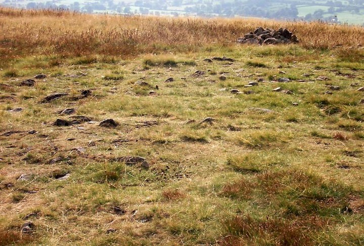
Remnants of the cairn-spoil cover the ground where the monument once stood proud!

You’ll see once you’re stood here that there are hundreds, maybe even several thousands of stones just on and below the ground, scattering a very well-defined roughly circular area measuring at least 21 yards (east-west) by 22 yards (north-south), right by the side of the path. The edges of this ransacked cairn are pretty well defined around the north and eastern sides. Near the centre of the old structure is a very notable ‘dip’ in the ground where it looks as if something has been dug away — though this could just as well be due to the presence of underground water, as indicated by the growth of Juncus grasses.  Without an excavation it’s obviously difficult to tell.

Folklore

Twas the following tale which first led my nose to explore this part of Pendle hill. It’s a tale we find at many of our upland tombs, though the record books said there was nowt here! (any myopic archaeologists out there who reckon that folklore has no relevance to their subject, educate one’s self!)

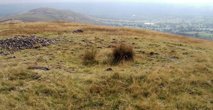
Looking from the Devil's Apronful towards Jeppe Knave's Grave
Looking from the Devil’s Apronful towards Jeppe Knave’s Grave

The Devil was having trouble with the folk at Clitheroe Castle (a few miles west) and wanted rid of it. So he picked up various large stones and put them in his apron then threw them towards the castle. Most of them missed, which made him angry and in a rage he accidentally dropped a great pile of rocks on the south side of Pendle Hill, creating the Devil’s Apronful on Apronfull Hill.

In another tale he was said to have stood at the Deer Stones a few hundred yards east of here and threw rocks from there. Perhaps a folk-remnant of where the Apronful stones once came from…? Perhaps not.

Jessica Lofthouse (1976) notes how this old spot was long known by local people as the Devil’s Apronful.

References:

  1. Lofthouse, Jessica, North-Country Folklore, Hale: London 1976.

© Paul Bennett, The Northern Antiquarian