St. Mary’s Well, Wallingwells, Nottinghamshire

Holy Well:  OS Grid Reference – SK 572 840

Archaeology & History

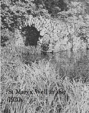
Old photo of St Mary's Well

Old photo of St Mary’s Well

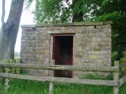
First mentioned in Pipe Rolls and referred to by the founder of Wallingwells Benedictine Priory (founded around 1150 CE) as ‘juxta fonts et rivum fontium’, the site Wallingwell or originally Waldon-by-the-Wells, may be significant.  The name refers to ‘bubbling wells’, but whether these wells were dedicated appears to be unknown, although it does seem likely.  Indeed, an anonymous article from the Worksop Guardian dated 1929 on the Wallingwell Estate, shows the well arising under a rough stone work arch beside the site of a lake.  Close by, appears to be a grotto of a similar construction. The article states that the grotto was built 250 years (from 1929 this suggests a date of 1679 which appears a little too early for this folly, a date in the 18th century being more likely). This was done by Thomas White using stone from petrified springs in Derbyshire. No reference is made of the well, but one assumes that it was built at the same time, but whether White was constructing a folly around an existing traditional site again is unknown.

Baker (2000) refers to the castle folly but fails to reference these sites suggesting that it had vanished. However, grotto and well still exist in the overgrown and forlorn garden to the back of the house.  The grotto is well-preserved, although signs of ruination are evident and the urn within has gone.

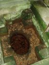
The internal brickwork

The internal brickwork

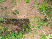
The overgrown well

The overgrown well

St. Mary’s Well is the most ruined. The archway appears to have fallen or been knocked down but the channel or basin the spring flows into still exists. Observation underneath a flattened stone covering the channel show that the spring flows from a pipe further up and under a series of neat brick arches. It is clear that the well structure was never accessible as it abutts onto the Lake, but was designed to be seen from the other side of the Lake. This view now is difficult due to the considerable plant growth obscuring the sites. It is good to see that the well still exists and hopefully the garden could be restored.

Extracted from R. B. Parish (2009) Holy Wells and Healing Springs of Nottinghamshire

Links:

  1. Holy & Healing Wells

© R.B. Parish, The Northern Antiquarian


Hawklemass Well, Whittingham, Northumberland

Healing Well:  OS Grid Reference – NU 0683 1228

Archaeology & History

Hawklemass Well on 1866 map

Hawklemass Well on 1866 map

References to this site seem very scarce.  A well is highlighted on the 1866 OS-map of the region close to the spot which D.D. Dixon (1895) said it was found, “near to the Howbalk Lane end, where is also the Hawklemass Stile and Hawklemass Well.”  A stone trough could once be seen here, but its presence today needs to be confirmed by local researchers.  The site is listed in Binnall & Dodds (1943) survey, but with no additional comments to those made by Mr Dixon.

Folklore

The historian D.D. Dixon (1895) told that the village of Whittingham only had one ghost, but it was known as the “Hawklemass Ghost” and was occasionally encountered at the Hawklemass Well:

“This was a place never passed after nightfall by the youth of the village without feeling an eerie, creepy sensation, and with many a furtive glance on either side.  This unearthly visitant, in its gambols and uncanny pranks, was said to rattle the chain by which it was supposed to be bound in a fearsome manner.  It was usually seen or heard by persons who, having lingered long at the village inn, could say with Tam o’ Shanter,

“While we sit bousing at the nappy,
An gettin’ fou and unco happy,
We think na on the lang Scots miles,
The mosses, waters, slaps and styles,
That lie between us and our hame.”

One Saturday night many years ago—perhaps fifty—a poor fellow on his way from Whittingham to Glanton fel into the roadside at Hawklemass, where he was found, quite dead, the next morning by some persons on their way to Glanton meeting.  This sad affair may have given rise to the tradition of the Hawklemass Ghost.”

The name of the old lane at whose junction the Hawklemass Well once flowed, ‘Howbalk Lane’, may derive from a lost tumulus, as the word how (and its variants) regularly relate to prehistoric mounds in our more northern climes.  Such an ancient tomb, close to the well, may be the origin of the ghost story.

References:

  1. Binnall, P.B.G. & Dodds, M.H., “Holy Wells in Northumberland and Durham – part 2”, in Proceedings of the Society of Antiquaries Newcastle-upon-Tyne, 10:2, 1943.
  2. Dixon, David Dippie, Whittingham Vale, Northumberland, Robert Redpath: Newcastle 1895.

Acknowledgements:  With thanks to Gill Rutherford for prompting me to finish this; and to Claire Heron for the OS-map reference.

© Paul BennettThe Northern Antiquarian


Ragged Spring, Healing, Lincolnshire

Healing Well:  OS Grid Reference — TA 199 096

Also Known as:

  1.  Ragged Well

Getting Here

The site can be found along Wells road, just after the turning for Healing wells farm and after the mirror.  One may need to beat through the thickets to reach it.

Archaeology & History
The Ragged Spring

The Ragged Spring

Some confusion exists over the relationship between the wells and the parish name. This is possibly an ancient site, as the earliest name for the parish is ‘Heghelinge’ and perhaps derive from the springs.  However, this is at variance to the view of Kenneth Cameron (1997) in his Place-Names of Lincolnshire, where it is noted that ‘Hægelingas’ is derived from “the sons or followers of a man named Hægel” rather than healing, although it is of course a strange coincidence!

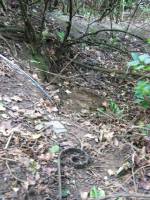
The springs are still marked on the current OS map, as Healing Wells, in a small plantation, but they are, as the photo shows, only marked by circular indentations in the ground.  The first spring is the easier one to trace and it appears to have holes, although these may be made by animals.  The springs are now quite dry, perhaps that the clogging of the springs noted above continued as the waters were forgotten, resulting in the current situation. There is no clear lining around the well or other structures. Lying around the springs are a range of metal buckets in various stages of decay and some metal pieces which may be remains of a metal fence around it. Sadly, I was unable to find any sign of rags although the man I asked in the whereabouts referred to them as “the ragged springs.”

Folklore

The Ragged Springs fed a stream where people paddled or hung garments on bushes to acquire good health strangely rather than the wells themselves. Gutch and Peacock  (1908) in their County Folklore note that a,

“Mr. Cordeaux visited them not long since for the purpose of discovering whether pins are ever dropped into them, but the bottom of the water in both cases was too muddy and full of leaves to allow accurate examination.”

According to Gutch and Peacock (1908) each well had a different use, one spring being a chalybeate one was done for eye problems, whereas the other was for skin problems. They continue to note that a:

F S, a middle-aged man, who grew up in an adjoining parish, states that when he was a lad, one spring was used for bathing, and the second for drinking. The latter was considered good against consumption, among other forms of sickness. . . . What the special gift of the bathing well was F S cannot say. He often plunged his feet into it when a boy, but he does not venture to assert that it had any great power in reality, although ‘folks used to come for miles,’ and the gipsies, who called the place Ragged Spring or Ragged Well, frequently visited it. A Gentleman who hunts with the Yarborough pack every winter, says that he notices the rags fluttering on the shrubs and briars each season as he rides past. There is always a supply of these tatters, whether used superstitiously or not, and always has been since his father first knew the district some seventy years ago.”

This would appear to be the site recorded as below under Great Cotes by R.C. Hope (1893) in his Legendary Lore of Holy Wells:

“there is a spring celebrated locally for its healing properties. It rises from the side of a bank in a plantation, and is overshadowed by an ancient thorn, on the branches of which hang innumerable rags, fastened there by those who have drunk it waters.”

The custom apparently continued until the 1940s.  Indeed a visitor in the 1920s noted that even the trunks were covered with longer pieces of rag.  A picture in the 1995 edition of Lincolnshire Past and Present journal shows a number of rags on the bushes. It is worth noting that perhaps the presence of a large thorn perhaps suggests a great antiquity to the site.

References:

  1. Cameron, Kenneth, The Place-Names of Lincolnshire – volume 5, EPNS: Nottingham 1997.
  2. Gutch, Mrs & Peacock, Mabel, County Folk-lore – volume v: Examples of Printed Folk-lore Concerning Lincolnshire, David Nutt: Folk-lore Society 1908.
  3. Hope, Robert Charles, Legendary Lore of the Holy Wells of England, Elliott Stock: London 1893.
  4. Parish, R.B., Holy Wells and Healing Springs of Lincolnshire. Pixyled Publications 2013

Links:

  1. Holy & Healing Wells

© R.B. Parish, The Northern Antiquarian


St. Patrick’s Well, Portpatrick, Wigtownshire

Holy Well (destroyed):  OS Grid Reference – NX 0010 5412

Also Known as:

  1. Canmore ID 60610

Archaeology & History

St Patricks Well on 1849 map

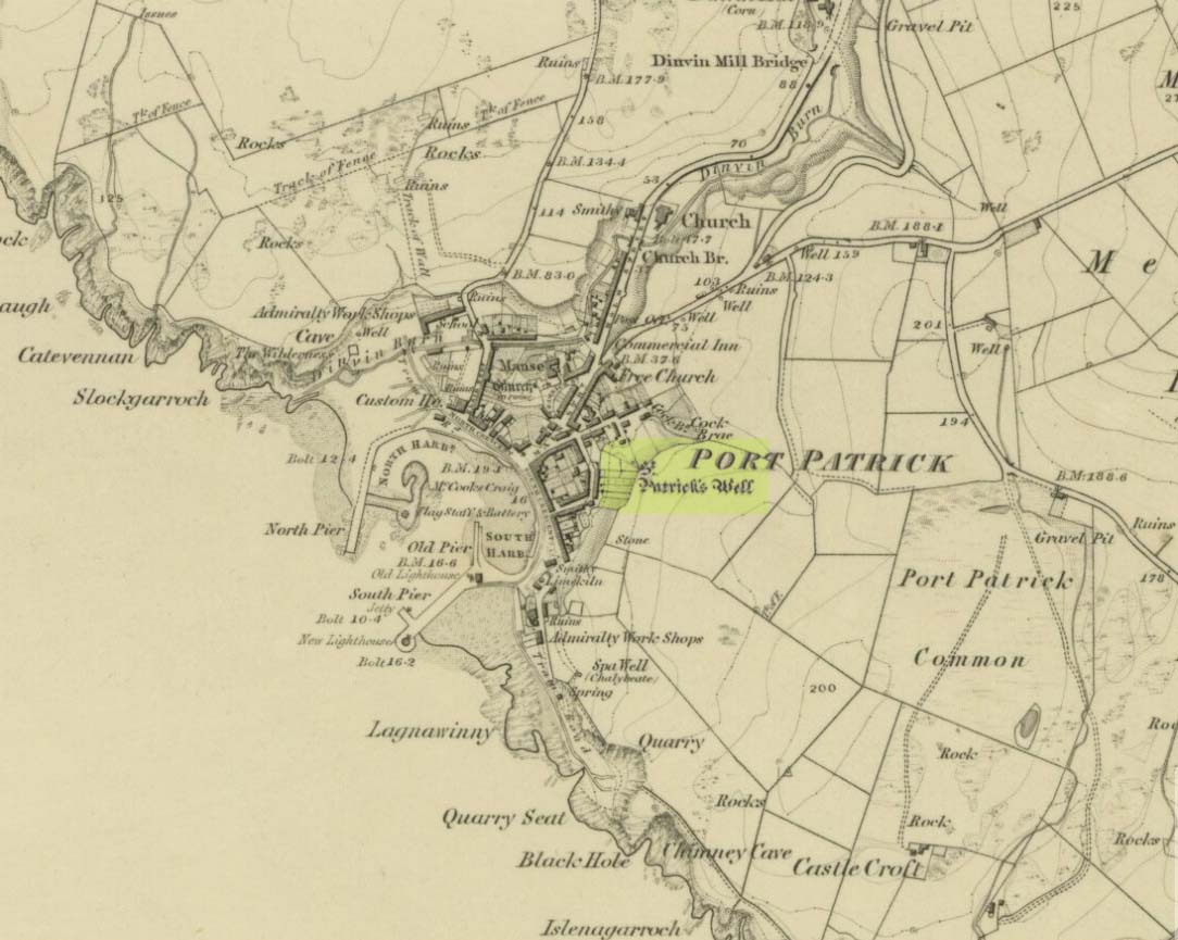
This long-lost  holy well was located on the southeast side of the town.  It was highlighted on the first OS-map in 1849, but its waters were disrupted shortly after this. Daniel Conway (1882) told that,

“It flowed where there was a quarry used for the harbour works. The writer of this notice heard from two men, John Mulholland and Owen Graham, dwelling at Portpatrick in 1860, that they had seen on the rock beside the well what tradition said was the impression of the knees and left hand of St. Patrick.”

When the holy wells writer E.M.H. M’Kerlie (1916) came to visit this site, it was “no longer to be seen.”  He wrote:

“The water which issued from a rock on the south side of the village is now diverted by means of pipes into another course.”

References:

  1. Agnew, Andrew, The Agnews of Lochnaw: The History of the Hereditary Sheriffs of Galloway, A. & C. Black: Edinburgh 1864.
  2. Agnew, Andrew, The Hereditary Sheriffs of Galloway – volume 1, David Douglas: Edinburgh 1893.
  3. Conway, Daniel, “Holy wells in Wigtonshire,” in Archaeological & Historical Collections Relating to Ayr & Wigton, volume 3, 1882.
  4. Harper, Malcolm MacLachan, Rambles in Galloway, Edmonston & Douglas: Edinburgh 1876.
  5. M’Kerlie, E.M.H., Pilgrim Spots in Galloway, Sands: Edinburgh 1916.
  6. MacKinlay, James M., Folklore of Scottish Lochs and Springs, William Hodge: Glasgow 1893.
  7. Morris, Ruth & Frank, Scottish Healing Wells, Alethea: Sandy 1982.
  8. Royal Commission Ancient & Historical Monuments of Scotland, Inventory of Monuments and Constructions in Galloway – County of Wigtown, HMSO: Edinburgh 1912.
  9. Walker, J. Russel, “‘Holy Wells’ in Scotland,” in Proceedings of the Society of Antiquaries of Scotland, vol.17 (New Series, volume 5), 1883.

© Paul Bennett, The Northern Antiquarian 


Penny Well, Granton, Edinburgh, Midlothian

Healing Well:  OS Grid Reference – NT 2187 7654

Penny Well on 1853 map

Archaeology & History

On the 1853 Ordnance Survey map of Granton we are show the house and place-name of Pennywell with a ‘pump’ adjacent to it.  Sadly we don’t have as rich a history of the place as its namesake at Newington.  Its earliest written appearance seems to be in 1812.  A few years later, in the  Ordnance Name Book of the area, it was recorded that,

“Two cottages on the property of Sir John McNeil the name appears to be derived from a well which was formerly situated at the North east end of the houses where one Penny was paid for a draught of water.”

Remembered as a watering place for horses, the old Scots word ‘penny’ may be behind this old name, in terms of it giving the animals and locals their water supply.  Stuart Harris (1996) thought that this Penny Well may have been the long lost St. Columba’s Well in the parish of Cramond.

References:

  1. Bennett, Paul, Ancient and Holy Wells of Edinburgh, TNA 2017.
  2. Harris, Stuart, The Place-Names of Edinburgh: Their Origins and History, Gordon Wright: Edinburgh 1996.

© Paul BennettThe Northern Antiquarian


Tobair na h-oige, St. Kilda, Outer Hebrides

Sacred Well (lost):  OS Grid Reference – NA 100 000

Also Known as:

  1. Well of Eternal Youth

Folklore

An old story told in previous centuries by the indigenous folk of Hirta (St. Kilda) described a long-lost well that was thought to be an abode of the little people, known as the Well of Eternal Youth.  Not to be confused with the Well of Virtues near the Amazon’s House less than a mile west, the rough whereabouts of this site is cited by J. Sands (1878) in the folklore section of his otherwise historical account on these faraway Atlantic islands.  He wrote:

“Once on a time an old fellow, in going up Connagher with a sheep on his back, observed a Well which he had never seen or heard of before.  The water looked like cream, and was so tempting, that he knelt down and took a hearty drink.  To his surprise all the infirmities of age immediately left him, and all the vigour and activity of youth returned. He laid down the sheep to mark the spot, and ran down the hill to tell his neighbours. But when he came up again neither sheep nor well were to be found, nor has any one been able to find the Tobair na h-oige to this day.  Some say that if he had left a small bit of iron at the well—a brog with a tacket in it would have done quite well—the fairies would have been unable to take back their gift.”

Explorations of old maps and texts has failed to show with certainty where this legendary well may have been (the grid-ref is an approximation), but it was reported in Mrs Banks’ Scottish Calendar Customs (1937) to have been “issuing out of the face of a rock on the north-side of the east bay…only accesible by the inhabitants, no stranger daring to climb the steep rock.” Some of us would try!

References:

  1. Banks, M. MacLeod, British Calendar Customs: Scotland – volume 2, Folklore Society: London 1937.
  2. Sands, J., Out of the World; or Life in St. Kilda, Maclachlan & Stewart: Edinburgh 1878.

© Paul Bennett, The Northern Antiquarian


Red Well, Alloa, Clackmannanshire

Healing Well:  OS Grid Reference – NS 87385 93435

Getting Here

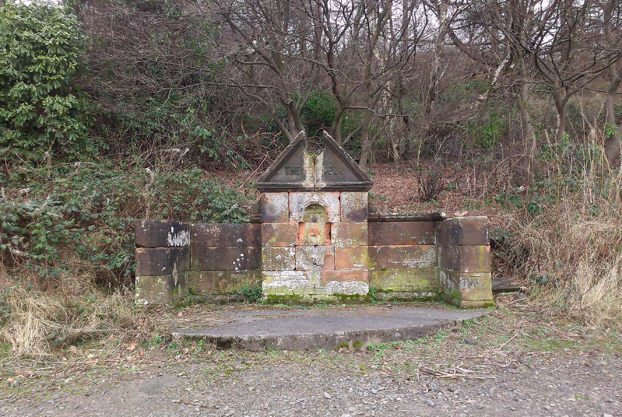
The somewhat ruinous old well

Along the A907 a mile west of Alloa and heading towards Tullibody, just before the roundabout across the road from the school fields, a small entrance takes you into the small wooded parkland.  There, right in front of you as you walk in, and visible from the road, is the enclosed architectural stone walling and somewhat ruinous remains that are the Red Well, with its faded name carved on top.

Archaeology & History

Red Well on 1913 map

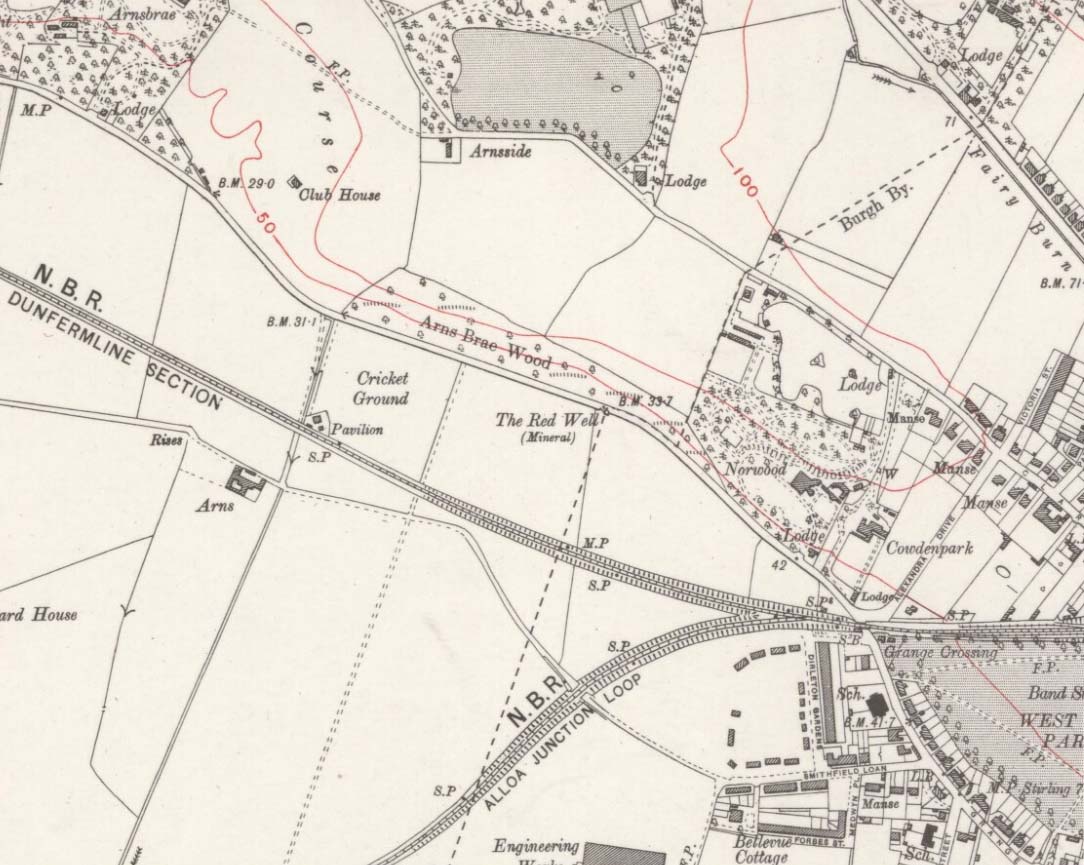
Although the waters no longer run for the people to drink, this old iron-bearing spring was long of repute to the old folk of eastern Alloa.  So much so, it seems, that even Janet & Colin Bord (1985) included it in their national survey of sacred wells!  Like other chalybeate springs, its waters were known to be good as a tonic—which makes sense as iron fortifies the blood and general immune system.  The Well was highlighted on the 1913 OS-map of the area.

References:

  1. Bord, Janet & Colin, Sacred Waters, Granada: London 1985.
  2. Morris, Ruth & Frank, Scottish Healing Wells, Alethea: Sandy 1982.

© Paul Bennett, The Northern Antiquarian


Vicar’s Well, Musselburgh, East Lothian

Holy Well (destroyed):  OS Grid-Reference – NT 3452 7264

Archaeology & History

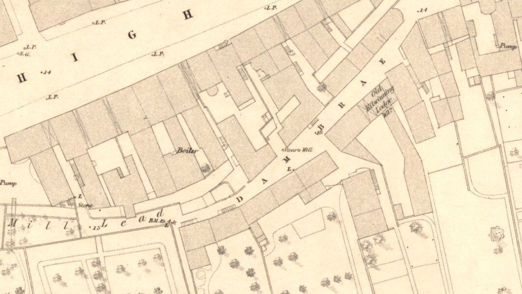
Vicars Well on 1853 map

First mentioned in the Scottish Statistical Account of 1845, its name originates from being attached to the vicarage of nearby St. Michael’s church.  Highlighted on the 1853 township map of Musselburgh, this forgotten holy well was described in the middle of the 19th century by local historian James Paterson (1857).  It was located near the middle of town, along a back-street south of the High Street.  Mr Paterson told us that:

“At the Dam Brae there is still a well, celebrated for the excellence of its water, called ‘the vicar’s well’, from which it is believed the present manse occupies the site of the ancient vicarage.  It lies to the southeast of the Brae, and the wall of the ground approaches pretty close to the mill lead, or damn, as it is called.  It is well surrounded with old trees.”

When it was described by Mr Beveridge in the 1845 Statistical Account, the spring had been covered by a pump.  Local lore told how the waters of this ancient Well was said by housewives to be excellent in the infusion of tea; and although its name was spoke in local dialect as the ‘Bickers Well’, Beveridge told it to mean the “Vicars Well.”  There is the obvious possibility that the ‘bickers’—as in chit-chat and gossip—related to it being where local folk simply met and chatted.

When Mr Stirling (1894) wrote his account of the adjacent Inveresk parish, he told how water from the Vicar’s Well,

“was in much request till a few years ago, when its use was forbidden and its site enclosed (for) sanitary considerations.”

References:

  1. Bennett, Paul, Ancient and Holy Wells of Edinburgh, TNA 2018.
  2. Paterson, James, History of the Regality of Musselburgh, James Gordon: Musselburgh 1857.
  3. Stirling, R.M., Inveresk Parish Lore from Pagan Times, T.C. Blair: Musselburgh 1894.

© Paul Bennett, The Northern Antiquarian 


Holy Well, Auchtertool, Fife

Holy Well:  OS Grid Reference – NT 20813 90189

Also Known as:

  1. Canmore ID 52985

Getting Here

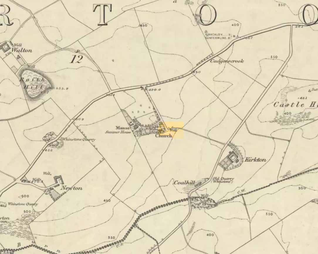
‘Well’ marked the spot in 1856

Along the B925 road between Dunfermline and Kirkcadly, ⅔ of a mile (1.07km) west of Auchtertool village, go down the small track leading down to the isolated church on the rise in some trees.  Walk through the churchyard and out the other side where a small footpath runs downhill.  50-60 yards along, by the walling, this holy well is/was said to be.

Archaeology & History

Both history and tradition are pretty shallow on this all-but-forgotten site, which Penny Sinclair guided us to see in the summer of 2016.  Sadly the entire area where the waters are reported to emerge were completely overgrown in nettles when we visited and, despite us trampling the Urtica down, we could find no remains of the spring. (the Church and its followers here should ensure that the well is properly maintained)

The greatest description of the site seems to be that given by William Stevenson (1908) in his rare work on the parish of Auchtertool.  He wrote:

“As you approach the Kirk of Auchtertool by the old road…you come upon a well by the wayside.  For many years it was the well that supplied the Manse with water, but it is now seldom used, even by the passing traveller.  There is a belief that at one time this well was what is known as a holy well.  Be that as it may, a friend of the late Rev. Walter Welsh, the late Dr Robert Wilson, caused a stone over the well to be inscribed with the following lines:

“Ye who the gently-winding path have trod,
To this fresh fount beside the house of God,
Taste the clear spring; and may each pilgrim know
The purer stream where living waters flow.””

The well was included in Ruth & Frank Morris’ (1982) survey, where they added that the waters from the well were “used in celebration of the mass.”

References:

  1. Morris, Ruth & Frank, Scottish Healing Wells, Alethea: Sandy 1982.
  2. Stevenson, William, The Kirk and Parish of Auchtertool, James Burt: Kirkcaldy 1908.

Acknowledgements:  Many thanks to Penny Sinclair for taking us to this locale.

© Paul Bennett, The Northern Antiquarian 


St. Margaret’s Well, Old Pentland, Midlothian

Holy Well (covered):  OS Grid Reference – NT 26388 66338

Archaeology & History

St Margarets Well at Pentland

Described in Hope & Telford’s (1813) rare work, this little-known holy well has escaped the attention of all surveyors since then.  It was one of four sacred and healing sites in the village and “the most copious” of them all, they said.

Located a little to the east of the old churchyard, chemical analysis showed its water to contain carbonates and sulphates of lime, “muriate of soda and a magnesium salt in very minute proportion, and carbonate of iron in a still smaller” amount.

Covering slabs on the well
The ‘Spring’ on 1894 map

Until recently, the waters of St. Margaret could still be seen in the small copse of trees, just off the footpath, but they have now been covered in large stone slabs.  Underneath them, you can clearly hear the sound of the rushing water still pouring out of the ground, quite copiously, as Hope & Telford said!  A little further down the slope—into which the waters have cut a tiny glen—the ground is very boggy and marshy due to the outflow from the well.  However, the waters here seem very dodgy indeed and it isn’t recommended that you try to drink them! (in the adjacent trees is a large dump site)

It is likely that the St. Margaret dedication here relates to the 11th century Scottish Queen, who was believed to have landed at nearby North Queensferry, known as St. Margaret’s Hope.  Literary history tells that she became a Roman Catholic.

References:

  1. Bennett, Paul, Ancient and Holy Wells of Edinburgh, TNA: Alva 2017.
  2. Hope, Thomas C. & Telford, Thomas, Reports on the Means of Improving the Supply of Water for the City of Edinburgh, A. Constable: Edinburgh 1813.

© Paul Bennett, The Northern Antiquarian