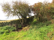
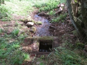
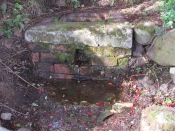
Healing Well (destroyed): OS Grid Reference – NS 8926 7977
Archaeology & History
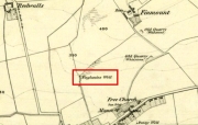
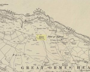
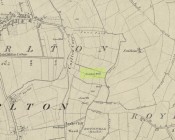
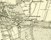
Marion’s Well on 1864 map
Recorded in 1860 by the Ordnance Survey and highlighted several years later, this Marionesque potential of a holy well is not thought to derive its name from the usual Catholic pantheon—but it’s close! It was obviously an important water source for the people of Falkirk in early times and its clear waters were used to supply an early washing house close by (as shown on the map). Now completely built over where the B8080 meets the roundabout east of the town centre, the best literary account we have was penned by the regional historian Robert Gillespie (1879) who, in his survey of the area, told us:
“Of Marion’s Well there is scant record. According to tradition it got its name from Marion Livingston—a nun of the house of Callendar who, in the performance of the sacerdotal vow which kept her from the world, visited the well at intervals and used its soft waters as a pediluvium. The original well which was built round with stone, stood at the bottom of the Cladden’s Brae, on the bank of the East Burn. It was further protected by a circle of upright slabs—the great resting place of the water maids and the scene of many a happy ‘touzle’ as the stoups or pitchers were sent rolling and rattling down into the brawling brook.”
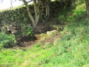
Marion’s Well, c.1900
The element of locals “touzling” here simply means that it was a meeting place for young lovers. (Grant 1973; Wright 1905) Although quite what Gillespie meant when he said it was surrounded “by a circle of upright slabs” is anyone’s guess! Was this architectural element constructed in the post-medieval period, or was it much much older…?
In the old photo of the well here, Scott & Astbury (1990) said how it,
“shows the trough of the well after it had been moved to the south side of Callender Road and shows a horse pulling a Barr’s cart at the trough. The view looks down what is now Corporation Street to the bridge over the East Burn.”
References:
Gillespie, Robert, Round about Falkirk, Dunn & Wright: Glasgow 1879.
Grant, William & Murison, David (eds.), The Scottish National Dictionary – volume 9, SNDA: Edinburgh 1973.
Holy Well (destroyed): OS Grid Reference – NT 2728 6669
Archaeology & History
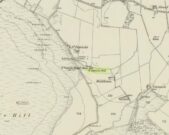
Our Ladys ‘Well’ on 1855 map
This is another all-but-forgotten holy well once dedicated to the Virgin Mary, close to the south-side of Edinburgh’s outer ring-road. It would seem to have been one in a cluster of sacred wells not far from each other (with the two Jacob’s Wells and St. Margaret’s Well at nearby Pentland), whose traditional stories have fallen prey to the incredulity of ‘progress’. I can find very little about the site, other than the note given it in George Good’s (1893) Liberton survey where, in stepping south towards the old hamlets of Broomhill and Straiton, he told:
“A little to the west of the hamlet, and near what was called Straiton Green, is an old draw-well dedicated to the Virgin, and known by the name of Our Lady’s Well. There may possibly have been a cell or chapel near this well, but no tradition or history regarding it is extant.”
We can only presume that the ‘Well’ which is highlighted on the first OS-map in 1855, maybe 20-30 yards west of the old road on what looks like a small park or ‘Green’, would be the ‘Lady Well’ in question. (another ‘Well’ is shown at Broomhill Cottage, which is unlikely to be the contender)
In Thomas Whyte’s (1792) lengthy survey of Liberton village, as it was in the 1790s, we come across what seems to be the earliest description of this long-lost sacrede site on the northwest side of the parish. In writing of the beauty of the countryside hereby in those times, he told how,
“on the north by the rivulet called Braid’s-burn, near which there is a well which has the appellation…of the Lady’s or Virgin Mary’s well, famous for its large current, and the salubrity and lightness of its waters.”
Site of Our Lady’s Well
Our Ladys Well on 1855 map
Mr Whyte believed that its dedication to Our Lady went way back, probably before Liberton parish was given to St. Cuthbert in the 11th or 12th century (whose own holy well could once be found several miles north, near Leith). Generally, wells that are dedicated to ‘Our Lady’, refer to the Virgin Mary; but prior to any christian affectation, the animistic genius loci of the waters would have been a local spirit.
It was visited and described by the Ordnance Survey lads in the Name Book of 1851, in which they said that Our Lady’s Well was,
“The site of a celebrated well situated in a hollow on the farm of Liberton Tower Mains, and dedicated to St. Mary, as it and the field is well known to be called to this day, “The lady’s Field” & Well”. This well however about 50 years ago underwent a drainage during some improvements that were making on the land. In its covered condition it takes a S.E. course till its Confluence with the Braid Burn where it is shown to this day as the water coming from the Lady’s Well, and from which a body of crystalized water flows copiously. It was supposed that a chapel was somewhere Convenient which gave rise to the name, but all traces have long since disappeared….”
“There is no tradition recorded among the County people as to whether this was a holy well, or resorted to for superstitious purposes. But it is well ascertained to have been once a remarkable well & an object well known and though now covered-in, the place is still well known, as is also the name.”
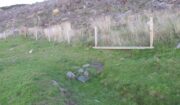
Although this holy well was shown on early and late 19th century OS-maps as ‘covered’, trying to find its exact position today has proven difficult. When Paul Hornby and I visited the site after some heavy rains in June, 2017, we found a large pool of water in the field exactly as shown on the old map. This was, however, misleading, as the owner of the land and the Blackford Glen Western Riding school—a Mr John Fyfe—told us that they had, for years, always wondered about its exact position, but been unable to ascertain it with any certainty. The pool in the field always appeared after the rains, he said. He did tell us however, that many years ago when he was digging in order that the Braid Burn stopped flooding his property, he came upon a length of ancient piping running in the direction of the burn, some 5 or 6 feet down, whose use he could not ascertain—but which might have once conducted the waters from the Lady Well away. No water was running through it though.
Near the middle of Liberton village a century or so ago, another holy well of the same name could once be seen less than a mile to the east.
Healing Well (covered): OS Grid-Reference – NT 23894 63346
Archaeology & History
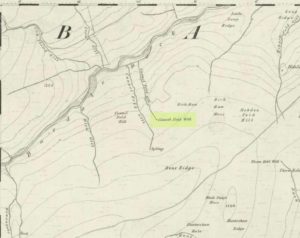
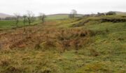
Site of Crawley Spring on the 1854 map
Once found flowing freely beneath the shadow of the prehistoric hillfort of Castlelaw, this all-but-forgotten site was thankfully recorded in Hope & Telford’s (1813) survey of Edinburgh’s natural water supply. Mr Telford said how “This noble spring rises from the bottom of a bank, at the foot of the Castlelaw Hill, at the edge of a small, low, almost marshy meadow close by the Glencorse Burn, a little way below the bridge.” Twelve years after writing this, the well had been blocked and a cistern built over it.
It was proclaimed by local people to be medicinal (though to what ailments, I cannot find), but there was an effective confirmation of some medicinal qualities in the waters following an analysis in 1810 when very tiny mineral elements were found. Mr Telford (1813) explained:
“The water is perfectly transparent and colourless, free from every smell and taste and is of excellent quality. It has, as is the case with almost all spring water, some matters dissolved in it, though in smaller quantities than common… This foreign matter consist of carbonate of lime, muriate of soda, and sulphate of lime, with an excessively minute portion of magnesium salt. The proportions of these ingredients, in each pound, are nearly:
Carbonate of Lime – 0.43 of a grain
Muriate of Soda – 0.10 of a grain
Sulphate of Lime – 0.90 of a grain
Sulphate of Magnesia – 0.05 of a grain
The carbonate of lime is dissolved by means of carbonic acid, which is not in greater quantity than is barely sufficient for the purpose. All of these ingredients are in themselves innocent to the human body; and in the quantity in which they are present in the water, do not affect its goodness. The water is perfectly soft and fit for washing, infusing tea and other domestic purposes. The water, therefore, is exceptional in every respect.”
When it came to the Crawley Spring waters being used to feed the habits of Edinburgh city, there was considerable opposition by the land-owner and local people who were, correctly, concerned that that ecosystem here would be adversely affected if the waters were to disappear. And so it was that Earth’s blood was taken from the land and the people and the animals, to benefit and feed the religion of Industrialism and ‘progress’ once more…
Healing Well (lost): OS Grid Reference – NS 593 648
Also Known as:
Ratten Well
Archaeology & History
This long lost well near the middle of Glasgow was known by this name as early as 1345. Close to the River Clyde, a wooden structure was built around the well—a stock—and its waters were used by local fishermen. A local fair used to be held hereby. It has long since been built over and its original position no longer seems to be known.
Folklore
The old traditional tale behind this site was written in a short piece in the Scottish Journal of Topography oh so long ago now… One pseudonymous “R.M.S.” said that:
“Stockwell Street in the city of Glasgow, is pretty well-known, and everybody in the locality is aware of the ‘Ratten Well’ with its impure waters. It is said that, in days of yore, when Sir William Wallace had occasion to be in that quarter, he and his party met a band of englishmen at the well. A battle ensued, and the bodies of the englishmen, who were defeated, were thrown by the incensed Scots into the well. “Stock it well! Stock it well” exclaimed Wallace, from which expression the street received its name. So says tradition; and it is even yet believed that the bad quality of the water is owing to the putrefaction of the dead bodies of the englishmen.”
The one thing we can be certain about in this story, is that the Scots wouldn’t be stupid enough to dump dead bodies into their own fresh water supplies. We must assume some englishman or dodgy corporation was responsible for that bit!
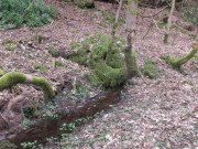
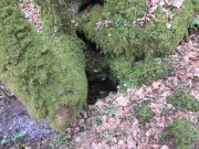
Get yourself to Glasgow Cathedral—wherein you’ll find St. Mungo’s Well—and walk down John Know Street. A coupla hundred yards down, across the road is a small street called Ladywell Lane (there’s no signpost for it though), running below the cemetery and leading to the back entrance of the giant Tennent’s Brewery. At the bottom of this, up against the wall on your left, is the Lady Well.
Archaeology & History
The origins and early traditional history of this once famous sacred well are sadly lost due to the intrusion of industrialism. It was obviously a place of some considerable repute and lent its name to local quarries and fields hereby. Used extensively by local people for countless centuries, things were to change in 1715 when the waters of this and other wells were to be kept clean by one John Black, “at a salary of 400 merks yearly.” The Glasgow historian Eyre-Todd (1934) told that,
“Black was to furnish them with chains, buckets, sheaves, ladles, and other necessary graith, aswell as with locks and iron bands. He was ‘to cleanse, muck and keep them clean,’ and to lock and open them in due time, evening and morning. In case of failure he was liable to a penalty of £100 Scots.”
Lady Well in 2015
Lady Well in 1883
That’s a helluva lot of money in those days! Even when M’Ure (1736) described it, only in passing, he had nothing to say about its curative properties or local rites. Once the Industrialists take control, the ways of local people are sanitized, sterilized and ‘progress’ outlaws tradition. The only reference to an earlier sacrality is in Mr Russel’s (1883) article, where he said simply, that the Lady Well was “so called after a fountain at the bottom of the Craigs…sacred in Popish times to the Virgin.”
The construction that we see today—of the well in its little enclave—was first built in 1835-6. The waters became polluted after they were redirected below the Necropolis and have not been used since (although they still flow out of the wall a couple of yards to the right, stinking!). The architectural feature was cleaned up and restored by the local brewery in 1983.
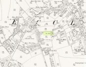
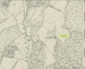
The site may have gained its name from one Lady Lochow, who lived nearby and built a hospital at the old Gorbels in the 14th century—but we might never know the real truth about the origin of its dedication. However, an intriguing ingredient relating to the dedication of the Lady Well is the incidence of a St. Anne’s Street that used to exist immediately to the east, as seen on the 1865 OS-map above. St. Anne may well be the mythic character behind the naming of this Lady Well, although I can find no literature to prove this. In the christian mythos, St. Anne was a very important character indeed: the mother of the Virgin Mary no less! However, as hagiographers from Attwater (1965), to Baring-Gould (1898) and Butler (1866) all tell, her biography is piecemeal—which is most surprising considering she was JC’s granny! Anne’s festival date was July 26 (a couple of days after Sirius enters the northern hemisphere); she was the patron saint of midwives, grandmothers and also miners, who invoked her as the deity who produced gold and silver—akin to the Earth Mother Herself! It’s obvious that Anne’s original mythic nature was subdued, as she represented an archaic root of matriarchal triplicity of the Virgin, the Lady and Old Woman and not the patriarchal triplicity of the incoming christian cult. The christian mythos at this Lady Well (as elsewhere) replaced one facet of the indigenous prima mater in Glasgow, known as the Cailleach—as shown in her attributes of midwife, grandmother and the deep Earth. If local historians can find field-names or wells dedicated to the Maiden, the Lady and the Carlin (or their variant titles) nearby, the lost layers of archaic Glasgow’s indigenous animistic folk memories could be mapped out once again…
References:
Attwater, Donald, The Penguin Dictionary of Saints, Penguin: Harmondsworth 1965.
For people who like to visit the sacred sites that determined a cross-over from Earth-based animism to one which ceased sanctifying the Earth, this ancient water source in the cellars beneath York Minster would be a good example. Sadly, the church has closed off access to this ancient heritage and you can no longer see it. Yet despite the fact that the modern-day christians have closed off your encounter with this important heritage site (York Minster’s website doesn’t even mention its existence!), we should not forget its mythic history…
As you walk into the building (at some great expense, it has to be said), the location of the holy well is said to be at its more western end, albeit in the crypt underground—although there does seems to be some confusion with some authors about exactly where the well is positioned.
The earliest account we hear of the place relates to when the northern tribal King Edwin, along with his sons Osfrid and Esfrid, came here to be “baptized” in the waters of this clear spring “on Easter day, April 12, 627” CE. Immediately thereafter a small wooden chapel was constructed next to or above the well. From then on, as the centuries passed, the renown of the well grew and eventually the magnificent ritual temple of York Minster was eventually built. The waters eventually became dedicated to St. Peter and an annual festival occurred here soon after the Midsummer solstice on what became known as St. Peter’s Day (June 29). After the year 1462, a secondary festival date was also given to the site by the Church and another annual celebration occurred here on October 1 too. Its waters remained accessible to people for drinking, healing and rites throughout the centuries. It is only now, in the 21st century, that its sacrality and spirit has been closed-off. This is a situation that must be remedied!
In Mr Goole’s (1850) survey of York Minster, his architectural illustration of the building showed that the water from the well had been brought up onto the ground floor, on the southeast side of the inner cathedral building in the easternmost vestry, and named as St Peter’s Pump. This is illustrated in the 1850 drawing above-left.
A whole series of early writers mention the well in earlier centuries—of whom a brief sample is given here. When Celia Feinnes came here in the 17th century, she said that,
“In the vestry of York Minster there is a well of sweet spring water called St Peter’s Well ye saint of ye Church, so it is called St Peter’s Cathedral.” (Smith 1923)
Mr Torre (1719) gave it equal brevity, saying simply that,
“at the south-west corner thereof is a draw-well (called St. Peter’s Well) of very wholesome clear water much drunk by the common people.”
In R.C. Hope’s (1893) national survey of sacred wells, he told that
“There is a draw well with a stone cistern in the eastern part of the crypt of York Minster… The Crypt is about 40 feet by 35 feet.”
The well was even included in Murray’s Handbook to Yorkshire (1892) as being “in the southwest corner of the Minster.” William Smith (1923) included the site in his fine survey, telling his readers that,
“The water is excellent in quality, which in measure, so chemists say, is due to the lime washed into it by the rain from the walls of the Minster. The water has for centuries been used for baptisms, and is so used today. The well has now for some years been covered with a pump.”
Folklore
In Geoffrey of Monmouth’s famous early History, we find that King Arthur visited here. …And one final note, about which we know not for certain whether it was relevant to the holy well hiding in the crypt, but a fascinating heathen custom was enacted here in bygone days, almost above the spring. Mistletoe, as Christina Hole (1950) told,
“was ceremonially carried to the cathedral on Christmas Eve and laid upon the high altar, after which a universal pardon and liberty for all was proclaimed at the four gates of the city for as long as the branch lay upon the altar.”
Mistletoe is one element that is known to have been sacred to the druids (not the present-day druids!) and was sacred to the ancient Scandinavians (who came here), and also possessed the powers of life and death in its prodigious folklore and phytochemistry. Fascinating…
…to be continued…
References:
Bord, Janet, Cures and Curses: Ritual and Cult at Holy Wells, HOAP: Wymeswold 2006.
Seemingly built over in recent years, the Pickel Well was one of the main water supplies to the people of Gomersal and Birstall in earlier times. Getting its name, probably, from the northern dialect word pikel or pickel, meaning “very heavy rain” (Joseph Wright [1903] associates it with the expression “raining cats and dogs”), this may be a description of the heavy flow of water which helped feed the large man-made ponds either side of the road.
The Monk Ings Field in which it was found, derives its name from the monks from Nostell Priory who lived here, centuries ago. They would, no doubt, have drunk the water from this well.
Folklore
A very curious legend relates to this place. H.A. Cadman (1930) told,
“that whenever a birth was expected in Great Gomersal, a pad-foot came out at night from the Monk Ing fields and shouted out, ‘Thee first or me first!’ This was said to be a warning to people not to go out.”
Padfoots were phantom black dogs, stories of which occur all over northern England and beyond. They were ostensibly interpreted as omens of doom and bringers of Death. This example at Gomersal is peculiar in that it is equated with birth, as well as giving warnings for local people to stay indoors, as is more usual.
Incidences of black dogs at wells are not uncommon. In West Yorkshire alone we find them haunting the waters at Low Moor, Idle, Thorp Arch, Eccleshill, Heaton and others. Their nature is quite complex, but ostensibly derives from animistic cyclical notions of death and rebirth—hence their emergence sometimes from wells; and in this instance, presaging a local birth.
References:
Cadman, H. Ashwell, Gomersal, Past and Present, Hunters Armley: Leeds 1930.
Eliade, Mircea, Zalmoxis – The Vanishing God, University of Chicago Press 1972.
Wright, Joseph (ed.), English Dialect Dictionary – volume 4, Henry Frowde: London 1903.
Not far from the old maypole, the Moor Lane Well was the innocuous-sounding site where legend told that a phantom horse was once seen running up and down the lane—said by old locals to be a “very ancient highway”. It was also a place where we find an intriguing tale of local disrepute, that brought humiliation to the culprit from the entire village.
There used to be a custom called ‘Riding the Stang’ which persisted in Yorkshire until the end of the 19th century. Thought to be of Scandinavian origin, it involved the culprit being hoisted onto a platform, held up by poles, then carried around the village where the person lived in a most ignominious procession. It was invariably described as being a public punishment and humiliation for faults made by one’s wife. Anyway, in the early 1840s, said H.A. Cadman (1930),
“there were two families who lived at Brecks Farm. I will not of course divulge their true names, so will describe one of them as the Jones family and the other as the Smith family. Jones’ wife accused Smith’s wife of having polluted the drinking water and the Smith family left the farm and removed to the top of Moor Lane. The Jones family wishing to make the most of the affair resolved that Mrs Smith’s effigy should ride the stang. A long pole was obtained and the effigy was affixed to the centre. Two men then took hold, one at each end, and walked up Moor Lane, folowed by a huge concourse of people. The procession stopped opposite Mrs Smith’s house and repeated the nominee. My informant, a dear old lady, would not tell me the whole of the verse, but it commenced thus:
“It’s neither your fault nor my fault that I ride this stang.”
“After all the verses had been repeated, the stang was taken round Gomersal, when ultimately the effigy was burned with the usual solemnities.
“The other instance of riding the stang occurred also in thge early ‘forties and I believe this was the last occasion of the stang being ridden. On this occasion a man…was in the habit of beating his wife harder than his neighbours thoughts proper with the result that he had to be punished. Now Jim was a most religious man, but the same rites had to be observed as in the other instance,
“It was for Jim Vasey that religious man
He paid her, he paid her indeed and
If Jim doesn’t alter his manners
We will take his skin “…….” to the tanners.
And if the tanner doesn’t tan it well,
We’ll send it to…”
“One must regret that the old custom of riding the stang has died out, as it must have had its good points.”
Local people could, of course, simply bring it back again! The Moor Lane Well was one of the main water supplies for the old villagers in bygone times, but seems to have disappeared under the modern houses. There is, however, a small narrow band of trees where the old waters once ran, amidst which it might still be found—if luck is on our side…
References:
Cadman, H. Ashwell, Gomersal, Past and Present, Hunters Armley: Leeds 1930.
Originally called the ‘Manor Lea Well’ because it could be found on the far west of the land belonging to the Manor House, the name later became corrupted to ‘Mannerly’ by local folk. It was one of the four prime water supplies for this part of the old village, but it had other important social and festive rites attached that undoubtedly went back centuries. H.A. Cadman (1930) told that:
“On Palm Sundays it was the custom for boys to take bottles containing Spanish juice, treacle, and any other sweet thing they could, for the purpose of having them filled with the water from the well. The boys then exchanged bottles with each other and each sampled the others. It was said that no better water existed for this purpose.”
This particular ritual was integral to virtually every Spa Well from Wakefield through to the source of the River Calder.
A Mr G.W. Parker said that the well was to be found at the “extreme Western side” of Manor Lea and was “still in existence” when Cadman wrote about it in 1930, “behind Company Mill” not far from the Moravian Burial Ground. Do any local historians know if the well is still there, or has it since been destroyed?
References:
Cadman, H. Ashwell, Gomersal, Past and Present, Hunters Armley: Leeds 1930.