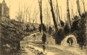
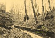
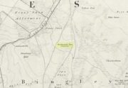
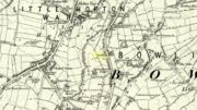
Very little seems to be known about this apparently lost site, deemed to be an authentic holy well in Francis Jones’ (1954) fine survey: the ‘Ellen’ in question here being the legendary St Helen. It was highlighted on the first OS-map of the area in 1869 and subsequently included in the Royal Commission’s huge Pembrokeshire (1925) tome, but when they came to visit the site they reported that “it could not be traced, nor any information obtained about it.” Has it truly fallen back to Earth, or do any local historians and antiquarians know where it is…?
References:
Jones, Francis, The Holy Wells of Wales, University of Wales 1954.
Royal Commission Ancient & Historical Monuments, Wales, An Inventory of the Ancient Monuments in Wales & Monmouthshire: VII – County of Pembroke, HMSO: London 1925.
Sacred Well (destroyed): OS Grid Reference – SE 1589 3132
Archaeology & History
Along the now-lost Low Well Road between Little Horton and West Bowling, could once be found this innocuous-sounding water source. Shown on the 1st OS-map of the area in 1852, the site was deemed to be little other than a ‘public well’. At the end of the 19th century, a small well-house was built over the waters; and the years following that saw its complete demise. Its name you would think relates to a position in the land, but the dialect word low, or lowe can mean “a flame, blaze, light, glow”, it can also refer to a prehistoric tomb. However in this case it most likely derives from “a pond or standing pool”.
…And if some of you wonder why I have given this so-called Public Well the provenance of being a “sacred well”, please keep reading…
Folklore
Although it was deemed a simple ‘public well’ by historians and the public water authority, local folk knew there was much more to it than that! In the Bradford area, this innocuously-named Well is the most promiscuously supernatural of all water sources, with a hidden history of magickians, ghosts and black dogs haunting its once ancient flow. It was a site remembered as having oracular powers, where local people used it in scrying the future. For such powers to work here, one had to gaze into the waters as they stilled at 6 o’ clock in the morning – a common time used by ritual magickians for the invocations of spirits.
The Bradford historian William Scrotum (1889) told us that in the 1860s, local people reported that the phantom black dog—or Bharguest as it was known—with its glowing red eyes, was seen coming out of the well after dark and scaring people half out of their wits. Very soon people would not even venture out after dark for fear of encountering this great harbinger of Death. Several years passed before local people called upon the abilities of a ritual magickian in the hope that he could lay the ghostly hound and bring peace and stability back to the hearts and minds of those living hereabouts. Eventually, after much work, the magickian exorcised the waters and cast the black dog back into the depths of the Earth from whence it had come and, to this day, sightings of the spectral hound have stopped.
Water sources that possess ingredients of hauntings, magic and oracular properties are universally ascribed as ‘sacred’ in one way or the other. In pre-industrial times I have little doubt that, amongst the animistic pantheon of local Bradfordians, this was no exception.
References:
Scruton, William, Pen and Pencil Pictures of Old Bradford, Thomas Brear: Bradford 1889.
Wright, Joseph, The English Dialect Dictionary – volume 3, Henry Frowde: London 1902.
Healing Well (lost): OS Grid Reference – NS 910 790
Also Known as:
Tammy Milns Well
Archaeology & History
This all-but-forgotten site situated somewhere on the north side of Lauriston was mentioned in Falkirk’s Notes & Queries (1906) journal, but its whereabouts is somewhat of a mystery (to me at least!). In a series of question and answers about the site, the editor of the journal, James Love, told us:
“Mr Charles Brown, factor to the Marquis of Zetland, kindly informs us that on a late occasion there passed through his hands a copy of a feu contract by the Right Honorable Francis Lord Napier in favour of Alexander Cowie, brewer, at New Merchiston (now Laurieston), of a piece of ground lying to the north of Mary Street. This is dated 7 August, 1762 and contains the following clause: ‘Providing also that the said Alexr Cowie and his foresaid have the Liberty of the water of Tammy Milns Well in common with the said Lord Napier’s other vassals ay New Merchiston.'”
The well was mentioned again in 1781 with similar historical information. As to the name of the well, Mr Love wrote,
“it would appear, from the circumstance, that an old infirm man belonging to the village, called Thomas Mills or Milns, used to sit with his wooden cup at the spring which flowed from the face of the hill, over which the present structure now stands, and served out to the weary passers-by the cooling and refreshing draught for any small pittance they in their generosity might think proper to give him. After the lands of Lauriston passed into the hands of Sir Laurence Dundas, he took the advantage of such a copious supply of what then was pure water, and built the present reservoir over the spring, and had it conveyed to Kerse House by means of leaden pipes.”
But he fails to tell us what “the present structure” was that covered the well, nor the whereabouts of the “reservoir over the spring”; and as there’s no such feature on any of the Ordnance Survey maps at the time he wrote his article, nor beforehand, I remain puzzled as to its exact position. This situation isn’t helped by the earlier description, which said it was found on “a piece of ground lying to the north of Mary Street”. There are two wells literlly on the other side of Mary Street, but Kerse House meanwhile—whose water supply came from the well—is about 1½ miles to the north! All in all there are more questions than answers here. Added to this, in John Reid’s (2009) magnum opus on local place-names, the site is mentioned, albeit in passing, where he gives us the vague grid-reference of just NS 91 79, but this may just be educated guesswork on his part. It would be good to know exactly where it was…
References:
Love, James (ed.), “Tammy Mills (or Milns) Well, Laurieston”, in Local Antiquarian Notes & Queries, Falkirk – volume 1, 1906.
Reid, John, The Place-Names of Falkirk and East Stirlingshire, Falkirk Local History Society 2009.
Petrifying wells are found across the British Isles and would be deemed as being medicinal, or curative at the very least. In Jeremy Harte’s (2008) massive study, he infers that some of them will have been regarded as sacred or ‘holy’. Their ability to calcify objects would be seen as a very strange effect indeed! Yet despite this Eskdale example being shown on the first OS-map in 1853, its history seems to have been forgotten. Back then, you could find it on the east side of the Murl Slack Beck, nearly a mile north of Grosmont village. I highlight the site in the hope that someone may be able to unearth something about its past and/or its present condition.
References:
Harte, Jeremy, English Holy Wells – volume 1, Heart of Albion Press: Marlborough 2008.
Curiously missing from Thompson’s (1999) Lincolnshire survey, this old watering place can apparently still be found in the appropriately named Holywell Wood, just north of this lovely little hamlet. Shown on the 1887 OS-map of the area, it’s first literary reference seems to be in George Weir’s (1820) early survey of Horncastle district where he gives it a brief mention, saying:
“In a woody dell in this parish is a spring, gently bursting from the rock, called Holy-well, but the name of the saint to whom it was dedicated is not preserved.”
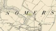
…Like oh so many others. But its ‘holiness’ may devive from other more archaic origins, in the spirit of the woods from whence the waters emerge. Certainly that’s what the poet laureate Alfred Lord Tennyson would have had us believe. He grew up in Somersby village and this old well was one of his places of inspiration. When the local writer H.D. Rawnsley (1900) described Tennyson’s affection for this site, he told us that,
“Alfred peopled that Holywell Wood with forms of fairies, and made the whole surrounding circle of the hills, a theatre for enchantment and chivalry.”
Nature can certainly do that to anyone who wanders Her body with open reverence.
Although the place is now quite overgrown, it wasn’t always this way. There used to be a well-trodden path with a gateway at the entrance that took you into the woods and up to the well. Above the gateway there used to be a Latin inscription that read, Intus aquae dulces, vivoque sedilia saxo, Et paulum silvae superest. His utere mecum. (meaning something akin to, “At these sweet waters, by this living seat of stone and small forest remains, Make use of me.”)
When J.C. Walters wrote about it, he told that a “local student” gave him the following particulars:
“A series of steps led down into the well, a post was fixed in front of it, and a cross-bar extended thence to the rock. On the cross-bar was a ring with a rope attached, so that the bather might safely descend into the well and enjoy the healing virtues of the stream which rushed from the rock. Geologists say that the wold villages are so closely placed on account of the superior quality of the water which springs up wherever the Spilsby sandstone meets the Kimmeridge clay. Susan Epton (Mrs. Thompson), Miss Emily Tennyson’s maid, tells me that she can remember the time when visitors came in scores to “take the waters.””
Some of this was later echoed in Rawnsley’s (1900) biographical account of Tennyson. He talked with a local sexton about the folklore of the area who told him of his memories:
“Halliwell wasn’t growed up then; there was a bath-house with steps down to the watter, and fwoaks in carriages came from far and near to drink it. Wonderful watter! it was nobbut a bit sen, that our owd nebbur was liggin’ adying and he axed for a cup o’ watter from the Holy Well, and they sent and fetched it, and he took it and went off upon his feet. Why, i’ my time theer was a school-house down in Halliwell Wood, and a skittle halley close by the well, but all them things is changed now, excep the snowdrops, and they coomes oop reg’lar, a sight on ’em i’ Halliwell.”
Once visible near the middle of the village, references to this local water supply seem pretty scant. According to Kenneth Cameron (1950) it gained its name from a local man called Robert Holland. This may be the case; but there is a curious entry found in a notice regarding the Land Enclosures of Smalley from November 6, 1784. In it we read that the land here was at that time owned by one Samuel Kerry (well known in the village as he built The Rose and Crown pub in 1768) who was living “upon the Common” and had “part of a croft” here. Therein was mentioned a water source named the ‘Holly Well’ instead of the Holland Well. I can only assume that the two are the same, as the proximity of them are very close indeed. The account told that,
“a disused well in the triangular croft at the back of the sixth milestone in the village marks the site of (Samuel Kerry’s) original home, and he is said to have dug the “Holly Well” close by for brewing purposes, which has long supplied the vicinity with good water.”
The name ‘Holly’ may infer that a holly tree grew by the side of the well, and that the title ‘Holland’ was a corruption later grafted onto the site. Are there any local historians out there who know more…?
References:
Cameron, Kenneth, The Place-Names of Derbyshire – volume 2, Cambridge University Press 1950.
This takes some finding! From the village of Doune take the A84 road towards Stirling and, just over the bridge barely 100 yards along, on your left, walk down the track past the old lodge house. 350 yards along, up the slope on your right where young trees and an excess of boscage prevails, walk up through it until, about 10 yards below an overgrown path at the top, beneath a raised section of old stonework, an old pipe protrudes from the undergrowth. The small spring of water that emerges 10 yards beneath this, amidst the brambles and reeds, is what you’re looking for.
Archaeology & History
Wells named ‘Ellen’ usually have a long and sacred history behind them, but this one seems unusually silent. Apart from being shown on the 1866 OS-map—simply as a ‘Well’—it is only mentioned briefly in Mr Mackay’s (1953) survey of Doune, being not far from the Clans Well, and in his day it was “still in use.” But not anymore! The water is barely running, but the trickle that still exists is nice and clear and it tastes good. It’s seen much better days though….
‘Ellen’s Wells’ tend to have one of three origins, being either 1) dedicated to St Helen, whose festival date is August 18; (2) named after or dedicated to the Elder tree (Sambucus niger); or, (3) named after a local person of this name. At some wells it may be two of these elements with their relative mythologies complimenting each other, overlapping between heathen peasant lore and early christian folklore. This has been the case at a number of St Helen’s Wells I’ve surveyed in Yorkshire and Lancashire. At this site however, there are no remaining Elder trees, meaning that its name relates to one of the two other options; but without any extant historical references to St. Helen hereby, we must conclude that at some point in the dim and distant past, a local lady called Ellen found her name immortalized in this all-but-forgotten sweet spring.
Best reached by going up Shipley Glen, to the Brackenhall Circle enclosure; keep going for a couple of hundred yards and then drop down into the trees, taking the directions directly to the Cloven Hoof Well. Just past the well, a small footpath leads you downhill towards the large stream at the bottom, where there’s a rocky crossing (an old ford). Go over here and, barely 50 yards upstream to your right, a large singular moss-covered boulder is set back, just a few yards above the stream with a small pool in front of it. That’s it!
Archaeology & History
The ‘directions’ to find this might seem a little confusing to locals at first. This is because the whereabouts of the Wood Well is on the eastern boundary edge of Gilstead – which is down at the bottom of Shipley Glen. The steep muddy hill above it is almost always slippy and wet through, so it’s easiest to approach from the Baildon side.
The site is shown on the 1852 map of the area, but I can find no written material telling of its qualities. If it ever had any medicinal virtues, they have long since been forgotten. Whilst the water here is fresh and drinkable, in times of drought and low rainfall the water subsides and leaves only a muddy pool – just as it was when I last visited, making it quite undrinkable. But to me, the main aspect of this site is its natural spirit, its locale, as it’s surrounded by unerring hues of rich greens, cast out by the landscape of mosses prevalent in a region almost bereft of such voices. If you like y’ wells – check it out!
Sacred Well (lost): OS Grid Reference – SP 664 733
Archaeology & History
It’s difficult to know precisely which category this site should come under: sacred well or just a healing well. I’ve opted for ‘sacred’, due to its peculiar and rare properties, i.e., turning things into stone. For a spring to do such a thing would have been seen by our ancestors as it having some sort of magickal or supernatural ability. Sadly however, it seems that all trace of this well has long since gone.
It was described only in passing in Peter Hill’s (2005) folklore survey of Northamptonshire, to which he gave no reference. He told us simply,
“Guilsborough had a petrifyiong spring near the Grange, which was ‘good for several diseases.”
None of the early OS-maps of the area show any such ‘well’ immediately in or around Guilsborough’s Grange and so I surmise (perhaps in error) that one of the two ponds to the south of the Grange is fed by the spring in question. It would be good to know for certain!
References:
Hill, Peter, Folklore of Northamptonshire, Tempus: Stroud 2005.
Healing Well (lost): OS Grid Reference – NS 7934 9412
Archaeology & History
Shown on the 1858 map of the city, this ‘Well of the Gorse’ (from the old folk-name ‘whin’, or Ulex Europareus) on the northern side of the old town, about 300 yards east of Stirling Castle, has long since gone. An old cottage of the same name was once to be found at the end of the appropriately named Whinwell Road, which also preserves its memory. Although the folklore of the site has seemingly been forgotten, it may be that the waters here had medicinal qualities akin to those given by the plant – i.e., jaundice, intestinal problems and to strengthen the heart. (see Mrs Grieve’s Modern Herbal)