Heber’s Ghyll Chalybeate, Ilkley, West Yorkshire

Healing Well:  OS Grid Reference – SE 0988 4692
Getting Here

Hebers Ghyll chalybeate

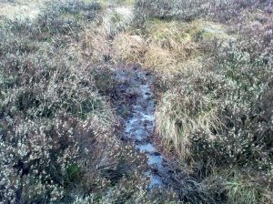
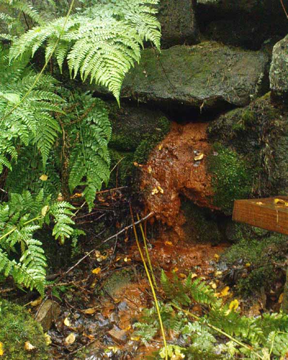
Walk from Ilkley up the Wells Roads as if you’re going to the White Wells, but keep following the road along, keeping to the moorside (don’t go up Panorama Drive).  A few hundred yards up, crossing the small bridge over the gorse-scattered stream, take the footpath to your right and walk along the moor-bottom, parallel to the rich houses.  Keep walking, past the reservoir (don’t go up the slope on the newly created path) and cross the small wooden bridge.  Once over the other side, head through the gate and walk along the rocky footpath into the woods.  Less than 100 yards down where the first seat is, there’s a slow-running blood of water oozing out from the rocks.

Archaeology & History

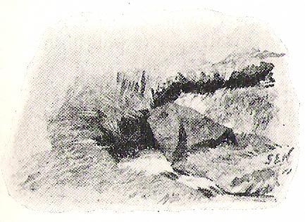
At the top of this bit of old woodland, out of rocks near the top of the trees, emerges another of Yorkshire thousands of chalybeates, or iron-bearing springs of water, on the very edge of Ilkley Moor.  Collyer and Turner (1885) mentioned its discovery in 1883, but gave no further details.  Searching for this place on one of my countless moorland ambles as a child, I found its waters oozing slowly from betwixt moss-enriched rocks on the west side of the stream.  If you look for it in the dry season though, there is little to see.  It is best seen later in the year, after heavy rains, although the waters are pretty slow running and have that distinct “off” taste (an attribute well-known of chalybeates —taste ‘em and see!).  The only real account of this little-known healing well was told in an early edition of the Leeds Mercury (1883), shortly after its rediscovery, in which we were told:

“Our Ilkley correspondent says the existence of a chalybeate spring has lately been discovered there, and from its valuable medicinal properties will prove a valuable adjunct in the future development of this health resort.  The water from the spring (which is situated near to the Panorama Rocks, in what is known as Hebers Gill, or Briery Wood) has been submitted to Mr F.M. Rimmington…of Bradford for analysis and his report is of a most favourable character.  The data shows that the water is remarkable for the smallness of the amount of its saline constituents, and (so far as the analyst has been able to discover by reference to published analysis of either English or Continental chalybeate springs), there is not one comparable to it: whilst its ferruginous element is equal to the majority of such waters and, in Mr Remmington’s opinion, as large as is desirable for medicinal effect.  The spa that most resembles the one under notice is that of Tunbridge Wells in Kent, which is derived from exactly the same geological formation (millstone grit), the total solid constituents of this water being 13½ grains to the gallon.  The report adds that, “The use of this class of waters as medical agents has, from remote periods, been found efficacious in those states of debility denominated anemia,” and “the value of this class of spa water as a safe and natural remedy can scarcely be overestimated.”  From the foregoing it will be seen that an important discovery has been made…”

This once important spring of water — that would have been known and used by our prehistoric ancestors living on the moors above — is nowadays but a shadow of its former self.  The water tables drop annually as a result of moorland drainage and other poor land management and we only see a small trickle of water emerging from the mossy rocks these days…

…to be continued…

References:

  1. Anonymous, “Important Discovery at Ilkley,” in Leeds Mercury, August 18, 1883.
  2. Bennett, Paul, Healing Wells and Springs of Ilkley Moor, unpublished: Hebden Bridge 1995.
  3. Collyer, Robert & Turner, J.H., Ilkley: Ancient and Modern, William Walker: Otley 1885.

© Paul Bennett, The Northern Antiquarian

Penny Well, Edinburgh, Midlothian

Holy Well:  OS Grid Reference – NT 2636 7177

Also Known as:

  1. Canmore ID 52492
  2. Pennywell

Getting Here

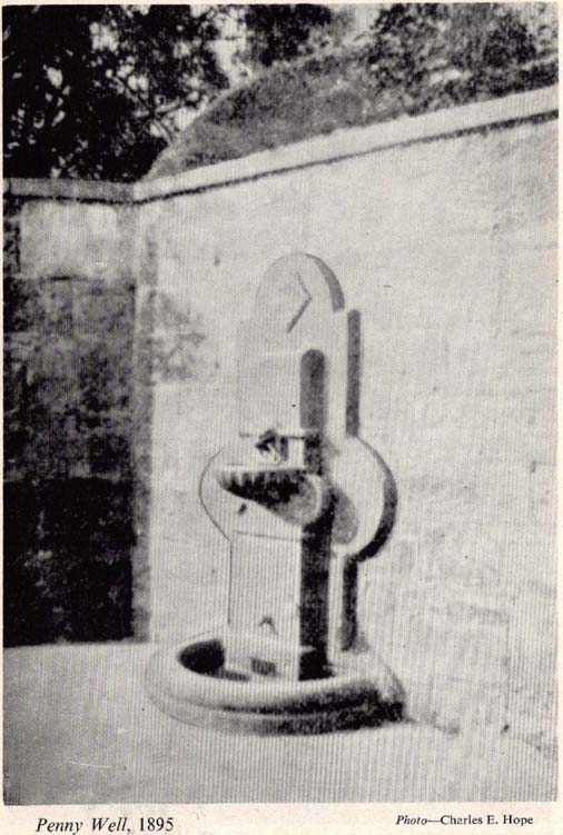
The Penny Well in 1895

The stone marking the position of the well is situated on the north side of the road at the east end of Grange Loan, a few yards west of the junction with Findhorn Place, at Newington on the south side of Edinburgh.  Unfortunately, all that now remains of the well is a red sandstone front with two pieces of metal on each side.

Archaeology & History

Set back a little into the wall alongside the road, we today see only the architectural memory of this once famous and much-reputed holy well, whose waters sadly no longer flow.  Curiously omitted from the primary Scottish surveys on holy wells, it was long known as an important water source by the people of Edinburgh in ages past. The best article on the site was written by W.F. Gray (1962) some fifty years ago, in which he told:

“Built against a garden wall, the Penny Well looks rather forlorn.  Now that a plentiful supply of water is in every dwelling, its public usefulness is definitely at an end, though it may slake the thirst of a passer-by.  But however that may be, the Penny Well has a long if not distinguished history, though fact and fiction, it is to be feared, are inextricably linked.

“And first, as to its age.  There is documentary evidence of the existence of the Penny Well as far back as 1716.  In that year Sir William Johnston of Westerhall, Dumfriesshire, disposed to William Dick of Grange three acres of his lands of Sciennes, which are described as bounded on the west by the lands belonging to “said William Dick and the Penny Well.”  The well really marked the south-east boundary of the lands of Grange.

“The actual age of the Penny Well is unknown.  All that can be positively stated is that it has existed for at least two hundred years… How the Penny Well came by its name is another unsolved mystery.  There is a story to the effect that in the earlier half of the nineteenth century an old woman who lived in the cottage opposite the well had charge of the spring and sold the water to wayfarers at a penny a glass.  A very plausible story by which to account for the name!  Unfortunately its credibility is shaken by the fact that…the spring was known as the Penny Well fully a century before…

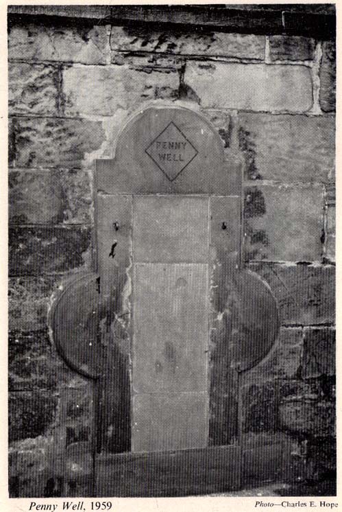
“Sir Thomas Dick Lauder, when he took up residence at Grange House in 1832, was deeply interested in the well at the east end of his property.  He had it restored and above it placed a tablet with the words, ‘Penny Well’ inscribed on it.

“About 1870, when feuing operations were in progress and there was much digging in the vicinity of the well, the water suddenly ceased to flow.  After an interval, however, it again became copious, so much so that it formed a tiny pond in front of an adjoining house.  In the hope of drawing off the water, a pit was dug.  This led to an interesting discovery.  Five feet below the surface, workmen came upon what there seems no reason for doubting was the original trough of the Penny Well.  This “interesting and unexpected find” (to quote from The Scotsman) was covered by a large block of hard sandstone.  The trough, which was circular, measured 32 inches across and had a depth of fully 1o inches in the centre.

“The Society of Antiquaries made investigations and the opinion was hazarded that “the basin into which the water ran was without doubt a baptismal font,” possibly the one which once stood beside St. Roque’s Chapel, situated at the southwest end of Grange Loan, but long since removed.

“In the (1890s) the Penny Well underwent a second restoration, the Town Council providing £30 for the purpose.  By this time however, the spring was found to be impure, but the trouble was got over by substituting the town water.”

Folklore

Penny Well in 1959
Penny Well in 1959

Although there are no documents proving with certainty, local tradition reputed this to be one of Edinburgh’s numerous holy wells.  It probably was.  And whilst W. Forbes Gray seemed at a loss to explain the name of this old water source, it probably comes from the old practice of local people dropping pennies and other offerings into the well in the hope that the spirit of the waters would confer good health or other benefits upon the hopeful pilgrim.  Such rites, of course, are very ancient indeed and relate specifically to the animistic spirit-nature of the site.  In Mr Gray ‘s (1962) essay on the Penny Well he also had this to say:

“According to one statement, it was a holy well attached to the Convent of St. Catherine of Sienna (which stood at the foot of St. Catherine’s Place), a well whose waters were possessed of miraculous powers of healing those afflicted with blindness, in which case it would be in the same category as the well of St. Triduana at Restalrig, and the Balm Well at Liberton.”

Reputed in times gone by to be one of the never-failing springs, this clear and sparkling water supply would keep bubbling away long after all others in the area had dried-up during summer droughts.

“It is also said that the ubiquitous Mary Queen of Scots, when she visited the religious sisterhood at Sciennes, partook of the waters of the Penny Well. “

References:

  1. Bennett, Paul, Ancient and Holy Wells of Edinburgh, TNA: Alva 2017.
  2. Gray, John G. (ed.), The South Side Story, W.F. Knox: Glasgow 1962.
  3. Gray, W. Forbes, “The Penny Well,” in South Side Story, Glasgow 1962.
  4. Smith, J. Stewart, The Grange of St Giles, T. & A. Constable: Edinburgh 1898.

© Paul Bennett, The Northern Antiquarian

Lowlands Well, Wycoller, Lancashire

Healing Well:  OS Grid Reference – SD 9317 3944

Archaeology & History

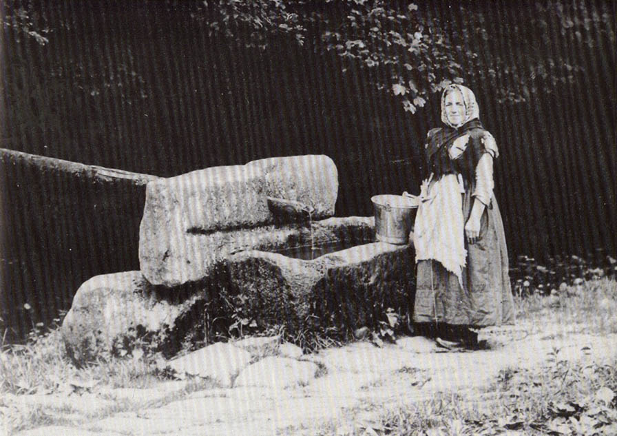
Lowlands Well

The huge stone trough at the side of the Wycoller Beck further down than the old bridge had a pipe leading to it from a spring on the other side of the beck.  Cookson & Hindle (1974) told that this was “the only source of drinking water” — which wasn’t quite true.  In the old photo shown here, the groove in the supporting vertical stone once held a lid over the top of the trough, “to prevent animals, dead leaves, etc, from fouling it.”  In addition to the old photo shown here, the well is also illustrated in Folley’s Romantic Wycoller (1949) with two young girls drinking the running water.

References:

  1. Bentley, John, Portrait of Wycoller, Nelson Local History Society 1975.
  2. Cookson, Stanley & Hindle, Herbert, Wycoller Country Park, H. Hindle: Colne 1974.
  3. Folley, E.W., Romantic Wycoller, Coulton & Co.: Nelson 1949.

© Paul Bennett, The Northern Antiquarian

Holy Ash Well, Bradford, West Yorkshire

Holy Well (destroyed):  OS Grid Reference SE 15942 34208

Also Known as:

  1. Ash Well
  2. Holy Well Ash Well
  3. Pin Well

Archaeology & History

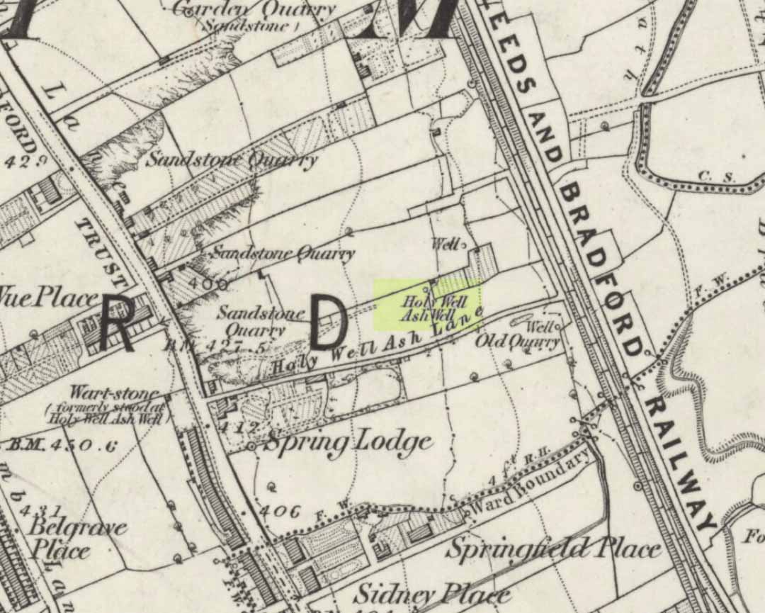
Holy Well Ash on 1852 map

Either right next to, or perhaps now beneath Bradford City’s Valley Parade football ground, was once a very important sacred well site.  Known as the Holy Ash Well and variants thereof, this healing spring was of considerable renown to people all around Bradford district in bygone days.  The site was illustrated on the 1852 OS map, and there was also a sacred stone adjacent to the well known as the Wart or Pin Stone, which had some animistic healing properties related the waters.

The old well was described by local historian Abraham Holroyd (1873) who said that:

“In Manningham Lane there is a fine well, in old deeds called Hellywell, i.e., holy well, in a field now called Halliwell Ash, now a stone quarry… Near this is the ancient Pin Stone.”

A few years later, in Robert Charles Hope’s (1893) monumental study, he described how,

“This holy well, not far from Manningham Lane, probably derived its name from having at some time been dedicated to some saint.  The inhabitants of Bradford were wont in ancient times to resort on Sundays to these wells as a common place of meeting, to drink of the waters and partake of their preternatural virtues.”

Which was another was of saying that he didn’t really know too much about the place!

The Bradford historian William Preston (1933) described this site in one of his early essays, where he informed us that local people knew the accompanying rock hereby as the Ash Stone, due to its proximity and ritual relationship to a great old ash tree (Fraxinus excelsior) that grew next to the well.  The mythic history of this particular tree should not be understated: it was a Creation deity par excellence in northern and Viking myths, but whatever old tales and power might once have been had here, in Bradford, they’ve long since been forgotten.  But it was the industrial historian William Cudworth (1896) who told the most of this all-but forgotten site, saying:

“On the sloping ground between Belle Vue and the Midland Railway there once existed a spring of water, supposed to have preternatural virtues. The name it bore within present recollection is probably a corruption of Holy-well. The holy wells of England as elsewhere had not all the same virtues attached to them. Some were blessed if used for baptisms, to others were attributed curative properties, especially for sore or weak eyes, while others were supposed to possess mystical powers, insomuch as any article dipped in them became charms or safeguards against witchery.  Any traditions associated with the spring at Halliwell (or Holywell) Ash are lost, but certainly in the early part of the present century the place was a favourite resort of the townspeople on Sundays.

“The derivation of the name is doubtful. In the survey of 1638 a close called ” Helliwell Ash” is mentioned as containing 2a. 3r. 26p., but without any indication as to its locality. The spelling of the name is of little moment.  Mr. James, in his “History of Bradford,” states that he had seen the place referred to in old deeds as “Helly-well.” By his will, dated May, 1685, Thomas Lister, of Manningham, devised to his two daughters, Juliana Lambrecht and Elizabeth Stapleton, equal shares in two closes of land called “Holywell Ash” and ” Delf Close,” besides other lands in Manningham. In the will disposing of the possessions of Juliana Lambrecht, her moiety of “Holywell Esh” was bequeathed to Francis Stapleton, her nephew.  In due course the lands in question were inherited by Francis Sharp Bridges, and have latterly belonged to Sir Francis Sharp Powell, M.P., in whose writings the form of spelling is given as ” Halliwell Ash.”

“Upon the ground in question there used to be a fine well of water issuing out of the higher ground, to which tradition assigned healing virtues. Might not the name of “holy” come from this circumstance?  Sufficient importance attaches to the tradition, however, to have led the farmers of the recent ordnance plan of Manningham to preserve the name, although the widening of the Midland Railway below Thorncliffe Terrace has almost obliterated the site.”

A more recent updated overview of the site was written by one of my old school-mates, Dave Pendleton (1997), who said of the place:

“Prior to 1886 the only feature of any real note in the Valley Parade environs was a holy well that emerged near the corner of the football grounds Midland Road and Bradford End stands; hence the road Holywell Ash Lane. Today the site of the well is covered by the football pitch.

Only the road name survives as a reminder of what was apparently one of the district’s foremost attractions. On Sundays and holidays people would gather to take the waters and leave pins, coins, rags and food as offerings to the spirit that resided in the waters.

Accounts suggest that the well was covered and had a great ash tree standing over it (hence ‘holy ash’). There was also a standing stone called the wart stone of unknown antiquity. The stone had a carved depression that collected water. It was believed that the water was a miraculous cure for warts. Indeed, as early as 1638 the Holy Well had been credited with healing powers.

The well suffered a decline in popularity during the late nineteenth century and its keepers resorted to importing sulphur water from Harrogate, which they sold for a half penny per cup. The well disappeared under the Valley Parade pitch during the summer of 1886 and the wart stone was moved to the top of Holywell Ash Lane – which then ran straight up to Manningham Lane. The stone was still there as late as 1911 but thereafter it seems to have disappeared into the mists of time.”

A night-club adjacent to the Valley Parade football ground—called Bibby’s—was said to have had an old well in its cellar, which the owner of the place, Mr Pearl Gladstone Minott, said was ‘haunted’.

Unfortunately I’ve not been able to find any old photos or drawings of this lost holy well – though I imagine that some local, somewhere must be able to help us out with this one.  Surely there’s more of this site hidden away somewhere….?

References:

  1. Bennett, Paul, The Old Stones of Elmet, Capall Bann: Milverton 2001.
  2. Cudworth, William, Manningham, Heaton and Allerton, W. Cudworth: Bradford 1896.
  3. Holroyd, Abraham, Collecteana Bradfordiana, Saltaire 1873.
  4. Hope, R.C., The Legendary Lore of the Holy Wells of England, Elliot Stock: London 1893.
  5. Pendleton, David & Dewhirst, John, Along the Midland Road, Bradford City AFC 1997.
  6. Preston, W.E., ‘Some Bradford Holy Wells’, in Bradford Antiquary, volume 7, 1933.

© Paul Bennett, The Northern Antiquarian 

Tobar na H-aoise, Iona, Argyll

Holy Well: OS Grid Reference – NM 2839 2525

Also Known as:

  1. Canmore ID 21613
  2. Pool of Healing
  3. Well of Age
  4. Well of Healing

Folklore

Although ascribed as a holy or healing well, this site is actually a curious natural water-filled depression near the top of Dun I, on the northern side of the island.  It is one of three magickal wells to be found hereby.  F.M. McNeill (1954) described this Well of Eternal Youth as having a fame that had spread far and wide, saying,

“Here, through ages past, pilgrims of each generation have lingered at the enchanted hour of dawn, ‘to touch the healing water the moment the first sun-ray quickens it.'”

In doing so, devotees would recover the energies of youth once more and live a longer healthy life.

References:

  1. Hannan, Thomas, Iona and some Satellites, W. & R. Chambers: London 1928.
  2. McNeill, F. Marion, Iona, Blackie & Sons: Glasgow 1954.

© Paul Bennett, The Northern Antiquarian

Peggy Well, Silsden, West Yorkshire

Healing Well:  OS Grid Reference – SE 0655 4413

Also Known as:

  1. Peggy Mawson’s Well
  2. Peggy’s Well

Getting Here

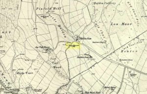
Peggy Mawson’s Well on 1853 map

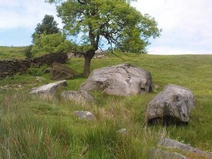
From Riddlesden, take the road up to the moorland and Rivock Edge.  When you reach the top (Silsden Road), turn left.  Go on for about 600 yards till you reach the lovely tree-hidden old cottages of Holden Gate, on your right.  Stop — and walk down the footpath opposite from here.  As the wall goes down, you’ll notice a stream in the next field to your left, emerging from a clump of large rocks.  That’s it! (there’s a footpath in the next field from the roadside)

Archaeology & History

Shown on the first OS-map as ‘Peggy Mawson’s Well,’ little else seems to known of this place; though it obviously got its name after the local lady, Peggy Mawson.  I can find no further information about this lady, nor why the site was named after her.  Any help here would be hugely appreciated!

Peggy Mawson’s Well – now drained-off through pipes

Sadly the waters from beneath the rocks have been channeled into a couple of pipes and the well no longer runs.  All that’s left is a small boggy region just in front of the boulders.  You have to walk about 100 yards further down the field where the water emerges from a modern pipe.  It doesn’t taste as nice as it originally did when coming straight from the ground, but it’s still quite drinkable (certainly beats any of the chlorinated stuff* that customers are forced to pay for, whether we want it or not – and most people don’t want it).

Folklore

This site has acquired modern folklore, but sadly no early traditions have been found.  Whelan & Taylor (1989) thought that Peggy Well’s “dedication suggests a connection with St. Margaret,” which unfortunately isn’t the case.  Several years later another writer, Val Shepherd (1994), spun the speculation even further, not checking the historical background to the site, and thought that “the well’s name may be derived from the water spirit, ‘Peg,’ who gave her name to other wells.”  Sadly neither idea holds any sway.

References:

  1. Shepherd, Val, Historic Wells in and Around Bradford, HOAP: Loughborough 1994.
  2. Whelan, Edna & Taylor, Ian, Yorkshire Holy Wells and Sacred Springs, Northern Lights: Pocklington 1989.

* Anyone know about this: surely because the water companies chlorinate and add other undesirable toxins into our tap water, what we’re actually drinking is a very weak solution and not actually water.  Isn’t that a trading standards violation?

© Paul Bennett, The Northern Antiquarian

Elm Crag Well, Bingley, West Yorkshire

Healing Well:  OS Grid Reference – SE 1028 3907

Getting Here

From Bingley, take the B6429 road up to Harden.  After going up the wooded winding road for a few hundred yards, stop where it levels out.  Cross onto the right-hand side of the road and walk up the slope a little, veering to your right.  You’ll notice a small disused building just off the roadside, in overgrowth, with a pool of water.  You need to be about 100 yards up the slope above it!

Archaeology & History

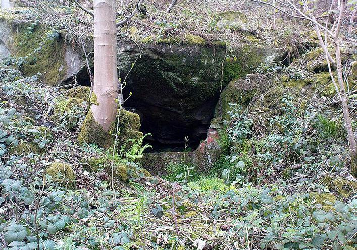
Elm Crag Well, Bell Bank Wood, Bingley

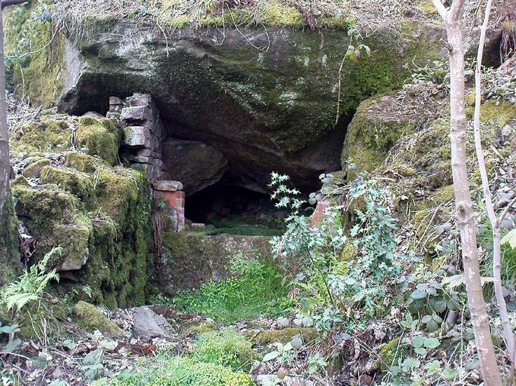
This is a beautiful old place.  If you walk straight up to it from the roadside, past the derelict building, you have to struggle through the brambles and prickly slope like we did – but it’s worth it if you like your wells!  However, if you try getting here in the summertime, expect to be attacked on all sides by the indigenous flora!  The waters here emerge from a low dark cave, in which, a century of three ago, someone placed a large stone trough.  When I first came here about 25 years ago, some halfwits had built an ugly red-brick wall into the cave which, thankfully, someone has had the sense to destroy and rip-out.

Shown on the 1852 Ordnance Survey map and highlighted as a ‘spring,’ Harry Speight (1898) gives a brief mention to this site, though refers us to an even earlier literary source when it was first mentioned. In John Richardson’s 18th century survey of the Craven area, he makes reference to an exceedingly rare fern, Trichomanes radicans, which was later included in Bolton’s classic monograph on British ferns of 1785.  In it, Bolton wrote that the very first specimen of this plant was “first discovered by Dr. Richardson in a little dark cavern, under a dripping rock, below the spring of Elm Crag Well, in Bell Bank.”

Elm Crag Well
Elm Crag Well

The waters from here come from two sides inside the small cave and no longer run into the lichen-encrusted trough, seemingly just dropping down to Earth and re-emerging halfway down the hillside.  But the waters here taste absolutely gorgeous and are very refreshing indeed!  And the old elms which gave this old well its name can still be seen, only just hanging on to the rocks above and to the side, with not much time left for the dear things.

References:

  1. Bolton, James, Filices Britannicae: An History of the British Proper Ferns, Thomas Wright 1785.
  2. Speight, Harry, Chronicles and Stories of Old Bingley, Elliott Stock: London 1898.

© Paul Bennett, The Northern Antiquarian

Robin Hood’s Well, Stanbury Moor, West Yorkshire

Sacred Well:  OS Grid Reference – SD 9795 3629

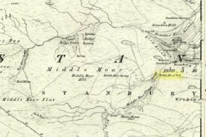
Robin Hoods Well on 1851 map

Getting Here

Follow the same directions to get to the nearby Ponden Kirk and, once on top of the rocks, overlooking the valley, walk on the footpath to your right.  It bends round and follows the stream up onto the moors.  About 100 yards along, walk up the heathery slope to the right and you’ll find several boggy watering holes on the top of the ridge.  In looking at the first OS-map of the area in 1853, it seems that the northernmost of six boggy springs is the Robin Hood’s Well – although we don’t know this for certain.  It’s one of them though!

Archaeology & History

Robin Hood’s Spring, above Ponden Kirk

There’s little to see here really: it’s little more than a small boggy spring of water emerging from the edge of the ridge, as the photo shows.  Curiously, descriptions of the site (and its neighbouring compatriots, Will Scarlett’s Well and Little John’s Well) are sparse aswell.  It was noted by the Ordnance Survey lads in 1848 and subsequently posted on the first OS-map of the area in 1851.  Both Horsfall Turner (1879) and Johnnie Gray (1891) mention the site passing, saying nothing of the place. However, several years after Gray’s work, Halliwell Sutcliffe (1899) ventured here and gave us the first real description of the place, telling:

“Half-hidden underground, and fringed with fern and bog-weed, lie the three wells which go by the names of Robin Hood, Little John and Will Scarlett.  One may stop to ask how they came by their birth-names, to wonder why a man should have troubled to fashion them in this out-of-the-way spot; but neither speculation nor questioning of the moor folk brings one nearer to an answer.”

Folklore

Halliwell Sutcliffe's scruffy quick sketch, circa 1898
Halliwell Sutcliffe’s scruffy quick sketch, circa 1898

Apart from this site being a spot where the legendary outlaw stopped and drank in ages past, the healing attributes of these waters have long since been forgotten.  Considering the proximity of the Ponden Kirk and its legendary association with fertility and marriage rites, I’d guess that such lore wold have centred around Beltane, or Mayday; and Robin Hood is very well known in folklore to have close associations with the same period.  So — and I’m guessing here — it’s likely that whatever might have occurred at this well, would have taken place around Beltane aswell.

References:

  1. Gray, Johnnie, Through Airedale from Goole to Malham, Walker & Laycock: Leeds 1891.
  2. Sutcliffe, Halliwell, By Moor and Fell in West Yorkshire, T. Fisher Unwin: London 1899.
  3. Turner, J. Horsfall, Haworth, Past and Present, Hendon Mill: Nelson 1879.

© Paul Bennett, The Northern Antiquarian

St. Helen’s Wells, Whittle-le-Woods, Lancashire

Holy Wells:  OS Grid Reference – SD 5856 2242

Getting Here

St Helen's Well on 1848 map
St Helen’s Well on 1848 map

Destroyed when the M6 motorway was built – but if you’re a really fanatic and wanna see the setting, simply get to the bridge that crosses the M61 north of the town, leading to Birchin Lane and Denham Lane. (To be honest though, if I lived nearby, I’d have to make 100% certain, and have a look in the trees between the west-side of the M6 and the trees at the end of the Wells Close Fold cul-de-sac, just in case its waters are there. If you find anything, let us know!)

Archaeology & History

St. Helen's Well (after Taylor 1906)
St Helen’s Well (Taylor 1906)

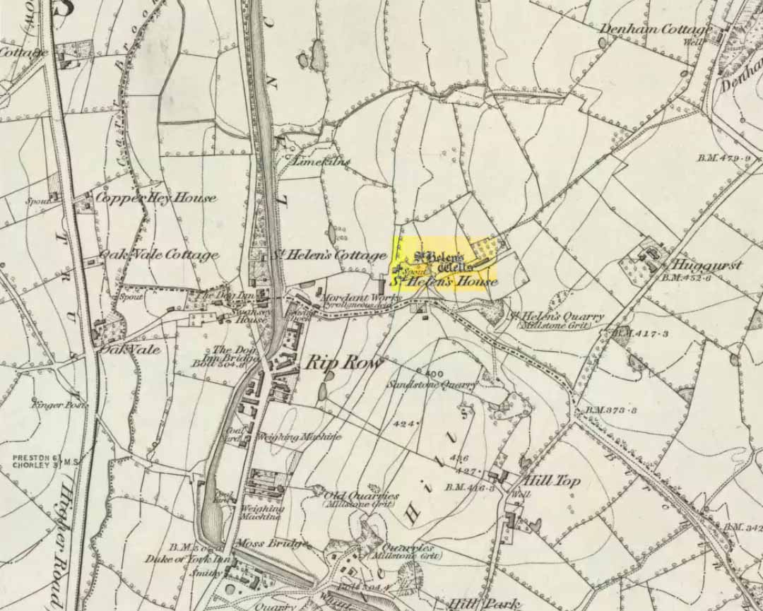
Highlighted on the very first OS-map of the region in 1848, this was one of many examples of a site dedicated to an important pre-christian deity which was eventually morphed into the character of Saint Helen.   Several sites nearby were all named after the saint, including the quarries, a cottage, house and the wells themselves.

When Henry Taylor (1906) came here, he wrote the following about this once important site:

“This celebrated well is situated in a wild, rugged and hilly part of the hundred, in the south of the parish of Brindle… The water, brilliantly clear and sparkling, bubbles up through white sand at the bottom of a stone-lined pit, about seven feet square and four feet deep.  On the southerly side of this pit, a few feet from it, is another similar stone-lined pit of about the same size.  An old inhabitant tells me that formerly both pits — now nearly empty — were filled to the brim; and this was clearly the case, as an open stone channel is in situ, provided to carry the overflow water from the southernmost pit, the water dropping from it down into the valley.  These structures are clearly of considerable antiquity, but the stones are somewhat displaced through neglect.  The water now comes underground, through a pipe, into a farmyard about one hundred yards south of the well in a splendid crystal stream.  Drinking water appears to be scarce in this district, for we met carts full of barrels which were apparently being taken to the neighbouring villages for sale from this spring.”

Folklore

Local folk visited here and dropped crooked pins into the well in the hope of wishes and future blessings one report saying such practices were done by local catholics!

References:

  1. Taylor, Henry, The Ancient Crosses and Holy Wells of Lancashire, Sherratt & Hughes: Manchester 1906.

© Paul Bennett, The Northern Antiquarian

Holy Well, Todmorden, West Yorkshire

Holy Well:  OS Grid Reference – SD 9344 2441

Getting Here

Now I aint been here for a few years, but it’s hopefully still where I last left it!  You need to get into the trees behind the Christ’s Church just out of the town centre, along the south-side of the Burnley valley road. (A646)  When you get to the footpath which runs just above the tree-line in the woods (it’s known locally as the ‘Lover’s Walk’ path), wander along for just a couple of hundred yards.  You’ll eventually get to the small spring of water and the tiny stream which runs down the slope, just to the left of the path. According to the old map I’ve got – that’s it!

Archaeology & History

This long-lost sacred well originally emerged a little bit further up the hill from where it is today.  Almost nothing is known about it.  Seemingly first highlighted in 1852, my first “discovery” of the place came as a result of going through some local old maps I’d had the fortune of obtaining.  In Victorian days when the site was much more prominent, the old road that took you into the woods was called Holy Well Lane.  Now, its memory has been subdued, and the old road is known simply as ‘Well Lane.’

A local writer, J.W. Crowther, mentioned the site in his local place-name survey, where he told that the Holy Well was a “name given to a well of excellent spring water” — but nothing more.  It was later mentioned in an article by J.A. Heginbottom [1988] who wrongly reported it as being “destroyed.”

Folklore

Local tradition told that ‘memaws’ (offerings such as rags, coins, flowers, etc) used to be left here by local people in olden times, as offerings to pacify or give respect to the waters; although what time of the year these were left, and the nature of the resident deity, has all been forgotten.  In very recent years however, it seems that some modern NewAge-types are now visiting the place once again.

References:

  1. Crowther, J.W., Place Names of Todmorden, privately printed: Todmorden (n.d.)
  2. Heginbottom, J.A., ‘Early Christian Sites in Calderdale’, in PHAS 1988.

© Paul Bennett, The Northern Antiquarian