St. Helen’s Well, Gosforth, Cumbria

Holy Well (lost):  OS Grid Reference – NY 0562 0303

Archaeology & History

Described as being “lost” in John Musther’s (2015) relatively recent survey, very little has been written about this site but, by the look of things, it may still exist—albeit in a boggy state of affairs!  It was mentioned in Parker’s (1926) classic history book of the area:

“Near to Newton is a very plentiful spring which is known to have been moved further from the house than it was.  Adam de Newton, son of Richard, mentions in one of his grants, “St. Helen’s Well, which is at the corner of my garden, the outfall going into Grucokesgile beck.”

Possible site of the Well

Parker found it to have been described in a local property charter in St Bee’s Register (Wilson 1915) as far back as 1220 CE.  On the earliest OS-map of the area, a “Spring” is shown just above Newton, which may mark the very spot!  Not far from the holy well was also a cross-marked stone called the Grey Stone (grey stones are usually boundary stones, but can also be standing stones—of which there were a lot in this neck o’ the woods).

Folklore

St. Helen’s Day was celebrated on August 18, but there seem to be no accounts of traditional customs recorded here.

References:

  1. Harte, Jeremy, English Holy Wells – volume 2, Heart of Albion press: Wymeswold 2008.
  2. Musther, John, Springs of Living Waters, privately printed: Keswick 2015.
  3. Page, Jim Taylor, Cumbrian Holy Wells, North West Catholic History Society: Ormskirk 1990.
  4. Parker, C.A. The Gosforth District: Its Antiquities and Places of Interest, Thomas Wilson: Kendal 1926.
  5. Wilson, James, The Register of the Priory of St. Bees, Surtees Society: Durham & London 1915.

© Paul BennettThe Northern Antiquarian

St. Helen’s Well, Hartlepool, Durham

Holy Well (destroyed):  OS Grid Reference – NZ 5236 3421

Also Known as:

  1. Freemen’s Well

Archaeology & History

Highlighted on the 1861 OS-map of the area, there is a curious lack of reference to this holy well until Cuthbert Sharp wrote about it in 1816.  Records of an adjacent St. Helen’s Chapel are in plentiful supply, going all the way back to around 1200 CE—although it’s pretty obvious that a water supply would be attached to the chapel, despite its late literary account.   Sharp told us:

“This chapel is stated to have been on the warren.  According to local tradition, a church once stood near the Freemen’s or St. Helen’s Well, in the Far-well Field, where the ground at present is considerably elevated, and where many hewn stones are constantly discovered, which renders it highly probable that this was the site of the chapel in question.”

Site shown on 1861 OS map
Site on the 1862 Town plan

When Robert Surtees visited here in 1823, the well was still visible, but remains of the chapel were negligible.  On the 1862 Hartlepool Town map, it would seem that a construction—perhaps a well-house—covered the waters, although whatever it may have been seems to have been destroyed sometime in the 1880s, when the entire area was built over.  No remains of this sacred site have been seen since.

References:

  1. Cuthbert Sharp, A History of Hartlepool, Francis Humble: Durham 1816.
  2. Surtees, Robert, The History and Antiquities of the County Palatine of Durham (4 volumes), London 1816-40.

Acknowledgements:  The map accompanying this site profile is Reproduced with the kind permission of the National Library of Scotland

© Paul BennettThe Northern Antiquarian

Holy Priests’ Well, York, North Yorkshire

Holy Well (destroyed):  OS Grid Reference – SE 6071 5187

Archaeology & History

At the beginning of the 19th century, William Hargrove (1818) described the scant remains of some old walling along old Haver Lane (renamed as Green Lane and now known as The Stonebow) which were the remains of a building, long gone, and which,

“tradition informs us (was) a religious house, which formerly stood here, called Holy-Priests; and though the site of it is not known, the report is greatly strengthened by the appearance of the walls just mentioned, and by the circumstance of a deep draw-well which now remains, being still called Holy-Priests Well.”

Some suggest that this water source may still exist beneath one of the buildings hereby, but the landscape here has been so badly mutilated over the last two hundred years that it’s very unlikely.

References:

  1. Hargrove, Willliam, History and Description of the Ancient City of York – volume 2, part 2, W. Alexander: York 1818.

© Paul BennettThe Northern Antiquarian

St. Dunstan’s Well, York, North Yorkshire

Holy Well (lost):  OS Grid Reference – SE 607 511

Archaeology & History

An entry in George Benson’s huge work on the history (mainly) of York, describes the holy well of St Dunstan “near the Glass Works”, which used to be at the south-side of the city on Fishergate.  I can find no other reference to this site and it’s not on the early OS-maps, so we must presume it is long gone.

Other wells in his name can be found in Kent, Somerset, Sussex and Tottenham.

Folklore

The fable relating Dunstan to wells was his ability to make springs miraculously appear.  Tradition relates him to have been born in Wessex in the 10th century.  His festival date is May 19.

References:

  1. Benson, George, An Account of the City and County of York – volume 3, Cooper & Swans: Micklegate 1925.

© Paul BennettThe Northern Antiquarian

Ellen’s Well, Angle, Pembrokeshire

Holy Well (lost):  OS Grid Reference – SM 86913 03483

Archaeology & History

Ellen’s Well on 1869 map

Very little seems to be known about this apparently lost site, deemed to be an authentic holy well in Francis Jones’ (1954) fine survey: the ‘Ellen’ in question here being the legendary St Helen.  It was highlighted on the first OS-map of the area in 1869 and subsequently included in the Royal Commission’s huge Pembrokeshire (1925) tome, but when they came to visit the site they reported that “it could not be traced, nor any information obtained about it.”  Has it truly fallen back to Earth, or do any local historians and antiquarians know where it is…?

References:

  1. Jones, Francis, The Holy Wells of Wales, University of Wales 1954.
  2. Royal Commission Ancient & Historical Monuments, Wales, An Inventory of the Ancient Monuments in Wales & Monmouthshire: VII – County of Pembroke, HMSO: London 1925.

© Paul BennettThe Northern Antiquarian


St. Ninian’s Well, Stirling, Stirlingshire

Holy Well:  OS Grid Reference – NS 79690 93012

Also Known as:

  1. Canmore ID 46210
  2. St. Ringan’s Well

Getting Here

St Ninian's Well, Stirling

St Ninian’s Well, Stirling

A short distance south out of Stirling town centre, along Port Street where it meets with Ninian’s Road, walk across at the traffic lights then turn immediately left down Wellgreen Road.  Barely 100 yards down (before you reach the roundabout), note the path on your right.  Walk along here and as it bends round into the car-park, look to your left and see the small ivy-covered building hiding away in below you, with an information plaque at its side.

Archaeology & History

“St Ninian’s” is a district unto itself on the south side of the ancient city of Stirling—and it has this holy well (and the demolished chapel that once stood by its side) to thank for this. James Johnston’s (1904) place-name study of the region showed that it had acquired its association with St Ninian as early as 1242 CE when it was described, “Ecclesia Sancti Niniani de Kirketoune.”  It was mentioned again in 1301 CE as the site of “Saint Rineyan”, or St Ringan, which was the other name given to this saint who spent much of his time at Whithorn, Galloway, where he “preached the gospel among the southern Picts.” (Attwater 1965)

The waters in the building

The waters in the building

The old well building

The old well building

At some later date, Ninian is thought to have ventured north and sanctified this already renowned water source which, in his day, would have been open and surrounded by ancient trees and an abundance of wild flowers and healing plants.  But today, typically, it is hiding almost secretly away, behind locked doors and not in view for the general public.  This needs to be changed!  Standing outside of the unkempt and overgrown building, you can faintly hear these ancient waters still flowing within their darkened enclave.

It has been described in a number of local history books down the years, but a lot of the old stories and traditions have sadly moved into forgotten memories… The first major description of the site was by J.R. Walker (1883) who wrote freshly about it soon after his visit—despite being “disappointed” with the architectural features of the building built over the well; which is hardly the right attitude as far as I’m concerned!  The waters, their natural environment, feeling and genius loci are the primary features to sacred wells—nottheir dissolution, nor the artifice of humans to contain and reduce the natural world at such a place!  But, this aside:  for the architects amongst you, here’s what Walker had to say about the well-house:

“Mr T.S.  Muir, in his Characteristics of Old Church Architecture, mentions it as “a large vaulted building with a chamber above it, which is supposed to have been a chapel.” From this notice I was led to think something of interest would be found in the chamber; but as will be seen by the drawing…it is utterly destitute of any feature worthy of particular notice.  On looking at the surroundings, however, which are all modern, and mostly new houses and streets in course of erection, I came to the conclusion that at no distant date the well was doomed, and that consequently I had better make a correct drawing of it.

“The lower chamber measures 16 feet by 11 feet 1 inch, and is covered with a vault running from end to end, measuring from floor to springing 2 feet 9 inches, and from floor to crown of arch 6 feet.  At the end where the spring rises there is a square recess 1 foot 9 inches high and 1 foot 7 inches wide and 17 inches deep; and at the other end two recesses, the largest measuring 2 feet 7 inches in height, 1 foot 4 inches wide and 1 foot 4 inches deep, the other 8 inches high, 8 inches wide, and 8 inches deep.  To what purpose these have been put I have formed no idea; they are on an average 12 inches from the floor to the sill.  The side walls are 2 feet 9 inches thick, and the end gable 3 feet; the other gable, between the well chamber and the adjacent building, being about 2 feet 3 inches.  The room above is the same size as the vaulted chamber below, and is divided by timber partitions to form a dwelling-house.  There is an ordinary fireplace and press in the gable; the press, however, does not go down to the floor, but is simply a recess or “aumbry,” such as we see in old Scotch houses.

“The roof seems to have been renewed at no distant date, although some of the timbers are, without doubt, home-grown.  The ground rises rapidly to the back, so that the entrance door to the house is level with the top of the vault; this door is simply splayed in the Scotch manner, with a square lintel over, and a relieving arch inside.  The door to the well chamber is also splayed, and in like manner the windows; the largest window has been altered, and a new projecting sill put in.

“At present the well is used for washing purposes, and must have been so for a considerable length of time, if we may judge from the table of rates affixed to the building; and a channel has been formed down one side and along the bottom end to carry away the water, the floor being paved with stones.  The vault inside is roughly dressed, very little labour seemingly having been bestowed upon it.

“In the New Statistical Account it is suggested that the chamber was used as a bath, and it also states that, “it is celebrated for its copiousness and its purity. It is a hardish water, but of low specific gravity, and much used for washing. It has been calculated that were all the waters proceeding from this spring forced into the pipes that supply the town, it would afford every individual not less than 14.03 gallons per twenty-four hours.  Its temperature is very cold and it exhibits muriate of lime and sulphate of lime. It is also much used for brewing.”

“Externally the building is roughly cast, or in Scottish phraseology, harled.”

A few years later when J.S. Fleming (1898) wrote an account of the place in his survey of local holy wells, he described a number of other historical elements not included in Walker’s (1883) account, telling:

“RINGAN” is stated to be the Scoto-Irish form of Saint Ninian’s name. He is alleged to have come from Ireland in the fifth century. St. Ringan’s Chapel was one of three attached to St. Ninians, the others being at Skeoch—dedicated to the Virgin Mary—and at Cambusbarron.  The remains of St. Ringan’s Chapel, a simple, barrel-vaulted chamber, 11 feet by 14 feet, built over the spring, are situated a few yards off Pitt Terrace, the upper walls having been built, in 1731, by order of the Stirling Town Council, and formed into a house for the convenience of the town’s washerwomen.  A niche in the north-east wall has evidently been made to hold the image of the Saint; while there has also been a piscina in the same wall. The flow of water is enormous, and enters the building from under the south-west gable, and after passing through the little chamber, flows out at the east wall.  In 1740, the Town Council, considering the large volume of water of some value, entertained the idea of having it conveyed into the town by means of pipes, and consulted an Edinburgh engineer with regard to the feasibility of the project.  Nothing resulted from their efforts, however.  The water of this spring is stated to be so cold in summer that people cannot stand in it for any length of time; while in winter, again, it is so warm that it rapidly thaws whatever is thrown into it.  Smoke rises from it at times, hanging over it like a vapour on a frosty morning.  These characteristics indicate that the waters must issue from a great depth in the ground.

“This Chapel was apparently held in high repute by King James IV., as in the Exchequer Rolls we find the following entries: — “1497, April 24. — Item to the King’s offerand in Saint Ringans Chapel, besid Strivelin, 14/.” ” Samen day to Schir Andro to get say a hental of messes of Saint Ringans, 20⋅/.”

The site was mentioned in the standard surveys of MacKinlay (1893) and Morris (1981), but with very little additional information.

Folklore

Ninian's Well on 1832 map

Ninian’s Well on 1832 map

St. Ninian’s festival date is September 16, but I’ve been unable to find any information about any practices here for that date. However, in 1659, St Ninian’s Well was mentioned as a site used in what the deluded criminal courts of the period called “a case of witchcraft”, against one Bessie Stevenson.  The lady concerned told of performing quite normal herbal practices and similar animistic healing traditions, typical of those found universally in peasant cultures, but which the crazed church-goers saw as something completely different.  Bessie told that for people who were either sick or bewitched, she would wash their clothes in the running waters of St. Ninian’s Well, to wash away any disease and cure the said person.  It is likely that the waters here were commonly used for such rites, much as the christian priesthood still do at many ‘holy waters’ to this very day.  Indeed, of the sacred waters here, St. Ninian himself was said to “have endowed it with peculiar virtues.” (Roger 1853)

References:

  1. Attwater, Donald, The Penguin Dictionary of Saints, Penguin: Harmondsworth 1965.
  2. Fleming, J.S., Old Nooks of Stirling, Delineated and Described, Munro & Jamieson: Stirling 1898.
  3. Johnston, James B., The Place-Names of Stirlingshire, R.S. Shearer 1904.
  4. MacKinlay, James M., Folklore of Scottish Lochs and Springs, William Hodge: Glasgow 1893.
  5. Morris, Ruth & Frank, Scottish Healing Wells, Alethea: Sandy 1982.
  6. Mould, D.D.C.P., Scotland of the Saints, Batsford: London 1952.
  7. Reid, John, The Place-Names of Falkirk and East Stirlingshire, Falkirk Local History Society 2009.
  8. Roger, Charles,  A Week at Bridge of Allan, Adam & Charles Black: Edinburgh 1853.
  9. Ronald, James, Landmarks of Old Stirling, Eneas Mackay: Stirling 1899.
  10. Simpson, W.D., St. Ninian and the Origins of the Christian Church in Scotland, Oliver & Boyd: Edinburgh 1940.
  11. Walker, J. Russel, “‘Holy Wells’ in Scotland,” in Proceedings of the Society of Antiquaries of Scotland, vol.17 (New Series, volume 5), 1883.

© Paul BennettThe Northern Antiquarian


St. Maha’s Well, Buchanan, Stirlingshire

Sacred Well:  OS Grid Reference – NS 4573 9180

Also Known as:

  1. Canmore ID 43475
  2. Saintmaha Well

Getting Here

St Maha's Well on 1865 map

St Maha’s Well on 1865 map

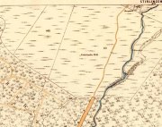
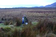
Bittova walk to reach this one.  From The Square in Drymen village, take the long Old Gartmore Road north for 1.4 miles (2.25km) until you reach the West Highland Way track. Turn left and walk along the track for 1.75 miles (2.8km), making sure that you note crossing the large burn as a guide before your next turn, right, uphill and further north. About 400 yards up, you emerge from the forestry plantation and onto the open moorland. Walk about 200 yards (185m) up the track then walk left, right into the boggy moorland. Keep your eyes peeled for a small standing stone on the heath about 130 yards along, and just below this is a stone-lined spring of water.

Archaeology & History

St Maha's Well

St Maha’s Well, near Drymen

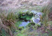
This little-known healing spring of water, high upon the moors overlooking the southern isles of Loch Lomond and the mountains beyond, is in a beautiful (if boggy) setting.  We visited here on a somewhat wet day, amidst a wealth of Nature’s downpours in previous days giving us the masks of grey overcast skies and soaking grounds.  Despite this, the setting is gorgeous and, if we’d have visited on a sunny day, the feel and views would be outstanding.  This mighthave been one of the reasons that this particular spring of water was chosen to be sanctified.  Certainly it has an ancient history, if christian tales are anything to go by…

Although listed in the parish of Buchanan, the well resides on the hills above the village of Balmaha more than 2 miles to the west, on the shores of Loch Lomond; and Balmaha is thought to have its origins enwrapped with an early christian characters of some prominence.  The element maha derives, said Watson (1926) from the Scottish Gaelic ‘Mo-Thatha’, from the earlier Irish name Tua, meaning “the silent one.”  The character known as St. Maha gives his name to the village and according to H.G. Smith (1896),

Bal maha may most probably retain the memory of St Mochai or Macai; Latin, Maccaeus, also known as St Mahew, a companion to St Patrick, to whom the church of Kilmahew in Cardross was dedicated.  Mahew lived at Kingarth in Bute, and Buchanan formed part of the district superintended by Kingarth.  He was a poet, physician, and noted in his day for his mathematical learning… (St Mahew’s day was 11 April).”

Close-up of the waters and stone surround

Close-up of the waters and its stone surround

It seems therefore probable that this poet-healer character underlies the old name at this well.  St. Maha’s attributes as a poet and healer would suggest he was trained in archaic techniques before declaring himself as ‘christian.’  In the landscape nearby are other early Irish christian traditions, pasted onto much earlier heathen ingredients.

When Mr Smith (1896) wrote about the well, the remains of an old tree still grew above the waters onto which local people left memaws and offerings for the resident spirit, maintaining the animistic traditions of popular culture that still endure.  He wrote:

“St Maha’s Well is in an upper field of the farm of Crietihall.  It was of old a healing well, and in the memory of man pieces of cloth used to be fastened to a tree which overshadowed it, votive offerings by the pilgrims who sought the saint’s favour.”

…Although in truth, “the saint’s favour” is mere window dressing for the more archaic and natural feel of the site: what John Michell (1975) would have termed the “resident Earth spirit.”

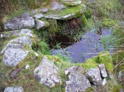
The well is surrounded by a small arc of stone masonry, which the ever-reliable Royal Commission (1963) lads tell us, “measures 2ft by 3ft internally and stands about 1ft above the surface of the water.”  Just above the well itself is a small rise with a standing stone at its edge—probably medieval in origin.  Barely three feet tall, it sits upon an overgrown arc of stones that curves around the hillock reaching down towards the well and was obviously a small building of some sort in previous centuries.  Its precise nature is unknown, but it has been suggested to have either been an earlier well-house or surround, or perhaps the remains of a hermit’s cell—even St. Maha himself—that has fallen away over time.  Without an excavation, we may never know what it was!

Little Leo by the little stone

Little Leo by the little stone

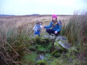
Aisha with Leo, shortly before he threw himself in!

Aisha with Leo, shortly before he threw himself in!

Whatever the origin behind the small standing stone and the overgrown scatter of rocks, one of our adventurers on the day we visited—little Leo—was fascinated by it, almost attaching himself to it and stroking his way round and round the old stone with playful endurance.  And then, when he got to see the sacred spring below, became so taken by it that he simply sat down in the waters without as much as making a gasp, despite the cold!  Aisha (his mum) would pick him up, only for him to walk right back over and sit himself right back into it again!  It was both comical and fascinating to watch and he seemed quite at home in the pool, despite being drenched and cold.  Indeed, he took exception to being lifted out of the water—and simply plonked himself back in it again!

Folklore

The Canmore website tells some intriguing folklore about the place, saying:

“The well is still a focus of local cult, and is visited by people who leave offerings in the water. A man dying recently in a local hospital refused to drink any water except water taken from this well.”

References:

  1. Edlin, Herbert L. (ed.), Queen Elizabeth Forest Park, HMSO: Edinburgh 1973.
  2. Johnston, James B., The Place-Names of Stirlingshire, R.S. Shearer 1904.
  3. Michell, John, The Earth Spirit: Its Ways, Shrines and Sanctuaries, Thames & Hudson: London 1975.
  4. Morris, Ruth & Frank, Scottish Healing Wells, Alethea: Sandy 1982.
  5. Nicholson, A. & Beaton, J.M., “Gaelic Place-Names and their Derivations,” in Edlin’s Queen Elizabeth Forest Park, HMSO: Edinburgh 1973.
  6. Royal Commission on the Ancient & Historical Monuments Scotland, Stirling – volume 1, HMSO: Edinburgh 1963.
  7. Smith, H. Guthrie, Strathendrick and its Inhabitants from Early Times, James Maclehose: Glasgow 1896.
  8. Watson, W.J., The History of the Celtic Place-names of Scotland, Edinburgh 1926.

Acknowledgements:  Many thanks to Aisha Domleo, Lara Domleo, Leo (the stone-hugger) Domleo, Unabel Gordon, Nina Harris, Paul Hornby and Naomi Ross for their help and attendance in finding and falling about this ancient sacred well. A damn good wet day all round!

© Paul BennettThe Northern Antiquarian


St. Anne’s Well, Strathaven, Lanarkshire

Holy Well:  OS Grid Reference – NS 7039 4438

Archaeology & History

St Anne's Well on 1865 map

St Anne’s Well on 1865 map

Long since lost it would seem, in a search for this legendary site over the weekend with Gordon, Aisha and Lara, I’m still not certain of the actual status of the site.  Although we found a very fresh water supply still running not far from where the old OS-map showed the original holy well to be, it may be a completely different water source.

There are hardly any references to the spring and those that exist are scant.  In the early 1860s, St. Ane’s Well was mentioned briefly in the Object Name Book of the area:

“This is a good spring well in the southern part of the town of Strathaven.  It is commonly called Tun’s (Tan’s?) Well, but this is an abbreviation of the name.”

Lara plays at a nearby well

Lara plays at a nearby well

Looking down on the waters

Looking down on the waters

More recently, thanks to a communication from the local historian Robert Currie, more information has come to light about the well.  It was described in the local history work by Mary Gebbie (1880).  Mr Currie told me:

“In her Sketches of Avondale and Strathaven…we read: “In a lane off Tod’s Hill was the famous Tann’s Well – obviously a corruption of the celebrated water saint, St. Anne. This spring has within a few years completely dried up. Access was easily had from the castle to it, over the draw-bridge, which is said to have rested on the ledge of the ground and rock on which the fifth house is built south of the bridge. Before this aperture was built up, the inhabitants around took advantage of the pathway for drawing water from the Pomillion, at a place called the Fairy Pool. A little above this comes the Dove Castle; and a half a mile further out is the Gallow Hill.”

He continued:

“That said, the current siting of St. Anne’s Well is located on Lesmahagow Road with (the) site being almost opposite the Council houses bordering on Station Road (there is currently a mini-roundabout near the locus). In recent years the site has become obscured but in my own living memory there was once a plaque authenticating the site and with a garden seat thereby.”

In searching through their own library, Mr Currie and his wife came across more about the site in William Downie’s (1979) book on Strathaven, in which he wrote:

“A small lane off Todshill went down to a cluster of houses called St. Anne’s Well nestling on the sloping ground beside the mill dam. In 1911 these houses were acquired and demolished by the Town Improvement Committee. A row of houses backing backing on to Powmillon Burn were also demolished at the same time and a retaining wall with railings erected, so opening up a very fine view of the castle and burn etc.”

The dedication here to the mythic figure of St. Anne (mother of the Virgin Mary and grandmother of Jesus) is isolated and mysterious.  No church is dedicated to her in the area, nor other relative christian remains.  Her appearance in Strathaven is something of an oddity.  There was a Duchess ‘Ann’ Hamilton of Strathaven Castle who lived 200 yards away at Strathaven Castle on the other side of the river that might have given her name to the well, but this is very unlikely.  More probable is that St. Anne was used as the mythic figure who covered an earlier dedication to the prima mater, or Cailleach—although there are no remains that relate to Her either.  However, the existence of St Mary’s church and an associated well to the north, along with a burn dedicated to a “maiden” in the same parish to the northwest add to the cailleach’s potential…..but all tales of Her have seemingly been forgotten.

…So it seems that the spring of water that Lara, Aisha, Gordon and I came across was obviously not the same place, but exists just below the roadside where the disused railway line is.  It’s close to St Anne’s Well – but is not the same water source.

References:

  1. Downie, Fleming, A History of Avondale and Strathaven, Eric Moore: Glasgow 1979.
  2. Gebbie, Mary, Sketches of the Town of Strathavon and Parish of Avondale: Historical & Traditional, John Menzies: Edinburgh 1880.

Links:

  1. Strathaven Past & Present

Acknowledgements:  Considerable thanks must be given to Robert Currie, BA Hons, who sent us additional information enabling a more informative and accurate site profile for this holy well.  Thanks Bob! Also huge thanks again to Aisha Domleo, Lara Domleo, Unabel Gordon and their frobbling Leonidus!

© Paul BennettThe Northern Antiquarian


Lady Well, Glasgow, Lanarkshire

Holy Well:  OS Grid Reference – NS 60376 65323

Also Known as:

  1. Canmore ID 45037

Getting Here

Lady Well on 1865 OS-map

Lady Well on 1865 OS-map

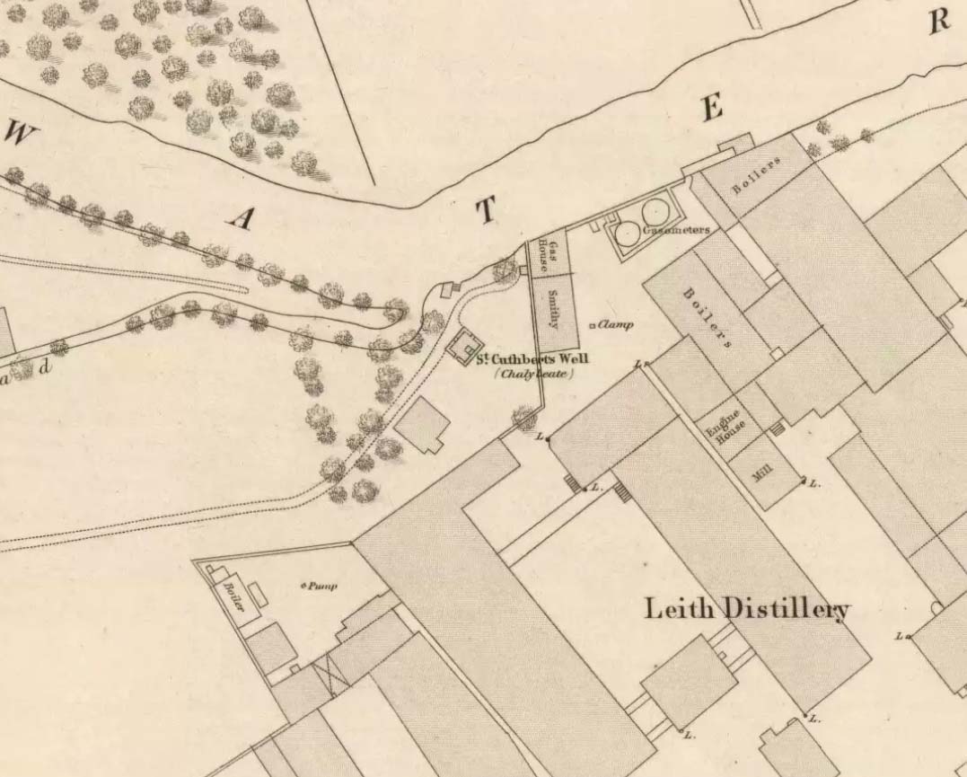
Get yourself to Glasgow Cathedral—wherein you’ll find St. Mungo’s Well—and walk down John Know Street.  A coupla hundred yards down, across the road is a small street called Ladywell Lane (there’s no signpost for it though), running below the cemetery and leading to the back entrance of the giant Tennent’s Brewery.  At the bottom of this, up against the wall on your left, is the Lady Well.

Archaeology & History

The origins and early traditional history of this once famous sacred well are sadly lost due to the intrusion of industrialism.  It was obviously a place of some considerable repute and lent its name to local quarries and fields hereby.  Used extensively by local people for countless centuries, things were to change in 1715 when the waters of this and other wells were to be kept clean by one John Black, “at a salary of 400 merks yearly.”  The Glasgow historian Eyre-Todd (1934) told that,

“Black was to furnish them with chains, buckets, sheaves, ladles, and other necessary graith, aswell as with locks and iron bands.  He was ‘to cleanse, muck and keep them clean,’ and to lock and open them in due time, evening and morning.  In case of failure he was liable to a penalty of £100 Scots.”

Lady Well in 2015

Lady Well in 2015

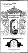
Lady Well in 1883

Lady Well in 1883

That’s a helluva lot of money in those days!  Even when M’Ure (1736) described it, only in passing, he had nothing to say about its curative properties or local rites.  Once the Industrialists take control, the ways of local people are sanitized, sterilized and ‘progress’ outlaws tradition.  The only reference to an earlier sacrality is in Mr Russel’s (1883) article, where he said simply, that the Lady Well was “so called after a fountain at the bottom of the Craigs…sacred in Popish times to the Virgin.”

The construction that we see today—of the well in its little enclave—was first built in 1835-6.  The waters became polluted after they were redirected below the Necropolis and have not been used since (although they still flow out of the wall a couple of yards to the right, stinking!).  The architectural feature was cleaned up and restored by the local brewery in 1983.

The site may have gained its name from one Lady Lochow, who lived nearby and built a hospital at the old Gorbels in the 14th century—but we might never know the real truth about the origin of its dedication.  However, an intriguing ingredient relating to the dedication of the Lady Well is the incidence of a St. Anne’s Street that used to exist immediately to the east, as seen on the 1865 OS-map above.  St. Anne may well be the mythic character behind the naming of this Lady Well, although I can find no literature to prove this.  In the christian mythos, St. Anne was a very important character indeed: the mother of the Virgin Mary no less!  However, as hagiographers from Attwater (1965), to Baring-Gould (1898) and Butler (1866) all tell, her biography is piecemeal—which is most surprising considering she was JC’s granny!  Anne’s festival date was July 26 (a couple of days after Sirius enters the northern hemisphere); she was the patron saint of midwives, grandmothers and also miners, who invoked her as the deity who produced gold and silverakin to the Earth Mother Herself!  It’s obvious that Anne’s original mythic nature was subdued, as she represented an archaic root of matriarchal triplicity of the Virgin, the Lady and Old Woman and not the patriarchal triplicity of the incoming christian cult.  The christian mythos at this Lady Well (as elsewhere) replaced one facet of the indigenous prima mater in Glasgow, known as the Cailleach—as shown in her attributes of midwife, grandmother and the deep Earth.  If local historians can find field-names or wells dedicated to the Maiden, the Lady and the Carlin (or their variant titles) nearby, the lost layers of archaic Glasgow’s indigenous animistic folk memories could be mapped out once again…

References:

  1. Attwater, Donald, The Penguin Dictionary of Saints, Penguin: Harmondsworth 1965.
  2. Baring-Gould, S., The Lives of the Saints – volume 8, J.C. Nimmo: London 1898.
  3. Bennett, Paul, Ancient and Holy Wells of Glasgow, TNA 2017.
  4. Brotchie, T.C.F., “Holy Wells in and Around Glasgow,” in Old Glasgow Club Transactions, volume 4, 1920.
  5. Butler, Alba, The Lives of the Fathers, Martyrs and other Principal Saints – volume 7, James Duffy: Dublin 1866.
  6. Eyre-Todd, George, History of Glasgow – volume 3, Jackson: Glasgow 1934.
  7. Greene, E.A., Saints and their Symbols, Sampson Low: London 1897.
  8. MacIntosh, Hugh, The Origin and History of Glasgow Streets, James Hedderwick: Glasgow 1902.
  9. M’Ure, John, History of Glasgow, D. MacVean: Glasgow 1736.
  10. Walker, J. Russel, “‘Holy Wells’ in Scotland,” in Proceedings of the Society of Antiquaries of Scotland, vol.17 (New Series, volume 5), 1883.

© Paul BennettThe Northern Antiquarian


St. Ouret’s Well, Brechin, Angus

Holy Well:  OS Grid Reference – NO 5869 5904

Getting Here

‘Spring’ shown on 1865 map

Travel north towards Brechin on the B9134, and cross the River South Esk at Stannochy Bridge.  Immediately after crossing the bridge, go through the double tubular steel gates to your right, descend the steep slope and walk along the boundary fence dividing the riverside field from the sloping woodland until you reach a tubular steel pedestrian gate. Go through this gate, over the burn and keep walking 150 yards or so to the right and St. Ouret’s Well is seen near the top of the slope.

Archaeology & History

Alexander Penrose Forbes, Bishop of Brechin wrote in 1872 :

Ouret – Close to Brechin, on the north bank of the Esk, near the Stannochy Bridge, is S.Ouret’s Well.”

The spring flows south into a burn then into the river South Esk

Perusal of the 25″ OS map of 1865 shows an enclosure marked ‘spring’ with a short pathway to the north-east, as the only water feature answering the written description. My field visit just over a century and a half later found a spring issuing at that point from the embankment, with the remains of old rough stone walling on either side of the spring. There was no sign of the pathway. The walling around an otherwise unremarkable spring located away from habitation would imply to me that this is the Saint’s Well.

As the good Bishop mentions the Well as the last entry in the Auctaria of his 1872 book—an afterthought as you will—it seems reasonable that the knowledge of St. Ouret and his well may have been at that time on the point of oblivion. The well is not noted as such by the earlier Ordnance Survey map,  nor can I find his name in any other of the hagiographies at my disposal.

Old walling still visible low down

Intriguingly, ‘Ouret’ is a modern Basque surname, and while it is tempting to think of a Basque Holy Man walking the Pictland, the name is more likely a transliteration into Scots from a now lost Pictish or Gaelic name.  There is a mysterious ‘Uoret’ named in the inscription (as interpreted by Elisabeth Okasha) ‘DROSTEN : IRE UORET [E]TT FORCUS’  on the Drosten Stone at St Vigeans, who may be our saint, but this Uoret has been interpreted by Thomas Clancy as the Pictish King Uurad, son of Bargoit, who ruled from 839 to 842.  I know of no reference as to where Forbes obtained his information on Ouret or his well, but is it reasonable to hypothesise that the information was passed to him orally and what he wrote down as ‘Ouret’ may have been meant to be the very similar sounding ‘Uoret’? Or alternately was King Uurad  subjected to local canonisation as St Uoret/Ouret after his death? Can anyone add more?

A mile or so south of here is the holy well of St. Murdoch.

References:

  1. Forbes, Alexander Penrose, Kalendars of Scottish Saints, Edmonston and Douglas: Edinburgh 1872.
  2. Dwelly, Edward, Gaelic – English Dictionary, Garmin Publications: Glasgow 1988

© Paul T. Hornby,  The Northern Antiquarian 2016