From Callander head east along the main A84 road and nearly 300 yards past the entrance to the Keltie Bridge caravan park, take the tiny road on your left (north) and barely 100 yards along turn right and go up here for exactly 1 mile. Walk up the track from here and follow the directions to find the Black Park (1) cairn; and then the nearby small Black Park (2) cairn. From here you need to walk north-east round the small rounded hillock in front of you, and cross a small burn (stream) up to the next small grassy rise. Altogether this is about 200 yards from the Black Park (2) cairn. On this grassy rise lives the Black Park (3) cairn!
Archaeology & History
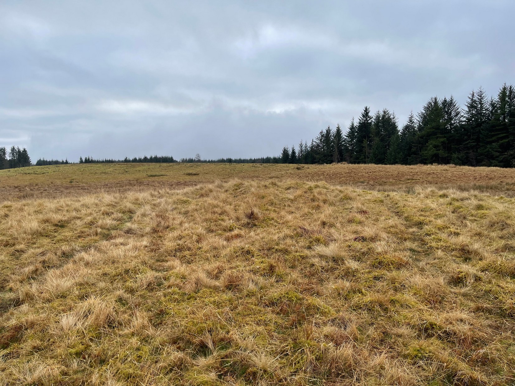
As with its compatriot Black Park (2) cairn 200 yards southwest, this can be hard to see. It’s an overgrown small singular cairn (it looks like a tumulus now) of no great note to look at: probably the resting spot of an individual or just a small family. Measuring some 5-6 yards across and less than a yard high at the most, its easily missed unless you’re really mean to find it. More impressive are the ones on the hill immediately above you to the east. Head there next!
References:
Royal Commission Ancient & Historical Monuments, Scotland, Braes of Doune: An Archaeological Survey, RCAHMS: Edinburgh 1994.
Take the same directions as if you’re going to visit the large Black Park (1) cairn, and from here look down the slight boggy slope to your right (east) and, across the other side of a small burn (stream) you’ll see a slightly raised grassy knoll. A curved dyke is to its left (west) side. You’re there!
Archaeology & History
This small cairn, barely two feet high at the most, and five yards across, is deemed as a possible Bronze Age cairn on Canmore and in the Royal Commission (1994) report of the area. There is certainly a pile of small stones here, but it may be a clearance cairn (I hope I’m wrong). Only an excavation will tell us for sure.
References:
Royal Commission Ancient & Historical Monuments, Scotland, Braes of Doune: An Archaeological Survey, RCAHMS: Edinburgh 1994.
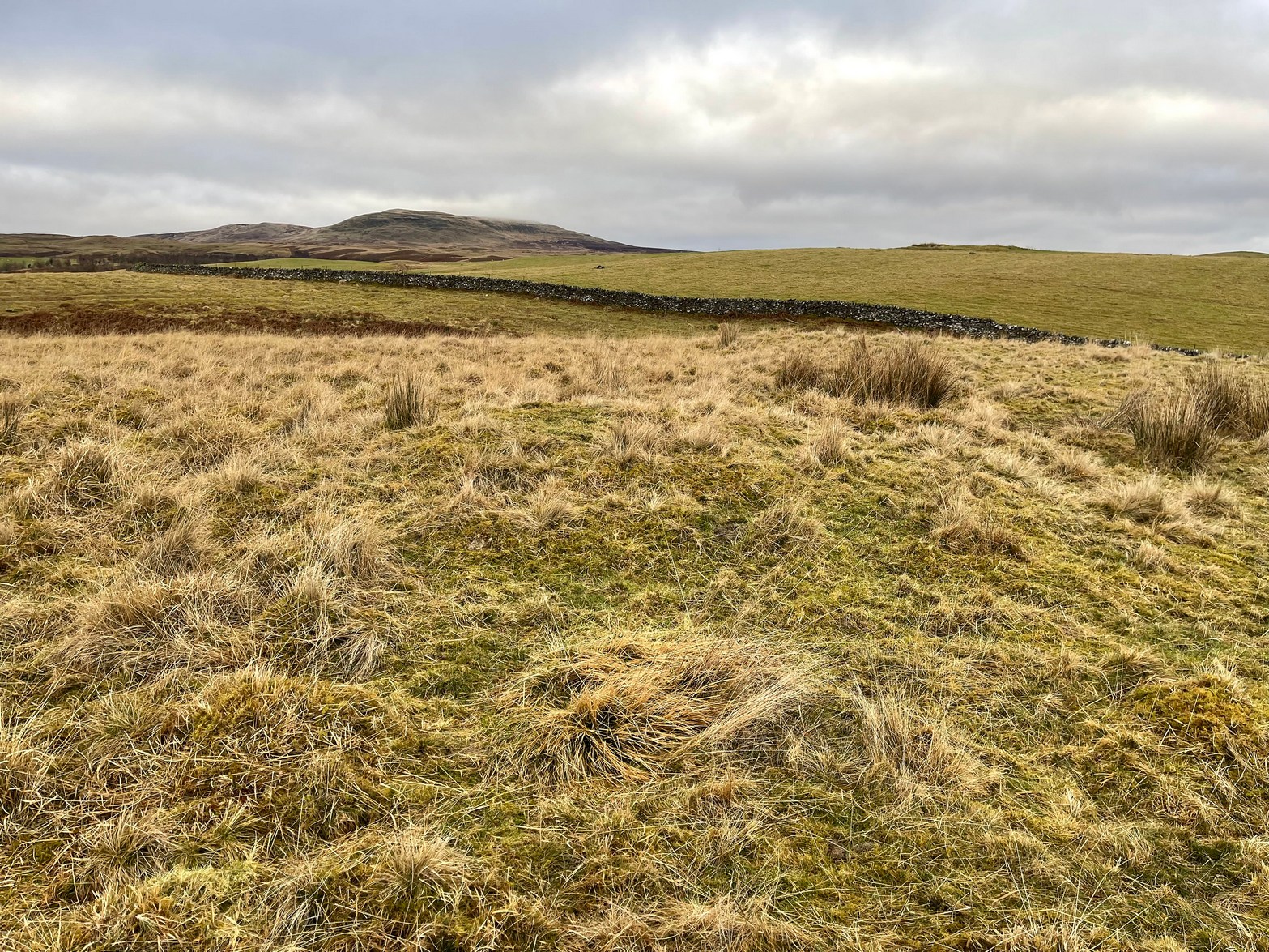
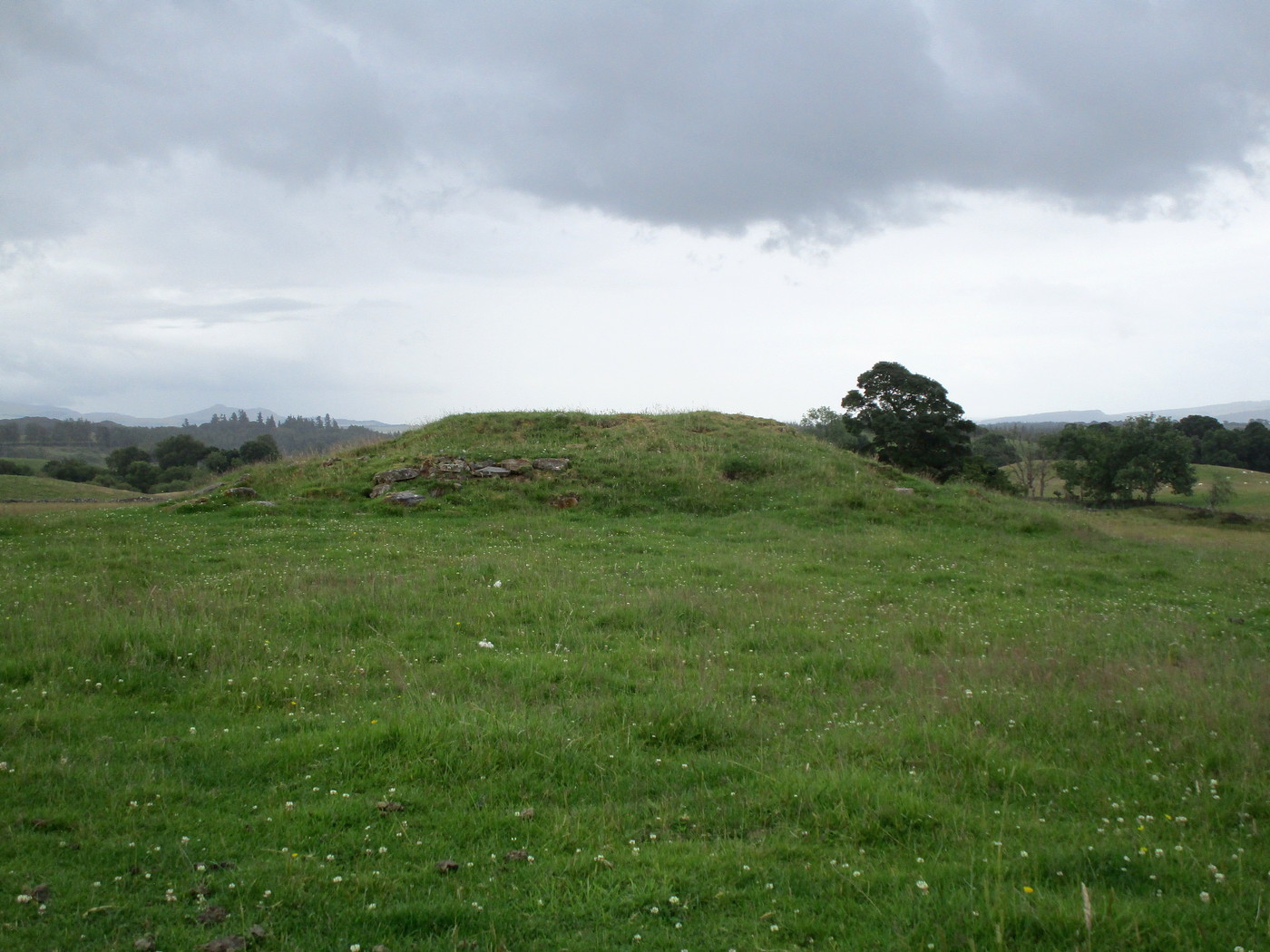
Less than a mile east of Callander on the main A84 road, nearly 300 yards past the entrance to the Keltie Bridge caravan park, take the tiny road on your left (north) and barely 100 yards along turn right and go up here for excatly 1 mile (give or take a few yeards) where track goes into the forest on your left and you can park-up here. Walk up the track into the silence for just under a mile where, as the track splits and you kink to the right, a gate appears. On the other side of the gate, turn immediately left, almost walking back on yourself, just above the curving waters of a burn, through boggy reeds, keeping to the fence-line until, less than 300 yards along, you’ll reach what you’re looking for.
Archaeology & History
Black Park (1), looking W
This reasonably large cairn and its neighbours (Black Park [2], [3], [4] and [5]) would appear to be relatively new discoveries as I can find nothing about it prior to the Royal Commission’s 1994 survey. They are even absent from Moray MacKay’s (1953) excellent work on the area! Hence, descriptions of it are scant and visitors to the place are few indeed (we did meet a local who knew about the old tomb, but said that nothing was known about it); but it is, nonetheless, a fine, albeit denuded and very overgrown cairn, living today amidst a quiet mass of reeds and surrounded by boggy ground—so make sure you’ve got your boots on!
Internal line of stoneworkBlack Park (1), looking SE
At its height, today, it stands less than four feet tall and measures roughly 16 yards across at its widest. Through one section of the tomb there runs a raised line of stonework that almost looks like internal walling, which may have been where a chamber once existed. It’s been hollowed out by someone in the not-too-distant past but, as I said, there are no records of such a thing, so whether or not that was a chamber or merely a fortuituous collapse of stone in a straight line, we can’t really say. Along its more northern edges there seems to be a small raised wall of stone defining its edge, although once again it requires a more discerning examination to work out whether this is part of its original facade, or is a result of some of the stone mass falling to the edges.
Visit the old place and sit with its silence for a while…
References:
Royal Commission Ancient & Historical Monuments, Scotland, Braes of Doune: An Archaeological Survey, RCAHMS: Edinburgh 1994.
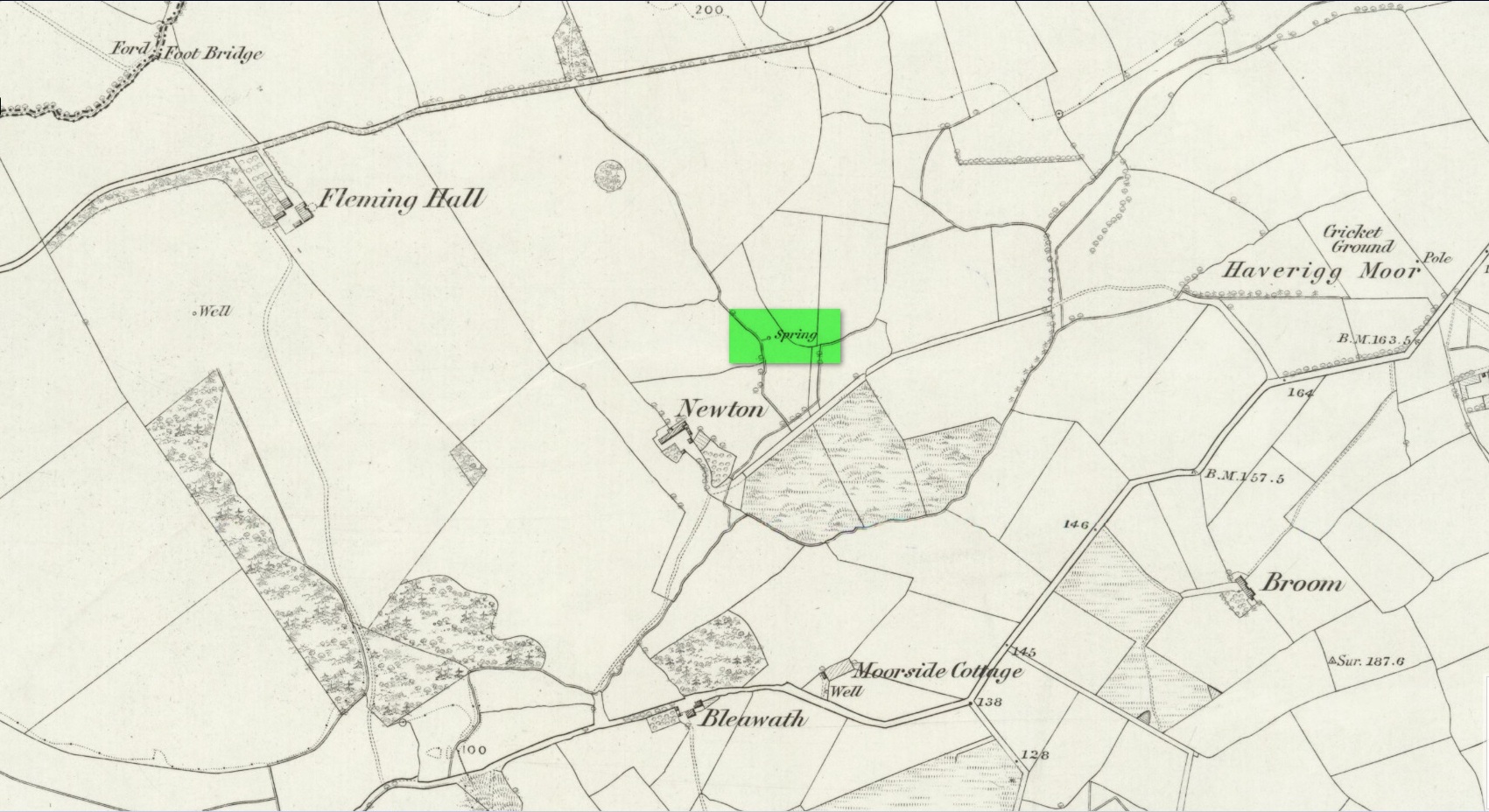
Holy Well (lost): OS Grid Reference – NY 0562 0303
Archaeology & History
Described as being “lost” in John Musther’s (2015) relatively recent survey, very little has been written about this site but, by the look of things, it may still exist—albeit in a boggy state of affairs! It was mentioned in Parker’s (1926) classic history book of the area:
“Near to Newton is a very plentiful spring which is known to have been moved further from the house than it was. Adam de Newton, son of Richard, mentions in one of his grants, “St. Helen’s Well, which is at the corner of my garden, the outfall going into Grucokesgile beck.”
Possible site of the Well
Parker found it to have been described in a local property charter in St Bee’s Register (Wilson 1915) as far back as 1220 CE. On the earliest OS-map of the area, a “Spring” is shown just above Newton, which may mark the very spot! Not far from the holy well was also a cross-marked stone called the Grey Stone (grey stones are usually boundary stones, but can also be standing stones—of which there were a lot in this neck o’ the woods).
Folklore
St. Helen’s Day was celebrated on August 18, but there seem to be no accounts of traditional customs recorded here.
References:
Harte, Jeremy, English Holy Wells – volume 2, Heart of Albion press: Wymeswold 2008.
Musther, John, Springs of Living Waters, privately printed: Keswick 2015.
Page, Jim Taylor, Cumbrian Holy Wells, North West Catholic History Society: Ormskirk 1990.
Parker, C.A. The Gosforth District: Its Antiquities and Places of Interest, Thomas Wilson: Kendal 1926.
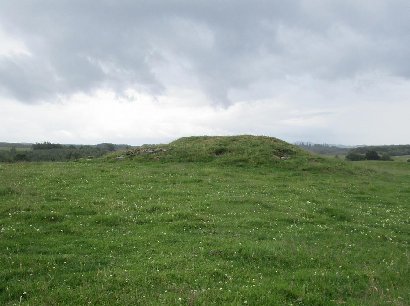
From Doune, take the A84 road to Callander. As you pass through the hamlet of Buchany, keep your eyes peeled a few hundred yards on as the road dips down and swerves gently right, for the road sign of Drumloist (or Moist as some locals keep amending!) which goes up to the right. It’s a small single track road that zigs and zags slowly uphill. After exact one mile you reach a small track on your right (there one left too). Carefully park hereby (don’t block the gate!). Across the road, go through the gate on your right and walk along the edge of the field until you reach the burn. Go across it, and then across the field, through the gate and you’ll see it ahead of you. In the tick season (summer) treat the brackens as possessed by a plague and avoid it!
Archaeology & History
Looking at its stony face
A curiously forgotten place, hidden from sight, this large rounded grass-covered mound with small upright stones around one side, seems timeless amidst the open fields. It seems alone, but the denuded chambered tomb of Ballachraggan is just visible 1.4 miles to the northwest on the near-horizon; and there’s a hidden cairnfield just a half-mile away. This cairn measures 18 yards (N-S) by 16 yards (E-W) and stands 7-8 feet high when you look at it from its southern side. The top of the mound is a mix of stone and grass with a slight dip in the middle, perhaps by someone in ages past digging, albeit only slightly—perhaps scared away by the old folk buried herein.
One of the most notable aspects of this site is the complete silence. On my last two visits hereby, a fusion of mists from the low cloud above and the breathing Earth below gave an atmosphere the likes of which lived when this tomb was first built. On one occasion hereby, no vehicles for several hours gave the silence a curious atmosphere (those of you who like sitting in the rain with the wilderness will know what I mean). To me this is a gorgeous site…
Healing Well (destroyed): OS Grid Reference – SE 45 21
Archaeology & History
The waters of the once-renowned Organn Well goes down in history as being one of the first wells in Britain whose waters were used in a town pump. Written minutes from an early council meeting described how people gathered in the market place to discuss the objective of making such a pump in the times of Queen Elizabeth 1, in 1571. It was completed a year later and, some 450 years on, this old relic can still be seen. The Well used to be found off Penny Lane (now Wakefield Road), some 4-500 yards to the southwest and as such it’s exact position has been difficult to locate. But the fact that the waters were piped such a distance strongly suggests that the water supply from the Well was damn good – and most probably damn refreshing too! The old charter told us, in that wonderfully dyslexic manner of the period,
“…that a conduit in the Markett Place with lead pipes leading to water from Organ Well to the said conduit shall bee cleansed and repayred at the charge and contribution of severall inhabitants of the Towne and espetially by those that fetch water from the same conduit. And according to the auncient custome of the said Towne, whoe shall not beare theire p’t of the chardge p’portionable to what water they from the same at the discretion of the Majo’ for the time being and his brethren shall be debarred from the benefitt of the said conduit except they shall be poore people. And likewise that none shall receive any water from the said conduite for to brewe or steep barley w’thall at such time or times as others have need the same for meat water and water to washe w’hall, but onely at such times as there is water to spare over and besides what is convenient for meat and washing.”
More than two hundred years later the water pump was in dire need of attention, as George Fox (1827) told:
“Being in a ruinous state about the year 1810 and the supplies of water being insufficient for the public use; a clause was inserted in the act of parliament… wherein the pump, its pipes, and all other appurtenances belonging to it were vested in the power of the commissioners of the streets, who where bound to see it kept in proper repair.”
And so the water from the Organn Well continued to supply the townsfolk.
The etymology of this well—along with another of the same name near Harrogate—truly puzzled me for a long time; that was until I came across, quite by accident, records from early texts on herbalism. As a result, it seems very likely that it derives its name from the old English ‘organe,’ which, according to Stracke (1974) and others relates to both varieties of the indigenous herb marjoram (Origanum vulgare and O.marjorana) — a grand medicinal plant that’s pretty common in northern England (I used to go out gathering it each year in my younger days). There were obviously profuse supplies of this herb growing in and around the well and, as all good herbalists will tell you, when they grow by an old spring or well, their medicinal properties are much better than normal. The waters and the plant obviously had a good symbiosis; or, as the old women who’d collect the waters and the herbs in days prior to the pump would have told us, “the spirits of the water here are good”…
References:
Fox, George, The History of Pontefract in Yorkshire, J.Fox: Pontefract 1827.
Padgett, Lorenzo, Chronicles of Old Pontefract, Oswald Homes: Pontefract 1905.
Stracke, J. Richard (ed.), The Laud Herbal Glossary, Rodopi: Amsterdam 1974.
In spite of this site being covered over some time in the 1950s, it is still retained on the modern Ordnance Survey maps. It was shown on the first one in 1860, but its literary history goes back much further. We find it described by the Minister for Maybole — one William Abercrummie — in his short 17th Century work named A Description of Carrict. He noted several springs in Maybole township, with this one of possessing the usual hallmarks of both christian and peasant customs alike:
“Another spring there is called St. Helens well or by a curt pronuntiation St. Emus for St. Antonies well, it is about a myle and ane halfe from Mayboll on the road to Aire a litle north of Balachmont. It is famous for the cure of unthriving children, to which at the change of the quarter especially at May-day there is a great resort of people from all quarters, and at a good distance.”
This piece was repeated in several 19th century works, including one by William Roberston (1891), who commented on the traditions themselves, saying:
“This can unquestionably be traced as a remnant of the ancient superstition that miracles were wrought at Holy Wells; which all the anathemas of the Reformed Kirk could not for a time obliterate from the minds of the common people. The records of the Kirk-session bear witness to the prevalence of applying to Saints’ Wells for the cure of bodily infirmities on stated occasions; particularly, when the Saint or Angel was understood to ‘move the waters.’ Pins, pieces of the dress of the patient, or such small trifles, were left at the well – the remains, no doubt, of the offerings formerly made to the Clergy – and in token that the disease was transferred from the sufferer to the rags, thus offered to the Genius loci. Numerous traces of this prevailing superstition could easily be cited.”
When the Ordnance Survey dudes wrote about the site in the Name Book in 1857, all they could tell us was that it was, “a beautiful spring of excellent water” but was said to have “no medicinal properties.”
Despite this sacred well now being covered over, there is surely a case to be made here for it to be restored back to its former glory, for all to visit and see. Local historians, pagans and Christians alike — join forces and gerrit sorted!
References:
MacKinlay, James M., Folklore of Scottish Lochs and Springs, William Hodge: Glasgow 1893.
Healing Well (covered): OS Grid Reference – TQ 6000 3963
Archaeology & History
Shown on early OS maps as a chalybeate spring, the denuded remains of this site can still be seen in Dunorlan Park, between the tearoom and the lake, where the spring can be seen on the left beneath a large tree. It was first described in John Britton’s (1832) famous account of the area, who told us:
Site shown on 1872 map
“There is a spring, called Burnt House Spring, situated in a little dell, in a romantic spot to the right of the road leading from Tunbridge Wells to Pembury. It is a good chalybeate, and the iron is in a state of carbonate. This spring rises rapidly into a stone basin, placed in the centre of a circular excavation, about ten feet in diameter and six or eight feet deep, which is bricked round, and with the remains of stone steps leading down to the basin at the bottom. This spring, therefore, has clearly been, at some time, made use of as a medicinal water. It was accidentally discovered choked up with rubbish. The country about Tunbridge Wells abounds with springs of this character.”
The spring was cleaned up some time ago and its waters rise in a square stone-lined chamber—accessed by four stone steps—into a circular stone basin, before flowing down a short channel and into the drains. I’ve no idea whether or not the water is still drinkable.
References:
Britton, John, Descriptive Sketches of Tunbridge Wells and Calverley Estate, Longman: London 1832.
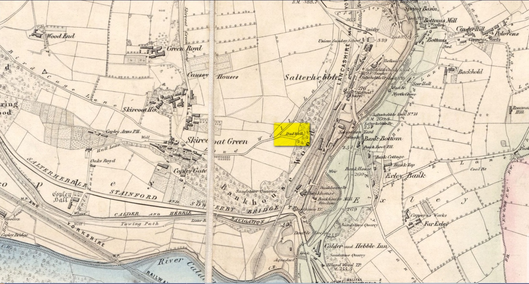
This curiously-named old water source may have an equally curious history behind it – albeit forgotten. Shown on the 1854 OS-map of the area and giving its s name to Dudwell Lane, we can see how an old path led from the road to the well and nowhere else.
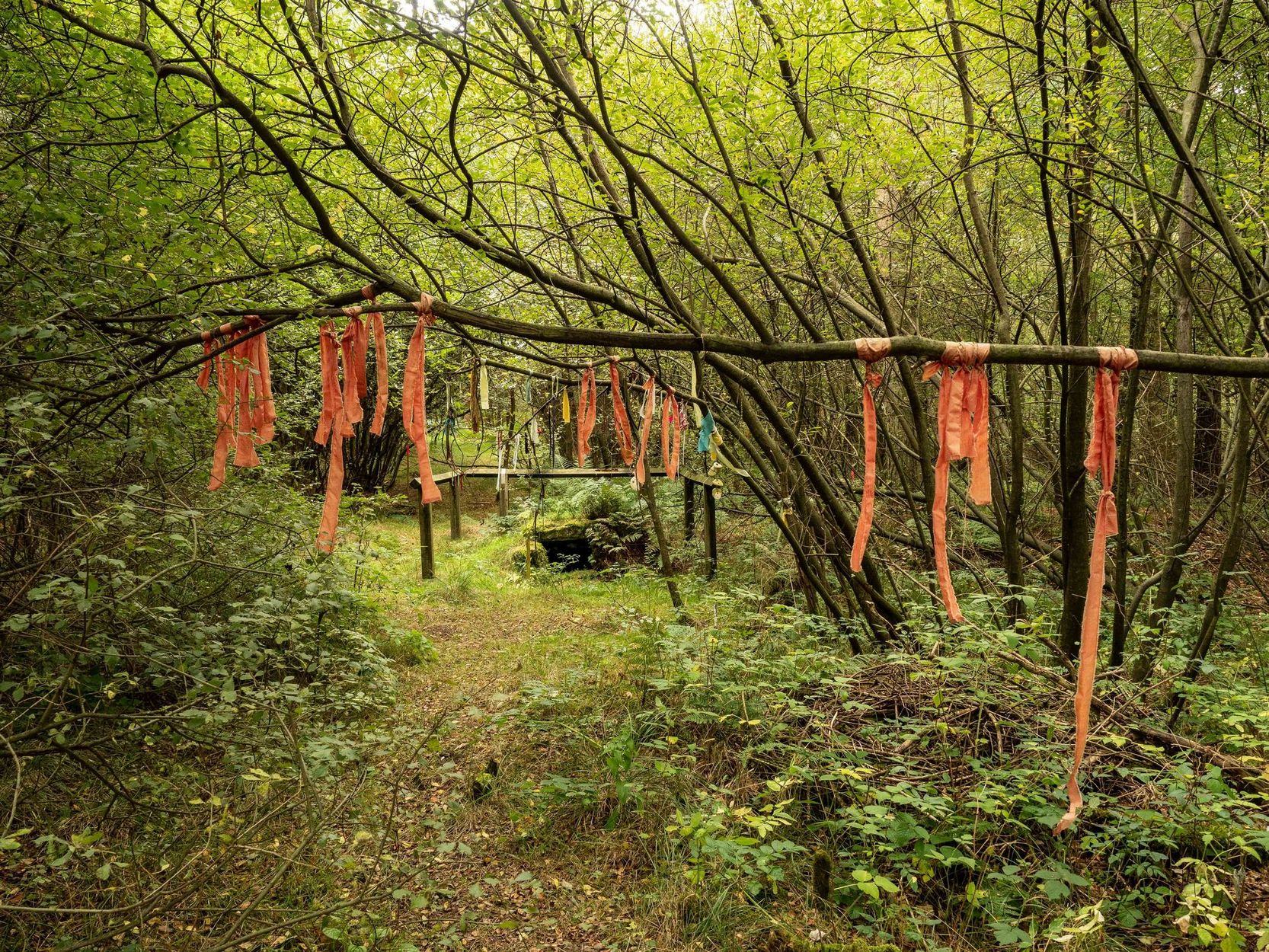
It’s the word “dud” that holds our attention here; for if we hasten to the immensely erudite Joseph Wright (1900) in his gigantic survey of northern dialect, we find that the word relates to “a rag, piece of cloth; pl. clothes, esp. shabby, ragged, or dirty clothing.” This is echoed in another Yorkshire dialect work by Morris (1892) who told that the word meant “clothes (or) rags.” Several other Victorian writers tell us variations on this meaning (one adds old shoes to the list!), but in all instances it relates to dud being a rag, whereas the plural duds are rags or scruffy clothes. Naathen (to use another old dialect word), those of us who know a thing or two abaat olde wells are very very familiar with their association to old rags that were hanged on the surrounding trees as offerings to the spirits of the water—the genius loci—to aid in the hope or desire of something, or merely as respect to the waters for their beneficient properties. (this sometimes occurred ritually at set times in the calendar)
Dud Well on 1854 OS-map
The Dud Well was obviously of considerable local repute, for just a couple of years after it was shown on the earliest OS-map, a local bailiff called Samuel Rhodes built The Dudwell house close to the waters, which he named “in honour of the magnificent and never-failing spring of pure, bright, sparkling water in the wells close by.”
There is a possible alternative meaning to the word dud, which is that some dood called ‘Duda’ left his name here! This seems much more speculative and unlikely than the use of a local dialect term. Hopefully a local historian amongst you might perhaps be able to find out more.
References:
Morris, M.C.F., Yorkshire Folk-Talk, Henry Frowde: London 1892.
Wright, Joseph, English Dialect Dictionary – volume 2, Henry Frowde: London 1900.
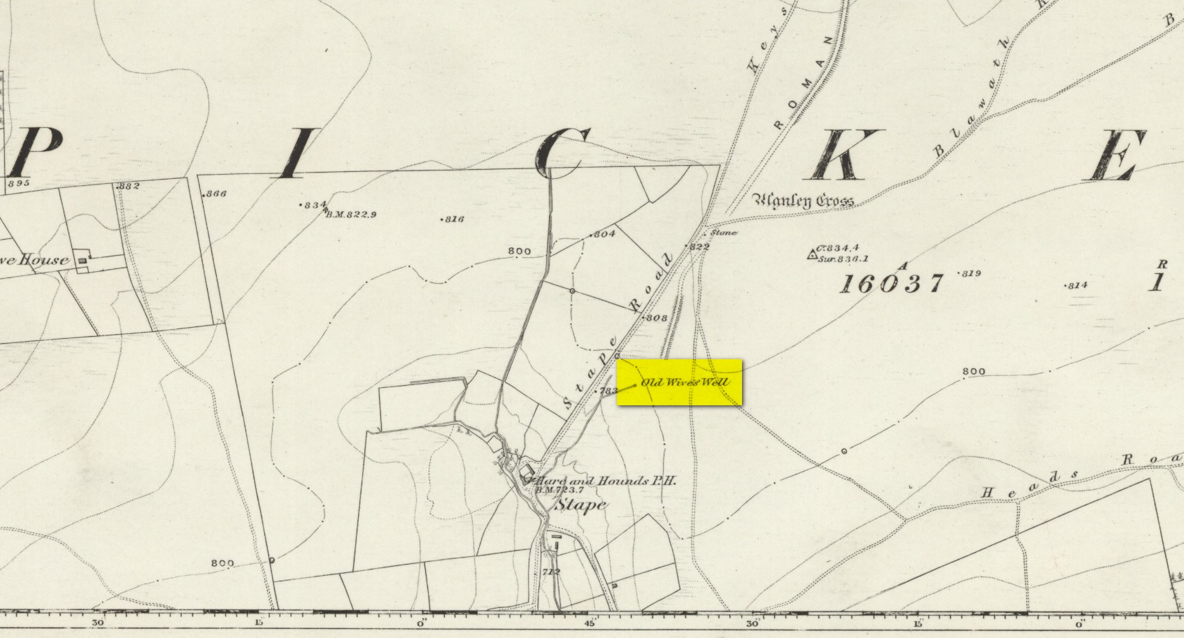
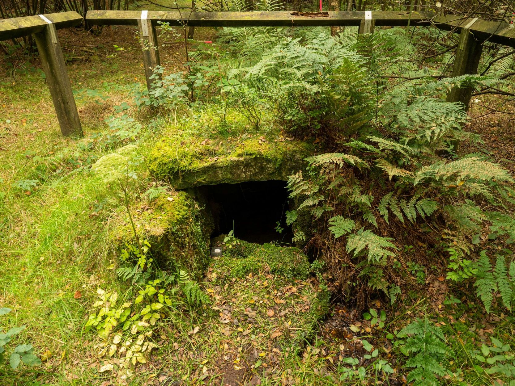
The history of the site is scanty to say the least. It first seems to have been recorded when the Ordnance Survey lads came here in the 1840s, although they left no record as to why the site was given such a dedication. It’s a decidedly pre-christian title as the name “old Wife” is usually indicative in northern counties as being related to the primal Earth deity of northern England and lowland Scotland (when we reach the Highlands and Ireland, She becomes known—amongst other names—as the cailleach). However, apart from its name we have no additional information. Neither the holy wells writer Edna Whelan (1989; 2001), nor hydrolatry researcher Graeme Chappell were been able to find anything about the place in their own researches. And so we must go on name alone…
The waters bubble up into a small stone-lined chamber with the words Nattie Fontein carved into the lintel. This is something of a mystery in itself, for, as Edna Whelan (1989) told,
“it would be most unusual for the word fonten to be used for a spring in North Yorkshire: ‘keld’ is the local word. The rather roughly inscribed word may be a corruption of Fons Natalis, the name of a Celtic water nymph.”
Graeme Chappell (2000) meanwhile, noticed in a visit to the site in June 1999,
“that the N and A in “NATTIE” are carved in such a way that the word could be read as “MATTIE FONTEIN” perhaps meaning “Mother Fountain”. This might then be another reference to the Old Wife?”
He then goes on to note how,
“the latin word ‘natalis‘ meaning ‘birth’ and its link with the roman Festival ‘Dies Natalis Sol Invictus‘ (day of the birth of the unconquered sun) which took place on the 25th December. Natalis also gave rise to the welsh word ‘Nadolig‘ – meaning Christmas.”
This Yuletide element has an intriguing relationship with the name of the well; for to the west of Yorkshire’s borders into Cumbria there was annual gathering known as Old Wives’ Saturday that took place on the first Saturday after Christmas, or first Saturday of the New Year in a person’s house or inn, where a feast was had to bring in the New Year; but there is no known written lore of such a tradition here.
Nowadays the old tradition of hanging rags on the trees surrounding the well as offerings to the spirit of the place (known as memaws in parts of Yorkshire, and clooties in Scotland) has become a regular practice of those who hold such sites as sacred in their own way. Whelan mentioned seeing memaws here in the 1908s, but the Northern Antiquarian contributor Jon Barker told that, “The rags are a comparatively recent addition to the well, it is not a tradition there. When I used to go in the ’60s therewere no rags.”
On an even more curious note: very recently (from when this profile was written), the Northern Antiquarian contributor and photographer James Elkington visited Old Wives’ Well for the first time. It was a grey overcast day and when he arrived here, there was a woman ahead of him at the head of the well. I’ll let him tell the rest of it in his own words:
The Old Wives Well, Stape (James Elkington)Old Wives Well at Stape (James Elkington)
“In front of the well was a lady dressed in what looked like a white nighty, she had her back to me. There was a candle lit nearby, and her hands were in the water moving slowly about like she was washing something. She had long dark shoulder length hair. As I was about 25 feet away I was sure she wasn’t aware of me, and I thought it would make a good photograph. I quietly put my bag on the ground and got my camera out, and looked up and…she was gone! I couldn’t have taken my eye off her for more than 5 or 6 seconds. I looked all around and there was no sign of her. Even if she had legged it through the woods I would have seen her. I think it was then that I realized that I may have had ‘an encounter’. I quickly took three pics of the Well and got the hell out of there!”
He rang me once he had regained his senses in a somewhat emotional state and recounted over and over what had just happened. Whether this was a visual manifestation of the genius loci of the we can’t say. But such encounters are not unknown at numerous sacred water sites all over the world. We can only hazard a guess that this is what he was fortunate to encounter.
Just a few hundred yards north is the old Mauley or Malo Cross, which may or may not have had some mythic relationship with our Old Wives…