Duncroisk, Glen Lochay, Perthshire

Dun (lost): OS Grid Reference – NN 539 386 (approximation)

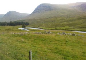
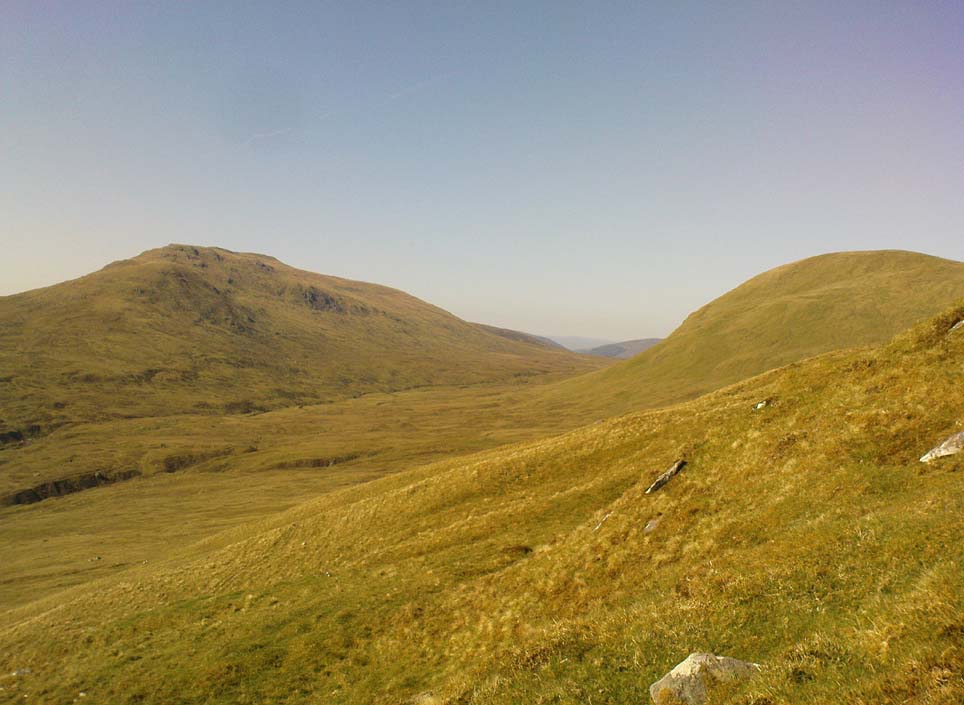
Looking towards Laraig Bhreislich, from the south

Also Known as:

  1. Dun croisgh
  2. Lairig Breisleich
  3. Laraig Bhreislich

Archaeology & History

Although this site doesn’t appear in the modern records, the remote situation of the place suggests that some remains of the site could remain and be uncovered by diligent explorers and students. It is one of several lost “circular forts” that were described in William Gillies’ (1938) detailed historical text, that were first highlighted on a map of 1769. His brief description of this old fort told,

“The name ‘Duncroisg’ in Glenlochay, bears witness to the fort that once stood at the southern entrance to Laraig Bhreislich, the pass leading over the mountain to Glenlyon.”

There is is the possibility that some of the remote shielings clustered on the level at Airigh Allt an Eilein and Riabhaich used stones from this ancient site for their construction. On the level to the south of here are the overgrown remains of a prehistoric cairn, not included in archaeological surveys.

Note – Huge sections of prehistoric man-made walling have been located in the area, comprised of gigantic boulders, more reminiscent of enclosure walling.  The remains are extensive and huge, but severely overgrown in this remote landscape.  Watch This Space!

Folklore

Although not named specifically, this site would have been another of the Forts of the Fiann, or tribes of the hero-figure, Finn. The valley immediately adjacent to the location of the fort is still known as Fionn Ghleann, with the waters of Allt Fionn Ghleann strongly flowing through.

References:

  1. Gillies, William A., In Famed Breadalbane, Munro Press: Perth 1938.

© Paul Bennett, The Northern Antiquarian


Caisteal Mhic Neill, Cashlie, Glen Lyon, Perthshire

Dun:  OS Grid Reference – NN 49036 41779

Also Known as:

  1. Caistealan nam Fiann

Getting Here

Site shown on 1867 OS-map

Truly remote, but easy to find once you’re nearing the western end of Glen Lyon. Going upstream, past Cashlie Dam, watch out for the well-preserved stone kiln on the left-hand side of the road, just before Cashlie house.  50 yards or further along, cross the road and in the field by the riverside, the circular mass of stones sorta gives the game away.

Archaeology & History

Shown on modern OS-maps as a ‘homestead’ and described variously by archaeologists and historians as a fort or a round-house, this is just one example of around twenty large prehistoric constructions that scatter the stunning mountainous Glen Lyon region which legend tells were the forts of the great hero-figure, Finn.  Three other constructions of the same nature are found just a few hundred yards further up the Glen from here.  Each is of roughly the same age and nature by the look of things.  Their walls are extremely wide and made up of very large rocks, which would have taken huge efforts to construct.

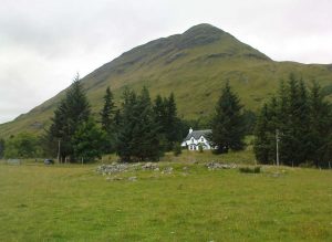
Caisteal Mhic Neill ruins, looking east
Caisteal Mhic Neill, with An Grianan behind

Highlighted on the 1867 OS-map as a “Tower”, the exact nature of this and its adjacent sites has yet to be academically ascertained, with the Canmore website ascribing the monument as a “settlement” – although, tradition tells them to be Scottish forts or duns, so we’ll stick with that until excavations tell otherwise!

The great Gaelic place-name master W.J. Watson (1912) told that:

“The fourth of the Cashlie towers is a few yards south of the road, right in front of Cashlie farmhouse, now a shooting lodge.  Though a quantity of large stones marks the site, the structure has been so badly knocked about that we found it impossible to take measurements sufficient for a plan. It was, however, apparently not circular, but rather oval. Its walls appeared to vary from about 9 feet to 12 feet 6 inches in thickness.”

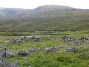
Close-up of Caisteal walling

This is one of several other duns (or homesteads as the OS-map calls them) close to each other.

Folklore

Ascribed as one of Glen Lyon’s Caisteilean nam Fiann, or “castles of the Fiann”, Mr Watson (1912) again told how “there is a widely known saying, the earliest notice of which occurs in Pennant, who got it doubtless from the Rev. J. Stewart:

‘…Twelve castles had Fionn,
In the dark Bent-glen of the stones.'”

References:

  1. Gillies, William A., In Famed Breadalbane, Munro Press: Perth 1938.
  2. Watson, W.J., “The Circular Forts of North Perthshire,” in Proceedings of the Society of Antiquaries, Scotland, volume 47, 1912.

ACKNOWLEDGEMENTS:  Many thanks to Andy Sweet of Stravaiging Around Scotland, for pointing me to the W.J. Watson article.  And of course, a huge thanks to Marion—”I don’t have a clue where I am!”—Woolley, for getting us here….

© Paul Bennett, The Northern Antiquarian


Dun Toiseach, Ford, Kilmartin, Argyll

Dun:  OS Grid Reference – NM 880 047

Getting Here

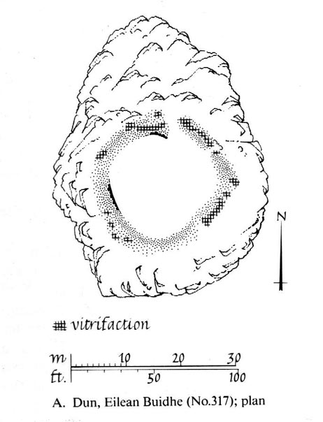
Dun Toiseach plan (after RCAHMS 1988)

You can see the rocky hillock ‘pon which this old dun sits from the roadside – and can approach it by either climbing up the slope, or go round t’ back and approach it from t’ track. Either way, it’s easy to get to.

Archaeology & History

The old dun was rather ramshackled when I used to sit here, sometimes on mi way home from working at the Inverliever Nursery, a bit further up the lochside — but it was a good spot to sit and daydream into Loch Awe and beyond…

Described as a vitrified fort, the structure is oval in shape.  Thought to have been constructed in the Iron Age, Dun Toiseach was originally about 50 feet across and its walls averaged 10 feet thick, with an entrance at its northeastern side.  The Royal Commission lads (1988) described it thus:

“Situated on a prominent rocky knoll overlooking the S end of Loch Awe 250m ESE of Torran farmsteading, there is a severely ruined dun measuring about 16m by 13m within a wall which has been some 4m thick. Two stretches of outer facing-stones are visible, as well as a few possible stones of the inner face, but, particularly on the NE, the wall has been severely robbed and the core material scattered. The entrance lies on the NE, the innermost portion of the SE passage-wall and what may be a door-jamb on the opposite side still being visible.  The knoll has acted as a focus for recent field-walls, but there is no indication that it was additionally defended by outworks. A small modern cairn…surmounts the dun wall on the SE.”

References:

  1. Royal Commission on the Ancient & Historical Monuments of Scotland, Argyll – Volume 6: Mid-Argyll and Cowal, HMSO: Edinburgh 1988.

© Paul Bennett, The Northern Antiquarian


Rathgall Hillfort, Coolkenna, County Wicklow

Hillfort:  OS Grid Reference – S 9020 7315

Archaeology & History

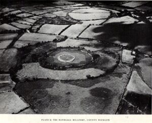
Early aerial photo of Rathgall hillfort

A prehistoric ‘fort’ with a long history behind it, with recent excavations finding burial and settlement remains from the Bronze- and Iron Ages.  The following article about this impressive archaeological site was written by Barry Raftery’s in an early edition of Antiquity journal (1970), following excavation work here.  He wrote:

“Rathgall is a large and imposing hillfort situated on the end of a long ridge some 6km east of Tullow, Co. Carlow.  It is sited impressively and commands a fine view on all sides.  The defences of the fort comprise four roughly circular, concentric ramparts.  The three outer banks, though largely overgrown, appear to be of earth faced with stone; the inner one is built entirely of granite boulders, many of considerable size.  The fort covers some 18 acres (c. 7 hectares); its overall diameter is about 310m. (Orpen 1911; 1913)

“Excavation in 1969 was confined, with the exception of one short trench, to the inner enclosure.  This is surrounded by the granite wall, dry-built and of poor quality.  It is made up of a series of straight lengths so that, though superficially the enclosure appears to be circular, it is in fact polygonal.  The entrance is a simple break on the western side.  The wall varies in thickness from 7m in the southeast, to 1.5m in the north, though the reason is not immediately clear.  In height the wall varies from 2m to 2.5m.  The minimum internal dimensions of the enclosure are 44m and 46m.

“About one-quarter of the enclosure was excavated in the northeastern quadrant.  A trench 2m wide and 20m long outside the wall and running into the interior was begun and this demonstrated the existence of occupation outside the wall.

“The first season’s excavation suggests the presence of at least three main phases of occupation on the site — Late Bronze Age, early Iron Age and Medieval.  The relatively thin soil covering on the site does not as yet allow the periods to be clearly defined stratigraphically.

“About 1500 objects came to light, over 1000 of them being pot-sherds.  The great majority belong to the Early Iron Age phase of occupation, apparently the period of densest settlement on the site.  As well as the remains of circular and rectangular structures, the excavation also revealed a number of very large hearths and a bank-and-ditch enclosure hitherto quite unsuspected.

“This latter feature partly underlay the granite wall.  The ditch had been filled in and the bank denuded before the construction of the wall.  The latter averaged about 50cm high and lay outside the ditch, which was dug carefully to a V-shaped section.  In width it varied from 1.5 to 3.5m at its edge and in depth from 75cm to 1.1m

“Bank and ditch enclosed an area about 35m in diameter.  So far no entrance to this enclosure has been distinguished, though there appears to be a gap in the south-east which may be an original opening.  It is noticeable that the bank runs, without a break, straight across the entrance to the stone enclosure, further emphasizing the lack of structural connection between the two features.

“The relationship of either of these enclosures to the outer lines of defence is not clear and so elucidation of this problem must await further excavation.  It seems, however, that the granite wall is a late feature and is probably of medieval date.  The massive outer ramparts, on the other hand, are more likely to belong to the Early Iron Age occupation of Rathgall.

“Over the whole area so far excavated indications of rectangular houses were frequent.  The walls of these houses were formed of timber posts, generally of no great size; they were set usually singly but sometimes in paris, in bedding trenches 30 to 40cm wide.  The upright posts presumably formed the framework of wattle-and-daub constructions.  There appears to have been extensive rebuilding, so that the plans are greatly confused and not always easy to interpret.  The houses were quite large: one of them was as much as 7.5m in length.

“These houses belong to the latest phase of occupation on the site and appear to be contemporary with the construction of the granite wall.  They were built on top of the fill of the ditch and were confined by the wall: there is no indication anywhere of house foundations running underneath the wall.  Green-glazed sherd from the fill of the bedding trenches suggests a 13th-century date for these houses and a late 13th-century silver coin points in the same direction.

“A circular bedding trench, apparently concentric with the large V-shaped ditch, was found in the centre of the stone-walled enclosure.  One-quarter of the bedding trench was exposed in the 1969 excavations.  In section it is roughly U-shaped and is 25cm wide and 30-35cm deep.  It encloses a space about 18m in diameter.  Its outer edge is for the most part lined with packing stones of medium size.  One metre inside this bedding trench and running concentrically with it for about one-third of the excavated arc there is a second bedding trench of similar type.  Whether these bedding trenches represent the remains of a large timber house of whether they were for a timber stockade is uncertain; further excavation may provide the answer to this problem.  As regards relative dating, however, it is clear that the circular structure, whatever it was, was earlier than the rectangular houses, for the bedding trenches of the latter lay above the trench for the former.  As well, some sherds of coarse ware of a date appreciably earlier than medieval times were found in the fill of the circular trenches.

“In turn, a huge oval hearth was found beneath the circular structure.  The hearth consisted of a steep-sided, flat-bottomed pit, 3.1m long and 1.5m wide, dug into the yellow subsoil.  A large quantity of black, burnt material came from the hearth and there appeared to be three main phases of use, each separated from the other by a layer of rough cobbling.  The hearth also produced sherds of coarse pottery, including two decorated fragments.  The decoration takes the form of one sherd of a row of finger-nail impressions and on the other a row of simple nicks in the edge of the rim.

“Large hearths of this type are, indeed, a feature of the site as a whole.  Five in all have so far come to light: one, especially elaborate, consisted of a large rectangular pit, 2.85m by 1.2m, dug 40cm into the subsoil.  At each corner there was a circular pit; two of these pits look like post-holes, the other two appear to be much too large to have served such a purpose.  All the hearths have produced coarse pottery and can thus be placed in their relative chronological position, though as yet none appears to be related specifically to any single structure on the site.  It may be that these were open-air hearths, covered by some sort of canopy.

“In addition to the hearths, the rectangular houses, the circular structure and the ditch and bank, a large number of post-holes were found.  Some of these were large, some small, but in no case could any positive pattern be established.

“The importance of the structural remains on the site is equalled by the significance of the material recovered.  The finds from the medieval period have already been referred to and the rectangular houses with which they were associated.  Before this there appears to have been a lengthy period when the site was not occupied.  The occupation before the beginning of this break appears to have been intensive.  It is characterized by large quantities of very coarse pottery.  This distinctive ware may be termed Freestone Hill Ware after the importance of the hillfort site of that name in County Kilkenny where the pottery was first isolated.  At this site it was associated with Roman bronzes of the 4th century AD and with a coin of Constantine II (Raftery, 1969).

“The sherds represent coarse, flat-bottomed, bucket-shaped pots, usually of a reddish, crumbly ware with very large grits.  Distinctive rims are characteristic: they are rounded, flat, T-shaped or internally bevelled.  At Freestone Hill a striking feature was the presence on many of the rim sherds of a row of small perforations; similar perforated rims are included in the Rathgall material.  In addition to the pottery, blue glass beads, bones, spindle whorls, portions of a lignite bracelet and many other objects of normal domestic refuse came to light.  A complete saddle quern was also found.  The most interesting of the Early Iron Age finds, however, was a small tinned strap-mount, beautifully decorated with a combination of openwork and incised curvilinear ornament of sub-La Tene type.  The art on this object has much in common with that on a bronze mount found at Freestone Hill and both appear to have a vital bearing on the transition from the true La Tene art of pre-christian times to the great flowering of art in Early Historic Ireland.

“Both at Freestone Hill and at Rathgall these decorated bronzes were associated with coarse pottery of identical type.  The pottery at the former site was dated to the mid-4th century and there, at least, the date is hardly in doubt.  It is possible to suggest a similar dating for the Wicklow material.  Coarse pottery of this type may, however, have had a fairly long life and indeed Freestone Hill may give but a central date for the group.

“Several points of some significance in relation to this pottery must be stressed.  Firstly, no excavated ring fort (rath) has ever produced this kind of ware — indeed, it is absent from any excavated site of the Early Historic Period in Ireland.  On the other hand, it is found increasingly in hillforts — to such an extent in fact, that it appears more and more to be basically a hillfort phenomenon.  Apart from the two sites referred to above, similar coarse sherds come from the hillforts at Clogher, Co. Tyrone, Emain Macaha, Co. Armagh, Downpatrick, Co. Down, and possibly also from Dunbeg in the same county.  In the present state of our knowledge therefore, it seems that Freestone Hill Ware may be regarded as characteristic of Irish hillforts: there is as yet no evidence for its continuation beyond the middle of the 1st millenium AD.

“The origins and ancestry of Freestone Hill Ware are matters which can hardly be discussed here, but pottery of this type without the perforated rims, may go back to pre-christian centuries.  Indeed, the indications at Emain Macha tend to confirm this possibility and Freestone Hill Ware may well have had its origins in the so-called Flat-rimmed wares of the Late Bronze Age in Ireland.

“This problem seems very real at Rathgall, since here are strong indications of Late Bronze Age activity.  This is the third of the three phases of occupation of the site.  Mould fragments of clay were recovered which were used in the manufacture of objects of Late Bronze Age type — swords, possibly spears and socketed implements with a rope moulding round the mouth of the socket.  The relationship of these fragments to any of the structures which were uncovered during the excavation is not clear.  In fact, apart from the mould fragments (and possibly the saddle quern) there is nothing else which can with certainty be assigned to a late Bronze Age context.  Some of the mould fragments came from the immediate vicinity of one of the large hearth, some from the fill of the ditch, and from the ditch also came the saddle quern.

“The presence of the mould fragments in the ditch is complicated by the discovery, in the very bottom, of fragments of pottery which seem to belong to that class known as Cordoned Ware which occurs in southwestern Britain and northwestern France in the centuries before and just after the birth of Christ.  It would seem then either that the mould fragments found their way into the ditch during an in-filling operation which took place at a time subsequent to the original Late Bronze Age occupation of the site, or alternatively that the pieces are contemporary with the Cordoned Ware, thereby suggesting a remarkable continuity of Late Bronze Age types in Ireland.

“At all events the construction of the ditch can be dated with reasonable certainty to the period of the Cordoned pottery.  Pottery of this type has never before been found in Ireland and its implications regarding Irish/British and Irish/Continental connections in the Early Iron Age — as well as having an important bearing on the development of the Irish hillfort — are considerable.

“The question of the date of the hearths is as yet a matter of some doubt.  It has already been pointed out that in one area  a hearth was overlain by both the circular enclosure and the much later rectangular structures.  This hearth at least belongs to any early phase of the occupation of the site and since all the five hearths so far revealed by excavation are not apparently associated with specific structures and have several points in common, such as size and details of construction, it seems reasonable to suggest that they may be broadly contemporary.

“All the hearths produced coarse ware and it therefore seems to be of prime importance to be able to distinguish between the Freestone Hill type of pottery of the Early Iron Age and the pottery to which the name Flat-rimmed Ware has been given and which is dated to the Late Bronze Age.  It may be that both are in the same developmental tradition and it is hoped that further work on the hillfort at Rathgall will help to elucidate the problem involved.”
References:

  1. Harbison, Peter, Pre-Christian Ireland, Thames & Hudson: London 1989.
  2. Raftery, Barry, “The Rathgall Hillfort, County Wicklow,” in Antiquity journal, volume 44 (no.173), March 1970.

Links:

  1. Rathgall Hill Fort on Irish Antiquities
  2. Rathgall Hillfort on Megalithic Portal

© Paul Bennett, The Northern Antiquarian


Castercliff, Nelson, Lancashire

Enclosure:  OS Grid Reference – SD 8850 3840

Also Known as:

  1. Caster Cliff

Getting Here

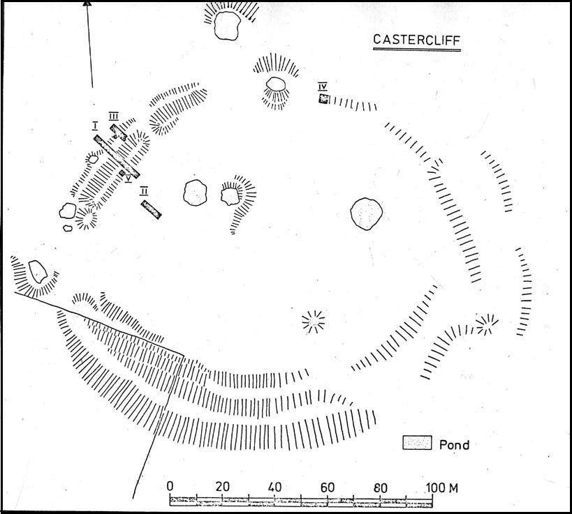
Castercliff hillfort plan (after D.G. Coombs)

From Colne train station, cross the road and go along Bridge Street and where it meets Knotts Street follow it all the way up into the countryside and, bending to the right, uphill again until it levels out.  The farmhouse a few hundred yards ahead of you (just off Southfield Lane) at the bend in the road is where you’re heading.  There’s a track on your right, just before the farm.  Go on this and look into the field immediately right.  The undulations and earthworks are the remains of this old hillfort!

Archaeology & History

This old site was constructed some 850 feet above sea level, overlooking the valley of Colne immediately west and giving commanding views of the outstretched landscape towards the sacred Pendle Hill and beyond for many miles.  The place was described as early as Castell Clif in 1515, and then again as Castyclyff in 1533, meaning simply the “castle on a cliff” or high verge as it is here.  Yet despite its early appearances in literary studies, the first real work to explore this monument doesn’t appear to have been done until one J.A. Plummer carried out work on the site between 1958-60.  However, Plummer died before being able to publish his findings in full.   Ascribed variously as a settlement, an enclosure, and generally in the archaeological fraternity as a hillfort, the first detailed published description of the site was done by Forde-Johnston (1965), where he told:

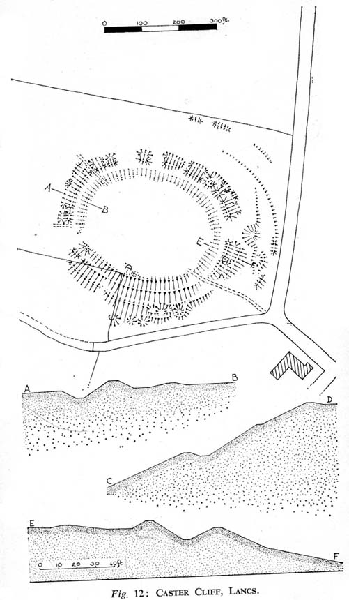
Forde-Johnston’s early plan

“The hillfort is a very regular oval in shape and encloses an area about 350ft long and 250ft wide.  The overall dimensions are 550ft by 450ft.  The site has been affected by quarrying on the south and east and there are a number of gaps in the defences on the northern and western sides.  The character of the remains differs in various parts of the site, but the general pattern appears to be as follows.  The innermost line of defence is represented by a very slight bank or, in many places, only a very shallow scarp which can be traced round the whole circuit of the site… The second or middle bank is the most prominent or substantial of the three.  It has considerable gaps in its length, but the various portions are all of much the same character — it rises between 3 and 5ft above the interior and falls about 9ft to the ditch bottom.  On the south side the middle rampart takes the form of a scarp about 10ft high, immediately below the scarp of the inner rampart.  The third, outermost bank is, in fact, a counterscarp bank to the second ditch.  It does not exist as a continuous bank around the whole of the site, but there are sections of it on the northern and eastern sides.  On the eastern and northeastern sides, from which approach was easiest, there appear to have been additional outer defences, situated about 70ft forward of the counterscarp bank.  These outer defences now take the form of a scarp about 4ft high curving round the eastern and northeastern sides for about 250ft.  At the southern end there is an inner scarp, forming a bank, and a little to the south, is a detached portion of bank.  There are other short detached sections of bank on the northern side which are presumably to be connected with these outer defences.”

When Mr Plummer did his excavation here a few years before, one section of the site was examined and, thanks to the survival of an interim report he did — described by D.G. Coombs (1971) — we know the following of what he did:

“His work was concentrated in the northwest corner of the site where he cut a trench through the defences.  Outside the counterscarp bank, which was not continuous, there was a bedding trench, packed with stones and containing charcoal.  The ditch, which was rock-cut and flat-bottomed, had a homogenous fill.  The rampart itself showed timber supports at the front and back with traces of stone revetting at the front and some distance from the timber uprights.  The rear of the rampart was marked by a line of stones.  Behind this rampart the site had been extensively disturbed and here he claimed to have found traces of primitive iron-smelting furnaces constructed from stones packed and sealed with loose black earth.  A single post-hole beneath the rampart was suggested to belong to an earlier phase.”

Though we have to note here that Mr Plummer believed that the iron furnace remains were actually medieval in date, but that the embanked settlement itself was Iron Age and “that the collapse of the fort could be dated between 60-90 AD.”  When Mr Coombs and his team came back here in 1970 to re-examine the works of both Plummer and Forde-Johnston, they confirmed some of their earlier finds, but uncovered additional finds at what they called this “once great fortress.”

Folklore

In Robert Lord’s (1976) superb imaginary piece on what he calls the Pendle Zodiac (a zodiac allegedly forged into the landscape in ancient times, in the manner of the famous and equally imaginary Glastonbury zodiac), a section of the deity Diana is made up of this prehistoric earthwork:

“The lower edge of the cap (on her head) coincides with a minor road between Colne, skirting the Iron Age Castercliffe hill-fort, above Nelson, as far as Catlow.”

…to be continued…

References:

  1. Coombs, D.G., Interim Report: Excavation at Castercliff, Nelson, Lancs., Unpublished Report 1971.
  2. Ekwall, Eilert, The Place-Names of Lancashire, Manchester University Press 1922.
  3. Forde-Johnston, The Hill-Forts of Lancashire and Cheshire, Lancashire & Cheshire Antiquarian Society 1962.
  4. Pennick, Nigel & Lord, Robert, Terrestrial Zodiacs in Britain, Institute for Geomantic Research: Bar Hill 1986.

© Paul Bennett, The Northern Antiquarian


Devil’s Dyke, Poynings, Sussex

Hillfort:  OS Grid Reference – TQ 260 111

Also Known as:

  1. Brighton Dyke
  2. Poor Man’s Wall 

Getting Here

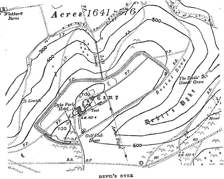
Map of Devil's Dyke
Map of Devil’s Dyke

Plenty of ways of approaching this huge fella!  Personally, I’d take it from the steep valley immediately east and north where the ramparts drop you down the hill, if only to get a decent idea of the scale of the thing!  But those of you into taking it easy can do no better than take the country road south out of Poynings village (towards Brighton), down Saddlescombe Road, for just under a mile, where you should take a right-hand turn along the Summer Down lane for a mile. You’ll then hit the Devil’s Dyke Road. Turn right here and go to the end.  You’re right in the middle of it!

Archaeology & History

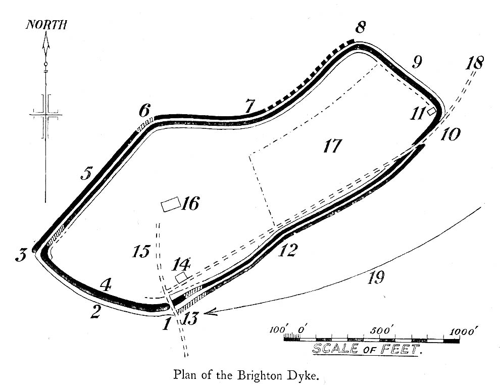
Early plan of Devil’s Dyke ‘camp’

Although most of this huge monument hasn’t been given the investigation it deserves — hence making knowledge of its origins more speculative than factual — as Jacquetta Hawkes (1973) wrote, seemingly all those years ago now, “it is known that a village lying half in and round them was occupied in the Belgic period at the end of the Iron Age.”  And it’s certainly big enough!  The encircling circuit of dykes themselves stretch all the way round a distance of more than 2150 yards long (that’s 1.22 miles, or 1.97km!), with the longest east-west axis being more than half-a-mile across.

Nowadays it seems, the Devil’s Dyke is the name given to the steep valley below the encampment, but a hundred years back it was the camp itself that was known by this name.  Described by the wandering antiquarian R. Hippisley Cox (1927) as “a camp containing forty acres (with) very steep and difficult approaches,” another early account in The Antiquaries Journal — commenting on a ground-plan of the site from the Brighton and Hove Herald of 1925 — told:

“The heavy encircling lines represent ramparts, and the thin line marks the outer margin of the accompanying ditch.  A spur renders the earthwork weakest on the south-west, and the rampart is therefore highest between the points 1 and 3, rising 21ft vertically above the ditch, which is nearly filled up at the present time.  On the north-west there is steep slope outside the camp, and the ramparts are considerably lower, the iner ditch being nearly obliterated.  The outer rampart is now wanting betwen 7 and 8, but this inner one becomes stronger as the outer slope of the ground decreases, only to die away again on the south-east where the camp overlooks the steep Dyke Valley.  A double-bank and inner ditch can still be traced from the north-east angle to a point near the old golf-club house.”

I first came here as a young lad and the site was lost on me (in them days, if monuments weren’t stiff and upright, I really didn’t see the point!).  These days however, the size of it alone blows you away somewhat.

Folklore

As you’d expect the creation myths of this site and its edges relate to our old heathen friend, the devil!  The landscape itself was, in old lore, the work of the devil (though prior to this, the devil was known in peasant-lore to be a legendary giant, though I am unaware of the name/s of the giant in question); and the great valley below the Devil’s Dyke encampment was actually dug out by Old Nick in the old tales.  That old folklorist Jacqueline Simpson (1973) takes up the story:

“The Devil…had been infuriated by the conversion of Sussex, one of the last strongholds of paganism in England, and more particularly by the way the men of the Weald were building churches in all their villages.  So he swore that he would dig right through the Downs in a single night, to let in the sea and drown them all.  He started just near Poynings and dug and dug most furiously, sending great clods of earth flying left and right — one became Chanctonbury, another Cissbury,  another Rackham Hill, and yet another Mount Caburn.  Towards midnight, the noise he was making disturbed an old woman, who looked out to see what was going on.  As soon as she understood what he was up to, she lit a candle and set it on her window-sill, holding up a sieve in front of it to make a dimly glowing globe.  The Devil looked round, and thought this was the rising sun.  At first he could hardly believe his eyes, but then he heard a cock crowing — for the old woman, just to make quite sure, had knocked her cockerel off his perch.  So Satan flew away, leaving his work half done.  Some say that as he went out over the Channel, a great dollop of earth fell from his cloven hoof, and that’s how the Isle of Wight was made; others, that he bounded straight over into Surry, where the impact of his landing formed the hollow known as his Punch Bowl.”

That’s the story anyway — take it or leave it!  Of importance in this fable is the figure of the “old woman”: a much watered-down version of the cailleach figure of more ancient northern and Irish climes, where tales of her doings are still very much alive.  And many are the tales of her battles with other giant figures, just as we evidently once had here.

Ghosts have been reported by local people upon this hill-top site; and there are a number of other folktales to be found here…which I’ll unfold over time as the months pass by…

References:

  1. Anon., “Notes: The Brighton Dyke,” in The Antiquaries Journal, 5:4, October 1925.
  2. Clinch, G., “Ancient Earthworks,” in Victoria County History of Sussex – volume 2 (edited by W. Page), St. Catherine’s Press: London 1905.
  3. Cox, R. Hippisley, The Green Roads of England, Methuen: London 1927.
  4. Hawkes, Jacquetta, A Guide to the Prehistoric and Roman Monuments in England and Wales, Chatto & Windus: London 1973.
  5. Hogg, A.H.A., “Some Aspects of Surface Fieldwork,” in The Iron Age and its Hillforts (edited by M. Jesson & David Hill), Southampton University Archaeology Society 1971.
  6. Simpson, Jacqueline, The Folklore of Sussex, Batsford: London 1973.
  7. Simpson, Jacqueline, “Sussex Local Legends,” in Folklore Journal, volume 84, 1973.

© Paul Bennett, The Northern Antiquarian


Dun Dubh, Ford, Argyll

Dun:  OS Grid Reference – NM 8640 0479

Also Known as:

  1. Canmore ID 22821

Getting Here

From Ford village, take the track that goes uphill (west) running near the edge of the forest-line. Keep going until you hit the top of the forest and the large rocky hill above you (on your right) is where you need to be heading.  The rise to your left is Dun Chonallaich.  Walk around the bottom of the hill until you get to the other side (you should be 100 yards or more above the tree-line) where you’ll notice a ‘pass’ running west, with a rocky knoll above you on your right.  That’s it!

Archaeology & History

Thought to date from the Iron Age, the remains here cover an area 15 yards by about 25 yards.  Remains of walling around the edge of the summit nearly a yard wide in places define quite clearly where the ‘fort’ was centred.  The entrance to the site was found on the northwestern side.  In more recent times however, animal pens have intruded on the remains here and the archaeological remnants are much denuded.

Folklore

Samhain fires were lit on the larger ridge above this ruined fort until recent years, as some old local folk will tell you. These Halloween fires (done to celebrate the old New Year) were stopped a short time after the new ‘owner’ of the Auchinellan Estate (on whose land Dun Dubh is found) took exception to them and, for all intent and purpose, deemed them a fire hazard! The lady in question who inherited the Estate was in fact a devout christian who took exception to the local “pagan” goings-on, contrary to the beliefs of the previous Estate owner, who not only allowed such old events, but played a part in them.  Local folk hereabouts, not surprisingly, aint too keen on their part-time dictatorial christian neighbour.

The fires up here were also related to the linear cemetery at Kilmartin. Here the giant tombs all line up & point to Dun Chonallaich, behind which hides the more flattened top of Dun Dubh. When the Halloween fires were lit on top of this, the glow from behind the great pyramid of Chonallaich all the way down to Valley of the Kings, was spectacular! One wonders just how long the local people had been doing this…

References:

  1. Royal Commission on the Ancient & Historical Monuments, Scotland, Argyll – volume 6, HMSO: Edinburgh 1988.

© Paul Bennett, The Northern Antiquarian