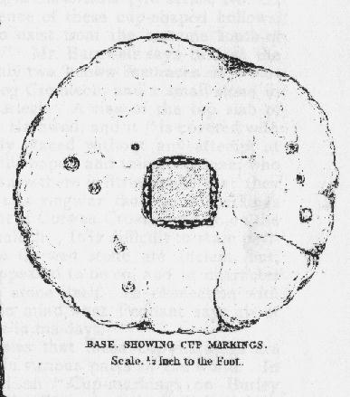
Merlin’s Mount, Marlborough, Wiltshire

Tumulus:  OS Grid Reference – SU 1836 6867

Also Known as:

  1. Marlborough Mount
  2. Merlin’s Barrow
  3. Merlin’s Mound

Getting Here

Pretty simple.  Get to the chapel in front of Marlborough College, and look at the stepped hill in the grounds thereof (with a big hole cut into the top where a water tower once stood).  That’s it!  Please be aware that this monument is on college ground, so it might be worthwhile telephoning them if you wanna wander upon the hill.

Archaeology & History
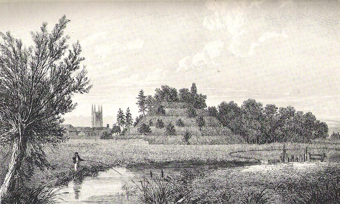
Merlin’s Mount (from Colt-Hoare’s Ancient Wiltshire)

This curious rounded, pyramidal hill is thought by some to have given the town of Marlborough its very name.  Described in Domesday as ‘Merleberge’, which is reckoned to derive from “the hill or barrow of Maerla”: Maerla in this case being a lost olde English name, said in local folklore and tradition to have been our old heathen magickian, Merlin, of Arthurian fame and legend.  Long ago his bones were laid to rest here and this great ‘tomb’ built over him.  We might never know…

The exact nature and date of this mound has yet to be satisfactorily explained.  Commonly ascribed as Norman in origin (based mainly on the notion that it wasn’t mentioned before Domesday and there being motte and bailey ruins here), the finding of Roman remains near its base then led some to think they had built the hill; but when “antler picks used by its prehistoric builders were unearthed in the late nineteenth century and again in 1912 when a trench was cut for the flue of a new engine-house chimney” (Burl 2002), the dates for its origin went a lot further back!

One of the earlier commentators on this archaeological curiosity was Sir Richard Colt-Hoare (1812) in the days when much more of this and other sites were visible in the landscape, saying:

“The Mount within the gardens of the Castle Inn is a remarkable earthwork: it is a huge pile of earth, and inferior in proportions only to Silbury Hill.  Each is situated on the River Kennet; the one near its source, the other near its margin; and I have no doubt but that in ancient times each had some corresponding connection with each other.”

A sentiment echoed by our modern megalithic scholar, Aubrey Burl. (2002)  But as Burl points out, the distance between Silbury and Merlin’s Mount would have been measured not in distance by those who constructed these giant mounds, but in time.  And the focus of our ancestors here in relation to these two great artificial mounds, would not be esteemed as much by engineering or measurement — for both mounds are gigantic — but a wholly mythic one.  Colt-Hoare continued:

“This mound has been so mutilated, as well as lowered in its height, that it is impossible to calculate an exact measurement of either its circumference or height; but as nearly as we could guess with our chains, we found the base to be about 1000 feet in circumference, and the diameter of the summit 100 feet.”
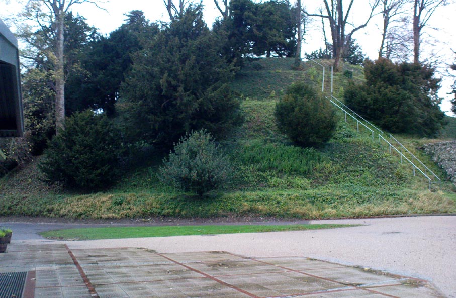
A piece of Merlin’s Mount!

When the reverend A.C. Smith (1885) described Merlin’s Mount — or ‘Marlborough Hill’ as he preferred it named — more than seventy years later as, “an artificial tumulus which deserves careful examination”, it seems little further investigation had been done.  And despite Smith’s wish for such care and attention, even today no detailed archaeological investigation has been undertaken.  Astonishing!  This fascinating-looking pyramidal “barrow” was thought by several early writers to have been constructed along similar architectural designs as that of Silbury Hill.  In Massingham’s (1926) fascinating Egyptian-origin hypothesis, he tells us the following:

“Merlin’s Mount encompasses only an acre-and-a-half of ground in comparison with Silbury’s five-and-a-half, and reaches a trifle more than half its height (60 feet).  In every other respect the twain are alike.  Both were raised at the foot of a gentle slope, both were made of chalk resting on a thin layer of clay, both were trenched around the bases, and in both were buried the antlered picks of the builders.  Both were built near the banks of the (River) Kennet within five miles of one and other.”

It certainly is impressive!  When Michala Potts and I came here last year in the fine company of Pete Glastonbury and others, we were somewhat in awe of the fact that so little has been said of this site in modern archaeological terms.  Indeed, the fact that the jury is still out as to the age of its construction we found quite surprising at the time.  Though another quick reading of Mr Burl’s Avebury work, combining the Roman finds and the antler picks here, makes him think that “a prehistoric origin for the mound likely.”

The name of Marlborough itself has been given a number of interpretations, most notably the attempt to derive it from the great shaman-poet Merlin.  But on a down-to-earth peasant level we find, in John Aubrey’s Monumenta Britannica there’s a note in the margin concerning the ‘marl’ element in the place-name that was told to him by a local man called Edward Leigh, which said,

“Marga, marle, we use instead of dung to manure our ground. It (Marlborough) lieth near a chalky hill, which our ancestors knew.  They borrowed this name ‘chaulk’ of the Latin, calx, named marle.”

More recently Margaret Gelling (1984) thought that the name of this hill or mound “is variously interpreted as a plant-name or a personal name.”  Which for some brings us back to Merlin!  We might never know…

References:

  1. Best, J., “The Marlborough Mound,” in A. Whittle’s Sacred Mound, Holy Rings (Oxford 1997).
  2. Burl, Aubrey, Prehistoric Avebury, Yale University Press 2002.
  3. Field, David, Brown, Graham & Crockett, Andrew, “The Marlborough Mound Revisited,” in Wiltshire Archaeologial & Natural History Magazine, 94, 2001.
  4. Gelling, Margaret, Place-Names in the Landscape, Phoenix: London 1984.
  5. Hoare, Richard Colt, The Ancient History of South Wiltshire and the Ancient History of North Wiltshire, London 1812.
  6. Massingham, H.J., Downland Man, Jonathon Cape: London 1926.
  7. Smith, A.C., Guide to the British and Roman Antiquities of the North Wiltshire Downs, WANHS 1885.

Links:

  1. Merlin’s Mount on Press TV

Acknowledgements:

With many thanks to Pete Glastonbury and Brian Edwards for their hints and corrections.

© Paul Bennett, The Northern Antiquarian

St. Patrick’s Well, Heysham, Lancashire

Holy Well:  OS Grid Reference – SD 4109 6159

Getting Here

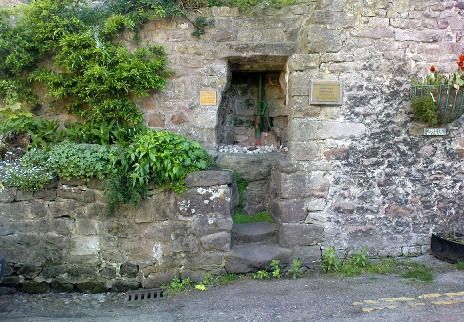
From Heysham village centre by the little roundabout, go down the gorgeous olde-worlde Main Street for about 150 yards, keeping your eyes peeled for the little track up to the tree-lined church of St. Peter.  Just before going up the path to the church, set back at the roadside, you’ll see an old pump in an arch in the walling.  That’s St. Patrick’s Well!

St.Patrick’s Well, Heysham

Archaeology & History

Not to be confused with another St. Patrick’s Well a few miles north of here, little has been said of this old holy well in literary tomes (even Henry Taylor’s (1906) magnum opus missed it!)  Sadly the waters here have long since been diverted (which violates religious tradition, quite frankly), and all we see today is an old iron water-pump set inside a stone arch, beneath which – I presume – the waters once ran.  An old plaque on the site of this ancient well tells:

“This is one of two holy wells in Heysham village (the other, Sainty Well, is on private property and covered over), whose dedications are long since lost.  Latterly the water from this well was used for utilitarian gardening purposes within the confines of the old rectory.

“Previously the well had fallen into disuse, suffered from surface contamination and became rubble-filled when the bank above gave way in the mid-1800s.  In the early 1900s, the well-head was again rebuilt and the well itself was cleaned and made safe by capping with concrete.  Recently (May 2002) the well-head has been refurbished and water artificially introduced, thus turning a derelict area into a feature of the village.”

It would be good if local people could complain to the regional water authority and make them redirect the waters beneath the well, back to the surface, to allow devotees — both Christian and otherwise — to partake of the holy blood sanctified by St. Patrick many centuries ago.  And without fluoride or other unholy chemical compounds that desecrate our waters.  Just the sacred waters of God’s Earth please!

Folklore

This is one of the many places in the British Isles where St. Patrick was said to have landed after he’d converted all the Irish into the christian cult!  One of the traditions was that St. Patrick said the well would never run dry — which was shown to be untrue when the waters were filled in with rubble in the 19th century.  The same saint also used the waters from the well to baptise and convert the peasants of his time.

References:

  1. Quick, R.C., Morecambe and Heysham, Past and Present, Morecambe Times 1962.

© Paul Bennett, The Northern Antiquarian

Almscliffe Crags, North Rigton, North Yorkshire

Legendary Rocks:  OS Grid Reference – SE 2681 4900

Also Known as:

  1. Ormscliffe Crags

Getting Here

This is an outstanding site visible for miles around in just about every direction – so getting here is easy! If you’re coming from Harrogate, south down the A658, turn right and go thru North Rigton.  Ask a local.  If you’re coming north up the A658 from the Leeds or Bradford area, do exactly the same! (either way, you’ll see the crags rising up from some distance away)

Archaeology & History

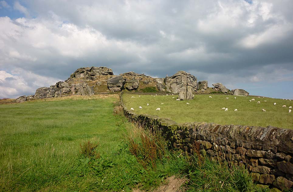
Almscliffe Crags – looking east

This giant outcrop of rock rises out from the meadowlands here like a miniature volcano, visible for many miles all round.  The history and legends surrounding the aged edifice are prodigious and the view from its tops on a fine day is one to be remembered.   It is likely, although there is little corroborative historical evidence, that is was an “omphalos”, or navel centre of the universe for the local people many centuries ago.  A great cutting runs through its centre and “runs from nearly north to south, and forms the boundary between the townships of Rigton and Stainburn, so that a portion of the rock is in each township.”  On the respective sides of this division are carved the letters “T.F.” and “E.L.”, being the initials of the families who owned the land here in olden days, Thomas Fawkes [of the legendary Guy Fawkes’ family] and Edwin Lascelles, of the ancient Harewood family.

Although Almscliffe Crags have been described in a great many local history books, it almost beggars belief to find it omitted from all the ancient mystery or “sacred sites” books ever written.  Curious…  Such lesser sites as Alderley Edge, the Cow and Calf rocks, Kilburn’s White Horse, Twelve Apostles stone circle, and many more, whilst having their respective virtues, don’t touch this place for ritual or sacred intent.

First described in the early 13th century records of Fountains Abbey, A.H. Smith (1961) thought the name of Almscliffe itself originally came from a hypothetical lady’s name, which seems an all-too-easy proclamation to make, instead of the humble option of  “I don’t know”!  But Smith wasn’t the only one to throw some curious ideas up about the etymology of Almscliffe.  Said by some local etymologists to derive from the Celtic Al-, a rock or cliff, and mias, an altar, there are other attempts to bring its rocky form into a consensus meaning.  The anglo-saxon Ael or El, being fire, and messe, or mass; and the Scandinavian Ormcliff, being the “cliff of the serpent”.  In Jones’ History of Harewood (1859), he tells

“it to have derived its name from the distribution of almes, at certain times, agreeably to the tenor of legacies left to the chapel which stood there in the sixteenth century, and was at that time dedicated to the Virgin Mary.”

It’s difficult to say which one tells its true title.  Many a druidic tale has also been carved into its form.  Such is the nature of this site that Grainge (1871) wrote how,

“it would not be difficult to show, with the exception of the artificial temple or circle of stones, this place possesses all the accessories of that ancient worship as…typical of the worship of the sun.”

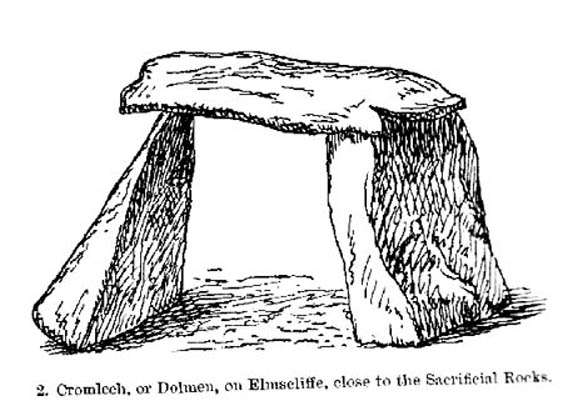
Simpson’s 1879 drawing of the Almscliffe ‘cromlech’

A remark that was even echoed by one of Yorkshire’s finest and most sober historians, Harry Speight. (1903)  Grainge also pointed out that in his day there were three standing stones by the great Crags, one fallen, but “two of these rocks yet stand upright.”  A few years later we find that the ranting christian writer,  Henry T. Simpson (1879), described similar megalithic remains here, though his description was of a “cromlech.” (illustrated here)  I can find no trace, nor further references to these relics; but think it reasonable to suggest that, perhaps, Simpson’s cromlech and Grainge’s standing stones may have been one and the same monument.

In the field 100 yards immediately north of the Crags (the one with the two rocks in it) there used to be seen the remains of some primitive early walling, suggestive of a small, early settlement site.  Very little can be seen of these remains today and, as far as I’m aware, no archaeological survey was ever done of them. In all honesty, it’s highly probable that a number of other important prehistoric sites were once in evidence at varying distances around Almscliffe Crags…

Folklore

The creation myth of Almscliffe tells that, long long ago, the great giant Rombald — whose main place of residence tended to be Ilkley Moor — was having a fight with the devil upon his homeland heath.  As is common in the myths of giants, the ‘devil’ picked up a great boulder and threw it at Rombald, but it missed and fell just short of the village of North Rigton, creating Almscliffe Crags. A variation of this tale tells that it was Rombald and his wife having the argument and she threw the stones to create the place.  Several sites have been named as the place where the mythological argument occurred: the Cow and Calf rocks, the Great Skirtful and Little Skirtful of Stones all cited in the folktales of our Yorkshire peasants.  Another variation of the tale tells that the devil was simply carrying some stones (as devils and giants are renowned to do in the folk-tales of the world) and he accidentally dropped them where the Crags now stand.  Such rock-throwing tales are, once more, symptomatic of cailleach tales more commonly found in Ireland and Scotland.

There are a great many cup-markings on the top surface of these Crags, most of which seem natural, but it is not unreasonable to think that, perhaps, some may have been carved by human hands? (not sure misself)  Eric Cowling (1946) sincerely believed the antiquity of some carvings here.  One of them particularly, three feet across and eighteen inches deep, though seemingly natural, has for several centuries been known as  the “Wart Well.”  Its name is attributed to folklore that is more commonly found in Ireland and the Scottish highlands; that is, should you have a wart, prick it with a pin until a drop or two of blood drips into the water that gathers in the stone bowl, then dip your hand in afterwards.  The wart is sure to vanish.  Another method to achieve the same end is to merely wash the skin affliction in the water, and it will soon fade. (Interestingly, an old psychotherapist friend, afflicted with the damned things, did just this and they promptly vanished.)

A more minor creation myth tells that the stone bowls we see on top of the Crags here – including the Wart Well – was actually made when the giant Rombald stepped from his home onto the Crags and left his footprint embedded in the rock face.  He was said to have made it in just one step, from the Giant Skirtful of Stones prehistoric cairn [where one legend reputes him buried].

Faerie folk were also long held to live here.  On the northwest side of the Crags is the entrance to a small cave that was always known as the Faerie’s Parlour, as it was said to be an entrance to their supernatural world.  In times past, many people have scrambled down into the cave, but never reached their Otherworldly paradise.  William Grainge (1871) wrote how the little people “were all powerful on this hill and exchanged their imps for children of the farmers round about.”  This is typical of old changeling lore!  In outlying villages surrounding the Crags there is a particular excess of faerie and old heathen lore.

One very curious-sounding tale tells how a goose was sent down the hole and, after some considerable time, re-emerged 3½ miles away out from a well near Harewood Bridge.  The goose is one of the many symbols of the sun and one of its primary symbolic attributes is that of winter.  Interestingly perhaps, as the rock art writer Graeme Chappell has pointed out, the underground journey of the goose from Almscliffe to Harewood Bridge coincides closely with the rising of sun on morning of the winter solstice.  This tale may simply be a folk remnant — and an archaic one at that — of just that event: ritualising winter solstice from these Crags.  In Norse lore, shamans tell of geese carrying the great god Wotan across the skies at the coming of the Yule period.

Another ritual date that was celebrated here was Beltane, or May 1.  Not only do we find many of the outlying villages possessed their own maypoles, but in 1879 Mr Simpson of Adel reported seeing Beltane fires atop of these rocks.  Other meetings were made here as the Crags are spliced in half by the local boundary line, and perambulation records show that people came here during the ‘beating of the bounds’, as they used to be called.  This boundary perambulation moot ingredient is what strongly implies the site to have had ritual importance.  And the fact that a mass of folktales emerge from here adds to this.  Then of course we have the physical situation of the Crags at the heart of the mid-Wharfedale landscape.  All these ingredients combined, strongly suggest the site would have been, not just the ritual meeting place of tribal elders in pre-christian times, but an omphalos: it rises majestically from the land and all monuments gaze towards its giant form.  Important giant prehistoric monuments from the hills miles away tell of myths that come and go from this proud mass of stone.  Although we have other omphali just over the extended horizons from Almscliffe, this is where the World began in the creation myths of ancient times in mid-Wharfedale, at the heart of the ancient kingdom of Elmet.

But there is still more lore to be told of these rocks…

The centre piece of the Crags is known as the Altar Rocks.  Upon its western side is carved the “figure of a large tree, which we take to be the monogram of the Celtic Jupiter,” says Grainge.  This assumption is derived from an eighteenth century writer who, said Speight (1903), told that “Almnus and Alumnus are titles of Jupiter, to whom this high altar was dedicated.”

The highest part of the Crags, to the west, is known as Lover’s Leap where, in 1766, a daughter of a respectable Rigton farmer of the name Royston, having been disappointed in love, decided to kill herself.  She jumped, so legend reputes, from a point some sixty feet above ground, but a strong wind blowing at the time caught hold of her dress and carried her through the air until she landed safely in an adjoining field with naught but a sprained thumb!  The said lady realised the stupidity of her ways and was said to have lived out a long and fine life.

In recent years earthlights (UFOs) have been seen floating above and around the great outcrop.  It is likely that these were the same things which, in days of olde, the people would call the faerie.  I highly recommend visiting the place!

References:

  1. Bennett, Paul, The Old Stones of Elmet, Capall Bann: Milverton 2001.
  2. Bogg, Edmund, From Eden Vale to the Plains of York, James Miles: Leeds 1895.
  3. Bogg, Edmund, Higher Wharfeland, James Miles: Leeds 1904
  4. Cowling, E.T., Rombald’s Way, William Walker: Otley 1946.
  5. Eliade, Mircea, Patterns in Comparative Religion, Sheed & Ward: London 1958.
  6. Grainge, William, History & Topography of Harrogate and the Forest of Knaresborough, J.R. Smith: London 1871.
  7. Jones, John, The History and Antiquities of Harewood, Simpkin Marshall: London 1859.
  8. Simpson, William, Archaeologia Adelensis, W.H. Allen: London 1879.
  9. Smith, A.H., The Place-Names of the West Riding of Yorkshire – volume 5, Cambridge University Press 1961.
  10. Speight, Harry, Kirkby Overblow and District, Elliott Stock: London 1904.

© Paul Bennett, The Northern Antiquarian

Wray Stone (314), Ilkley Moor, West Yorkshire

Cup-Marked Stone:  OS Grid Reference – SE 13173 46585

Also Known as:

  1. Carving no.150 (Hedges)
  2. Carving no.314 (Boughey & Vickerman)

Getting Here

Take the road up across from Ilkley train station uphill towards the moor until you reach great rocks on your right.  From here, the Cow & Calf Stones car park (packed with tourists and litter everywhere these days), go up the steep footpath onto the moor.  As you level out looking across the first moorland ridge, to your left is a rounded hillock.  Go into the heather there and near its small peak and you’ll find what you’re looking for.

Archaeology & History

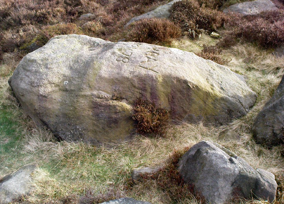
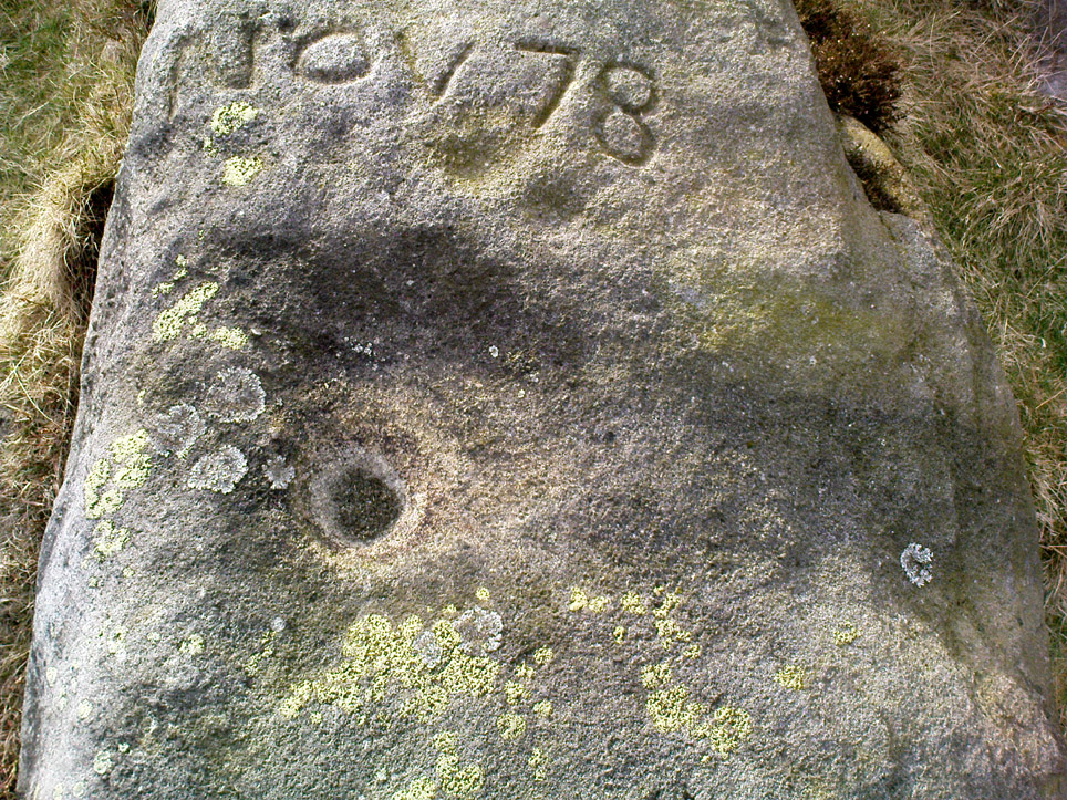
This is a nice big stone, found amidst a clump of other stones, that gives the distinct impression of once being a large cairn or similar artificial prehistoric feature.  But that’s wishful thinking on my behalf…  This long fat 10-foot long rock has the distinct signature of someone who thought it a good idea to carve his little name on the carving in 1978, as the name of the rock tells: “Wray Nov 78” — vandalism which the local Ilkley Parish Council and local businessman Tom Lonsdale validate as little more than “twenty-first century informal unauthorised carving.”  Beneath the great artist’s signature we find two distinct cup-marks above a large rounded bowl, inside of which seems to be the impression of an old ring, but this seems due to the actions of water and lichen.  There are perhaps another two faded cup-markings alongside those distinctly visible.  In Hedges (1986) survey he described the “top flat surface has three cups and one basin” — so let’s play safe and go with that!

Close-up of cups, bowl & modern etching

It’s a good stone, sat upon a fine ridge with distinctive views for miles both east and west along the valley of the Wharfe, and north to the ancient settlements and burial grounds of Middleton Moor on the other side of the River Wharfe.  From here, behind and up onto Ilkley Moor, unfolds its greater mythic history, scattered and hidden over differing ages.  In years past, this site was a fine one for reflection and insight.  Today, one must venture further and to other sites for such quiet realities. Close by you can find the double-ringed carving of stone 318 and other faded cup-mark stones nearby.

References:

  1. Boughey, Keith & Vickerman, E.A., Prehistoric Rock Art of the West Riding, WYAS: Wakefield 2003.
  2. Cowling, E.T., Rombald’s Way: A Prehistory of Mid-Wharfedale, William Walker: Otley 1946.
  3. Hedges, John (ed.), The Carved Rocks on Rombalds Moor, WYMCC: Wakefield 1986.

© Paul Bennett, The Northern Antiquarian

Devil’s Dyke, Poynings, Sussex

Hillfort:  OS Grid Reference – TQ 260 111

Also Known as:

  1. Brighton Dyke
  2. Poor Man’s Wall 

Getting Here

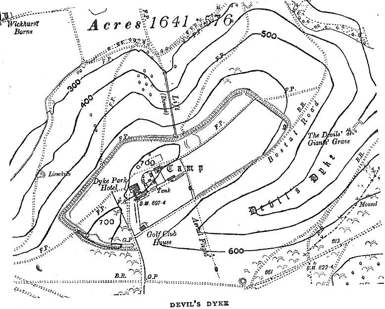
Map of Devil's Dyke
Map of Devil’s Dyke

Plenty of ways of approaching this huge fella!  Personally, I’d take it from the steep valley immediately east and north where the ramparts drop you down the hill, if only to get a decent idea of the scale of the thing!  But those of you into taking it easy can do no better than take the country road south out of Poynings village (towards Brighton), down Saddlescombe Road, for just under a mile, where you should take a right-hand turn along the Summer Down lane for a mile. You’ll then hit the Devil’s Dyke Road. Turn right here and go to the end.  You’re right in the middle of it!

Archaeology & History

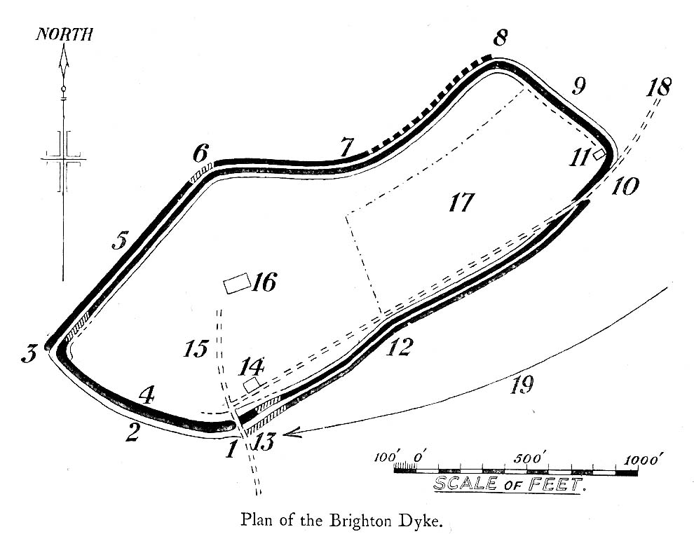
Early plan of Devil’s Dyke ‘camp’

Although most of this huge monument hasn’t been given the investigation it deserves — hence making knowledge of its origins more speculative than factual — as Jacquetta Hawkes (1973) wrote, seemingly all those years ago now, “it is known that a village lying half in and round them was occupied in the Belgic period at the end of the Iron Age.”  And it’s certainly big enough!  The encircling circuit of dykes themselves stretch all the way round a distance of more than 2150 yards long (that’s 1.22 miles, or 1.97km!), with the longest east-west axis being more than half-a-mile across.

Nowadays it seems, the Devil’s Dyke is the name given to the steep valley below the encampment, but a hundred years back it was the camp itself that was known by this name.  Described by the wandering antiquarian R. Hippisley Cox (1927) as “a camp containing forty acres (with) very steep and difficult approaches,” another early account in The Antiquaries Journal — commenting on a ground-plan of the site from the Brighton and Hove Herald of 1925 — told:

“The heavy encircling lines represent ramparts, and the thin line marks the outer margin of the accompanying ditch.  A spur renders the earthwork weakest on the south-west, and the rampart is therefore highest between the points 1 and 3, rising 21ft vertically above the ditch, which is nearly filled up at the present time.  On the north-west there is steep slope outside the camp, and the ramparts are considerably lower, the iner ditch being nearly obliterated.  The outer rampart is now wanting betwen 7 and 8, but this inner one becomes stronger as the outer slope of the ground decreases, only to die away again on the south-east where the camp overlooks the steep Dyke Valley.  A double-bank and inner ditch can still be traced from the north-east angle to a point near the old golf-club house.”

I first came here as a young lad and the site was lost on me (in them days, if monuments weren’t stiff and upright, I really didn’t see the point!).  These days however, the size of it alone blows you away somewhat.

Folklore

As you’d expect the creation myths of this site and its edges relate to our old heathen friend, the devil!  The landscape itself was, in old lore, the work of the devil (though prior to this, the devil was known in peasant-lore to be a legendary giant, though I am unaware of the name/s of the giant in question); and the great valley below the Devil’s Dyke encampment was actually dug out by Old Nick in the old tales.  That old folklorist Jacqueline Simpson (1973) takes up the story:

“The Devil…had been infuriated by the conversion of Sussex, one of the last strongholds of paganism in England, and more particularly by the way the men of the Weald were building churches in all their villages.  So he swore that he would dig right through the Downs in a single night, to let in the sea and drown them all.  He started just near Poynings and dug and dug most furiously, sending great clods of earth flying left and right — one became Chanctonbury, another Cissbury,  another Rackham Hill, and yet another Mount Caburn.  Towards midnight, the noise he was making disturbed an old woman, who looked out to see what was going on.  As soon as she understood what he was up to, she lit a candle and set it on her window-sill, holding up a sieve in front of it to make a dimly glowing globe.  The Devil looked round, and thought this was the rising sun.  At first he could hardly believe his eyes, but then he heard a cock crowing — for the old woman, just to make quite sure, had knocked her cockerel off his perch.  So Satan flew away, leaving his work half done.  Some say that as he went out over the Channel, a great dollop of earth fell from his cloven hoof, and that’s how the Isle of Wight was made; others, that he bounded straight over into Surry, where the impact of his landing formed the hollow known as his Punch Bowl.”

That’s the story anyway — take it or leave it!  Of importance in this fable is the figure of the “old woman”: a much watered-down version of the cailleach figure of more ancient northern and Irish climes, where tales of her doings are still very much alive.  And many are the tales of her battles with other giant figures, just as we evidently once had here.

Ghosts have been reported by local people upon this hill-top site; and there are a number of other folktales to be found here…which I’ll unfold over time as the months pass by…

References:

  1. Anon., “Notes: The Brighton Dyke,” in The Antiquaries Journal, 5:4, October 1925.
  2. Clinch, G., “Ancient Earthworks,” in Victoria County History of Sussex – volume 2 (edited by W. Page), St. Catherine’s Press: London 1905.
  3. Cox, R. Hippisley, The Green Roads of England, Methuen: London 1927.
  4. Hawkes, Jacquetta, A Guide to the Prehistoric and Roman Monuments in England and Wales, Chatto & Windus: London 1973.
  5. Hogg, A.H.A., “Some Aspects of Surface Fieldwork,” in The Iron Age and its Hillforts (edited by M. Jesson & David Hill), Southampton University Archaeology Society 1971.
  6. Simpson, Jacqueline, The Folklore of Sussex, Batsford: London 1973.
  7. Simpson, Jacqueline, “Sussex Local Legends,” in Folklore Journal, volume 84, 1973.

© Paul Bennett, The Northern Antiquarian

Adam’s Oak, Brierley, South Yorkshire

Legendary Tree:  OS Grid Reference – SE 4280 1015

Also Known as:

  1. Adam & Eve’s Oak
  2. Wind-gap Oak

Archaeology & History

Highlighted on the 1854 Ordnance Survey map close to the township boundary line as Adam & Eve’s Oak, between Brierley and South Kirkby, I can’t find too much about this once great tree.  However the Wakefield historian W.S. Banks (1871) told us the following:

“Upon the common at Ringston Hill grows the remarkable ‘old Adam’ oak, much decreased in size in late years.  It is an ancient and large tree measuring twenty-seven feet in girth at a yard above the ground.  The trunk is hollow and the north side is broken away.  Most of the branches are also gone.  In 1868 a very large branch was blown off by the wind; but on the southerly side are still some very vigorous limbs.”

The old oak on the 1854 map

Even when Banks wrote this he said how the tree “must be many centuries old.”  In the time of King Charles II there used to be an old inn by Adam’s Oak at the foot of Ringston Hill, where the famous highwayman, Nevison (much-loved by many Yorkshire-folk because of his Robin-Hood-like character), used to stay.  The inn was owned by one Adam Hawksworth, but was ordered “to have his sign taken down for harbouring Nevison.”

Folklore

W.S. Banks also wrote of this once great tree:

“The people at Brierley tell of Nevison the highwayman lodging in it and hiding stolen treasures in it, things which probably did not happen, though Nevison’s name is connected with Ringston Hill.”

The treasure legend may have more to do with the adjacent stone circle, as we find ‘treasure’ a common motif at such places.

References:

  1. Banks, W.S., Walks in Yorkshire: Wakefield and its Neighbourhood, Longmans, Green  Co.: London 1871.

© Paul Bennett, The Northern Antiquarian 

Hawk Stone, Spelsbury, Oxfordshire

Standing Stone:  OS Grid Reference – SP 33923 23544

Getting Here

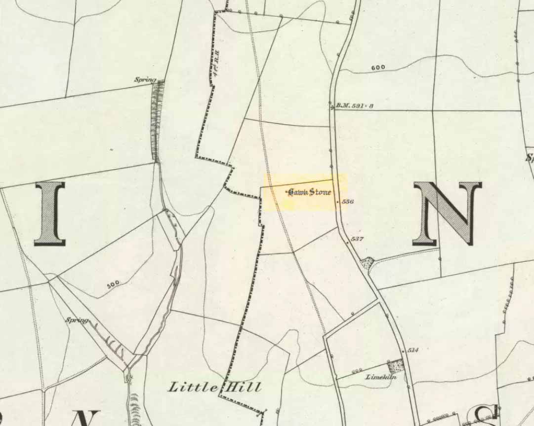
Hawk Stone on 1885 map

Best visited out of season before the corn’s been planted. It makes it  easier to find and doesn’t annoy the land-owner here, who tends to be a decent dood.  From Chipping Norton go southeast along the B2046 road to Charlbury.  After about 1½ miles take the second right turning down the small country lane.  Go slowly down here for less than half a mile, watching the fields on your right.  You’re damn close!

Archaeology & History

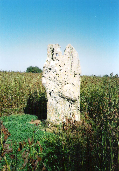
The Hawk Stone

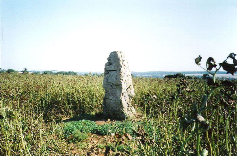
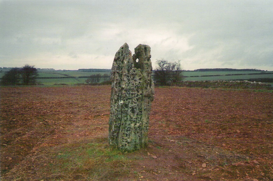
This impressive, weather-worn, eight-foot tall standing stone stands aloft in the middle of a field due west of the road between Chalford Green and Dean.  It’s an excellent monolith and one which, I think, has a lot more occult history known of it than described here.  Thought by O.G.S. Crawford (1925) and others in the past to have been “formerly part of a chambered structure,”  or prehistoric chambered tomb like that of the Hoar Stone at nearby Enstone, no remains of such a structure unfortunately remain today.  It is first illustrated and named on a local map of the region in 1743 CE, and the stone at least has fortunately managed to escape the intense agricultural ravages endemic to this part of the country.

The name “Hawk” stone has been fancied by some to relate to some obscure resemblence to a Hawk, or because there very often are hawks hovering over those upland fields – but these are unlikely.  It’s thought by place-name authorities more likely to derive from a corruption of ‘Hoar’ meaning a grey or boundary stone; and as it stands just yards east of the present township boundary line, this derivation seems more probable.

To all lovers of megalithic sites, we highly recommend a visit here!

Folklore

In local folklore and in the opinion of some earlier historians, the Hawk Stone formed an integral part of a stone circle here, but there is little known evidence to substantiate this.

Hawk Stone in summer
Hawk Stone in winter

A creation legend attached to this site tells that the stone was thrown, or dragged across the land, by a old witch or hag — though we are not told from where.  This is a motif found at megalithic sites all across the country (see Bord & Bord 1977; Grinsell 1976, etc).  In Corbett’s History of Spelsbury (1962) the author told of the folklore spoken of by one Mr Caleb Lainchbury who

“said the cleft at the top of the Hawk Stone at Dean was supposed to of been made by the chains of the witches who were tied to it and burnt. As witches seem to have been extremely rare in Oxfordshire it cannot have been a very common practise to burn them at Dean; but there may indeed have been some kind of fire ceremonies near the stone.”

Grinsell (1976) also tells how the Hawk Stone has that animistic property, bestowed upon other old monoliths, of coming to life and going “down to the water to drink when it hears the clock strike 12.”

This evidently important and visually impressive monolith also plays an important part in an incredibly precise alignment (ley) running roughly east-west across the landscape.  At first, Tom Wilson (1999) thought the alignment had previously gone unnoticed, but later we later found a reference to the same line in an early copy of The Ley Hunter (Cooper 1979). It links up with other important megalithic sites, such as the Hoar Stones at Enstone, Buswell’s thicket, and the ancient Sarsden Cross.

Similarly, when Tom Graves’ (1980) was doing some dowsing experiments at the Rollright stone circle a few miles west, he found what he described as an ‘overground’ (or ley) linking the ring of stones to the Hawk Stone, but no other connecting sites are known along this line.

References:

  1. Bennett, Paul & Wilson, Tom, The Old Stones of Rollright and District, Cockley: London 1999.
  2. Bord, Janet & Colin, The Secret Country, BCA: London 1977.
  3. Cooper, Roy, “Some Oxfordshire Leys,” in The Ley Hunter, 86, 1979.
  4. Corbett, Elsie, A History of Spelsbury, Cheney & Sons: Banbury 1962.
  5. Crawford, O.G.S., The Long Barrows of the Cotswolds, John Bellows: Gloucester 1925.
  6. Gelling, Margaret, The Place-Names of Oxfordshire – volume 2, Cambridge University Press 1954.
  7. Graves, Tom, Needles of Stone, Granada: London 1980.
  8. Grinsell, L.V., Folklore of Prehistoric Sites in Britain, David & Charles: Newton Abbot 1976.

© Paul Bennett, The Northern Antiquarian 

Dun Chathach, Connel, Argyll

Hillfort: OS Grid Reference – NM 9674 3401

Also known as:

  1. Canmore ID 23261
  2. Dun Cathich

Getting Here

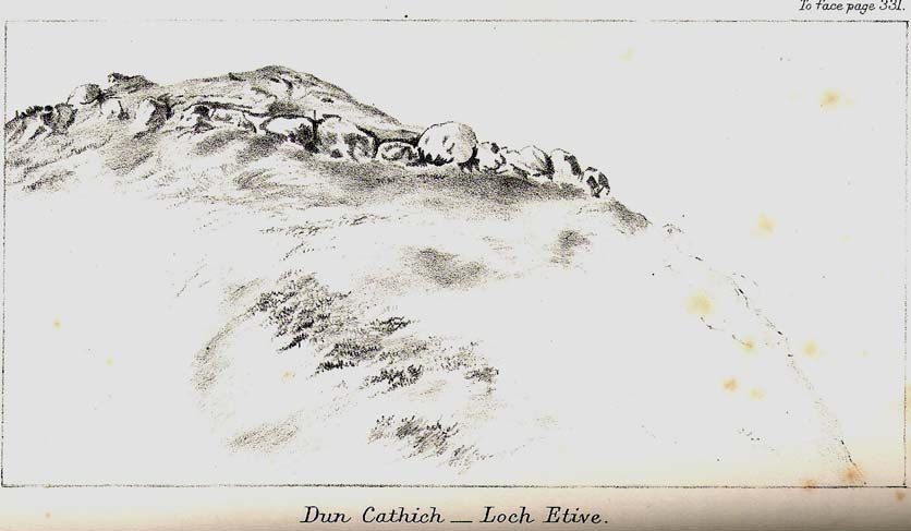
Dun Chathach (drawn by Miss J. Knox Smith 1885)

Go up from Oban on the A85, past Connel and towards Taynuilt, keeping your eye out for where the train-line crosses the road. Just before this is a small road on your left leading down to the sea, with the train line running parallel all the way down. Go right to the end and then look up to the rocky rise a coupla hundred yards on where the train line runs out of view round the coastal edge. That’s it!

Archaeology & History

When Scottish writer and historian R. Angus Smith (1885) first saw this, the close arrangement and size of the stones that make up the edges of this dun made him think this was actually a stone circle up here.  Sadly it wasn’t to be.  Following an examination of the site in 1969 by members of the Scottish Royal Commission (Argyll – Volume 2, 1975), they described Dun Chathach as,

“circular in plan…measuring 18.3 metres in diameter externally. The wall, which has been about 3.4 metres in average thickness, is now reduced to a low grass-grown stony bank, but considerable stretches of the outer face are still visible in situ. Many of the facing stones, which lie as much as 1.6 metres below the level of the summit, are of massive proportions, the largest measuring 1.4 metres by 1.3 metres and 1 metre high. It is uncertain which of the three gaps now visible in the wall indicates the site of the original entrance.”

Folklore

Legend has it that this was a hill of battles.  It was also said by R. Angus Smith (1885) to “have been used as one of a chain of beacons,” with the next fire on being lit upon a small hill nearer Connel called Tom na h-aire, ‘the mound of watching.’

References:

  1. Royal Commission on the Ancient & Historical Monuments, Scotland, Argyll- volume 2, HMSO: 1974.
  2. Smith, R. Angus, Loch Etive and the Sons of Uisnach, Alexander Gardner: London & Paisley 1885.

© Paul Bennett, The Northern Antiquarian
Corwen Cross, Denbighshire

Cross & Cup-Marked Stone:  OS Grid Reference – SJ 0787 4340

Getting Here

Simple.  The church in the centre of the village across from the T-junction with the A5 is where it’s at!

Archaeology & History

Cross-base with cup-marks (from Owen, 1886)

At Corwen churchyard we find a number of curious old stone relics — not least of which is this seemingly 12th century christian cross, more than seven-feet tall, on the west side of the church. Not only does this have a curious history in itself, but the base on which the cross stands has what may be at least seven cup-markings etched on it.  These were first mentioned – I think – by Elias Owen in his Old Stone Crosses of the Vale of Clwyd, (1886) who wrote:

“The stone basement in which the (cross) shaft is placed is elliptical in form, with transverse and conjugate diameters measuring respectively 64 and 60 inches; it is 12 inches or so thick, is of a slaty nature and might have been procured in the neighbourhood… There are seven peculiar artificial depressions along the surface of the pedestal, strongly resembling the cup-markings which are found occasionally on the capstones of cromlechs, etc. They are irregularly arranged: on the north side there are three, almost in a line; and on other parts of the stone there are four of these marks. They differ somewhat from each other in size and shape, but they are for the most part circular, though one is more of an oblong than a circle. They vary also in depth, one being two-and-half inches deep, while the others are shallow. The largest is three inches in diameter; the others are not so broad.”

Owen makes note of a previous description of the Corwen “cross” by Thomas Pennant in 1784, where sounds as if this stone had a decidedly megalithic precursor. He told us:

“A most singular cross in the churchyard merits attention: the shaft is let into a flat stone, and that again is supported by four or five rude stones, as if the whole had been formed in imitation of, and in veneration of, the sacred Cromlech of very early times.”

Two other crosses are found at Corwen church – one of which has a decidely heathen legend attached to it. The Carreg y Big yn y Fach Rhewllyd monolith is also found here, in the porch wall.  A few miles east of here we also find another cup-marked stone, shown on The Old-Fashioned Antiquarian website.  Looks a good n’!

References:

  1. Owen, Elias, Old Stone Crosses of the Vale of Clwyd and Neighbouring Parishes, Bernard Quaritch: London & Oswestry 1886.

© Paul Bennett, The Northern Antiquarian

Serpent Mound, Scallasaig, Glen More, Inverness-shire

Cairn:  OS Grid Reference – NG 848 202

Folklore

I’m presuming that this burial site is the right one, described in the fine Mr MacGregor’s Peat Fire Flame (1937) as being “by the roadside up near Scallasaig.”  There certainly doesn’t appear to be another alternative site close by (though if I’ve got it wrong, someone please lemme know!).  This place was, said MacGregor, a site “where the people in olden times used to worship the serpent.”

MacGregor spoke with a local man about the myths here and asked how long it had been associated with serpents.

“Och, about two thousand years,” said Mr John MacRae. “The mound was in the shape of a serpent, and when the chief of the people would die, he would be buried in the head of the serpent..”

He continued, saying, “One from London, that was going about searching things like that, opened the mound, and they found in the mound a big stone coffin with a big stone slab on the top. And there the bowl was found with the ashes of the chief of the people at that time. The bowl was taken to the Manse. That’s about fifty years ago. It was there for a few months; and they took it to Edinburgh, to some museum or something. They were saying that there was a funny noise in the Manse when the bowl was lying there. If there was any treasure in the bowl, or in the grave along with the bowl, it was taken out before. You see, had he any treasure – the chief like – guns and money and the like – I’m sure they wouldn’t be putting much money in the grave. It would be going into the grave with the dead man, so, when he would rise in the next world, he would be ready to start at the same game as he was carrying on here on Earth.”

This sounds a little like the folk-memory of an idea of a heathen afterlife – and of course it’d make sense finding such lore here at a tomb.

I’ve come across references to several other serpent mounds scattering the western side of Scotland, but their exact locations have proven hard to pin down. It makes y’ wonder how many more there once were before the christian paradigm became entangled in the myths of the country people.

References:

  1. MacGregor, Alisdair Alpin, The Peat-Fire Flame: Folk-Tales and Traditions of the Highlands and Islands, Ettrick Press: Edinburgh 1937.

© Paul Bennett, The Northern Antiquarian