Cup-and-Ring Stone (removed): OS Grid Reference – NT 12364 32627
Also Known as:
Drumelzier Carving
Archaeology & History
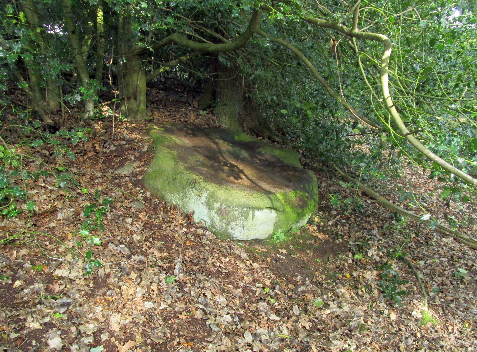
Position of stone in cairn
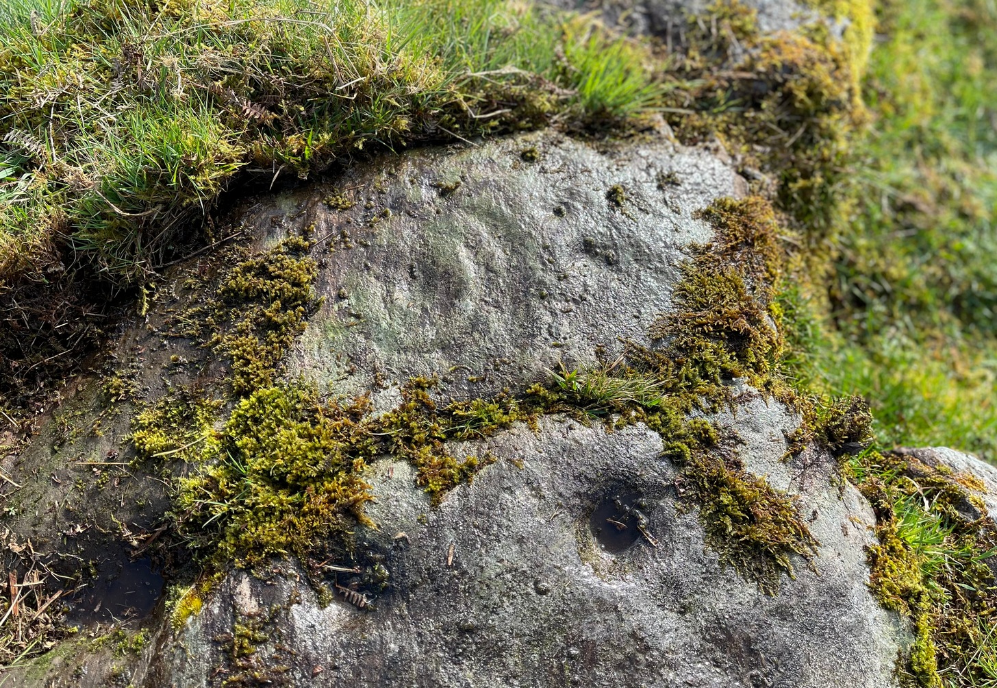
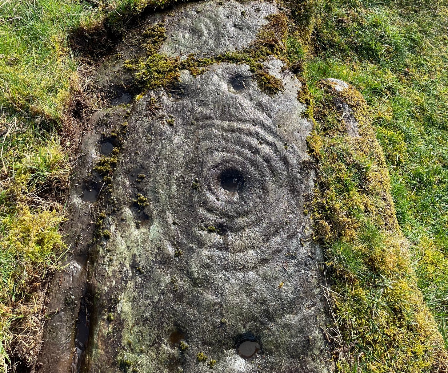
A carving that was located at the edge of a cairn on a knoll on the east-side of the River Tweed, this is an odd design that now lives in Edinburgh’s central museum: odd, inasmuch as the design looks as if it’s a typical cup-and-ring carving, yet none of the cups on this stone were ever hollowed or pecked out, and so the “cups”, so to speak, are actually small rings (if that makes sense!). There are a number of similar unhollowed “cups” on other carvings that are found associated with prehistoric tombs, so perhaps this aspect was something of a burial trend—amongst a very small tribal group, perhaps… It’s an element that was remarked upon in Simpson & Thawley’s (1972) examination of petroglyphs in neolithic tombs that were called “passage grave style” carvings: a sort of dyslexic cup-and-ring design no less! The intriguing thing about this carving is that it’s one in a small cluster of dyslexic cup-and-rings that are found in this part of Scotland—in an area where rock art itself is pretty scarce. Which begs the question: was it a local tribal style? Anyhow…
The carving was first uncovered when J.H. Craw (1930) excavated the aforementioned cairn, finding therein a number of cists. There’s speculation that the petroglyph might originally have been a covering stone for one of the cists, but we don’t know for sure. Craw described the carving as follows:
Craw’s 1930 sketchRon Morris’ 1981 sketch
“The ring-marked slab…measures 3 feet by 2 feet by 6 inches. It lay at the north side of the cairn (highlighted in sketch, PB), outside the encircling ring, but may originally have been the cover of cist No.2. On the upper side are five shallow ring-markings, four being double and one single. The former measure 3 inches to 4 inches in diameter, and the latter 1¾ inch. The figures are thus much smaller than in typical cup-and-ring-marked stones, and the lines are only ¼ inch in width. The only similar markings known to me are on a slab which I found a number of years ago near the site of several former cairns, and forts at Harelawside near Grant’s House, Berwickshire. The stone is now in our Museum.”
The “museum” in question being Edinburgh’s National Museum (I don’t know if it’s in a box somewhere or on public display, which is where it needs to be). If anyone can get a good photo of this carving, please send it to us or add it on on our Facebook group.
Morris, Ronald W.B., “The Cup-and-Ring and Similar Early Sculptures of Scotland; Part 2 – The Rest of Scotland except Kintyre,” in Transactions of the Ancient Monuments Society, volume 16, 1969.
Morris, Ronald W.B., The Prehistoric Rock Art of Southern Scotland, BAR: Oxford 1981.
Ritchie, Graham & Anna, Edinburgh and South-East Scotland, Heinnemann: London 1972.
Royal Commission on the Ancient & Historical Monuments, Scotland, Peeblesshire – volume 1, Aberdeen University Press 1967.
Simpson, D.D.A. & Thawley, J.E., “Single Grave Art in Britain,” in Scottish Archaeological Forum, no.4, 1972.
Acknowledgements:Huge thanks for use of the Ordnance Survey map in this site profile, reproduced with the kind permission of the National Library of Scotland.
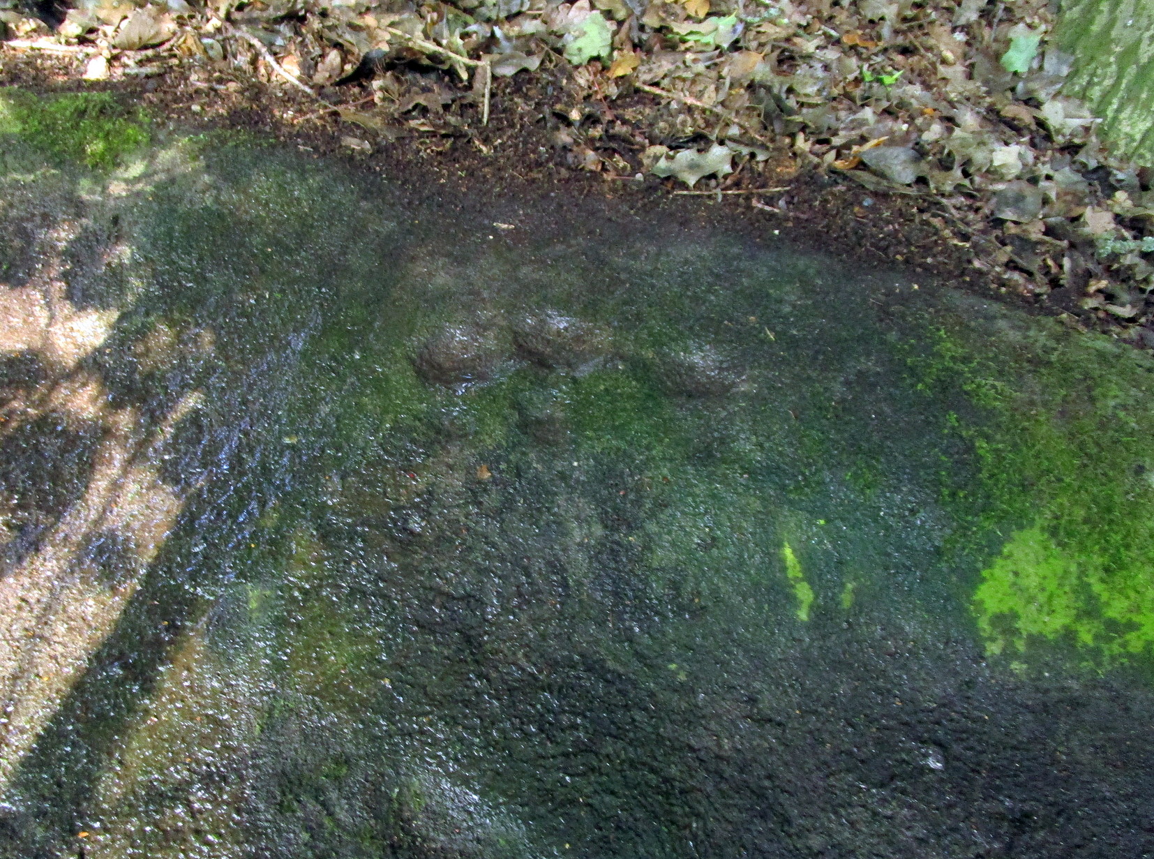
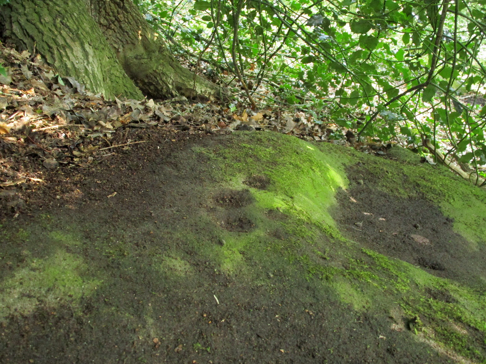
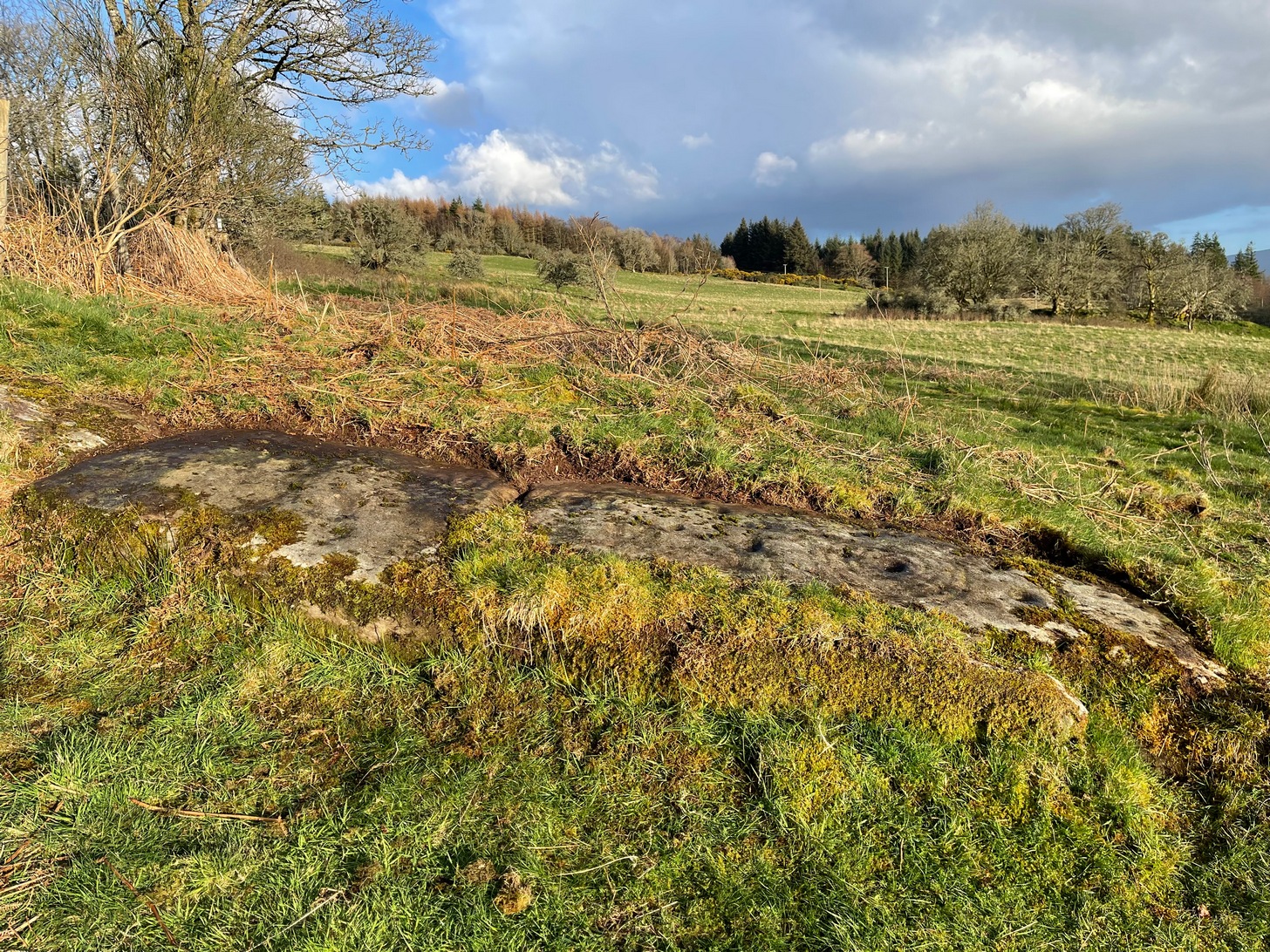
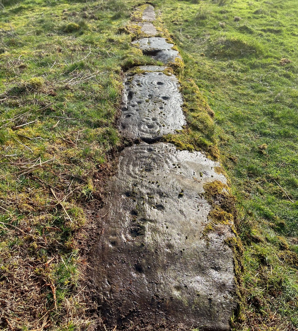
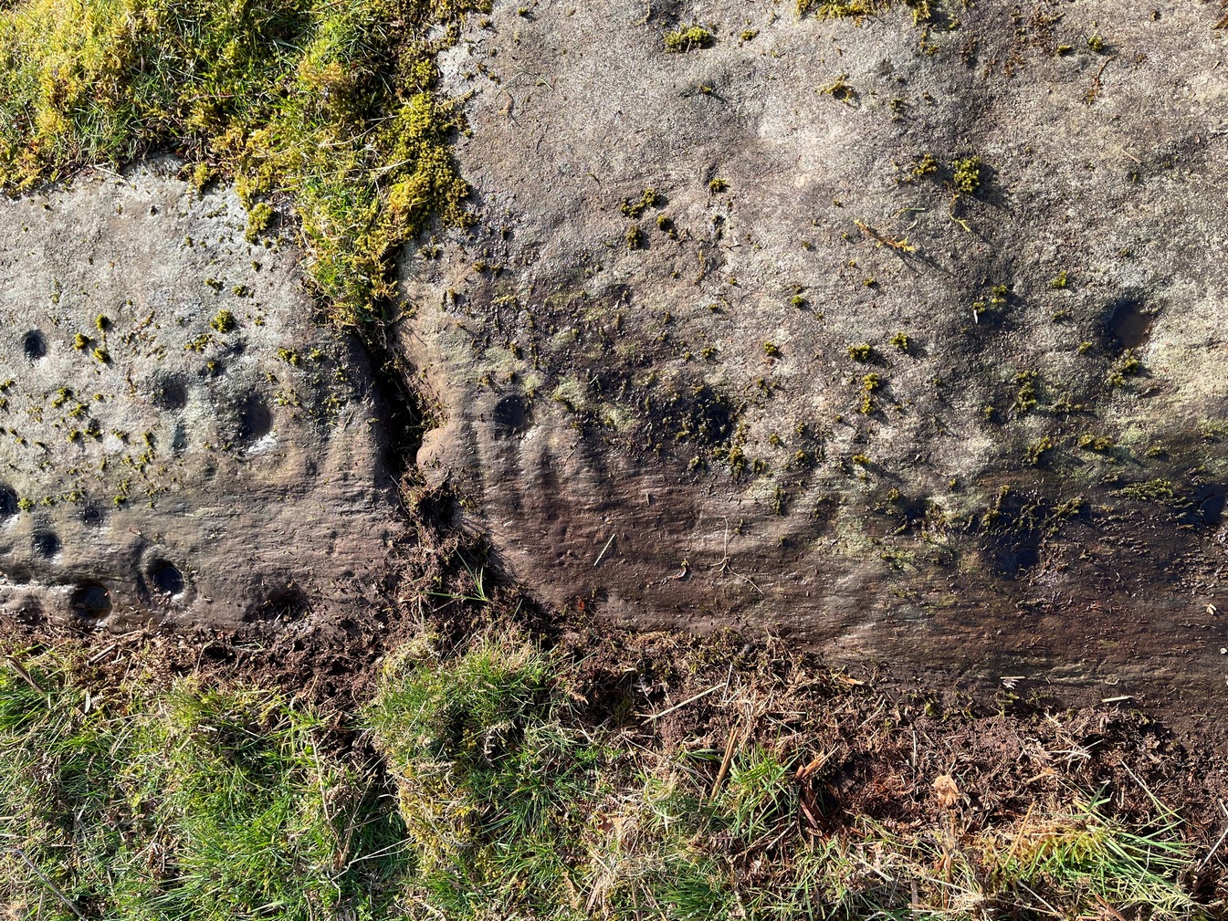
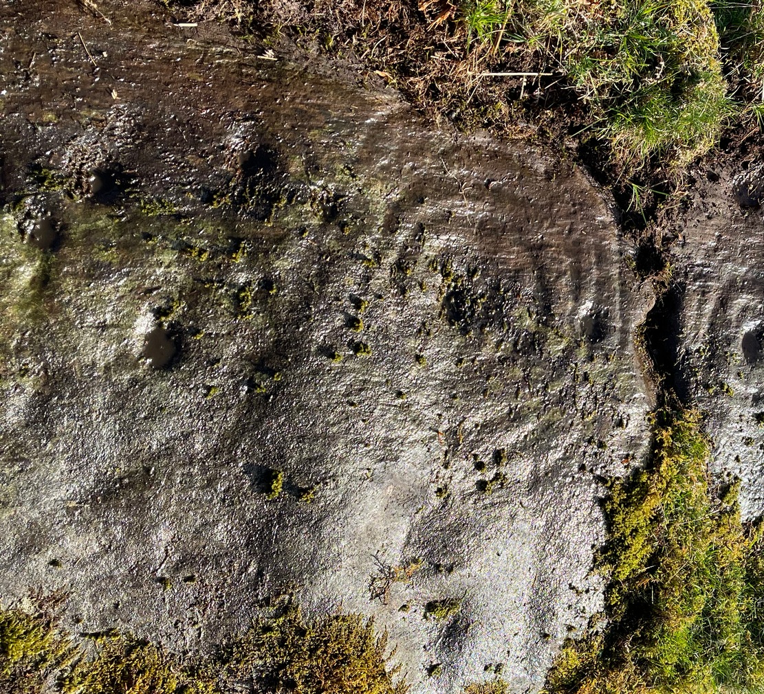
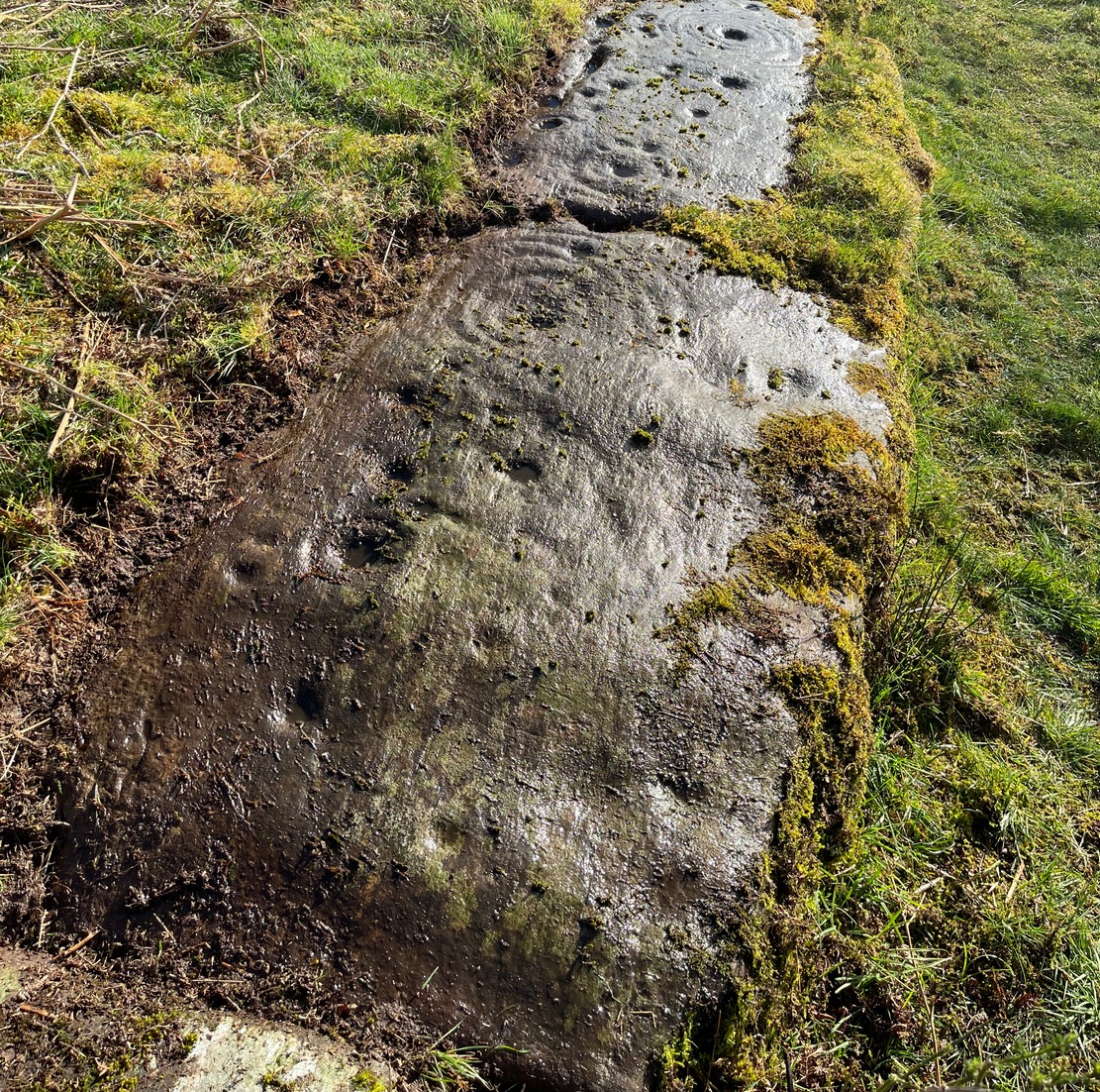
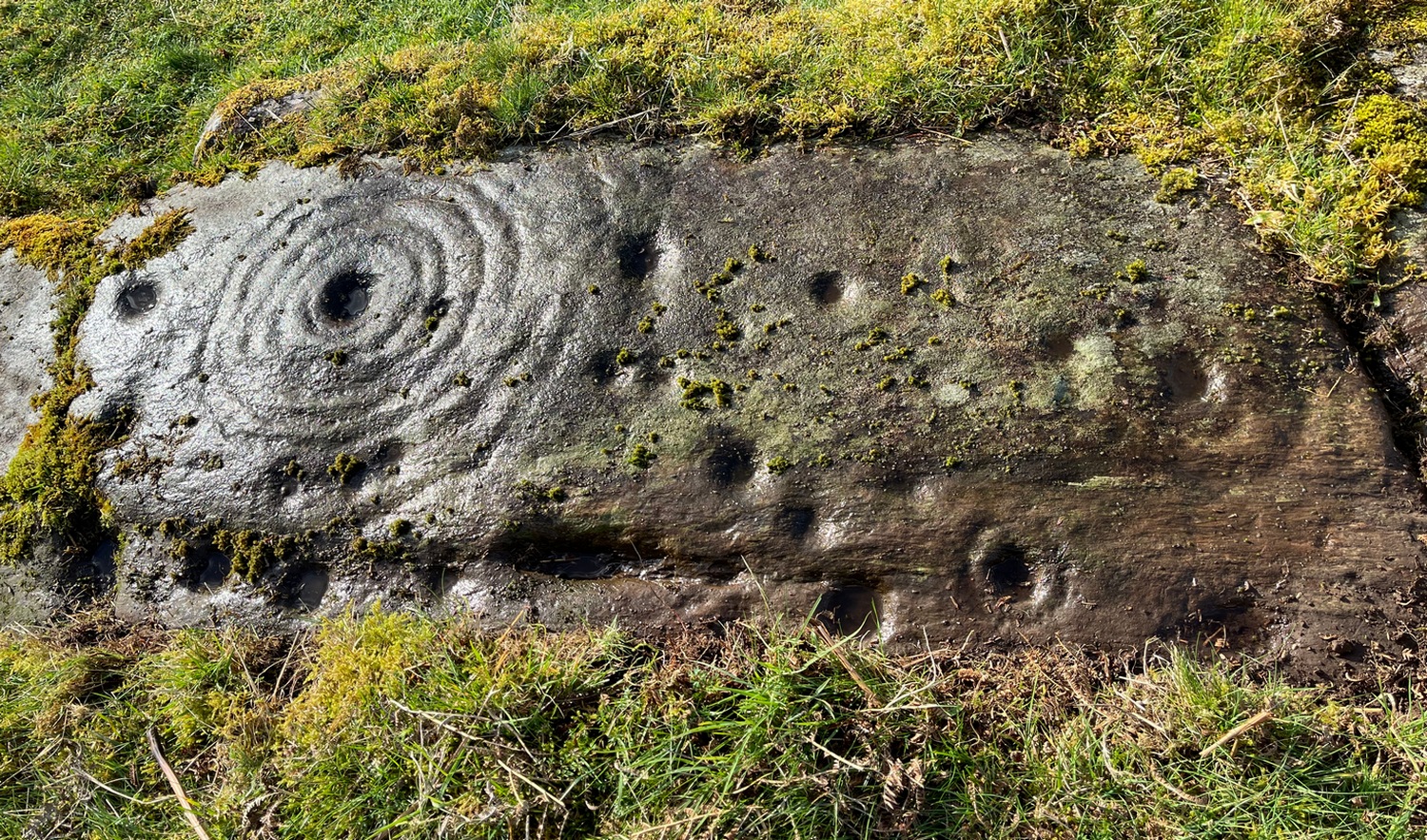
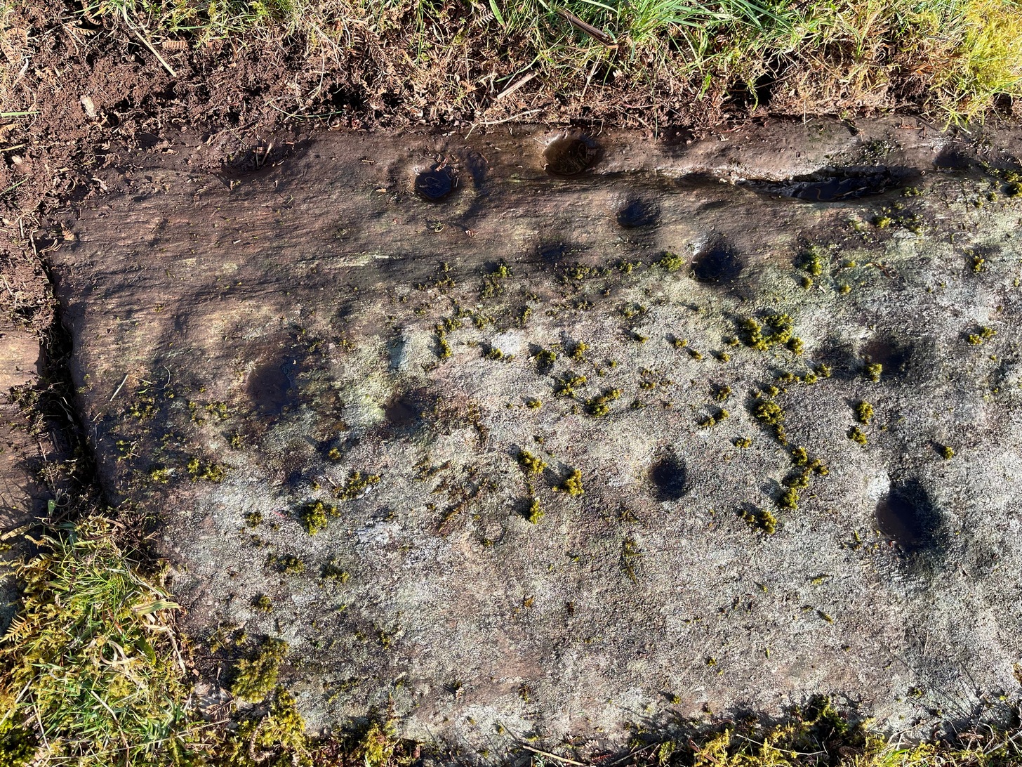
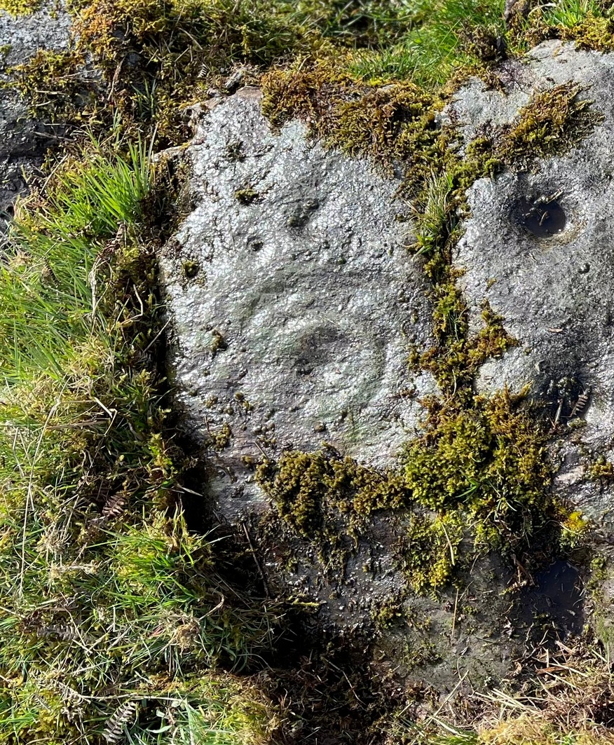
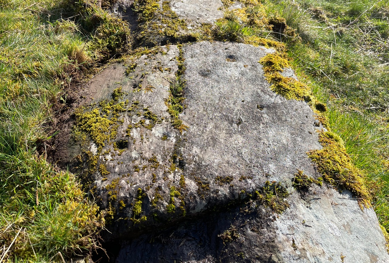
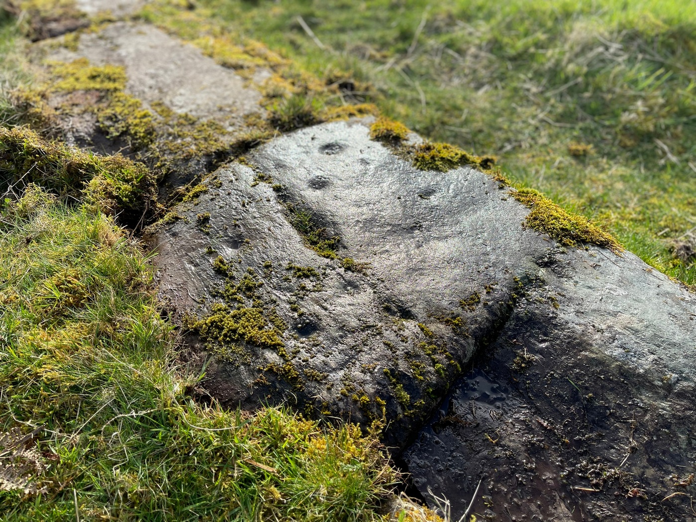
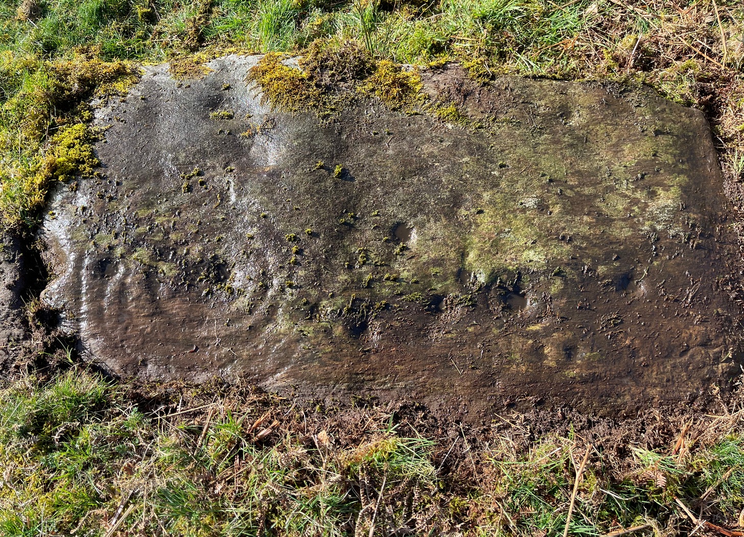
A little-known multiple ringed carving was discovered a few years ago during the excavation of a prehistoric cairn just immediately east of the A701 roadside, several miles south of Broughton. The cairn itself had been recognised many years prior to the recent excavation, when one of two cists inside it was noted by R.B.K. Stevenson (1940), and which was subsequently described in slightly more detail in the Royal Commission Inventory (1967). But when the modern investigation was undertaken by the Biggar Archaeology Group in 2008, a damaged but impressive carving was uncovered that somehow hadn’t been noticed before. It was described in Tam Ward’s (2008) excavation report where he told that,
Carving in situ (photo courtesy Jim Ness)Carving looking N: courtesy Jim Ness
“lying almost immediately on the east side of Cist 1 is an angular rock…measuring 1m long and over 0.3m wide on the uppermost face, itself lying at an angle facing SW and away from the cist. The rock has fractured due to weathering in post deposition times, as indeed several other surface stones had, but on the widest part of the upper surface are at least seven concentric lines faintly pecked into the smooth flat surface of the stone. The lines are up to 10mm wide and appear to have been intended to form semi ovals on the edge of the rock. The outer ring forms an arc of c270mm on the long axis by c140mm on the short one (the former measurement being straight between the ends of the lines and the latter being a radius across the design). The terminals of the inner curved line are about 80mm apart. The lines are slightly irregular in distance from one another. Although it is far from certain, it does not appear that the rock has been part of a larger one with a more complete design on it, rather the pecking appears not to have been finished since the surface of the rock is similar in appearance overall while the abrasion of the carving varies.”
Fractured design (photo courtesy Jim Ness)
The carving remains in place with the cist, which was covered back over when the excavation had been finished.
Carvings such as this are uncommon in this neck o’ the woods; although less than a mile downstream from here, on the other side of the river, another petroglyph—known as the Drumelzier carving—accompanied another prehistoric tomb. Apart from this, there’s a great scarcity of carvings scattering the Lowlands—although it’s likely that there are others hiding away, waiting to be found on these hills…
References:
Royal Commission on the Ancient & Historical Monuments, Scotland, Peeblesshire – volume 1, Aberdeen University Press 1967.
Stevenson, R.B.K., “Cists near Tweedsmuir,” in Proceedings Society Antiquaries, Scotland, volume 74, 1940.
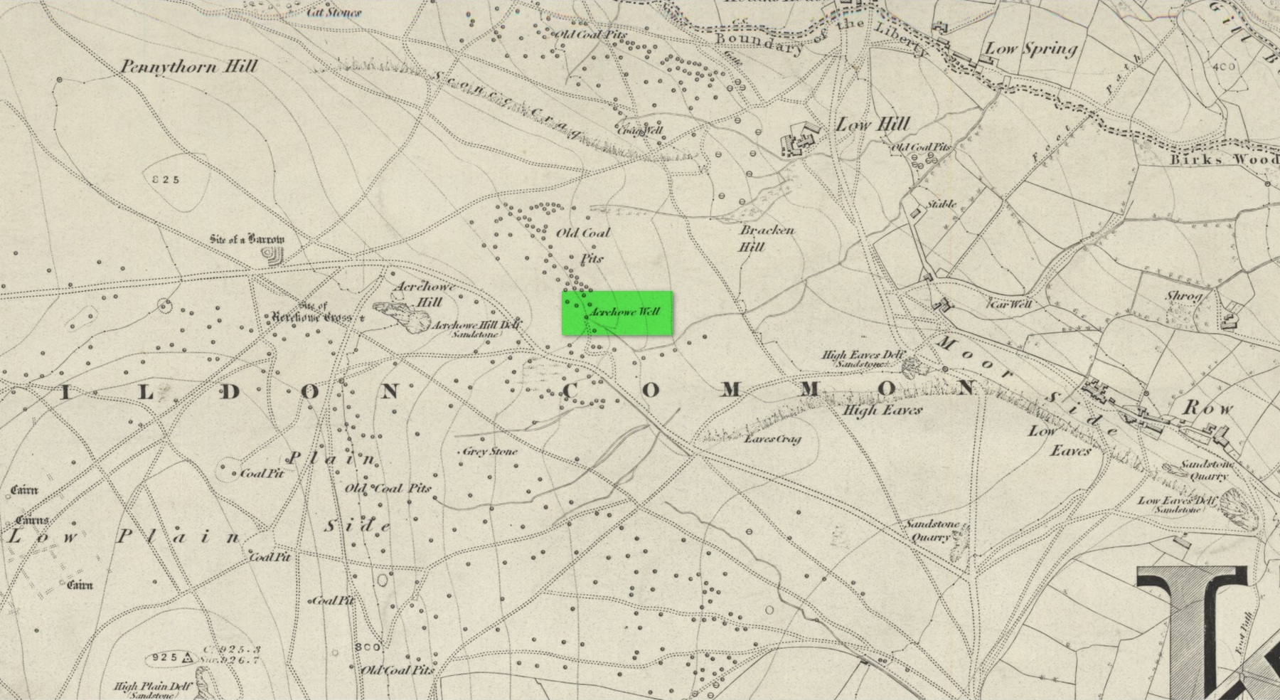
First illustrated on the 1852 Ordnance Survey map of the area and now only visible as a small marshy area, this once fast-flowing well gained its name from the old stone cross (very probably a standing stone before that) four hundred feet west of here, called Acrehowe Cross, now gone. It is possible that this ‘cross’ gave the well a local reputation as a holy well. A solitary path once led to the well, whose waters rise up through a coal seam giving the place its medicinal qualities, which have sadly been forgotten. Up and down this path towards Baildon village one would have regularly met a local character in the 19th century known as “Dinnis” (his real name was Joseph Halliday) who, along with his partner would take ‘kits’ (a large bucket with parallel sides) of water from the well into the village and sell it for a halfpenny each.
Site shown on 1852 map
Later in the 19th century, a cottage was built here (known as Acre Cottage) and gained its water supply from the well. This was curtailed with the construction of the Baildon Moor reservoirs by the roadside, which took the water from both here and the nearby Spink Well (over the hill on the far side of the golf course), leaving us with little more than the trickling water we see today, just a little further down from its original location.
References:
la Page, John, The Story of Baildon, William Byles: Bradford 1951.
Acknowledgements:Huge thanks for use of the Ordnance Survey map in this site profile, reproduced with the kind permission of the National Library of Scotland.
The exact location of this site seems privy to a select few and has remained that way since its existence appeared in print in the 19th century. It was first mentioned by Arthur Mitchell (1874) following a holiday that he’d had in the area in the early 1870s. He’d visited a petroglyph at Laggan with a Mr David Ross and when he returned home received a letter from him that told how,
“he had heard from Mr M’Bain of Auchterblair of two huge granite boulders, situated on a shelving rock over an abyss on the Loch Avon side of Cairngorm, with hand-made cups on them about a foot wide and correspondingly deep.”
They were subsequently visited by Thomas Wise (1884) a few years later, who told how these huge granite boulders were,
“20 feet in height,” upon which “there are four basins, 1 foot, or 1 foot and a-half long, and 6 inches wide at the top, rounding off to 1 inch in the bottom.”
Initially Mr Mitchell (1874) was cautious in associating these carved basins with cup-marked stones—and indeed, we concur with this—but seemed to have changed his opinion when he wrote about them a few years later (Mitchell 1881). But it’s the folklore attached to this site that intrigued him – and myself…
Folklore
The traditions attached to this site will be recognised by all students of animism and folklore. Arthur Mitchell (1874) was informed how the carved bowls in the stone helped infertile women and how “sitting on (them) is said to be efficacious in cases of barrenness.” Their importance was highlighted in the fact that there had been “pilgrimages to them undertaken within the memory of people still living.”
This was affirmed by Thomas Wise (1884) who told that,
“They are supposed to be efficacious in barrenness, and people still living remember pilgrims coming to sit upon them for some time, that they might obtain what they wished. A visit to them was by no means an easy task, as the ascent was difficult, and to sit on them required a steady head, as they are on the brink of a rock overhanging a precipice. These basins are the “woman’s stone” mentioned by Tennant. They are supposed to be the resting place or throne of a certain fairy queen; but however efficacious they may have been, they have lost much of their celebrity; and as the shepherd, who acted as guide to the pilgrims, is dead, and has left no successor, they are now rarely visited.”
Does anyone know the whereabouts of this heathen magickal site? If you happen to find it, see if you can get a good photo or two and let us know on our Facebook group.
Cup-Marked Stone (lost): OS Grid Reference – NN 4808 0140
Archaeology & History
On the south-side of Loch Ard, just a few yards from the entrance to Rob Roy’s Cave (one of several), right by the water’s edge are the natural upstanding pillars known locally as Gog and Magog. In Peter Joynson’s (1996) work on Aberfoyle, this site is listed as one in a number of unrecorded cup-and-ring stones in the area. Discovered by a local lady—”the late Mrs Maitland”—here we have,
“two huge stones about 30ft high known as Gog and Magog situated at the mouth of Blan Ross Bay. They have numerous cup marks, but sadly have disappeared from view as they have been covered by forestry planting.”
An increasingly annoying problem that many rock art students are having to contend with! When we visited the site, the tops of these huge stones were, indeed, covered in depths of mosses and pine needles and the carving is hidden from sight. When the trees are felled, let’s hope someone can find it!
Folklore
These natural rocks were said to have been two giants that were turned to stone, the story of which seems to have been forgotten…
References:
Joynson, Peter, Local Past, privately printed: Aberfoyle 1996.
This is an outstanding site visible for miles around in just about every direction – so getting here is easy! If you’re coming from Harrogate, south down the A658, turn right and go thru North Rigton. Ask a local. If you’re coming north up the A658 from the Leeds or Bradford area, do exactly the same! (either way, you’ll see the crags rising up from some distance away) As you walk to the main crags, instead of going to the huge central mass, you need to follow the line of walling down (south) to the extended cluster of much lower sloping rocks. Look around and you’ll find it!
Archaeology & History
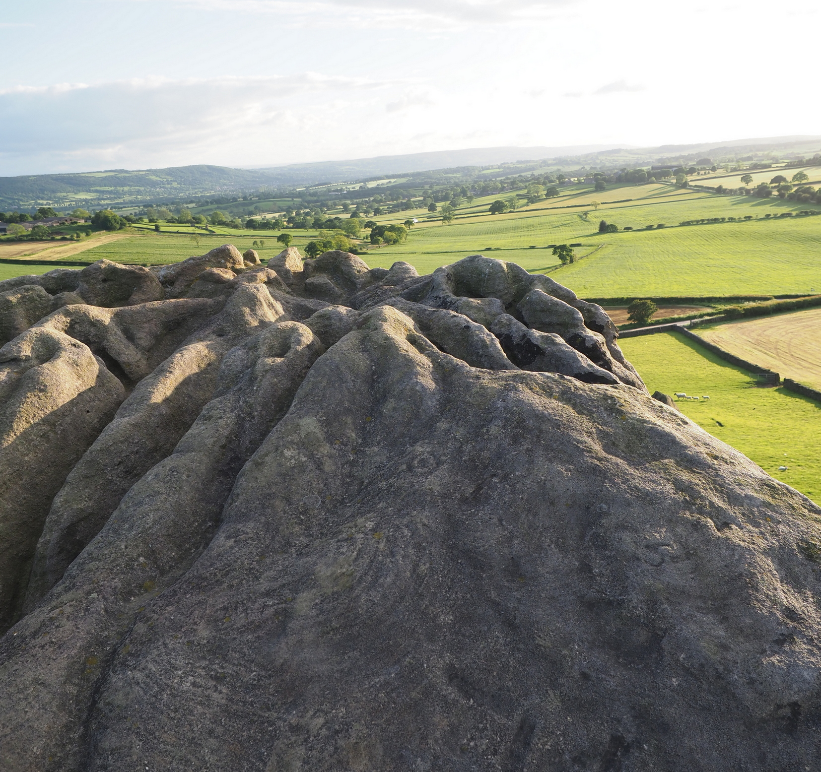
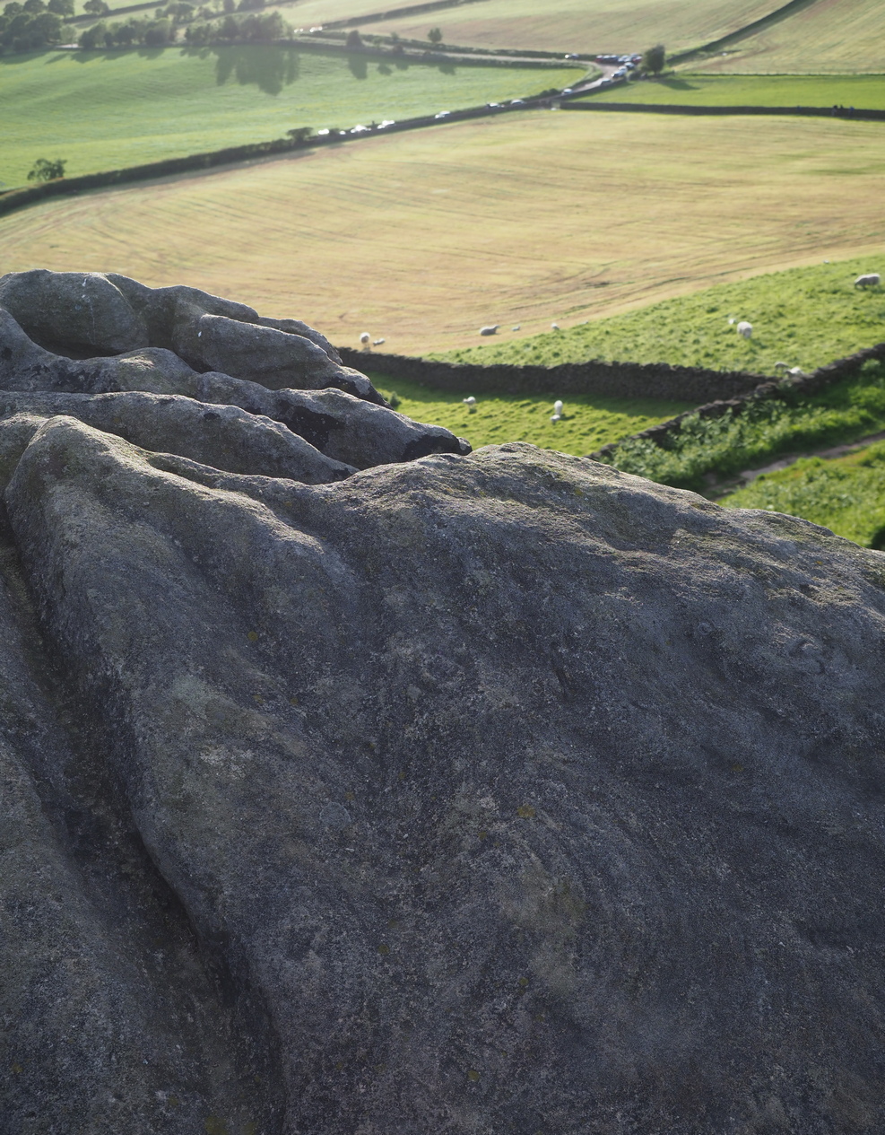
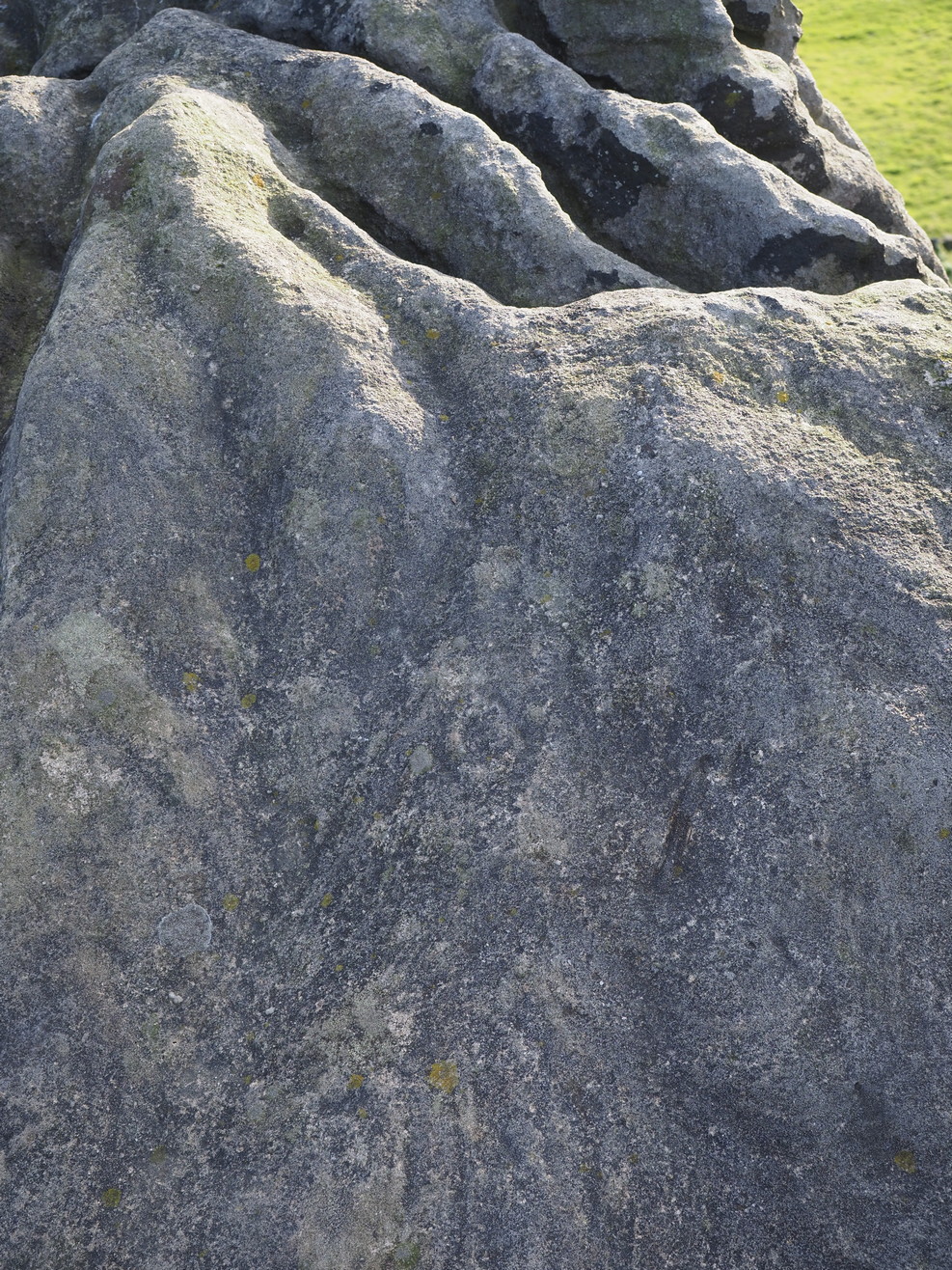
On the evening of May 27, 2024, I received a phone call from a Mr James Elkington of Otley. He was up Almscliffe Crags and the wind was howling away in the background, taking his words away half the time, breaking the sentences into piecemeal fragments. But through it all came a simple clarity: as the sun was setting and the low light cut across the rocky surface, a previously unrecorded cup-and-ring design emerged from the stone and was brought to the attention of he and his compatriot Mackenzie Erichs. All previous explorations for rock art here over the last 150 years had proved fruitless—until now!
Looking northwestCentral cup-&-ring
On the east-facing slope of the stone, just below the curvaceous wind-and-rain hewn shapes at the very top of the boulder, is a singular archetypal cup-and-ring. It’s faint, as the photos show, but it’s definitely there. What might be another cup-and-ring is visible slightly higher up the sloping face, but the site needs looking at again when lighting conditions are just right! (you can just about make it out in one of the photos) But, at long last, this giant legend-infested mass of Almscliffe has its prehistoric animistic fingerprint, bearing fruit and giving watch to the countless heathen activities going back centuries. Rombald’s wife Herself might have been the mythic artist of this very carving! (if you want to read about the many legends attached to the major Almscliffe rock outcrop, check out the main entry for Almscliffe Crags)
On the A81 road from Aberfoyle to Strathblane, about a mile south of Aberfoyle take the tiny right turn (keep your eyes peeled!) to Gartmore. Along the tiny curving road for exactly 1km (0.61 miles), where the road has straightened out there’s a small dirt-track with a parking spot along it. A few hundred yards along there’s a crossroads of dirt-tracks: walk to your left (SW) for nearly a mile (or exactly 1.5km) keeping your eyes peeled for a small distinct footpath leading down-slope on your left. Walk along this undulating path for just over 200 yards till you go through the gate, then walk immediately to your right down the side of the fence in the field for about 20 yards. Y’ can’t miss it!
Archaeology & History
Blarnaboard (3), NE-SW
Located on the land of the early bards of Gartmore, we could speculate that those early orators told tales of, and from this old stone—but that’s all it would be: dreamy speculation. Instead, passing that aside, the petroglyph itself brings us a feast to drool over!
Made up of four distinct carved sections of almost interconnecting rock, this flat thin line of stone is covered with an impressive array of cups and multiple rings. Running downhill in a northeast to southwest line, it would appear to have been written about for the first time by Lorna Main (1988) who subsequently described it in the usual archaeological shorthand, simply telling that,
“There are at last 28 cups, 3 cup and one ring, 4 cup and two rings, 2 cup and three rings, 1 cup and five rings and 1 cup and seven rings.”
Multiple ringed elementSection 1 overview
…But, as usual, there’s much more to be said of it than that. Of the four sections, we’ll start at the uppermost northeastern section and work down the sloping ridge, looking at the respective symbols as we go. Section 1 has the largest surface area, but isn’t the most decorated of the bunch. Nonetheless, what we find here is impressive. About a dozen single cup-marks of various ages are scattered over the surface in what initially seems to be no recognizable order; these are accompanied by two single cup-and-rings: one of which could be said to be of standard size and form, whilst the other has a much larger and broken ring, near the middle of the rock, about 12 inches across. This larger ring has two or three of the cup-marks incorporated into its outer edges. The most impressive element of Section 1 is the large multiple-ringed design, five in all, radiating outwards or funneling inwards (depending on what was intended) around a central cup. The outer ring of this is incomplete.
Impressive cup & 7 ringsScatter of cups & rings
Section 2 is the most visually impressive of all the Blarnaboard (3) carvings: almost an evolutionary development of what we see on the first part. A 2-dimensional panorama shows off a distinct cup-and-ring close to the edge of the soil, and there’s a somewhat wonky incomplete cup with double-ring below it. A very clear cup-mark to the right of this has another faint incomplete double-ring round it—but this is hard to see. The same cannot be said of the cup with seven concentric rings surrounding it! (the outer two of these are incomplete) As I walked round and round this section, drooling somewhat, it became obvious that a number of well-defined cup-marks had been carved around the outer edges of the rings, deliberately creating an eighth ring comprised purely of cup-marks. It gave me the impression of it representing heavenly bodies revolving around the central Pole Star; but also of it defining the movement of the Moon through the heavens during a calendar year. (the astronomy of my youth still comes through at times!)
Section 3 carvingFaint double cup-and-ring
By comparison, the third and smallest section of Blarnaboard (3) almost pales into insignificance, possessing a mere cup-and-double-ring—and a very faint one at that. From a certain angle it looked like it possessed a third ring, but this was probably more to do with me wanting to see more than there is! Just below this double-ring, a single cup has what might have once been another incomplete ring round it—but we’d need the computer graphic students among you to suss that bit out! You can’t make it out on the photos here, sadly…
Section 4 carvingFaint double-arc, lower cup
The fourth section is the most visually unimpressive of the entire cluster and was probably carved much later than the rest. The poor little fella has just five single cup-marks, with a sixth at the top-corner or northeastern part with what seems to be a small carved double-arc, or partial lozenge, that was started and never finished.
A couple of other exposed sections of stone running a few more yards further down the same line have no carvings on them—but there may well be more to this petroglyph hiding beneath the turf, which covers quite a large area. I have no doubt that other unrecorded carvings exist in close by, but due to excessive forestry plantations all around here, they’ll either be covered over or will have been destroyed. Don’t let this put you off looking for others though!
Cup-and-five-ringsCup-and-seven rings
An interesting feature of this long line of stone is its potential alignment. When we were photographing the site, a local man came over and got chatting with us. He knew of the carving and had been here many times and told us that his wife had looked at this one and found it aligned with another cup-and-ring on the south-side of Blarnaboard farm and another one (officially unrecorded) even further along. I checked this when I got home and found that this long line of petroglyphs did indeed line up with the Blarnaboard farm carving, perfectly. Whether this was intentional and/or possesses an astronomical function, we might never know. The third carving along the line has yet to be located. I must emphasize however, that the relationship between earthfast petroglyphs and alignments is very rare and, where found, is little more than fortuitous. But when we find cup-markings on alignments of standing stones and other prehistoric monuments, the relationship seems to be much more intentional and would have had a specific mythic function.
If y’ follow the fence-line from this carving down to the small burn, on the other side is the much less impressive Blarnaboard (2) cup-marked stone.
Folklore
Prior to Lorna Main’s (1988) short note on this petroglyph, local people had long known about the carving. As late as the 20th century, people with fevers were brought to this stone in the early morning to be cured of the illness. The idea was that medicinal herbs were collected and placed in some of the cup-marks, which were used like a mortar and pestle to prepare the plants. This healing magick, spoken of by some of the old folk in Aberfoyle, was known to them as children, who’d been told of this by their elders and, of course, by the elders before them.
There is also a tradition that some of the stone that makes up the curious moondial (not sundial) that can be seen at the back of the church in Gartmore village nearly a mile to the southeast, originally came from here.
References:
Main, L., “Blarnaboard (Aberfoyle parish), Cup and Ring Marked Outcrop,” in Discovery & Excavation Scotland, 1988.
Acknowledgements:Huge thanks for use of the Ordnance Survey map in this site profile, reproduced with the kind permission of the National Library of Scotland.
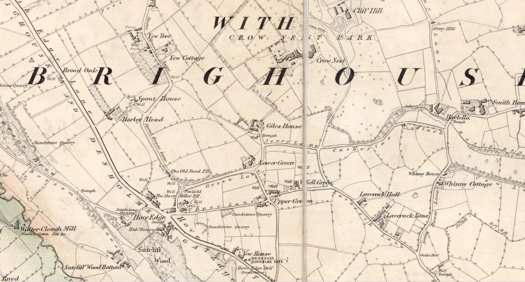
In times gone by there was a singular St.Giles’ Well in the old village of Lightcliffe, but the only reference we have of it is from one of James Parker’s works (1904) where, in his description of St. Giles’ House, he tells, “It derives its name from an ancient well, called ‘St. Giles’ Well,’ which once existed near to the house, and was dedicated to St. Giles”: an 8th century Greek prince who left everything to become a hermit. He lived on wild herbs and developed the ability to cure rheumatism (perhaps a curative aspect of the well), cripples and help beggars. He is the patron saint of woodlands and his symbol is the arrow gained after he healed a wounded doe shot by one (the mass of Robin Hood folklore in this area may have something to do with this symbolism). His date is September 1.
A.H. Smith (1963) cites the “local tradition that it is named from a well dedicated to St. Giles,” but thinks this attribution to be an unlikely one. As can be seen on the accompanying map, a great number of wells are in this area, none of them named, with one just below the said Giles House.
References:
Parker, James, Illustrated History from Hipperholme to Tong, Percy Lund: Bradford 1904.
Smith, A.H., The Place-Names of the West Riding of Yorkshire – volume 3, Cambridge University Press 1961.
Acknowledgements:Huge thanks for use of the Ordnance Survey map in this site profile, reproduced with the kind permission of the National Library of Scotland.
Standing Stone (destroyed): OS Grid Reference – NT 074 698
Archaeology & History
A few hundred yards west of the commemorative Wallace Stone monolith could once be seen a standing stone of considerable size. It was described by James Primrose (1898) in his description of the standing stones of the Strathbrock region; but even in his day, remains of it were fragmentary. He wrote:
“On Drumshoreland Moor, within the grounds of Pumpherston Oil Company, there is a stone, popularly styled Bucksides — its correct designation being Backsides — from its position at the backside of Pumpherston. This stone, a huge whinstone boulder about 12 feet long and 8 feet broad, was blasted in 1888, to make room for the site of a bench of retorts; a few fragments of the stone, however, yet remain by the roadside. The ancient name of this stone was Ballengeich — apparently the Gaelic for “the township towards the wind”, — as if a croft once stood here, near Pumpherston Mains, in an exposed and windy situation.”
A visit to the local history department of the local library might prove fruitful in giving us more information about this place—that’s assuming the filthy tory central government’s theft of taxpayer’s money doesn’t close it! (does that sound a bit harsh? )
Folklore
The same historian told of a “tradition…that round this stone in days gone by the Broxburn folks, along with their neighbours, used to assemble at Fair time, in the month of August, in order to witness their favourite sport of horse-racing; but whether there was any more ancient custom associated with it, we have never learned.”
References:
Primrose, James, Strathbrock; or, the History and Antiquities of the Parish of Uphall, Andrew Elliot: Edinburgh 1898.
You can take the same directions to get here is you follow the route for the Hawksworth Spring (01) carving, or take this alternative route. Take the standard road from Guiseley along Hawksworth Road. When you reach the first row of old houses in the village, a couple of hundred yards on you reach the village school and, shortly after the footpath is sign-posted. Walk left (downhill) through the field for half-a-mile until you reach the woods. 100 yards into the into the trees, walk to your right and follow the line of walling straight for 400 yards, then veering right up the slope and it then slowly bends round, keeping to the wallside all along. It then starts heading back downhill. As it does so, 10 yards from the wall into the woods you’ll see the broken triangular rock of the Hawksworth Spring (01) carving. Walk another 10 yards where the large holly bushes are and you’ll see the large sloping stone in front of you.
Archaeology & History
This carving is similar in nature to its companion 10 yards away, inasmuch as each of them possess two small arcs of cup-marks almost in the same format, very close together, one above the other near the top of the stone. It’s possible that the mythic nature/function of this particular element of arcs is the same on each stone—although fuck knows what it might be!
Clear line & faint line of arcsClear arc of cups
Below this double arc (only one of which is clearly visible in the photos) we see a scatter of other cup-marks—perhaps six, perhaps seven—one of which appears to have a very faint incomplete ring round it. When Liz Sykes and I visited the place, the light of day and the shadows across the rock didn’t help to convince us one way or the other, so we await news from other visitors who get better light conditions to tell us whether our hopeful eyes were deceiving us or not. There are a number of other marks on its surface, but these are much more recent and very obviously cut, or rather scratched, by metal artifacts with no bearing on the prehistoric design.
References:
Boughey, K.J.S. and Vickerman, E.A., Prehistoric Rock of the West Riding (Supplement), Shipley 2018.
Acknowledgements: Huge thanks to Liz Sykes for her renowned cleaning skills!


 )
)