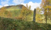
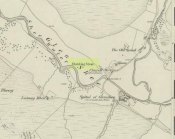
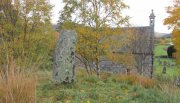
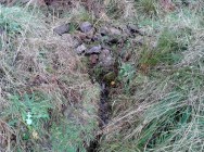
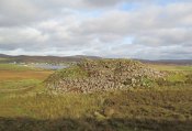
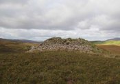
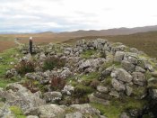
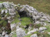
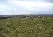
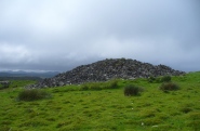
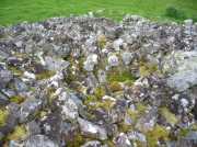
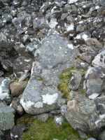
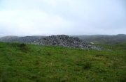
Giant’s Leap & Rock, Black Hill, Abernyte, Perthshire.

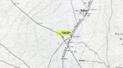
Legendary Rock: OS Reference – NO 21559 31659

Getting Here

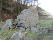
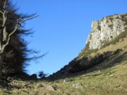
Giant’s Rock in ravine overlooked by the Leap

The Rock and Leap may be seen from the B953 Bandirran to Abernyte road.  Approach across the fields.

Archaeology & History

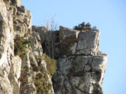
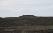
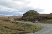
A large boulder perhaps 40 tons in weight lies in a ravine between Dunsinane and Black Hill. The ‘Leap’ is a flat topped ledge jutting out from the west side of Black Hill facing Dunsinane.

Folklore

Melville (1939) in his The Fair Land of Gowrie writes of the simple pleasures of the giant:

“From the farther side of the ravine [between Dunsinane and Black Hill], a precipitous rock juts out, which is called the “Giant’s Leap”. According to the lore of the Sidlaws, a giant, who once lived in these parts, leaped from this rock right on to the top of Dunsinane Hill.  The giant also amused himself by tossing about a huge boulder which can be seen lying at the bottom of the ravine.”

And adds:

The Big Fellow’s toy
Giant’s Leap from the north

“Fairies haunted the hills here and on summer nights they descended to the meadows, where they danced at a spot called “Fairygreen”. The Black Hill gets its name from the dark heath which covers it. Weird and bleak looking for most of the year, the lower slopes are brightened by glowing patches of purple flowers in late summer.”

Fairygreen Farm lies a mile almost due north of Dunsinane.

Reference:

  1. Melville, Lawrence, The Fair Land of Gowrie, William Culross & Son, Coupar Angus, 1939.

© Paul T Hornby 2020, The Northern Antiquarian


Tobar Bhride, Keppoch, Kilmonivaig, Inverness-shire

Sacred Well (lost):  OS Grid Reference – NN 27 81

Also Known as:

  1. St Bride’s Well

Archaeology & History

This long lost ‘holy well of St Brigit’ (Tobar Bhride) has been mentioned—purely in literary repetition—by such folklore giants as F.M. MacNeill and others, but none of them give any additional information about it than that first mentioned by Alexander Stewart’s (1890) in his fascinating article on magical stones.  Indeed, knowledge of this well’s very existence was only preserved thanks to a ritual incantation that was recited to imbue and maintain healing properties of one such magickal stone, known as the Charm Stone of Keppoch.  It

“was an oval of rock crystal, about the size of a small egg, fixed in a bird’s claw of silver, and with a silver chain attached, by which it was suspended when about to be dipped.”

It was dipped in water taken from the sacred well of St Brigit, somewhere not far from Keppoch.  The incantation made over the stone was in Gaelic, obviously, but the english translation is:

“Let me dip thee in the water,
Thou yellow, beautiful gem of Power!
In water of purest wave,
Which (saint) Bridget didn’t permit to be contaminated.
In the name of the Apostles twelve,
In the name of Mary, virgin of virtues,
And in the name of the high trinity
And all the shining angels,
A blessing on the gem,
A blessing on the water, and
A healing of bodily ailments to each suffering creature.”

On the east side of the river, just a few hundred yards away, could once be found the Fuaran na Ban-Tighearna, or the Well of Her Ladyship.  In this sense, the term ‘ladyship’ refers to the “wife of a baronet or knight.” (Dwelly 1918)  The idea that it may refer to Bride in Her guise as a ‘lady’ is linguistically improbable here (though not impossible).  Also, if this fuaran did have a geomythic relationship with Bride, we would expect to find a Cailleach in the nearby landscape, which we don’t.

Folklore

An interesting piece of folklore that may relate to this well is described by the great Scottish landscape wanderer, Seton Gordon. (1948)  Although he makes no mention of a Bride’s Well, there is the tale of a missing bride up Glen Roy, of which Keppoch sits below.  “It was in earlier times,” he wrote,

“that the Maid of Keppoch was taken by the fairies in Glen Roy.  She was an Irish girl, little more than a child, and had become the wife of MacDonell of Keppoch.  But the wedding rejoicings were scarcely over when the bride, wandering into the oak woods which still clothe the lower slopes of Glen Roy, disappeared mysteriously.  It was believed that, like the Rev Robert Kirk…she had been spirited away by the fairies.  If indeed she was abducted by the Little People they held her closely, for from that day to this no trace has been found of the fair Maid of Keppoch.”

St Bride of course was Irish, like the Maid of Keppoch.  And just a mile up Glen Roy from Keppoch House we find the Sron Dubh and Sithean, or Ridge of the Dark Fairy Folk.  There are several burns (streams) running either side and below this fairy haunt, but I can find none with Bride’s name.  Someone, somewhere, must know where it is…

References:

  1. Gordon, Seton, Highways and Byways in the Central Highlands, MacMillan: London 1948.
  2. Dwelly, Edward, The Illustrated Gaelic English Dictionary – volume 1, Fleet Hants 1918.
  3. Stewart, Alexander, “Notice of a Highland Charm-Stone,” in Proceedings Society Antiquaries, Scotland, volume 24, 1890.

© Paul BennettThe Northern Antiquarian


Breckon Howe, Sleights Moor, Sleights, North Yorkshire

Tumulus:  OS Grid Reference – NZ 85374 03406

Also Known as:

  1. Brakken Howe
Breckon Howe on 1853 map

Getting Here

Along the A169 road between Sleights and Pickering, some two miles south of Sleights at the highest point on the moors just above the west side of the road, you’ll see a large mound with what looks like a standing stone on top of it.  A minor road turns off the A169 at this point, heading southeast, and the large mound is 150 yards from the roadside. You can’t really miss it!

Archaeology & History

Shown on the first OS map of the area in 1853, this conspicuous prehistoric tomb surmounted by a relatively recent boundary stone, sits at the highest point on the moors in these parts.  Despite this (as with others on these moors), very little has been written about the place and it has received only minimal attention in archaeology tomes.  Even the renowned pen of Frank Elgee (1912; 1930) gave it only passing mention.  Perhaps it aint a bad thing to be honest.

Breckon Howe, from the south

As well as being conspicuous, it’s large.  Rising some six feet above the natural ground level, it measures 26 yards across its east-west axis, and 29 yards north-south, with a rough circumference of 88 yards.  The boundary stone that surmounts its crown sits in a hollow that looks like it was opened up a century or two ago by antiquarians (much like ourselves).  But its position of the tomb in the landscape that is most striking.  The view from here is considerable, having a clear 360º view for many miles around.  Other prehistoric tombs can be seen from here, but more importantly this tomb can be seen on the skyline from many others.  This was probably a deliberate feature intended by its builders–and it’s not uncommon, as many of our upland regions are crowned with ancient tombs like Breckon Howe.  In all likelihood this would have been the resting place of some important ancestral figure: a tribal elder or a shaman, whose spirit after death could view and travel across the landscape they inhabited in life.

Although the tomb presently sits amidst an endless sea of heather (Calluna vulgaris) typical of moorland across our northern lands, the name of the site ‘breckon’, according to George Young (1817) derives from the dialect word meaning ferns or bracken.  This is echoed in Francis Kildale’s (1855) local dialect study and subsequently in Joseph Wright’s (1898) unequalled magnum opus.

Folklore

In the early 19th century, one George Calvert who lived in the area, collected as much folklore as he could, as it was dying off with the coming of the Church.  One such piece told that there was once a hob who lived by this old tomb.  A hob is generally known as a supernatural creature, but in this area it can also be a medicine man.  Some hobs were good, others were malicious.  We know not what type of hob lived lived here, but Calvert simply told us there used to be “T’ Hob of Brackken Howe”.  Nowt more!  It would be good to find the story behind this old character, if it hasn’t been lost entirely…

References:

  1. Elgee, Frank, Early Man in Northeast Yorkshire, Frank Bellows: Gloucester 1930.
  2. Elgee, Frank, The Moorlands of North-Eastern Yorkshire, A. Brown: London 1912.
  3. Kildale, Francis, A Glossary of Yorkshire Words and Phrases Collected in Whitby and the Nieghbourhood, J.R. Smith: London 1855.
  4. Home, Gordon, The Evolution of an English Town, J.M. Dent: London 1905.
  5. Wright, Joseph, English Dialect Dictionary – volume 1, .Henry Frowde: London 1898.
  6. Young, George, A History of Whitby and Streoneshalh Abbey – volume 2, Clarke & Medd: Whitby 1817.

Acknowledgements:  A huge thanks to Lindsay Mitchell for getting us up to see this great tomb and its companion.

© Paul BennettThe Northern Antiquarian


Spittal of Glenshee, Kirkmichael, Perthshire

Standing Stone:  OS Grid Reference – NO 10865 70201

Also Known as:

  1. Canmore ID 29609

Getting Here

Spittal of Glenshee stone

Take to A93 road, north, between Blairgowrie and Braemar, keeping your eyes peeled many miles on, to turn left along the minor road as you approach the tiny Spittal of Glenshee hamlet. Just as you go over the ancient bridge, park up on your left, below the church.  Walk round the back of the church and you’ll see a large tree-covered mound.  Walk onto its top.

Archaeology & History

Stone marked on 1862 map

This quiet, almost hidden, six-foot tall standing stone on what initially seems to be a large fairy mound or tumulus at the back of the rude church, has been occluded from general view (in my opinion, deliberately) by the construction of the more debased christian edifice right in front of it.  But it detracts not from its gentle majesty once you reach its ancient body, atop of the old hill.

The stone is one in a cluster of prehistoric sites in and around this Glen of the Fairy Folk (as its name tells), where the rivers Shee and Beag converge.  If the church didn’t obstruct the view, some of the other sites would have been visible from here.

Folklore

The old stone, looking east

Folklore tells that when the christians came into the Glen to build a church—initially a half-mile or so to the east—the little people were much annoyed at the actions of the incomers, as it intruded on one of their sacred rings of stone close by.  By night they came out, and every stone that had been laid by the christians in the day was removed.  Each day the insensitive christians came and built their church without asking, and each night the little people removed it.  Eventually an agreement was made, and the fairies let them build the church next to this standing stone.  So goes the tale….

A veritable cluster of stories about Fingal, Ossian, Dermid and Grianne scatter this area, with many of them relating to ancient sites, but I’ve not found one directly relating to this stone.

References:

  1. Miller, T.D., Tales of a Highland Parish, Munro Press: Perth 1929.

© Paul BennettThe Northern Antiquarian


Pitcur Souterrain (3), Kettins, Perthshire

Souterrain:  OS Grid Reference – NO 2529 3738

Also Known as:

  1. Canmore ID 30539
  2. The Cave
  3. Pitcur II (Wainwright)

Getting Here

Pitcur souterrain entrance

From Coupar Angus, take the A923 road southeast for nearly 2½ miles where you reach the crossroads.  Keeping walking along the A923 for just over 300 yards, then where you come to the second field on your left, follow the line of fencing the slope until you reach an overgrown fenced section.  It’s in there!

Archaeology & History

This is a mightily impressive site, which I’ve been looking forward to experience for many an age.  And—despite Nature covering it in deep grasses—it was even better than any of us anticipated.  Souterrains are ten-a-penny in this part of Scotland, but this one’s a beauty!  Here, dug 6-8 feet into the ground are at least two long curvaceous passageways, linked by another stone-roofed passageway—with the longest central passage leading at one end into a completely covered stone hallway, whose end is blocked by a massive fall of earth.  Outside this entrance, laid on the ground, is what looks like a possible old stone ‘door’ that may have once blocked the entrance, now fallen into disuse.  It is too small to have been a roofing stone.  In the walling just outside the entrance, on your left, you will see a faint cup-marked stone (Pitcur 3:5) and a larger cup-and-ring stone (Pitcur 3:6), both just above ground-level.
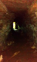
Inside looking out (photo by Frank Mercer)

Outside looking in (photo by Frank Mercer)

The site is evocative on so many levels: not least because we still don’t know what the hell it was used for.  The over-used idea that souterrains were cattle-pens makes no sense whatsoever here; the idea that they were food storage sites is, I suppose, a possibility; that they were possible shelters for people during inter-tribal raids is another; and equally as probable is that the deep dark enclosed construction was used by shamans, or neophytes enclosed for their rites of passage.  Iron Age archaeology specialist Ian Armit (1998) thought there may well be some as yet undiscovered “timber roundhouse” associated with this souterrain, awaiting excavation.  He may be right.  When we came here the other week we found previously unrecorded cup-and-ring carvings, at a site already renowned for decent petroglyphs.  A post-winter visit will hopefully bring us more finds.

The general history of this strange site is captured in Wainwright’s (1963) survey of souterrains, in which he wrote:

“Pitcur II was discovered in 1878 when a large stone, hit by a plough, was removed to reveal an underground passage.  Mr John Granger, tenant of Pitcur farm, excavated the souterrain himself, and twenty-two years later his son, Mr A. Granger Heiton, said that the only objects found by members of his family were ‘a small red clay bowl of Samian ware in pieces’ and ‘a Roman coin.’  The latter, according to David MacRitchie, ‘has been lost sight of’.  Mr Granger Heiton also told McRitchie that ‘one or two other coins were reported as having been found’, but were not seen by his father.

“As an excavation, Mr Granger’s effort seems to have been unsatisfactory by any standards, and it was followed by a ‘supplementary excavation’ conducted by Mr R. Stewart Menzies.  This was more successful as a relic-hunting operation, if not as an archaeological excavation, for between one hundred and two hundred finds are reported, including ‘a bronze pin’ and ‘a quantity of stones, beads, etc.’  But these too ‘seem to have been mislaid.’
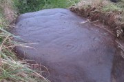
Newly-found Pitcur 3:2 carving

Curiously Mr Wainwright made little mention of the impressive petroglyphs within this complex, save to say that “they were too heavy to be removed and ‘mislaid’.”  There are at least seven of them at Pitcur-3: four complex cup-and-ring designs and three basic cup-marked stones (described individually in separate site-profiles).  They have all been incorporated into the walls and roofing stones. At least one of these is so eroded (Pitcur 3:2) that there is little doubt it was re-used from a now-lost neolithic structure; the rest may have been from Bronze Age sites (also lost) and their respective lack of erosion shows they have been inside this Iron Age structure, away from Nature’s wind and weathering effects. It is likely that the re-use of these carvings in Pitcur-3 was of significance to the builders; although we cannot be sure as to what their function may have been within the souterrain.  It’s quite possible that some form of ‘continuity of tradition’ as posited by David MacRitchie (1890) was in evidence, over that huge time scale from the neolithic into the Iron Age, relating specifically to the animistic plinth implicit in all early agrarian cultures.

But the first real overview of the site was written at the end of the 19th century by David MacRitchie (1900), over twenty years after its rediscovery in 1878.  His account was a good one too:

“The Pitcur house consists of one long subterranean gallery, slightly curved throughout most of its length, and bending abruptly in a hook shape at its western end. From this western end a short broad gallery or room goes off, curving round the outside of the ‘hook.’ The length of the main gallery, following the medial line, and measuring from the extreme of the entrance at either end, is almost 190 feet; while the subsidiary room is 60 feet long. For most of its length, this subsidiary room is 10 feet wide, measuring at the floor level. On account of this unusual width, it is reasonable to suppose that its roof was of timber; for although the walls slightly converge at the top, reducing the intervening space to 8 or 9 feet, the span is still so great that a flagged roof would scarcely have been practicable. To be sure, the walls might have been raised several courses higher, in the usual ‘ Cyclopean arch,’ and thus the interval to be bridged would become sufficiently narrowed at a height of say 12 feet. But there is no indication that the walls of any portion of this earth-house ever rose higher than the present level of their highest parts. Thus the inference is that this subsidiary room may have been roofed with timber.”

Modern groundplan (after RCAHMS, 1994)

MacRitchie’s 1900 groundplan

It may, but we have no remaining evidence to tell us for sure. MacRitchie cited possible evidences from elsewhere to add weight to this thought, but had the humility to leave the idea open, telling simply how “no vestige of a roof is visible at the present day, and the whole of this side room is open to the sky,” as with the majority of this entire souterrain.  In my opinion, more of it would have been roofed in stone slabs, but these would seem to have been robbed.  Certainly a well-preserved cup-marked stone (Pitcur 3:3) laying up against one of the walls appears to have slid from its topmost covering position into where it now rests in the passageway (near ‘b‘ in MacRitchie’s plan).

Continuing with Mr MacRitchie’s account, he (like most of us) found the underground section most impressive, telling:

“This covered section is unquestionably the most interesting and instructive of the whole building; for, as already stated, the other parts are more or less ruined and roofless. A few remaining flags lying in the unroofed part of the main gallery show, however, that it once possessed the usual stone roof throughout its entire length. This was rendered possible by the comparative narrowness of the main gallery, the width of which on the floor averages about 6 feet. The greater breadth of the subsidiary gallery will be realised by glancing at the cross section, a-b in the plan.

“The Pitcur earth-house had at least three separate entrances, namely, at the points hi, and j.  The subsidiary room appears also to have had an independent connection with the, outside world, at the point g, and perhaps also f, though the latter may only mark a fireplace or air-hole, for the condition of the ruin makes it difficult for one to speak with certainty. The entrance at i, which slopes rapidly downward, is roofed all the way to d; and consequently this short passage remains in its original state.

“Within the covered portion, and quite near its entrance, a well-built recess (e in the plan) seems clearly to have been used as a fireplace, although the orifice which presumably once connected it with the upper air is now covered over.  Another and a smaller recess in the covered portion (k in the plan) can hardly have been a fireplace, and it is difficult to know what it was used as.

“One other point of interest is the presence of two cup-marked stones (p and q on the plan). Of these, the former is lying isolated on the surface of the ground near the entrance i, while the latter forms one of the wall stones beside the doorway c.”
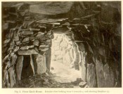
‘Fireplace’ near the entrance

The internal ‘cave’ section has that typical damp smell and feel to it, beloved of underground explorers.  As we can see in MacRitchie’s old photo of the site, the seeming ‘fireplace’ that he mentions is very obvious. Frank Mercer posited the same idea about this underground alcove when he first saw it, and it makes a lot of sense.  On the left-upright stone in the photo (right) you can just make out a single cup-marking (Pitcur 3:7) which we found when we visited; another one may be on the inside edge of the same fireplace.  If you climb up on top of the souterrain close to where the opening of the fireplace would have been, you’ll see the impressive Pitcur 3:5 petroglyph; whilst the Pitcur 3:1 carving is difficult to see (though Mr Mercer noticed it), just above ground-level, beneath the covering stone ‘m‘ in MacRitchie’s plan.  All in all, a bloody impressive place!

Folklore

In earlier centuries the site was known locally as The Cave, yet considering how impressive it is, folklore and oral tradition seem sparse.  Even David MacRitchie (1897) struggled to find anything here.  But in one short article he wrote for The Reliquary, he thought that stories of little-people may have related to Pitcur-3:

“A tradition which a family of that neighbourhood has preserved for the past two centuries, has, in the opinion of the present writer, a distinct bearing upon the “cave” and its builders.

“This is that, a long time ago, a community of “clever” little people, known as “the merry elfins,” inhabited a “tounie,” or village, close to the place. The present inheritors of the tradition assume that they lived above ground and do not connect them at all with this “cave,” of whose existence they were unaware until a comparatively recent date. But, in view of a mass of folk-lore ascribing to such “little people” an underground life, the presumption is that the “tounie” was nothing else than the “cave”. This theme cannot be enlarged upon here; but a study of the traditions relating to the inhabitants of those subterranean houses will make the identification clearer.

“It may be added that the term “Picts’ house” applied to the Pitcur souterrain, is in agreement with the inherited belief, so widespread in Scotland, that the Picts were a people of immense bodily strength, although of small stature.”

References:

  1. Armit, Ian, Scotland’s Hidden History, Tempus: Stroud 1998.
  2. Barclay, Gordon, “Newmill and the ‘Souterrains of Southern Pictland’”, in Proceedings Society of Antiquaries, Scotland, volume 110, 1980.
  3. Mackenna, F.S., “Recovery of an Earth House”, in The Kist, volume 4, 1972.
  4. Mackie, Euan, Scotland: An Archaeologial Guide, Faber: London 1975.
  5. MacRitchie, David, The Testimony of Tradition, Kegan Paul: London 1890.
  6. MacRitchie, David, “Pitcur and its Merry Elfins,” in The Reliquary, 1897.
  7. MacRitchie, David, “Description of an Earth-house at Pitcur, Forfarshire,” inProceedings Society of Antiquaries, Scotland, volume 34, 1900.
  8. Neighbour, T., “Pitcur Souterrain (Kettins parish)”, in Discovery & Excavation Scotland, 1995.
  9. Royal Commission on the Ancient & Historical Monuments of Scotland, South-East Perth: An Archaeological Landscape, HMSO: Edinburgh 1994.
  10. Wainwright, F T., The Souterrains of Southern Pictland, RKP: London 1963.
  11. Warden, Alex J., Angus or Forfarshire: The Land and People – Descriptive and Historical – 5 volumes, Charles Alexander: Dundee 1880-1885.
  12. Young, Alison, “Cup-and ring Markings on Craig Ruenshin, with some Comparative Notes“, in Proceedings Society of Antiquaries, Scotland, volume 72, 1938.

Acknowledgements:  This site profile would not have been made possible were it not for the huge help of Nina Harris, Frank Mercer & Paul Hornby.  Huge thanks to you all, both for the excursion and use of your photos in this site profile. 🙂

© Paul BennettThe Northern Antiquarian


Fairy Well, Logie, Stirlingshire

Sacred Well:  OS Grid Reference – NS 8135 9804

Also Known as:

  1. Canmore ID 47123
  2. Hielantman’s Well
  3. Highlandman’s Well
  4. Holy Well

Getting Here

Fairy Well, emerging from wall

Fairy Well, emerging from wall

From Stirling, take the A9 to Bridge of Allan, turning right at the roundabout along the A907 for less than a mile, then turning left at the next roundabout up the A91.  A half-mile down, at the small roundabout, bear left and first right, up to Logie Church.  Keep going all the way up this steep winding road, turning right at the junction.  Go along here for a quarter of a mile and park up at the roadside.  Walk along a bit further where the road has a bittova sharp bend.  The sound of the stream coming out of the small glen is obvious.  Walk past this and, on the right-hand side of the road, past the stream, you’ll find a water source emerging from the boscage of an overgrown wall.  Keep looking.  It’s damn close!

Archaeology & History

In the 1792 Statistical Account of this northeastern edge of Stirling, moving into the ancient parish of Logie, we were given an early brief account of this all-but-forgotten sacred water source which, thankfully, still runs fine water to this day.  It was described in tandem with the ancient Hill of the Picts called Dunmyatt, more than a mile to the east; but,

“About half-a-mile from the foot of this hill…is a very fine well, which issues from more than sixty springs, that rise through the sand and channel.  It is called the Holy Well, and is said to have been much resorted to by the Roman Catholics.”

Close-up of the running waters

Close-up of the running waters

In R.M. Menzies (1905) magnum opus on the parish of Logie, he told that it “was popularly known as ‘the Heilantman’s Well’, a possible reminiscence of the ’15 where the battle of Sheriffmuir was fought nearby.”  This tradition is echoed by several local historians; though Angus Watson (1995) wonders whether it’s ‘Highlandman’s Well’ name (and its variants) is “perhaps more likely to the use of the well by Highland drovers.”  It’s in the perfect spot too!

When the Royal Commission (1963) lads visited the place in 1952, they described the well to have “been filled up.”  Thankfully today, the old well emerges out of the overgrown remains of an old wall, the waters of which still run fast and free and into the larger stream ahead of it.  The waters are fine and clear, and tasted cold and refreshing when I drank some a few days ago.  It’s an excellent spot to quench the thirst after a day out in the Ochils.

Folklore

Of the various titles given to this old water source, the more popular choice in recent years has been to call it the Highlandman’s Well.  However, local lore had always known it to be a place where the little people had acquaintance and it seems more vital to maintain its old folk-name.  In R.M. Menzies (1912) rare work on the folklore of the region, he told us the story behind the name:

“Once upon a time, when people took life more leisurely, and when the wee folk frequented the glens and hills of Scotland, there was one little fairy whose duty it was to look after certain wells renowned for their curative properties.  This fairy was called Blue Jacket, and his favourite haunt was the Fairy Well on the Sheriffmuir Road, where the water was so pure and cool that nobody could pass along without taking a drink of the magic spring.  A draught of this water would have such a refreshing effect that the drinker could go on his journey without feeling either thirsty or hungry.  Many travellers who had refreshed themselves at the Fairy Well would bless the good little man who kept guard over its purity, and proceed upon their way dreaming of pleasant things all the day long.

“One warm day in June, a Highland drover from the Braes of Rannoch came along with a drove of Highland cattle, which he was taking to Falkirk Tryst, and feeling tired and thirsty he stopped at the Fairy Well, took a good drink of its limpid water, and sat down beside it to rest, while his cattle browsed nearby.  The heat was very overpowering, and he fell into a dreamy sleep.

“As he lay enjoying his noonday siesta, Blue Jacket stepped out from among the brackens and approaching the wearied drover, asked him whence he came.  The drover said:

“‘I come from the Highland hills beside the Moor of Rannoch; but I have never seen such a wee man as you before.  Wha’ may you be?’

“‘Oh,’ said the fairy, ‘I am Blue Jacket, one of the wee folk!’

“‘Ay, ay man, ye have got a blue jacket, right enough; but I’ve never met ony o’ your kind before. Do ye bide here?’

“‘Sometimes; but I am the guardian of the spring from which you have just been drinking.’

“‘Weel, a’ I can say is that it is grand water; there is no’ the likes o’t frae this to Rannoch.’

“‘What’s your name?’ asked the fairy.

“‘They ca’ me Sandy Sinclair, the Piper o’ Rannoch,’ was the reply.

“‘Have you got your pipes?’ asked Blue Jacket.

“‘Aye, my mannie, here they are.  Wad ye like a tune?  Ye see there’s no’ a piper like me in a’ Perthshire.’

“‘Play away then,’ said Blue Jacket.

“Sandy Sinclair took up his pipes and, blowing up the bag, played a merry Highland reel.  When he finished, he was greatly surprised to see above the well a crowd of little folk, like Blue Jacket, dancing to the music he had been playing.  As he stopped they clapped their little hands and exclaimed, ‘Well done Sandy! You’re the piper we need.’

“Thereupon Blue Jacket blew a silver whistle, which he took from his belt, and all the wee folk formed themselves into a double row.  Blue Jacket then took the Highland piper by the hand, led him to the front of the procession, and told him to play a march.  Sandy felt himself unable to resist the command of the fairy, and, putting the chanter into his mouth, blew his hardest and played his best, marching at the head of the long line of little people, who tripped along, keeping time to the strains of the bagpipes.  Blue Jacket walked in front of the piper, leading the way in the direction of the Fairy Knowe.

“Sandy Sinclair never marched so proudly as he did that day, and the road, though fairly long, seemed to be no distance at all; the music of the pibroch fired his blood and made him feel as if he was leading his clansmen to battle.   When the Fairy Knowe was reached, the wee folk formed themselves into a circle round the little hill, and sang a song the sweetest that ever fell upon the ears of the Highlandman.  Blue Jacket once more took his whistle and, blowing three times upon it, held up his hand, and immediately the side of the knoll opened.  Bidding the piper to play on, Blue Jacket led the procession into the interior; and when all were inside, the fairies formed themselves into sets, and the piper playing a strathspey, they began dancing with might and main.

“One dance succeeded another, and still Sandy played on, the wee folk tripping it as merrily as ever.  All thoughts of Sandy’s drove had gone quite out of his head, and all he thought of now was how best to keep the fairies dancing: he had never seen such nimble dancers, and every motion was so graceful and becoming as made him play his very best to keep the fun going.  Sandy Sinclair was in Fairyland, and every other consideration was forgotten.

“Meanwhile his cattle and sheep were following their own sweet will, the only guardian left to take care of them being his collie dog.  This faithful animal kept watch as well as he could, and wondered what had become of his master.  Towards evening another drover came along with his cattle for the same tryst.  He knew the dog at once, and began to pet the animal, saying at the same time, ‘Where’s your master, Oscar? What’s become o’ Sandy?’

“All the dog would do was to wag his bushy tail, and look up with a pleading air, as if to say, ‘I don’t know; will you not find him?’

“‘My puir wee doggie, I wonder what’s come over Sandy?  It’s no like him to leave his cattle stravaiging by the roadside.  Ay ay man; and at the Fairy Well too!  Indeed, this looks unco bad.’

“The newcomer, who was also a Highlander, made up his mind to spend the night with his own drove and that of Sandy Sinclair, thinking that the missing man would turn up in the morning.  But when the morning came there was no sign of Sandy.

“Taking Sandy’s collie and leaving his own dog in charge of the combined droves, he said, ‘Find master, Oscar!’  The wise beast sniffed around for a little and then trotted off in the direction taken the day before by Sandy Sinclair and the fairies.  By and by they reached the Fairy Knowe; but there was nobody there as far as the drover could see.  The dog ran round and round the knoll, barking vigorously all the time, and looking up into the face of the drover as if to say, ‘This is where he is; this is where he is.’  The drover examined every bit of the Fairy Knowe, but there was no trace of Sandy Sinclair.  As the drover sat upon the top of the Fairy Knowe, wondering what he should do next, he seemed to hear the sound of distant music.  Telling the faithful dog to keep quiet, he listened attentively, and by-and-by made out the sound of the pibroch; but whether it was at a long distance or not, he could not be certain.  In the meantime, the dog began to scrape at the side of the mound and whimper in a plaintive manner.  Noticing this, the drover put his ear to the ground and listened.  There could be no mistake this time: the music of the pibroch came from the centre of the Fairy Knowe.

“‘Bless my soul!’ exclaimed Sandy’s friend. ‘He’s been enticed by the fairies to pipe at their dances.  We’ll ne’er see Sandy Sinclair again.’

“It was as true as he said.  The Piper of Rannoch never returned to the friends he knew, and the lads and lasses had to get another piper to play their dance music when they wished to spend a happy evening by the shore of the loch.  Long, long afterwards, the passers-by often heard the sound of pipe music, muffled and far away, coming from the Fairy Knowe; but the hidden piper was never seen.  When long absent friends returned to Rannoch and enquired about Sandy Sinclair, they were told that he had gone to be piper to the wee folk and had never come home again.”

The Fairy Knowe is the large prehistoric burial mound, neolithic in origin, found 1.08 miles (1.74km) west of the Fairy Well, above Bridge of Allan—and an absolute must to visit for any lovers of fairy lore!

References:

  1. Fergusson, R. Menzies, Logie: A Parish History – volume 1, Alexander Gardner: Paisley 1905.
  2. Fergusson, R. Menzies, The Ochil Fairy Tales, David Nutt: London 1912.
  3. Royal Commission on the Ancient & Historical Monuments Scotland, Stirling – volume 2, HMSO: Edinburgh 1963.
  4. Watson, Angus, The Ochils – Placenames, History, Tradition, Perth & Kinross District Libraries 1995.

© Paul BennettThe Northern Antiquarian


Wells o’ Wearie, Duddingston, Edinburgh, Midlothian

Sacred Wells (destroyed):  OS Grid Reference – NT 2741 7241

Also Known as:

  1. Wells o’ Weary
  2. Well of Wery

Archaeology & History

The precise spot for these “wells” is difficult to say today with any certainty, which is unfortunate as it was a renowned spot for a variety of reasons.  The wells were apparently disrupted and fell back into the Earth when the Industrialists dug their train-line into the south-side of Arthur’s Seat.  On the early maps, we can see several ‘troughs’, ‘pumps’ and ‘wells’—one or more of which are said to be the site (and which we base the OS grid-reference on, above).

Site on 1821 Kirkwood map
Wells o’ Wearie ponds

The Wells of Wearie were one of nearly a dozen sacred and healing wells surrounding legendary Arthur’s Seat at the edge of Edinburgh, and whose waters were also said to have supernatural properties.  Shown on James Kirkwood’s 1821 map of Edinburgh (left) as the ‘Well of Wery’, this curiously named site was renowned in earlier centuries as an excellent water supply for the local people — “to cure the weary traveller” for one.  Today, all we have left of them are the small ponds immediately below the road, next to the converted railway line path, just as you come out of the long tunnel.

Folklore

In Henderson & Cowan’s (2007) fine work on Scottish fairy lore, they outline the witchcraft trial of a local woman, Janet Boyman, who was said to have performed ritual magick at the Wells of Wearie.  They told:

“Jonet Boyman of Canongate, Edinburgh, accused in 1572 of witchcraft and diabolic incantation, the first Scottish trial for which a detailed indictment has so far been found. Indeed, it is one of the richest accounts hitherto uncovered for both fairy belief and charming, suggesting an intriguing tradition which associated, in some way, the fairies with the legendary King Arthur.  At an ‘elrich well’ on the south side of Arthur’s Seat, Jonet uttered incantations and invocations of the ‘evill spreits quhome she callit upon for to come to show and declair’ what would happen to a sick man named Allan Anderson, her patient.  She allegedly first conjured ‘ane grit blast’ like a whirlwind, and thereafter appeared the shape of a man who stood on the other side of the well, and interesting hint of liminality.  She charged this conjured presence, in the name of the father, the son, King Arthur and Queen Elspeth, to cure Anderson.  She then received elaborate instructions about washing the ill man’s shirt, which were communicated to Allan’s wife.  That night the patient’s house shook in the midst of a huge and incomprehensible ruckus involving winds, horses and hammering, apparently because the man’s wife did not follow the instructions to the letter.  On the following night the house was plagued by a mighty din again, caused, this time, by a great company of women.’”

The Wells were, in earlier centuries, a site where lovers and wanderers came to relax and dream. It was a traditional gathering spot — not just for witches! — and poetry was written of them – including this by A.A. Ritchie:

“The Wells o’ Wearie — 

Sweetly shines the sun on auld Edinbro’ toun.
And mak’s her look young and cheerie;
Yet I maun awa’ to spend the afternoon
At the lanesome Wells o’ Wearie.

And you maun gang wi’ me, my winsome Mary Grieve,
There’s nought in the world to fear ye;
For I hae ask’d your minnie, and she has gien ye leave
To gang to the Wells o’ Wearie.

O the sun w-inna blink in thy bonny blue een.
Nor tinge the white brow o’ my dearie.
For I’ll shade a bower wi’ rashes lang and green,
By the lanesome Wells o’ Wearie.

But Mary, my love, beware ye dinna glower
At your form in the water sae clearly,
Or the fairy will change ye into a wee wee flower,
And you’ll grow by the Wells o’ Wearie.

Yestreen, as I wander’d there a’ alane,
I felt unco douf and drearie,
For wanting my Mary a’ around me was but pain
At the lanesome Wells o’ Wearie.

Let fortune or fame their minions deceive,
Let fate look gruesome and eerie ;
True glory and wealth are mine wi’ Mary Grieve,
When we meet by the Wells o’ Wearie.

Then gang wi’ me, my bonny Mary Grieve,
Nae danger will daur to come near ye.
For I hae ask’d your minnie, and she has gien ye leave
To gang to the Wells o’ Wearie.”

References:

  1. Baird, William, Annals of Duddingston and Portobello, Andrew Elliot: Edinburgh 1898.
  2. Bennett, Paul, Ancient and Holy Wells of Edinburgh, TNA: Alva 2017.
  3. Carrick, John D. (ed.), Whistle-Binkie, or the Piper of the Party – volume 2, David Robertson: Glasgow 1878.
  4. Colston, James, The Edinburgh and District Water Supply, Edinburgh 1890.
  5. Henderson, Lizanne & Cowan, Edward J., Scottish Fairy Belief: A History, John Donald: Edinburgh 2007.
  6. Ramsay, Alexander, On the Water Supply of Edinburgh, Neill & Co.: Edinburgh 1853.

© Paul BennettThe Northern Antiquarian


Dun Osdale, Dunvegan, Skye

Broch:  OS Grid Reference – NG 24162 46424

Also Known as:

  1. Canmore ID 10832

Getting Here

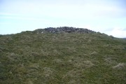
Dun Osdale, by the roadside

From the A863 Dunvegan road, a mile south of the village turn onto the B884 road at Lonmore, making sure you veer right after a few hundred yards and head towards Glendale.  About a mile along, on the left-hand side of the road, note the small rocky crag that begins to grow just above the roadside.  At the end of this crag you’ll see a huge pile of rocks, seemingly tumbling down, just by a small T-junction to Uiginish.  You can’t really miss it.

Archaeology & History

Listed as one of the duns, or fortified prehistoric structures in Skye by the old writer J.A. MacCulloch (1905), the rediscovery of this broch was, said A.A. MacGregor (1930), one that “became historical only within living memory.”  I find that hard to believe!  The Gaelic speakers hereby merely kept their tongues still when asked, as was common in days of olde—and it was a faerie abode….

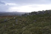
Looking at the SW walling

Looking at the SE walls

Once you go through the gate below the broch, the large boggy area you have to circumnavigate is the overflow from an ancient well, known as Tobar na Maor, where Anne Ross said, “tradition that the stewards of three adjacent properties met there.”  This well was covered by an ancient Pictish stone (now in Dunvegan Castle), which may originally have been associated with the broch just above it.  When I visited the site with Aisha and Her clan, we passed the overgrown well and walked straight up to the broch.

Despite being ruinous it is still most impressive.  The massive walling on its southwestern side is still intact in places; but you don’t get a real impression of the work that went into building these structures until you’re on top.  The walls themselves are so thick and well-built that you puzzle over the energy required to build so massive a monument.  And Scotland has masses of them!

Aisha in the broch

Small internal chamber

The site was surveyed briefly when the Ordnance Survey lads came here in 1877, subsequently highlighting it on the first OS-map of the area.  But it didn’t receive any archaeocentric assessment until the Royal Commission (1928) lads explored the area some fifty years later.  In their outstanding Inventory of the region they described Dun Osdale in considerable detail, although kept their description purely architectural in nature, betraying any real sense of meaning and history which local folk must have told them.  They wrote:

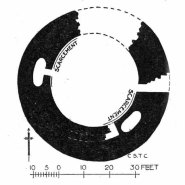
“The outer face of the wall of the broch for a great part is reduced to the lower courses, but on the west-southwest a section still maintains a height of about 7 feet; on the south-side, although hidden by fallen stones, it is about 4 to 5 feet high, and on the northeast there is a very short section 3 feet in height.  The stones are of considerable size and laid in regular courses.  In the interior a mass of tumbled stone obscures the most of the inner face of the wall, but on the south and northwest it stands about 8 feet above the debris.  The broch is circular with an internal diameter of 35 feet to 35 feet 6 inches, and the wall thickens from 10 feet on the north to 13 feet 7 inches on the south. The entrance, which is one the east, is badly broken down, but near the inside has a width of 3 feet 2 inches, and appears to have been 2 feet 10 inches on the outside; it has run straight through the wall without checks.  In the thickness of the wall to the south of the entrance is an oval chamber measuring 10 feet long by 4 feet 9 inches broad above the debris with which it is half-filled.  The roof has fallen in, but the internal corbelling of the walls is well displayed.  The fallen stones no doubt still cover the entrance, which has probably been from the interior.  Within the western arc of the wall, nearly opposite the main doorway, is another oval cell 12 feet in length and 4 feet 6 inches in breadth over debris, with a doorway 2 feet 9 inches wide; its outer and inner walls are 5 feet 9 inches, and 2 feet 6 inches respectively.  The roof od this chamber has also collapsed, but from the masonry which remains in position it must have been over 6 feet in height.  Immediately to the west of the cell near the entrance are exposed the left jamb of a door and a short length of a gallery 3 feet 6 inches wide in the thickness of the southern wall, which probably contained the stairs, as traces of a gallery at a higher level than the oval chambers are seen here, the inner wall being about 3 feet and the outer 8 feet thick. Parts of a scarcement 9 inches wide can be detected on the northwestern and southeastern arcs.”

Dun Osdale plan (RCAHMS 1928)

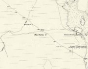
Dun Osdale on 1881 map

Measurements and architectural tedium aside, the broch is worthwhile for anyone interested in our ancient mythic past, not least because of its position in the landscape and its visual relationship with other sites of the same period nearby.  As well as that, there are unrecorded ancient sites still hiding in these olde moors…

Folklore

Tradition tells that Dun Osdale was used as a watch-tower by the tribal folk—which seems quite credible.  But the original inhabitants of Duirinish, the sith or fairy folk, were also said to live here.  It’s one of several places in Duirinish where the legendary Fairy Cup of Dunvegan was said to have come from.  Otta Swire (1961) told its tale:

“One midsummer night a MacLeod, searching for strayed cattle, stayed late on the moor.  In the moonlight he saw the door of Dun Osdale open and the little people come out, a long train of them, and began to dance on the green grass knoll nearby.  Fascinated, he watched, forgetting everything but the wonderful dance. Suddenly he sneezed.  The spell was broke.  The dance stopped.  MacLeod sprang up to fly, but the fairies were upon him and he was dragged, willy-nilly, into the dun.  Inside, as soon as his eyes grew accustomed to that strange green light associated with fairyland, he beheld a pleasing sight.  A great banquet was spread on a large table carved from a single tree: on it were vessels of gold and silver, many of them set with jewels or chased in strange designs.  His fairy ‘hosts’ led him to the table, poured wine into one of the beautiful cups and, giving it to him, invited him to toast their chief.  Now this man’s mother was a witch, so he knew well that if he ate or drank in the dun he was in the Daoine Sithe’s power for ever.  He lifted the cup and appeared to drink the required toast, but in fact skilfully let the wine run down inside his coat.  As soon as his neighbours saw the cup was half empty, they ceased to bother about him but went off on their own affairs or to attend the banquet.  Thereafter MacLeod watched for a chance of escape and, when one offered, slipped quietly through the door of the dun and away, carrying the cup with him.

“The fairies soon realised what had happened and started in pursuit, but he was already across the Osdale river and in safety.  He hurried home, told his mother the story, and showed her the cup.  Being a wise woman she realised the peril in which he undoubtedly stood and at once put her most powerful spell upon him to protect him from the arts of the Daoine Sithe, warning him seriously never to leave the house for a moment without getting the spell renewed.  But she forgot to put a protecting spell upon the cup also.  The fairies soon discovered the exact state of affairs and immediately laid their own spell upon the cup, a spell so powerful that all who saw the cup or even heard of it, were seized with an overmastering desire to possess it, even if such possession involved the murder of the holder.

“For a year, all went well and thanks to his mother’s care the young man went unharmed.  Then he grew careless and one day ventured out without the protecting spell.  A one-time friend, bewitched by the cup, had been awaiting just such a chance and immediately murdered him and went off with the prize.  The fairies, their revenge achieved, took no further interest in the matter, but MacLeod of MacLeod did.  The boy’s mother hurried to him with her story, and he at once gave orders that the murderer be found and brought to justice.  He was duly hanged and the trouble-making cup, now free of enchantment, passed into the possession of the chief and can still be seen in (Dunvegan) castle.”

References:

  1. Donaldson-Blyth, Ian, In Search of Prehistoric Skye, Thistle: Insch 1995.
  2. MacCulloch, J.A.,  The Misty Isle of Skye, Oliphant, Anderson & Ferrier: Edinburgh 1905.
  3. MacGregor, Alasdair Alpin, Over the Sea to Skye, Chambers: Edinburgh 1930.
  4. Royal Commission on Ancient & Historical Monuments of Scotland, Inventory of Monuments and Constructions in the Outer Hebrides, Skye and the Small Isles, HMSO: Edinburgh 1928.
  5. Swire, Otta F., Skye: The Island its Legends, Blackie & Sons: Glasgow 1961.

Acknowledgements:  Eternally grateful to the awesome Aisha Domleo and Her little clan for getting us to this ancient haven on Skye’s endless domain of natural beauty.  Without Her, this would not have been written.  Also, accreditation of early OS-map usage, reproduced with the permission of the National Library of Scotland.

© Paul BennettThe Northern Antiquarian


Fiscary (4), Farr, Sutherland

Cairn:  OS Grid Reference – NC 72858 62620

Also Known as:

  1. Canmore ID 6437

Getting Here

Approaching Fiscary 4, north

Approaching Fiscary 4, north

A mile east of Bettyhill on the A836 road, watch for the large piles of rocks up on the hill on your left (north).  Turn left on the tiny road past the first house for 150 yards and then on the track past the sheep-fanks through the gate and up the small hill.  The cairn is the smallest of the pile of rocks in front of you.

Archaeology & History

Of the four giant cairns clustered here at Fiscary, a mile east of Bettyhill, this one has received the least attention.  It is found amidst a massive cluster of archaeological remains running from the 19th century all the way back into the neolithic period. Quite impressive!

Sitting on top of the cairn the view is impressive: looking 360º with the Orkney islands s to the northeast, Durness and the rising mountains west and southwest, and endless craggy moorlands peppered with lochans driving in all directions to the south countless miles away.  This panorama of wilderness is something to behold…

Looking west out to sea

Looking west out to sea

Looking southwest

Looking southwest

The tomb itself, with the acceptable scatter of fallen rocks to the edges, is nearly 50 yards in circumference, measuring more than 12 yards east-west and nearly 14 yards north-south, with the Earth covering the older rocks to the edges with more and more vegetation as the years pass.  It stands about 5-6 feet high with the typical internal mass of thousands of stones making up the cairn.  No known excavations have ever been made here.

In the otherwise superb Royal Commission (1911) survey of Sutherland, they only had scant information to say about this tomb, telling that,

“The fourth cairn…measures 28′ to 30′ in diameter and is about 6′ high.  There are no signs of chambers visible and the cairn has been a good deal dilapidated.”

Even when R.J. Mercer (1981) came to give this area greater attention, he passed by the Fiscary 4 cairn with equal brevity, noting simply its dimensions, elevation above sea level and the fact that it is a “circular cairn on crest of hill.”

The tombs of Fiscary 12 and 3 are very close by some beginning some 257 yards (235m) to the east.  I cannot recommend this entire complex highly enough!

References:

  1. Henshall, Audrey S., The Chambered Cairns of Sutherland, Edinburgh University Press 1995.
  2. Mercer, R.J. & Howell, J.M., Archaeological Field Survey in Northern Scotland – volume 2, University of Edinburgh 1981.
  3. o’ Reilly, Kevin & Crockford, Ashley, What to See Around Bettyhill, privately printed 2009.
  4. Royal Commission on Ancient & Historical Monuments, Scotland, Second report and inventory of monuments and constructions in the county of Sutherland. HMSO: Edinburgh 1911.

© Paul Bennett,  The Northern Antiquarian 2016
Fiscary (3), Farr, Sutherland

Cairn:  OS Grid Reference – NC 73222 62484

Also Known as:

  1. Canmore ID 6446
  2. Pict’s House

Getting Here

Fiscary 3 giant cairn, looking west

Fiscary 3 giant cairn, looking west

Along the A836 road from Bettyhill to Thurso, a mile east of the village keep your eyes peeled to your left (or to the right if you’re coming the other way!), looking north, and you’ll see some very large piles of stones a few hundred yards away. Go through the gate onto the rough grasslands and the first one you reach is the cairn in question. Y’ can’t miss it!

Archaeology & History

On 1878 OS-map as Picts House

On 1878 OS-map as Picts House

Close to the Fiscary 1 and Fiscary 2 tombs, this is the third and southernmost of the three giant cairns on this moorland hillside and is the second largest of the trio.  Curiously it was the only one highlighted by the Ordnance Survey lads in their cartographic analysis here in 1873—they somehow missed the others—when they told it to be a ‘Pictish House’, or broch.  A few years later when the Royal Commission (1911) fellas got their noses up here, they said that this,

“which is the most easterly, is circular in form, is about 68ft in diameter, and 15ft 6in to the apex, on which a small pile of stones has recently been erected.  The cairn does not appear to have been excavated, but the stones in several places have been pulled out, probably in attempts to discover the chambers or in pursuit of rabbits.”

Looking into its centre

Looking into its centre

Long stone at southern edge

Long stone at southern edge

Considering the size of this giant cairn and its close association with is neighbours 150 yards northwest, I’m surprised at the lack of attention it’s been given.  Within the collapse of stones on its southern-side we find an elongated stone which seems to have stood upright at some point in the past, either at the very edge of the cairn, or just inside it.  It may even have been a covering stone to a collapsed entrance, but without an excavation we’re not gonna know for certain.

The fact that this cairn is on the slopes south of the crowning cairns of Fiscary 1 and Fiscary 2 implies that this was built some centuries later than them.  Also notable here is that the view to the north is blocked and we are instead only looking across a panorama east, south and west.

Folklore

Looking across into the east

Looking across into the east

Local tradition told that this was a Pict’s house, or broch (it may well have been) and is shown as such on the first Ordnance Survey account of the region in 1878.  Otta Swire (1963) told that this landscape was once peopled by giants who made the land and played a part in the creation of some of the giant tombs around here.  One time local school-teacher at Bettyhill, Alan Temperley (1977) also told us how the fairy folk lived close to the giant tombs of Fiscary.

References:

  1. Gourley, Robert, Sutherland: An Archaeological Guide, Birlinn: Edinburgh 1996.
  2. Henshall, Audrey S., The Chambered Tombs of Scotland – volume 1, Edinburgh University Press 1963.
  3. Henshall, Audrey S., “The Distant Past,” in The Sutherland Book (edited by Donald Omand), Northern Times: Golspie 1991.
  4. Henshall, Audrey S., The Chambered Cairns of Sutherland, Edinburgh University Press 1995.
  5. Lelong, Olivia C., “Writing People into the Landscape: Approaches to the Archaeology of Badenoch and Strathnaver,” University of Glasgow 2002.
  6. o’ Reilly, Kevin & Crockford, Ashley, What to See Around Bettyhill, privately printed 2009.
  7. Royal Commission on Ancient & Historical Monuments, Scotland, Second report and inventory of monuments and constructions in the county of Sutherland. HMSO: Edinburgh 1911.
  8. Sutherland, George, Folk-lore Gleanings and Character Sketches from the Far North, John o’ Groats Journal: Wick 1937.
  9. Temperley, Alan, Tales of the North Coast, Research Publishing Company: London 1977.

Acknowledgments:  HUGE thanks to Aisha Domleo and for getting me up here.

© Paul BennettThe Northern Antiquarian