Ruston Beacon, Ruston Parva, East Yorkshire

Tumulus (destroyed):  OS Grid Reference – TA 0584 6128

Archaeology & History

Ruston Beacon tumulus on 1854 map

Ruston Beacon tumulus on 1854 map

A fallen tumulus that once marked the southwestern side of the village boundary line, and was once adjacent to the prehistoric Green Dikes earthworks that once passed here.  Sadly however, sometime early in the 20th century, this ancient burial mound fell victim to usual ignorance of arrogant land-owners who place money ahead of history and local tradition and it was ploughed-up and destroyed.  Thankfully we have an account of the site in J.R. Mortimer’s (1905) incredible magnum opus.  Listing it as ‘Barrow no.272’ in the number of tombs excavated, he told us that:

“It is situated on elevated ground about half-a-mile (south)west of Ruston Parva.  On September 20th and 21st, 1886, it measured about 70 feet in diameter and 2 feet in elevation; and had originally been several feet higher, as an old inhabitant remembered assisted in removing its upper portion, which was carried away and spread on the surrounding land many years previously.  At the base of the barrow, near the centre, was a long heap of cremated bones which had been interred in a hollow log of wood with rounded ends, about 3 feet in length and 14 inches in width, well shown by impressions in the plastic soil, and by the remains of the decayed wood.  The heap of bones was rather large and probably consisted of the remains of more than one body.  No relic accompanied them.  Several splinters and flakes of flint were picked from the mound.”

The tumulus (as its name implies) became a spot besides which one of East Yorkshire’s many ancient beacons were built.  In Nicholson’s (1887) survey of such monuments, he told that

“the modern beacon, apparently, stood on the site of the old one, on the high ground in the angle of the road from Driffield to Kilham.  It was a prominent object and would be well-known to the coachmen and guards…for it stood on the side of the road from Driffield to Bridlington.  Mr John Browne, of Bridlington, remembers it; and says, ‘It would be the last of the beacons that remained in this district and was removed between fifty and sixty years ago.  My recollection of it is that it was a tall pole, with a tar barrel at the top, and had projected steppings to reach the barrel.”

One of the earliest accounts of the beacon from the late-1500s told that it took signal for its light from the beacon at Rudston, which stood upon one of the Rudston cursus monuments, a short distance from the massive Rudston monolith.

References:

  1. Mortimer, J.R., Forty Years Researches in British and Saxon Burial Mounds of East Yorkshire, Brown & Sons: Hull 1905.
  2. Nicholson, John, Beacons of East Yorkshire, A. Brown & Sons: Hull 1887.

© Paul Bennett, The Northern Antiquarian


Rudston Monolith, East Yorkshire

Standing Stone:  OS Grid Reference – TA 09803 67740

Getting Here

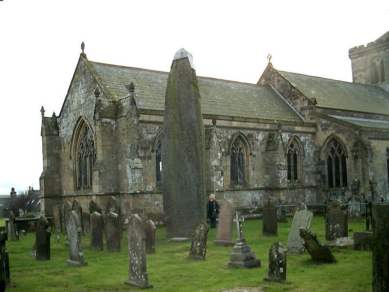
Rudston’s monolith (photo by ‘QDanT’)

To get to the monolith travel along the B1253 road to the west of Bridlington for about 5 miles or from York take the A166 in an easterly direction then onto the B1251 and at Fridaythorpe take the B1253 east again toward Bridlington. The huge stone cannot be missed from the road and from the surrounding area. It stands within the graveyard of All Saints’ church at the north-eastern side of Rudston village.

Archaeology & History

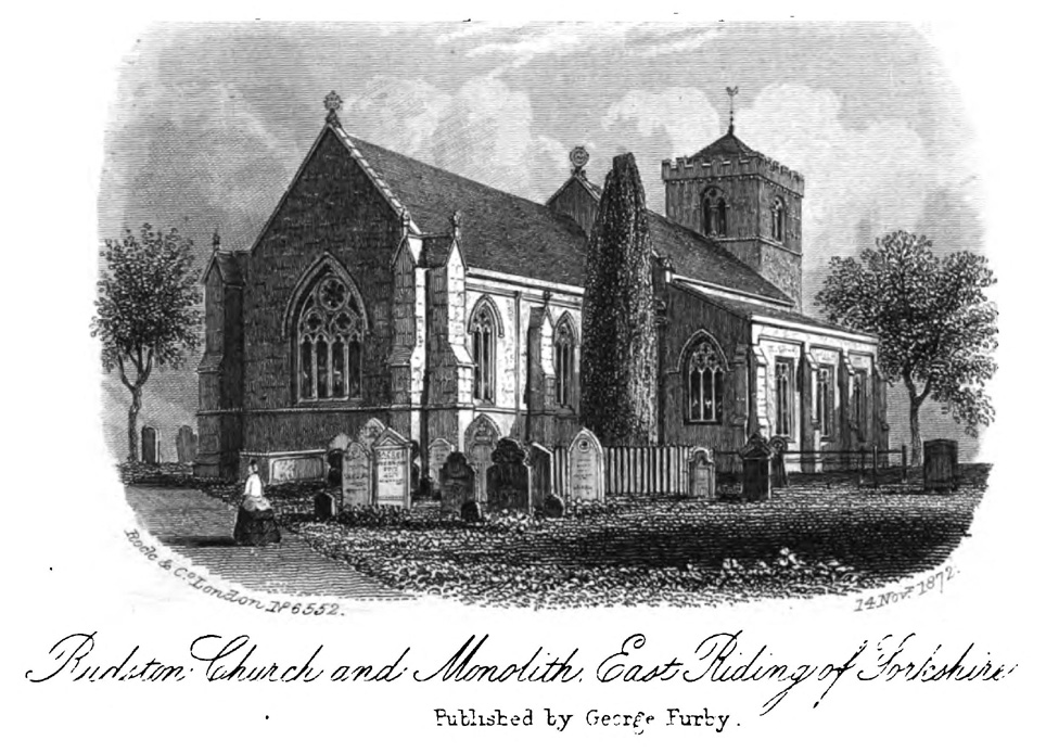
Located in the graveyard of All Saints’ church, this huge and mighty monolith or menhir stands at 25 foot 9 inches high (7.7 metres), and is the tallest prehistoric standing stone in Britain. It is estimated to weigh 40 tons, and it is thought to be the same in height below ground as what it is above the ground, though I don’t know whether anyone has ever checked that theory out. It probably dates from the Bronze-Age about 1,600 BC. Because of vandalism and erosion the top of the stone now has a lead cap, so it is said the stone could have originally been 28 feet high. So where has the top part gone to, I wonder. We are told that the stone was dragged, or rolled on logs, all the way from an outcrop at Cayton Bay some 10 miles as the crow flies to the north.

Royston’s 1873 drawing
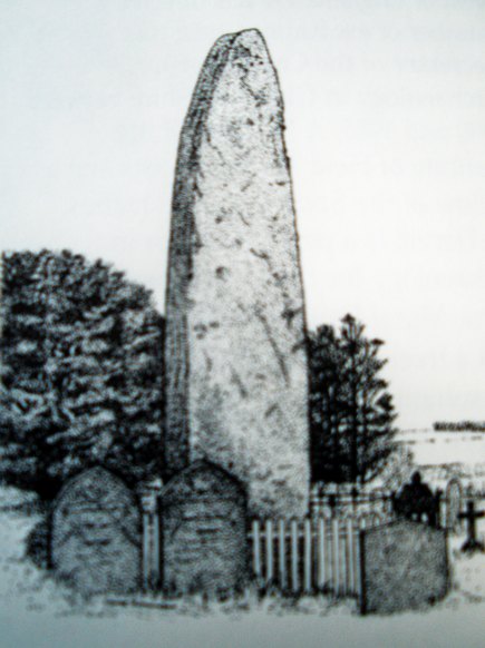
Rudson Monolith (Louise Hutchinson 1988)

Rudston monolith stands at the end of at least one cursus monument on an old prehistoric alignment (see the Rudston B Cursus entry).  It would appear to have played an important ingredient in a huge ceremonial landscape on the Gypsey Race.  Also in the churchyard (north-east corner) there is a large slab-stone cist which was removed from a nearby round barrow and also a gritstone. At Breeze Farm about one mile to the south-west of the village is the site of a Roman villa.

Folklore

The folklore elements tell us that this is, in fact, a phallic stone and in pagan times some form of ritual was held around the monolith, but then the Christian church was built around it in the Dark Ages – it was a case of Christianity adopting the pagan religion and allowing the stone to stay where it was, but what else could they do because the stone was to big to move, so a lot of tolerance was in order here. The present church of All Saints’ dates from the Norman period. In any case the stone had stood here for a good 2,000 years or more before any church was established in the village. According to the legend, the devil hurled the huge stone at the first Christian church on the site, but as usual he just missed – doesn’t he always!

References:

  1. Bord, Janet & Colin, Ancient Mysteries of Britain, Diamond Books: London 1991.
  2. Anderton, Bill, Guide To Ancient Britain, Foulsham: London 1991.
  3. Darvill, Timothy, AA Glovebox Guide – Ancient Britain, AA Publishing Division: Basingstoke 1988.
  4. Royston, Peter, Rudston: A Sketch of its History and Antiquities, George Furby: Bridlington 1873.

© Ray Spencer, The Northern Antiquarian 2011


Elf Howe, Folkton, East Yorkshire

Tumulus (destroyed):  OS Grid Reference – TA 0422 7726

Archaeology & History

A once-impressive haunted burial mound on the southern edge of Folkton parish, all that remains of the place now are aerial images showing the ghostly ring of its former site.  Commenting on the destruction of this burial mound  before he had chance to give it his full attention, in William Greenwell’s (1877) magnum opus he wrote the following:

“Elf Howe had been removed to a great extent, and the grave had been dug out before I had an opportunity of examining it.  I however got an account of what was discovered from the foreman on the farm, and I was able personally to inspect a small portion which had not been disturbed.  The barrow had been 60ft in diameter and 6ft high, and was made of earth and chalk.  Near the centre a deposit of burnt bones was met with, over which some large flints were placed; this was at a depth of 4ft, and as a great quantity of burnt earth was observed immediately round the bones, it is probable that the body had been burnt on the spot where the bones were placed.  Two unburnt bodies were found on the south side of the mound, with one of which a vessel of pottery was associated.  At a distance of 17ft south-south-east of the centre I found the body of a strongly-made man, laid on the right side, with the head to the south and the hands to the knees; he body was placed about 6in above the natural surface.  Immediately below the head was the body of a very young child, the bones of which were too much decayed to admit of anything being made out beyond the fact that it was a child’s body which was laid there.  Still lower, and on the natural surface, was a patella, a radius, and some other bones of a body, which had been disturbed, probably in the interring of the person who was found buried above.  At the centre was a grave, lying northwest and southeast, 7ft by 6½ft and 2½ft deep.  On the bottom at the north side was the body of a strongly-made man in the middle period of life, whose head…was to the south, but my informant could not remember on which side the body was laid; at the head was a ‘food vessel’, which, from the fragments that have been preserved, must have been a rudely-made one with unusually thick walls.”

Folklore

Although antiquarians and archaeologists such as Elgee, Grinsell, Gutch, Johnson and others each tell (in their own respective ways) that Elf Howe “testifies to a widespread belief in goblin-haunted barrows” — albeit in the linguistic ‘elven’ of the Scandinavian invaders — we appear to have lost the original tale behind this fairy-haunted site.

References:

  1. Greenwell, William, British Barrows, Clarendon Press: Oxford 1877.

© Paul Bennett, The Northern Antiquarian


Spell Howe, Folkton, East Yorkshire

Tumulus:  OS Grid Reference – TA 0657 7878

Archaeology & History

This once impressive tumulus a half-mile east of the village was first mentioned in the Bardney Cartulary in the early 13th century, where is was written as Spelhou.  Suggested by Olof Anderson (1934) to have been an early moot site — “the meeting place of the Torbar Hundred” — this appears to be confirmed in Smith’s (1937) etymological analysis where he ascribes Spell Howe to be literally, “‘Speech mound’, from OE spell, speech and haugr” (burial mound).  Rising about four-feet above ground level, this is a traditional ’round barrow’ type of tumulus.  In recent years, reports tell that it has been built onto with some fencing.  Hopefully the present land-owners now look after the place!

References:

  1. Anderson, O.S., The English Hundred-Names, Lunds Universitets Arsskrift 1934.
  2. Mortimer, J.R., Forty Years Researches in British and Saxon Burial Mounds of East Yorkshire, Brown & Sons: Hull 1905.
  3. Smith, A.H., The Place-Names of the East Riding of Yorkshire and York, Cambridge University Press 1937.

© Paul Bennett, The Northern Antiquarian