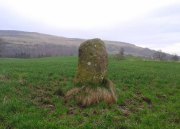
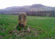
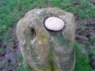
Devil’s Well, Abernethy, Perthshire

Sacred Well:  OS Grid Reference – NO 19430 14758

Also Known as:

  1. Canmore ID 28084

Getting Here

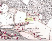
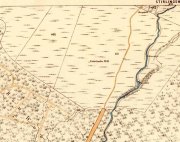
Devil’s Well on 1860 map

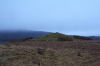
From Abernethy village, go west along the A913 road for half-a-mile, then turn left up the long and winding Glenfoot road up the Abernethy Glen.  About a mile up on your left-side is Craigden Farm and, just a bit past this, the forestry plantation.  Just before the trees, cut up the field and head uphill, passing the near forest of gorse, until you reach the huge detached house of Turflundie.  In the field immediately east, right up against the barbed-wire fence where it meets the depleted forestry, a very small trickle of water emerges beneath a small pile of rocks.  You’re here!

Archaeology & History

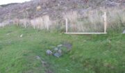
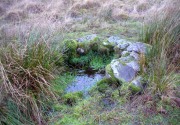
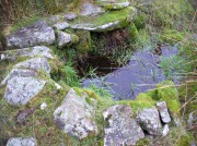
Long since thought to have been lost, the trickling remains of this old Well of the Devil are, in fact, still running beneath the pile of stones just over the barbed-wire fence on the edge of the forestry section.  A cluster of other worn rounded rocks scatter the ground just to the rear of where the water first comes out of the ground, suggesting, perhaps, that a small well-house covered the spring; but this is me being speculative, as there’s no mention of this in the early writings of the Ordnance Survey lads, nor is one shown on the first OS-map of the area in 1860.  And you’ll see on the OS-map how the well is slightly lower than where it presently trickles, but this is down to the fact that the source of it was piped-off at sometime in the not-too-distant past, as evidenced by remains of such piping laying just over the barbed-wire fence close to the source.  In truth, unless you’re hardcore, there’s very little to see.

Folklore

The trickling waters are on the other side of this fence

The dedication of this water-site to the christian ‘devil’ is obviously a corruption of its original traditional name, which may have simply been to the Bodach, or ‘Old Man’ in Gaelic and northern British lore.  The bodach‘s consort is the great prima Mater of the northern realms known as the Cailleach, but I can find no dedication to Her anywhere nearby.  The best we have are the ‘Witches Graves’ a half-mile to the northwest, below the edge of the geological ridge overlooking Abernethy, where folklore tells us 22 women were murdered and buried by the local christians several centuries ago.

In the Ordnance Name Book of 1859, they recorded that,

“A small Spring well on the farm of Turflundie, so called from the mark of a cloven hoof on a near, supposed to have been made by his Satanic majesty when he stopped to quench his thirst at this well during some of his midnight rambles.”

There’s no apt word that follows the word “near”, but assume it was meant to be a “stone,” although we could find no such stone close by and there are no known petroglyphs that could account for that ingredient.

References:

  1. Morris, Ruth & Frank, Scottish Healing Wells, Alethea: Sandy 1982.

© Paul BennettThe Northern Antiquarian


Brandy Well, Carlton, North Yorkshire

Holy Well (lost):  OS Grid Reference – NZ 52 03?

Archaeology & History

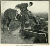
Brandy Well c.1910

Not marked on any map of the area (that I can find), this little-known possible holy well is described just once in one of Mr Blakeborough’s (1912) numerous regional history tomes.  Although he doesn’t explore the origin of the well’s name (which we find repeated at other water sources in northern Britain), the Scottish writers, Ruth & Frank Morris (1982) tell how examples of wells with this name in Scotland owe their names to the curious early christian figure of St. Brendan, whose annual saint’s day is May 16.  Whether this applies here I cannot tell.

We need some help locating the place, as it seems to have fallen off the radar.  The best I can do is give Mr Blakeborough description, who wrote of this Brandy Well:

“Speaking of superstitions reminds me of a tradition that the water in Brandy Well, half way up Carlton Bank, has most wonderful curative properties, and that a wish made here when drinking, is pretty certain to be fulfilled.  The well is by the road side and the water is no doubt just about as pure as it could possibly be, coming as it does, after much filtering through peat, straight from the hills.  There may be something more than mere superstition in the health giving properties of this water, especially in conjunction with the climb up the hill amid pine trees and the inhaling of the invigorating air.”

Its exact location is difficult to pin down.  There is no sign of any Well along the roadside between Carlton village and where the road eventually levels out on the northwest side of the hill.  It certainly isn’t the Mere Beck Spring on the south-side of the hill (is that still there and what is its history?); but there is however a ‘Spring’ shown on the early OS-maps on the east-side of the hill, along an old track at roughly NZ 52233 02357. Could this be it?  Or has the old Brandy Well been destroyed?  In an area littered with prehistoric and mythic sites, it would be good to relocate this one.

References:

  1. Blakeborough, J. Fairfax, Life in a Yorkshire Village, Yorkshire Publishing: Stockton-on-Tees 1912.
  2. Morris, Ruth & Frank, Scottish Healing Wells, Alethea: Sandy 1982.

© Paul BennettThe Northern Antiquarian


Todholes, Fintry Hills, Stirlingshire

Cairn:  OS Grid Reference – NS 67761 87011

Also Known as:

  1. Canmore ID 45284

Getting Here

Todholes Cairn one wintry evening

Todholes Cairn one wintry eve

Along the B818 road that runs between Fintry and Denny, get to the western end of the Loch Carron reservoir and park up at the entrance to the forest.  Across the road, walk up the track towards the (planned) wind farm.  Nearly a mile along watch out for the walling of derelict buildings on the slope above the track—but instead of walking up to them (west), walk up the slope on the other side of the track (east), over the annoying fence, then another one barely 50 yards away.  The large fairy mound on the moorland plain barely 100 yards ahead is the site in question.

Archaeology & History

Todholes Cairn looking north

Todholes Cairn looking north

On the day that Paul Hornby, Nina Harris and I visited this site, Nature had been watering Her ground excessively and the moorland was becoming an immense bog.  The daylight was fading fast too, so we didn’t get much time to sit and play and take in the colourful panorama that unfolds its vision as She normally would—and it would be a magnificent view on a clear bright day!  Instead, Her grey carpets and skies darkened quickly, leaving only a bare meander around this old prehistoric tomb before us.  It’s quite a big thing too…

Records of it are scant, both in archaeology accounts and popular culture.  In 1952 the Royal Commission (1963) lads visited the site and subsequently wrote that:

“This cairn…consists of a grass-covered mound of stones which stands to a height of 8ft and measures about 55ft in diameter. Two large boulders which lie at the foot of the mound to the south may represent the remains of a peristalith.  Three small holes caused by quarrying or by excavation appear on the surface of the cairn.”

Another cairn can be found a short distance northwest and what seems to be the remains of a prehistoric hut circle was visible on the moorland plain a few hundred yards south.  The word ‘todholes’ derives from ‘the abode of foxes’—and I saw two dead foxes recently shot by local land-owners hereby, showing that the place-name is valid.

References:

  1. Royal Commission on the Ancient & Historical Monuments Scotland, Stirlingshire – volume 1, HMSO: Edinburgh 1963.
  2. Royal Commission on the Ancient & Historical Monuments of Scotland, Archaeological Sites and Monuments of Stirling District, Central Region, Society of Antiquaries of Scotland 1979.

© Paul BennettThe Northern Antiquarian


St. Ninian’s Well, Stirling, Stirlingshire

Holy Well:  OS Grid Reference – NS 79690 93012

Also Known as:

  1. Canmore ID 46210
  2. St. Ringan’s Well

Getting Here

St Ninian's Well, Stirling

St Ninian’s Well, Stirling

A short distance south out of Stirling town centre, along Port Street where it meets with Ninian’s Road, walk across at the traffic lights then turn immediately left down Wellgreen Road.  Barely 100 yards down (before you reach the roundabout), note the path on your right.  Walk along here and as it bends round into the car-park, look to your left and see the small ivy-covered building hiding away in below you, with an information plaque at its side.

Archaeology & History

“St Ninian’s” is a district unto itself on the south side of the ancient city of Stirling—and it has this holy well (and the demolished chapel that once stood by its side) to thank for this. James Johnston’s (1904) place-name study of the region showed that it had acquired its association with St Ninian as early as 1242 CE when it was described, “Ecclesia Sancti Niniani de Kirketoune.”  It was mentioned again in 1301 CE as the site of “Saint Rineyan”, or St Ringan, which was the other name given to this saint who spent much of his time at Whithorn, Galloway, where he “preached the gospel among the southern Picts.” (Attwater 1965)

The waters in the building

The waters in the building

The old well building

The old well building

At some later date, Ninian is thought to have ventured north and sanctified this already renowned water source which, in his day, would have been open and surrounded by ancient trees and an abundance of wild flowers and healing plants.  But today, typically, it is hiding almost secretly away, behind locked doors and not in view for the general public.  This needs to be changed!  Standing outside of the unkempt and overgrown building, you can faintly hear these ancient waters still flowing within their darkened enclave.

It has been described in a number of local history books down the years, but a lot of the old stories and traditions have sadly moved into forgotten memories… The first major description of the site was by J.R. Walker (1883) who wrote freshly about it soon after his visit—despite being “disappointed” with the architectural features of the building built over the well; which is hardly the right attitude as far as I’m concerned!  The waters, their natural environment, feeling and genius loci are the primary features to sacred wells—nottheir dissolution, nor the artifice of humans to contain and reduce the natural world at such a place!  But, this aside:  for the architects amongst you, here’s what Walker had to say about the well-house:

“Mr T.S.  Muir, in his Characteristics of Old Church Architecture, mentions it as “a large vaulted building with a chamber above it, which is supposed to have been a chapel.” From this notice I was led to think something of interest would be found in the chamber; but as will be seen by the drawing…it is utterly destitute of any feature worthy of particular notice.  On looking at the surroundings, however, which are all modern, and mostly new houses and streets in course of erection, I came to the conclusion that at no distant date the well was doomed, and that consequently I had better make a correct drawing of it.

“The lower chamber measures 16 feet by 11 feet 1 inch, and is covered with a vault running from end to end, measuring from floor to springing 2 feet 9 inches, and from floor to crown of arch 6 feet.  At the end where the spring rises there is a square recess 1 foot 9 inches high and 1 foot 7 inches wide and 17 inches deep; and at the other end two recesses, the largest measuring 2 feet 7 inches in height, 1 foot 4 inches wide and 1 foot 4 inches deep, the other 8 inches high, 8 inches wide, and 8 inches deep.  To what purpose these have been put I have formed no idea; they are on an average 12 inches from the floor to the sill.  The side walls are 2 feet 9 inches thick, and the end gable 3 feet; the other gable, between the well chamber and the adjacent building, being about 2 feet 3 inches.  The room above is the same size as the vaulted chamber below, and is divided by timber partitions to form a dwelling-house.  There is an ordinary fireplace and press in the gable; the press, however, does not go down to the floor, but is simply a recess or “aumbry,” such as we see in old Scotch houses.

“The roof seems to have been renewed at no distant date, although some of the timbers are, without doubt, home-grown.  The ground rises rapidly to the back, so that the entrance door to the house is level with the top of the vault; this door is simply splayed in the Scotch manner, with a square lintel over, and a relieving arch inside.  The door to the well chamber is also splayed, and in like manner the windows; the largest window has been altered, and a new projecting sill put in.

“At present the well is used for washing purposes, and must have been so for a considerable length of time, if we may judge from the table of rates affixed to the building; and a channel has been formed down one side and along the bottom end to carry away the water, the floor being paved with stones.  The vault inside is roughly dressed, very little labour seemingly having been bestowed upon it.

“In the New Statistical Account it is suggested that the chamber was used as a bath, and it also states that, “it is celebrated for its copiousness and its purity. It is a hardish water, but of low specific gravity, and much used for washing. It has been calculated that were all the waters proceeding from this spring forced into the pipes that supply the town, it would afford every individual not less than 14.03 gallons per twenty-four hours.  Its temperature is very cold and it exhibits muriate of lime and sulphate of lime. It is also much used for brewing.”

“Externally the building is roughly cast, or in Scottish phraseology, harled.”

A few years later when J.S. Fleming (1898) wrote an account of the place in his survey of local holy wells, he described a number of other historical elements not included in Walker’s (1883) account, telling:

“RINGAN” is stated to be the Scoto-Irish form of Saint Ninian’s name. He is alleged to have come from Ireland in the fifth century. St. Ringan’s Chapel was one of three attached to St. Ninians, the others being at Skeoch—dedicated to the Virgin Mary—and at Cambusbarron.  The remains of St. Ringan’s Chapel, a simple, barrel-vaulted chamber, 11 feet by 14 feet, built over the spring, are situated a few yards off Pitt Terrace, the upper walls having been built, in 1731, by order of the Stirling Town Council, and formed into a house for the convenience of the town’s washerwomen.  A niche in the north-east wall has evidently been made to hold the image of the Saint; while there has also been a piscina in the same wall. The flow of water is enormous, and enters the building from under the south-west gable, and after passing through the little chamber, flows out at the east wall.  In 1740, the Town Council, considering the large volume of water of some value, entertained the idea of having it conveyed into the town by means of pipes, and consulted an Edinburgh engineer with regard to the feasibility of the project.  Nothing resulted from their efforts, however.  The water of this spring is stated to be so cold in summer that people cannot stand in it for any length of time; while in winter, again, it is so warm that it rapidly thaws whatever is thrown into it.  Smoke rises from it at times, hanging over it like a vapour on a frosty morning.  These characteristics indicate that the waters must issue from a great depth in the ground.

“This Chapel was apparently held in high repute by King James IV., as in the Exchequer Rolls we find the following entries: — “1497, April 24. — Item to the King’s offerand in Saint Ringans Chapel, besid Strivelin, 14/.” ” Samen day to Schir Andro to get say a hental of messes of Saint Ringans, 20⋅/.”

The site was mentioned in the standard surveys of MacKinlay (1893) and Morris (1981), but with very little additional information.

Folklore

Ninian's Well on 1832 map

Ninian’s Well on 1832 map

St. Ninian’s festival date is September 16, but I’ve been unable to find any information about any practices here for that date. However, in 1659, St Ninian’s Well was mentioned as a site used in what the deluded criminal courts of the period called “a case of witchcraft”, against one Bessie Stevenson.  The lady concerned told of performing quite normal herbal practices and similar animistic healing traditions, typical of those found universally in peasant cultures, but which the crazed church-goers saw as something completely different.  Bessie told that for people who were either sick or bewitched, she would wash their clothes in the running waters of St. Ninian’s Well, to wash away any disease and cure the said person.  It is likely that the waters here were commonly used for such rites, much as the christian priesthood still do at many ‘holy waters’ to this very day.  Indeed, of the sacred waters here, St. Ninian himself was said to “have endowed it with peculiar virtues.” (Roger 1853)

References:

  1. Attwater, Donald, The Penguin Dictionary of Saints, Penguin: Harmondsworth 1965.
  2. Fleming, J.S., Old Nooks of Stirling, Delineated and Described, Munro & Jamieson: Stirling 1898.
  3. Johnston, James B., The Place-Names of Stirlingshire, R.S. Shearer 1904.
  4. MacKinlay, James M., Folklore of Scottish Lochs and Springs, William Hodge: Glasgow 1893.
  5. Morris, Ruth & Frank, Scottish Healing Wells, Alethea: Sandy 1982.
  6. Mould, D.D.C.P., Scotland of the Saints, Batsford: London 1952.
  7. Reid, John, The Place-Names of Falkirk and East Stirlingshire, Falkirk Local History Society 2009.
  8. Roger, Charles,  A Week at Bridge of Allan, Adam & Charles Black: Edinburgh 1853.
  9. Ronald, James, Landmarks of Old Stirling, Eneas Mackay: Stirling 1899.
  10. Simpson, W.D., St. Ninian and the Origins of the Christian Church in Scotland, Oliver & Boyd: Edinburgh 1940.
  11. Walker, J. Russel, “‘Holy Wells’ in Scotland,” in Proceedings of the Society of Antiquaries of Scotland, vol.17 (New Series, volume 5), 1883.

© Paul BennettThe Northern Antiquarian


St. Maha’s Well, Buchanan, Stirlingshire

Sacred Well:  OS Grid Reference – NS 4573 9180

Also Known as:

  1. Canmore ID 43475
  2. Saintmaha Well

Getting Here

St Maha's Well on 1865 map

St Maha’s Well on 1865 map

Bittova walk to reach this one.  From The Square in Drymen village, take the long Old Gartmore Road north for 1.4 miles (2.25km) until you reach the West Highland Way track. Turn left and walk along the track for 1.75 miles (2.8km), making sure that you note crossing the large burn as a guide before your next turn, right, uphill and further north. About 400 yards up, you emerge from the forestry plantation and onto the open moorland. Walk about 200 yards (185m) up the track then walk left, right into the boggy moorland. Keep your eyes peeled for a small standing stone on the heath about 130 yards along, and just below this is a stone-lined spring of water.

Archaeology & History

St Maha's Well

St Maha’s Well, near Drymen

This little-known healing spring of water, high upon the moors overlooking the southern isles of Loch Lomond and the mountains beyond, is in a beautiful (if boggy) setting.  We visited here on a somewhat wet day, amidst a wealth of Nature’s downpours in previous days giving us the masks of grey overcast skies and soaking grounds.  Despite this, the setting is gorgeous and, if we’d have visited on a sunny day, the feel and views would be outstanding.  This mighthave been one of the reasons that this particular spring of water was chosen to be sanctified.  Certainly it has an ancient history, if christian tales are anything to go by…

Although listed in the parish of Buchanan, the well resides on the hills above the village of Balmaha more than 2 miles to the west, on the shores of Loch Lomond; and Balmaha is thought to have its origins enwrapped with an early christian characters of some prominence.  The element maha derives, said Watson (1926) from the Scottish Gaelic ‘Mo-Thatha’, from the earlier Irish name Tua, meaning “the silent one.”  The character known as St. Maha gives his name to the village and according to H.G. Smith (1896),

Bal maha may most probably retain the memory of St Mochai or Macai; Latin, Maccaeus, also known as St Mahew, a companion to St Patrick, to whom the church of Kilmahew in Cardross was dedicated.  Mahew lived at Kingarth in Bute, and Buchanan formed part of the district superintended by Kingarth.  He was a poet, physician, and noted in his day for his mathematical learning… (St Mahew’s day was 11 April).”

Close-up of the waters and stone surround

Close-up of the waters and its stone surround

It seems therefore probable that this poet-healer character underlies the old name at this well.  St. Maha’s attributes as a poet and healer would suggest he was trained in archaic techniques before declaring himself as ‘christian.’  In the landscape nearby are other early Irish christian traditions, pasted onto much earlier heathen ingredients.

When Mr Smith (1896) wrote about the well, the remains of an old tree still grew above the waters onto which local people left memaws and offerings for the resident spirit, maintaining the animistic traditions of popular culture that still endure.  He wrote:

“St Maha’s Well is in an upper field of the farm of Crietihall.  It was of old a healing well, and in the memory of man pieces of cloth used to be fastened to a tree which overshadowed it, votive offerings by the pilgrims who sought the saint’s favour.”

…Although in truth, “the saint’s favour” is mere window dressing for the more archaic and natural feel of the site: what John Michell (1975) would have termed the “resident Earth spirit.”

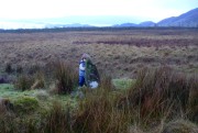
The well is surrounded by a small arc of stone masonry, which the ever-reliable Royal Commission (1963) lads tell us, “measures 2ft by 3ft internally and stands about 1ft above the surface of the water.”  Just above the well itself is a small rise with a standing stone at its edge—probably medieval in origin.  Barely three feet tall, it sits upon an overgrown arc of stones that curves around the hillock reaching down towards the well and was obviously a small building of some sort in previous centuries.  Its precise nature is unknown, but it has been suggested to have either been an earlier well-house or surround, or perhaps the remains of a hermit’s cell—even St. Maha himself—that has fallen away over time.  Without an excavation, we may never know what it was!

Little Leo by the little stone

Little Leo by the little stone

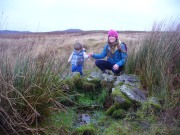
Aisha with Leo, shortly before he threw himself in!

Aisha with Leo, shortly before he threw himself in!

Whatever the origin behind the small standing stone and the overgrown scatter of rocks, one of our adventurers on the day we visited—little Leo—was fascinated by it, almost attaching himself to it and stroking his way round and round the old stone with playful endurance.  And then, when he got to see the sacred spring below, became so taken by it that he simply sat down in the waters without as much as making a gasp, despite the cold!  Aisha (his mum) would pick him up, only for him to walk right back over and sit himself right back into it again!  It was both comical and fascinating to watch and he seemed quite at home in the pool, despite being drenched and cold.  Indeed, he took exception to being lifted out of the water—and simply plonked himself back in it again!

Folklore

The Canmore website tells some intriguing folklore about the place, saying:

“The well is still a focus of local cult, and is visited by people who leave offerings in the water. A man dying recently in a local hospital refused to drink any water except water taken from this well.”

References:

  1. Edlin, Herbert L. (ed.), Queen Elizabeth Forest Park, HMSO: Edinburgh 1973.
  2. Johnston, James B., The Place-Names of Stirlingshire, R.S. Shearer 1904.
  3. Michell, John, The Earth Spirit: Its Ways, Shrines and Sanctuaries, Thames & Hudson: London 1975.
  4. Morris, Ruth & Frank, Scottish Healing Wells, Alethea: Sandy 1982.
  5. Nicholson, A. & Beaton, J.M., “Gaelic Place-Names and their Derivations,” in Edlin’s Queen Elizabeth Forest Park, HMSO: Edinburgh 1973.
  6. Royal Commission on the Ancient & Historical Monuments Scotland, Stirling – volume 1, HMSO: Edinburgh 1963.
  7. Smith, H. Guthrie, Strathendrick and its Inhabitants from Early Times, James Maclehose: Glasgow 1896.
  8. Watson, W.J., The History of the Celtic Place-names of Scotland, Edinburgh 1926.

Acknowledgements:  Many thanks to Aisha Domleo, Lara Domleo, Leo (the stone-hugger) Domleo, Unabel Gordon, Nina Harris, Paul Hornby and Naomi Ross for their help and attendance in finding and falling about this ancient sacred well. A damn good wet day all round!

© Paul BennettThe Northern Antiquarian


Airthrey Mineral Wells, Bridge of Allan, Stirlingshire

Healing Wells:  OS Grid Reference – NS 79504 97686

Also Known as:

  1. Airthrey Spa
  2. Airthrey Springs
  3. Bridge of Allan Spa
  4. Canmore ID 317260

Getting Here

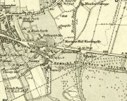
Site shown on 1865 OS map

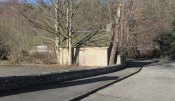
The old well-house is accessed easily.  From the main road of Henderson Street (or A9), that runs through the town, as you approach the main shopping area, go up Alexander Drive, then immediately turn right up Well Road. 100 yards up, take your first right again along Kenilworth Road and then first right up Mine Road.  100 yards or so along here, as you reach the tennis courts on your right, a small crumbly-tumbly building is to your left, just by the car-park to the hotel, with some old trees hiding its presence.  You can’t get into it and the waters therein sound to have fallen silent.

Archaeology & History

In 1761, the great writer Daniel Defoe in his Tour across Britain, found himself visiting a healing spring under the western reaches of the Ochils:

“Airthrey Well, two miles north of Stirling, flows from a mountain, where is a copper mine, with some mixture of gold; the water is very cold, and being tinctured with the minerals it flows through, is of use against outward distempers.”
Airthrey Wellhouse in ruins

Perhaps the earliest literary description of this site, the Bridge of Allan that we see today was little more than a stretch of old abodes, reaching into woodland above the crystal clear river and burns, chiming with countless fauna and that rich chorus of colours that pre-date the Industrialist’s ‘progress’.  The old hamlet was said by Robert Chambers (1827) to be “a confusion of straw-roofed cottages and rich massy trees; possessed of a bridge and a mill, together with kail-yards, bee-skeps, colleys, callants, and old inns.” But all of this was about to change.

In the old woods on the northwest slopes above the hamlet was indeed an old copper mine as Defoe described, and housed therein were a number of mineral springs–six of them according to the early reports of Forrest (1831) and Thomson. (1827)  They were obviously “known to the country people,” said Thomson, and had been “used by them as an occasional remedy for more than forty years”; although in Forrest’s very detailed account of these wells, he told how

“one of the old miners, an intelligent man and an enthusiastic admirer of the medicinal virtues of these waters, informs me, that they have been known for at least one hundred years.”

This comment was echoed a few years later when Charles Roger (1853) wrote his extensive book on the village.

It was in the 1790s when the mineral waters were channeled out of the mines for the first time, and Mr Forrest told that they were collected lower down the slope,

“in a wooden trough, for the use of the miners, and of the country people, some of whom used it as an aperient, whilst others, deeming the water impregnated with common salt merely, employed it for culinary purposes. …It was…much used as a medicine by the country people of the neighbourhood who attended regularly every Sunday morning to partake of it.”
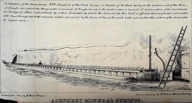
Airthrey waters channeled along the long trough (Robert Mitchell 1831)

The fact that Sunday mornings was when people came here tell us that the Church had something to do with the timing; strongly implying that the wells possessed earlier indigenous traditions—probably similar to those practiced at the Christ’s Well, the Chapel Well and countless others across the country.  But written records on this are silent.

The main history of the Airthrey Springs is of them becoming famous Spa Wells and, much like Harrogate in Yorkshire, were responsible for the very growth of Bridge of Allan itself.  Oddly enough, this came about a few years after the copper mines were closed in 1807.  This wouldn’t have stopped some of the local people still getting into them and drinking the waters when needed—but the written records simply tell that, for a few years at least, their reputation faded.  Around the same time in the village of Dunblane, just a few miles to the north, another Spa Well had been discovered and it was attracting quite a lot of those rich wealthy types—bringing fame and money to the area.  As a result of this, the medicinal virtues of the Airthrey Springs were revived thanks to the attention of the local lord, a Mr Robert Abercromby, who thought that Bridge of Allan could gain a reputation of his own.  And so in the winter of 1821-22, Abercromby procured the research chemist Thomas Thompson to analyse the medicinal waters at Airthrey and have them compared with the ones at Dunblane.  He was in luck! Not only were they medicinal, they were incredibly medicinal!

Dr Thomson then wrote a series of articles in various academic journals in the early 19th century—each espousing, not just the health-giving property of the Airthrey waters, but lengthy chemical analyses outlining the active constituents.  To his considerable surprise he found that the Airthrey waters were as good as any of the great spa towns in England at Harrogate, Buxton, Bath and Leamington.  Their virtues were so good that Mr Forrest (1831) doubted any of the Spa Wells in England were as beneficial as the waters here!  R.M. Fergusson (1905) echoed this sentiment in his massive work on the adjacent parish of Logie, calling the Airthrey springs “the Queen of Scottish Spas”!—and these accolades prevailed long after Dr Thomson’s analyses.  He wrote:

“At Airthrey there are six springs containing, all of them, the same saline constituents, but differing a good deal in their relative strengths. I analyzed two of these during the winter of 1821-22, and the other four during the autumn of 1827.”

He found that, in varying degrees, the main constituents were salt, muriate of lime, sulphate of lime and muriate of magnesia. At that time, in medical circles, these ingredients were beauties!  As Mr Logie (1905) said:

“This mineral water has been for long distinguished as a specific for derangements of the stomach and liver, and skin and chest diseases, rheumatism, gout, sciatica, and nerve affections…”

Thomson’s initial findings were much to the liking of Mr Abercromby; for hereafter, he realised, all and sundry who could read and travel to the country spas in England and beyond, would visit Bridge of Allan and bring with it great trade.  So Abercromby quickly,

“caused the water of the two Springs analysed by Dr. Thomson, one of which was characterised by its strength, the other by its comparative weakness, to be carefully collected and conveyed apart in earthen pipes, to two stone troughs placed in a convenient situation, from which it was raised by two well-constructed forcing pumps. Over these pumps a commodious house was erected.

In 1822, several thousand copies of Dr. Thomson’s analyses were circulated; and the water acquired immediate celebrity.  Invalids from all parts of the country, but especially from Glasgow and its vicinity, resorted to Airthrey. Every house, in fact, in its neighbourhood, however mean and incommodious, was occupied by strangers; and so great was the popularity of the new springs that even in 1823 they threatened to supersede all the other same springs of Scotland.”

The success of these medicinal waters created the town itself and, unlike many other spa wells, this one continued to be used until the end of the 1950s.  Its demise came when, in one financial year, only two people came to “take the cure,” as it was called.
Side wall of ruined wellhouse

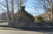
If you visit the well-house nowadays, it’s in rather poor condition and will be of little interest unless you’re a devout architectural fanatic.  It’s thought to be the earliest surviving building associated with this spa town, said by Mr Roger (1853) to have been built in 1821.  Shown on the first OS-map of the area, adjacent buildings were constructed to accommodate the overflow of people who came here.  And in the woodlands above, if you look around halfway up the slopes, an old trough has water running into it just by the side of a path.  This, say some local folk, is the trickling remains of the medicinal waters, still used occasionally by some people…

References:

  1. Durie, Alastair J., “Bridge of Allan: Queen of the Scottish Spas,” in Forth Naturalist & Historian, volume 16, 1993.
  2. Erskine, John, Guide to Bridge of Allan, Observer Press: Stirling: 1901.
  3. Fergusson, R. Menzies, Logie: A Parish History – 2 volumes, Alexander Gardner: Paisley 1905.
  4. Forrest, W.H., Report, Chemical and Medical, of the Airthrey Mineral Springs, John Hewit: Stirling 1831.
  5. Morris, Ruth & Frank, Scottish Healing Wells, Alethea: Sandy 1982.
  6. Roger, Charles, A Week at Bridge of Allan, Adam & Charles Black: Edinburgh 1853.
  7. Stewart, Peter G., Essay on the Dunblane Mineral Springs, Hewit: Dunblane 1839.
  8. Thomson, Thomas, “On the Mineral Waters of Scotland,” in Glasgow Medical Journal, volume 1, 1827.
  9. Turner, E.S., Taking the Cure, Michael Joseph: London 1967.

© Paul BennettThe Northern Antiquarian


Marion’s Well, Falkirk, Stirlingshire

Healing Well (destroyed):  OS Grid Reference – NS 8926 7977

Archaeology & History

Marion's Well on 1864 map

Marion’s Well on 1864 map

Recorded in 1860 by the Ordnance Survey and highlighted several years later, this Marionesque potential of a holy well is not thought to derive its name from the usual Catholic pantheon—but it’s close!  It was obviously an important water source for the people of Falkirk in early times and its clear waters were used to supply an early washing house close by (as shown on the map).  Now completely built over where the B8080 meets the roundabout east of the town centre, the best literary account we have was penned by the regional historian Robert Gillespie (1879) who, in his survey of the area, told us:

“Of Marion’s Well there is scant record.  According to tradition it got its name from Marion Livingston—a nun of the house of Callendar who, in the performance of the sacerdotal vow which kept her from the world, visited the well at intervals and used its soft waters as a pediluvium.   The original well which was built round with stone, stood at the bottom of the Cladden’s Brae, on the bank of the East Burn.  It was further protected by a circle of upright slabs—the great resting place of the water maids and the scene of many a happy ‘touzle’ as the stoups or pitchers were sent rolling and rattling down into the brawling brook.”

Marion's Well, c.1900

Marion’s Well, c.1900

The element of locals “touzling” here simply means that it was a meeting place for young lovers. (Grant 1973; Wright 1905)  Although quite what Gillespie meant when he said it was surrounded “by a circle of upright slabs” is anyone’s guess!  Was this architectural element constructed in the post-medieval period, or was it much much older…?

In the old photo of the well here, Scott & Astbury (1990) said how it,

“shows the trough of the well after it had been moved to the south side of Callender Road and shows a horse pulling a Barr’s cart at the trough.  The view looks down what is now Corporation Street to the bridge over the East Burn.”

References:

  1. Gillespie, Robert, Round about Falkirk, Dunn & Wright: Glasgow 1879.
  2. Grant, William & Murison, David (eds.), The Scottish National Dictionary – volume 9, SNDA: Edinburgh 1973.
  3. Morris, Ruth & Frank, Scottish Healing Wells, Alethea: Sandy 1982.
  4. Reid, John, The Place-Names of Falkirk and East Stirlingshire, Falkirk Local History Society 2009.
  5. Scott, Marion & Astbury, Tom, Falkirk’s Yesterdays, FDD: Falkirk 1986.
  6. Wright, Thomas (ed.), English Dialect Dictionary – volume 6, Henry Frowde: Oxford 1905.

© Paul BennettThe Northern Antiquarian


Loch Ardinning, Mugdock, Stirlingshire

Cup-and-Ring Stone (lost):  OS Grid Reference – NS 56 77

Archaeology & History

The hidden Loch Ardinning stone

The hidden Loch Ardinning stone

This site-profile is one for the explorers amongst you.  It was last reported by the rock art author Ronald Morris (1981) who himself looked several times for this multiple-ringed carving, but never managed to find it.  The carving was rediscovered and described by the Glasgow archaeologist J. Harrison Maxwell, who took the only known photograph of the carving (reproduced here).  Sadly, he only left a short note about the site which read simply: “cups-and-rings to the west of Loch Ardinning.”

It seems probable that the carving would be in the area between the loch and the A81 road (between Strathblane and Bearsden) and not on the western side of the road—but we cannot be certain.  It may be hidden in the trees somewhere between the road and the lochside—which means that it’s probably completely overgrown by vegetation.  Morris (1981) described the carving as:

“a cup-and-four-rings, 2 cups-and-two-rings, and at least 4 cups-and-one-ring. Some rings are complete without radial groove and some are gapped with groove from the cup.”

If any explorers out there manage to unearth this lost carving, please give us a shout!

References:

  1. Morris, Ronald W.B., “The Cup-and-Ring and Similar Early Sculptures of Scotland; Part 2 – The Rest of Scotland except Kintyre,” in Transactions of the Ancient Monuments Society, volume 16, 1969.
  2. Morris, Ronald W.B., “The cup-and-ring marks and similar sculptures of Scotland: a survey of the southern Counties – part 2,” in Proceedings of the Society of Antiquaries, Scotland, volume 100, 1969.
  3. Morris, Ronald W.B., The Prehistoric Rock Art of Southern Scotland, BAR: Oxford 1981.

© Paul BennettThe Northern Antiquarian


Knockraich, Fintry, Stirlingshire

Standing Stone:  OS Grid Reference – NS 60889 87739

Also Known as:

  1. Canmore ID 45305
  2. Knockcraich

Getting Here

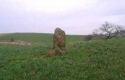
Knockraich standing stone

Knockraich standing stone

From Fintry village take the B822 road towards Kippen.  Only half-a-mile (0.8km) along, take the track on your left to Knockraich Farm and cafe.  Go all the way through the farm along the track and out the other side then follow the fence downhill across the field. At the bottom, go through the gate towards the stone which you’ll already be able to see ahead of you, in the next field. Y’ can’t miss it!

Archaeology & History

This little-known four-foot tall monolith standing alone in the fields northwest of Fintry, just above the River Endrick, is a fascinating little fella!  It stands at the western end of an elongated rise in the land, almost as if mimicking an ancient long barrow.  But more intriguingly (for me at least) are the cup-markings that adorn each of its four sides.

Cup-mark at base of the north side

Cup-mark at base of the north side

Cup-mark near top of west face

Cup-mark near top of west face

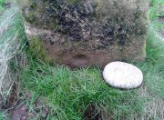
Upon first glance it seems that there are a number of such cup marks on the stone, but further inspection shows that only one occurs on each of the four faces.  Near the very bottom of the stone on its north and south sides a single large cup-mark has been etched; and on its east and western faces, the cup-mark has been carved further up towards the middle of the stone, with the east-facing side having a groove running from near the top and stopping at the cup-mark.  On top of the stone is a large ‘bowl’ (possibly natural, possibly man-made—it is difficult to say with any certainty) and a single cup-mark next to it.  When Nina, Paul and I visited here a few days ago, a palm-sized smooth stone was resting in the large bowl on top, akin to the healing and divination stones found placed in bullauns in Ireland and other parts of the world.

The first description of any length was cited in A.F. Hutchinson’s (1893) paper on the standing stones of Stirlingshire in which he wrote:

“This stone…is placed on the bank rising up from the river.  In shape it is approximately square—the two sides facing nearly east and west, measuring each 1ft 7in, the north face 1ft 6in, and the south 1ft 3in.  These dimensions are uniform from top to bottom.  The total girth is therefore 5ft 11in, while the height is 3ft 8 in.  Orientation 225º.  There are a number of cupmarks both on the top and side, as well as having several incised lines and other markings, some of which, however, give evidence of recent sculpture.”

Knockraich stone, looking south at Dunmore hillfort

Knockraich stone, looking south at Dunmore hillfort

Cupmark, hollow & stone on top

Cupmark, hollow & stone on top

The more modern or “recent sculpture” was that of a human figure, now very faint, etched onto the most western face of the stone, beneath a large solitary cup-mark.  When the site was visited and described by the Royal Commission (1963) lads, they gave a lengthier description of the carved elements on the stone, telling us that:

“On the top, which has been brought to an irregularly rounded point, there is an almost circular hollow measuring 5½in to 6in across and 2½in in depth; it is difficult to suppose that this is other than artificial, although its bottom shows differential weathering.  The SE side of the stone shows several natural cavities, and a deep and wide vertical groove which is also presumably natural.  The NW face seems to have been flattened to a certain extent, a slight ridge which is visible along part of either margin probably representing a survival of the original surface.  On this face, 12in above the ground, a human figure has been outlined in pocked technique.  It is in full-face, the features being indicated by pocked marks; the arms are extended jut below the level of the shoulders and the legs are widely spread with the feet turned outwards.  The lower edge of a tunic or short kilt seems to be indicated by a single line between the legs.  The figure is 8in heigh and measures 7in in breadth between the hands and 7½in between the feet.  This face of the stone also shows a number of small natural cavities, together with a shallow cup which has a somewhat artificial appearance; this cup is in the centre of the face and 2ft 4½in above ground level, apparently at the upper margin of the flattened area.  The figure lacks any distinctive characteristics which might afford evidence of date, but it may be relatively modern…”

Folklore

Mr Hutchinson (1893) told that,

“The stone seems to have brought down through the ages a tradition of sanctity in connection with it, as there is a legend to the effect that any attempt to move it is attended by convulsions of Nature and evil consequences to the rash disturber.”

Whether the position of the water-worn smooth rock found in the bowl on top of this standing stone has any ancient tradition, records seem silent on the matter.

References:

  1. Hutchinson, A.F., “The Standing Stones of Stirling District,” in The Stirling Antiquary, volume 1, 1893.
  2. Royal Commission on the Ancient & Historical Monuments Scotland, Stirling – 2 volumes, HMSO: Edinburgh 1963.
  3. Royal Commission on the Ancient & Historical Monuments of Scotland, Archaeological Sites and Monuments of Stirling District, Central Region, Society of Antiquaries of Scotland 1979.
  4. Smith, H. Guthrie, Strathendrick and its Inhabitants from Early Times, James Maclehose: Glasgow 1896.

Acknowledgements:  Many thanks to Nina Harris and Paul Hornby for their help and attendance at this old stone.

© Paul BennettThe Northern Antiquarian
King’s Yett, St. Ninians, Stirlingshire

Cairn:  OS Grid Reference – NS 7373 8922

Also Known as:

  1. Canmore ID 45951

Getting Here

King's Yett cairn, from the track below

King’s Yett cairn, from the track below

Going west out of Stirling or St Ninians, you need to take the minor road/s that cross the M9 and head past the wooded hills, past Graystale and Wallstale.  A mile or so on, keep right when you hit the small road junction past Shielbrae.  A mile past here, where the edges of the road disappears into the moors and the forest grows to your right, park up where the small parking spot takes you down the track into the trees on the right-side.  Walk down here for a coupla hundred yards and keep yer eyes peeled for the rounded fairy-mound on the heaths about 30 yards above you.

Archaeology & History

When we visited this place a few weeks ago, the Dark was almost upon us when we arrived and the clouds were low with a deathly silent mist breathing from the trees and reaching up to meet the low clouds not far above.  It was a curious feeling, borne from the darkening landscape, feeling almost as if the dead were around us—which I suppose they were, in this prehistoric tomb at least.  At the clap of our hands, a great echo rang loudly from the misty silence and the land in which it lived.  Twas almost hypnotic in its lull…..

Looking to the NW

Looking to the NW

King's Yett cairn, looking NE

King’s Yett cairn, looking NE

This site isn’t always gonna have this feel to it of course.  If we’d have visited it on a nice clean blue-sky day, no such feelings would have greeted us—and the tomb would, perhaps, have been little more than an uninteresting-looking mound, overgrown with heather and grasses.  But Nature breathes and casts such entrancements to our central nervous system every now and then—and such states are as worthy of sincere attention as any intellect preys to insist otherwise…. and I should know!

The King’s Yett cairn has yet to be excavated, but it has all the hallmarks of a traditional Bronze Age signature in its structure.  When the Royal Commission  lads came here in 1954, after a report describing the mound, their brief account of it (1963:1) later told, simply:

“A cairn is situated on open moorland, a quarter of a mile W of King’s Yett, at an elevation of 950ft OD.  It consists of a grass-covered, stony mound which measures about 30ft in diameter and stands to a height of 4ft 6in.  A rectangular boulder which lies in the S arc of the base of the cairn, and which appears to be in situ, may have formed part of a peristalith.” (i.e., an encircling ring of stones, PB)

Adjacent circular mound nearby

Adjacent circular mound nearby

This singular fallen stone is now covered in vegetation and there is little evidence of any stone circle around the tomb.  But immediately west, 70 yards WNW on the other side of the forestry track, rises an even larger circular mound, deeply covered in heather and consisting of earth and stones beneath the surface.  It looks for all the world like another giant cairn (up to 6ft high and measuring about 26 yards (23.9m) E-W, by 27.5 yards (25.2m) N-S) upon which new trees have recently been planted.  It might not be, of course—but we’re gonna look at this again when She gives us more daylight and clearer skies…..just in case…

Locally there are various tales of the Sma’ Folk or little people, fallaciously ascribed by romantic intellectuals as ethereal spirits, but which were and are known to have been tribal people in these uplands; and although such stories excel in this area, we have nothing specific relating to the rounded mound of King’s Yett – yet!

References:

  1. Royal Commission on the Ancient & Historical Monuments Scotland, Stirling – volume 1, HMSO: Edinburgh 1963.
  2. Royal Commission on the Ancient & Historical Monuments of Scotland, Archaeological Sites and Monuments of Stirling District, Central Region, Society of Antiquaries of Scotland 1979.

© Paul BennettThe Northern Antiquarian