Kirktonhill, Channelkirk, Berwickshire

Stone Circle (destroyed):  OS Grid Reference – NT 474 548

Archaeology & History

Included in Aubrey Burl’s (1976) first gazetteer, without comment, the site was subsequently added to John Barnatt’s (1989) magnum opus.  He tells that in the 19th century, “early Ordnance Survey records…note a destroyed stone circle” here, but draws a somewhat sceptical opinion of its very existence as “the Ordnance Survey frequently made mistaken interpretations in the 19th century and hence this should be treated with caution.”

Despite this, early local historians refer to the site, albeit in the past tense.  The first would seem to have been Walter Elliot (1869) in his address to the respected Berwickshire Naturalists Club.  Some members of this group had visited a number of ancient sites the previous year:

“A camp above Channel Kirk was also indicated, near which a stone circle formerly existed, but it has been destroyed and the materials used for building dykes within the last five or six years.”

The “camp” was an old Roman one which has itself been almost completely destroyed, despite it still being shown on modern OS-maps.

The circle was mentioned in passing in Mr Thomson’s (1902) huge work on his descriptions of the many local hillforts.  Close to one at Kirktonhill known as the Roman or Agricola’s Camp, “forty years ago, there was said to have been a stone circle.”  This was reiterated in Craw’s (1920) survey of prehistoric monuments in Berwickshire.

Perhaps the most curious omission is in Mr Allan’s (1900) huge survey on Channelkirk parish.  His description of the Roman camp was considerable, but he made no mention of an adjoining circle.  The best we got from him was a vague allusion about some ancient pre-christian site not far from the church, when he wrote:

“Whether or not some rude form of a place of worship might then exist on the spot where now a church has stood for so long it were rash to assert, but there are certain indications that some particular place, specially marked as consecrated to religious rites, was then a local possession.”

(it should be noted that the Canmore entry for this site has its location at the prehistoric camp due west of Kirktonhill, which is incorrect)

References:

  1. Allan, Archibald, History of Channelkirk, J. Thin: Edinburgh 1900.
  2. Barnatt, John, Stone Circles of Britain – volume 2, BAR: Oxford 1989.
  3. Burl, Aubrey, The Stone Circles of British Isles, Yale University Press 1976.
  4. Burl, Aubrey, The Stone Circles of Britain, Ireland and Brittany, Yale University Press 2000.
  5. Craw, J H., “Early types of burial in Berwickshire“, in History Berwickshire Naturalists Club, volume 24, 1920.
  6. Elliot, Walter, “Anniversary Address Delivered at Berwick on the 30th of September, 1869,” in History Berwickshire Naturalists Club, volume 6, 1869-72.
  7. Thomson, A., Lauder and Lauderdale, Craighead Brothers: Galashiels 1902.

© Paul BennettThe Northern Antiquarian

Little Almscliffe Crags, Stainburn, North Yorkshire

Legendary Rocks:  OS Grid Reference – SE 23237 52275

Also Known as:

  1. Little Almes Cliffe
  2. Little Almias Cliff Crag

Getting Here

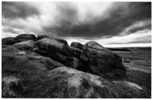
Little Almscliffe Crag (photo – James Elkington)

Coming from Harrogate, take the B6162 and B6161 road to Beckwithshaw, through the village and, 4-500 yards on, turn right onto Norwood Lane.  2 miles along, keep your eyes peeled on your left for a gravelled parking spot and you’ll see the large rock outcrop 200 yards south of the road. …Otherwise, from Otley: go over the river bridge and turn right up Farnley Lane and follow the B6451 for a few miles, thru Farnley village up the Washburn valley, past Norwood and at Bland Hill, turn right along Broad Dubb Road for 1¾ miles where you’ll reach that same gravelled parking spot.

Archaeology & History

Very much the ‘little brother’ of Great Almscliffe, 3 miles (4.83km) to the southeast, this site would be more of interest to the travelling geologist, perhaps, than to antiquarians.  But that depends what tickles y’ fancy I s’ppose.

In 1702 when the northern antiquarian Ralph Thoresby mentioned this and its big brother to the southeast, he described the “two famous crags of Almes Cliff—in some old writings called Aylmoys ut dicitur—but have seen nothing memorial of it, saving its remarkable lofty situation.”  He missed the cup-and-ring carving on the east-side of the crags, obviously, which indicates that it had some form of animistic sanctity in ancient times.

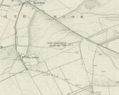
The location on 1851 map
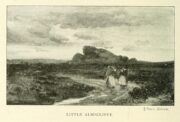
Little Almscliffe c.1900

Little Almscliffe was one of many impressive places located within the ancient Forest of Knaresborough; and although it wasn’t on the original boundary line, a perambulation (i.e., annual ritual walking to the old stones, trees and wells defining the region) of the area written in 1770, in what Mr Grainge called “the Copyhold Forest”, was undertaken by the Enclosure Commissioners.  It differed from the more ancient perambulation rite, in that the newer one included a mention of,

“five bounder stones also marked F to an earth-fast stone, lying northeast of Little Almes Cliffe, marked also with an F; (and) from thence by other four bounder stones marked F to Sandwith Wath…”

The letter ‘F’ here signifying the word ‘forest’, as in the Forest of Knareborough.

William Grainge (1871) also believed these crags to have been a place of druidic worship.  He wasn’t the only one.  Many other writers of the time thought the same thing; and although we have no concrete evidence to prove this, it is highly likely that these rocks would have served some ritual purpose in pre-christian days.  Certainly in more recent times (during the 1980s and ’90s) we know that ritual magickians used this site for their workings.  On a more mundane level, the crags were previously used as a site for for beacon fires.  One was erected here in 1803 when the first Bonaparte threatened to invade England; but I can find no written accounts of earlier beacons here.

References:

  1. Bennett, Paul, The Old Stones of Elmet, Capall Bann: Milverton 2001.
  2. Bogg, Edmund, From Eden Vale to the Plains of York, James Miles: Leeds 1895.
  3. Bogg, Edmund, Higher Wharfeland, James Miles: Leeds 1904
  4. Cowling, E.T., Rombald’s Way, William Walker: Otley 1946.
  5. Grainge, William, History & Topography of Harrogate and the Forest of Knaresborough, J.R. Smith: London 1871.
  6. Parkinson, Thomas, Lays and Leaves of the Forest, Kent & Co.: London 1882.

© Paul BennettThe Northern Antiquarian 

Holy Well, Nether Heyford, Northamptonshire

Holy Well (lost):  OS Grid Reference – SP 66 59 (approximate)

Archaeology & History

In George Baker’s (1822) massive regional history work he spoke of the village being “well supplied with springs, one of which, called Holywell, is medicinal.”  But it would seem to have fallen foul of that thing called progress, as no one has spoken of it since then.  When the Northampton historian, Beeby Thompson, looked for the site early in the 20th century, his enquiries drew a blank and he reported simply that “at the present time no one in the village appears to know of such a well.”  A field-name survey of the area may prove worthwhile…

References:

  1. Baker, George, The History and Antiquities of the County of Northampton, J.B. Nichols: London 1822.
  2. Harte, Jeremy, English Holy Wells – volume 2, HOAP: Wymeswold 2008.
  3. Thompson, Beeby, “Peculiarities of Waters and Wells,” in Journal Northamptonshire Natural History Society, volume 17, 1914.

© Paul BennettThe Northern Antiquarian

West Lamberkine (1), Aberdalgie, Perth, Perthshire

Cup-Marked Stone (lost):  OS Grid Reference – NO 0617 2328

Archaeology & History

Site shown on 1933 map

First highlighted on the 1933 OS-map of the area, it was located alongside the old fence-line hereby, but no subsequent description of the carving has been made since then.  A small boulder and a number of other stones can be found along the line of fencing, but none seem to be possessed of petroglyphs and apart from it being shown on the old maps, I can find no reference or description of it.  It may have been destroyed.  Some researchers have wondered if the carving was mistakenly marked at this spot by surveyors who confused it with another one more than 500 yards to the southeast (and described by Fred Coles in 1903), but this would seem an unlikely error to have been made.  Whilst this was described as a simple “cup-marked stone”, its neighbour at West Lamberkine (2) was a distinct and more complex cup-and-ring design.

References:

  1. Coles, Fred,  “Notices of …(4) of Some Hitherto Undescribed Cup-and-ring-marked Stones…” in Proceedings Society Antiquaries Scotland, volume 37, 1903.

Acknowledgements:  Many thanks for use of the Ordnance Survey map in this site profile, reproduced with the kind permission of the National Library of Scotland

© Paul BennettThe Northern Antiquarian


St. George’s Well, Harrogate, North Yorkshire

Holy Well (destroyed):  OS Grid Reference – SE 2997 5561

Also Known as:

  1. St. George’s Spa

Archaeology & History

About 50 yards away from the Royal Promenade on the east-side of Parliament Street, there used to the flowing water of this old holy well, later becoming one more of Harrogate’s spa wells.  It was first recognized as a medicinal spring about 1792 when Thomas Garnett (1794) uncovered it beneath the overgrowth of vegetation surrounding the spring-head.  In doing so, it became evident that at some time in the past it had been used by local people as,

“a wall was discovered round the spring, but whether this had been built with an idea of its being a medicinal water, or with an intention of collecting water for cattle, I cannot determine.”

Chalybeate (iron-bearing) in nature, the waters were analyzed by Adam Hunter (1830) in the 1820s and, although possessed of soluble iron, had less than its medicinal compatriots nearby, meaning that its fortifying qualities weren’t quite as good. He told us how,

“it had been known (by locals) for many years, but at no time much used internally; it had acquired some celebrity however as a wash for sore eyes, for which purpose it was well adapted.  As chalybeate water has long been a favourite popular remedy for a wash in various weaknesses, and chronic affections of the eyes, it is proper to state that (the nearby) John’s Well, the Tewit Spa, or the succeeding one at Starbeck, are the only three chalybeates which can at present be recommended for that purpose.”

A few years after Hunter had been here, the well was destroyed “by the making of a highway drain.” Jennings 1981)

Folklore

St George (saint’s day – April 23) was one of the christian dragon-killers.  There is no known tradition of the saint or festivities that may once have occured here.

References:

  1. Garnett, Thomas, A Treatise on the Mineral Waters of Harrogate, Thomas Gill: Leeds 1794.
  2. Hunter, Adam, The Waters of Harrogate and its Vicinity, Langdale: Harrogate 1830.
  3. Jennings, Bernard, A History of the Wells and Springs of Harrogate, Interprint: Harrogate 1981.

© Paul BennettThe Northern Antiquarian

St. Ann’s Well, Harrogate, North Yorkshire

Holy Well (lost):  OS Grid Reference – SE 298 548

Archaeology & History

Very little is now known about this sacred site that was once found “a few hundred yards east from the New Church at Low Harrogate.” (Hunter 1830)  Even most of travellers and medical experts who wrote about the numerous Harrogate wells in the 18th and 19th century bypassed its quietude; and by the time Mr Hunter wrote about it in his great descriptive catalogue, its healing or medicinal qualities had been forgotten.

He told that “the spirit in the water…or that with which it is infused, has long been most actively engaged in adding real or fancied comforts to the (Harrogate) Fair, and is now in much more general use” than the two other holy wells in the town. It was, he said, “the best water for making tea and more extensively used for that purpose than any in the neighborhood of Harrogate.”  It would also appear to have been built over at some time in the not-too-distant past…

Folklore

St Ann (saint’s day – July 26) was a giant in early christian and Islamic myths.  An apocryphal figure, She was the Great Mother of the mother of Christ—the Virgin Mary—and was Herself a Virgin until, in Her old age, after seeing a bird feeding a chick, decided She wanted a child and so eventually gave birth to Mary.  An old woman giving birth when the Springtime appears (when birds and other animals become fertile) is the same motif found in the lore of the Cailleach in Ireland and Scotland (and parts of northern England).  Pre-christian lore at this old well would seem evident here.

References:

  1. Hunter, Adam, The Waters of Harrogate and its Vicinity, Langdale: Harrogate 1830.

© Paul BennettThe Northern Antiquarian

Burnt House Well, Tunbridge Wells, Kent

Healing Well (covered):  OS Grid Reference – TQ 6000 3963

Archaeology & History

Shown on early OS maps as a chalybeate spring, the denuded remains of this site can still be seen in Dunorlan Park, between the tearoom and the lake, where the spring can be seen on the left beneath a large tree.  It was first described in John Britton’s (1832) famous account of the area, who told us:

Site shown on 1872 map

“There is a spring, called Burnt House Spring, situated in a little dell, in a romantic spot to the right of the road leading from Tunbridge Wells to Pembury. It is a good chalybeate, and the iron is in a state of carbonate. This spring rises rapidly into a stone basin, placed in the centre of a circular excavation, about ten feet in diameter and six or eight feet deep, which is bricked round, and with the remains of stone steps leading down to the basin at the bottom. This spring, therefore, has clearly been, at some time, made use of as a medicinal water. It was accidentally discovered choked up with rubbish. The country about Tunbridge Wells abounds with springs of this character.”

The spring was cleaned up some time ago and its waters rise in a square stone-lined chamber—accessed by four stone steps—into a circular stone basin, before flowing down a short channel and into the drains.  I’ve no idea whether or not the water is still drinkable.

References:

  1. Britton, John, Descriptive Sketches of Tunbridge Wells and Calverley Estate, Longman: London 1832.

© Paul BennettThe Northern Antiquarian

Fairy Oak, Whitford, Flintshire

Sacred Tree:  OS Grid Reference – SJ 1577 7889

Folklore

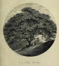
Highlighted on the earliest Ordnance Survey map of the region in 1878 and described much earlier by Thomas Pennant (1796)—almost as legendary as the fairies themselves in some parts—this ancient tree was obviously a place of great repute in the mythic history of the people in previous centuries.  Animistic relationships with the landscape were still deeply embedded in the daily lives of our peasant communities all across the country when Pennant wrote about this place.  In his antiquarian history of the area he described the great mansion of Downing Hall and in its grounds the ruins of Molandina Abbey.  “Above this,” he wrote,

Fairy Oak on the 1878 map
Pennant’s 1796 drawing

“is a spreading oak of great antiquity, size, and extent of branches: it has got the name of the Fairy Oak.  In this very century a poor cottager, who lived near the spot, had a child who grew uncommonly peevish; the parents attributed this to the fairy, and imagined that it was a changeling.  They took the child, put it in a cradle, and left it all night beneath the tree, in hopes that the tylwydd têg, or fairy family, or the fairy folk, would restore their own before morning.  When morning came they found the child perfectly quiet, so went away with it, quite confirmed in their belief.”

Nearby, and in the same grounds of the mansion, Pennant told there to be an even older and greater oak tree that “has in it furrows so deep, and of aspect so uncommonly venerable, as to render its shade as worthy of the solemn rites of the Druids.”

References:

  1. Pennant, Thomas, The History of the Parishes of Whiteford and Holywell, B. & J. White: London 1796.

© Paul BennettThe Northern Antiquarian 

Stone of Stars, Rivock, Silsden, West Yorkshire

Cup-and-Ring Stone:  OS Grid Reference – SE 07507 44564

Also Known as:

  1. Carving no.26 (Hedges)
  2. Carving no.65 (Boughey & Vickerman)

Getting Here

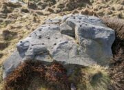
A Stone of Stars, Rivock

The best/easiest way to approach this and the Rivock carvings as a whole is to reach the Silsden Road that curves round the southern edge of Rombalds Moor (whether it’s via East Morton, Riddlesden, Keighley or Silsden) and keep your eyes peeled for the singular large windmill.  About 200 yards east of this is a small parking spot, big enough for a half-dozen vehicles.  From here walk 450 yards east along the road till you hit the dirt-track/footpath up towards the moor.  Follow the track up for about 400 yards and you’ll see the crags a half-mile ahead of you.  Get up there to the Wondjina Stone and follow the walling east for about 175 yards where you’ll see a track-cum-clearing in the woods. Walk along and the first large stone on your left is what you’re after.

Archaeology & History

I first visited this carving in my teenage years in the 1970s, before the intrusive so-called “private” forest covered this landscape and when its petroglyphic compatriots were easier to find.  Thankfully this one’s still pretty accessible and possesses a damn good clear design.  It was rediscovered in the 1960s by Stuart Feather and his gang, zigzagging their way across the open moors, pulling back the heather to see what they might find.  His description of it told how the stone,

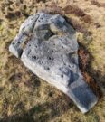
“has two roughly level areas, one 18ins and the other 2 feet above ground level.  Both (levels) have several well-preserved cup-and-ring markings on them.  There are eight single cup-and-rings and 18 cups, two of the latter being joined by a clear channel seven inches long and 1½ inches wide.  Nearly all the markings are unusually well preserved and the pocking marks are very clear.”

Note the line running down

He also had “the impression that all the markings on this stone and possibly one other similar stone in the Rivock area have been carved by the same hand, as all the symbols are nearly identical in in type, size and execution.” (this other carving he’s referring to seems to be one about 170 yards to the north, where occasionally “offerings” have been found)

The design from E-W

When John Hedges (1986) and his team checked the stone out he could only make out “seven cups with single rings, twenty two other cups”; whilst the ever descriptive Boughey & Vickerman (2003) saw “twenty-nine cups, eight with single rings.”  Eight cup-and-rings is what most people see when the light’s right.  There’s also a long, bent carved line on the lower level of the rock, running from near the middle of the stone out to the very edge.  It seems to be man-made (although I may be wrong) – and I draw attention to it as this same feature exists on at least three of the other large and very ornamental cup-and-rings hereby within 300 yards of each other – and on these other carvings the long “line” is definitely artificial.  Tis an intriguing characteristic…

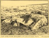
Stuart Feather’s old sketch

When visiting this petroglyph you’ll notice how some of the carved elements on top of the stone are more eroded than those on the lower section.  This is due to the fact that the lower section was only revealed by Feather and his team in the mid-20th century, after it had been covered in soil for countless centuries.  As a result you can still see the peck-marks left by the implements that were used to make the carving, perhaps 5000 years ago!

The name of the stone was inspired by a local lady who saw an astronomical function in the design (I quite like it as well).  Examples of petroglyphs representing myths of heavenly bodies have been described first-hand in some tribal cultures and, nowadays, even a number of archaeologists are making allusions about potential celestial features in some carvings in the British Isles.  That doesn’t mean to say that it’s correct, but the idea’s far from unreasonable…

Anyhow – check this one out when you’re next up here.  You’ll like it!

References:

  1. Bennett, Paul, “The Prehistoric Rock Art and Megalithic Remains of Rivock & District (parts 1 & 2),” in Earth, 3-4, 1986.
  2. Boughey, Keith & Vickerman, E.A., Prehistoric Rock Art of the West Riding, WYAS 2003.
  3. Deacon, Vivien, The Rock Art Landscapes of Rombalds Moor, West Yorkshire, ArchaeoPress: Oxford 2020.
  4. Feather, Stuart, “Mid-Wharfedale Cup-and-Ring Markings – no.16 – Rivock,” in Cartwright Hall Archaeology Group Bulletin, volume 8, no.10, 1963.
  5. Hedges, John (ed.), The Carved Rocks on Rombalds Moor, WYMCC: Wakefield 1986.
  6. Morris, Ronald W.B., “The Prehistoric Rock Art of Great Britain: A Survey of All Sites Bearing Motifs more Complex than Simple Cup-marks,” in Proceedings of the Prehistoric Society, volume 55, 1989.

AcknowledgmentsHuge thanks to Collette Walsh for use of her photos.

© Paul BennettThe Northern Antiquarian

Holy Well, Aston, Oxfordshire

Holy Well:  OS Grid Reference – SP 35833 02611

Archaeology & History

‘Spring’ marks the holy well

First mentioned as the field-name Holywellefield in the Court Roll of 1432, there is a possibility that this seemingly lost site still exists.  It was mentioned briefly in John Giles’ (1848) old history book of the area where he told us that, “a field beyond Cote House on the road to Shifford is still called ‘Holy-well field’, (but) no legend has been recorded.”

If we go 400 yards northeast across the field on the other side of the road from Cote House, a “Spring” that was shown on the early OS-maps would still seem to be actively feeding a dyke that runs roughly north from here.  This is probably the holy well that was described in those Court Roll records—and it still seems to exist.

References:

  1. Gelling, Margaret, The Place-Names of Oxfordshire – volume 2, Cambridge University Press 1954.
  2. Giles, J.A., History of the Parish and Town of Bampton, privately published: Bampton 1848.

Acknowledgements:  Huge thanks for use of the Ordnance Survey map in this site profile, reproduced with the kind permission of the National Library of Scotland

© Paul BennettThe Northern Antiquarian