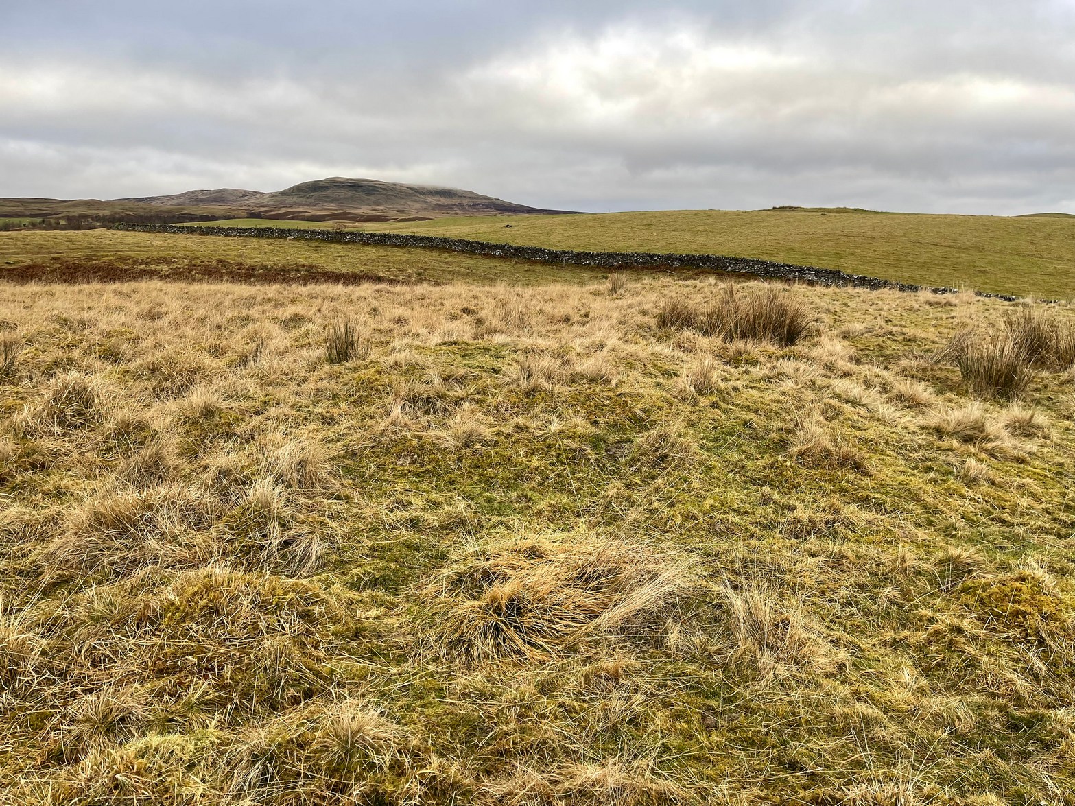
Located in the copse known as Godwell’s Grove on the western boundary of Arkesden, there are good grounds for thinking this was a sacred well: not necessarily relating to the christian God, but what A.H. Smith (1956) described simply as, from the old English, “a (heathen) god.” Another site of the same name is found in Wiltshire. In the local survey by Parish (2010), he told that “its name suggests it is a holy well.”
In Reaney’s (1976) survey on English place-names, he looks at a number of places where the element “god” is found and explores the notion of them recording a personal name, Gode. This is evident of course, but he stated that,
“it would indeed be a remarkable coincidence if all these names…were to contain the personal-name Gode, a short form of Godric, Godwine, etc. It in inconceivable that the reference should be to the christian deity… All are situated in areas of early settlement where heathen place-names might be expected and may well contain OE god, ‘a god’.”
There is no longer any trace of the well.
References:
Parish, R.B., Holy Wells and Healing Springs of Essex, Pixyled Press: Nottingham 2010.
Reaney, P.H., The Place-Names of Essex, Cambridge University Press 1935.
Reaney, P.H., The Origin of English Place-Names, RKP: London 1976.
Smith, A.H., English Place-Name Elements – volume 1, Cambridge University Press 1956.
From Callander head east along the main A84 road and nearly 300 yards past the entrance to the Keltie Bridge caravan park, take the tiny road on your left (north) and barely 100 yards along turn right and go up here for exactly 1 mile. Walk up the track from here and follow the directions to find the Black Park (1) cairn; and then the nearby small Black Park (2) cairn. From here you need to walk north-east round the small rounded hillock in front of you, and cross a small burn (stream) up to the next small grassy rise. Altogether this is about 200 yards from the Black Park (2) cairn. On this grassy rise lives the Black Park (3) cairn!
Archaeology & History
As with its compatriot Black Park (2) cairn 200 yards southwest, this can be hard to see. It’s an overgrown small singular cairn (it looks like a tumulus now) of no great note to look at: probably the resting spot of an individual or just a small family. Measuring some 5-6 yards across and less than a yard high at the most, its easily missed unless you’re really mean to find it. More impressive are the ones on the hill immediately above you to the east. Head there next!
References:
Royal Commission Ancient & Historical Monuments, Scotland, Braes of Doune: An Archaeological Survey, RCAHMS: Edinburgh 1994.
Robin Hood wells are numerous in Yorkshire and Derbyshire, but finding them in this neck o’ the woods is unusual (a Robin Hood’s Farm can be found nearly 14 miles south). The waters here would have had obvious importance for local peasant folk in bygone centuries, perhaps with scatterings of Beltane and Midsummer rites hereby; but it seems that records are silent on such matters. The only reference I can find of this place is in Bracken’s (1860) fascinating work on Sutton Coldfield, where he told that,
“At the extremity of the parish, near Pype, a little field is still called the Bowbearer’s Croft. Tradition says two officers of the chase, bowbearers, had a lodge there; and that their duty was to guide the travellers across the wild country. A very old cottage, that had been well built, was removed from the croft in 1828. In that neighbourhood was a fountain, called Robin Hood’s well, now enclosed within the grounds of Penns, where the natural beauties of the situation have been judiciously displayed and improved by the taste of the late proprietor, Joseph Webster.”
Marshy ground to the east of Pype Hall fed the large pond, which is one contender for the site of this lost well. What has become of it? A search in the local library archives for any old manorial maps, or the field-name maps showing Bowbearer’s would prove truly helpful in relocating this site.
References:
Bracken, L., History of the Forest and Chase of Sutton Coldfield, Simpkin Marshall: London 1860.
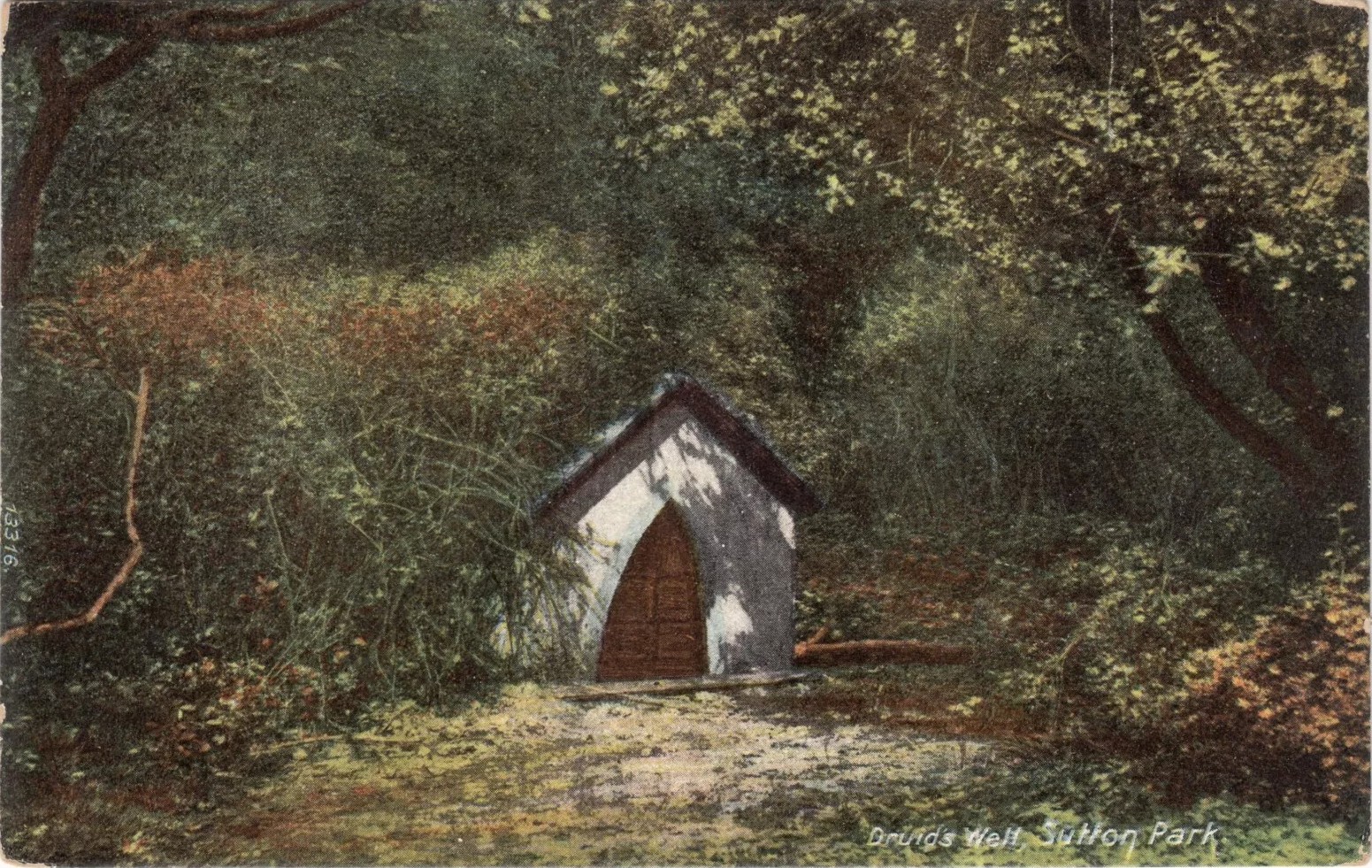
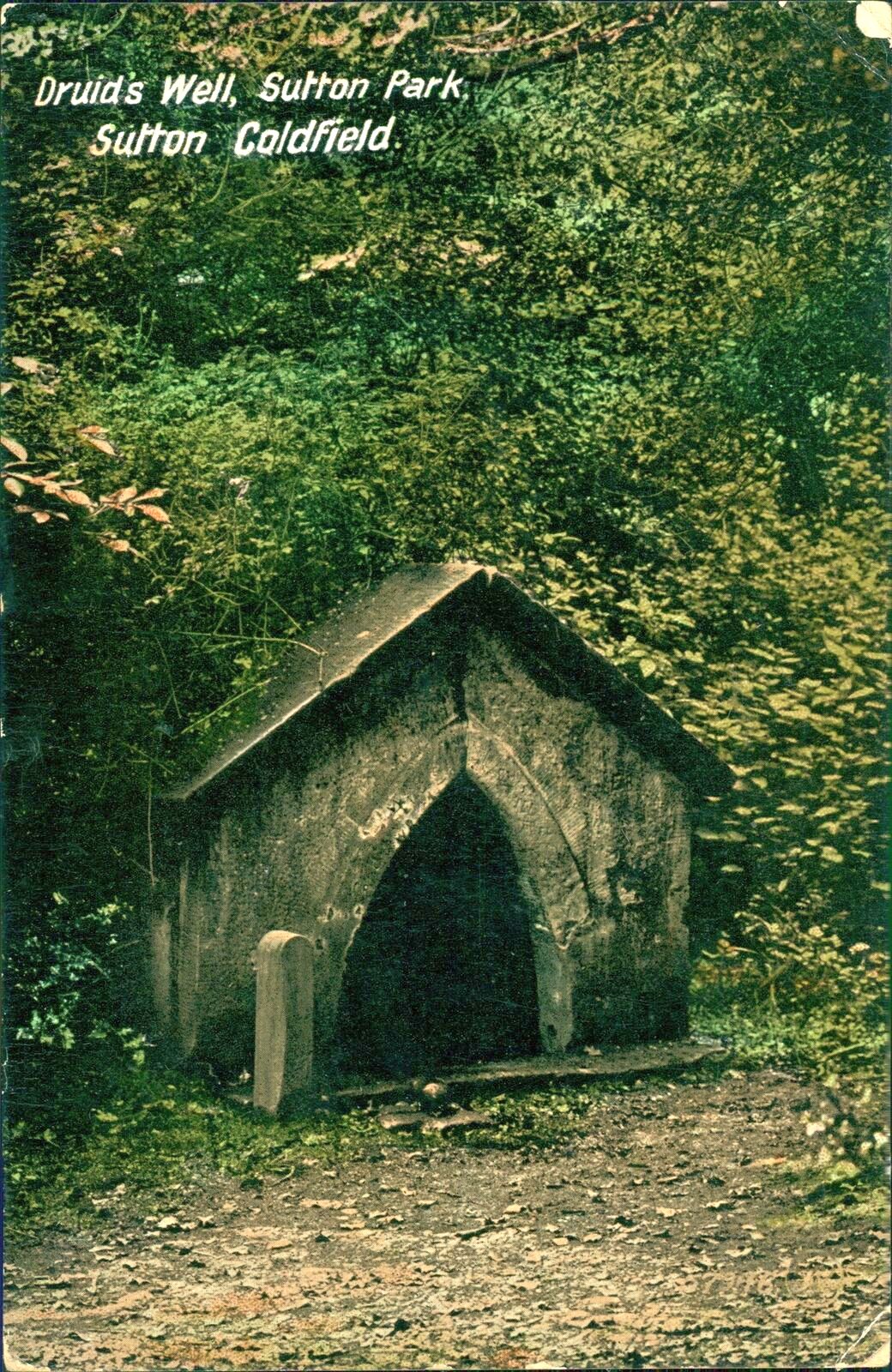
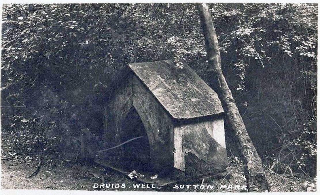
Highlighted on the 1884 Ordnance Survey map of the region and located beyond the far eastern end of Braceridge Lake, this legendary well has seen better days. A small well-house once covered the spring, but all we have left today is little more than a rectangular stone-lined concrete hole-in-the-ground where the waters collect (hopefully some local folk can bring it back to life). But in the 19th century it was well known, much frequented and maintained.
Not much seems to be known about its mythic history, as the traditions surrounding its dual pagan-christian dedication seem to have been forgotten. When the local writer Tom Burgess (1893) came to explore its history, he merely wrote:
“How it came to be called the Druids’ Well is not known, it is scarcely necessary to say that it can have no Druidical connection; it is very probable, however, that it was dedicated to Saint Mary long before the dam of Bracebridge Pool was made by Ralph Bracebridge in the reign of Henry V.”
Druids Well in 1917Druid’s Well in 1932
Jeremy Harte (2008) suggested that this well’s druidic association may have come from a local man, William Hutton who, in the middle of the 18th century, “speculated on a druid sanctuary near Sutton Coldfield.” But before Hutton, the 17th century Staffordshire topographer, Robert Plot, suggested that an arch-druid held residence on Barr Beacon, which is less than three miles west of here. This idea was echoed by Midgley (1904) who told that Barr Beacon “is supposed to have been a Druidical shrine.” Just over three miles to the northwest, the Druid’s Heath (a place-name derived, apparently, from an old family) at Aldridge also had its own array of folklore which, perhaps, may have had something to do with this well’s association. When Roy Palmer (1976) wrote about the Druid’s Well in his folklore survey, he told that Sutton Coldfield,
“is said once to have been the seat of the arch-druid of Britain; perhaps this was his well, which was later christianized.”
So much to choose from…
References:
Bord, Janet, Holy Wells in Britain – A Guide, HOAP: Wymeswold 2008.
Bracken, L., History of the Forest and Chase of Sutton Coldfield, Simpkin Marshall: London 1860.
Harte, Jeremy, English Holy Wells – volume 2, Heart of Albion press: Wymeswold 2008.
Midgley, W., A Short History of the Town and Chase of Suton Coldfield, Midland Counties Herald: Birmingham 1904.
Palmer, Roy, The Folklore of Warwickshire, Batsford: London 1976.
Acknowledgements:Huge thanks for use of the Ordnance Survey map in this site profile, reproduced with the kind permission of the National Library of Scotland.
Sitting quietly “on the village green, where the fair is still held,” wrote Wigram (1885), “stands the base of the old market-cross, reduced to a shapeless stump, but still bearing traces of leaden setting.” Thought to be mediaeval in age, it was described as a sundial on some of the early Ordnance Survey maps which, perhaps, it may have been used as for a short period (although records are silent on the matter). Standing just three-feet tall, this old stone pillar still lives on its ancient spot, as quiet as always, keeping itself to itself…
References:
Wigram, S.R., Chronicles of the Abbey of Elstow, Parker & Co.: Oxford 1885.
When the Grey Cairn above Balnabroich, Kirkmichael, was explored in the second-half of the 19th century by John Stuart (1865) and a number of local labourers, they found the floor of the tomb had been paved with a number of large boulders. Near its centre, along with finding remains of charred wood, they moved some of the rocks and,
“On turning over the stones a circular disc of stone with a hole in the centre was found, and also a small boulder with a cup on its flat face.”
Grey Cairn at sunfall
He made no further remarks about the carving and no intimation that it was removed, so we must presume it is still there, at the botton of the cairn. Any visitors to the site might want to have a look at the massive scatter of surface stones that make up the cairn to see if any further cup-marks exist on them. It’s not uncommon to find them on such giant tombs.
Folklore
A very curious folktale was known of the cairn in the 19th century, whose theme is recognized at numerous other prehistoric sites, but the mythic creature involved here is very much different from the ones we’re used to. Mr Stuart told that,
“The popular belief is that a mermaid is buried beneath it. This mermaid used to throw stones at people who were coming from church at Kirkmichael, and she could only be seen through a hole in the knot of the pine tree. At last she was chased to the hill at Balnabroch on her flight to the waters of Loch Marech, on the other side of the hill, and there killed, when the Grey Cairn was raised over her.”
References:
Royal Commission on the Ancient & Historical Monuments of Scotland, North-East Perth: An Archaeological Landscape, HMSO: Edinburgh 1990.
Stuart, John, “Account of Excavations in Groups of Cairns, Stone Circles and Hut Circles on Balnabroch, Parish of Kirkmichael, Perthshire,” in Proceedings Society Antiquaries, Scotland, volume 6, 1865.
Acknowledgements:Huge thanks for use of the Ordnance Survey map in this site profile, reproduced with the kind permission of the National Library of Scotland.
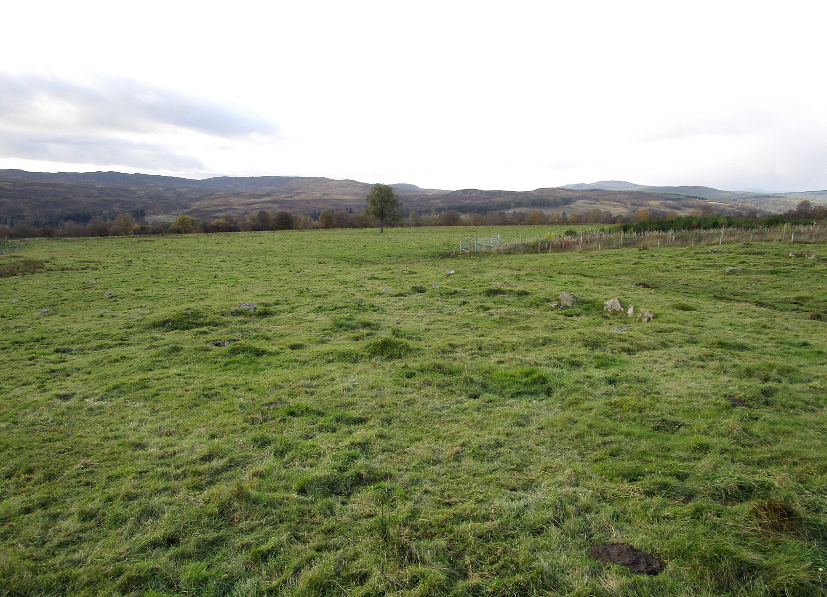
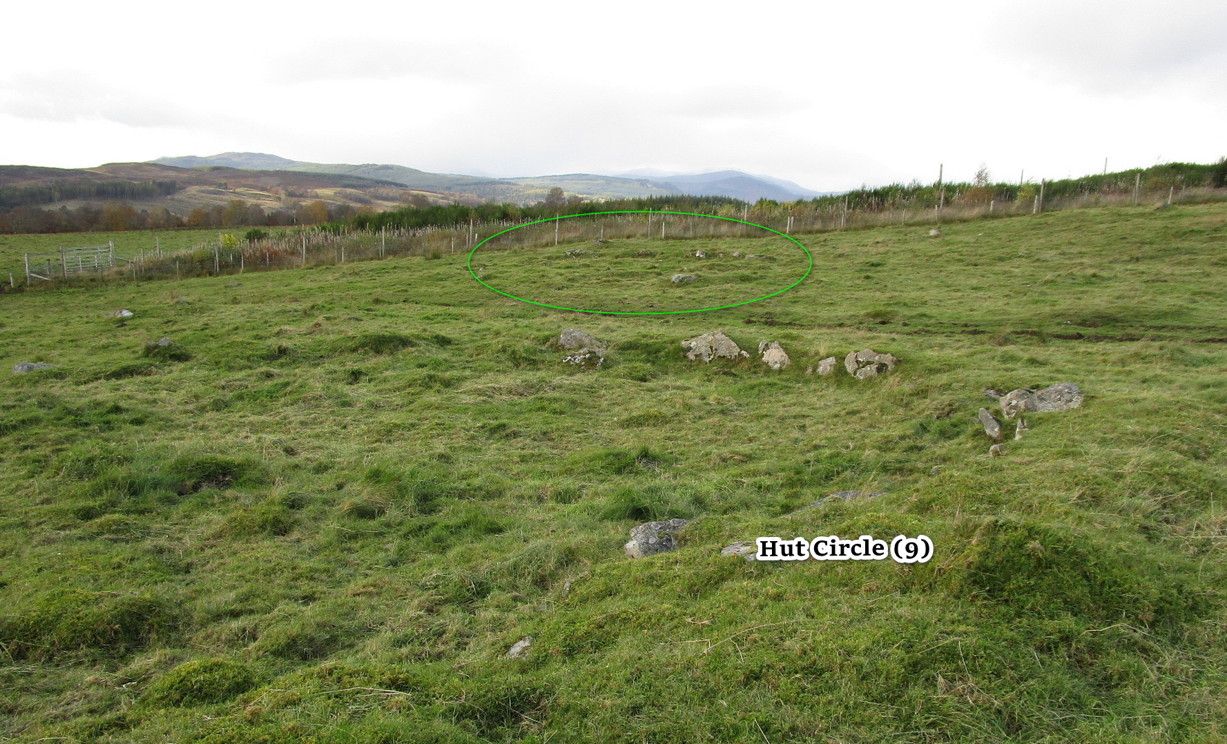
Along the A924 Strathardle road, a couple of miles south of Kirkmichael, about 100 yards south of the Balnabroich standing stone, look out for the dirt-track that runs up the slope on the east side of the road. Go up here, past Stylemouth house and further up the track where it opens out into the fields. Keep heading up the same track and you’ll notice on the near skyline a few hundred yards ahead of you, a mass of stones with a tree growing out of it. That’s the Grey Cairn; and about 75 yards below it, just to the right-side of the path low down in the grasses, you’ll see this hut circle.
Archaeology & History
In an upland area that is literally teeming with ancient remains, this is a good place to start if you’re wanting a day out exploring. It’s the best and easiest of the hut circles to find and is a good indicator of what to look for when you’re seeking out the others close by. This particular prehistoric house has been noted in various books and essays: firstly by the great Scottish antiquarian John Stuart (1868) in his overview of the great mass of sites hereby, saying simply:
“A hut circle on the south-west of the Grey Cairn was dug into around the entrance, in the belief that in this situation articles would probably have been thrown out, but with no result. In the centre, charred wood and minute fragments of bones were found.”
Looking from aboveArc of walling north to east
The great Christian MacLagan (1875) came to survey the area shortly after Stuart’s visit, making a series of sketches of some of the circles. She noted fourteen huts hereby, but it’s not totally clear which of them is this particular “hut 9”. It seems to have been her hut circle no.13, which she told “has a central chamber 40 feet in diameter, and its wall is 10 feet broad.” This is pretty close to our modern measurements. From outer wall to outer wall, its east-west axis measures 47 feet, and its north-south axis measures 49 feet. The most notable section of the walling is on is northern and eastern sides where it is deeply embedded into the ground.
When you’re sitting in this hut circle, eating your sandwich or drinking your juice, remember that thousands of years ago someone was doing exactly the same thing in the place where you’re now sat!
Just 70 feet away is hut circle no.10 in this cluster; whilst above this is the massive prehistoric rock pile of the Grey Cairn; and the smaller earth-covered mound above you to the right is another prehistoric burial. A small stone circle is on the moorland level beyond that… There’s plenty to see here.
References:
Coutts, Herbert, Ancient Monuments of Tayside, Dundee Museum 1970.
Harris, Judith, “A Preliminary Survey of Hut-circles and Field Systems in SE Perthshire”, in Proceedings Society Antiquaries, Scotland, volume 114, 1984.
MacLagan, Christian, The Hill Forts, Stone Circles and other Structural Remains of Ancient Scotland, Edmonston & Douglas: Edinburgh 1875.
Royal Commission on the Ancient & Historical Monuments of Scotland, North-East Perth: An Archaeological Landscape, HMSO: Edinburgh 1990.
Stuart, John, “Account of Excavations in Groups of Cairns, Stone Circles and Hut Circles on Balnabroch, Parish of Kirkmichael, Perthshire,” in Proceedings Society Antiquaries, Scotland, volume 6, 1865.
Thorneycroft, Wallace, “Observations on Hut Circles near the Eastern Border of Perthshire, north of Blairgowrie,” in Proceedings Society Antiquaries, Scotland, volume 67, 1933.
Acknowledgements:Huge thanks for use of the Ordnance Survey map in this site profile, reproduced with the kind permission of the National Library of Scotland.
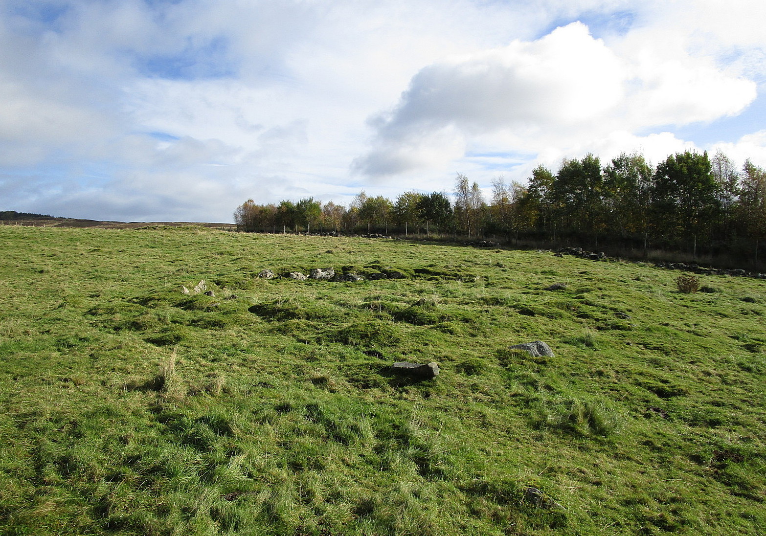
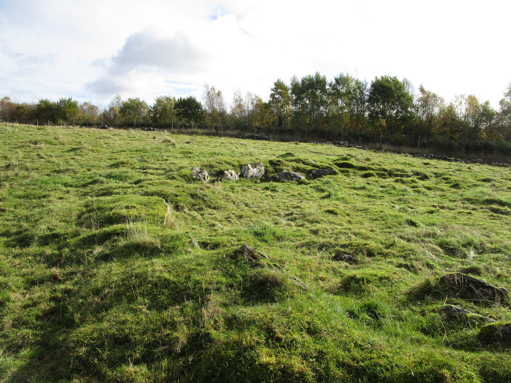
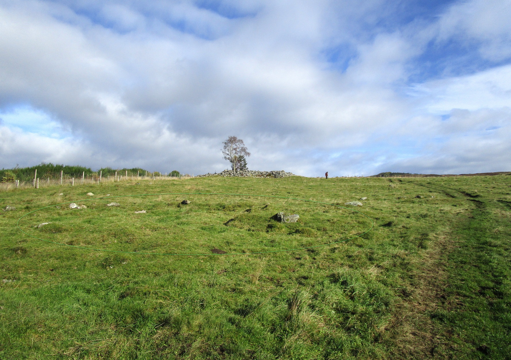
From Kirkmichael to the Balnabroich standing stone, take the same directions as if you’re heading up to the Balnabroich hut circle (9). Just over 20 yards NNW of it, on the other side of the faint footpath that takes you to the Grey Cairn, look closely at the ground and you’ll see a broken oval of stones in the grasses.
Archaeology & History
This can be difficult to see in poor light, and I found it easier to look at from above, closer to the Grey Cairn.
Hut remains, circled
It’s one of the twenty (known) hut circles in this archaeologically rich neck o’ the woods. Nothing special to look at, but it is perhaps 4000 years old! This one seems to have been listed by Christian MacLagan (1875) as her hut circle no.12 and which she described briefly, telling that “the central chamber of this circle is 36 feet in diameter, and the surrounding wall is 15 feet broad.” Much of the walling would seem to have been stripped away considerably since MacLagan’s time. The faded remains of its entrance can be seen on its southwestern side.
References:
Coutts, Herbert, Ancient Monuments of Tayside, Dundee Museum 1970.
Harris, Judith, “A Preliminary Survey of Hut-circles and Field Systems in SE Perthshire”, in Proceedings Society Antiquaries, Scotland, volume 114, 1984.
MacLagan, Christian, The Hill Forts, Stone Circles and other Structural Remains of Ancient Scotland, Edmonston & Douglas: Edinburgh 1875.
Royal Commission on the Ancient & Historical Monuments of Scotland, North-East Perth: An Archaeological Landscape, HMSO: Edinburgh 1990.
Stuart, John, “Account of Excavations in Groups of Cairns, Stone Circles and Hut Circles on Balnabroch, Parish of Kirkmichael, Perthshire,” in Proceedings Society Antiquaries, Scotland, volume 6, 1865.
Thorneycroft, Wallace, “Observations on Hut Circles near the Eastern Border of Perthshire, north of Blairgowrie,” in Proceedings Society Antiquaries, Scotland, volume 67, 1933.
Acknowledgements:Huge thanks for use of the Ordnance Survey map in this site profile, reproduced with the kind permission of the National Library of Scotland.
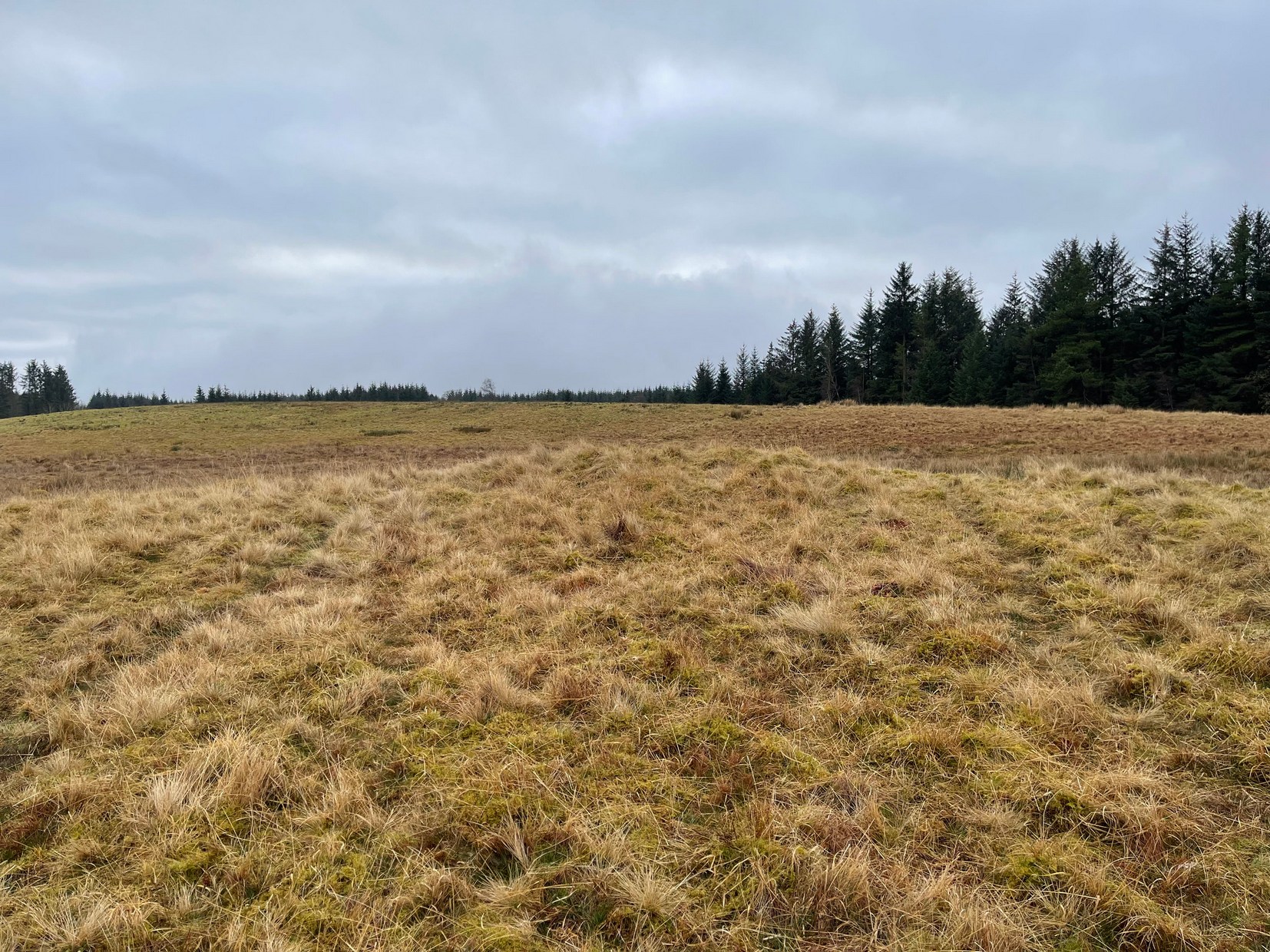
Take the same directions as if you’re going to visit the large Black Park (1) cairn, and from here look down the slight boggy slope to your right (east) and, across the other side of a small burn (stream) you’ll see a slightly raised grassy knoll. A curved dyke is to its left (west) side. You’re there!
Archaeology & History
This small cairn, barely two feet high at the most, and five yards across, is deemed as a possible Bronze Age cairn on Canmore and in the Royal Commission (1994) report of the area. There is certainly a pile of small stones here, but it may be a clearance cairn (I hope I’m wrong). Only an excavation will tell us for sure.
References:
Royal Commission Ancient & Historical Monuments, Scotland, Braes of Doune: An Archaeological Survey, RCAHMS: Edinburgh 1994.
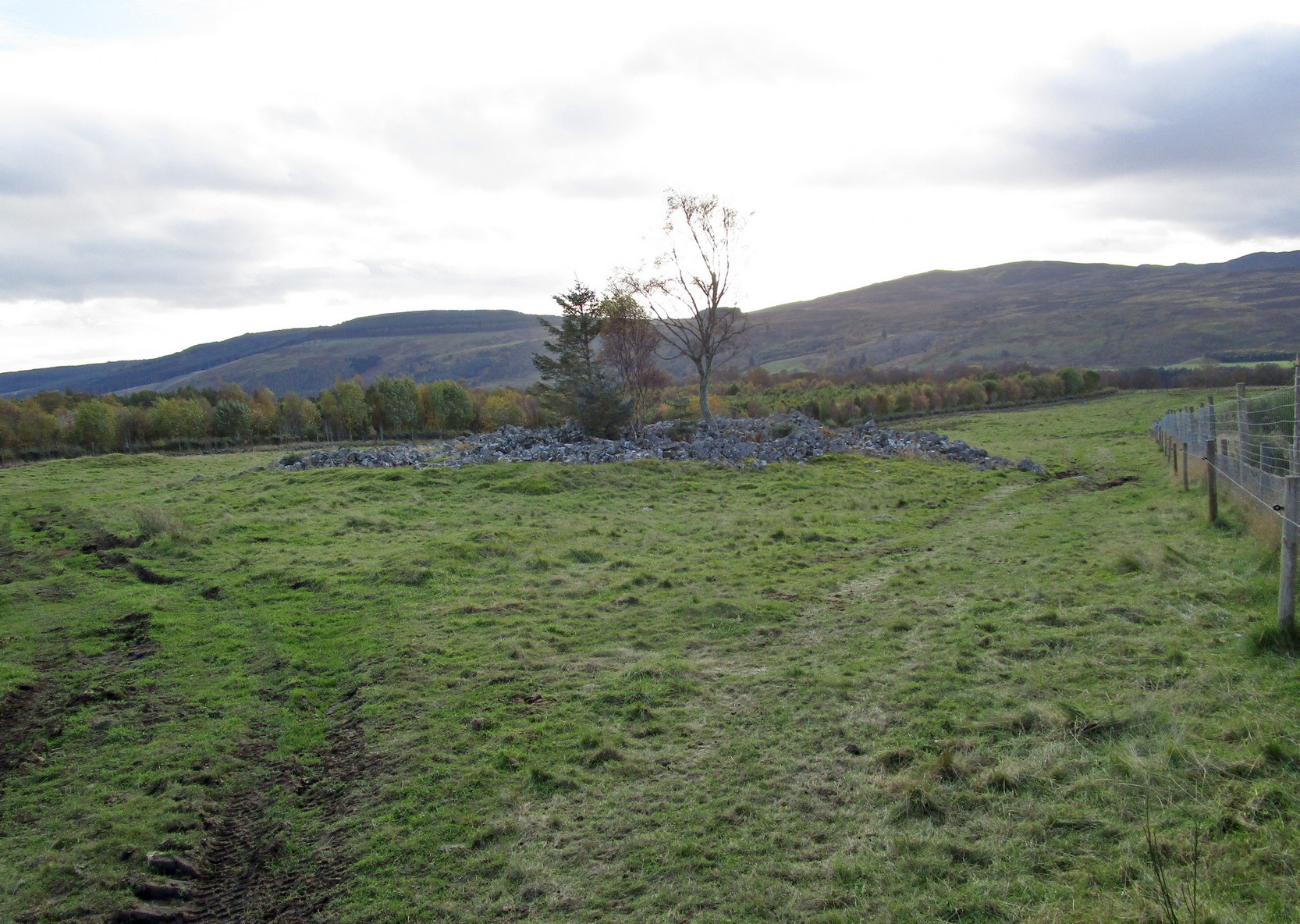
Less than a mile east of Callander on the main A84 road, nearly 300 yards past the entrance to the Keltie Bridge caravan park, take the tiny road on your left (north) and barely 100 yards along turn right and go up here for excatly 1 mile (give or take a few yeards) where track goes into the forest on your left and you can park-up here. Walk up the track into the silence for just under a mile where, as the track splits and you kink to the right, a gate appears. On the other side of the gate, turn immediately left, almost walking back on yourself, just above the curving waters of a burn, through boggy reeds, keeping to the fence-line until, less than 300 yards along, you’ll reach what you’re looking for.
Archaeology & History
Black Park (1), looking W
This reasonably large cairn and its neighbours (Black Park [2], [3], [4] and [5]) would appear to be relatively new discoveries as I can find nothing about it prior to the Royal Commission’s 1994 survey. They are even absent from Moray MacKay’s (1953) excellent work on the area! Hence, descriptions of it are scant and visitors to the place are few indeed (we did meet a local who knew about the old tomb, but said that nothing was known about it); but it is, nonetheless, a fine, albeit denuded and very overgrown cairn, living today amidst a quiet mass of reeds and surrounded by boggy ground—so make sure you’ve got your boots on!
Internal line of stoneworkBlack Park (1), looking SE
At its height, today, it stands less than four feet tall and measures roughly 16 yards across at its widest. Through one section of the tomb there runs a raised line of stonework that almost looks like internal walling, which may have been where a chamber once existed. It’s been hollowed out by someone in the not-too-distant past but, as I said, there are no records of such a thing, so whether or not that was a chamber or merely a fortuituous collapse of stone in a straight line, we can’t really say. Along its more northern edges there seems to be a small raised wall of stone defining its edge, although once again it requires a more discerning examination to work out whether this is part of its original facade, or is a result of some of the stone mass falling to the edges.
Visit the old place and sit with its silence for a while…
References:
Royal Commission Ancient & Historical Monuments, Scotland, Braes of Doune: An Archaeological Survey, RCAHMS: Edinburgh 1994.