East Whitefield, Cargill, Perthshire

Stone Circle (destroyed): OS Grid Reference – NO 1730 3515

Also Known as:

  1. Canmore ID 28503 

Getting Here

Site shown on 1867 OS map

Travelling north from Perth on the A94, take the left hand turn to Strelitz as you go into Burrelton, and follow that road for two miles, and park up about 300 yards past the turning to Gallowhill. The circle stood at the far end (south-east) of the field on your left. Keep the distant gap in the hills in sight and the probable site of the circle is in a dip in the land in front of the ditch.

History & Archaeology

The circle had been destroyed by the middle of the nineteenth century, but was remembered by locals who gave this description to the Ordnance Survey bods:

‘The authorities quoted says that this is the site of a number of standing stones, they formed a circle, and one stood in the centre and according to tradition they were the remains of a Druidical Temple.’

In 1969 an Ordnance Survey archaeologist wrote:

‘There is no trace of this circle, the site being in a level arable field. Immediately to the SE in a ditch running parallel to the fence are about a dozen large boulders cleared from the field, possibly from the site of the circle.’

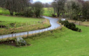
The boulders have now gone but there are some broken stones on the banks of the drainage ditch which may or may not be the sorry remains of some of the stones. There is a depression in the field just in front of the ditch which is the likely site of the circle based on the position shown on the 1867 map.

Left – A faint cropmark which may show the position of the circle in this winter view. Centre – Shattered stones in the ditch bank. Right – View looking south-east from the probable site of the circle – the gap between Black Hill, left and Dunsinane, right

What is interesting is the gap in the horizon facing south east from the site of the circle. On the left of the gap is Black Hill, and on the right Dunsinane Hill of Macbeth fame. My reading of the angle from the probable site of the circle to the gap using a hand held compass was around 135° to 140°, and that may indicate a midwinter sunrise alignment from the lost circle. Something to be checked out when winter comes.

And there is a legend of a giant who leaped from Black Hill to Dunsinane who also tossed a boulder which stands between the two hills – whether this legend has anything to do with the possible solstitial sighting line from East Whitehill is an intriguing question.

Reference:

  1. Ordnance Survey Name Book – Perthshire Vol. XV, 1859-62

Acknowledgements:  Big thanks for use of the 1st edition OS-map in this site profile, Reproduced with the kind permission of the National Library of Scotland

To be continued…

© Paul T Hornby 2021

Giant’s Stones, Arnbathie, Perthshire.

Legendary Stones: OS Reference – NO 16695 26086

Getting Here

The two stones in relation to each other

Travelling north from Perth on the A94, take the right turning for Murrayshall just before entering Scone, then take the first right and continue up to the road junction, and park up at the trackway opposite.  You’ll see the big stone in the field to the right, up against the road embankment; and the small stone is in the paddock to the left of the trackway at the edge of the trees.

Archaeology & History

Two large glacial erratics which have acquired mythic status and picked up a Christian triumphalist message on the way.

Folklore

In Lawrence Melville’s (1939) excellent local history work, he thankfully put to pen an all-but-forgotten tale of oral tradition:

“Where the road from the Muir of Durdie leaves Kilspindie parish, a grass grown road leads north to Boglebee….. A few yards from the highway lie two large stones, said to have been flung from the Giant’s Hill in Collace parish – the flat topped eminence lying due north from the stones, about two or three miles away, better known as “Macbeth’s Hill”, or “Dunsinane Hill”.

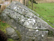
The ‘string’ marks of legend
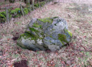
The smaller stone with its ‘string’ marks

“When the church dedicated to St John in Perth was being built and its tower began to appear, a witch living in Collace was enraged to see this proof of the approach of Christianity and determined to destroy it. She had a son, a giant (after whom the hill receives one of its names), whom she sent to the top of the hill, giving him two huge stones with which to destroy the rising church.

“By her incantations she had supernatural power and knew that when Christianity came her power would be destroyed. She gave him her mutch from her head to be used as sling and in it the giant put the two huge stones. Whirling it around his head, he aimed them in a line with the tower, but, just as he let them fly, the string of his mother’s cap broke and the stones only went the length of Boglebee. The marks on the stones are said to be the marks of the witch’s mutch strings.”

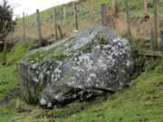
Another view of the larger stone

A familiar folkloric message is remembered the length of Britain:  a giant, a devil or other supernatural being throwing stones that either spill out of an apron or otherwise miss their mark.  And in this case an unsubtle message to anyone trying to take on the might of the church.  But what was the original story of these stones as told by the old time oral storytellers before Christian missionaries stalked the land?

If the string hadn’t broken and the stones had followed their original trajectory they would have fallen south of St John’s Kirk, but it was the thought that counted….

Reference:

  1. Melville, Lawrence, The Fair Land of Gowrie, William Culross: Coupar Angus, 1939.

©Paul T. Hornby 2020, The Northern Antiquarian


Giant’s Leap & Rock, Black Hill, Abernyte, Perthshire.

Legendary Rock: OS Reference – NO 21559 31659

Getting Here

Giant’s Rock in ravine overlooked by the Leap

The Rock and Leap may be seen from the B953 Bandirran to Abernyte road.  Approach across the fields.

Archaeology & History

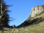
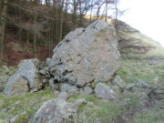
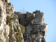
A large boulder perhaps 40 tons in weight lies in a ravine between Dunsinane and Black Hill. The ‘Leap’ is a flat topped ledge jutting out from the west side of Black Hill facing Dunsinane.

Folklore

Melville (1939) in his The Fair Land of Gowrie writes of the simple pleasures of the giant:

“From the farther side of the ravine [between Dunsinane and Black Hill], a precipitous rock juts out, which is called the “Giant’s Leap”. According to the lore of the Sidlaws, a giant, who once lived in these parts, leaped from this rock right on to the top of Dunsinane Hill.  The giant also amused himself by tossing about a huge boulder which can be seen lying at the bottom of the ravine.”

And adds:

The Big Fellow’s toy
Giant’s Leap from the north

“Fairies haunted the hills here and on summer nights they descended to the meadows, where they danced at a spot called “Fairygreen”. The Black Hill gets its name from the dark heath which covers it. Weird and bleak looking for most of the year, the lower slopes are brightened by glowing patches of purple flowers in late summer.”

Fairygreen Farm lies a mile almost due north of Dunsinane.

Reference:

  1. Melville, Lawrence, The Fair Land of Gowrie, William Culross & Son, Coupar Angus, 1939.

© Paul T Hornby 2020, The Northern Antiquarian