Ninewells, Caputh, Perthshire

Ring Cairn:  OS Grid Reference – NO 0757 4360

Also Known as:

  1. Canmore ID 27115
  2. Nine Wells

Getting Here

Outer edge of the overgrown Ninewells circle

From Dunkeld, head out for a mile or so on the long and winding A923 road, taking your first road right along the Craigie and Caputh road, south of the Loch of Lowes.  Go along here for about 2 miles, watching out for the little road to Black Hill on your left, where you can park up (if you hit a road junction, you’ve gone too far). Across the road, note the copse of trees.  Go in there along the walling for about 50-70 yards, past the curious gathering of rounded stones, then walk into the trees where the giant fir trees stand. You’re damn close!

Archaeology & History

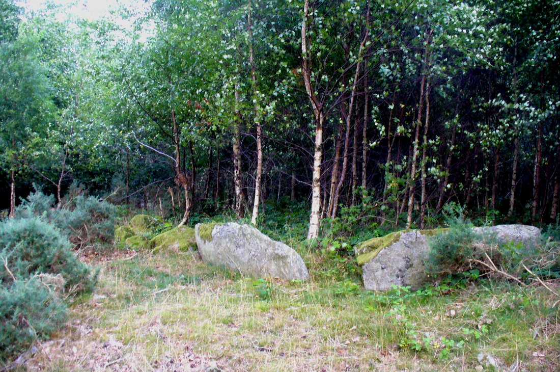
This is an excellent site, hiding away in a scattered copse of woodland, with young trees inside and very old ones in close proximity to its outer edge.  We visited the place for the first time in the middle of summer, not knowing anything about it, and found Nature had covered much of the place in Her usual clothes of fern, bramble, gorse and other vegetation.  Yet despite this, the site was superb!  In a very good state of preservation this ring of small stones is more than 30 feet across, though the stones making up the ring are only small.  Within the ring itself you’ll find many young birch trees growing over a mass of small rounded rocks, typical of cairn material such as found at other prehistoric sites of this nature up and down our northern counties, from the overgrown Roms Law, to Temple Wood and many others.  No evidence of internal burial or cist of any form was noted on our visit, nor mentioned in the Canmore survey.
Section of the Ninewells ring
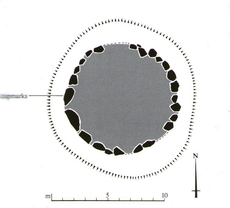
Plan of the Ninewells ring (after RCAHMS)

Although rightly classed as a cairn circle or ring-cairn, I’ve seen sites like this labelled as ‘stone circles’ in the past — and it’s easy to see why once you’re inside this!  If the internal scatter of cairn-material had been cleared in earlier centuries—as with many others—this site would be classed as a typical stone circle.  Curiously it hasn’t fared too well in archaeological surveys, but thankfully the Scottish Royal Commission (1994) lads included the site in theirs, telling us,

“This cairn measures 10m in diameter and 0.75m in height and has a near-complete kerb of large contiguous boulders and slabs set on edge.  The kerb is graded so that the largest, though not the tallest stones are situated in the southwestern quadrant, and one of the stones on the west bears four cupmarks.  Today the cairn material is roughly level with the top of the kerbstones, but there is no evidence to suggest that it has been heavily robbed and it was probably never much higher.  Concentric with the kerb there is an external platform about 0.2m high.  This type of feature is more usually associated with Clava ring-cairns and passage graves around Inverness, which are believed to be of late Neolithic date; but, despite the disturbance of the centre of the Ninewells cairn, there is no evidence of stones defining an internal court.”
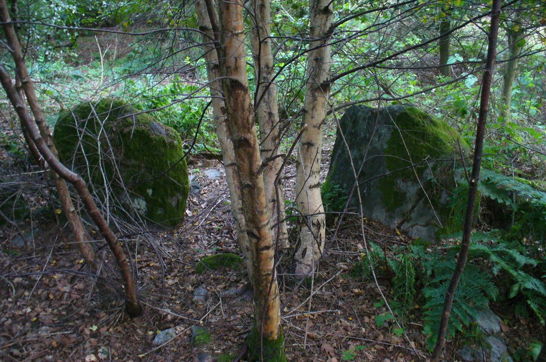
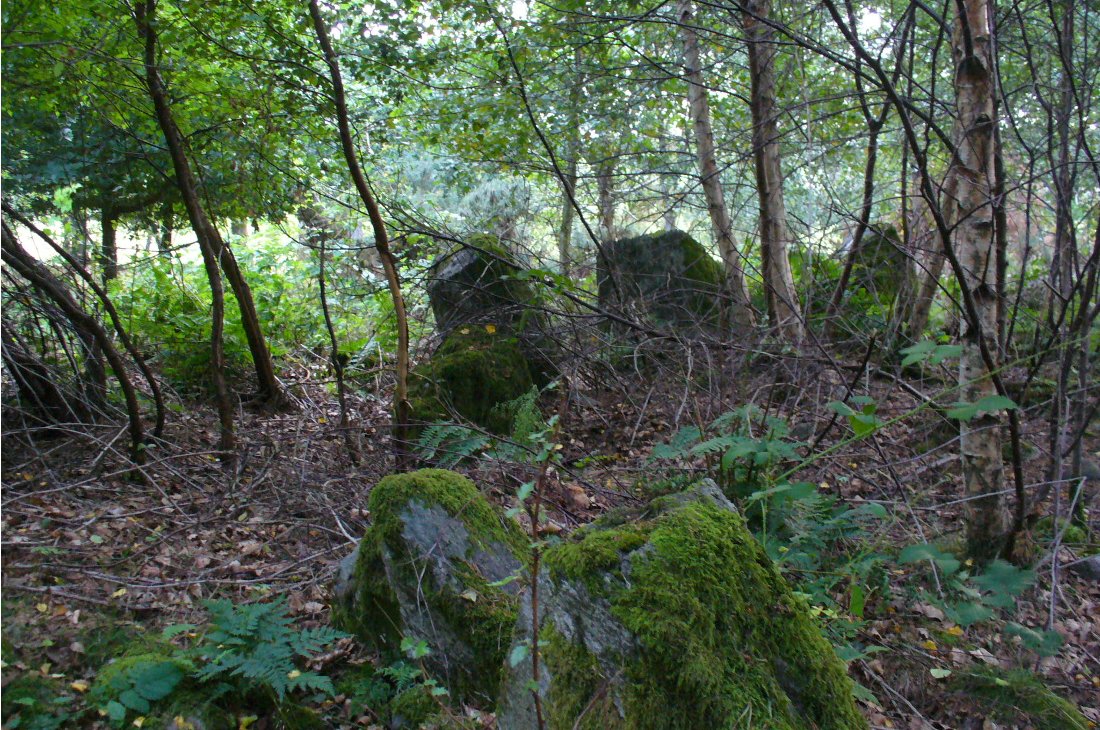
Two of the largest stones

Some broken quartz stones were also found inside this ring.  The cup-marked stone on the west side of the circle has an entry of its own.  Whether or not the ‘opening’ or lack of stones in the north of the ring was intentional can only be known with certainty if an excavation happens here; suffice to say that North is the airt or direction most commonly representative of the Land of the Dead in many early northern cultures, which may explain this. A truly fascinating site…

The name ‘Ninewells’ derives from a cluster of healing springs of water that once flowed nearby.  Several legendary waters with this name can be found in this part of southern Perthshire.

References:

  1. Royal Commission on the Ancient & Historical Monuments of Scotland, South-East Perth: An Archaeological Landscape, HMSO: Edinburgh 1994.

© Paul Bennett, The Northern Antiquarian

Dunkeld Park, Dunkeld, Perthshire

Standing Stone:  OS Grid Reference – NO 01426 42994

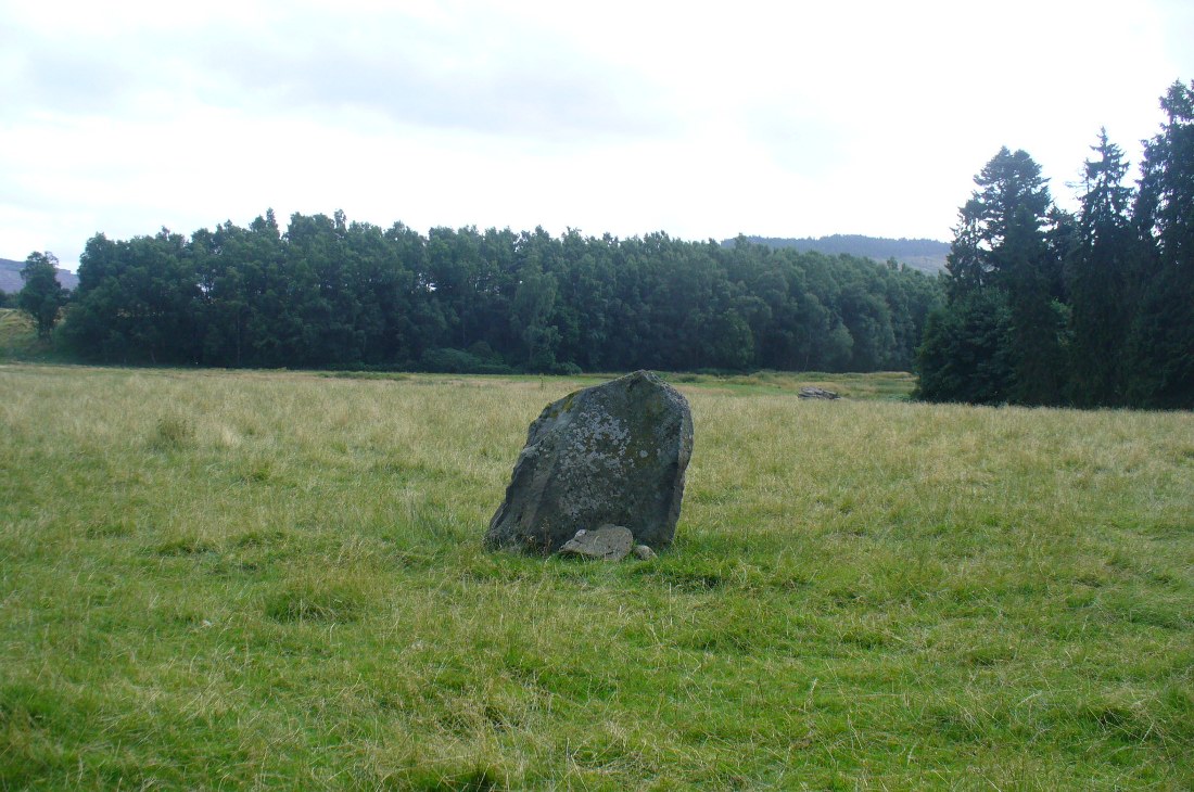
Dunkeld Park monolith

Also Known as:

  1. Canmore ID 27205
  2. Dunkeld House
  3. Pulney Lodge

Getting Here

Take the A923 road through Dunkeld and across the river, making sure that where the road veers sharply to the right as you go out of town, you go the left as the road bends round.  100 yards along, past the trees on your left, fields open up. A few hundred yards along on the left, you’ll note the small standing stone about 50 yards in the field below the wall, getting close to some trees again. That’s the spot!

Archaeology & History

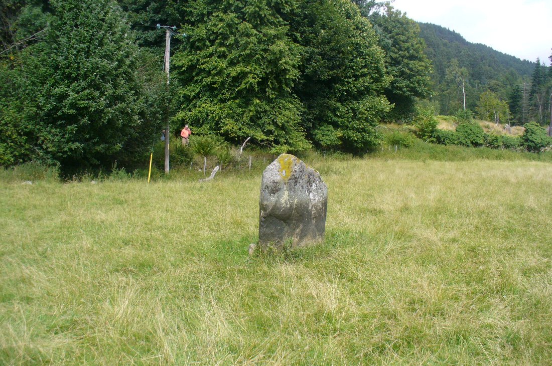
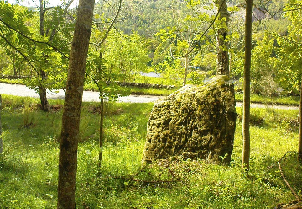
Standing stone, looking NE

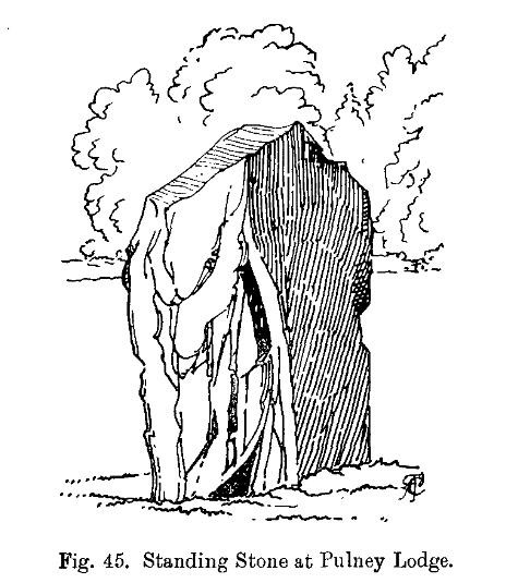
The stone is given only a passing mention in the Royal Commission’s (1994) poor work on the region, describing neither its height nor form and erroneously relating it to what is probably a much earlier series of pit alignments in the same field.  Thankfully we had a better description from the early 20th century antiquarian Fred Cole (1908) who visited and drew the site and who told us:

“This Stone is marked on the Ordnance Map in a field behind the Lodge, at a height above sea-level of 300 feet, and styled “sepulchral.”  In size and character it much resembles the Kilmoraich monolith, and seems to have stood solitary for ages.  It is a roughly oblong slab of schist, set with its longer axis nearly east and west, the north face measuring 4 feet and the south 4 feet 9 inches, and the basal girth about 10 feet 7 inches.  It is 4 feet 9 inches in height.  The grandly-timbered policies of the ducal estate enclose this site on all sides.  In the illustration…the Stone is drawn as seen from the east.”

Fred Cole's 1908 drawing
Fred Cole’s 1908 drawing
Dunkeld Stone looking north

Close to the walling on the WNW just a few yards away, we see a cluster of small rounded stones and a couple of larger stones, much overgrown, giving the impression that they were field clearance.  There is a possibility that they may have had something to do with the standing stone in earlier times; the small stones being very worn and perhaps being part of a cairn—although there seems little evidence of this in the on-line aerial surveys.  The stone was also mentioned in Elizabeth Stewart’s Dunkeld (1926), where she wrote:

“In the park near Polney Loch, one mile from Dunkeld, is a Standing Stone, quite noticeable from the Highland road. This monolith is one of those styled sepulchral, and is a rough oblong slab of schist, its basal girth being 10 feet 7 inches, and its height 4 feet 9 inches. Mr. Coles, who describes this stone in the “Proceedings of the Society of Antiquaries”, supposes it to have been part of a circle. It is not far from the ancient stronghold on King’s Seat.”

References:
  1. Coles, Fred, “Report on Stone Circles Surveyed in Perthshire – Northeastern Section,” in Proceedings of the Society of Antiquaries of Scotland, volume 42, 1908.
  2. Royal Commission on the Ancient & Historical Monuments of Scotland, South-East Perth: An Archaeological Landscape, HMSO: Edinburgh 1994.
  3. Stewart, Elizabeth, Dunkeld: An Ancient City, Munro Press 1926.

© Paul Bennett, The Northern Antiquarian 

Newtyle, Dunkeld, Perthshire

Standing Stones:  OS Grid Reference – NO 04489 41057

Also Known as:

  1. Doo’s Nest
  2. Druid’s Stones
  3. New Tyle

Getting Here

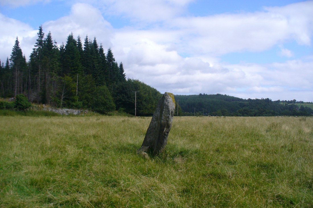
Newtyle’s standing stones

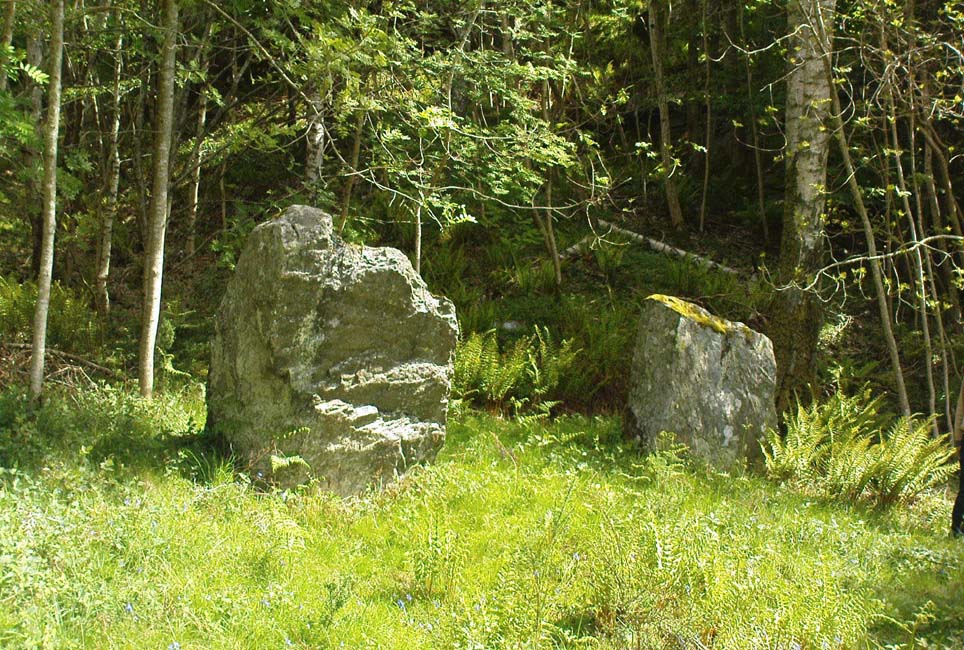
From Dunkeld travel southeast on the A984 road to Caputh and after about 1½ miles, set back a few yards from the road amidst the trees below the Newtyle Quarries (whose mass of slate and loose rocks cover the slopes), you’ll see these two large monoliths.  There’s nowhere to park here, but there’s a small road a coupla hundred yards before the stones aswell as a space to park on the verge by the side of the road a few hundred yards after them.  Take your pick!

Archaeology & History

When we visited these two tall standing stones a few weeks ago, guerilla archaeologist Hornby and I were a little perplexed at the state of these stones, wondering whether they were a product of the fella’s who dug the quarries above here, or whether they were truly ancient.  It seems the latter is the consensus opinion!

They were described by the great Fred Coles (1908) in one of his lengthy essays on the megaliths of Perthshire, where he thought the two stones here were all that remained of a stone circle that once stood on the flat, above the River Tay, but whose other stones “were destroyed in the making of the road” which runs right past here.  Not so sure misself!  He told that,

“An old cart-track runs up between the stones, leading from the main road…up to the quarry. The mean axis of the two stones runs N 13° W and S 13° E (true), and although their broader faces do not point towards the centre of a circle on the west, it is certainly much more probable that the other stones were on this side, the lower and flatter ground, than on the east, where the ground slopes and is more broken and rough.

“Both stones are of the common quartzose schist, but they differ considerably in shape.  A is 6 feet 7 inches high at the north corner, but only 4 feet 10 inches at the south, and its vertical height at the east is only 3 feet.  The basal girth is 13 feet 3 inches, and in the middle 15 feet 9 inches.  The broad east face measures 5 feet.  Stone B is level-topped and 5 feet in height; it has a basal girth of 12 feet 4 inches, and at the middle of 11 feet 8 inches.  Its two broad faces are of the same breadth.”

Little else was said of the two stones for many years and, to my knowledge, no real excavation has been undertaken here.  But when Alexander Thom (1990) visited the site he found that,

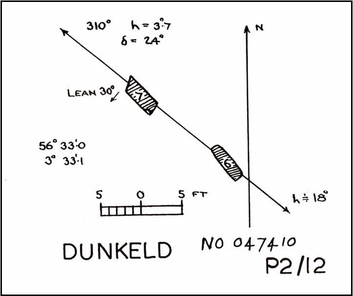
“This two stone alignment showed the midsummer setting sun.  The south stone may possibly, by itself, have shown the setting Moon at major standstill.”

Aubrey Burl’s description of the stones was succinct and echoed much of what Coles had said decades earlier, telling:

“Two very large stones stand only 9 feet (2.7m) apart in an unusually closed-in environment for a Perthshire pair.  The ground rises very steeply to the east.  To the west the stones overlook the valley of the River Tay.

“Both are of local quartzoze schist and are ‘playing-card’ in shape.  As usual it is the westernmost stone that is taller, 7ft 2in (2.2m) in height.  Its peak tapers almost to a point.  Conversely, its partner is flat-topped and only 4ft 9in (1.5m) high.  The pairing of such dissimilarly shaped stones has led to the interpretation of them as male and female personifications.”

Alex Thom’s groundplan
Back of the smaller stone

Burl’s latter remark thoughtfully recognises that such animistic qualities are found in many other cultures in the world and this ingredient was also an integral part of early peasant notions in Britain; therefore such ingredients are necessities to help us understand the nature and function of megalithic sites.  We must be cautious however, not to fall into the increasingly flawed modern pagan notion of such male and female ‘polarizations’, nor the politically-correct sexist school of goddess ‘worship’ and impose such delusions upon our ancestors, whose worldviews had little relationship with the modern pagan goddess fallacies, beloved of modern Press, TV shows and pantomime festival displays.

Folklore

In Elizabeth Stewart’s history of Dunkeld, she narrates the tale told by an earlier historian who told that,

“these two upright stones at the Doo’s Nest, but says they are supposed to mark the graves of two Danish warriors returning from the invasion of Dunkeld.”

References:

Burl, Aubrey, From Carnac to Callanish, Yale University Press 1993.
Coles, Fred, “Report on Stone Circles Surveyed in Perthshire – Northeastern Section,” in Proceedings of the Society of Antiquaries, Scotland, volume 42, 1908.
Stewart, Elizabeth, Dunkeld – An Ancient City, Munro Press: Perth 1926.
Thom, A., Thom, A.S. & Burl, Aubrey, Stone Rows and Standing Stones – 2 volumes, BAR: Oxford 1990.

© Paul Bennett, The Northern Antiquarian