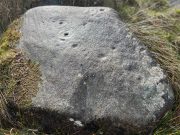
Blarnaboard (3), Gartmore, Perthshire

Cup-and-Ring Stone:  OS Grid Reference – NS 51084 97979

Getting Here
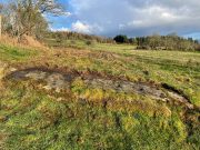
Blarnaboard (3) carving

On the A81 road from Aberfoyle to Strathblane, about a mile south of Aberfoyle take the tiny right turn (keep your eyes peeled!) to Gartmore.  Along the tiny curving road for exactly 1km (0.61 miles), where the road has straightened out there’s a small dirt-track with a parking spot along it. A few hundred yards along there’s a crossroads of dirt-tracks: walk to your left (SW) for nearly a mile (or exactly 1.5km) keeping your eyes peeled for a small distinct footpath leading down-slope on your left. Walk along this undulating path for just over 200 yards till you go through the gate, then walk immediately to your right down the side of the fence in the field for about 20 yards.  Y’ can’t miss it!

Archaeology & History
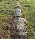
Blarnaboard (3), NE-SW

Located on the land of the early bards of Gartmore, we could speculate that those early orators told tales of, and from this old stone—but that’s all it would be: dreamy speculation.  Instead, passing that aside, the petroglyph itself brings us a feast to drool over!
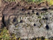
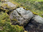
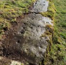
Made up of four distinct carved sections of almost interconnecting rock, this flat thin line of stone is covered with an impressive array of cups and multiple rings.  Running downhill in a northeast to southwest line, it would appear to have been written about for the first time by Lorna Main (1988) who subsequently described it in the usual archaeological shorthand, simply telling that,

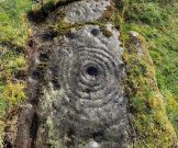
“There are at last 28 cups, 3 cup and one ring, 4 cup and two rings, 2 cup and three rings, 1 cup and five rings and 1 cup and seven rings.”
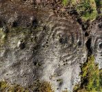
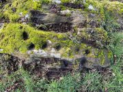
Multiple ringed element
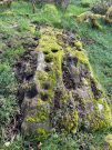
Section 1 overview

…But, as usual, there’s much more to be said of it than that.  Of the four sections, we’ll start at the uppermost northeastern section and work down the sloping ridge, looking at the respective symbols as we go.  Section 1 has the largest surface area, but isn’t the most decorated of the bunch.  Nonetheless, what we find here is impressive. About a dozen single cup-marks of various ages are scattered over the surface in what initially seems to be no recognizable order; these are accompanied by two single cup-and-rings: one of which could be said to be of standard size and form, whilst the other has a much larger and broken ring, near the middle of the rock, about 12 inches across.  This larger ring has two or three of the cup-marks incorporated into its outer edges.  The most impressive element of Section 1 is the large multiple-ringed design, five in all, radiating outwards or funneling inwards (depending on what was intended) around a central cup.  The outer ring of this is incomplete.
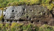
Impressive cup & 7 rings
Scatter of cups & rings

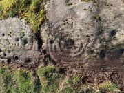
Section 2 is the most visually impressive of all the Blarnaboard (3) carvings: almost an evolutionary development of what we see on the first part.  A 2-dimensional panorama shows off a distinct cup-and-ring close to the edge of the soil, and there’s a somewhat wonky incomplete cup with double-ring below it.  A very clear cup-mark to the right of this has another faint incomplete double-ring round it—but this is hard to see. The same cannot be said of the cup with seven concentric rings surrounding it! (the outer two of these are incomplete)  As I walked round and round this section, drooling somewhat, it became obvious that a number of well-defined cup-marks had been carved around the outer edges of the rings, deliberately creating an eighth ring comprised purely of cup-marks.  It gave me the impression of it representing heavenly bodies revolving around the central Pole Star; but also of it defining the movement of the Moon through the heavens during a calendar year. (the astronomy of my youth still comes through at times!)
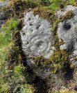
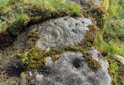
Section 3 carving
Faint double cup-and-ring

By comparison, the third and smallest section of Blarnaboard (3) almost pales into insignificance, possessing a mere cup-and-double-ring—and a  very faint one at that.  From a certain angle it looked like it possessed a third ring, but this was probably more to do with me wanting to see more than there is!  Just below this double-ring, a single cup has what might have once been another incomplete ring round it—but we’d need the computer graphic students among you to suss that bit out!  You can’t make it out on the photos here, sadly…
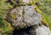
Section 4 carving
Faint double-arc, lower cup

The fourth section is the most visually unimpressive of the entire cluster and was probably carved much later than the rest.  The poor little fella has just five single cup-marks, with a sixth at the top-corner or northeastern part with what seems to be a small carved double-arc, or partial lozenge, that was started and never finished.

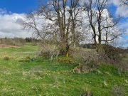
A couple of other exposed sections of stone running a few more yards further down the same line have no carvings on them—but there may well be more to this petroglyph hiding beneath the turf, which covers quite a large area.  I have no doubt that other unrecorded carvings exist in close by, but due to excessive forestry plantations all around here, they’ll either be covered over or will have been destroyed.  Don’t let this put you off looking for others though!
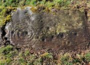
Cup-and-five-rings
Cup-and-seven rings

An interesting feature of this long line of stone is its potential alignment.  When we were photographing the site, a local man came over and got chatting with us.  He knew of the carving and had been here many times and told us that his wife had looked at this one and found it aligned with another cup-and-ring on the south-side of Blarnaboard farm and another one (officially unrecorded) even further along.  I checked this when I got home and found that this long line of petroglyphs did indeed line up with the Blarnaboard farm carving, perfectly.  Whether this was intentional and/or possesses an astronomical function, we might never know.  The third carving along the line has yet to be located.  I must emphasize however, that the relationship between earthfast petroglyphs and alignments is very rare and, where found, is little more than fortuitous.  But when we find cup-markings on alignments of standing stones and other prehistoric monuments, the relationship seems to be much more intentional and would have had a specific mythic function.

If y’ follow the fence-line from this carving down to the small burn, on the other side is the much less impressive Blarnaboard (2) cup-marked stone.

Folklore

Prior to Lorna Main’s (1988) short note on this petroglyph, local people had long known about the carving.  As late as the 20th century, people with fevers were brought to this stone in the early morning to be cured of the illness.  The idea was that medicinal herbs were collected and placed in some of the cup-marks, which were used like a mortar and pestle to prepare the plants.  This healing magick, spoken of by some of the old folk in Aberfoyle, was known to them as children, who’d been told of this by their elders and, of course, by the elders before them.

There is also a tradition that some of the stone that makes up the curious moondial (not sundial) that can be seen at the back of the church in Gartmore village nearly a mile to the southeast, originally came from here.

References:

  1. Main, L., “Blarnaboard (Aberfoyle parish), Cup and Ring Marked Outcrop,” in Discovery & Excavation Scotland, 1988.

Acknowledgements:  Huge thanks for use of the Ordnance Survey map in this site profile, reproduced with the kind permission of the National Library of Scotland

© Paul BennettThe Northern Antiquarian

Blarnaboard (2), Gartmore, Perthshire

Cup-Marked Stone:  OS Grid Reference – NS 50977 97972

Getting Here

Blarnaboard (2) site

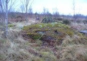
Anyone who’s going to visit this carving will be doing so as a result of visiting the impressive Blarnaboard (3) cup-and-ring stone, 115 yards (105m) away.  From Blarnaboard (3), walk down the slope on your right (west), cross the tiny burn and go round to the other side of the small rocky hawthorn-topped hillock just a few yards in front of you.  Fumble about and you’ll find what you’re looking for!

Archaeology & History

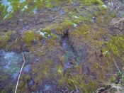
It’s possible that there’s more to this carving than meets the eye.  On the west-side of this small rocky rise, along a thin elongated raised section in the stone, a gently meandering line of nine deep cups runs roughly northeast to southwest.  You can’t really miss them as they average some 2 inches across and 1 inch deep, strongly suggesting that they were cut and reworked over and over for a long period of time.

Line of cups, from above
Rough NE-SW alignment

It was first described in distinct brevity by L. Main (1988) who told that, “over a length of 60cm on a north-east facing outcrop are 9 cup marks.”  And, whilst all of the cups are clearly visible, one of them at the edge of the stone has been cut or worked into a natural curved hollow.  You’ll see what I mean when you visit the site (it’s pretty clear in the photos).

Beneath the roots and soil there may well be other cup-markings that are still hiding away on this rocky dome.  I have no doubt that other unrecorded carvings exist in this area, but due to the excessive forestry plantations all around here, they will be covered over or have been destroyed.

References:

  1. Main, L., “Blarnaboard (Drymen parish), Cup Marked Rock,” in Discovery & Excavation Scotland, 1988.

© Paul BennettThe Northern Antiquarian

St. Maha’s Well, Buchanan, Stirlingshire

Sacred Well:  OS Grid Reference – NS 4573 9180

Also Known as:

  1. Canmore ID 43475
  2. Saintmaha Well

Getting Here

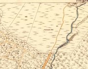
St Maha's Well on 1865 map

St Maha’s Well on 1865 map

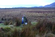
Bittova walk to reach this one.  From The Square in Drymen village, take the long Old Gartmore Road north for 1.4 miles (2.25km) until you reach the West Highland Way track. Turn left and walk along the track for 1.75 miles (2.8km), making sure that you note crossing the large burn as a guide before your next turn, right, uphill and further north. About 400 yards up, you emerge from the forestry plantation and onto the open moorland. Walk about 200 yards (185m) up the track then walk left, right into the boggy moorland. Keep your eyes peeled for a small standing stone on the heath about 130 yards along, and just below this is a stone-lined spring of water.

Archaeology & History

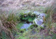
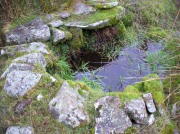
St Maha's Well

St Maha’s Well, near Drymen

This little-known healing spring of water, high upon the moors overlooking the southern isles of Loch Lomond and the mountains beyond, is in a beautiful (if boggy) setting.  We visited here on a somewhat wet day, amidst a wealth of Nature’s downpours in previous days giving us the masks of grey overcast skies and soaking grounds.  Despite this, the setting is gorgeous and, if we’d have visited on a sunny day, the feel and views would be outstanding.  This mighthave been one of the reasons that this particular spring of water was chosen to be sanctified.  Certainly it has an ancient history, if christian tales are anything to go by…

Although listed in the parish of Buchanan, the well resides on the hills above the village of Balmaha more than 2 miles to the west, on the shores of Loch Lomond; and Balmaha is thought to have its origins enwrapped with an early christian characters of some prominence.  The element maha derives, said Watson (1926) from the Scottish Gaelic ‘Mo-Thatha’, from the earlier Irish name Tua, meaning “the silent one.”  The character known as St. Maha gives his name to the village and according to H.G. Smith (1896),

Bal maha may most probably retain the memory of St Mochai or Macai; Latin, Maccaeus, also known as St Mahew, a companion to St Patrick, to whom the church of Kilmahew in Cardross was dedicated.  Mahew lived at Kingarth in Bute, and Buchanan formed part of the district superintended by Kingarth.  He was a poet, physician, and noted in his day for his mathematical learning… (St Mahew’s day was 11 April).”

Close-up of the waters and stone surround

Close-up of the waters and its stone surround

It seems therefore probable that this poet-healer character underlies the old name at this well.  St. Maha’s attributes as a poet and healer would suggest he was trained in archaic techniques before declaring himself as ‘christian.’  In the landscape nearby are other early Irish christian traditions, pasted onto much earlier heathen ingredients.

When Mr Smith (1896) wrote about the well, the remains of an old tree still grew above the waters onto which local people left memaws and offerings for the resident spirit, maintaining the animistic traditions of popular culture that still endure.  He wrote:

“St Maha’s Well is in an upper field of the farm of Crietihall.  It was of old a healing well, and in the memory of man pieces of cloth used to be fastened to a tree which overshadowed it, votive offerings by the pilgrims who sought the saint’s favour.”

…Although in truth, “the saint’s favour” is mere window dressing for the more archaic and natural feel of the site: what John Michell (1975) would have termed the “resident Earth spirit.”

The well is surrounded by a small arc of stone masonry, which the ever-reliable Royal Commission (1963) lads tell us, “measures 2ft by 3ft internally and stands about 1ft above the surface of the water.”  Just above the well itself is a small rise with a standing stone at its edge—probably medieval in origin.  Barely three feet tall, it sits upon an overgrown arc of stones that curves around the hillock reaching down towards the well and was obviously a small building of some sort in previous centuries.  Its precise nature is unknown, but it has been suggested to have either been an earlier well-house or surround, or perhaps the remains of a hermit’s cell—even St. Maha himself—that has fallen away over time.  Without an excavation, we may never know what it was!

Little Leo by the little stone

Little Leo by the little stone

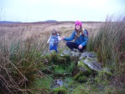
Aisha with Leo, shortly before he threw himself in!

Aisha with Leo, shortly before he threw himself in!

Whatever the origin behind the small standing stone and the overgrown scatter of rocks, one of our adventurers on the day we visited—little Leo—was fascinated by it, almost attaching himself to it and stroking his way round and round the old stone with playful endurance.  And then, when he got to see the sacred spring below, became so taken by it that he simply sat down in the waters without as much as making a gasp, despite the cold!  Aisha (his mum) would pick him up, only for him to walk right back over and sit himself right back into it again!  It was both comical and fascinating to watch and he seemed quite at home in the pool, despite being drenched and cold.  Indeed, he took exception to being lifted out of the water—and simply plonked himself back in it again!

Folklore

The Canmore website tells some intriguing folklore about the place, saying:

“The well is still a focus of local cult, and is visited by people who leave offerings in the water. A man dying recently in a local hospital refused to drink any water except water taken from this well.”

References:

  1. Edlin, Herbert L. (ed.), Queen Elizabeth Forest Park, HMSO: Edinburgh 1973.
  2. Johnston, James B., The Place-Names of Stirlingshire, R.S. Shearer 1904.
  3. Michell, John, The Earth Spirit: Its Ways, Shrines and Sanctuaries, Thames & Hudson: London 1975.
  4. Morris, Ruth & Frank, Scottish Healing Wells, Alethea: Sandy 1982.
  5. Nicholson, A. & Beaton, J.M., “Gaelic Place-Names and their Derivations,” in Edlin’s Queen Elizabeth Forest Park, HMSO: Edinburgh 1973.
  6. Royal Commission on the Ancient & Historical Monuments Scotland, Stirling – volume 1, HMSO: Edinburgh 1963.
  7. Smith, H. Guthrie, Strathendrick and its Inhabitants from Early Times, James Maclehose: Glasgow 1896.
  8. Watson, W.J., The History of the Celtic Place-names of Scotland, Edinburgh 1926.

Acknowledgements:  Many thanks to Aisha Domleo, Lara Domleo, Leo (the stone-hugger) Domleo, Unabel Gordon, Nina Harris, Paul Hornby and Naomi Ross for their help and attendance in finding and falling about this ancient sacred well. A damn good wet day all round!

© Paul BennettThe Northern Antiquarian


Garadh Ban Wood, Buchanan, Stirlingshire

Chambered Cairn:  OS Grid Reference – NS 45217 91907

Also Known as:

  1. Canmore ID 282019

Getting Here

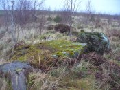
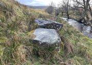
The main stones in this ruined cairn

The main stones in this ruined cairn

On the B837 between Balmaha and Drymen at the hamlet called Milton of Buchanan, at the little road junction where the houses are on the right, go uphill for 1 mile (1.6km) until you reach the West Highland Way, where you need to go left (NW).  Keep walking for another half-mile (if you get to end of the forestry plantation, you’ve gone too far) where, on your left, a small widening valley appears.  Walk along the eastern edge of this, keeping your eyes peeled for a small upright stone and two large flat companions next to it.

Archaeology & History

This site is really only for the archaeological purists amongst you, as the forestry plantation has truly taken its toll on the site and very little of it remains.  It appears to have been described first of all in H.G. Smith’s (1896) masterful local history work—although popular tradition was not assigning the place as a prehistoric tomb of any sort.  Rather, it possessed a somewhat familiar folklore element, well-known to occult historians and antiquarians.  Smith told us:

“Not far off, in Garradh-ban Wood, is the ‘Deil’s foot mark stone‘.  It is a large flat stone, 7 feet long and 6 feet wide, with an impression on it not unlike a huge foot mark.  There is another stone close to it, 7 feet by 5 feet.  These stones were probably placed there for some purpose now unknown.”

Mr Smith’s dimensions of the stones correlate closely with the modern analysis taken up by the archaeologists who visited the site more than 100 years later.  Mainly comprising of two large stones on the ground with an accompanying upright monolith on the western side, the official Canmore account tells us:

“The cairn has been reduced to a low stony mound measuring 15m from N to S by 12m transversely and up to 0.5m in height. The chamber, which lies off-centre to the SW, comprises two upright stones and two displaced capstones. The overall plan of the chamber can no longer be determined, and the two upright stones are set splayed to one another; that on the W measures 0.53m by 0.25m and 0.15m in height, and that on the E is heavily laminated measuring 1m by 0.18m and 0.8m in height. The SE corner of one capstone rests on the smaller of the two uprights. It measures 2.1m by 2.03m and up to 0.3m in thickness, and has two fragments broken off at its NE corner. The second capstone lies immediately adjacent to the N, flush with the surface of the cairn, and measures 2.3m by 1.7m and 0.17m in thickness.”

When they assessed the site in 2006, archaeologists reported finding small pieces of quartz scattered over the surface of the cairn, but when we visited here last week, there was little trace of any.

The 'Deil's foot mark'

The ‘Deil’s foot mark’

Garadh Ban, looking west

Garadh Ban, looking west

I was hoping that the “Devil’s footmark” on the stone was going to be a cup-marking of some form, as found at some other sites (Kilneuair church, etc)—but it wasn’t to be.  Instead, it seems that the curvaceous indentation left by the ‘devil’ was simply a natural cavity.  The folktale behind the name, and its possible cultural function, seems to have been forgotten.

Although (perhaps) unrelated, H.G. Smith told us of other remains not too far from here, which remain elusive and not in any official record-books.  We had a quick meander over to see if there was anything to be seen, but daylight was fading fast and more searches are required.  It sounds intriguing:

“A little above these ruins (of Cul-an-Endainn farmhouse at NS 4453 9244 – PB), on the right of the burn, but considerably above it, is a curious structure built of turf.  It is quite round, and is 25 feet in diameter at the top and 15 feet at the bottom.  It has entrances at the south, east and west.  There are others of the same construction both above and below, but not so well defined.”

Recently, industrialists have gone onto this part of the countryside and have already began scarring the hillsides, perhaps even destroying these curious remains before we’ve had a chance to assess them.  Hopefully however, they will remain untouched and allow us site analysis before any real damage is done.

Folklore

Followers of the christian cult said this site was a place where the devil had been.

References:

  1. Smith, H. Guthrie, Strathendrick and its Inhabitants from Early Times, James Maclehose: Glasgow 1896.

Acknowledgements:  Many thanks to Aisha Domleo, Lara & Leo Domleo, Unabel Gordon, Nina Harris, Paul Hornby and Naomi Ross for their help and attendance in finding this ancient site. 

© Paul BennettThe Northern Antiquarian


Corrie (1), Gartmore, Perthshire

Cup-and-Ring Stone:  OS Grid Reference – NS 49502 95052

Also Known as:

  1. Canmore ID 43472

Getting Here

The cup-and-ring stone

On the A81 road from Aberfoyle to Strathblane, about a mile south of Aberfoyle take the tiny right turn (keep your eyes peeled!) to Gartmore.  At the end of the village, turn right at the T-junction.  Just over a mile along the tiny road, just over the tiny road-bridge, turn right again up up the dead straight road to Drymen for nearly a mile and park up.  A dirt-track is on your right: walk along here for ¾-mile (1.2km) and in a large field on your left a huge rock sits (no carvings on it).  Keep walking on the track and where the field ends, a path to your left runs above a small burn.  Naathen, 150 yards along here, look down at the waters and there’s a clump of large rocks. Check ’em out!

Archaeology & History

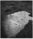
Morris’ old photo (from PSAS 1967)

This stone and others were mentioned in MacNair’s (1973) essay in the popular history guide to the region, after it had seemingly been rediscovered a few years earlier by Ron Morris (1967; 1969), who listed it in his petroglyph catalogues.  It was originally located at the top of the slope above the burn, but was rolled down here shortly after Morris discovered the cup-and-rings on it.  The farmer at the time had made a bore-hole into the rock with the intention of blowing it up, but Morris found it just in time and the stone managed to survive!

Faint CnR’s just visible

It’s a large rock with a decent ornate design that was clearly visible when Morris surveyed it (see photo, right).  It comprises of, “a cup-and-two-rings, 18cm (7in) diameter, 6 cups-and-one-ring (2 of which are tangential) and at least 8 cups.  All rings are complete.  Greatest carving depth 2cm (¾in).”  There also appears to be a line of four or five small cup-marks running in a short line by one of the lower cup-and-rings, but these are very faint indeed.  The double cup-and-ring mentioned by Morris is the one at the top-centre in my photo, but the next cup-and-ring down may also be a double-ring.  At the top-right of the photo is where two cup-and-rings are conjoined.

Since being rolled down the slope to the side of the burn, the carving’s much more in the shadows and is more difficult to work out.  Sadly on the day when I visited here, Nature bestowed on me a wet and cloudy day, so the design was even more difficult to see, as my photos illustrate.

Morris (1981) told that “other stones in the immediate vicinity bear possible cup-marks,” and one of these may exist just a couple of stones away (Corrie 2), leaning up into the grasses: this is another rock that has been pushed down the slope and has curious natural cup-markings on it, with one or two that could be man-made, but we need a geomorphologist to have a look at it and tell us one way or the other.

References:

  1. Edlin, Herbert L. (ed.), Queen Elizabeth Forest Park, HMSO Edinburgh 1973.
  2. MacNair, A.S., “History,” in Edlin’s Queen Elizabeth Forest Park, HMSO 1973.
  3. Morris, Ronald W.B., “The cup-and-ring marks and similar sculptures of Scotland: a survey of the southern Counties,” in Proceedings of the Society of Antiquaries, Scotland, volume 98, 1967.
  4. Morris, Ronald W.B., “The Cup-and-Ring and Similar Early Sculptures of Scotland; Part 2 – The Rest of Scotland except Kintyre,” in Transactions of the Ancient Monuments Society, volume 16, 1969.
  5. Morris, Ronald W.B., The Prehistoric Rock Art of Southern Scotland, BAR: Oxford 1981.

© Paul BennettThe Northern Antiquarian